Marine Geomatics as a Management Tool for Atlantic Canada
•
2 likes•954 views

The document discusses using applied marine geomatics as a management and planning tool for protecting the marine environment, using a case study in Atlantic Canada. It describes MARIN, which studies maritime activities and risks to develop risk analysis methodologies. MARIN has developed a comprehensive maritime traffic database and GIS-based software (MARIS) to simulate traffic. The case study examines using GIS-MCDA to determine where to apply a limited budget for marine research by analyzing factors like marine traffic, cargo types, hydrography, and positioning quality control. The process involves setting goals, criteria, standardizing and weighting factors, aggregating criteria, and validating results.

Recommended
Recommended
More Related Content
What's hot
What's hot (16)
Similar to Marine Geomatics as a Management Tool for Atlantic Canada
Similar to Marine Geomatics as a Management Tool for Atlantic Canada (20)
More from Centre of Geographic Sciences (COGS)
More from Centre of Geographic Sciences (COGS) (16)
Recently uploaded
Recently uploaded (20)
Marine Geomatics as a Management Tool for Atlantic Canada
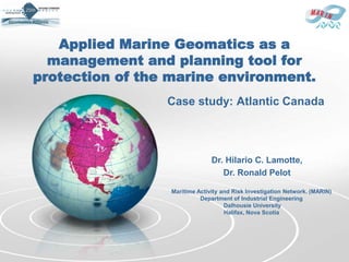
- 1. Applied Marine Geomatics as a management and planning tool for protection of the marine environment. Case study: Atlantic Canada Dr. Hilario C. Lamotte, Dr. Ronald Pelot Maritime Activity and Risk Investigation Network. (MARIN) Department of Industrial Engineering Dalhousie University Halifax, Nova Scotia
- 2. MARIN Maritime Activity and Risk Investigation Network MARIN studies all types of maritime activities , as well as the risks associated with them, to develop methodologies MARIN has developed a comprehensive database of many types of maritime traffic including fishing, shipping, ferries, recreational boating, and others. MARIS, a GIS -based program, was developed by MARIN to simulate this traffic and assist in traffic and risk analysis. http://www.marin-research.ca Lamotte-Pelot, 2012
- 3. MARIN Maritime Activity and Risk Investigation Network Maritime Activity and Risk Investigation Network. (MARIN) Department of Industrial Engineering Dalhousie University Halifax, Nova Scotia http://www.marin-research.ca Lamotte-Pelot, 2012
- 4. Marine resources Its demand is continuously growing to satisfy human beings’ basic needs. It is needed to select the best use of this resource to be able to sustain the for the next generations to come However, people have different knowledge, priorities, goals, interests & concerns Decision-making on how a particular resource should be utilized is not an easy task. The protection of the marine environment is the responsibility of everyone. Lamotte-Pelot, 2012
- 5. Maritime Traffic & Risk With the growth of the marine transportation system, safety of navigation is one of the most important topics and issues at all levels of the decision making process. At the same time we must be conscious of the pollution threats to our waterways and oceans and the serious effects that may result. As part of this effort a group of techniques has to be used for managing all types of risks, including trying to prevent any kind of maritime accidents in areas where the volume, complexity and variety of maritime traffic is increased. Lamotte-Pelot, 2012
- 6. Marine spatial planning The Marine spatial planning aims to: “….create and establish a more rational organization of the use of marine space and the interactions between its uses, to balance demands for development with the need to protect the environment, and to achieve social and economic objectives in an open and planned way ….” Source: IOCAM Dossier, n.4. UNESCO, 2007 Lamotte-Pelot, 2012
- 7. 7 Management and Planning tools How and When use them? as individual tools, they provide an organized way of thinking and making decisions. in combination with each other, they provide a powerful answer to the way in which teams can respond effectively to issues that can at times seem confusing and chaotic. The problem solving process has 2 parts: Problem Analysis: Where is identified a list of root causes Action Planning : Corrective actions and list of risks Lamotte-Pelot, 2012
- 8. Problem Analysis Tools (4) (1) Affinity Diagram (KJ Method. Group and classify brainstormed factor affecting the problem (2) Interrelationship Digraph (ID). Analyze cause and effect relationship of the factors, and help to identify drivers and indicator among the factors (3) Root Cause Tree Diagram. Analyze the root of factors and define possible corrective actions (4) Prioritization Matrix. Prioritize factors according to criteria Lamotte-Pelot, 2012
- 9. Action Planning Tools (3) (5) Involvement Matrix Diagram. Formulate a list of corrective actions, define participants of each action and distribute them by involvement level. (6) Process Decision Program Chart (PDPC). Originate actions, place them into a schedule, visualize logical relationship and critical path. (7) Activity Network Diagram. Do a risk analysis, prescribe actions to eliminate obstacles Lamotte-Pelot, 2012
- 10. Mapematic Lamotte-Pelot, 2012 Modified from Joseph K. Berry (2004)
- 11. MCDA based on GIS MCDA – Multi-Criteria Decision Analysis Problem Spatial decision problems typically involve a large set of feasible alternatives & multiple evaluation criteria. Alternatives & criteria* are often evaluated by a number of individuals (decision- makers, managers, stakeholders, interest groups). * often are conflicting Lamotte-Pelot, 2012
- 12. MCDA based on GIS Cont... GIS MCDA These techniques & procedures are It provides a rich collection of recognized as a decision support techniques and procedures for: system involving the integration of structuring decision problems, spatially referenced data in a designing, evaluating and problem solving environment. prioritizing alternative decisions GIS-MCDA Is defined as a process that transforms and combines geographical data and value judgments to obtain information for decision making Lamotte-Pelot, 2012
- 13. GIS-MCDA Steps: 1. Set the goal/define the problem. 2. Determine the criteria. (factors/constraints) 3. Standardize the factors/criterion scores. 4. Determine the weight of each factor. 5. Aggregate the criteria. 6. Validate/verify the result. Lamotte-Pelot, 2012
- 15. Case Study: Atlantic Canada Where to apply the limited budget for marine research? GOAL CRITERIA Factor 1 Factor 2 ......... Factor n Constrains ATTRIBUTES Attr 1 Attr 2 ......... Attr n Attributes Lamotte-Pelot, 2012
- 16. Case Study: Atlantic Canada Marine Risk Assessment FACTOR ATTRIBUTE WHERE? LOCATION WHEN? TIME HOW MUCH? FREQUENCY Lamotte-Pelot, 2012
- 17. Case Study: Atlantic Canada Long Range Identification and Tracking of ships (LRIT) LRIT is operated by the Canadian Coast Guard and it was spearheaded at the International Maritime Organization as a means of enhancing maritime security. The intent is to enhance security by providing SOLAS vessel identity and current location information in sufficient time for a Government to evaluate the security risk posed by a ship off its coast and to respond, if necessary. An active and accurate LRIT system also has clear safety benefits for maritime search and rescue, as well as for environmental response. Goal of it use is the potential calculations of: traffic density distance travelled Lamotte-Pelot, 2012 time on water
- 18. Case Study: Atlantic Canada Other Data sources: ECAREG, NORDREG Zonal Interchange Fisheries (ZIF) Ferries Aquaculture, Mariculture Offshore Oil and Gas Recreational (commercial, private) Lamotte-Pelot, 2012
- 19. Case Study: Atlantic Canada Analysis of Marine Traffic. Category of Cargo in the CHS Survey Planning Tool (SPT) [ MARIN ] [ SPT ] Category Category Description Category Category Label Label Merchant / Bulk / Cargo M Fishing F Hazardous Includes all vessels transporting oil, oil HzC products and Liquefied natural gas Tanker T Cargo Cruise Ship / Passenger C (LNG). This includes small tankers serving Pleasure Craft L coastal communities. Gov't Non-Military G Research and R This is restricted to vessels carrying 50 Exploration Human Cargo HmC people or more. This includes ferries and Tugs and Service S cruise ships. It excludes most recreational Vessels and excursion (whale watching, harbor cruises, etc.) vessels. [ SPT ] Category Label HzC HmC Oth NoT All other vessels are considered in this Other Oth M category. This includes all remaining X F commercial vessels (container, ore, bulk), X Category Label government fleets, fishing and recreational. T [ MARIN ] X C X L X G No Traffic NoT No identifiable traffic and definitely no X R X commercial traffic. There may be occasional S X traffic, usually limited to small, open boats. Lamotte-Pelot, 2012
- 21. . Hazardous Cargo Lamotte-Pelot, 2012
- 24. Case Study: Atlantic Canada Set the goal/define the problem Lamotte-Pelot, 2012
- 25. Case Study: Atlantic Canada Where to apply a limited budget for marine research? Lamotte-Pelot, 2012
- 26. Case Study: Atlantic Canada Determine the criteria (factors/constraints) Marine Traffic Type of Cargo Hydrography Aid to Navigation Positioning QC Lamotte-Pelot, 2012
- 27. Case Study: Atlantic Canada Determine the criteria (factors/constraints) Marine Traffic Type of Cargo Hydrography Aid to Navigation Positioning QC Lamotte-Pelot, 2012
- 28. Case Study: Atlantic Canada Standardize the factors/criterion scores. Marine Traffic Type of Cargo Hydrography Aid to Navigation Positioning QC Lamotte-Pelot, 2012
- 29. Case Study: Atlantic Canada Determine the weight of each factor. Lamotte-Pelot, 2012
- 30. Case Study: Atlantic Canada Aggregate the criterion. Lamotte-Pelot, 2012
- 31. Case Study: Atlantic Canada Validate the result. Marine Traffic Type of Cargo Hydrography Aid to Navigation Positioning QC Lamotte-Pelot, 2012
- 32. Case Study: Atlantic Canada Verify the result. Marine Traffic Type of Cargo Hydrography Aid to Navigation Positioning QC Lamotte-Pelot, 2012
- 33. Remarks Expected Outcomes after the GIS-MCDA: Action plan List of Risks Preventive actions Agreement on way forward. There is not an unique way to resolve MCDA, as neither an unique GIS platform to resolve complex scenarios (ArcGIS, Mapinfo, IDRISI, GRASS, etc) Lamotte-Pelot, 2012
- 34. Remarks Benefits of Using the Seven Management and Planning tools combined with GIS- MCDA: Provides visual communication tools for every stage of work Consistency, visibility, justification of the action plan Visual reports of problems solving steps taken for quality improvement Lamotte-Pelot, 2012
- 35. Recommended Readings Estoque, R C and Murayama, Y (2011). Beekeeping sites suitability analysis integrating GIS and MCE techniques. In Murayama, Y and Thapa, R B (Eds), Spatial Analysis and Modeling in Geographical Transformation Process: GIS-based Applications. Dordrecht: Springer Science +Business Media B.V., isbn:978-94-007-0670-5 Haugey, D. “SMART Goals”. Project Smart. Accessed January 11, 2011. www.projectsmart.co.uk/smart-goals.html Malczewski, J (2006). GIS-based multicriteria decision analysis: a survey of the literature. International Journal of Geographical Information Science, 20, 703 – 726. Malczewski, J (2004). GIS-based land-use suitability analysis: a critical overview. Progress in Planning, 62, 3 – 65. Saaty, T L (1980). The Analytic Hierarchy Process. New York: McGraw Hill. Teknomo, K (2006). Analytic Hierarchy Process (AHP) Tutorial . Accessed January 11, 2011. http://people.revoledu.com/kardi/tutorial/ahp/ Dr. Lamotte, 2012
- 36. Applied Marine Geomatics as a management and planning tool for protection of the marine environment. Case study: Atlantic Canada Dr. Hilario C. Lamotte, Dr. Ronald Pelot Maritime Activity and Risk Investigation Network. (MARIN) Department of Industrial Engineering Dalhousie University Halifax, Nova Scotia
Editor's Notes
- Affinity Diagram (KJ Method)This tool takes large amounts of disorganized data and information and enables one to organize it into groupings based on natural relationships. It was created in the 1960s by Japanese anthropologist JiroKawakita. Its also known as KJ diagram,afterJiroKawakita. Affinity diagram is a special kind of brainstorming tool. Interrelationship Digraph (ID)This tool displays all the interrelated cause-and-effect relationships and factors involved in a complex problem and describes desired outcomes. The process of creating an interrelationship digraph helps a group analyze the natural links between different aspects of a complex situation. Tree DiagramThis tool is used to break down broad categories into finer and finer levels of detail. It can map levels of details of tasks that are required to accomplish a goal or task. It can be used to break down broad general subjects into finer and finer levels of detail. Developing the tree diagram helps one move their thinking from generalities to specifics. Prioritization MatrixThis tool is used to prioritize items and describe them in terms of weighted criteria. It uses a combination of tree and matrix diagramming techniques to do a pair-wise evaluation of items and to narrow down options to the most desired or most effective. Matrix DiagramThis tool shows the relationship between items. At each intersection a relationship is either absent or present. It then gives information about the relationship, such as its strength, the roles played by various individuals or measurements. Six differently shaped matrices are possible: L, T, Y, X, C, R and roof-shaped, depending on how many groups must be compared. Process Decision Program Chart (PDPC)A useful way of planning is to break down tasks into a hierarchy, using a Tree Diagram. The PDPC extends the tree diagram a couple of levels to identify risks and countermeasures for the bottom level tasks. Different shaped boxes are used to highlight risks and identify possible countermeasures (often shown as 'clouds' to indicate their uncertain nature). The PDPC is similar to the Failure Modes and Effects Analysis (FMEA) in that both identify risks, consequences of failure, and contingency actions; the FMEA also rates relative risk levels for each potential failure point.Activity Network DiagramThis tool is used to plan the appropriate sequence or schedule for a set of tasks and related subtasks. It is used when subtasks must occur in parallel. The diagram enables one to determine the critical path (longest sequence of tasks). (See also PERT diagram.)
- Affinity Diagram (KJ Method)This tool takes large amounts of disorganized data and information and enables one to organize it into groupings based on natural relationships. It was created in the 1960s by Japanese anthropologist JiroKawakita. Its also known as KJ diagram,afterJiroKawakita. Affinity diagram is a special kind of brainstorming tool. Interrelationship Digraph (ID)This tool displays all the interrelated cause-and-effect relationships and factors involved in a complex problem and describes desired outcomes. The process of creating an interrelationship digraph helps a group analyze the natural links between different aspects of a complex situation. Tree DiagramThis tool is used to break down broad categories into finer and finer levels of detail. It can map levels of details of tasks that are required to accomplish a goal or task. It can be used to break down broad general subjects into finer and finer levels of detail. Developing the tree diagram helps one move their thinking from generalities to specifics. Prioritization MatrixThis tool is used to prioritize items and describe them in terms of weighted criteria. It uses a combination of tree and matrix diagramming techniques to do a pair-wise evaluation of items and to narrow down options to the most desired or most effective. Matrix DiagramThis tool shows the relationship between items. At each intersection a relationship is either absent or present. It then gives information about the relationship, such as its strength, the roles played by various individuals or measurements. Six differently shaped matrices are possible: L, T, Y, X, C, R and roof-shaped, depending on how many groups must be compared. Process Decision Program Chart (PDPC)A useful way of planning is to break down tasks into a hierarchy, using a Tree Diagram. The PDPC extends the tree diagram a couple of levels to identify risks and countermeasures for the bottom level tasks. Different shaped boxes are used to highlight risks and identify possible countermeasures (often shown as 'clouds' to indicate their uncertain nature). The PDPC is similar to the Failure Modes and Effects Analysis (FMEA) in that both identify risks, consequences of failure, and contingency actions; the FMEA also rates relative risk levels for each potential failure point.Activity Network DiagramThis tool is used to plan the appropriate sequence or schedule for a set of tasks and related subtasks. It is used when subtasks must occur in parallel. The diagram enables one to determine the critical path (longest sequence of tasks). (See also PERT diagram.)
- The mapematic is used to derive new map variables