Soils in the tvc
•Download as PPTX, PDF•
1 like•719 views

Soils in the TVC, patterns and processes

Recommended
More Related Content
What's hot
What's hot (18)
Similar to Soils in the tvc
Similar to Soils in the tvc (20)
More from Taka Geo
More from Taka Geo (20)
Recently uploaded
Recently uploaded (20)
Soils in the tvc
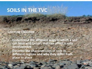
- 1. SOILS IN THE TVC Learning Objective • Understand the different ways in which a soil can form and factors that can affect a soils development • Describe the characteristics of soils in different regions and why they differ from place to place
- 2. How are Soils Formed? • Soils are a mixture of weathered rock and organic matter • Diagram of how soils are formed • Diagram of soil profile
- 3. Soil Processes The type of soil depends on: The _________ of the bedrock The type of _________ on top The climate The ________ – how steep the slopes are
- 4. Soil Processes Continued On the volcanic plateau this means: • Geology – mainly volcanic ash and scoria • Vegetation – beech forests lower down slopes and scrub or tussock nearer top • Climate – cold which slows weathering and wet which causes leaching of minerals • Relief – steep slopes on mountains do not allow deep soils to develop
- 5. GENERAL CHARACTERISTICS Soils are __________ as volcanic ash is easily _____________. However they are ___________ or not well developed without clear __________. They are not fertile on the ________ side due to the fact that there is limited _________ or organic matter.
- 6. GENERAL CHARACTERISTICS At the top of the ___________ the climate is too cold for ____________ to occur and heavy rain causes _____________ of nutrients so minerals ar often lacking trace elements of Potassium and __________ making the soils fairly barren. On the _________ side there is more vegetation and so more __________ can occur, this causes a more _____________ soil to form.
- 7. Words to use for fill in the gaps Eroded west horizons Vegetation decomposition leaching Cobalt mountains immature Thick decomposition east nutritious
- 8. Soil Characteristics and Patterns The type of soil in the TVC varies from place to place depending on the conditions there. The patterns can be seen in four main areas: • The Mountain Peaks • The Western Slopes • The Eastern Side (Rangipo Desert) • The Kaimanawas
- 9. Use the information on the following four slides to ANNOTATE the diagram on your worksheet You need to annotate both the characteristic of the soil and the reasons why that type of soil develops.
- 10. Mountain Peaks Little or no soils with most of area covered in bare rock Reasons: Altitude above 2000 m therefore too cold (3 deg) and strong winds and steep slopes
- 11. Western Slopes Deep but immature yellow brown pumice soils Reasons: • Leaching of nutrients (esp cobalt) due to orographic rainfall • As slope decreases and vegetation and temp increase decomposition occurs and deeper soils develop.
- 12. Eastern Side (Rangipo Desert) Poor sandy soils which will gain a hard ‘crust’ or pan at the surface Reasons: • High W winds and lack of vegetation (tussock and mat weed) mean soil is unprotected. • Higher temps (12 deg) and rainshadow (1000 mm) mean water is evaporated leaving salts behind
- 13. Kaimanawas Fertile mature soils capable of sustaining larger vegetation forms. Nutrient rich and deep. Reasons: • Gentler slopes and greater vegetation cover (beech and podocarp) • Higher temps therefore more decomposition • Less affected by volcanic eruptions