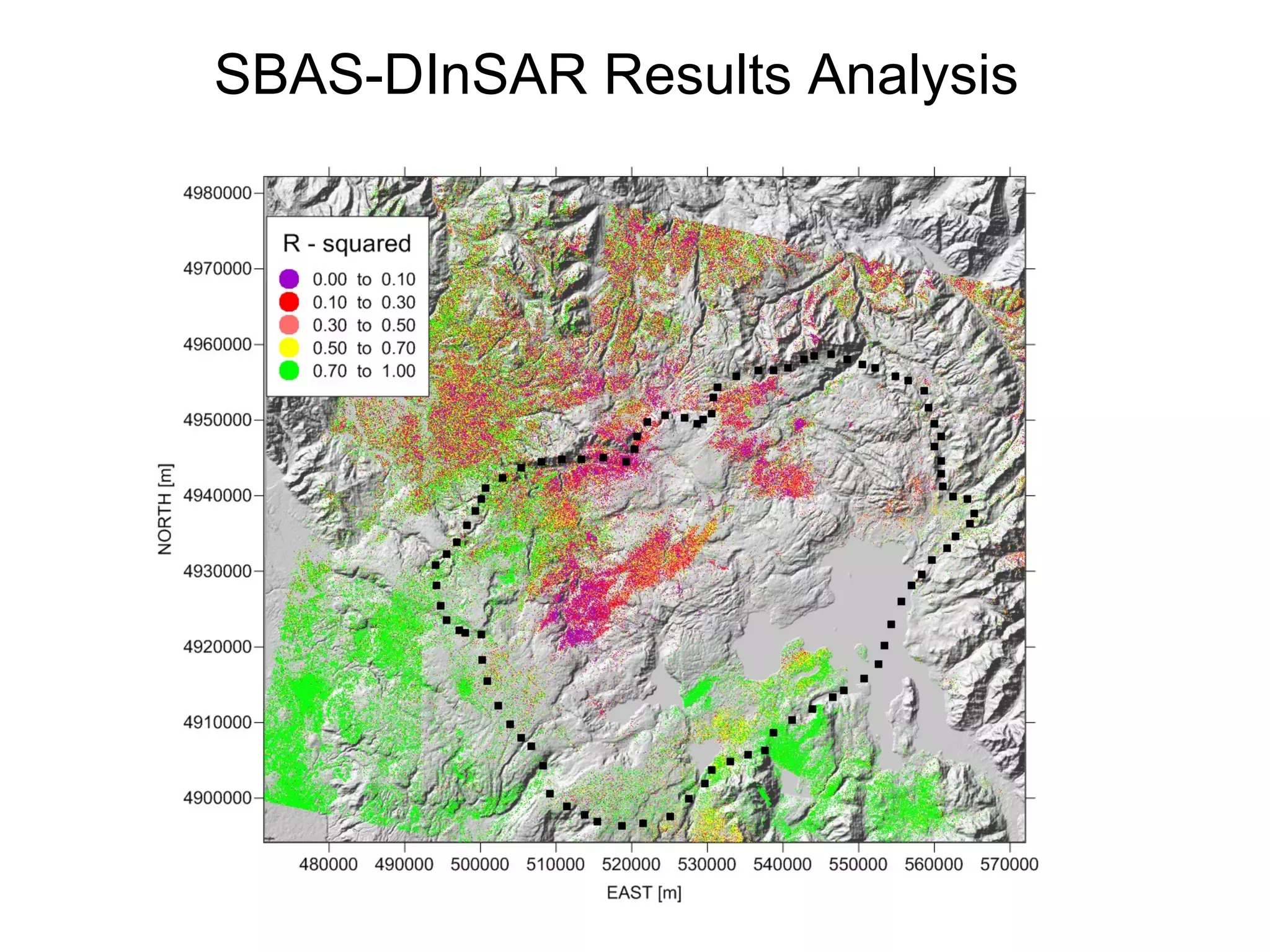
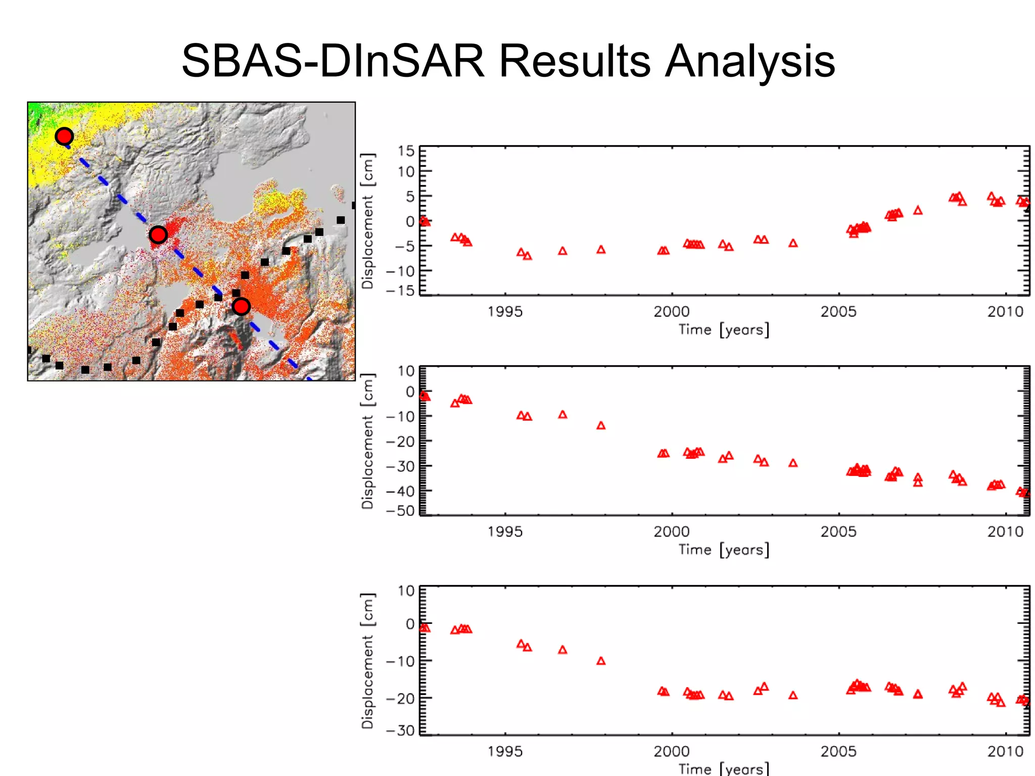
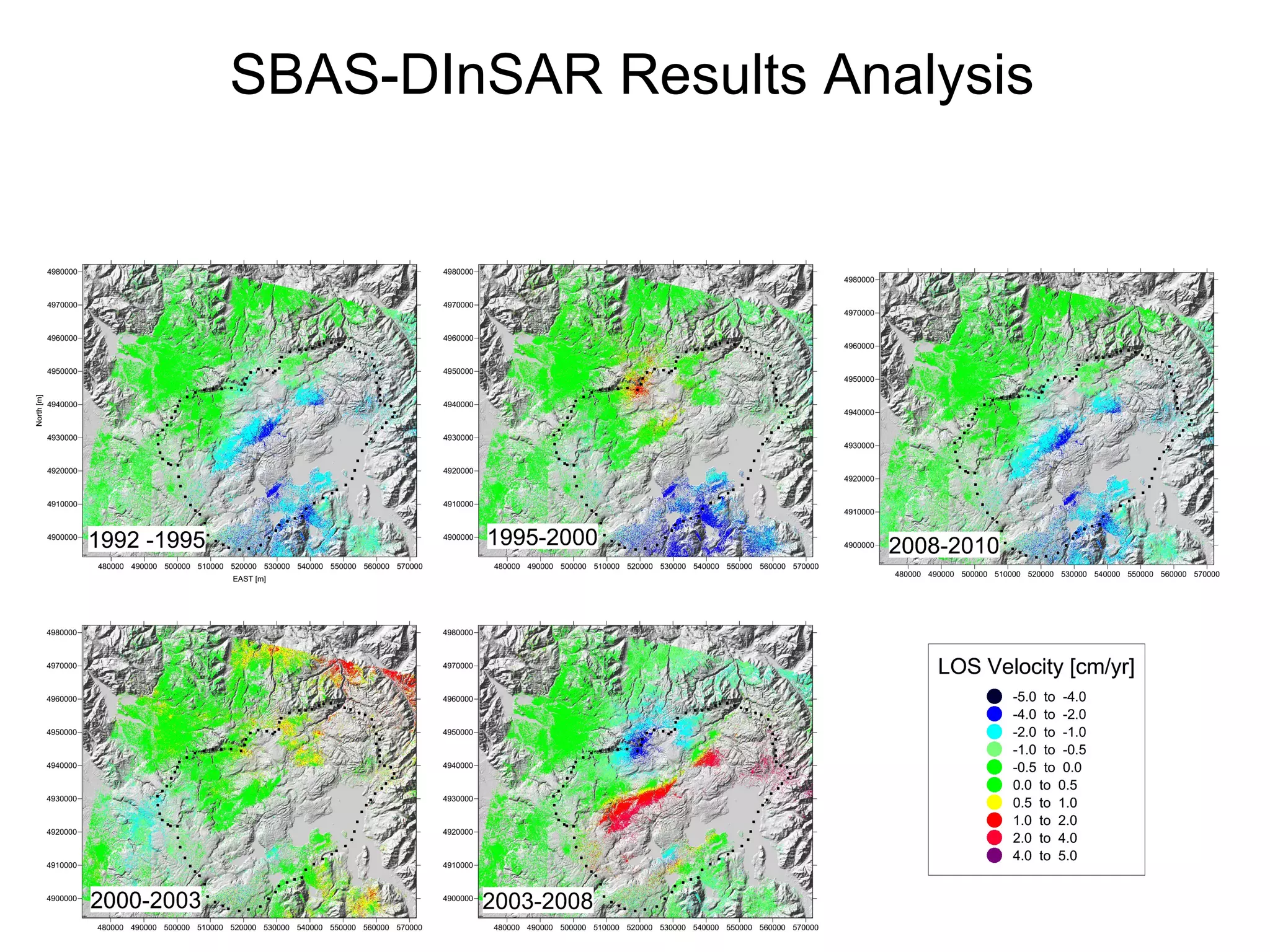
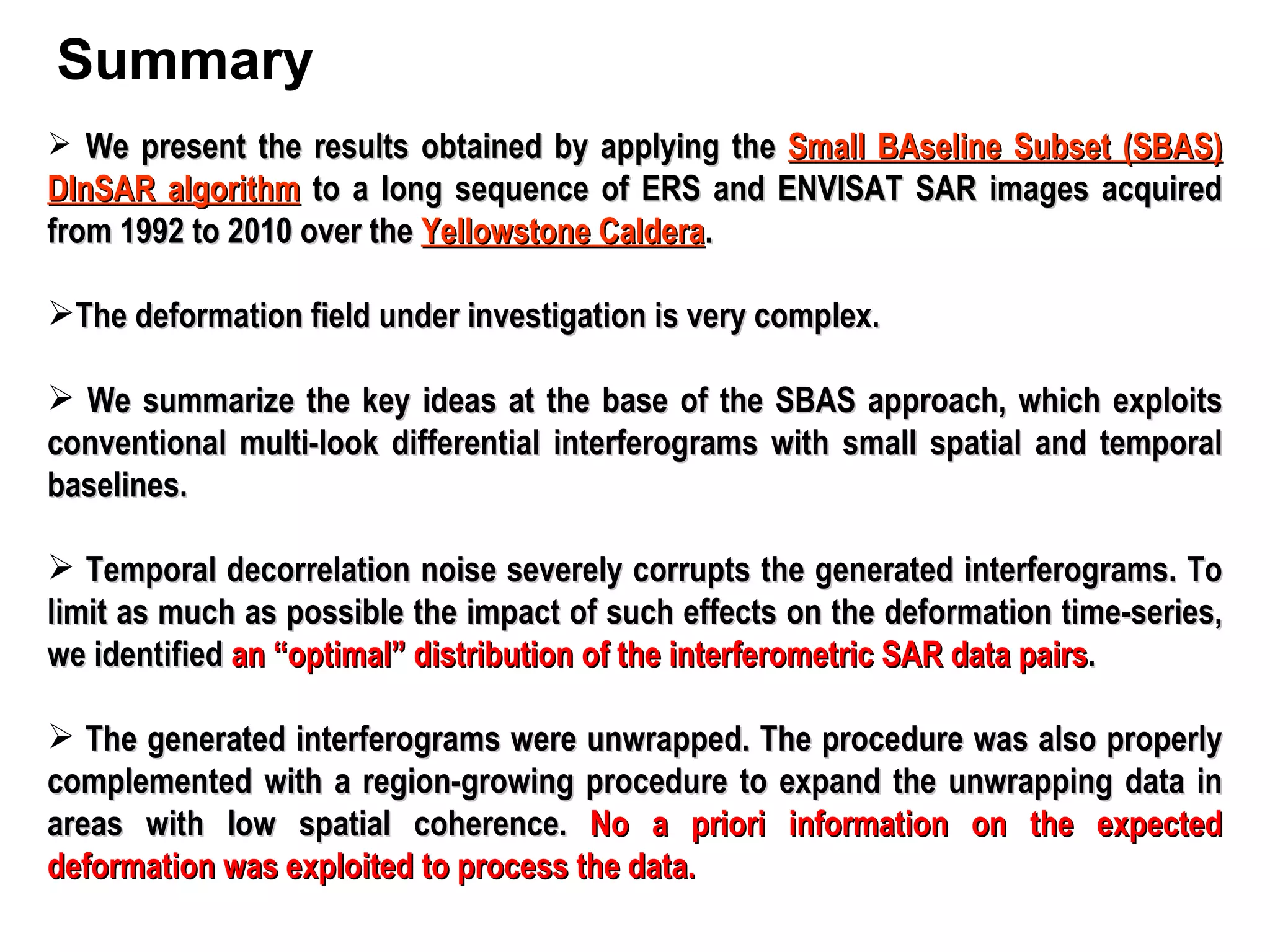
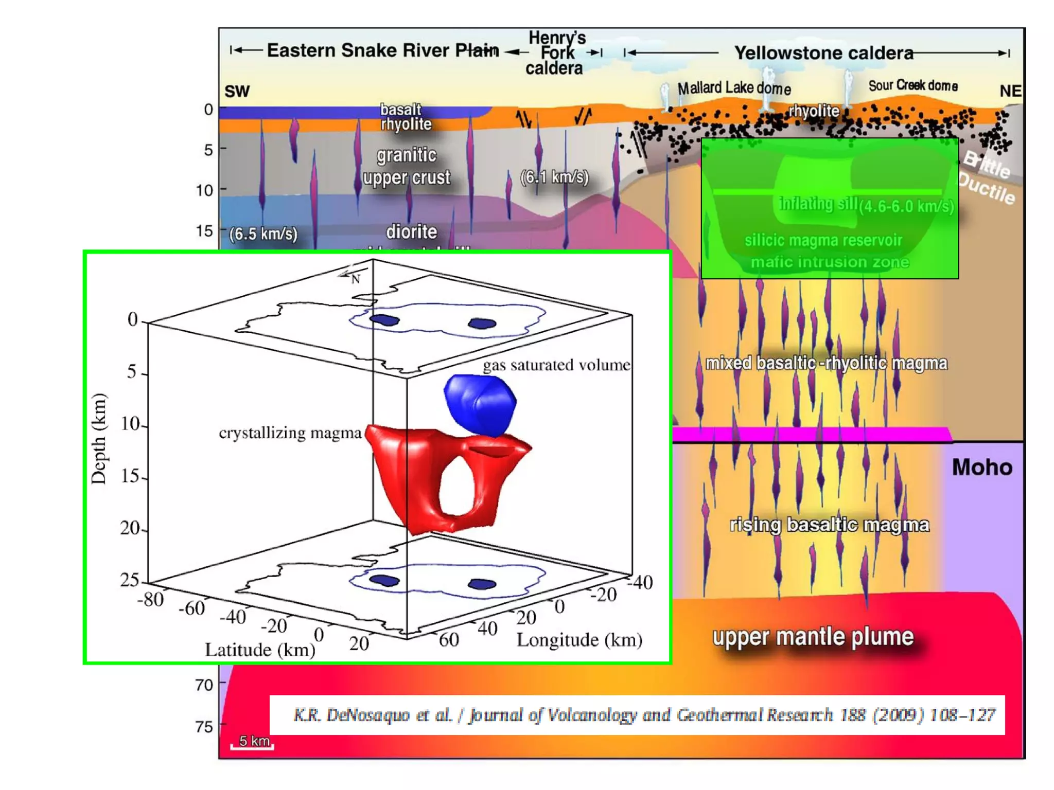
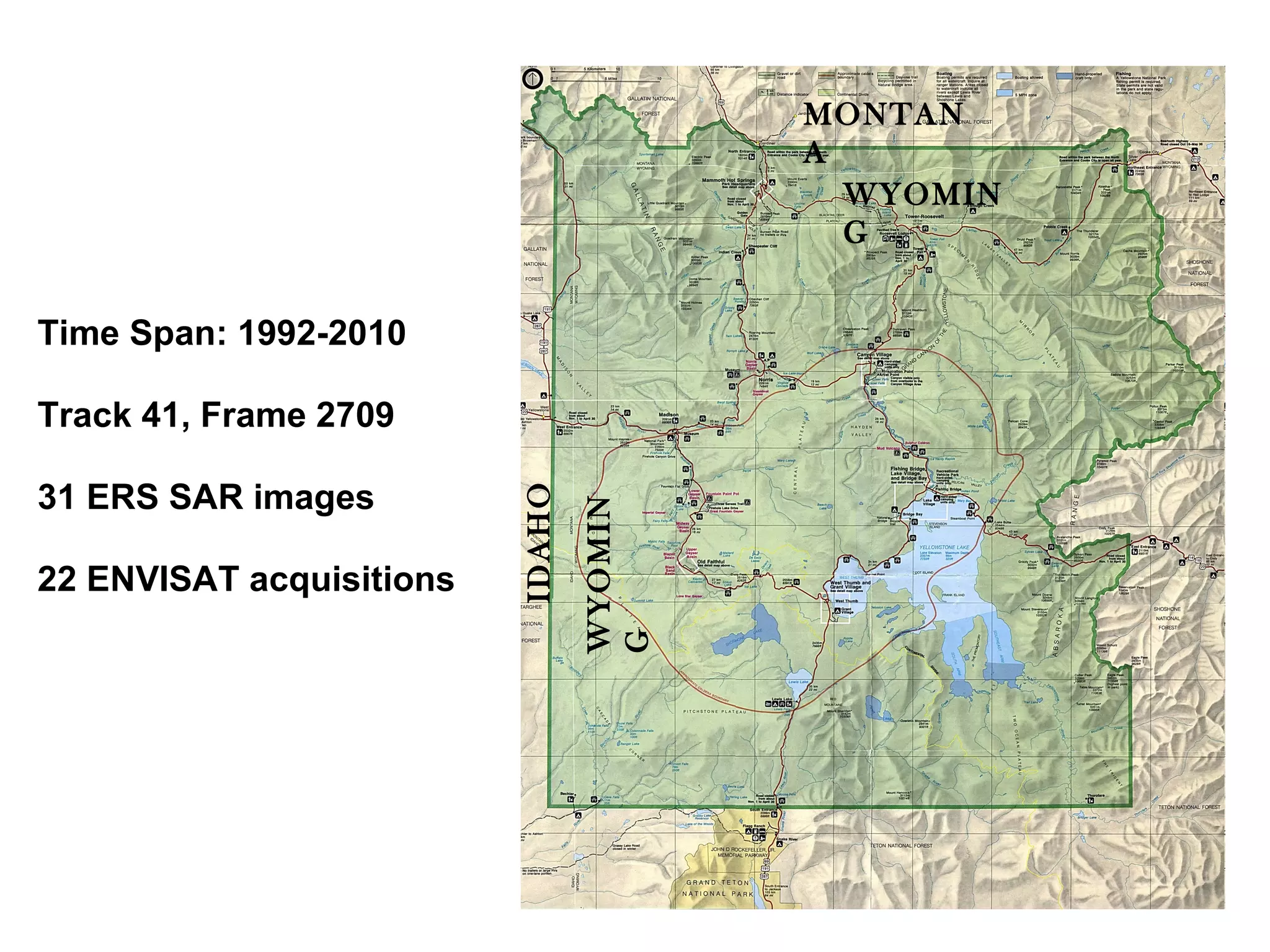
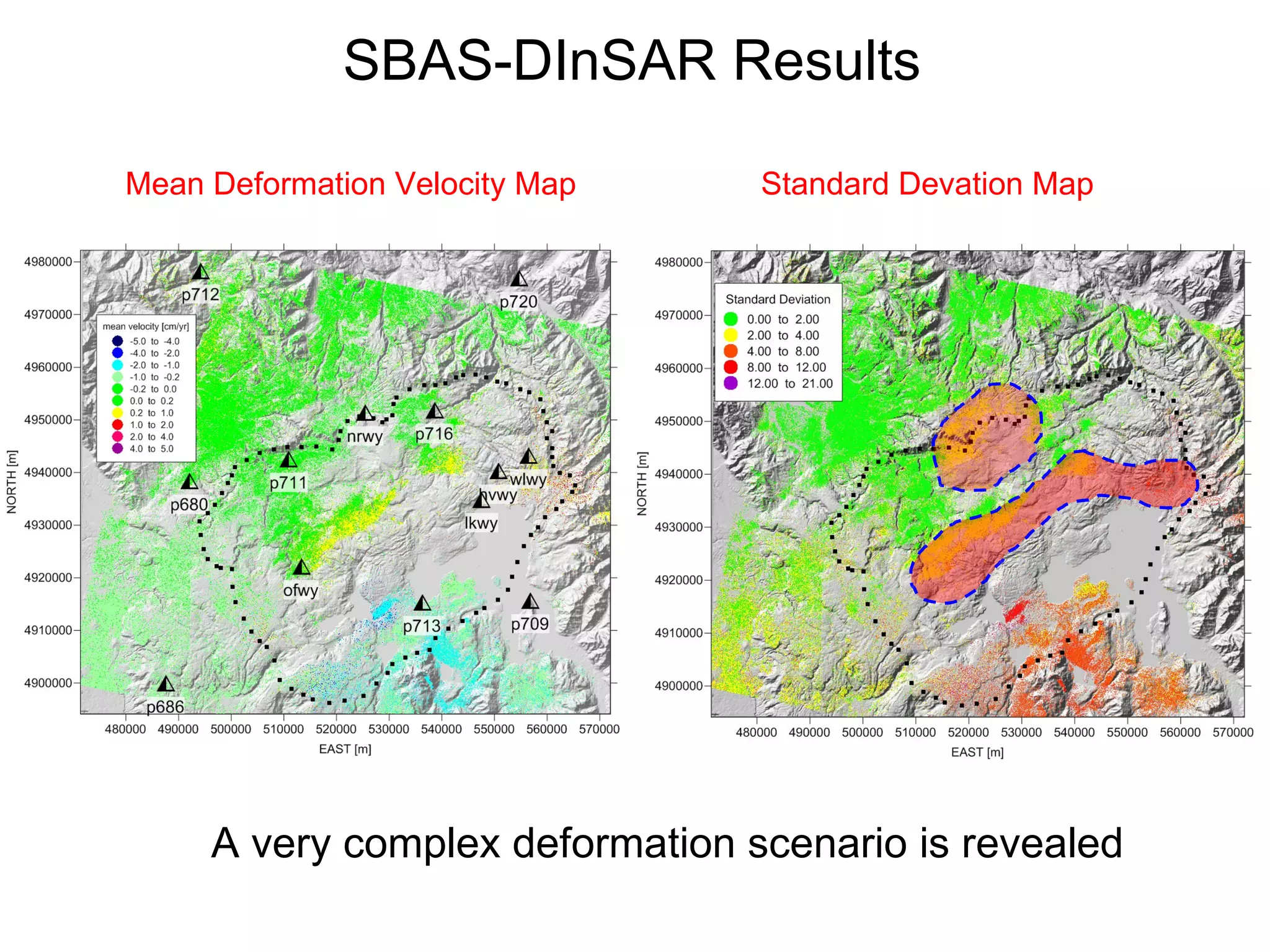
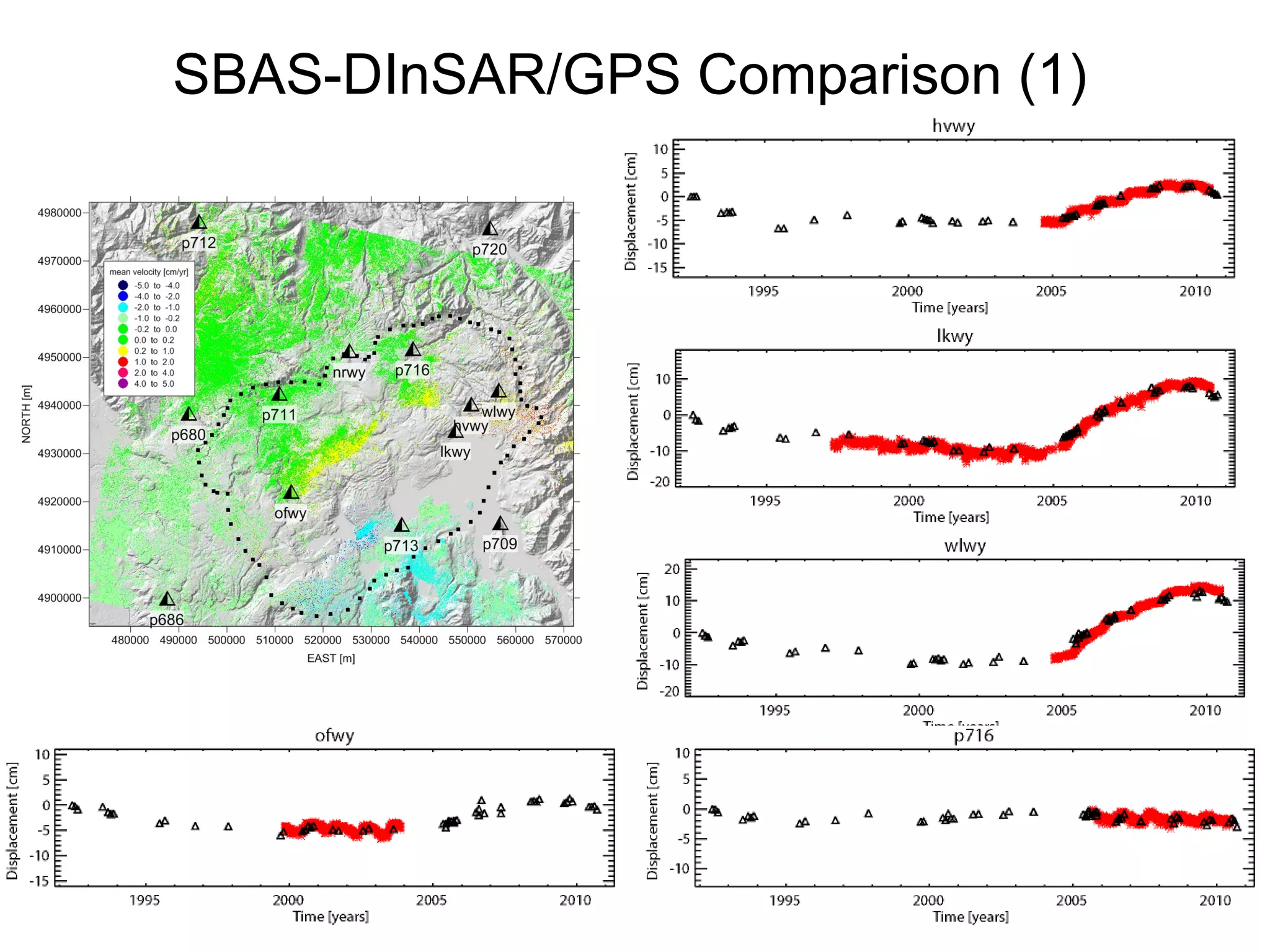
1. The SBAS-DInSAR algorithm was used to analyze ERS and ENVISAT SAR data from 1992-2010 over the Yellowstone Caldera, revealing a complex deformation field.
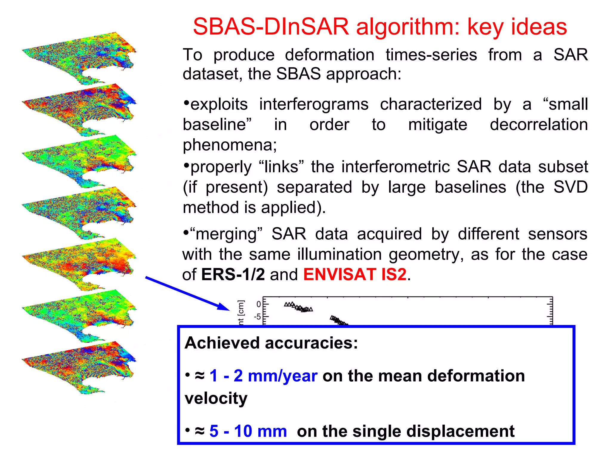
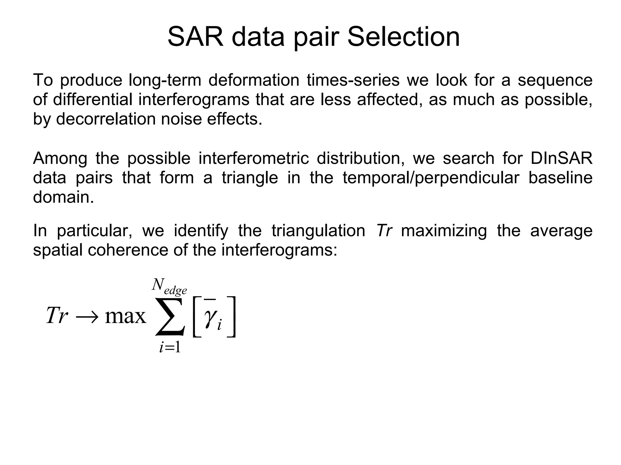
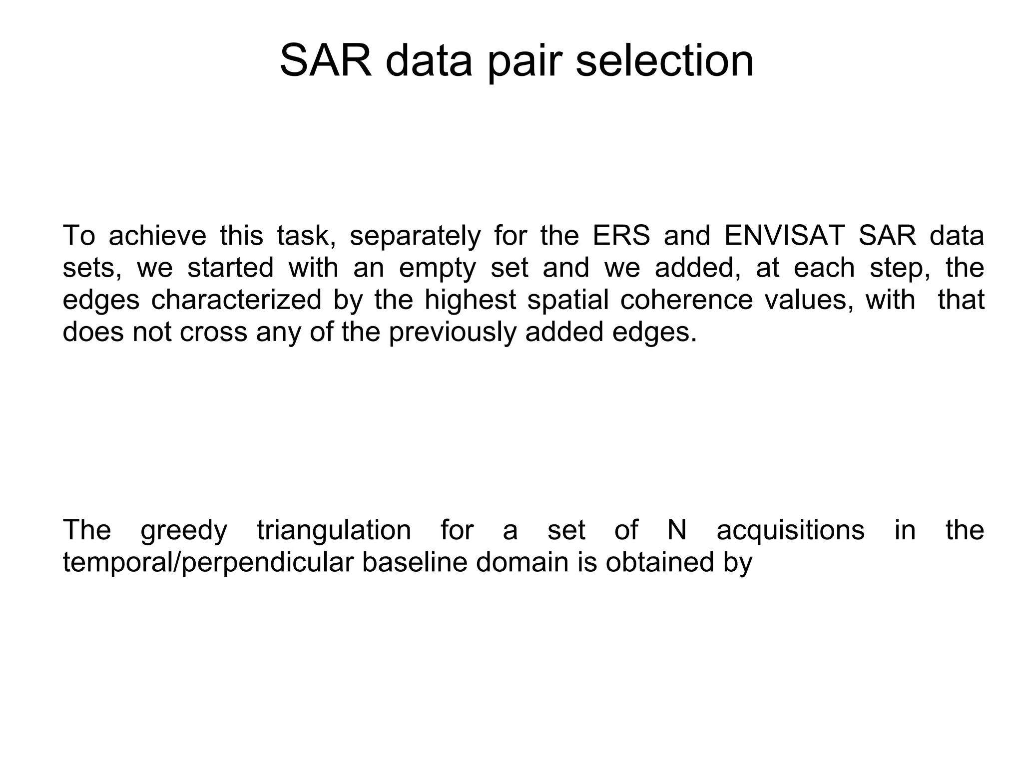
2. An optimal distribution of interferometric pairs was identified to limit the impact of temporal decorrelation, exploiting pairs with small baselines.
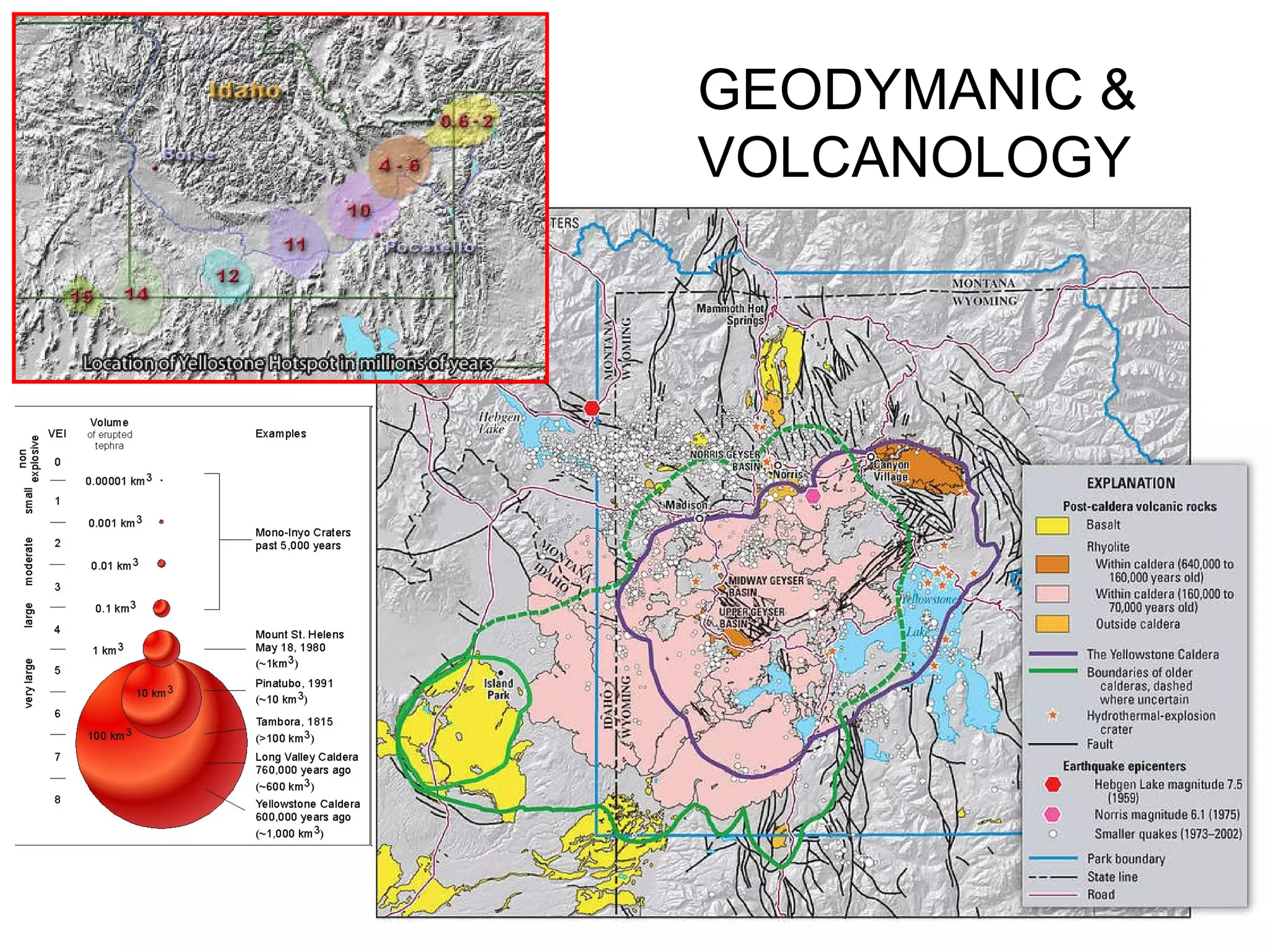
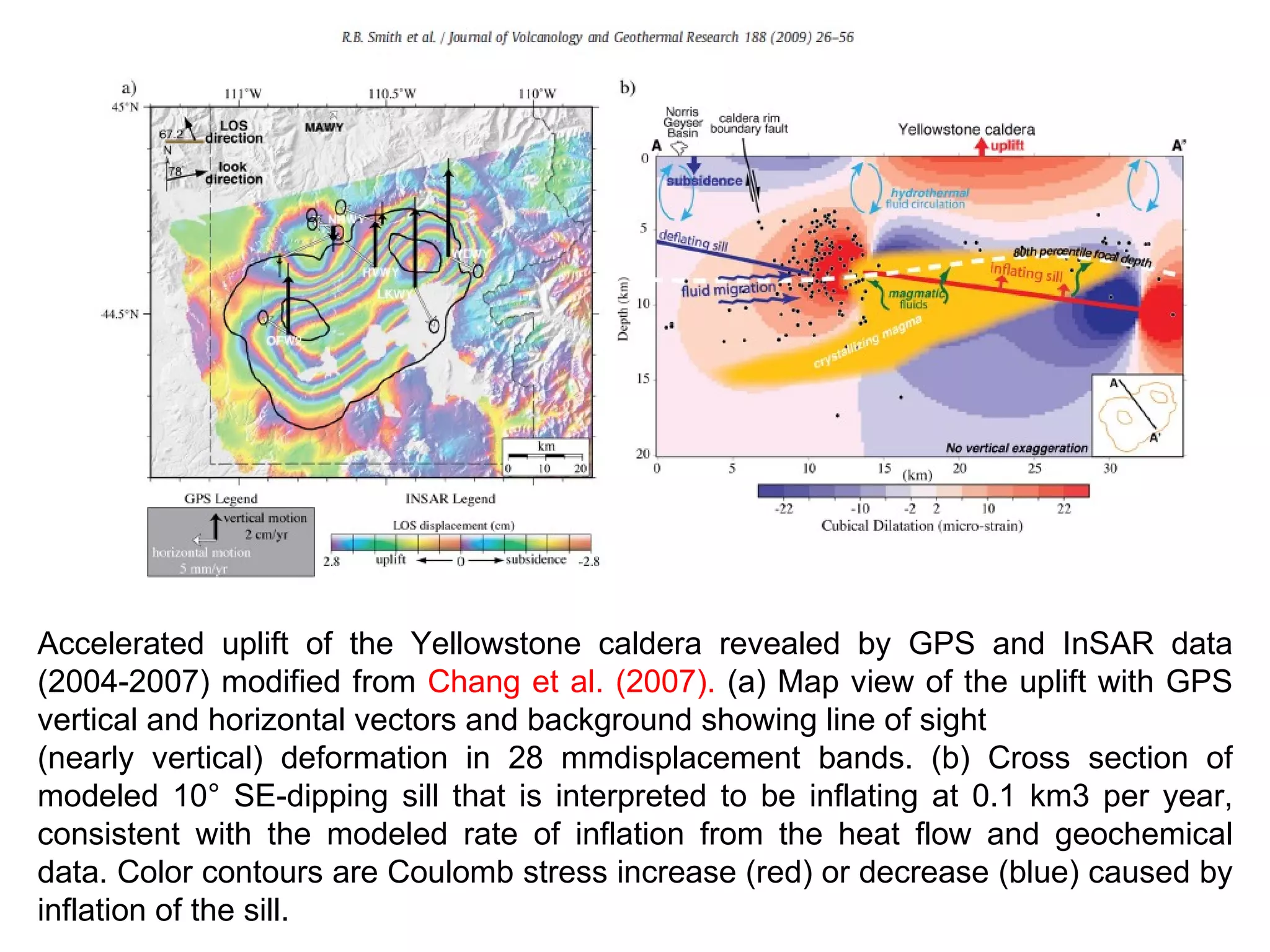
3. The analysis revealed accelerated uplift in the Yellowstone caldera between 2004-2007, with rates consistent with inflation of a subsurface sill at a rate of 0.1 km3 per year.
![Yellowstone SAR dataset Time [year] Perpendicular Baseline [m] ERS ENVISAT](https://image.slidesharecdn.com/yellowigarss-110727150529-phpapp02/75/YellowIGARSS-ppt-9-2048.jpg)
![Yellowstone SAR dataset: Temporal Decorrelation Effects Time [year] Perpendicular Baseline [m] ERS ENVISAT 10/12/2006 06/09/2005](https://image.slidesharecdn.com/yellowigarss-110727150529-phpapp02/75/YellowIGARSS-ppt-10-2048.jpg)
![Time [year] Perpendicular Baseline [m] ERS ENVISAT Yellowstone SAR dataset: Temporal Decorrelation Effects 08/30/1995 07/12/1992](https://image.slidesharecdn.com/yellowigarss-110727150529-phpapp02/75/YellowIGARSS-ppt-11-2048.jpg)
![ERS1-2 Interferometric Distribution Time [year] Perpendicular Baseline [m] ERS ENVISAT](https://image.slidesharecdn.com/yellowigarss-110727150529-phpapp02/75/YellowIGARSS-ppt-14-2048.jpg)
![ERS1-2 Interferometric Distribution Time [year] Perpendicular Baseline [m] ERS ENVISAT](https://image.slidesharecdn.com/yellowigarss-110727150529-phpapp02/75/YellowIGARSS-ppt-15-2048.jpg)
![ERS1-2 Interferometric Distribution Time [year] Perpendicular Baseline [m] ERS ENVISAT](https://image.slidesharecdn.com/yellowigarss-110727150529-phpapp02/75/YellowIGARSS-ppt-16-2048.jpg)
![ERS1-2 Interferometric Distribution Time [year] Perpendicular Baseline [m] ERS ENVISAT](https://image.slidesharecdn.com/yellowigarss-110727150529-phpapp02/75/YellowIGARSS-ppt-17-2048.jpg)
![ERS1-2 Interferometric Distribution Time [year] Perpendicular Baseline [m] ERS ENVISAT](https://image.slidesharecdn.com/yellowigarss-110727150529-phpapp02/75/YellowIGARSS-ppt-18-2048.jpg)
![ERS1-2 Interferometric Distribution Time [year] Perpendicular Baseline [m] ERS ENVISAT](https://image.slidesharecdn.com/yellowigarss-110727150529-phpapp02/75/YellowIGARSS-ppt-19-2048.jpg)
![… and ENVISAT Time [year] Perpendicular Baseline [m] ERS ENVISAT ERS ENVISAT](https://image.slidesharecdn.com/yellowigarss-110727150529-phpapp02/75/YellowIGARSS-ppt-20-2048.jpg)
![Optimal Interferometric Distribution Time [year] Perpendicular Baseline [m] Finally, we also cut from the triangulations the triangles involving large baseline interferograms ERS ENVISAT ERS ENVISAT](https://image.slidesharecdn.com/yellowigarss-110727150529-phpapp02/75/YellowIGARSS-ppt-21-2048.jpg)
![hvwy, 0.59 lkwy, 1.04 nrwy, 0.36 ofwy, 0.18 p680, 0.33 p686, 0.24 p709, 0.61 p711, 0.29 p712, 0.24 p713, 0.39 p716, 0.41 wlwy, 0.86 GPS/SBAS Standard Deviation [cm] SBAS-DInSAR/GPS Comparison (2)](https://image.slidesharecdn.com/yellowigarss-110727150529-phpapp02/75/YellowIGARSS-ppt-25-2048.jpg)