Download to read offline
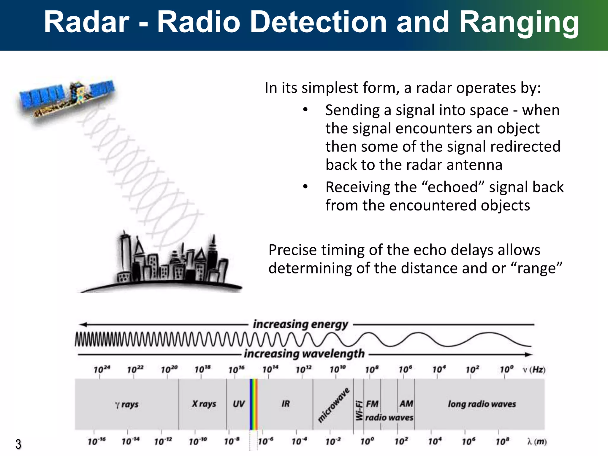
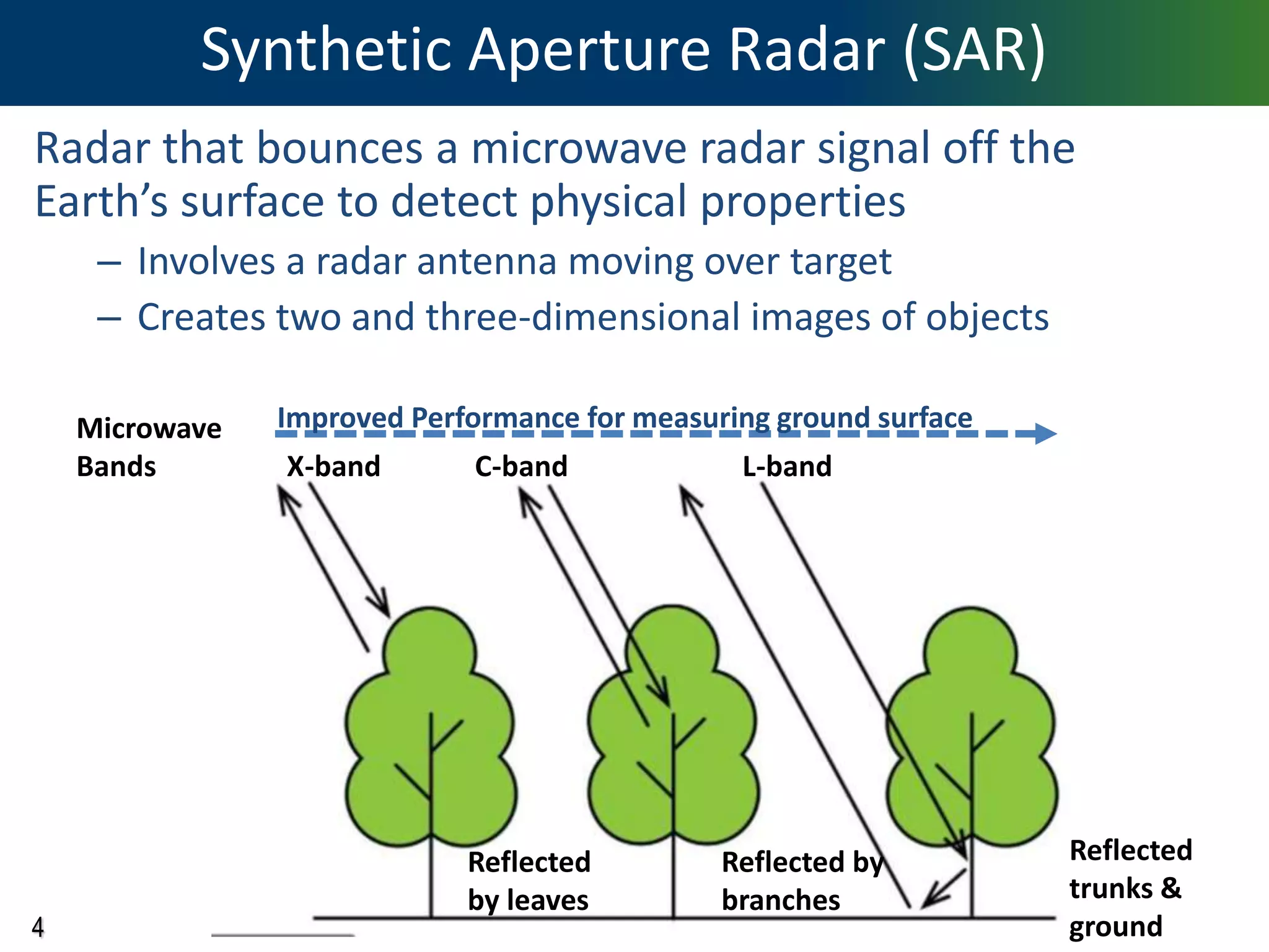
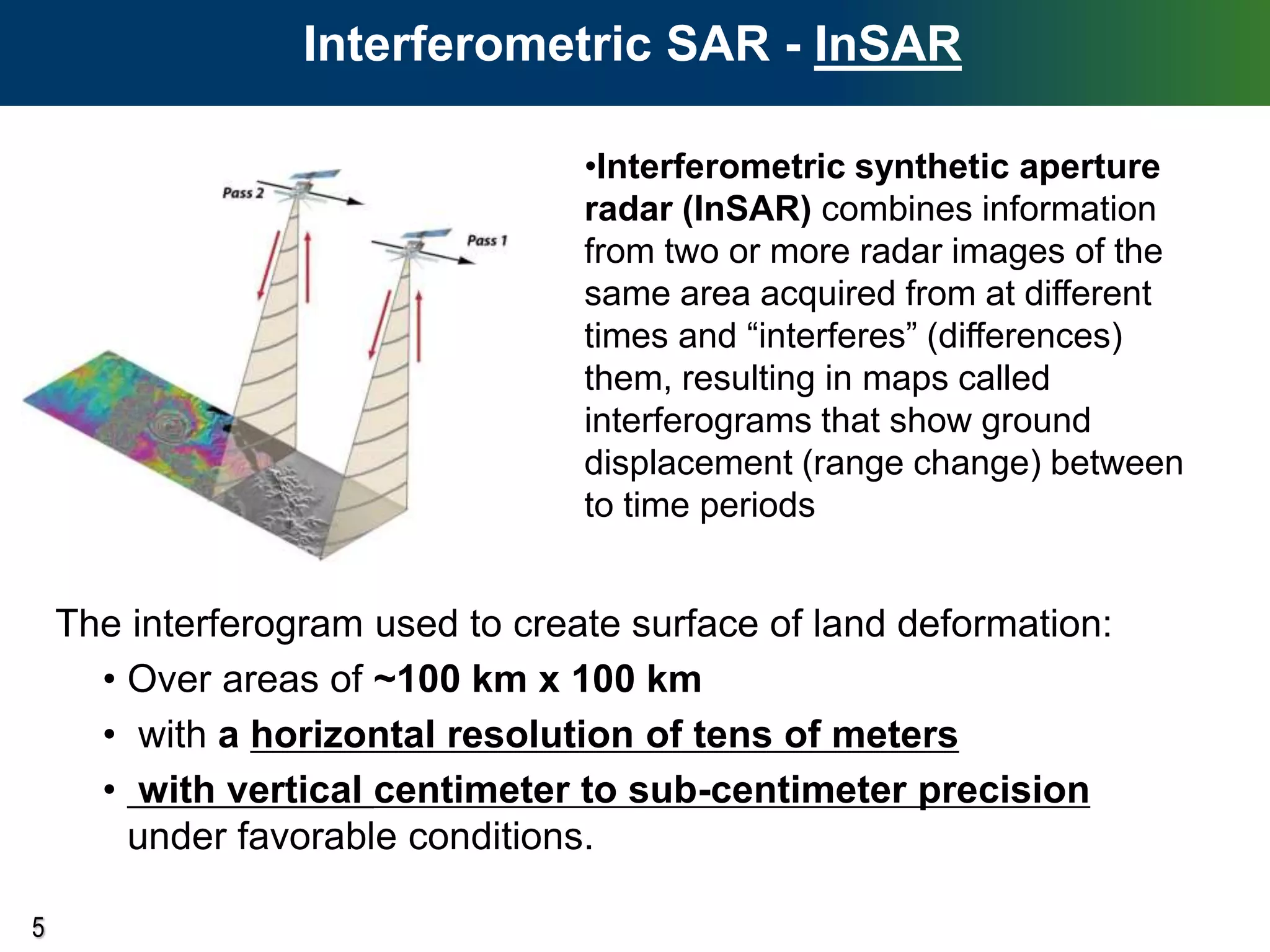
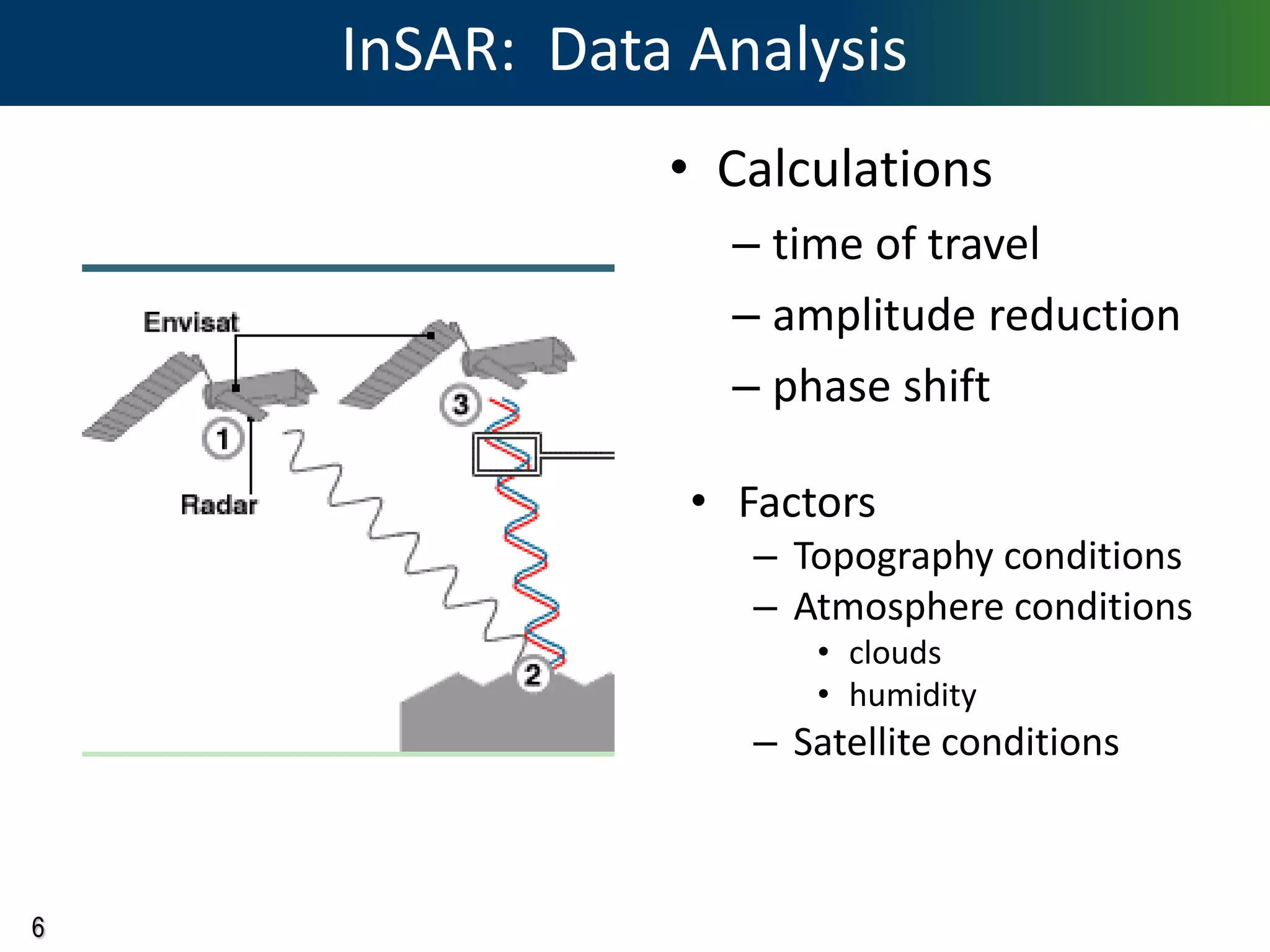
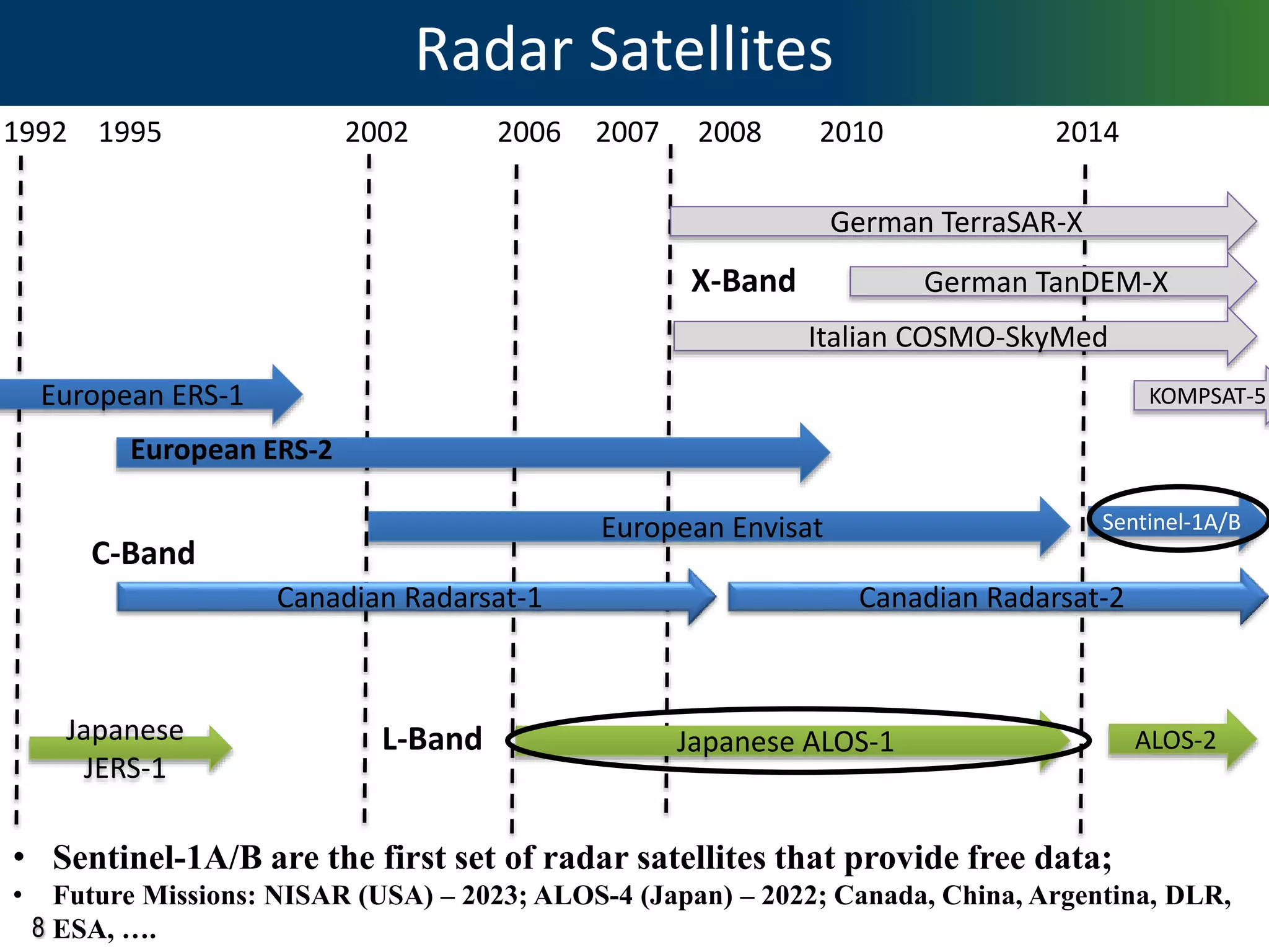
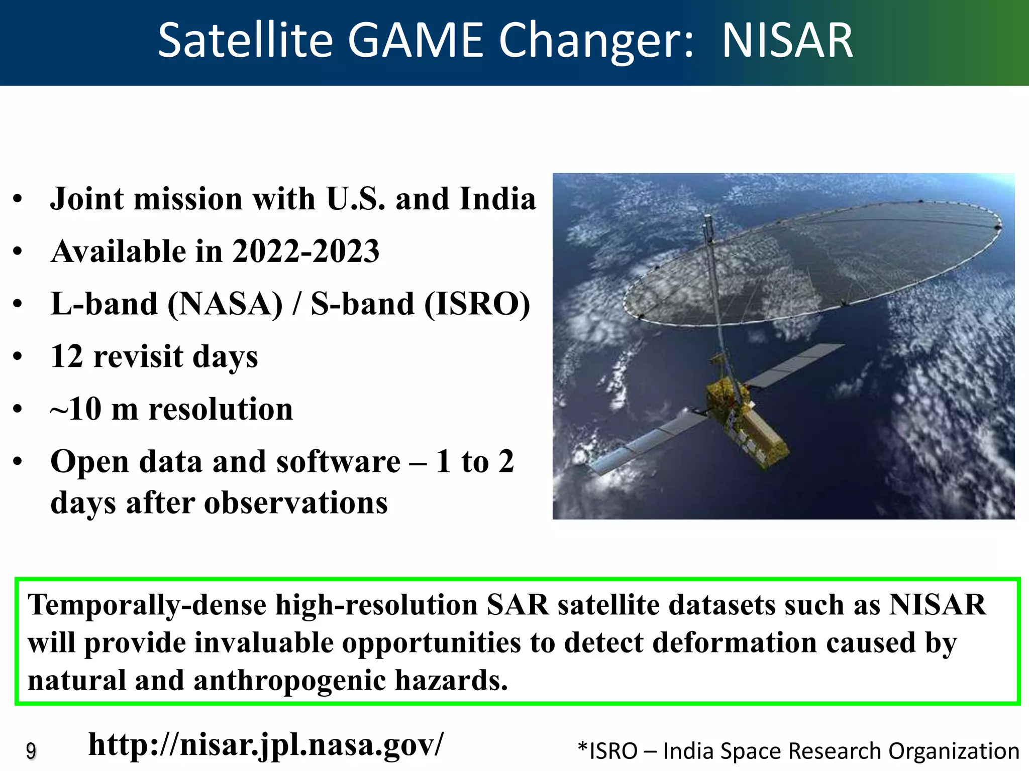
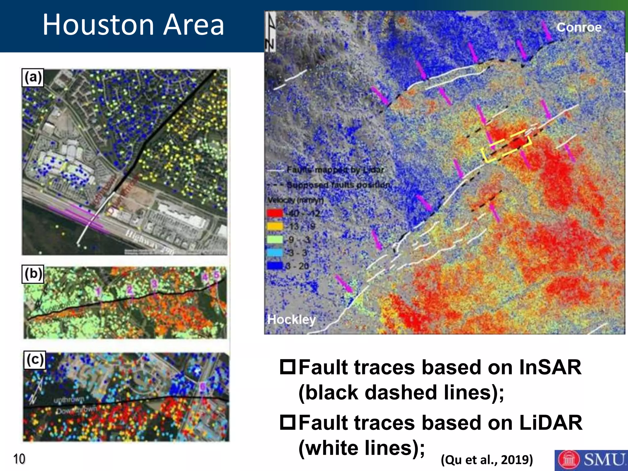
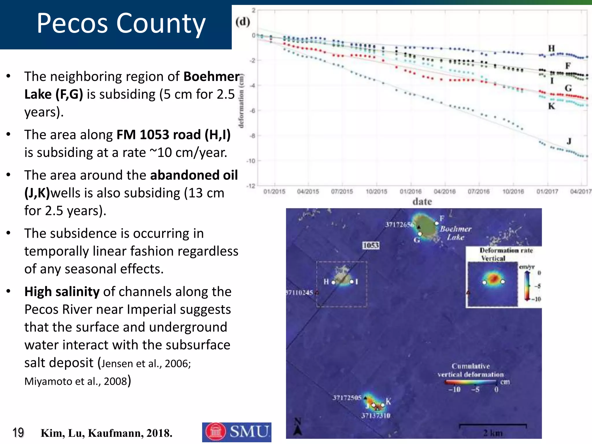
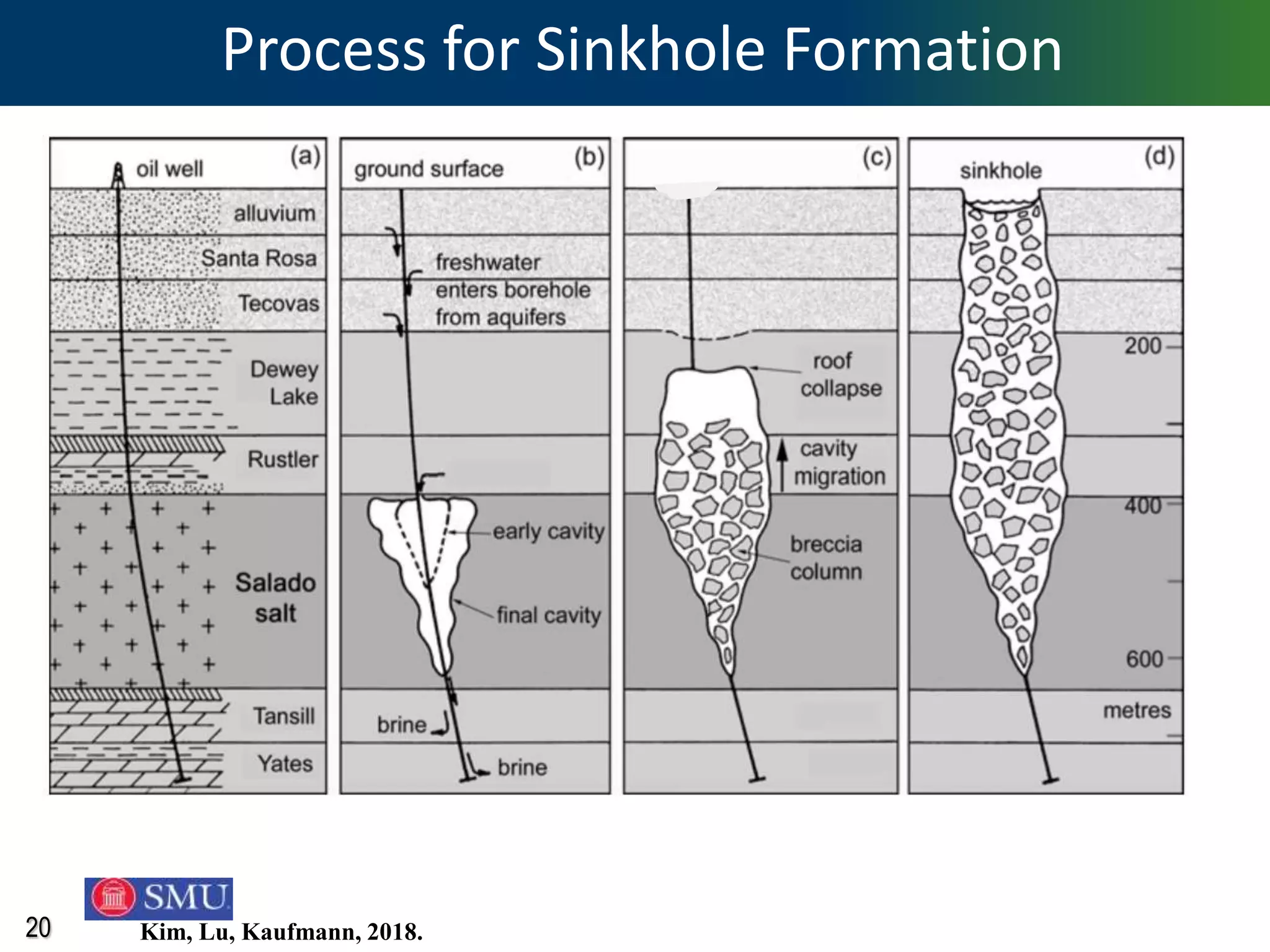


InSAR uses radar data from satellites to measure and monitor ground deformation over large areas with high precision. It works by comparing phase differences between radar images taken at different times. Recent satellite missions like Sentinel-1 and upcoming NISAR provide free and frequent data. Case studies in Texas show InSAR can detect subsidence and uplift related to oil/gas production, wastewater disposal and other human and natural causes at rates of centimeters per year over areas of 100 km squared with resolutions of tens of meters. Available data and analysis software allow low-cost, rapid evaluation of deformation trends.