Discussing the various methods of coastal protection against erosion and the challenges faced during management of Indian coasts. Delineating the hard and the soft methods of coastal protection giving several case studies from all around the world and detailing few Indian ones from West Bengal, Tamil Nadu, Puducherry, Kerala and Gujarat.
Review of RRZ and CRZ notification in Maharashtra. by-P.P.nandusekarEcotist
Classifying Rivers as per the beneficial use of the water: A-I, A-II, A-III & A-IV and SW-II class of water. Discussing very detailed comparison between RRZ Notification dtd.15.07.2000 and dtd.13.07.2009.
Current Status of CRZ It’s implementation. by-Vasudev P. Mahale Ecotist
Details of the immense fieldwork required for accurately determining the high tide line (HTL). As clear from the CRZ notification 2011, HTL is an extremely significant parameter for determining the various coastal zones.
Adequacy Check of Existing Crest Level of Sea Facing Coastal Polders by the E...IOSR Journals
The coastal embankment system has been gradually built during the last 40 years. The embankments
were originally designed to increase agricultural production by preventing salt water intrusion not to protect
against cyclonic storms. The alignment of the embankments did not consider the changing conditions in
bathymetry of the sea and thalweg migration of the rivers and therefore many embankments are located under
tidal water level and have severe toe and slope erosion problems during the monsoon season. The crest level
and embankment cross sections have not optimized the protection of hinterland and the embankment itself and
therefore the embankments typically only provide protection for the cyclones with 5-12 year return periods and
the designed crest level of the sea facing coastal polder equal to the sum of normal maximum recorded water
stage plus 1.50m. In this study to estimate the design crest level and side slope for sea facing embankment have
been established based on maximum storm surge level, wave run-up for cyclonic wave, freeboard allowing 5
l/m/s overtopping ,potential climate change impact and land subsidence. Statistical analysis of surge level and
wave run-up is carried out using Extreme Value Analysis (EVA) in MIKE Zero.
Coastal & River Zone Management, Regulations & Development. -Prof. Shyam R. A...Ecotist
Detailed background of the 1991 CRZ notification, and how it underwent as many as 25 amendments before the 2011 CRZ notification was passed and a detailed description of CRZ I-IV.
Presentation on RRZ Policy. by- Mr. V. M. Motghare Ecotist
The challenges of riverine pollution. Keeping population rise and unplanned urbanization as the major hurdles, he described the sources of pollution such as sewage disposal, industrial effluent discharge, cremation activities , idol immersion and the activity of haphazard sand mining was also brought forth. With this background, he described the RRZ policy enacted by the Maharashtra government and how the rivers here have been classified into zones as per their quality and usage and concluding by discussing the various steps needed to improve the implementation of the RRZ policy.
Presentation on Implementation of Coastal Regulation Zone Notification dtd.19...Ecotist
Described in detail the multiple challenges of implementing the CRZ regulations. He discussed how a wide gamut of issues such as fishing, industrial pollution, illegal construction and mangrove destruction were faced and many of which were pending. He concluded by comparing CRZ and Maharashtra state RRZ notification.
The prolific Niger Delta Basin is a mature petroleum province. Therefore, further prospectivity in
the basin lies within deeper plays which are high pressure and high temperature (HPHT) targets. One of the
main characteristics of the Niger Delta is its unique diachronous tripartite stratigraphy. Its gross onshore and
shallow offshore lithostratigraphy consists of the deep-seated Akata Formation and is virtually exclusively
shale, the petroliferous paralic Agbada Formation in which sand/shale proportion systematically increases
upward, and at the top the Benin Formation composed almost exclusively of sand. This stratigraphic pattern is
not exactly replicated in the deep offshore part of the delta.
Presentation on the CRZ 2011: Business as usual? by-Marianne ManuelEcotist
Traditional use of coasts such as fish drying and the immense social and cultural importance of this region for the local fishing communities. Associated industries such as thermal power plants and tourism also pose a threat to the coasts.
A Numerical Simulation for Predicting Sea Waves Characteristics and Downtime ...Professor Kabir Sadeghi
In this paper, a numerical simulation of sea wave characteristics and operation
downtimes of offshore structures is presented. The simulation was based on available
wind data and seawater temperature recorded by an oceanography buoy installed in
the Caspian Sea. Wave characteristics were simulated for deepwater parts of the
Caspian Sea by applying the Bretschneider spectrum and equations using following
recorded data: wind velocity, wind duration, fetch length, and water/air temperature
differences. Since recorded wave data were only available for a one-year period, they
were solely used for validation of the simulation results with recorded data but for
not the simulation itself. Some practically established thresholds for wave velocity,
wave period, and wind velocity were considered as constrains, limiting the operation
of offshore installations. The numerical simulation model revealed that it is possible
to operate offshore installations for 250 days per year in the southern parts of the
Caspian Sea. A worst-case scenario showed that the maximum waiting time for
restarting the offshore installations is 17 days. Considering the swell parameter, it
was concluded that the annual downtime period of offshore installation operations in
southern parts of the Caspian Sea is about one third of a year and the maximum
waiting time for this operation is about two third of a month.
STUDY AND DESIGN OF PROTECTION WALL AGAINST SEA EROSION AT SURVADA COAST LINE...Journal For Research
Sea erosion of coastal regions of the country becomes a threat to the existing of valuable coastal lands as well as nearby villages. The total coastal length of Gujarat is about 1600 km. Valsad, Navsari, Surat & Bharuch district of Gujarat state has its western boundary as Arabian sea having length of about 300 km. This coastal length have experience severe coastal erosion during last 10year, which ultimately leads damage of immovable properties and as well as loss of life of people. Considering in the safety of people and their properties, this research has been planned to safe guard the people of Survada coast line of Valsad district by designing protection structure against sea erosion and study their feasibility. For the protection of coastal length, Gujarat government has proposed schemes of assistance in which 10 percent share of the total expenditure to be incurred is contributed by the people and 90 percent by the government. Several such schemes are in operation presently in Valsad district. These are at Nani-Danti , Moti-Danti (720m long), Bhadeli-Jagalala(600m long), Kosamba(890m long), Bhagadavada-Tithal(1375m long), Tithal(665m long), Survada-Tithal(1025m long), Fansa(900m long), Maroli(1935 m long), Kolak(830m long), Umarsadi(460m long), Nargol(390m long) and at village Umargaon(285m long).Under this research, the designs of protection wall for the site was prepared. The work in this research was initiated with the survey of the selected coastal region i.e. Survada site and the required information on various aspects for the research was collected. After acquiring the required information, the structure was constructed suiting the project site and it was decided based on the obtained database. There after the designs of the structures was made keeping in mind the cost and strength of the protection wall. The design was made keeping in view the optimize cost and strength of the structure.
This training report is created during the ONGC training programme and all the informations are gathered from the training officers and the classroom programmes organised during the training prrogramme.
Optimistic, deterministic design of karaikal port breakwater structure case...eSAT Journals
Abstract Ports are important in international trade. These are gateway to country transport for cargo handling and commodity, where vessels may discharge or receive cargo. Karaikal port is the private port between the major ports of Chennai and tuticorin. It has two breakwater one is north breakwater of 650mtr and south breakwater of 600mtr. To increase cargo handling and protection of harbour from the waves and currents, breakwater structure is built and expansion has been taking place 400mtr on North side breakwater and 350mtr on south side Breakwater.For the expansion of breakwater, optimistic and deterministic design has been applied. In the deterministic design structural alternatives have been considered for economic design of breakwater. In the optimistic design we have to consider most economical Concrete Armour unit for the Armour layer of Karaikal port. Design of Rubble mound breakwater in a mathematical model for the purposes of weight of Armour layer and thickness of armour layer has been concluded.Design of Rubble mound breakwater in a mathematical model has consider x-bloc as a concrete armour unit which is suitable to reduce Breakwater structure construction cost in a Karaikal port. A breakwater could be optimized with respect to amongst others, construction costs, construction time, material reduction, environmental impacts and total cost. The most promising alternatives should be economically optimized and the results should be compared in order to assess the best solution. Rubble mound breakwater type with an concrete armour unit for that deterministic design and optimistic design has been applied for a Karaikal port. Keywords: Karaikal port 1, Rubble mound break water2.
A multi-purpose artificial surfing reef is an innovation that provides multiple benefits, particularly coastal protection,improved marine ecology, sheltered water inshore for safer swimming and recreation.
Coasts and River Zones: Major Corridors of Concerns. -Dr. Rakesh KumarEcotist
A comprehensive overview on the lack of scientific basis of many of the rules and regulations of CRZ Notification. Rules have safeguards, and enough peer and expert group participation, but implementation is an issue and lack of scientific basis.
Marine Pollution Control. - Dr. J.S. Pandey Ecotist
Elaborating about the control of marine pollution. Various types of wastes such as sewage, agricultural run-off, industrial wastes including radioactive waste, and oil spills being sent into the sea. Chemical pesticides find entry into the food chain. Harmful impact of oil spill. Discussing some of the positive features of CRZ Notification 2011, which included the inclusion of seawater as CRZ IV and the concept of hazard line. Ports and associated ship movement for business purposes cause marine pollution.
Coastal and River Zone Management: Perspectives from Mumbai. by-Rishi AggarwalEcotist
Observer Research Foundation, made a rousing presentation on the neglected aspects of CRZ interpretation and implementation in Mumbai. Presented several case studies emphasizing that CRZ implementation was not up to the mark. Marked the lack of proper solid waste management strategies in a city like Mumbai.
Protecting Environment by Protecting Wetlands and Mangrove Forests. by- D.S. ...Ecotist
Diminishing Wetlands and vanishing of the shelters for migratory birds are resulting in for these innocent birds moving towards the townships and been killed.
Significance of Geographic Information System (GIS) and remote sensing in management of coastal issues. Remote sensing monitoring can serve the dual purpose of water quality monitoring and nature policing.
Coastal Eco-systems, Vulnerability, and Sustainability: Social Science Persp...Ecotist
Delineated the extremely significant and sensitive issue of Socio-Economic aspect of CRZ; elaborating on the dubious purpose of CRZ- what is it trying to protect?
OBJECT ORIENTATION in CRZ Notification. by-G.D. ChiplunkarEcotist
Explaining the Concept of OBJECT ORIENTATION by defining Object for a given area at CENTRE LEVEL through nationwide debate, dialogue and all such participatory processes followed for a period of 2 years to 3 years.
Kubernetes & AI - Beauty and the Beast !?! @KCD Istanbul 2024Tobias Schneck
As AI technology is pushing into IT I was wondering myself, as an “infrastructure container kubernetes guy”, how get this fancy AI technology get managed from an infrastructure operational view? Is it possible to apply our lovely cloud native principals as well? What benefit’s both technologies could bring to each other?
Let me take this questions and provide you a short journey through existing deployment models and use cases for AI software. On practical examples, we discuss what cloud/on-premise strategy we may need for applying it to our own infrastructure to get it to work from an enterprise perspective. I want to give an overview about infrastructure requirements and technologies, what could be beneficial or limiting your AI use cases in an enterprise environment. An interactive Demo will give you some insides, what approaches I got already working for real.
Connector Corner: Automate dynamic content and events by pushing a buttonDianaGray10
Here is something new! In our next Connector Corner webinar, we will demonstrate how you can use a single workflow to:
Create a campaign using Mailchimp with merge tags/fields
Send an interactive Slack channel message (using buttons)
Have the message received by managers and peers along with a test email for review
But there’s more:
In a second workflow supporting the same use case, you’ll see:
Your campaign sent to target colleagues for approval
If the “Approve” button is clicked, a Jira/Zendesk ticket is created for the marketing design team
But—if the “Reject” button is pushed, colleagues will be alerted via Slack message
Join us to learn more about this new, human-in-the-loop capability, brought to you by Integration Service connectors.
And...
Speakers:
Akshay Agnihotri, Product Manager
Charlie Greenberg, Host
Neuro-symbolic is not enough, we need neuro-*semantic*Frank van Harmelen
Neuro-symbolic (NeSy) AI is on the rise. However, simply machine learning on just any symbolic structure is not sufficient to really harvest the gains of NeSy. These will only be gained when the symbolic structures have an actual semantics. I give an operational definition of semantics as “predictable inference”.
All of this illustrated with link prediction over knowledge graphs, but the argument is general.
DevOps and Testing slides at DASA ConnectKari Kakkonen
My and Rik Marselis slides at 30.5.2024 DASA Connect conference. We discuss about what is testing, then what is agile testing and finally what is Testing in DevOps. Finally we had lovely workshop with the participants trying to find out different ways to think about quality and testing in different parts of the DevOps infinity loop.
GraphRAG is All You need? LLM & Knowledge GraphGuy Korland
Guy Korland, CEO and Co-founder of FalkorDB, will review two articles on the integration of language models with knowledge graphs.
1. Unifying Large Language Models and Knowledge Graphs: A Roadmap.
https://arxiv.org/abs/2306.08302
2. Microsoft Research's GraphRAG paper and a review paper on various uses of knowledge graphs:
https://www.microsoft.com/en-us/research/blog/graphrag-unlocking-llm-discovery-on-narrative-private-data/
Dev Dives: Train smarter, not harder – active learning and UiPath LLMs for do...UiPathCommunity
💥 Speed, accuracy, and scaling – discover the superpowers of GenAI in action with UiPath Document Understanding and Communications Mining™:
See how to accelerate model training and optimize model performance with active learning
Learn about the latest enhancements to out-of-the-box document processing – with little to no training required
Get an exclusive demo of the new family of UiPath LLMs – GenAI models specialized for processing different types of documents and messages
This is a hands-on session specifically designed for automation developers and AI enthusiasts seeking to enhance their knowledge in leveraging the latest intelligent document processing capabilities offered by UiPath.
Speakers:
👨🏫 Andras Palfi, Senior Product Manager, UiPath
👩🏫 Lenka Dulovicova, Product Program Manager, UiPath
Software Delivery At the Speed of AI: Inflectra Invests In AI-Powered QualityInflectra
In this insightful webinar, Inflectra explores how artificial intelligence (AI) is transforming software development and testing. Discover how AI-powered tools are revolutionizing every stage of the software development lifecycle (SDLC), from design and prototyping to testing, deployment, and monitoring.
Learn about:
• The Future of Testing: How AI is shifting testing towards verification, analysis, and higher-level skills, while reducing repetitive tasks.
• Test Automation: How AI-powered test case generation, optimization, and self-healing tests are making testing more efficient and effective.
• Visual Testing: Explore the emerging capabilities of AI in visual testing and how it's set to revolutionize UI verification.
• Inflectra's AI Solutions: See demonstrations of Inflectra's cutting-edge AI tools like the ChatGPT plugin and Azure Open AI platform, designed to streamline your testing process.
Whether you're a developer, tester, or QA professional, this webinar will give you valuable insights into how AI is shaping the future of software delivery.
UiPath Test Automation using UiPath Test Suite series, part 4DianaGray10
Welcome to UiPath Test Automation using UiPath Test Suite series part 4. In this session, we will cover Test Manager overview along with SAP heatmap.
The UiPath Test Manager overview with SAP heatmap webinar offers a concise yet comprehensive exploration of the role of a Test Manager within SAP environments, coupled with the utilization of heatmaps for effective testing strategies.
Participants will gain insights into the responsibilities, challenges, and best practices associated with test management in SAP projects. Additionally, the webinar delves into the significance of heatmaps as a visual aid for identifying testing priorities, areas of risk, and resource allocation within SAP landscapes. Through this session, attendees can expect to enhance their understanding of test management principles while learning practical approaches to optimize testing processes in SAP environments using heatmap visualization techniques
What will you get from this session?
1. Insights into SAP testing best practices
2. Heatmap utilization for testing
3. Optimization of testing processes
4. Demo
Topics covered:
Execution from the test manager
Orchestrator execution result
Defect reporting
SAP heatmap example with demo
Speaker:
Deepak Rai, Automation Practice Lead, Boundaryless Group and UiPath MVP
Accelerate your Kubernetes clusters with Varnish CachingThijs Feryn
A presentation about the usage and availability of Varnish on Kubernetes. This talk explores the capabilities of Varnish caching and shows how to use the Varnish Helm chart to deploy it to Kubernetes.
This presentation was delivered at K8SUG Singapore. See https://feryn.eu/presentations/accelerate-your-kubernetes-clusters-with-varnish-caching-k8sug-singapore-28-2024 for more details.
Let's dive deeper into the world of ODC! Ricardo Alves (OutSystems) will join us to tell all about the new Data Fabric. After that, Sezen de Bruijn (OutSystems) will get into the details on how to best design a sturdy architecture within ODC.
LF Energy Webinar: Electrical Grid Modelling and Simulation Through PowSyBl -...DanBrown980551
Do you want to learn how to model and simulate an electrical network from scratch in under an hour?
Then welcome to this PowSyBl workshop, hosted by Rte, the French Transmission System Operator (TSO)!
During the webinar, you will discover the PowSyBl ecosystem as well as handle and study an electrical network through an interactive Python notebook.
PowSyBl is an open source project hosted by LF Energy, which offers a comprehensive set of features for electrical grid modelling and simulation. Among other advanced features, PowSyBl provides:
- A fully editable and extendable library for grid component modelling;
- Visualization tools to display your network;
- Grid simulation tools, such as power flows, security analyses (with or without remedial actions) and sensitivity analyses;
The framework is mostly written in Java, with a Python binding so that Python developers can access PowSyBl functionalities as well.
What you will learn during the webinar:
- For beginners: discover PowSyBl's functionalities through a quick general presentation and the notebook, without needing any expert coding skills;
- For advanced developers: master the skills to efficiently apply PowSyBl functionalities to your real-world scenarios.
From Siloed Products to Connected Ecosystem: Building a Sustainable and Scala...
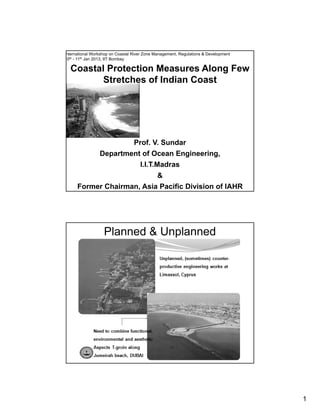
Coastal Protection Measures Along few stretches of Indian Coast. by-V. Sundar
1. 1
Coastal Protection Measures Along Few
Stretches of Indian Coast
nternational Workshop on Coastal River Zone Management, Regulations & Development
10th - 11th Jan 2013, IIT Bombay
Prof. V. SundarProf. V. Sundar
Department of Ocean Engineering,
I.I.T.Madras
&
Former Chairman, Asia Pacific Division of IAHR
Planned & Unplanned
2. 2
COASTAL ENGG. PROBLEMS ALONG THE
INDIAN COAST
Most major rivers drain into Bay of Bengal (Imbalance in
Sediments from rivers)Sediments from rivers)
Problems along east coast dominant
Silting up of entrance channels
Closing of river mouths
Problems concerning aquaculture Problems concerning aquaculture
Silting up of intake structures
Erosion along the coast
Organisation of presentation
• Introduction
• Options under Soft & Hard measures
• Case Studies and proposed coastal protection
measures along selected stretches of maritimemeasures along selected stretches of maritime
states
West Bengal
Andhra Pradesh
Tamilnadu
Puducherry (Pondichery)
Kerala
Gujarat
• Summary
3. 3
Organisation of presentation
• Introduction
• Options under Soft & Hard measures
• Case Studies and proposed coastal protection
measures along selected stretches of maritimemeasures along selected stretches of maritime
states
West Bengal
Orissa
Andhra Pradesh
Tamilnadu
Puducherry (Pondichery)
Kerala
Gujarat
• Summary
A Few Typical damages due to coastal erosion
4. 4
Coastal Protection measures
HARD MEASURES SOFT MEASURES
Normal to the coastline [groins] Replenishment of coast withNormal to the coastline [groins]
Deposition Erosion Groins
Sea
Sea
Wave direction
Replenishment of coast with
sand.
At the landward side of the
dune [A]
At the seaward side of the
dune, landward of the dune
base [B]
At the seaward side of the
dune, seaward of the dune
base [C]
Parallel to the coastline on shore
[seawalls]
C B A
Seawall
Land
Sea
Parallel to the coastal offshore
break waters
Land
Land
Offshore breakwater Wave direction
Groynes, Jetties & training walls
Oldest groins (1503),Vissingen, Netherlands
T-Groin field protecting the coast of Florida
Suitable in areas where LST is predominant
Normandy Island
Groin field
Jetties
6. 6
Artificial Beach recharge schemes
Sand replenishment from the
nearshore on to the beach
Before
Department of Ocean Engineering, IIT Madras, Chennai , India – 600 036
Beach replenishment in miami
After
LONGSHORE CURRENT -ANIMATION
Q=0 Q further increases
Oblique wave
Q increases
Wave direction Normal
7. 7
LONGSHORE CURRENT -ANIMATION
OBJECTIVES OF THE PRESENT WORK
Coastal challenges along the Chennai coast
The problems around the Chennai coast attempted by IITM is addressed in
this lecture
The main seed for these problems is dated back to one and a quarter
century, that is the construction of Chennai Port(Man made problem).
3
1
4 5
1. Coastal erosion on the northern coast Chennai port
2. Choking up of Cooum River mouth
3. Coastal erosion towards the north of River Cooum
4. Coastal erosion beyond the north Chennai groin field
5. Proposal of Chennai Port Mega Terminal
23
8. 8
Location map of the site
WEST BENGAL
Usage of Ballas on the western
side of the coast near the road
near Chandpur
STATUS OF THE COAST in mid 2007
Usage of Ballas on the eastern
side of the coast near the road
near Chandpur
Dhiga beach- view towards east of
SeaHawk hotel
High tide
penetration into
the sand dunes
9. 9
STATUS OF THE COASTAL PROTECTION FROM MID 2007 to
EARLY 2008
Status prior to protection
Completed portion of the protection
Some problems with Geo-tubes
10. 10
Coastal protection measures for Uppada, Andhra Pradesh
BREAKWATER
N LITTORAL DRIFT
COASTAL ENGINEERING PROBLEM
NEAR MADRAS
Northern breakwater
Southern
TAMILNADU
I N D I A
MADRAS
MARINA BEACH
+VE
LAND
Wave direction
-VE
-VE (Sand bar)
HARBOUR
BASIN
+VE
RIVER COOUM
MAN MADE PROBLEM
11. 11
STATUS OF THE STUDY AREA PRIOR TO THE PROTECTION
Swallowing of Temple
Temple about to be
Sacrificed to the sea
TEMPLE BEING SACRIFICED
g p
by Erosion in process
12. 12
Satellite
Port
K hi kkCreek
Ennore Expressway
Thiruvoutiyur High road
Shoreline
Sand trap
A new 500m long groin
A new 250m short groin
N
Phase 1
G i fi ld i th 2 t t h t b
Stretch I (2.0km)
Proposed 6 groins
by IIT Madras
(Not to scale)
Ernavoor
bridge
Ernavoor
ICI Ltd.
Ennore
E.I.D Parry
Kathivakkam
Ennore
C A new 250m short groin
Groin fields in the 2 stretches to be
completed by May.
Monitoring of the shoreline & if possible
sand by-passing from ennore port
Numerical, physical model studies &
field studies
Harbor
Royapuram
Tondiarpet
Tollgate
Eveready&co
Stretch II (1.5km)
Proposed 4 groins
by IIT Madras
(Not to scale)
0 0.5 1.0 1.5 2.0 km
Phase 2
Long and short Groins near ennore
creek mouth.
Groin 6
Beach formed
Beach formed on the south of Groin 6
North of Groin 6
Beach formed on the south of Groin 6
Beach Formation South of Groin 6 (Royapuram) in July-Aug’04
N
Groin 6
13. 13
Groin 6
length: 165m
As on 13/08/04 (3684 sq.m)
As on 25/08/04 (6973 sq.m)
As on 14/09/04 (8800 sq.m)
As on 06/01/05 (4660 sq.m)
As on 21/01/05 (10452 sq.m)
Work commenced in May 2004
BAY OF BENGAL
30 m
To ENNORE
15 m
30 m
SEA WALL
60 m 90 m
SEA WALL
120 m 150 m 180 m 210 m
GROYNENO:6
60 m
NORTH
45 m
70 m 300 m
240 m
To PARYYS
270 m
GROYNENO:5
SOUTH
Groin 5
length: 200m
Area =10452 Sq.m
N
Groin 6
Groin 5
SEA WALL
Satellite Imageries of Stretch 1
G5
G4
G6
G6
G5
(ROYAPURAM)
G2
G3
G1 G4
G2
G3
G1
G6Less erosion protected with seawall
14. 14
WAVE DATA
The coastal region around India is divided into 10 grids,
each of size 50 latitude and 50 longitude.
The present study area comes under the grid located at
10 – 150N and 75 – 800E in the wave atlas representing grid
number six.
The wave data obtained
from wave atlas is for
deep-water conditions.
B A Y
VISAKHAPATNAM
3
2
15°
20°
25° N
65° E
25° N
20°
15°
70° 75°
80°
85°
90°
ARA
10
9
1
B A Y
O F
B E N G A L
I N D I A N O C E A N
6
7
8
4
TUTICORIN
MANGALORE
MADRAS
5°
65° E
70° 75° 80°
85°
90°
95°
5°
10°
10°
K
E
R
A
L
A
TAMIL
NADU
5
BIANSEA
Before Restoration
15. 15
FINAL LAYOUT
G1
G3
G2G4
G5
G6
G7
G8
G9
G10
G11
G12
Layout of groin field for Simon Colony, Vaniyakudi and Kurumbanai villages
Groin abutting the
rock outcrop
Shoreline evolution on Eastern side due to
the construction of Groin G9-G10 (May’04)
Groin G9-G10
Groin G9-G10
Shore line evaluation in between
Groins G9-G10 and G11-G12
Rock outcrop near Groin G9-G10
Beach formation on the
Eastern side of Groin G9-G10
Status of beach in April’04
16. 16
Beach formation in between the Groins G3-G4 and G5-G6(Oct’04)
A view of the shoreline from the eastern of the groins G5-G6 (oct04
G3
G4
G5
G6
Rock outcrop
During the tsunami of 2004, the beaches formed
due to the present groin field had acted as buffers
due to which the inundation distance and run-up
heights had reduced leading to almost nil damage.
The tsunami had exhibited its might on the
villages adjoining the study area. The groin field acts
as coastal protection measure, but also has
enhanced the livelihood of the fisherman as the
S b t th i fi h l diSpace between the groins serve as fish landing
centre.
This success has lead to a great demand for
groins along the coastal areas.
17. 17
Prior 2006
IIT M proposal (2007)
Ratchagan Street (Kanyakumari)
Present (2008)
Kilmanakudi
MEL & KIL MANAKUDI
Melmanakudi
19. 19
Southern
Breakwater
Pile supported
Jetty
Northern
Breakwater
A view of breakwaters at Pondicherry
The erosion and
accretion is estimated
from 1986 to 2002, i.e.,
over a period of 16 years
with the satellite imagery
data using GIS software.
The rate of
erosion is about 4m per
year and the accretion is
6m per year.
The extent of
erosion in the northern
side is 33.59 hectares
compared to the
accretion on southern
side of 30.71 hectares..
20. 20
Offshore
Breakwater
Northern
B k t
Inlet
channel
Submarine
Tunnel
Pile supported
Jetty
Southern Groin
Breakwater
SAND BY-PASSING IN
Total quantity of sand bypassing
= 0.4 million cu.m (mar to
Oct’02)
PONDICHERRY
BEFORE SAND BYPASSING
January 2002
A VIEW OF SHORELINE NEAR GANDHI STATUE
AFTER SAND BYPASSING
October 2002
BEACH WON
21. 21
A VIEW ON NORTH SIDE
OF GANDHI STATUE
(BEFORE SAND BYPASSING)
January 2002
FORMATION OF
BEACH ON
NORTH SIDE OF
GANDHI STATUE
(AFTER SAND
BYPASSING)
October 2002
C t f K l St t t t f
INTRODUCTION KERALA
• Coast of Kerala State starts from
Latitude 12°41’ N, Longitude
74°54’ E at North and ends at
Latitude 8°17’ N, Longutude
77°05’ E at South.
• Kerala has 560 Kms of coastline
of which about 350 Kms is
already protected by sea walls.
• There are 44 rivers in Kerala.
• Besides the Port of Kochi (a Major
Port governed by Major Port
Trusts Act, 1963), there are 3
Intermediate and 14 Minor Ports
in Kerala.
22. 22
Strengthening of existing seawall
(as a protection till the construction of
groin field)
Typical cross section of
contd…
THIRUVANATHAPURAM DISTRICT
Panathurakara
Thiruvanathapuram kollam Alappuzha Ernakulam Thrissur Malappuram Kozhikode Kannur Kasargod
Typical cross section of
conventional sea wall
Typical cross section of
sea wall using PP Gabions
Typical cross section of
sea wall with Toe Gabions
Janarthanapuram
Varkala beach is an important tourism and heritage spot.
THIRUVANATHAPURAM DISTRICT
Thiruvanathapuram kollam Alappuzha Ernakulam Thrissur Malappuram Kozhikode Kannur Kasargod
PROBLEM
•Plenty of scope to convert the location as a major attraction.
•Site with predominant cliff erosion.
North of Janarthanapuram (Varkala Beach) South of Janarthanapuram (Varkala Beach)
23. 23
SOLUTION
THIRUVANATHAPURAM DISTRICT
Janarthanapuram
Thiruvanathapuram kollam Alappuzha Ernakulam Thrissur Malappuram Kozhikode Kannur Kasargod
10 m 3 m
+5.50 m
Cliff
Gabions
2m x 2m
MSL
Protection of the cliff with seawall and gabions.
Submerged geotubes for reduction of wave energy.
GEOTUBES OF WIDTH 4.44 M AND OF HEIGHT 1.54 M FILLED WITH SAND
5.0m
MSL
GEOWOVEN TEXTILES
FLEXIBLE GEO BAGS GWF 40-220 OF SIZES 0.5M X0.5 M
EACH 0.2M THICK OF OVERALL SIZE 3M X 1 M
GEO CONTAINERS GWF 38-285 2m X 1.50m X 1m
OF 1M HEIGHT ABOVE BED
SOLUTION
It is proposed that the existing seawall be rehabilitated with the cross-
ti d b IITM h b l th t l l f hi h h ld b
ERNAKULAM DISTRICT : Nayarambulam-North
Thiruvanathapuram kollam Alappuzha Ernakulam Thrissur Malappuram Kozhikode Kannur Kasargod
section proposed by IITM as shown below, the top level of which should be
at +4.00 m
Transition groin
field as a long-term
measure
24. 24
Is it role of vegetation?
Tsunami Heights =3-4m
BG
Design Questions
Dt
Greenbelt Parameters
D
SP
25. 25
DEFINITION SKETCH OF VEGETATION AND POROSITY
Dt
Regular Arrangement Zig-Zag Arrangement
BG
SP
BG
Porosity =[(SP-Dt)/SP]
SP=c/c distance between Vegetationg
Dt=Diameter of Vegetation
BG=Breadth of Green belt
EXPERIMENTAL INVESTIGATIONS
BG=0.25m:D=1.65mm:SP=37.5mm(RE) BG=0.25m:D=1.65mm:SP=37.5mm(RE) BG=0.25m:D=5.5mm:SP=37.5mm(RE)
26. 26
3.5
4
SP/Dt=3.75
SP/Dt=3.75
SP/Dt=7.5
SP/Dt=12.5
Resistance in terms of Darcy’s f in Steady Uniform Flow
Reduced
Velocity, Vr
(V/fD)~4.0
1
1.5
2
2.5
3 SP/Dt=25
SP/Dt>3.75
Darcy's'f'
0
0.5
0.3 0.4 0.5 0.6 0.7 0.8 0.9
Froude Number
SP/D ~3.75: Proximity Effect Predominant
Vr~4.0: Wake Effect Predominant
SUMMARY
• An overview on the options for protecting
th t i t i hi hli ht dthe coast against erosion was highlighted
• A few case studies was discussed in brief
27. 27
Under normal conditions
INUNDATION OF INTERINUNDATION OF INTER--DUNAL FLATSDUNAL FLATS-- MOVIESMOVIES
Tsunami traveled up to 1km, with
a height of even upto @10m
Thanks for your
kind attention