Download to read offline

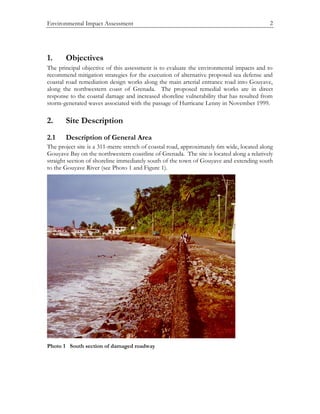

The document provides an environmental impact assessment for a proposed seawall and road repair project in Gouyave, Grenada. It finds that constructing a seawall with armor stone will provide long-term benefits to shoreline stability and access. Nearshore habitat consists of bare sand but more sensitive habitats are located further offshore and will not be impacted. Water quality sampling found elevated levels of turbidity, nitrates, and bacteria in nearshore waters compared to offshore.


