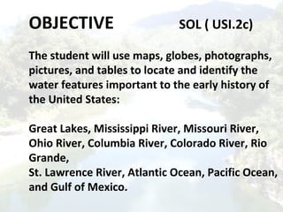
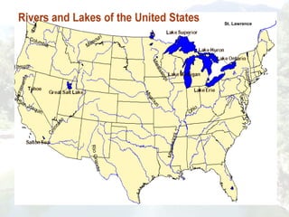
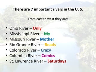
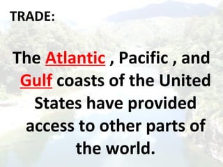
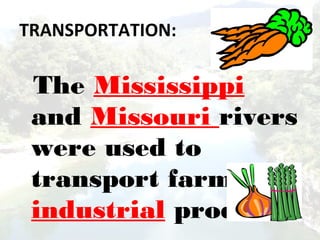
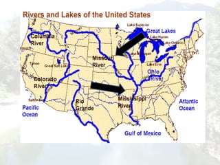
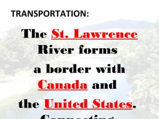
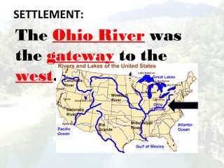
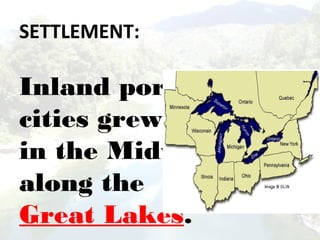
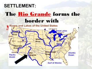
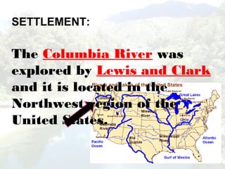
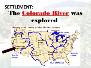
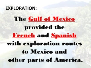
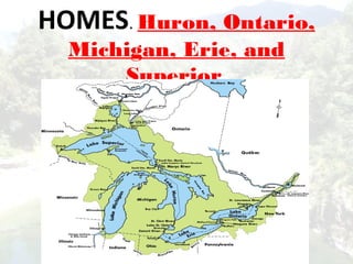
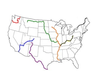
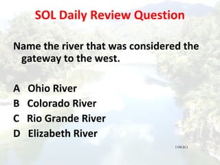
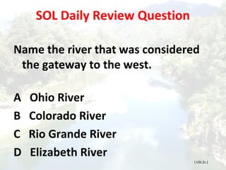
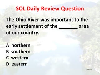
WATER FEATURES
United States History I
SOL ( USI.2c )
( Basic) SOL Review Questions
This continent contains the
longest river and largest desert in
the world.
a. Asia
b. North America
c. Africa
d. Europe
( Basic) SOL Review Questions
This continent contains the largest
Tropical rainforest in the world.
a. Australia
b. Canada
c. Asia
d. South America
( Basic) SOL Review Questions
Which region stretches from Canada to
Alabama and has the oldest mountain
ranges in North America?
f. Interior Lowlands
g. Coastal Range
h. Canadian Shield
j. Appalachian Highlands (Mountains)
( Basic) SOL Review Questions
Which region is along the Atlantic Ocean
and Gulf of Mexico? It has many
excellent harbors.
 
a. Rocky Mountains
b. Great Plains
c. Coastal Plains
d.Basin and Range
( Basic) SOL Review Questions
Which region has rolling hills with many
rivers, broad river valleys and grassy
hills?
a. Basin and Range
b. Interior Lowlands
c. Rocky Mountains
d. Appalachian Mountains
( Basic) SOL Review Questions
Which region stretches from Alaska
almost to Mexico and includes the
Continental Divide? It has rugged
mountains with high elevations?
f. Appalachian Highlands
g. Basin and Range
h. Rocky Mountains
j. Coastal Range
OBJECTIVE SOL ( USI.2c)
The student will use maps, globes, photographs,
pictures, and tables to locate and identify the
water features important to the early history of
the United States:
Great Lakes, Mississippi River, Missouri River,
Ohio River, Columbia River, Colorado River, Rio
Grande,
St. Lawrence River, Atlantic Ocean, Pacific Ocean,
and Gulf of Mexico.
St. Lawrence
There are 7 important rivers in the U. S.
From east to west they are:
• Ohio River – Only
• Mississippi River – My
• Missouri River – Mother
• Rio Grande River – Reads
• Colorado River – Crazy
• Columbia River – Comics
• St. Lawrence River – Saturdays
Can you remember the rivers?
Only My Mother
Reads Crazy Comics
Saturdays.
TRADE:
The Atlantic , Pacific , and
Gulf coasts of the United
States have provided
access to other parts of
the world.
The Atlantic
Ocean served as
the highway for
explorers, early
settlers and
later
TRANSPORTATION:
The Mississippi
and Missouri rivers
were used to
transport farm and
industrial products.
TRANSPORTATION:
The St. Lawrence
River forms
a border with
Canada and
the United States.
The Ohio River was
the gateway to the
west.
SETTLEMENT:
SETTLEMENT:
Inland port
cities grew
in the Midwest
along the
Great Lakes.
SETTLEMENT:
The Rio Grande forms the
border with
Mexico and Texas ( in the
United States ).
SETTLEMENT:
The Columbia River was
explored by Lewis and Clark
and it is located in the
Northwest region of the
United States.
SETTLEMENT:
The Colorado River was
explored
by the Spanish.
EXPLORATION:
The Pacific Ocean was
an early exploration
destination.
EXPLORATION:
The Gulf of Mexico
provided the
French and Spanish
with exploration routes
to Mexico and
other parts of America.
HOMES. Huron, Ontario,
Michigan, Erie, and
Superior.
SOL Daily Review Question
Name the river that was considered the
gateway to the west.
A Ohio River
B Colorado River
C Rio Grande River
D Elizabeth River
( USI.2c )
SOL Daily Review Question
Name the river that was considered
the gateway to the west.
A Ohio River
B Colorado River
C Rio Grande River
D Elizabeth River
( USI.2c )
SOL Daily Review Question
The Ohio River was important to the
early settlement of the _______ area
of our country.
A northern
B southern
C western
D eastern
( USI.2c )
SOL Daily Review Question
• This huge body of water borders Florida,
Alabama, Mississippi, Louisiana, Texas and
Mexico.
• A Atlantic Ocean
• B Colorado River
• C Rio Grande River
• D Gulf of Mexico
SOL Daily Review Question
• This body of water connects Europe to
America.
• A Pacific Ocean
• B Gulf of Mexico
• C Hudson Bay
• D Atlantic Ocean
SOL Daily Review Question
• This body of water flows into the Mississippi
from the east.
• A Ohio River
• B Colorado River
• C Rio Grande River
• D Elizabeth River
SOL Daily Review Question
This body of water forms a border between the United
States and Canada, it also connects Lake Erie to the
Atlantic Ocean providing a shorter and faster
transportation route for trade.
• A Ohio River
• B St. Lawrence River
• C Rio Grande River
• D Elizabeth River
SOL Daily MAP Review

Usi.2c rivers ppt

  • 1.
    WATER FEATURES United StatesHistory I SOL ( USI.2c )
  • 2.
    ( Basic) SOLReview Questions This continent contains the longest river and largest desert in the world. a. Asia b. North America c. Africa d. Europe
  • 3.
    ( Basic) SOLReview Questions This continent contains the largest Tropical rainforest in the world. a. Australia b. Canada c. Asia d. South America
  • 4.
    ( Basic) SOLReview Questions Which region stretches from Canada to Alabama and has the oldest mountain ranges in North America? f. Interior Lowlands g. Coastal Range h. Canadian Shield j. Appalachian Highlands (Mountains)
  • 5.
    ( Basic) SOLReview Questions Which region is along the Atlantic Ocean and Gulf of Mexico? It has many excellent harbors.   a. Rocky Mountains b. Great Plains c. Coastal Plains d.Basin and Range
  • 6.
    ( Basic) SOLReview Questions Which region has rolling hills with many rivers, broad river valleys and grassy hills? a. Basin and Range b. Interior Lowlands c. Rocky Mountains d. Appalachian Mountains
  • 7.
    ( Basic) SOLReview Questions Which region stretches from Alaska almost to Mexico and includes the Continental Divide? It has rugged mountains with high elevations? f. Appalachian Highlands g. Basin and Range h. Rocky Mountains j. Coastal Range
  • 8.
    OBJECTIVE SOL (USI.2c) The student will use maps, globes, photographs, pictures, and tables to locate and identify the water features important to the early history of the United States: Great Lakes, Mississippi River, Missouri River, Ohio River, Columbia River, Colorado River, Rio Grande, St. Lawrence River, Atlantic Ocean, Pacific Ocean, and Gulf of Mexico.
  • 9.
  • 10.
    There are 7important rivers in the U. S. From east to west they are: • Ohio River – Only • Mississippi River – My • Missouri River – Mother • Rio Grande River – Reads • Colorado River – Crazy • Columbia River – Comics • St. Lawrence River – Saturdays
  • 11.
    Can you rememberthe rivers? Only My Mother Reads Crazy Comics Saturdays.
  • 12.
    TRADE: The Atlantic ,Pacific , and Gulf coasts of the United States have provided access to other parts of the world.
  • 13.
    The Atlantic Ocean servedas the highway for explorers, early settlers and later
  • 14.
    TRANSPORTATION: The Mississippi and Missouririvers were used to transport farm and industrial products.
  • 16.
    TRANSPORTATION: The St. Lawrence Riverforms a border with Canada and the United States.
  • 17.
    The Ohio Riverwas the gateway to the west. SETTLEMENT:
  • 18.
    SETTLEMENT: Inland port cities grew inthe Midwest along the Great Lakes.
  • 19.
    SETTLEMENT: The Rio Grandeforms the border with Mexico and Texas ( in the United States ).
  • 20.
    SETTLEMENT: The Columbia Riverwas explored by Lewis and Clark and it is located in the Northwest region of the United States.
  • 21.
    SETTLEMENT: The Colorado Riverwas explored by the Spanish.
  • 22.
    EXPLORATION: The Pacific Oceanwas an early exploration destination.
  • 23.
    EXPLORATION: The Gulf ofMexico provided the French and Spanish with exploration routes to Mexico and other parts of America.
  • 24.
  • 26.
    SOL Daily ReviewQuestion Name the river that was considered the gateway to the west. A Ohio River B Colorado River C Rio Grande River D Elizabeth River ( USI.2c )
  • 27.
    SOL Daily ReviewQuestion Name the river that was considered the gateway to the west. A Ohio River B Colorado River C Rio Grande River D Elizabeth River ( USI.2c )
  • 28.
    SOL Daily ReviewQuestion The Ohio River was important to the early settlement of the _______ area of our country. A northern B southern C western D eastern ( USI.2c )
  • 29.
    SOL Daily ReviewQuestion • This huge body of water borders Florida, Alabama, Mississippi, Louisiana, Texas and Mexico. • A Atlantic Ocean • B Colorado River • C Rio Grande River • D Gulf of Mexico
  • 30.
    SOL Daily ReviewQuestion • This body of water connects Europe to America. • A Pacific Ocean • B Gulf of Mexico • C Hudson Bay • D Atlantic Ocean
  • 31.
    SOL Daily ReviewQuestion • This body of water flows into the Mississippi from the east. • A Ohio River • B Colorado River • C Rio Grande River • D Elizabeth River
  • 32.
    SOL Daily ReviewQuestion This body of water forms a border between the United States and Canada, it also connects Lake Erie to the Atlantic Ocean providing a shorter and faster transportation route for trade. • A Ohio River • B St. Lawrence River • C Rio Grande River • D Elizabeth River
  • 33.