SlideShare a Scribd company logo
Physical and Human Geography of
Asia
By: Group 4
Group Members
• Sana Bakht
• Kainat Safdar
• Syeda Maheen Ali
• Adil Fayyaz
• Hunain Munir
• 15051561-034
• 15051561-002
• 15051561-023
• 15051561-035
• 15051561-028
INTRODUCTION
• Planet earth: Home to 7.3 billion people and over 1.5 million
species of animals
• The continental drift: It’s a theory that explains the sifting of
the continents which was set forth by Alfred Wegener.
• Geography: The key
subject that made us
to lift our eyes to see
the complex and
magnificent world
What is a Continent?
• Several very large land masses on earth
• The numbers of continent: always under discussion
 5 continents: Africa, America, Asia, Australia &
Europe
 6 continents: America, Antarctica, Africa, Oceania,
Europe & Asia
 7 continents: North America, South America, Africa,
Antarctica, Oceania, Europe &Asia
ASIA
• Land Area of Asia: 17,210,000 (mi²) / 44,029,797
(km²)
• Population of Asia: 4,494,302,221 (2016)
• Largest City in Asia: Tokyo, Japan (37,126,000
(2012)
• Largest religion :ISLAM with 1.1 billion people
• Most spoken language: Chinese
Continued…..
• Boundaries: The borders of Asia
ASIA
• Outline History:
Empires and civilizations in the south west
Nomadic tribes of the central Asia
Wars : korean war, communism vs capitalism,
western power aliences, World wars, Japanese
occupations, nations with powerful military
• Asian geology:
ASIA
• Asian geology:
 Great peninsulas extend out from the mainland, dividing the
oceans into seas and bays, many of them protected by Asia's
numerous offshore islands
 Asia's rivers, among the longest in the world. the Amur-Argun,
Huang He, Chang (Yangtze), Xi, of E and SE Asia.Ganges-
Brahmaputra, Indus, and Tigris-Euphrates of S and SW Asia.
Central Asia has vast areas of interior drainage, including the
Amu Darya, Syr Darya, Ili, and Tarim rivers.
 Lake Baykal and Lake Balkash are among the world's largest
lakes
 Climatically, the continent ranges through all extremes, from
torrid heat to arctic cold and from torrential rains
ASIA
• Population, culture, politics and economy
1. Southwest Asia:is characterized by an arid climate and
irrigated agriculture, great petroleum reserves, and the
predominance of Islam.
2. South Asia: monsoon climate, maritime orientation, the fusion
of Indian and Chinese cultures, and a great diversity of ethnic
groups, languages, religions, and politics
3. East Asia:
4. Russian Asia:
5. Central Asia
Continued…….
• Flora-vegetation cover:
 far north of the continent (Siberia) tundra and taiga vegetation
predominate
 South of the taiga
 S + SE + E Asia = predominating equatorial rainforest
 Farther north of the equator lies a more open tropical forest
• Fauna-animal life
 The northern regions = brown bear, otter, lynx, ermine and wolf, in
addition to a vast amount of bird species.
 Freshwater fish are found in all parts of the continent = Lake Baikal
is notable for its distinctive fauna.
 Highlands = Wild sheep and goats and Tibet is the home of the wild
yak.
 Hot desert regions of SW and S Asia = wildlife is scarcer (rare).
Continued…….
 E and SE Asia = notably of loss of habitat and hunting.
 S and SE Asia =Birdlife, snakes, and lizards abound (occur
often) and various types of crocodiles are widely distributed.
Wild apes such as the gibbon and the scarce orang-utan are
found in SE Asia. Many types of deer and antelope also live in
well-populated areas (Borneo), where flying squirrels and tree
rats are numerous
Geographical Divisions Of
Asia
South East Asia
Subregion of asia, consisting of the countries that are
geographically south of china, east of india, west of new guinea
and north of australia.
Southeast asia together with the indian subcontinent and
lowland southern china forms the indomalaya ecozone, one of the
eight great ecozones that cover the earth's land surface.
Divided into two subregions, namely mainland southeast asia
(or indochina) and maritime southeast asia
Mainland south east asia includes vietnam , laos, cambodia
,thailand,myanmar (burma) and peninsular malaysia.
Maritime southeast asia includes indonesia, philippines, east
malaysia, brunei, singapore, east timor.
Is bounded to the southeast by the australian continent, a
boundary which runs through indonesia.
Physical Geography (climatology)
 Climate in southeast asia is mainly tropical–hot and humid all
year roundwith plentiful rainfall.
 Northern vietnam and the myanmar himalayas are the only
regions in southeast asia that feature a subtropical climate,
which has a cold winter with snow.
 Majority of southeast asia has a wet and dry season caused by
seasonal shift in winds or monsoon due to rainforest.
Hydrology
More than 150,000 cubic metres of available
water per square kilometre.
Water utilization
 In all subregions of asia and the pacific,
between 60% and 90% of water withdrawal is
used for agriculture.
Within south- east asia, water use for agriculture
in myanmar and cambodia is above 90% of the
total use, whereas in malaysia agriculture
accounts for just over 60% of water use.
Metrology
 Area of southeast asia is 4,500,000 km2 (1,700,000 sq mi).
 Homo sapiens, austronesian people from indonesia, malaysia,
brunei, east timor, and the philippines, taiwan reached the region by
around 45,000 years ago.
Geomorphology:
 Dominate landscape, island mountains form part of ring of fire.
Soil geography
 On balance, has a higher proportion of relatively fertile soils than
most tropical regions, and soil erosion is less severe than elsewhere.
Landscape ecology:
 The physiography of southeast asia has been formed to a large
extent by the convergence of three of the earth’s major crustal units:
the eurasian, indian-australian, and pacific plates.
Potamology:
 Mainland southeast asia is drained by five major river systems,
which from west to east are the irrawaddy, salween, chao phraya,
mekong, and red rivers.
Temperatures
 Regional temperatures at or near sea level remain fairly
constant throughout the year, although monthly averages tend
to vary with increasing latitude.E.G. Northern vietnam, annual
average temperatures are close to 80 °F (27 °C).
Human geography;population:
 Population of this region is 623,000,000 and density is
135.6/km2 (351/sq mi).
Settlement patterns:
 Southeast asia is predominantly rural: three-fourths of the
people live in nonurban areas.
 Population is heavily clustered in fertile river valleys and
especially in delta areas, such as those of the mekong and
irrawaddy rivers.
Developmental geography:
 The annual rate of natural increase in southeast asia averages
slightly higher than the annual world rate.
CONTI…..
 Philippines, laos, malaysia, vietnam, and brunei are characterized by
higher growth; singapore, thailand, and indonesia, on the other hand,
have considerably lower rates.
Economy:
 The keppel container terminal in the port of singapore,which is the
busiest transshipment and container port in the world.
 Especially important things were spices such as pepper, ginger,
cloves, and nutmeg,the rubber plantations of malaysia, java, vietnam
and cambodia, the tin mining of malaya, the rice fields of the
mekong delta in vietnam and irrawaddy river delta in burma.
 Chinese community has played a large role in the development of
the economies in the region.
Historical geography:
 45,000 years ago,people came here and established it.
Migration or transportation:
 Population change also is directly related to internal and external
migration, movements between rural areas (e.G., Thailand) and
mobility between urban areas (indonesia).
South
West
Asia
Hydrology
 There are parts of this area that actually get reliable rainfall and have adequate
springs for fresh water.
 Running parallel across Turkey, Iraq, and Syria, the Tigris and Euphrates are
the dominant rivers of the region.
 Climatology:
 The climate of the Middle East ranges from the warm summers and cold
winters of highland Turkey and Iran, through hotter summers and cool winters
of northern Mesopotamia and the Mediterranean coast, to the extreme
temperatures of the Arabian desert.
• The climatic regions are identified as
• 1. Tropical desert type.
• 2. Interior plateau Type.
• 3. Modified Mediterranean type.
Southwest Asia
Other name is ‘Middle East’
The Middle East is a transcontinental region centered on Western
Asia and Egypt.
Arabs, Turks, Persians, Azeris , Kurds , Armenians, Assyrians, Circassians, Co
pts, Greeks, Jews, Somalis, Shabaks, Mandaeans lies in this region.
Physical geography
Landforms:
Southwest Asia gets a negative image as a place of endless deserts, but it is
dominated not just by deserts but by two major peninsulas, surrounded by water.
 The Anatolian Peninsula, basically what we call the modern nation of Turkey,
is situated right in between the Black Sea and the Mediterranean Sea.
The Arabian Peninsula is further south, separating the Red Sea, Persian Gulf,
and Arabian Sea.
Topography
 Western Asia contains large areas of mountainous terrain.
 The Anatolian Plateau is sandwiched between the Pontus Mountains and
Taurus Mountains in Turkey.
 The Zagros Mountains are located in Iran, in areas along its border with Iraq.
The Central Plateau of Iran is divided into two drainage basins. The northern
basin is Dasht-e Kavir (Great Salt Desert), and Dasht-e-Lut is the southern
basin.
 Geology:
 Three major tectonic plates converge on Western Asia, including the African,
Eurasian, and Arabian plates.
 The boundaries between the tectonic plates make up the Azores-Gibraltar
Ridge, extending across North Africa, the Red Sea, and into Iran.
 Human Geography:
 Borders:
 The countries that make up boundry of Southwest Asia include Turley, Syria,
Lebanon, Cyprus, Israel, Jordan, Kuwait, Iraq, Bahrain, the United Arab
Emirates, Oman, Qatar, Afghanistan, Yemen, and Saudi Arabia.
Economics
 The economy of Western Asia is diverse and the region experiences high
economic growth.
 Turkey has the largest economy in the region, followed by Saudi Arabia and
Iran.
 Petroleum is the major industry in the regional economy, as more than half
of the world's oil reserves and around 40 percent of the world's natural gas
reserves are located in the region.
 Demographics:
 The population of Western Asia was estimated at 272 million as of 2008,
projected to reach 370 million by 2030 by Maddison.
 This corresponds to an annual growth rate of 1.4%
 The most populous countries in the region are Turkey and Iran and, each
with around 75 million people, followed by Iraq and Saudi Arabia with
around 32 million people each.
 Religion:
 Arabs, Turks, Persians, Azeris and Kurds constitute the largest ethnic groups
in the region by population,
 while Armenians, Assyrians, Circassians, Copts, Greeks, Jews, Somalis, Sha
baks, Mandaeans and other ethnic and ethnoreligious groups form
significant minorities
Political Geography
 West Asia is an area which is strategically situated at the
junction of the three continents of Asia, Europe and Africa.
So,it commands the approaches of these continents.
 Because of its tricontinental location and its central position in
the world island, the region has historically been cross road of
the world.
 During the 19th century West Asia became one of the
important regions for European diplomacy.
 Two obvious routes for such a communication presented
themselves: the Persian Gulf route and the Red sea route.
• Central asia is the core region of all the asian continent.
• Stretches from the caspian sea in the west to china in the east and
from afghanistan in the south to russia in the north.
• Referred to as "the 'stans"
• The persian suffix "-stan", meaning "land of, homeland")
• (As the six countries generally considered to be within the region all have
names ending with…
Area: 4,003,451 km2(1,545,741 sq mi)
Central Asia
Countries in Central Asia
• Include these five republics of the former soviet union:-
• Kazakhstan (pop. 17 million), (from its beginning in 1917, the
soviet state never included Kazakhstan in Muslim central Asia,
preferring to give it a non-asian identity by linking it closely
to Russia and Siberia.)
• The second largest republic in the former soviet union (U.S.S.R.).
• Kyrgyzstan (5.7 million),
• Tajikistan (8.0 million),
• Turkmenistan (5.2 million),
• And Uzbekistan (30 million), for a total population of about 66
million as of 2013–2014.
• Afghanistan (pop. 31.1 million) is also sometimes included.
Countries in Central Asia
Religion
• Includes muslim countries.
• Most central asian muslims are sunni,
although there are sizable shia minorities in
afghanistan & tajikistan.
• Buddhism and zoroastrianism were the
major faiths in central asia prior to the arrival
of islam.
Conti…
Central Asia
Central Asia,extending from the Caspian Sea in the west to the border of western
China in the east.
It is bounded on the north by Russia and on the south by Iran, Afghanistan, and
China.
The region consists of the former Soviet republics of Kazakhstan, Uzbekistan,
Tajikistan, Kyrgyzstan, and Turkmenistan.
Physical geography:
Landscape:
Central Asia’s landscape can be divided into the vast grassy steppes of
Kazakhstan in the north and the Aral Sea drainage basin in the south.
About 60 percent of the region consists of desert land, the principal deserts being
the Karakum, occupying most of Turkmenistan, and the Kyzylkum, covering much
of western Uzbekistan.
Climatology:
Central Asia experiences very dry climatic conditions, and inadequate
precipitation has led to heavy dependence on the Syr Darya and Amu Darya for
irrigation.
The region as a whole experiences hot summers and cool winters,
with much sunshine and very little precipitation.
 Distribution of regions on the basis of climate:
 Mid-Latitude Desert:
 The southern third of Kazakhstan, western two-thirds of
Uzbekistan and Turkmenistan and both the eastern and western
thirds of Kyrgyzstan, is a true desert, with low relative humidity
and mean annual precipitation not exceeding 10 inches.
 it's a cool desert,Annual temperatures average below 64 degrees
Fahrenheit.
 the mercury drops below freezing in winter, although it can soar
in the summer.
• Steppe:
• The middle third of Kazakhstan, the western third of Turkmenistan and
most of the western third of Uzbekistan are considered a steppe climate.
• This semi-arid grassland receives slightly more precipitation than its
neighbor, the mid-latitude desert, with annual totals ranging from 10 to
20 inches per year.
Humid Continental
 Central and northern Kazakhstan, eastern Uzbekistan, central
Kyrgyzstan and nearly all of Tajikistan.
 This area receives more precipitation on average than the rest of
central Asia, at least 20 inches per year,
 Hydrology:
 Lake Baikal, located in southern Russia, is the deepest lake in the
world, reaching a depth of 1,620 meters (5,315 feet) contains 20
percent of the world’s unfrozen freshwater, making it the largest
reservoir on Earth.
 The Yangtze is the longest river in Asia and the third longest in the
world reaching 6,300 kilometers (3,915 miles).
• Saltwater:
 The Persian Gulf has an area of more than 234,000 square
kilometers (90,000 square miles).
• The Sea of Okhotsk covers 1.5 million square kilometers (611,000
square miles) and The Bay of Bengal is the largest bay in the world,
covering almost 2.2 million square kilometers also lies in this
region.
Paleogeography
 The Cretaceous and Paleocene sediments of the Central Asian basins
include remnants of the easternmost extent of a large epi-continental
sea.
 Natural Resources:
 Rich in oil ,natural gas,gold,silver,copper,machinery,cotton,fruits and
corn.
 Human Geography:
 Cultural and social geography:
 Flamboyant silk dress of a Central Asian bride, soaring minarets
against an azure sky, geometric patterns on a red, hand-loomed carpet,
ceramic tessellations on monuments to the past and bustling sights and
sounds of an exotic bazaar.
 Traditional and everyday artifacts, music, costuming and handicrafts;
Silks, carpets, embroidery, and jewelry, along with photographs of
stunning mountain ranges, glittering alpine lakes and vast stretches of
steppe and desert.
Historical Geography
 Starting with the Alexander the Great’s conquests in the 4th
century B.C. then The ancient Greeks and later, the Arabs were
familiar with the area .
 Islam came to the region with the Arab conquest in the mid-7th
century and became firmly rooted by the 11th century when the
Turks were ruling.
 Population geography:
 Combined population of the Uzbek, Kirgiz, Tajik, and Turkmen
Soviet Socialist Republics totals more than 30 million people, one
tenth of the population of the Soviet Union.
 Military geography:
 From 1813 to 1907 Great Britain and Tsarist Russia were engaged
in a strategic competition for domination of Central Asia, known
in Britain as "The Great Game", and in Russia as the "Tournament
of Shadows.“so,This region has a high military force
Medical and health geography:
Transcontinental countries
• Transcontinental countries are the countries
which covered land on two or more continents,
including islands associated with a continent
other than the one where the country was
based.
Asia and Europe
• There are some how believe that Europe and
Asia are not actually separate continents.
• Instead, the European and Asian continents
should be treated as one mega-continent called
Eurasia.
• If Eurasia existed, it would be the largest
single continent in the world, with a population
of around 4 billion people – almost a half of
the world’s population.
Russia
• Because the Ural Mountains form the
boundary between the two continents and mark
the unofficial border between Asia and Europe,
Russia is a part of two continents – Russia is
in both Europe and Asia
• Anything to the west of the Urals is considered
to be in Europe and everywhere on the Eastern
side of the range is considered to be in Asia.
Russia
• Russia is a massive country – 17,098,242
square kilometres in size.
• But only about 4 million square kilometres of
Russia are in Europe, west of the Urals.
• The remaining 13 million square kilometers,
including Siberia and the Russian Far East are
in Asian Russia.
Azerbaijan
Azerbaijan
• Continents: Asia and Europe
• Azerbaijan is officially called the Republic of
Azerbaijan.
• Azerbaijan is the land of beautiful landscapes.
• This country has diplomatic relations with 158
countries and hold membership in 38
International Organizations.
• Azerbaijan is divided into 10 economic regions,
66 districts and 77 cities, of which 11 are under
the direct control of the republic.
Georgia
Georgia
• Continents: Asia and Europe
• Georgia considers a sovereign territory under the
Russian military occupation.
• The name of the Georgia is refers to St. George,
Georgia’s patron saint.
• The Georgian railway is an important link
between the Black Sea and the Caspian Sea, as
well as the shortest route between Europe and
Central Asia.
• Georgia's economy is based on Services,
Agriculture, Transport and Truism.
Greece
Greece
• Continents: Europe and Asia
• Greece is officially called the Hellenic
Republic or Hellas, located at the crossroads of
Europe, Asia, Middle East and Africa.
• It is a developed country with a very high
standard of living.
• Greek is a founding member of United Nation.
The name of Greece came from Latin word
Graecia, which means "The Land of the
Greeks".
Indonesia
Indonesia
• Continents: Asia and Australia
• Indonesia is officially called the Republic of
Indonesia, located in South Asia and Oceania.
• The name of Indonesia drives from the Greek
word Nesos, which means “Island”.
• The country has 17,508 islands.
• Indonesia is the sixteen largest economies in the
world.
• It is the founding member of ASEAN and also the
member of G-20.
Kazakhstan
Kazakhstan
• Continents: Asia and Europe
• Kazakhstan is officially called the Republic of
Kazakhstan.
• It is a country in Central Asia, and the smaller
part is in Europe.
• Kazakhstan is landlocked country and Share 5
borders with China, Kyrgyzstan, Russia,
Turkmenistan and Uzbekistan.
• The territory of the Republic of Kazakhstan
makes it the ninth largest country in the world.
Turkey
Turkey
• Continents: Asia and Europe
• Turkey is officially called the Republic of Turkey.
• It is a democratic and secular country with
diversified culture and traditions.
• Turkey is located at the junction of Europe and
Asia and is bordered by eight countries.
• The larger area of Turkey is located in Western
Asia, and Eastern Thrace located in South Eastern
Europe.
Egypt
Egypt
• Continents: Africa and Asia
• Egypt is officially called the Arab Republic of
Egypt.
• This is one of the most ancient places on earth.
• Most of its territory lies in the North Africa,
and from the north east it lies in the Middle
East.
• Egypt's economy depends on tourism,
agriculture, industry and services.
CONCLUSION
• Asia is the largest continent of the world so it
have the most diverse human and physical
geography ,the knowledge is so vast that even
mega size books cannot help to show everything.
• M.Augestine says the world is abook and those
do not travel have read only a page.
• So going out there and learning geography is far
more important to find the true ‘why’s’.
• why is the culture, economy, politics etc of a
country as it is.
Geography of Asia

More Related Content

What's hot

7 continents
7 continents 7 continents
7 continents
ShevchukN
 
18.1 East Asia Physical Geography
18.1 East Asia Physical Geography18.1 East Asia Physical Geography
18.1 East Asia Physical Geographymshyland
 
Physical features of asia
Physical  features of asiaPhysical  features of asia
Physical features of asiamrgupton1
 
ITFT- asia physical division
ITFT-  asia physical division ITFT-  asia physical division
ITFT- asia physical division
Aruna Poddar
 
Regions of asia
Regions of asiaRegions of asia
Europe
EuropeEurope
Europe
mgdean
 
Southeast Asia Geography
Southeast Asia GeographySoutheast Asia Geography
Southeast Asia Geography
Chris Calvert
 
Physical geography of europe
Physical geography of europePhysical geography of europe
Physical geography of europeAaron Carn
 
South Asia Physical
South Asia PhysicalSouth Asia Physical
South Asia PhysicalAlison Kurtz
 
Geography of Europe
Geography of EuropeGeography of Europe
Geography of Europe
amamu
 
Asia: Climate and Natural Vegetation
Asia: Climate and Natural VegetationAsia: Climate and Natural Vegetation
Asia: Climate and Natural Vegetation
Enamul H
 
southeast asia
southeast asiasoutheast asia
southeast asia
santistebanjers
 
Central Asia People and Places
Central Asia People and PlacesCentral Asia People and Places
Central Asia People and Places
Pyramid Connections
 
South america project
South america projectSouth america project
South america project
misswardsclass
 
South America - Intro PPT
South America - Intro PPTSouth America - Intro PPT
South America - Intro PPT
Matthew Lawhead
 
Asia
AsiaAsia
1 introduction to world geography
1  introduction to world geography1  introduction to world geography
1 introduction to world geography
Manuel S. Enverga University Foundation
 

What's hot (20)

7 continents
7 continents 7 continents
7 continents
 
18.1 East Asia Physical Geography
18.1 East Asia Physical Geography18.1 East Asia Physical Geography
18.1 East Asia Physical Geography
 
Physical features of asia
Physical  features of asiaPhysical  features of asia
Physical features of asia
 
ITFT- asia physical division
ITFT-  asia physical division ITFT-  asia physical division
ITFT- asia physical division
 
Regions of asia
Regions of asiaRegions of asia
Regions of asia
 
Europe
EuropeEurope
Europe
 
Southeast Asia Geography
Southeast Asia GeographySoutheast Asia Geography
Southeast Asia Geography
 
Physical geography of europe
Physical geography of europePhysical geography of europe
Physical geography of europe
 
Powerpoint Asia
Powerpoint AsiaPowerpoint Asia
Powerpoint Asia
 
South Asia Physical
South Asia PhysicalSouth Asia Physical
South Asia Physical
 
Geography of Europe
Geography of EuropeGeography of Europe
Geography of Europe
 
South america
South  americaSouth  america
South america
 
Asia: Climate and Natural Vegetation
Asia: Climate and Natural VegetationAsia: Climate and Natural Vegetation
Asia: Climate and Natural Vegetation
 
southeast asia
southeast asiasoutheast asia
southeast asia
 
Central Asia People and Places
Central Asia People and PlacesCentral Asia People and Places
Central Asia People and Places
 
South america project
South america projectSouth america project
South america project
 
South America - Intro PPT
South America - Intro PPTSouth America - Intro PPT
South America - Intro PPT
 
Asia
AsiaAsia
Asia
 
1 introduction to world geography
1  introduction to world geography1  introduction to world geography
1 introduction to world geography
 
North america ppt
North america pptNorth america ppt
North america ppt
 

Viewers also liked

The geography of asia
The geography of asiaThe geography of asia
The geography of asiaAlice Herman
 
Asia.ppt
Asia.pptAsia.ppt
Asia.ppt
IES El Majuelo
 
Geography of southeast asia
Geography of southeast asiaGeography of southeast asia
Geography of southeast asiahookc
 
Intro to the Middle East/Southwest Asia
Intro to the Middle East/Southwest AsiaIntro to the Middle East/Southwest Asia
Intro to the Middle East/Southwest AsiaA Lecesse
 
Pie chart introduction slides
Pie chart introduction slidesPie chart introduction slides
Pie chart introduction slidesMeagan Kaiser
 
Lecture 9 tourism in south asia
Lecture 9   tourism in south asiaLecture 9   tourism in south asia
Lecture 9 tourism in south asiaASU Online
 
Geography: Geography of Asia
Geography: Geography of AsiaGeography: Geography of Asia
Geography: Geography of AsiaRebecca Subert
 
Geography of time social cities
Geography of time   social citiesGeography of time   social cities
Geography of time social cities
Posterscope
 
World Geography (part 1)
World Geography (part 1)World Geography (part 1)
World Geography (part 1)
KatieEnglishTutoring
 
Intro to world geography skills
Intro to world geography skillsIntro to world geography skills
Intro to world geography skills
karrinem
 
introduction in world tourism
introduction in world tourismintroduction in world tourism
introduction in world tourism
ej Caintic
 
Lesson 1 (all about asia)
Lesson 1 (all about asia)Lesson 1 (all about asia)
Lesson 1 (all about asia)holycrackers
 
Geography - Population
Geography - PopulationGeography - Population
Geography - Population
jpalmertree
 
Chapter 4-–-people-and-places World Geography Sections 1-5
Chapter 4-–-people-and-places World Geography Sections 1-5Chapter 4-–-people-and-places World Geography Sections 1-5
Chapter 4-–-people-and-places World Geography Sections 1-5
kprice70
 
Human Geography:SOCIAL GEOGARPHY
Human Geography:SOCIAL GEOGARPHYHuman Geography:SOCIAL GEOGARPHY
Human Geography:SOCIAL GEOGARPHY
Louise Anne Lidem
 
Central Asia Slides
Central Asia SlidesCentral Asia Slides
Central Asia SlidesEric Castro
 

Viewers also liked (20)

Geography of asia
Geography of asiaGeography of asia
Geography of asia
 
The geography of asia
The geography of asiaThe geography of asia
The geography of asia
 
Asia.ppt
Asia.pptAsia.ppt
Asia.ppt
 
Geography of southeast asia
Geography of southeast asiaGeography of southeast asia
Geography of southeast asia
 
Asia
AsiaAsia
Asia
 
Intro to the Middle East/Southwest Asia
Intro to the Middle East/Southwest AsiaIntro to the Middle East/Southwest Asia
Intro to the Middle East/Southwest Asia
 
Pie chart introduction slides
Pie chart introduction slidesPie chart introduction slides
Pie chart introduction slides
 
Lecture 9 tourism in south asia
Lecture 9   tourism in south asiaLecture 9   tourism in south asia
Lecture 9 tourism in south asia
 
Geography: Geography of Asia
Geography: Geography of AsiaGeography: Geography of Asia
Geography: Geography of Asia
 
Geography of time social cities
Geography of time   social citiesGeography of time   social cities
Geography of time social cities
 
Chapter 4
Chapter 4Chapter 4
Chapter 4
 
World Geography (part 1)
World Geography (part 1)World Geography (part 1)
World Geography (part 1)
 
Intro to world geography skills
Intro to world geography skillsIntro to world geography skills
Intro to world geography skills
 
introduction in world tourism
introduction in world tourismintroduction in world tourism
introduction in world tourism
 
Lesson 1 (all about asia)
Lesson 1 (all about asia)Lesson 1 (all about asia)
Lesson 1 (all about asia)
 
Wg ch03
Wg ch03Wg ch03
Wg ch03
 
Geography - Population
Geography - PopulationGeography - Population
Geography - Population
 
Chapter 4-–-people-and-places World Geography Sections 1-5
Chapter 4-–-people-and-places World Geography Sections 1-5Chapter 4-–-people-and-places World Geography Sections 1-5
Chapter 4-–-people-and-places World Geography Sections 1-5
 
Human Geography:SOCIAL GEOGARPHY
Human Geography:SOCIAL GEOGARPHYHuman Geography:SOCIAL GEOGARPHY
Human Geography:SOCIAL GEOGARPHY
 
Central Asia Slides
Central Asia SlidesCentral Asia Slides
Central Asia Slides
 

Similar to Geography of Asia

Asia
AsiaAsia
Chapter 4
Chapter 4 Chapter 4
Chapter 4
izzhani
 
Zoogeography.pdf
Zoogeography.pdfZoogeography.pdf
Zoogeography.pdf
AhmedAtef510130
 
Continents
ContinentsContinents
Continents
Athiramr14
 
SOUTH East Asia
SOUTH East AsiaSOUTH East Asia
SOUTH East Asia
Raja Haider
 
ASIAN_REGIONALISM.pptx
ASIAN_REGIONALISM.pptxASIAN_REGIONALISM.pptx
ASIAN_REGIONALISM.pptx
RusselBuraga
 
Asia and its Economy
Asia and its EconomyAsia and its Economy
Asia and its Economy
Nisar Khand
 
Asia
AsiaAsia
The planet earth
The planet earthThe planet earth
The planet earth
AlexAlbios
 
Presentation.pptx
Presentation.pptxPresentation.pptx
Presentation.pptx
JericLogrosa1
 
SST HHW 2023.pptx
SST HHW 2023.pptxSST HHW 2023.pptx
SST HHW 2023.pptx
ssuser7ce488
 
Geographyofpakistanfinal 140319145302-phpapp01
Geographyofpakistanfinal 140319145302-phpapp01Geographyofpakistanfinal 140319145302-phpapp01
Geographyofpakistanfinal 140319145302-phpapp01
mirza suleiman
 
Asia 6A
Asia 6AAsia 6A
Asia 6AC FM
 
ASIA ppt.pptx the daily information about the continent
ASIA ppt.pptx the daily information about the continentASIA ppt.pptx the daily information about the continent
ASIA ppt.pptx the daily information about the continent
kavita88rana
 
Chapter Three-1 (2)(1).pptx
Chapter Three-1 (2)(1).pptxChapter Three-1 (2)(1).pptx
Chapter Three-1 (2)(1).pptx
SimeChala
 

Similar to Geography of Asia (20)

Asia
AsiaAsia
Asia
 
Chapter 4
Chapter 4 Chapter 4
Chapter 4
 
Zoogeography.pdf
Zoogeography.pdfZoogeography.pdf
Zoogeography.pdf
 
Continents
ContinentsContinents
Continents
 
Asia map study
Asia map studyAsia map study
Asia map study
 
SOUTH East Asia
SOUTH East AsiaSOUTH East Asia
SOUTH East Asia
 
ASIAN_REGIONALISM.pptx
ASIAN_REGIONALISM.pptxASIAN_REGIONALISM.pptx
ASIAN_REGIONALISM.pptx
 
Unit One Of Asia Reg.
Unit One Of Asia   Reg.Unit One Of Asia   Reg.
Unit One Of Asia Reg.
 
Asia and its Economy
Asia and its EconomyAsia and its Economy
Asia and its Economy
 
Asia
AsiaAsia
Asia
 
Geography Of Asia
Geography Of AsiaGeography Of Asia
Geography Of Asia
 
The planet earth
The planet earthThe planet earth
The planet earth
 
Presentation.pptx
Presentation.pptxPresentation.pptx
Presentation.pptx
 
SST HHW 2023.pptx
SST HHW 2023.pptxSST HHW 2023.pptx
SST HHW 2023.pptx
 
Geographyof asia
Geographyof asiaGeographyof asia
Geographyof asia
 
Geographyofpakistanfinal 140319145302-phpapp01
Geographyofpakistanfinal 140319145302-phpapp01Geographyofpakistanfinal 140319145302-phpapp01
Geographyofpakistanfinal 140319145302-phpapp01
 
Geography of Pakistan
Geography of PakistanGeography of Pakistan
Geography of Pakistan
 
Asia 6A
Asia 6AAsia 6A
Asia 6A
 
ASIA ppt.pptx the daily information about the continent
ASIA ppt.pptx the daily information about the continentASIA ppt.pptx the daily information about the continent
ASIA ppt.pptx the daily information about the continent
 
Chapter Three-1 (2)(1).pptx
Chapter Three-1 (2)(1).pptxChapter Three-1 (2)(1).pptx
Chapter Three-1 (2)(1).pptx
 

Recently uploaded

Template Jadual Bertugas Kelas (Boleh Edit)
Template Jadual Bertugas Kelas (Boleh Edit)Template Jadual Bertugas Kelas (Boleh Edit)
Template Jadual Bertugas Kelas (Boleh Edit)
rosedainty
 
Palestine last event orientationfvgnh .pptx
Palestine last event orientationfvgnh .pptxPalestine last event orientationfvgnh .pptx
Palestine last event orientationfvgnh .pptx
RaedMohamed3
 
How libraries can support authors with open access requirements for UKRI fund...
How libraries can support authors with open access requirements for UKRI fund...How libraries can support authors with open access requirements for UKRI fund...
How libraries can support authors with open access requirements for UKRI fund...
Jisc
 
Home assignment II on Spectroscopy 2024 Answers.pdf
Home assignment II on Spectroscopy 2024 Answers.pdfHome assignment II on Spectroscopy 2024 Answers.pdf
Home assignment II on Spectroscopy 2024 Answers.pdf
Tamralipta Mahavidyalaya
 
Cambridge International AS A Level Biology Coursebook - EBook (MaryFosbery J...
Cambridge International AS  A Level Biology Coursebook - EBook (MaryFosbery J...Cambridge International AS  A Level Biology Coursebook - EBook (MaryFosbery J...
Cambridge International AS A Level Biology Coursebook - EBook (MaryFosbery J...
AzmatAli747758
 
Phrasal Verbs.XXXXXXXXXXXXXXXXXXXXXXXXXX
Phrasal Verbs.XXXXXXXXXXXXXXXXXXXXXXXXXXPhrasal Verbs.XXXXXXXXXXXXXXXXXXXXXXXXXX
Phrasal Verbs.XXXXXXXXXXXXXXXXXXXXXXXXXX
MIRIAMSALINAS13
 
Unit 2- Research Aptitude (UGC NET Paper I).pdf
Unit 2- Research Aptitude (UGC NET Paper I).pdfUnit 2- Research Aptitude (UGC NET Paper I).pdf
Unit 2- Research Aptitude (UGC NET Paper I).pdf
Thiyagu K
 
Sectors of the Indian Economy - Class 10 Study Notes pdf
Sectors of the Indian Economy - Class 10 Study Notes pdfSectors of the Indian Economy - Class 10 Study Notes pdf
Sectors of the Indian Economy - Class 10 Study Notes pdf
Vivekanand Anglo Vedic Academy
 
Digital Tools and AI for Teaching Learning and Research
Digital Tools and AI for Teaching Learning and ResearchDigital Tools and AI for Teaching Learning and Research
Digital Tools and AI for Teaching Learning and Research
Vikramjit Singh
 
Operation Blue Star - Saka Neela Tara
Operation Blue Star   -  Saka Neela TaraOperation Blue Star   -  Saka Neela Tara
Operation Blue Star - Saka Neela Tara
Balvir Singh
 
ESC Beyond Borders _From EU to You_ InfoPack general.pdf
ESC Beyond Borders _From EU to You_ InfoPack general.pdfESC Beyond Borders _From EU to You_ InfoPack general.pdf
ESC Beyond Borders _From EU to You_ InfoPack general.pdf
Fundacja Rozwoju Społeczeństwa Przedsiębiorczego
 
Mule 4.6 & Java 17 Upgrade | MuleSoft Mysore Meetup #46
Mule 4.6 & Java 17 Upgrade | MuleSoft Mysore Meetup #46Mule 4.6 & Java 17 Upgrade | MuleSoft Mysore Meetup #46
Mule 4.6 & Java 17 Upgrade | MuleSoft Mysore Meetup #46
MysoreMuleSoftMeetup
 
Sha'Carri Richardson Presentation 202345
Sha'Carri Richardson Presentation 202345Sha'Carri Richardson Presentation 202345
Sha'Carri Richardson Presentation 202345
beazzy04
 
Unit 8 - Information and Communication Technology (Paper I).pdf
Unit 8 - Information and Communication Technology (Paper I).pdfUnit 8 - Information and Communication Technology (Paper I).pdf
Unit 8 - Information and Communication Technology (Paper I).pdf
Thiyagu K
 
Instructions for Submissions thorugh G- Classroom.pptx
Instructions for Submissions thorugh G- Classroom.pptxInstructions for Submissions thorugh G- Classroom.pptx
Instructions for Submissions thorugh G- Classroom.pptx
Jheel Barad
 
The geography of Taylor Swift - some ideas
The geography of Taylor Swift - some ideasThe geography of Taylor Swift - some ideas
The geography of Taylor Swift - some ideas
GeoBlogs
 
The Art Pastor's Guide to Sabbath | Steve Thomason
The Art Pastor's Guide to Sabbath | Steve ThomasonThe Art Pastor's Guide to Sabbath | Steve Thomason
The Art Pastor's Guide to Sabbath | Steve Thomason
Steve Thomason
 
Fish and Chips - have they had their chips
Fish and Chips - have they had their chipsFish and Chips - have they had their chips
Fish and Chips - have they had their chips
GeoBlogs
 
CLASS 11 CBSE B.St Project AIDS TO TRADE - INSURANCE
CLASS 11 CBSE B.St Project AIDS TO TRADE - INSURANCECLASS 11 CBSE B.St Project AIDS TO TRADE - INSURANCE
CLASS 11 CBSE B.St Project AIDS TO TRADE - INSURANCE
BhavyaRajput3
 
How to Make a Field invisible in Odoo 17
How to Make a Field invisible in Odoo 17How to Make a Field invisible in Odoo 17
How to Make a Field invisible in Odoo 17
Celine George
 

Recently uploaded (20)

Template Jadual Bertugas Kelas (Boleh Edit)
Template Jadual Bertugas Kelas (Boleh Edit)Template Jadual Bertugas Kelas (Boleh Edit)
Template Jadual Bertugas Kelas (Boleh Edit)
 
Palestine last event orientationfvgnh .pptx
Palestine last event orientationfvgnh .pptxPalestine last event orientationfvgnh .pptx
Palestine last event orientationfvgnh .pptx
 
How libraries can support authors with open access requirements for UKRI fund...
How libraries can support authors with open access requirements for UKRI fund...How libraries can support authors with open access requirements for UKRI fund...
How libraries can support authors with open access requirements for UKRI fund...
 
Home assignment II on Spectroscopy 2024 Answers.pdf
Home assignment II on Spectroscopy 2024 Answers.pdfHome assignment II on Spectroscopy 2024 Answers.pdf
Home assignment II on Spectroscopy 2024 Answers.pdf
 
Cambridge International AS A Level Biology Coursebook - EBook (MaryFosbery J...
Cambridge International AS  A Level Biology Coursebook - EBook (MaryFosbery J...Cambridge International AS  A Level Biology Coursebook - EBook (MaryFosbery J...
Cambridge International AS A Level Biology Coursebook - EBook (MaryFosbery J...
 
Phrasal Verbs.XXXXXXXXXXXXXXXXXXXXXXXXXX
Phrasal Verbs.XXXXXXXXXXXXXXXXXXXXXXXXXXPhrasal Verbs.XXXXXXXXXXXXXXXXXXXXXXXXXX
Phrasal Verbs.XXXXXXXXXXXXXXXXXXXXXXXXXX
 
Unit 2- Research Aptitude (UGC NET Paper I).pdf
Unit 2- Research Aptitude (UGC NET Paper I).pdfUnit 2- Research Aptitude (UGC NET Paper I).pdf
Unit 2- Research Aptitude (UGC NET Paper I).pdf
 
Sectors of the Indian Economy - Class 10 Study Notes pdf
Sectors of the Indian Economy - Class 10 Study Notes pdfSectors of the Indian Economy - Class 10 Study Notes pdf
Sectors of the Indian Economy - Class 10 Study Notes pdf
 
Digital Tools and AI for Teaching Learning and Research
Digital Tools and AI for Teaching Learning and ResearchDigital Tools and AI for Teaching Learning and Research
Digital Tools and AI for Teaching Learning and Research
 
Operation Blue Star - Saka Neela Tara
Operation Blue Star   -  Saka Neela TaraOperation Blue Star   -  Saka Neela Tara
Operation Blue Star - Saka Neela Tara
 
ESC Beyond Borders _From EU to You_ InfoPack general.pdf
ESC Beyond Borders _From EU to You_ InfoPack general.pdfESC Beyond Borders _From EU to You_ InfoPack general.pdf
ESC Beyond Borders _From EU to You_ InfoPack general.pdf
 
Mule 4.6 & Java 17 Upgrade | MuleSoft Mysore Meetup #46
Mule 4.6 & Java 17 Upgrade | MuleSoft Mysore Meetup #46Mule 4.6 & Java 17 Upgrade | MuleSoft Mysore Meetup #46
Mule 4.6 & Java 17 Upgrade | MuleSoft Mysore Meetup #46
 
Sha'Carri Richardson Presentation 202345
Sha'Carri Richardson Presentation 202345Sha'Carri Richardson Presentation 202345
Sha'Carri Richardson Presentation 202345
 
Unit 8 - Information and Communication Technology (Paper I).pdf
Unit 8 - Information and Communication Technology (Paper I).pdfUnit 8 - Information and Communication Technology (Paper I).pdf
Unit 8 - Information and Communication Technology (Paper I).pdf
 
Instructions for Submissions thorugh G- Classroom.pptx
Instructions for Submissions thorugh G- Classroom.pptxInstructions for Submissions thorugh G- Classroom.pptx
Instructions for Submissions thorugh G- Classroom.pptx
 
The geography of Taylor Swift - some ideas
The geography of Taylor Swift - some ideasThe geography of Taylor Swift - some ideas
The geography of Taylor Swift - some ideas
 
The Art Pastor's Guide to Sabbath | Steve Thomason
The Art Pastor's Guide to Sabbath | Steve ThomasonThe Art Pastor's Guide to Sabbath | Steve Thomason
The Art Pastor's Guide to Sabbath | Steve Thomason
 
Fish and Chips - have they had their chips
Fish and Chips - have they had their chipsFish and Chips - have they had their chips
Fish and Chips - have they had their chips
 
CLASS 11 CBSE B.St Project AIDS TO TRADE - INSURANCE
CLASS 11 CBSE B.St Project AIDS TO TRADE - INSURANCECLASS 11 CBSE B.St Project AIDS TO TRADE - INSURANCE
CLASS 11 CBSE B.St Project AIDS TO TRADE - INSURANCE
 
How to Make a Field invisible in Odoo 17
How to Make a Field invisible in Odoo 17How to Make a Field invisible in Odoo 17
How to Make a Field invisible in Odoo 17
 

Geography of Asia

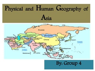
  • 1. Physical and Human Geography of Asia By: Group 4
  • 2. Group Members • Sana Bakht • Kainat Safdar • Syeda Maheen Ali • Adil Fayyaz • Hunain Munir • 15051561-034 • 15051561-002 • 15051561-023 • 15051561-035 • 15051561-028
  • 3. INTRODUCTION • Planet earth: Home to 7.3 billion people and over 1.5 million species of animals • The continental drift: It’s a theory that explains the sifting of the continents which was set forth by Alfred Wegener. • Geography: The key subject that made us to lift our eyes to see the complex and magnificent world
  • 4. What is a Continent? • Several very large land masses on earth • The numbers of continent: always under discussion  5 continents: Africa, America, Asia, Australia & Europe  6 continents: America, Antarctica, Africa, Oceania, Europe & Asia  7 continents: North America, South America, Africa, Antarctica, Oceania, Europe &Asia
  • 5.
  • 6. ASIA • Land Area of Asia: 17,210,000 (mi²) / 44,029,797 (km²) • Population of Asia: 4,494,302,221 (2016) • Largest City in Asia: Tokyo, Japan (37,126,000 (2012) • Largest religion :ISLAM with 1.1 billion people • Most spoken language: Chinese
  • 8. ASIA • Outline History: Empires and civilizations in the south west Nomadic tribes of the central Asia Wars : korean war, communism vs capitalism, western power aliences, World wars, Japanese occupations, nations with powerful military • Asian geology:
  • 9. ASIA • Asian geology:  Great peninsulas extend out from the mainland, dividing the oceans into seas and bays, many of them protected by Asia's numerous offshore islands  Asia's rivers, among the longest in the world. the Amur-Argun, Huang He, Chang (Yangtze), Xi, of E and SE Asia.Ganges- Brahmaputra, Indus, and Tigris-Euphrates of S and SW Asia. Central Asia has vast areas of interior drainage, including the Amu Darya, Syr Darya, Ili, and Tarim rivers.  Lake Baykal and Lake Balkash are among the world's largest lakes  Climatically, the continent ranges through all extremes, from torrid heat to arctic cold and from torrential rains
  • 10. ASIA • Population, culture, politics and economy 1. Southwest Asia:is characterized by an arid climate and irrigated agriculture, great petroleum reserves, and the predominance of Islam. 2. South Asia: monsoon climate, maritime orientation, the fusion of Indian and Chinese cultures, and a great diversity of ethnic groups, languages, religions, and politics 3. East Asia: 4. Russian Asia: 5. Central Asia
  • 11. Continued……. • Flora-vegetation cover:  far north of the continent (Siberia) tundra and taiga vegetation predominate  South of the taiga  S + SE + E Asia = predominating equatorial rainforest  Farther north of the equator lies a more open tropical forest • Fauna-animal life  The northern regions = brown bear, otter, lynx, ermine and wolf, in addition to a vast amount of bird species.  Freshwater fish are found in all parts of the continent = Lake Baikal is notable for its distinctive fauna.  Highlands = Wild sheep and goats and Tibet is the home of the wild yak.  Hot desert regions of SW and S Asia = wildlife is scarcer (rare).
  • 12. Continued…….  E and SE Asia = notably of loss of habitat and hunting.  S and SE Asia =Birdlife, snakes, and lizards abound (occur often) and various types of crocodiles are widely distributed. Wild apes such as the gibbon and the scarce orang-utan are found in SE Asia. Many types of deer and antelope also live in well-populated areas (Borneo), where flying squirrels and tree rats are numerous
  • 14. South East Asia Subregion of asia, consisting of the countries that are geographically south of china, east of india, west of new guinea and north of australia. Southeast asia together with the indian subcontinent and lowland southern china forms the indomalaya ecozone, one of the eight great ecozones that cover the earth's land surface. Divided into two subregions, namely mainland southeast asia (or indochina) and maritime southeast asia Mainland south east asia includes vietnam , laos, cambodia ,thailand,myanmar (burma) and peninsular malaysia. Maritime southeast asia includes indonesia, philippines, east malaysia, brunei, singapore, east timor. Is bounded to the southeast by the australian continent, a boundary which runs through indonesia.
  • 15. Physical Geography (climatology)  Climate in southeast asia is mainly tropical–hot and humid all year roundwith plentiful rainfall.  Northern vietnam and the myanmar himalayas are the only regions in southeast asia that feature a subtropical climate, which has a cold winter with snow.  Majority of southeast asia has a wet and dry season caused by seasonal shift in winds or monsoon due to rainforest.
  • 16. Hydrology More than 150,000 cubic metres of available water per square kilometre. Water utilization  In all subregions of asia and the pacific, between 60% and 90% of water withdrawal is used for agriculture. Within south- east asia, water use for agriculture in myanmar and cambodia is above 90% of the total use, whereas in malaysia agriculture accounts for just over 60% of water use.
  • 17. Metrology  Area of southeast asia is 4,500,000 km2 (1,700,000 sq mi).  Homo sapiens, austronesian people from indonesia, malaysia, brunei, east timor, and the philippines, taiwan reached the region by around 45,000 years ago. Geomorphology:  Dominate landscape, island mountains form part of ring of fire. Soil geography  On balance, has a higher proportion of relatively fertile soils than most tropical regions, and soil erosion is less severe than elsewhere. Landscape ecology:  The physiography of southeast asia has been formed to a large extent by the convergence of three of the earth’s major crustal units: the eurasian, indian-australian, and pacific plates. Potamology:  Mainland southeast asia is drained by five major river systems, which from west to east are the irrawaddy, salween, chao phraya, mekong, and red rivers.
  • 18. Temperatures  Regional temperatures at or near sea level remain fairly constant throughout the year, although monthly averages tend to vary with increasing latitude.E.G. Northern vietnam, annual average temperatures are close to 80 °F (27 °C). Human geography;population:  Population of this region is 623,000,000 and density is 135.6/km2 (351/sq mi). Settlement patterns:  Southeast asia is predominantly rural: three-fourths of the people live in nonurban areas.  Population is heavily clustered in fertile river valleys and especially in delta areas, such as those of the mekong and irrawaddy rivers. Developmental geography:  The annual rate of natural increase in southeast asia averages slightly higher than the annual world rate.
  • 19. CONTI…..  Philippines, laos, malaysia, vietnam, and brunei are characterized by higher growth; singapore, thailand, and indonesia, on the other hand, have considerably lower rates. Economy:  The keppel container terminal in the port of singapore,which is the busiest transshipment and container port in the world.  Especially important things were spices such as pepper, ginger, cloves, and nutmeg,the rubber plantations of malaysia, java, vietnam and cambodia, the tin mining of malaya, the rice fields of the mekong delta in vietnam and irrawaddy river delta in burma.  Chinese community has played a large role in the development of the economies in the region. Historical geography:  45,000 years ago,people came here and established it. Migration or transportation:  Population change also is directly related to internal and external migration, movements between rural areas (e.G., Thailand) and mobility between urban areas (indonesia).
  • 21. Hydrology  There are parts of this area that actually get reliable rainfall and have adequate springs for fresh water.  Running parallel across Turkey, Iraq, and Syria, the Tigris and Euphrates are the dominant rivers of the region.  Climatology:  The climate of the Middle East ranges from the warm summers and cold winters of highland Turkey and Iran, through hotter summers and cool winters of northern Mesopotamia and the Mediterranean coast, to the extreme temperatures of the Arabian desert. • The climatic regions are identified as • 1. Tropical desert type. • 2. Interior plateau Type. • 3. Modified Mediterranean type.
  • 22. Southwest Asia Other name is ‘Middle East’ The Middle East is a transcontinental region centered on Western Asia and Egypt. Arabs, Turks, Persians, Azeris , Kurds , Armenians, Assyrians, Circassians, Co pts, Greeks, Jews, Somalis, Shabaks, Mandaeans lies in this region. Physical geography Landforms: Southwest Asia gets a negative image as a place of endless deserts, but it is dominated not just by deserts but by two major peninsulas, surrounded by water.  The Anatolian Peninsula, basically what we call the modern nation of Turkey, is situated right in between the Black Sea and the Mediterranean Sea. The Arabian Peninsula is further south, separating the Red Sea, Persian Gulf, and Arabian Sea.
  • 23. Topography  Western Asia contains large areas of mountainous terrain.  The Anatolian Plateau is sandwiched between the Pontus Mountains and Taurus Mountains in Turkey.  The Zagros Mountains are located in Iran, in areas along its border with Iraq. The Central Plateau of Iran is divided into two drainage basins. The northern basin is Dasht-e Kavir (Great Salt Desert), and Dasht-e-Lut is the southern basin.  Geology:  Three major tectonic plates converge on Western Asia, including the African, Eurasian, and Arabian plates.  The boundaries between the tectonic plates make up the Azores-Gibraltar Ridge, extending across North Africa, the Red Sea, and into Iran.  Human Geography:  Borders:  The countries that make up boundry of Southwest Asia include Turley, Syria, Lebanon, Cyprus, Israel, Jordan, Kuwait, Iraq, Bahrain, the United Arab Emirates, Oman, Qatar, Afghanistan, Yemen, and Saudi Arabia.
  • 24. Economics  The economy of Western Asia is diverse and the region experiences high economic growth.  Turkey has the largest economy in the region, followed by Saudi Arabia and Iran.  Petroleum is the major industry in the regional economy, as more than half of the world's oil reserves and around 40 percent of the world's natural gas reserves are located in the region.  Demographics:  The population of Western Asia was estimated at 272 million as of 2008, projected to reach 370 million by 2030 by Maddison.  This corresponds to an annual growth rate of 1.4%  The most populous countries in the region are Turkey and Iran and, each with around 75 million people, followed by Iraq and Saudi Arabia with around 32 million people each.  Religion:  Arabs, Turks, Persians, Azeris and Kurds constitute the largest ethnic groups in the region by population,  while Armenians, Assyrians, Circassians, Copts, Greeks, Jews, Somalis, Sha baks, Mandaeans and other ethnic and ethnoreligious groups form significant minorities
  • 25. Political Geography  West Asia is an area which is strategically situated at the junction of the three continents of Asia, Europe and Africa. So,it commands the approaches of these continents.  Because of its tricontinental location and its central position in the world island, the region has historically been cross road of the world.  During the 19th century West Asia became one of the important regions for European diplomacy.  Two obvious routes for such a communication presented themselves: the Persian Gulf route and the Red sea route.
  • 26.
  • 27. • Central asia is the core region of all the asian continent. • Stretches from the caspian sea in the west to china in the east and from afghanistan in the south to russia in the north. • Referred to as "the 'stans" • The persian suffix "-stan", meaning "land of, homeland") • (As the six countries generally considered to be within the region all have names ending with… Area: 4,003,451 km2(1,545,741 sq mi) Central Asia
  • 29. • Include these five republics of the former soviet union:- • Kazakhstan (pop. 17 million), (from its beginning in 1917, the soviet state never included Kazakhstan in Muslim central Asia, preferring to give it a non-asian identity by linking it closely to Russia and Siberia.) • The second largest republic in the former soviet union (U.S.S.R.). • Kyrgyzstan (5.7 million), • Tajikistan (8.0 million), • Turkmenistan (5.2 million), • And Uzbekistan (30 million), for a total population of about 66 million as of 2013–2014. • Afghanistan (pop. 31.1 million) is also sometimes included. Countries in Central Asia
  • 30. Religion • Includes muslim countries. • Most central asian muslims are sunni, although there are sizable shia minorities in afghanistan & tajikistan. • Buddhism and zoroastrianism were the major faiths in central asia prior to the arrival of islam.
  • 32. Central Asia Central Asia,extending from the Caspian Sea in the west to the border of western China in the east. It is bounded on the north by Russia and on the south by Iran, Afghanistan, and China. The region consists of the former Soviet republics of Kazakhstan, Uzbekistan, Tajikistan, Kyrgyzstan, and Turkmenistan. Physical geography: Landscape: Central Asia’s landscape can be divided into the vast grassy steppes of Kazakhstan in the north and the Aral Sea drainage basin in the south. About 60 percent of the region consists of desert land, the principal deserts being the Karakum, occupying most of Turkmenistan, and the Kyzylkum, covering much of western Uzbekistan. Climatology: Central Asia experiences very dry climatic conditions, and inadequate precipitation has led to heavy dependence on the Syr Darya and Amu Darya for irrigation.
  • 33. The region as a whole experiences hot summers and cool winters, with much sunshine and very little precipitation.  Distribution of regions on the basis of climate:  Mid-Latitude Desert:  The southern third of Kazakhstan, western two-thirds of Uzbekistan and Turkmenistan and both the eastern and western thirds of Kyrgyzstan, is a true desert, with low relative humidity and mean annual precipitation not exceeding 10 inches.  it's a cool desert,Annual temperatures average below 64 degrees Fahrenheit.  the mercury drops below freezing in winter, although it can soar in the summer. • Steppe: • The middle third of Kazakhstan, the western third of Turkmenistan and most of the western third of Uzbekistan are considered a steppe climate. • This semi-arid grassland receives slightly more precipitation than its neighbor, the mid-latitude desert, with annual totals ranging from 10 to 20 inches per year.
  • 34. Humid Continental  Central and northern Kazakhstan, eastern Uzbekistan, central Kyrgyzstan and nearly all of Tajikistan.  This area receives more precipitation on average than the rest of central Asia, at least 20 inches per year,  Hydrology:  Lake Baikal, located in southern Russia, is the deepest lake in the world, reaching a depth of 1,620 meters (5,315 feet) contains 20 percent of the world’s unfrozen freshwater, making it the largest reservoir on Earth.  The Yangtze is the longest river in Asia and the third longest in the world reaching 6,300 kilometers (3,915 miles). • Saltwater:  The Persian Gulf has an area of more than 234,000 square kilometers (90,000 square miles). • The Sea of Okhotsk covers 1.5 million square kilometers (611,000 square miles) and The Bay of Bengal is the largest bay in the world, covering almost 2.2 million square kilometers also lies in this region.
  • 35. Paleogeography  The Cretaceous and Paleocene sediments of the Central Asian basins include remnants of the easternmost extent of a large epi-continental sea.  Natural Resources:  Rich in oil ,natural gas,gold,silver,copper,machinery,cotton,fruits and corn.  Human Geography:  Cultural and social geography:  Flamboyant silk dress of a Central Asian bride, soaring minarets against an azure sky, geometric patterns on a red, hand-loomed carpet, ceramic tessellations on monuments to the past and bustling sights and sounds of an exotic bazaar.  Traditional and everyday artifacts, music, costuming and handicrafts; Silks, carpets, embroidery, and jewelry, along with photographs of stunning mountain ranges, glittering alpine lakes and vast stretches of steppe and desert.
  • 36. Historical Geography  Starting with the Alexander the Great’s conquests in the 4th century B.C. then The ancient Greeks and later, the Arabs were familiar with the area .  Islam came to the region with the Arab conquest in the mid-7th century and became firmly rooted by the 11th century when the Turks were ruling.  Population geography:  Combined population of the Uzbek, Kirgiz, Tajik, and Turkmen Soviet Socialist Republics totals more than 30 million people, one tenth of the population of the Soviet Union.  Military geography:  From 1813 to 1907 Great Britain and Tsarist Russia were engaged in a strategic competition for domination of Central Asia, known in Britain as "The Great Game", and in Russia as the "Tournament of Shadows.“so,This region has a high military force
  • 37. Medical and health geography:
  • 38.
  • 39. Transcontinental countries • Transcontinental countries are the countries which covered land on two or more continents, including islands associated with a continent other than the one where the country was based.
  • 40. Asia and Europe • There are some how believe that Europe and Asia are not actually separate continents. • Instead, the European and Asian continents should be treated as one mega-continent called Eurasia. • If Eurasia existed, it would be the largest single continent in the world, with a population of around 4 billion people – almost a half of the world’s population.
  • 41. Russia • Because the Ural Mountains form the boundary between the two continents and mark the unofficial border between Asia and Europe, Russia is a part of two continents – Russia is in both Europe and Asia • Anything to the west of the Urals is considered to be in Europe and everywhere on the Eastern side of the range is considered to be in Asia.
  • 42. Russia • Russia is a massive country – 17,098,242 square kilometres in size. • But only about 4 million square kilometres of Russia are in Europe, west of the Urals. • The remaining 13 million square kilometers, including Siberia and the Russian Far East are in Asian Russia.
  • 44. Azerbaijan • Continents: Asia and Europe • Azerbaijan is officially called the Republic of Azerbaijan. • Azerbaijan is the land of beautiful landscapes. • This country has diplomatic relations with 158 countries and hold membership in 38 International Organizations. • Azerbaijan is divided into 10 economic regions, 66 districts and 77 cities, of which 11 are under the direct control of the republic.
  • 46. Georgia • Continents: Asia and Europe • Georgia considers a sovereign territory under the Russian military occupation. • The name of the Georgia is refers to St. George, Georgia’s patron saint. • The Georgian railway is an important link between the Black Sea and the Caspian Sea, as well as the shortest route between Europe and Central Asia. • Georgia's economy is based on Services, Agriculture, Transport and Truism.
  • 48. Greece • Continents: Europe and Asia • Greece is officially called the Hellenic Republic or Hellas, located at the crossroads of Europe, Asia, Middle East and Africa. • It is a developed country with a very high standard of living. • Greek is a founding member of United Nation. The name of Greece came from Latin word Graecia, which means "The Land of the Greeks".
  • 50. Indonesia • Continents: Asia and Australia • Indonesia is officially called the Republic of Indonesia, located in South Asia and Oceania. • The name of Indonesia drives from the Greek word Nesos, which means “Island”. • The country has 17,508 islands. • Indonesia is the sixteen largest economies in the world. • It is the founding member of ASEAN and also the member of G-20.
  • 52. Kazakhstan • Continents: Asia and Europe • Kazakhstan is officially called the Republic of Kazakhstan. • It is a country in Central Asia, and the smaller part is in Europe. • Kazakhstan is landlocked country and Share 5 borders with China, Kyrgyzstan, Russia, Turkmenistan and Uzbekistan. • The territory of the Republic of Kazakhstan makes it the ninth largest country in the world.
  • 54. Turkey • Continents: Asia and Europe • Turkey is officially called the Republic of Turkey. • It is a democratic and secular country with diversified culture and traditions. • Turkey is located at the junction of Europe and Asia and is bordered by eight countries. • The larger area of Turkey is located in Western Asia, and Eastern Thrace located in South Eastern Europe.
  • 55. Egypt
  • 56. Egypt • Continents: Africa and Asia • Egypt is officially called the Arab Republic of Egypt. • This is one of the most ancient places on earth. • Most of its territory lies in the North Africa, and from the north east it lies in the Middle East. • Egypt's economy depends on tourism, agriculture, industry and services.
  • 57. CONCLUSION • Asia is the largest continent of the world so it have the most diverse human and physical geography ,the knowledge is so vast that even mega size books cannot help to show everything. • M.Augestine says the world is abook and those do not travel have read only a page. • So going out there and learning geography is far more important to find the true ‘why’s’. • why is the culture, economy, politics etc of a country as it is.