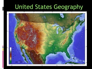
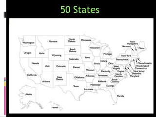
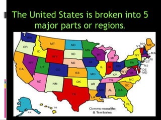
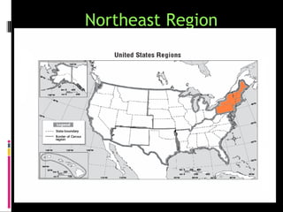
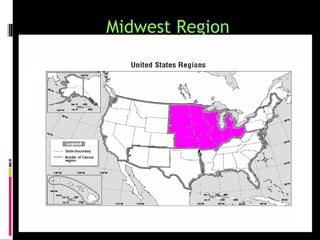
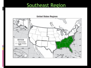
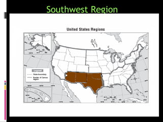
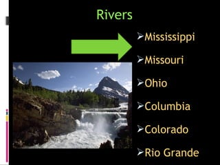
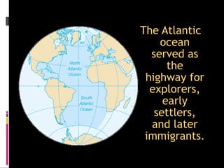
United States Geography
50 States
Population: 314,636,000
Capital: Washington, DC
Bird: Bald Eagle
The United States is broken into 5
     major parts or regions.
What is a REGION?

Places that have similar
 characteristics that make them
 different from surrounding areas.
Compass Rose
A compass rose helps us give a
 name to the regions.
Let’s start
      with a map
      of the entire
United States of America…
The United States is broken into 5
               regions
Northeast Region
Midwest Region
Southeast Region
Southwest Region
West Region
5 Regions
Northeast Region
Midwest Region
Southeast Region
Southwest Region
West Region
Major Bodies of Water in the United
States
Oceans

         Atlantic


         Pacific
Rivers
         Mississippi

         Missouri

         Ohio

         Columbia

         Colorado

         Rio Grande
Lakes
        Great Lakes
        Huron

        Ontario

        Michigan

        Erie

        Superior
Gulf

       Gulf of
       Mexico
The Ohio River was the “gateway to the
west”
Inland port cities grew in the Midwest along
               the Great Lakes.
The Mississippi and Missouri Rivers were the
transportation arteries for farm and industrial
products. They were links to ports and other parts of
the world.
The Columbia River was
explored by Lewis and Clark.
The Colorado River was explored
         by the Spanish.
The Rio Grande forms the
   border with Mexico.
The Atlantic
    ocean
  served as
      the
 highway for
  explorers,
     early
   settlers,
  and later
 immigrants.
The
 Pacific
 Ocean
 was an
  early
explorati
on route.
The Gulf of Mexico provided the
French and Spanish with exploration
routes to Mexico and other parts of
America.

Geography powerpoint