2016-21 State of the Environment Report for Councils in the Greater Central W...Neil Dufty
A summary State of the Environment (SoE) Report for 15 local councils across the Central West Region of New South Wales, Australia. The report trends data for the past five years related to over 100 environmental indicators across five themes: Land, Biodiversity, Water and Waterways, People and Communities, and Towards Sustainability. A SoE report was also produced for each of the 15 local councils which related the trends to the council's environmental objectives.
2016-21 State of the Environment report for Moree Plains and Narrabri CouncilsNeil Dufty
The State of the Environment (SoE) report for two local councils (Moree Plains and Narrabri) in New South Wales, Australia. The SoE report trends data for over 100 environmental indicators across the past five years. The report outlines progress towards the environmental objectives of both councils and highlights initiatives through a series of case studies related to the themes of: Land, Biodiversity, Water and Waterways, People and Communities, and Towards Sustainability.
Indiscriminate ground Water withdrawal with an unplanned and unorganized urbanization has caused depletion of Ground Water table,Rain Water Harvesting has been necessary in certain part of the urban area for sustainability of water cycle, This Slide show tries ti reach the urban population as a part of awareness policy.
City Of Kolkata ,My City, City of Billions for last 320 years,is on process of collapse in terms of its Natural Resources: Land and Water, Greenery and Space.Can we try to make it Sustainable?
Peri urban Project Introduction_Anjal Prakash and Vishal NarainSaciWATERs
About the Project – Water Security in Peri-urban South Asia: Adapting to Climate Change and
Urbanization- Dr. Anjal Prakash, SaciWATERs, Hyderabad and Dr. Vishal Narain, MDI, Gurgaon
This presentation describes how the greatest conservation successes occur in collaboration with non-profit partners. This presentation was made at NRPA Conference New Orleans in 2017 and the Minnesota Recreation and Park Association state conference in Rochester in 2018. Both presentation were made with my co-presenter Jim Garges.
Reducing deforestation and implementing sustainable land-use are major challenges in the Peruvian Amazon, where the socio-economic development of smallholder migrant farmers and the attraction of private investment forlarge-scale agriculture, oil extraction and mining, together with the construction of roads, are part of government strategy to integrate the region in the growing national economy. This study considers the potential of intervening in the configuration and structure of the agricultural mosaic, combining avoided deforestation, reforestation and tree enrichment in the landholdings of smallholder cacao farmers of the Ucayali region. Due to favorable international prices and public and private investments, the last 10 years has seen a rapid proliferation of producers’ associations that have become important players in local development. Besides connecting farmers to the market and providing agricultural services, associations are important in the process of land allocation and titling, in lobbying for infrastructure and services for settlers, and ultimately in determining land-use trajectories, including deforestation and forest degradation. Cacao producers’ associations have also played an important role in promoting the certification process and, more recently, access to the voluntary carbon market. For all these reasons, such associations are a suitable entry-point for interventions affecting land-use at the landscape-level.
This presentation was made at the NRPA 2017 annual conference in New Orleans and the 2018 Minnesota Recreation and Park Association state conference with my co-presenter Jim Garges.
Presentation by Tomas Rodriguez, Chair of the Rio Grande Regional Water Planning Group (Region M), at the 2016 SWIFT Funding Workshop in Weslaco, Texas.
Daylighting the Amorsolo Creek - Participatory Design and the Revival of an U...Rodelon Ramos
Daylighting the Amorsolo Creek - Participatory Design and the Revival of an Urban Waterway in Makati CBD
Author: Rodelon Ramos, Master of Architecture, University of the Philippines Diliman
A presentation given at the annual meeting of the American Planning Association, Utah Chapter. This presentation illustrates the need for water conservation districts and municipalities to work together to ensure that water supply planning is part of the community development process at every level.
The presentation includes some basic design changes we can all encourage that improve efficiency without sacrificing the quality of our shared landscape experience. Additionally, it encourages adoption of ordinances which support conservation- with particular emphasis on parkstrips.
Bill Cesanek, co-chair of the APA Water and Planning Network, discusses the value of land use planning in achieving improved water efficiency for the 2020 Central Texas Water Conservation Symposium hosted by the Texas Living Waters Project.
On April 20, ICLR held a Friday Forum workshop titled 'Flood Mitigation Planning in BC's Lower Mainland', led by Steve Litke of the Fraser Basin Council. Communities across British Columbia’s Lower Mainland – both urban and rural – face different types of flood hazards and risks. The Lower Mainland Flood Management Strategy is a collaborative, regional-scale planning process that aims to proactively reduce vulnerability and increase resilience to Fraser River and coastal flood hazards. This process has been designed, and is being implemented, by a broad-based network of partners that are sharing information, funding, and expertise to strengthen flood mitigation approaches across the region. The Flood Strategy is being developed through two parallel and connected tracks. One track involves a process of dialogue, knowledge-sharing, engagement, consultation, and consensus-building. The second track involves a series of scientific investigations and technical analyses to improve knowledge and understanding and to provide evidence to support sensible decisions. This session explores many different aspects of the Flood Strategy, including the flood mitigation planning process and some of the supporting technical tools and analyses, with an emphasis on completed research findings from Phase 1. The session highlights lessons learned through this collaborative, regional-scale initiative.
Steve Litke has worked with the Fraser Basin Council since 1998 and is the Senior Manager responsible for the Council’s Watersheds and Water Resources Program. Steve and the Council are currently facilitating a collaborative initiative to develop a Lower Mainland Flood Management Strategy to reduce flood vulnerability and improve resilience in relation to river and coastal flood hazards.
Steve has coordinated and facilitated inter-jurisdictional committees, delivered communication and public education materials, and managed policy reviews and technical projects including flood mapping and modelling. Steve Litke graduated from Simon Fraser University in 1995 with a Master's Degree in Resource and Environmental Management.
Efficient Use of Water - Drew Beckwith, Western Resources Associatesrshimoda2014
Three sources of water are generally cited for to support continued population growth in the West: new diversions from rivers, transfers from agriculture to cities, or reduced use through conservation. Municipal conservation is the cheapest of the three, and often has the least impact on Western rivers.
This presentation describes the potential for conservation to reduce future demands, provide examples of implementation (including rate structures, water loss reduction, and indoor and outdoor best practice programs), and discuss Colorado state-level resources available to develop and implement conservation plans. Important concerns and issues regarding water conservation will also be addressed, including cost to the consumer, water quality, and impacts to return flows.
On September 23-24, Chattanooga business owners, residents, City engineering, transportation, and planning staff welcomed Dutch bicycle transportation experts to plan and discuss how Chattanooga can become more bike-friendly. The two day ThinkBike workshop addressed how to improve multi modal access along Frazier Avenue and Cherokee Blvd on the north shore and create a link for the St Elmo neighborhood to the planned Riverwalk extension. The result was a broadened understanding of how incorporating bikes and pedestrians into all projects can create a sense of place.
ThinkBike was hosted by the Royal Netherlands Embassy and the City of Chattanooga with generous support from the Benwood Foundation and Friends of Outdoor Chattanooga. The Regional Planning Agency provided staff support for the planning of the workshop.
More information about ThinkBike available here: http://www.chattanooga.gov/transportation/transportation-resources
DRAFT 2014-2017 Transportation Improvement Program (TIP)CHCRPA
The Chattanooga-Hamilton County/North Georgia's Draft TIP for 2014-2017 is open for public comment. Comments can be submitted to tpo(at)chattanooga.gov.
Summary of input gained from the first rounds of committee meetings and public meetings (July-September 2012) for the 2040 Regional Transportation Plan.
Maps from teams participating in the Leadership Symposium Mobility Chip Game on 8.24.12. Teams implemented desired transportation infrastructure (type and location) for the region with finite resources. See what our teams came up with- you will notice some very different approaches to promoting mobility in the region!
Key:
Dark Blue=Multimodal Street Improvement
Light Blue=Bus Transit
Gray=Rapid Transit
Green=Multi-use Path
Red=Road Widening
Orange=Roadway New Location
2040 RTP Community Advisory Committee/Core Technical Team #1CHCRPA
Presentation made to the 2040 RTP Community Advisory Committee and Core Technical Team 7.25.12 & 7.16.12. The presentation introduces the purpose of the 2040 Regional Transportation Plan, goals and challenges, land use and transportation integration, and the concept of performance-based planning.
As Europe's leading economic powerhouse and the fourth-largest hashtag#economy globally, Germany stands at the forefront of innovation and industrial might. Renowned for its precision engineering and high-tech sectors, Germany's economic structure is heavily supported by a robust service industry, accounting for approximately 68% of its GDP. This economic clout and strategic geopolitical stance position Germany as a focal point in the global cyber threat landscape.
In the face of escalating global tensions, particularly those emanating from geopolitical disputes with nations like hashtag#Russia and hashtag#China, hashtag#Germany has witnessed a significant uptick in targeted cyber operations. Our analysis indicates a marked increase in hashtag#cyberattack sophistication aimed at critical infrastructure and key industrial sectors. These attacks range from ransomware campaigns to hashtag#AdvancedPersistentThreats (hashtag#APTs), threatening national security and business integrity.
🔑 Key findings include:
🔍 Increased frequency and complexity of cyber threats.
🔍 Escalation of state-sponsored and criminally motivated cyber operations.
🔍 Active dark web exchanges of malicious tools and tactics.
Our comprehensive report delves into these challenges, using a blend of open-source and proprietary data collection techniques. By monitoring activity on critical networks and analyzing attack patterns, our team provides a detailed overview of the threats facing German entities.
This report aims to equip stakeholders across public and private sectors with the knowledge to enhance their defensive strategies, reduce exposure to cyber risks, and reinforce Germany's resilience against cyber threats.
Data Centers - Striving Within A Narrow Range - Research Report - MCG - May 2...pchutichetpong
M Capital Group (“MCG”) expects to see demand and the changing evolution of supply, facilitated through institutional investment rotation out of offices and into work from home (“WFH”), while the ever-expanding need for data storage as global internet usage expands, with experts predicting 5.3 billion users by 2023. These market factors will be underpinned by technological changes, such as progressing cloud services and edge sites, allowing the industry to see strong expected annual growth of 13% over the next 4 years.
Whilst competitive headwinds remain, represented through the recent second bankruptcy filing of Sungard, which blames “COVID-19 and other macroeconomic trends including delayed customer spending decisions, insourcing and reductions in IT spending, energy inflation and reduction in demand for certain services”, the industry has seen key adjustments, where MCG believes that engineering cost management and technological innovation will be paramount to success.
MCG reports that the more favorable market conditions expected over the next few years, helped by the winding down of pandemic restrictions and a hybrid working environment will be driving market momentum forward. The continuous injection of capital by alternative investment firms, as well as the growing infrastructural investment from cloud service providers and social media companies, whose revenues are expected to grow over 3.6x larger by value in 2026, will likely help propel center provision and innovation. These factors paint a promising picture for the industry players that offset rising input costs and adapt to new technologies.
According to M Capital Group: “Specifically, the long-term cost-saving opportunities available from the rise of remote managing will likely aid value growth for the industry. Through margin optimization and further availability of capital for reinvestment, strong players will maintain their competitive foothold, while weaker players exit the market to balance supply and demand.”
Techniques to optimize the pagerank algorithm usually fall in two categories. One is to try reducing the work per iteration, and the other is to try reducing the number of iterations. These goals are often at odds with one another. Skipping computation on vertices which have already converged has the potential to save iteration time. Skipping in-identical vertices, with the same in-links, helps reduce duplicate computations and thus could help reduce iteration time. Road networks often have chains which can be short-circuited before pagerank computation to improve performance. Final ranks of chain nodes can be easily calculated. This could reduce both the iteration time, and the number of iterations. If a graph has no dangling nodes, pagerank of each strongly connected component can be computed in topological order. This could help reduce the iteration time, no. of iterations, and also enable multi-iteration concurrency in pagerank computation. The combination of all of the above methods is the STICD algorithm. [sticd] For dynamic graphs, unchanged components whose ranks are unaffected can be skipped altogether.
Levelwise PageRank with Loop-Based Dead End Handling Strategy : SHORT REPORT ...Subhajit Sahu
Abstract — Levelwise PageRank is an alternative method of PageRank computation which decomposes the input graph into a directed acyclic block-graph of strongly connected components, and processes them in topological order, one level at a time. This enables calculation for ranks in a distributed fashion without per-iteration communication, unlike the standard method where all vertices are processed in each iteration. It however comes with a precondition of the absence of dead ends in the input graph. Here, the native non-distributed performance of Levelwise PageRank was compared against Monolithic PageRank on a CPU as well as a GPU. To ensure a fair comparison, Monolithic PageRank was also performed on a graph where vertices were split by components. Results indicate that Levelwise PageRank is about as fast as Monolithic PageRank on the CPU, but quite a bit slower on the GPU. Slowdown on the GPU is likely caused by a large submission of small workloads, and expected to be non-issue when the computation is performed on massive graphs.
Adjusting primitives for graph : SHORT REPORT / NOTESSubhajit Sahu
Graph algorithms, like PageRank Compressed Sparse Row (CSR) is an adjacency-list based graph representation that is
Multiply with different modes (map)
1. Performance of sequential execution based vs OpenMP based vector multiply.
2. Comparing various launch configs for CUDA based vector multiply.
Sum with different storage types (reduce)
1. Performance of vector element sum using float vs bfloat16 as the storage type.
Sum with different modes (reduce)
1. Performance of sequential execution based vs OpenMP based vector element sum.
2. Performance of memcpy vs in-place based CUDA based vector element sum.
3. Comparing various launch configs for CUDA based vector element sum (memcpy).
4. Comparing various launch configs for CUDA based vector element sum (in-place).
Sum with in-place strategies of CUDA mode (reduce)
1. Comparing various launch configs for CUDA based vector element sum (in-place).
Chatty Kathy - UNC Bootcamp Final Project Presentation - Final Version - 5.23...John Andrews
SlideShare Description for "Chatty Kathy - UNC Bootcamp Final Project Presentation"
Title: Chatty Kathy: Enhancing Physical Activity Among Older Adults
Description:
Discover how Chatty Kathy, an innovative project developed at the UNC Bootcamp, aims to tackle the challenge of low physical activity among older adults. Our AI-driven solution uses peer interaction to boost and sustain exercise levels, significantly improving health outcomes. This presentation covers our problem statement, the rationale behind Chatty Kathy, synthetic data and persona creation, model performance metrics, a visual demonstration of the project, and potential future developments. Join us for an insightful Q&A session to explore the potential of this groundbreaking project.
Project Team: Jay Requarth, Jana Avery, John Andrews, Dr. Dick Davis II, Nee Buntoum, Nam Yeongjin & Mat Nicholas
Chatty Kathy - UNC Bootcamp Final Project Presentation - Final Version - 5.23...
Renewing Our Vision - Trends analysis
1. Click to edit Master text styles
CLICK TO EDIT MASTER TITLE STYLE
Click to edit Master text styles
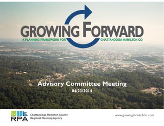
Advisory Committee Meeting
04/23/2014
Chattanooga-Hamilton County
Regional Planning Agency
www.growingforwardchc.com
3. TRENDS : POPULATION PROJECTIONS
500,000
80,000
400,000
,
300,000
Hamilton County
City of Chattanooga
100,000
200,000
City of Chattanooga
0
1970 Census 1980 Census 1990 Census 2000 Census 2010 Census 2012 Estimate 2040 Projection
16. Jobs / More housing than jobs
Household
Mix Even mix of jobs and housing
MAIN POINT More jobs than housing
Where we live and
where we work has
More jobs than housing
impacts on our
infrastructure
network and the
cost of the
network.
19. TRENDS : HOUSEHOLDS ARE CHANGING
Families with
Children
H il C1970 2010
1.7% 12.9%
Hamilton County1970 2010
% 12.9%
27.9%
Married Couple
85.4%
64.9%7.2%Single Father Families
Married Couple
Male householder, no wife present
Female householder, no husband present
Married Couple
Male householder, no wife present
Female householder, no husband
Single Mother Families
Female householder, no husband present Female householder, no husband
present
25. NEED FOR NEW INVESTMENT APPROACH
Nationally:
• Transportation funds lagging, at same time that transportation needs have
increased
• Emphasis on asset management, coupled with less revenue, has serious
implications on revenue availability for new infrastructure
• Multimodal capital investments must be identified in transparent
processes that are performance-driven and outcome-based
26. NEED FOR NEW INVESTMENT APPROACH
In Planning Area:
• Shift to multimodal investment
has been limited in its geographic
extent
• Large areas throughout region remain
dangerous to pedestrians and cyclists
and inaccessible to transit users
30. TRANSPORTATION/ LAND USE INTEGRATION
• Evaluate land use impacts related to transportation
choices/investments
• Update Comprehensive Plan to reflect the Regional
Transportation Plan
• Create new land use and transportation strategies
to support community goals.
• Increase density and encourage transit oriented
mixed use developments
32. NATURAL RESOURCES
Purpose :
• Inventory and analysis of natural resources
• Prioritize areas for protection
• Target development to areas most appropriate
• Expand public’s knowledge of environmental issues
in Hamilton County
• Inform the development of goals regarding
conservation, protection, preservation, or
restoration of natural resources
33. FLOOD PLAINS
Functions and Benefits:
• Infiltrates stormwater
• Regulates flow
• Recharges groundwater
• Buffers sensitive riparian
resources
• Filters water
• Mitigates erosion
• Stores sediment
and nutrients
• Provides habitat and
preserves biodiversity
• Provide scenic beauty
Acres
% of Acres
in Hamilton
County
% of Sloped
Acreage with a
building on the
Slope*
%
Protected**
Floodway 9,525 2.6% 20.3% 89.4%
100 Yr Flood 35,041 9.5% 22.1% 6.9%
500 Yr Flood 8,296 2.3% 58.8% 7.6%
Wetlands 1,734 0.5% 1.7% 24.7%
*Parcel based **Protected is a rough estimate based on ownership.
34. FLOOD PLAINS
Development related disturbance can:
• Alter flow patterns and habitat functions
• Fragment floodplains and habitats
• Increase runoff and flooding
• Reduce water quality
• Result in loss of biodiversity
• Result in loss of scenic beauty and community
character
2003 flooding of East Ridge Hospital
36. STEEP SLOPES
Benefits and Functions:
• Provide scenic beauty and community
character
• Improve water quality and reduce runoff
• Provide habitat and protect biodiversity
Slope Acres
% of
Acres in
Hamilton
County
Percent of
Sloped Acreage
with a building
on the Slope*
%
Protected**
Slope 15% ‐ 19.9% 36249 9.8% 32.8% 9.3%
Slope 20% ‐ 24.9% 27743 7.5% 34.6% 11.2%
Slope 25% ‐ 29.9% 19572 5.3% 34.2% 14.0%
Slope 30% ‐ 34.9% 13255 3.6% 32.9% 17.3%
Slope 35% and greater 25599 6.9% 24.4% 33.3%
*Parcel based **Protected is a rough estimate based on ownership.
37. STEEP SLOPES
Development related disturbance can:
• Increase erosion, slope instability, and
safety concerns
• Increase quantity of runoff and reduced
water quality
• Result in loss of habitat and biodiversity
• Result in loss of scenic beauty and
community character
In 2013, the City spent $1.8 million in repairs due to
slope instability issues.
Public Works asked for an annual $2 million dollar
budget to address slope instability issues in 2013.
2012 rock slide on the W Road
38. ADDITIONAL ANALYSIS NEEDED
• Intact Forests
• Farmlands and Prime Agricultural Soils
• Biodiversity
• Where do sensitive resources overlap?
• What areas should be protected?
• How do we minimize the unintended impacts
of development ?
Loss of Open Space
Fragmentation and Habitat Loss
Increased Runoff Increased Pollution