Unblocking The Main Thread Solving ANRs and Frozen Frames
Travis Tuesdaynoon 102709
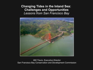
1. Changing Tides in the Inland Sea: Challenges and Opportunities Lessons from San Francisco Bay Will Travis, Executive Director San Francisco Bay Conservation and Development Commission
104. The world we have created today, as a result of our thinking thus far, has problems that cannot be solved by thinking the way we thought when we created them. Albert Einstein
Editor's Notes
I know the focus of this conference is the Inland Sea, but I think that understanding some of the work we’re doing in the San Francisco Bay region may be helpful when dealing with climate change and sea level rise in other regions. To orient you and help you understand why sea level rise is such a big deal to us, I’m going to give you a short geography lesson followed by a short history lesson about San Francisco Bay.
First, the geography lesson. This is the west coast of the United States.
This is California.
And this is San Francisco Bay and the Sacramento-San Joaquin River Delta. The Bay and Delta comprise the largest estuary on the west coast of the North and South American continents. It is a single ecosystem,…
… but politically the Bay and Delta are like New York and New Mexico. They have one thing in common and everything else is different. In the case of New York and New Mexico, the common element is one word: new. In the case of the Bay and the Delta, the common element is the ecosystem.
This is the the sort of image people have in mind when they think of San Francisco Bay.
This is the image Californians have in mind when we think about the Delta. We know it’s someplace somewhere that water flows through. But that’s about all we know about it.
Environmentalists see the Delta as a potentially spectacular natural resource on par with the Florida Everglades–– if only it could be restored.
Water users see the Delta as a broad, leaky ditch where the water they want to use gets wasted and lost.
Local governments and developers in the Delta see it as a place to build houses they can’t get approval to build in the Bay Area to sell to people who work in the Bay Area, but can’t afford to live there.
And politicians see the Delta as California’s Bermuda Triangle where people of good will enter never to be heard from again.
Based on the very little I know about the Delta, I think the Delta Vision Blue Ribbon Task Force got everything about right.
Key to their recommendations is establishing a workable and enforceable Delta governance structure. It remains to be seen whether that can be achieved.
To ensure that I don’t get drawn into the murky waters of California’s Bermuda Triangle, I’m now going to depart from the Delta and go back to the place where I am safe––San Francisco Bay. This is what the Bay looks like today.
But if we go back to the California’s early days we find that the Bay was quite a bit bigger. The yellow areas on this map show the extent of the wetlands in the Bay and Delta at the time of the 1849 Gold Rush. Then the Bay waters and surrounding wetlands covered 787 square miles. By the 1950s, a third of the Bay was gone.
The Bay got smaller for a simple reason: It’s shallow. Two-thirds of it was less than 12 feet deep. So it was easy to fill, and large parts of the Bay were reclaimed for real estate development. On average, between 1850 and 1960 two square miles were filled every year.
Today the Bay is surrounded by 240 square miles of filled land. If you’re anywhere along the shoreline of the Bay and you’re standing on flat ground, you’re probably on filled land. And there were grand plans to fill even more of the Bay.
In 1959, the U.S. Army Corps of Engineers released a report with this map. It showed that 60% of the remaining Bay-- another 325 square miles-- could be reclaimed with landfill projects. Citizens revolted. They didn’t want the Bay to become little more than a broad river.
Under the leadership of three Berkeley women, in 1965 the citizens of the Bay Area convinced the California Legislature to create the San Francisco Bay Conservation and Development Commission––BCDC–– to stop the Bay from continuing to get smaller. Although the Legislature didn’t know it at the time, they had created the nation’s first state coastal management agency.
Regional oversight was needed because fragmented political control of the Bay had put local governments into the position of competing with each other for tax revenues by encouraging Bay fill projects.
So in addition to preventing unneeded Bay fill, BCDC is responsible for requiring that new shoreline development provides public access to the waterfront. Why? Because when the Commission was established, much of the shoreline looked like this. Only four miles of the shoreline were open to the public.
We’ve been around for 44 years. And we’ve done a pretty good job. We’ve actually reversed the shrinking of the Bay. As a result of wetland restoration projects, like this one in San Francisco, the Bay has become bigger.
We’ve required public access along 117 miles of the shoreline.
And over $16 billion in attractive development has been built along the Bay shoreline.
BCDC is in that elite corps of government agencies that know what they’re supposed to do… and have actually done it At this point, it would be nice to say: Mission Accomplished. The Bay has been saved. Let’s close up shop and go home. But sometimes things aren’t as simple as they seem to be.
Now we’re facing a different problem. Though some people still doubt that there is a correlation between human behavior and global warming, here is scientific graphic proof.
The most well-known repercussion of global warming is sea level rise. This is a graph of sea level rise in San Francisco Bay. The most important thing to note about this graph is that it is not a prediction. This is history. Over the past century, Bay waters have risen about seven inches. We know this because the nation’s oldest tide gauge is at the Golden Gate.
Depending on whether and how much greenhouse gas emissions can be brought under control, the report projects that by the end of the century average temperatures in California will rise between 3 and 10.5 degrees F. To put that into context, the difference between the average temperature in San Francisco in the in the winter and the average temperature in the summer is 10 degrees. So it would be like changing winter into summer. Let’s ignore Mark Twain’s statement, “ The coldest winter I ever spent was a summer in San Francisco.”
If the temperature increases are at the upper end of the spectrum, by 2050 the Bay could rise 4/10th of a meter –– about 16 inches–– and 1.4 meters or about 55 inches by 2100.
To see what sea level rise will do to the Bay we have to remember that the Bay is surrounded by 240 square miles of low-lying filed land, land that was filled just high enough to avoid flooding. Here are two maps, one showing how what the Bay looked in 1849 and the other showing how it might look in 2100 with 55 inches of sea level rise. They look pretty much the same. At first blush, it’s tempting to think that this might be good news. All the area that was reclaimed in the past century would once again become part of the Bay.
The bad news is that we’ve built all kinds of very expensive stuff that is critical to civilization in the Bay Area on most of that filled land. Let me show you a few examples.
This is San Francisco International Airport. Unless protected, the light blue area that will be inundated by mid century. The dark blue area shows that by 2100 almost the entire airport will be underwater.
The situation is much the same at Oakland International Airport.
This is Silicon Valley, which faces double jeopardy. Bay waters are rising and ground levels sank when wells drew water to irrigate the orchards in the area formerly called The Valley of Heart’s Delight. As a result, much of the South Bay are already below sea level.
Over the next century, the average level of the Bay will slowly rise. But we can’t wait a century to face this problem because another effect of global warming is that we will have more intense storms more often. A storm surge is what happens when a heavy rain falls during a high tide and wind pushes the water across the Bay onto the shoreline.
The scientists tell us that the kind of intense storms that have occurred once a century in the past will occur ten times more often or once every ten years.
California has already taken a world leadership position in the battle against global warming.
Over the past several years, California has enacted landmark legislation that is aimed at reducing greenhouse gas emissions .
But California has also recognized that we have to compliment our greenhouse gas reduction efforts with strategies to adapt to the impacts of climate change. Last November Governor Schwarzenegger issued an executive order directing state agencies to work together to develop a statewide climate adaptation strategy. The Governor also asked the National Academy of Sciences to advise California on the range of sea level rise we should be using in our adaptation planning. The NAS has been asked to deliver its recommendations by November 2010.
An adaptation strategy is essential because it’s too late to prevent climate change and sea level rise. They’re already happening. Even if we shut down all our power plants and park all our cars there’s so much greenhouse gas in the atmosphere, it will continue to get warmer.
In many ways, we’re in the same position as the captain of the Titanic . At the speed he was going, once he saw the iceberg, it was inevitable he would hit it, no matter what he did.
Climate change presented interesting policy and legal challenges for BCDC. The agency was created to prevent San Francisco Bay from getting smaller. We’ve done that, but sea level rise promises to make the Bay bigger, an issue which the Commission had no legal mandate or authority to address.
The typical bureaucratic response would have been to say, “ That’s not our job and we can’t do anything about it.” Instead, we decided to accept this situation as meaning there were no legal limitations on our thinking.
Ultimately, we secured a change of state law that directs us to work with our regional partners to develop a climate strategy for our region. However, the new law does not give us any additional regulatory authority over areas that might be in danger of flooding from sea level rise .
As required by the Governor, BCDC is working with other departments in the California Natural Resources Agency to develop an ocean and coastal adaptation strategy. To develop the Bay Area component of this strategy, BCDC has partnered with three other regional agencies that deal with land use planning, transportation and air quality.
This type of cooperation is essential. But regional cooperation alone has its limitations.
If someone proposes to put a new subdivision in one of those areas along the shoreline that is doomed to be underwater from sea level rise, none of the four agencies has the authority to prohibit the new construction. We don’t even have the authority to require that a levee be built to protect the newly planned subdivision. That authority rests with the 101 cities and nine counties that have primary jurisdiction over land use and development in the Bay region. 55 of those local government front on the Bay.
Our regional mitigation strategy is aimed at reducing greenhouse gas emissions.
This is our portfolio of pollutants. In the Bay Area, we don’t have a very diversified portfolio. Most of our air emissions come from the transportation sector so that’s where we’re putting our focus for greenhouse gas reductions.
Most of those emissions are coming out of the tail pipes of cars and light trucks.
We have to develop alternative fuels that pollute less...
… and alternative vehicles that use less fuel.
But have decided to focus on where and how our region is growing because this is the best way to reduce our collective carbon footprint.
There’s a lot of sprawl in the Bay Area where almost everybody needs a car to get from one place to another.
To deal with this situation, we’re working with our regional partners on a program called FOCUS that is encouraging more higher density, mixed use communities where residents can get around on foot, bike or transit instead of having to drive everywhere.
Lots of this transit-oriented development will be built at BART and other rail stations.
We’re also looking for opportunities to take advantage of the new fleet of Bay ferries being built by planning transit-oriented communities within walking distance of ferry terminals like this plan for Treasure Island.
As we thought about the vexing question of what a sea level adaptation strategy for the Bay Area should look like we found there were three basic approaches we could take.
The first option was to ignore the problem for now. We could wait for the National Academy of Sciences to issue its report in the hope that their projections will be more definitive. However, it’s unlikely that future projections will be any more definitive than the current ones are. All projections will be based on assumptions, show a range of possibilities and have a degree of uncertainty.
And we’re already seeing impacts from sea level rise. This is Pier one-half, just north of San Francisco’s Ferry Building. It had to be condemned because of structural damage. The damage didn’t result entirely from age and deterioration. Higher and more frequent waves hammered the underside of the deck. So we have evidence that sea level rise isn’t some problem that we’ll have to confront a century from now.
We won’t have to wait long to see more extreme evidence of sea level rise. This map shows that around the Bay many areas that are now within the 100 year flood plain will be washed by high tides at mid-century. In other words, low-lying lands where there is currently a one percent chance of flooding in any one year will face the possibility of a 100 percent chance of flooding every year in four decades. In short, the longer we wait, the worse the problem will become.
The second option was to begin a planned retreat from the water’s edge and prohibit all new development in low-lying areas. In other words, we shouldn’t make the problem worse by allowing new development that may have to be protected from flooding in the future. However, we found that problems can arise if we paint with too broad a brush.
Some of these undeveloped sites are large enough to be planned in a way that can accommodate sea level rise. Some of them are small and in the midst of other sites that will probably be protected. And it may be possible to develop some of these areas in a way that can be integrated into a regional flood protection system.
Also prohibiting development in all low-lying property within the inner core of the metropolitan Bay Area would conflict with regional strategy we are developing with our partners to cut greenhouse gases. That strategy aims to concentrate growth within the mild micro-climate of the Bay Area near transit so we can reduce the automobile driving that is the largest source of our greenhouse gas emissions.
In other words, we want more development in this already urbanized core, not less. We want more growth near transit and ferry terminals, not less. And we want more housing in the mild microclimate of the Bay Area instead of in inland areas where it’s hotter in the summer and colder in the winter.
In the end, we decided to use a third approach which is much like triage in an emergency room. We’ll have to decide which areas must be protected, however high the cost, which are the areas where we should retreat from the waterfront and focus on natural resource enhancement and which areas deserve special attention. Just as in emergency room, making these policy decisions won’t be easy.
New Orleans has been famously described as “ the impossible city at the inevitable location.” Much the same description can be applied to San Francisco, Silicon Valley and our international airports. Some areas are simply too important to loose. So we’ll try to find ways of protecting them whatever the cost.
So we’re going to have to build levees. Lots of levees. We face a double challenge in building our levees.
They have to be big enough and strong enough to hold back rising seas and floods. And they have to be able to do it during an earthquake.
In some places we can retreat from the shoreline and focus on restoring tidal wetlands, which are about as close to magic as you can get when you’re dealing with sea level rise. All wetlands are helpful in floods. They soak up water and absorb wave energy. The wider the wetland at the front, the lower the levee has to be at the back. Tidal wetlands do something else. They take carbon out of the atmosphere and put it in the ground. They sequester carbon.
So wetland restoration can be part of both our sea level rise adaptation strategy and our greenhouse gas mitigation strategy. That’s why we need to take a hard look at whether there are some areas along the Bay shoreline where it’s more cost effective to remove existing development and replace it with wetlands than it is to protect low-value structures.
We also have to take a second look at low-lying areas planned for new development. Unless these plans address sea level rise it may be better to abandon them…
… rather than to allow the development to built and then have to try to protect the houses from the flooding.
In order for our regional sea level rise strategy to be successful, it has to be bold and audacious. We need to stop trying to protect the Bay the way it is now and we need to abandon the folly that we can ever restore the Bay to the way it once was.
Instead, we need to design the Bay for the way it will be in the future when it will have different elevations, different salinity levels, different temperatures, different chemistry and different species. Our strategy has to anticipate the impacts of climate change and help us be ready to adapt to those impacts when they occur by putting conditions in place that will respond the way we want to the changes that will come about in the future.
In other words, we need to be guided by the wisdom of the great Canadian philosopher, Wayne Gretzky, who said, “ Skate to where the puck will be.”
The two things we learned from Hurricane Katrina are: We shouldn’t build below sea level, and We have to figure out how to build in areas that may some day be below sea level. To accomplish this, we have to design resiliency and sustainability into our planning. This is where we need help because we don’t know exactly what resiliency and sustainability look like.
We hope that planning to accommodate sea level rise will be much like planning to accommodate seismic activity. When we learned we lived in a region filled with earthquake faults, we didn’t move away. Instead, we turned to architects, engineers, scientists and planners and asked, “ How do we build structures that can withstand earthquakes?”
We know Bay water levels will continue. We just don’t know exactly how fast they will rise or how high the water will get. So, we need to again turn to the architects, engineers, scientists and planners, and ask “ How do we build around a bay that will surely get bigger?”
To generate other innovative, new ideas for adapting to sea level rise, we held international design competition.
A few ideas for accommodating sea level rise include having structures that can be easily moved as the waters rise.
Maybe the solution is communities that float.
But what we’re looking for is something truly innovative.
The design competition generated 130 submissions from 18 nations.
A multi-disciplinary, international jury spent a full day evaluating all the submissions. Marcel Stive, Scientific Director of the Water Research Centre at Delft in Holland. Denise Reed, Professor and Researcher at the University of New Orleans. Tracy Metz, a native of Los Angeles, who is a journalist with a Dutch daily newspaper. Michael Sorkin. Distinguished Professor of Architecture and Director of the Graduate Program in Urban Design at the City College of New York. Walter Hood. Professor and former Chair of the Landscape Architecture Department at the University of California, Berkeley.
They carefully considered every idea.
We asked the jury to select one grand prize winner. They decided San Francisco Bay is too complex and the solutions needed to deal with sea level rise too varied to select just one idea. So ultimately the jury selected six winners and five honorable mentions. We’ve found that so much thought went into each 20x30 panel that it takes a lot of time to distill the information from the boards. Therefore, I urge you to visit our website where the entries are posted.
We’ve also had the benefit of a project funded by the Dutch government. A consortium of Dutch consultants and universities evaluated conditions in the Bay Area and offered their advice, based on their hundreds of years of experience of living below sea level, as to how we can deal with sea level rise in the Bay.
This Dutch/California partnership generated a whole new conceptual approach to help decide how a particular shoreline area should be planned and which adaptation techniques should be considered for each area. We intend to test this concept at several areas around the Bay.
The Dutch also provided us with examples of design solutions they have used so we can consider them in our adaptation planning for the Bay Area.
They also showed us how some of the approaches they use might look if used in San Francisco Bay. This is how part of the San Francisco waterfront might look in the future.
This illustrates how wetland restoration can be combined with development on top of a levee in a suburban location.
The Dutch study also looked at some ideas for better institutional arrangements for addressing sea level rise. Here’s what we learned. A Dutch child quickly becomes conscious of the danger from the North Sea. He’s always looking over his shoulder and is aware of the danger of flooding. But the child expects his government to take care of this danger so much so that it is not only unnecessary to buy flood insurance in Holland, it is illegal to do so.
In contrast, when Americans find out that their property may be in danger of flooding, their first reaction is to fear that their government may interfere with their private property rights.
In the end, we learned that by gaining a better understanding of the cultural differences between Holland and the United States, it is not reasonable to expect that institutional solutions that work well in one society will necessarily work well in another society.
We intend to use the Dutch recommendations, along with the ideas from the design competition, as inspiration and guidance in our adaptation planning for the Bay Area. In our planning for low-lying shoreline areas, we intend to set high performance standards and encourage imagination and innovation to find new ways of meeting those standards.
Our region is famous for finding new solutions to old problems, better solutions for new problems and even solutions to problems most people don’t even know they have. We’re looking for ways to harness this innovative spirit in our planning.
We’ll have to change some of our laws that worked well to deal with the problems of the past, but aren’t adequate for addressing the challenges of climate change in the future.
The cost of developing and implementing a regional climate change strategy will be enormous. But economically, we don’t have any other choice. The cost of not doing anything will be far greater than the cost of dealing with the inevitable.
A half century ago, our region realized that business as usual would destroy San Francisco Bay. So we found the conviction and the political leadership to save the Bay.
Over the next half century, we face the prospect of loosing the Bay Area to the Bay if we continue business as usual. Once again, we need the kind of courageous political leadership that can deal forcefully with the rising waters of the Bay.
Admittedly, by ourselves, what we do in the Bay Area will be only a small fraction of what has to be done worldwide to deal with global climate change. But we can do what we have done so many times in the past: We can leverage our impact by providing leadership and developing ideas that can be used around the nation and the world.
The challenge posed by global warming is enormous. We have to succeed in meeting this challenge. There’s too much at stake for us to fail. If we fail, somewhere in each of our futures is a child, a grandchild or somebody else’s child who will ask us, “ How could you have not seen what what happening and why didn’t you do something about it?” We don’t want to have to face that question.
Madness has been described as doing the same thing over and over, but expecting a different outcome. Clearly, we can’t solve the problem of sea level rise by continuing to do what we’ve been doing in the past. That’s why the best advice we’ve found for dealing with this problem comes from Albert Einstein. He said, “The world we have created today, as a result of our thinking thus far, has problems that cannot be solved by thinking the way we thought when we created them.” It’s time for all of us to begin the process of thinking in all new ways.