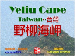
Taiwan yeliu cape (台灣野柳海岬)
•Download as PPSX, PDF•
3 likes•1,236 views

The Yehliu Geopark can be divided into three zones. The first zone contains mushroom rock and ginger rock formations. The second zone also features these rock formations but in fewer numbers. The third zone is a narrow wave-cut platform located on the other side of Yehliu Cape, featuring rocks shaped by sea erosion including the 24-filial piety hill and Marine Bird Rock. This zone also contains an important ecological conservation area.

Recommended
More Related Content
What's hot
What's hot (19)
Viewers also liked
Viewers also liked (18)
Similar to Taiwan yeliu cape (台灣野柳海岬)
Similar to Taiwan yeliu cape (台灣野柳海岬) (20)
More from Chung Yen Chang
More from Chung Yen Chang (20)
Recently uploaded
Recently uploaded (20)
Taiwan yeliu cape (台灣野柳海岬)
- 2. The Yehliu Geopark can be divided into three zones. Now introduce the third zone Yeliu Cape. 野柳地質公園內可概分為三區。 現在介紹第三區野柳海岬。
- 3. About Cape of Yehliu Geopark The total distance measured from the entrance of the Yehliu Geopark to the end of the cape is about 1.7 km, the widest area in between is shorter than 300 m. The rock landscape of Yehliu Geopark is one of most famous wonders in the world. The costal line is stretching in a direction vertical to the layer and the structure line; besides, the influences caused by wave attack, rock weathering, earth movement and crustal movement all contribute to the formation of such a rare and stunning geological landscape. Yehliu Geopark can be divided into three zones. The first zone contains mushroom rock and ginger rock. You may learn the development process of mushroom rock as well as witness the appearance of ginger rock, cleavage, pothole and melting erosion panel. On top of that, the famous candle shaped rock and the ice cream rock are presented in this area too. The second zone is similar to the first zone, where the mushroom rock and the ginger rock are the main focuses, only they are fewer in numbers. You may see the Queen’s Head, Dragon’s Head Rock, and etc. Since the area is near the coast, rocks that develop into four different kinds of formations can be seen in this area: elephant rock, fairy’s shoe, earth rock and peanut rock. The aforementioned are parts of the layers featuring special shapes as a result of being corroded by sea water. The third zone is the wave-cut platform located on the other side of Yehliu. This area is much narrower than the second zone; one side of the platform is closely adjacent to steep cliffs while down below the other side is a scene of torrent waves. Several rocks of grotesque shapes and sizes that are incarnated as a result of sea erosion can be seen in this area, including the 24-filial piety hill, pearl rock and Marine Bird Rock. The third zone also includes the major ecology reserve of Yehliu Geopark in addition to the said rock landscapes.
- 4. The first zone The second zone The third zone
- 15. Yehliu Cape trail entrance 野柳岬步道入口
- 16. Yehliu ecological conservation area 野柳生態保護區 Plants : Formosan nato tree, Shrubby false nettle, Tahitian screw pine, Seashore Vine Morning Glory...etc. Birds : Chinese Bulbul, Osprey, Little Egret, Pacific reef egret, Hoopoe, Japanese White-eye...etc. 植物:大葉山欖、苧麻、林投、馬鞍藤、台灣海桐、蔓莖...等。 鳥類:白頭翁,魚鷹(鳶)、小白鷺、岩鷺、戴勝、綠繡眼...等。
- 19. Tofu Rock 豆腐岩
- 23. Radio tower 無線電塔
- 24. Yehliu Radio Tower 野柳無線電塔 The radio tower located beside the Yehliu Lighthouse is used for fishery communication. The 20 m tall tower is easily distinguished with its white-red interleaves design, and is often mistaken with the lighthouse. 位於野柳燈塔旁邊的無線電發射塔用於漁業通信。 紅白交錯的20米高塔很容 易辨別,但是經常被誤認為是燈塔。
- 26. Look to Jinshan direction, tofu rock beneath the cliff 遙望金山方向,懸崖底下是豆腐岩。
- 28. Yehliu Lighthouse 野柳燈塔 The lighthouse is designed in a fashion following the candle shaped rock as prototype. Built in 1967, the lighthouse is measuring 11.3 m in height and is located on the top of Gueitou Mountain. 燈塔是依照燭狀石為原型的一種時尚設計。建於1967年,高度11.3米, 位於龜頭 (Gueitou) 山的頂部。
- 29. Resting pavilion under lighthouse 燈塔下的休息涼亭
- 32. Photographic cannon array 攝影大砲陣
- 33. Bird faithful waiting to shoot migratory birds back north 鳥友們等待拍攝北返的候鳥
- 39. This way down to wave cut platform under the cliff 此路可通往峭壁下海蝕平台
- 49. Look to the west Jinshan direction 西望金山方向
- 50. Keelung Islet and ship 基隆嶼與船舶
- 64. From Yehliu Cape (third zone) overlooking the first and second zones of Yehliu Geopark 從野柳海岬 (第三區) 遙望野柳地質公園第一 區和第二區。
- 65. The first zone The second zone
- 68. Marine Bird Rock 瑪伶鳥石
- 75. http://www.slideshare.net/changcy0326 Music : Chinese Music 鋼琴 雨夜花