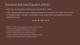
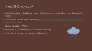
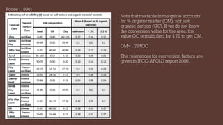
The document discusses the estimation of soil erosion using the Universal Soil Loss Equation (USLE) in ArcGIS Pro, developed by Wischmeier and Smith in the 1950s. It outlines the components of the equation (a = r * k * ls * c * p) and the sources of required data, including rainfall erosivity, soil erodibility, topography, crop management, and support practices. The document also highlights limitations of the model and provides links for further reference on various factors affecting soil erosion.

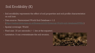
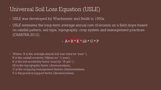
![Topographic factor (LS)
• Topographic factors LS consist of slope length L and slope steepness S.
• Increase in the slope length L causes increase in erosion due to a progressive
accumulation of runoff in the direction of downslope.
• Increase in slope steepness factor S increase the soil erosion as a result of increasing
velocity.
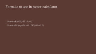
L = [(FA * cell size)/22.13]m (Moore and Wilson, 1992)
• where, FA is flow accumulation, cell size is the size of DEM and m ranges from 0.2-0.6.
• S = [(sinβ * 0.01745)/0.09]n
• where, β is slope angle in percentage, n ranges from 1.0 -1.3.
• LS = (L * S)/100
• DEM data source: SRTM (30 m) (https://dwtkns.com/srtm30m/)](https://image.slidesharecdn.com/soillossgeodev-220417125521/85/Soil-Loss_GeoDev-pdf-7-320.jpg)