SlideShare a Scribd company logo
1 of 21
Site Planning in Architectural
Projects- Principles and Approach
*Jit Kumar Gupta
Buildings have critical and important
role in making human settlements,
productive, efficient, liveable and
sustainable. No city can be made
smart and sustainable, unless it is
supported by built environment, which
is carbon neutral, energy and
resources efficient. Buildings, as
largest consumers of energy,
resources and generators of waste,
are known to use over 40% world’s
total energy, 30% global raw materials
extracted, 25% timber harvested, 16%
fresh water withdrawal, 35% of world’s CO2 emission, generators of 40% municipal solid
waste and 50% ozone depleting CFC besides making 30% residents suffering from sick
building syndrome. With number of people rushing towards urban centres, energy
requirements of cities due to buildings, is going to rise sharply in future. As per McKinsey
Global Institute Report (April, 2010), ‘India Urban Awakening: Building Inclusive Cities’,
India would be required to create ,on annual basis, buildings to the tune of 700-900 million
sqmts (equal to the built-up volume of Chicago City in USA), to meet the emerging needs
of urban India for housing and trade and commerce. Considering the large volume of built
space to be created, its implications in terms of resources, energy and waste, are going
to be colossal. Despite huge implications, very little focus is being given to mitigate the
adverse impact on the environment caused by rapid and uncontrolled growth of building
industry. Thus building, as a sector, would require close scrutiny and monitoring, for
effecting overall economy in the levels of energy consumption and for making cities
resource efficient and sustainable.
Experience and studies have shown that adopting an integrated and passive approach to
design and designing with nature, orientation, climate, wind and using natural elements
of Sun, Space and Greenery, can help in proper site planning. Integrated approach to
building design is known to essentially revolve round; rationalising site planning;
optimising shape and size of the buildings; evolving sustainable built form; optimising
surface to volume ratio; promoting building efficiency; designing energy efficient building
envelop; rationalising ratio between length and depth of the building; making building
structurally light and cost-effective; adopting solar passive techniques; controlling lighting,
heating, ventilation; using solar energy, optimising landscaping etc. Making optimum use
of existing natural elements/sources and vegetation, offer the best options for creating
green buildings. In order to ensure that buildings are made energy and resource efficient,
they must be planned and designed to conform to the stipulations laid down by the Indian
Green Building Council (IGBC) ,for site planning and designing of buildings.
Making buildings sustainable will be largely contingent upon the quality of site selected
and approach used for site planning; designing buildings including defining building fabric,
positioning footprints in the context of site. In this paper, we will define and explain the
approach which can be considered for adoption for site planning of any project to make
the buildings/project qualitative, sustainable and rational.
Site Planning
Site planning is considered both as an
art and most crucial component of any
project. Site planning is also
considered and valued as the most
crucial aspect of architecture while
evolving design solutions and placing
them within a given site. Architectural
solutions have their origin and genesis
in the site on which they are to be
located. All sites remain unique in their
fabric, shape, size, structure, area,
location, physical features, orientation,
surroundings, environment, ecology, and accessibility. Accordingly, design solutions
provided by Architects remain different, distinct and unique, considering response of the
designer to the uniqueness of the site and its surroundings.
Site planning remains a complex and intricate process, involving number of elements
and studying number of contexts including; positioning of structures and designing
internal and external elements including defining space and positioning of various
services and parking. Site planning is considered both an art and science of determining
the basic fabric, footprints and typology of buildings besides locating them in the context
of a given site, having due regard to prevailing orientation, landscaping, infrastructure,
mobility, parking, privacy, view etc. A site plan is a graphical depiction showing the layout
and includes the location, design, and specifications for roads, streets and parking areas;
storm water management systems, wastewater management systems, utilities, and other
infrastructure; structures; landscaping and common areas; and other facilities associated
with the project.
Site planning essentially involves arranging structures on a given land besides shaping
spaces between them. In addition, it also involves making optimum use of available
resources on site and reduction of impervious surfaces, decreased generation of
pollutants, and treatment of storm water runoff. Kelvin Lynch considered site planning,
‘As a process, linking architecture, engineering, landscaping and city planning’. Creating
logical relation between mass, space, zoning, services & maintenance is also known to
be the outcome of site planning besides locating activities and objects in space and time.
Site planning is considered, both as a compromise between the site, modified to work out
building program taking into account existing features of site. Since land remains the
basic and essential platform of site planning, accordingly site planning is also reckoned
as art and science of planning, designing and management of land. Considering
numerous implications and its role and importance in promoting sustainability of
architectural projects, site planning has to be done with sensitivity, care and caution to
eliminate any possible adverse impact and blend the project with local environment,
ecology, climate, culture and bio-diversity.
Suggested Principles for Site Planning;
Considering major implications of site planning in the context of making architectural
projects sustainable, cost-effective, rational, supportive and making value addition to
prevailing quality of environment, ecology and local bio-diversity, it will be essential that
broad principles governing the process of site planning must be defined and detailed to
serve as a guide to all architects while planning the sites
of their projects. These principles should revolve
around;
* Respecting site and respecting all physical
features existing on site- to make optimum use of
such features in the designing of the built environment
and placing various project element in site planning
*Planning with nature, using natural elements of sun, space and greenery- should
invariably be the approach which should form the guiding principle of site planning. Any
site planning leveraging the nature and panchmahabhutas including Prithvi, Jal, Agni,
Vayu and Akash, shall always remain relevant, rational and logical; never failing on the
altar of sustainability.
* Adopting strategy of protecting, preserving enhancing and promoting available
physical features shall invariably help in making site planning more rational and realistic
*Minimise fingerprints of proposed buildings should be used one of the guiding
principle of preparing the site plan for covering minimum area of site and leaving maximum
open area within the site, to be used for promoting landscaping, creating green spaces
and for giving a sense of more openness in the site, besides overcoming limitations
imposed by smaller land area. Having minimum building footprints will help in promoting
higher order of ground water recharging, lowering incidence of heat island, lowering
temperature on site, reducing demand for energy for heating and cooling and ensuring
adequate air, light and ventilation besides making living and working area more user
friendly.
*Keeping maximum area under open – will go a long way in promoting air, light and
ventilation, creating large area for landscape, providing enlarged scope for water
absorption, making provision for adequate parking space, reducing congestion, improving
environment, creating large open space for sit-outs, providing adequate space for laying
basic services, providing protection to adjoining properties from fire and making provision
for rainwater harvesting and ensuring ground water re-charging.
*Identifying entire range of flora and fauna- on site and preserving them ,by making
them integral part of site planning and building design process, will not only help in
improving environment but also ensure imparting a distinct ambience, character and
culture to the project. Preservation existing/ natural vegetation on site is known to help in
creating natural buffer, protecting existing soils from water and wind erosion, removing
sediments / other pollutants from storm water runoff and protecting unique or endangered
plant species besides making value addition to the project. This principle remains
universal and has applicability for all site planning. Retaining existing vegetation offers
distinct advantages in term of reducing the intensity of rainwater by absorbing the energy
of falling rain; holding soils/soil particles in place and developing soil structure for
increasing the soil’s absorptive capacity / soil permeability to absorb storm water runoff
through dense root structures . Vegetation also helps in slowing down the velocity of
runoff and acts as a filter to trap sediment; reducing noise by creating a buffer zone;
makes value addition to the area; reducing heat /minimizing heat island, lowering
temperature, providing shade during summer; creating value for the residential and
commercial properties. Retaining existing flora and fauna not only remains valuable but
also help in promoting economy in the project through reduced maintenance cost when
compared with planting new vegetation. In addition, it promotes local environment,
preserve ecology and bio-diversity besides contributing to sustainability of the project.
Preserving existing wealth of trees and plantation would remain most appropriate and
critical in areas, which are prone to high rates of soil erosion and where other soil erosion
control measures would be difficult to establish, install, or maintain. Trees can be used
with considerable advantage in areas where storm water runoff flow velocities need
considerable reduction. However, preserving existing vegetation has to be planned as
integral part of the building design and site planning process and should be completed
before the commencement of any construction activity on the site.Architects must do a
detailed study and analysis of the existing vegetation with regard to the quality, age,
growth, value etc and come to a logical conclusion as to vegetation which needs to be
preserved and conserved, based on the proposed road network and building/structures
finalized . Barricades/signs should be erected to protect vegetation boundaries selected
for preservation. Planning for protecting vegetation should also include the maintenance
requirements of the existing vegetation, based on soil types and climate. Different species
require different maintenance activities in terms of fertilization, irrigation, pruning, and
weed/pest control. These activities should be performed regularly during construction in
order to safeguard the existing vegetation.
*Making adequate provision for rain water harvesting -and ground water recharging
will improve and help in not only raising the water table in the area but will also make
available large amount of precious water for use and reduce the demand /pressure on
ground water.
* Opting for brownfield development by using areas, which were earlier used for
buildings, to help in minimising adverse impact of green field development and
regenerating the existing derelict areas.
*Providing setbacks of adequate width, - for ensuring availability of adequate air- light
and ventilation within and outside the buildings and for facilitating easy vehicular access
of the fire/ ambulance vehicles in case of natural and manmade disasters; for creating
large landscaped area within the site, providing space for parking; mitigating outside
noise; promoting privacy and allowing expansion of urban road network/laying of city
services, will be critical while preparing part of site planning
*Minimising damage to the site-- by minimising changes to existing environment,
ecology, bio-diversity, flora& fauna, physical terrain/contours of the site and by making
value addition to the site through rational site planning will be vital and crucial.
*Restoring the derelict area existing within the site by developing them and restoring
them to original status, as part of the site planning process, shall be crucial for promoting
sustainability of the project.
* Site planning for Planning steep sites and sites falling in the hill areas/
contoured sites- should preferably be based on placing and designing buildings along
the contours to the extent possible so as to minimise damage to physiography and
environment. When placed across contours, care should be taken that building
design/fabric must involve minimum cutting/filling and damage to the structure of the
site.
In case of hilly terrain and undulating sites, efforts should invariably be made to avoid
development on steep hill, ridge, and ravine slopes, especially those with side slopes of
15 percent or greater. In addition, efforts should be made to preserve, existing vegetation
to minimize erosion potential and generation of sediment. It has been observed that
building on flatter areas invariably reduces soil erosion; cut-and-fill volumes and the cost
of grading operations. Accordingly planning along contours should be reckoned as the
best option of development on hilly sites. However, where due to certain reasons,
construction has to be done across contours, then it should be ensured that
Cutting and filling shall be minimum.
* Minimising changing/tempering with the existing physiography of the site
* Preserving and protecting all existing natural areas and elements of natural/
scenic beauty and protecting all good views of built/ manmade /natural heritage to
and from the site
*Evaluating, analysing and mitigating the adverse impact of development on
heritage buildings/ site and adjoining areas, communities, ecology and
environment
Approach to Site Planning
After briefing about the principles to be
considered and approach to be adopted
for site planning, it will be relevant to
define and describe the process which
needs to be followed in order to evolve
rational options for site planning.
Rational site planning needs to be
considered and evaluated looking at the
broad range of concerns and issues
related to building design and their inter-
relationship before finalisation. Site
planning should essentially be made a
synthesis of a number of collated factors
and should be based on carrying out
detailed study and analysis of existing physical aspects of site; vision/ program of client;
designer’s own creative inclination; concerns of community; interests of end user;
zoning /bye-laws requirements for regulating the density, height, coverage, geometry of
development, road widths , parking and drainage requirements; protection of natural
resources ; Neighbourhood Character; Physical Characteristics etc. Accordingly, site
planning must incorporate an accurate description of well-defined, well-designed and
well-executed site analysis, which remains critical for evolving cost-effective,
environmentally sustainable and eco- friendly design options. Considering the total
fabric and structure of any architectural project, site planning process includes large
number of elements involving; buildings, roads, walkways, trees, gardens, water bodies,
landscaping, plazas, environment, services, parking, natural and manmade features etc.
Evolving site plan design based on prevailing site conditions and respecting existing
natural features can minimize, to a large extent, the project’s adverse environmental
impacts. Considering large number of elements and factors involved, following approach
is being suggested, for rationalizing and optimizing the process of site planning of any
project for achieving its sustainability.
i. Looking at Project brief
Before undertaking the exercise of site planning of any project, it will be
important to understand the genesis, context, intent and content of the project.
Reference in this regard needs to be made to the project profile already
prepared; so that scope of the project, built spaces requirements, services and
infrastructures to be provided, are clearly delineated, understood and
appreciated. If no such document is available, then such a document must be
created for keeping the project on track , keeping it within defined scope and
for avoiding any complications and omissions arising out of time overrun / cost-
overrun, at a later date.
ii. Locating and Understanding Site
• After having understood the project profile and requirements of the project, it
will be critical to do a detailed study and analysis of the site, identified for the
project for understanding its complexity, uniqueness, strength and locational
peculiarities. Understanding site, remains critical, important, vital for preparing
rational site planning and state of art designing of buildings. Before starting
planning of site and designing of buildings proposed; site needs to be properly
documented, visited, studied, analyzed and understood thoroughly and
objectively. Preparing site plan and designing buildings have to be the outcome
• of the prevailing site conditions and they should effectively respond to those
conditions. Premeditated designs have always/invariably failed to produce
great and sustainable solutions and do justice to the project, making them in
majority of cases irrational/ unsustainable.
• For rational site planning, it will be important to carry out in-depth site analysis.
Carrying out a realistic and rational site analysis, endeavor shall be to do
research to the extent possible and collect all relevant and available data that
relates to the site and building design. A poorly executed site analysis can lead
to a sub- standard design due to the designer not having all requisite and critical
information to respond and develop appropriate designsolutions for the project.
Knowing fully any site and its peculiarities and characteristics, always remain a
challenge. To help collecting adequate, relevant and vital information for the
site, it will be advisable to prepare a check list which should define and include,
all the aspects which needs to be looked into, as part of the site analysis.
Checklist should be the starting point for analyzing the site and gathering data.
The checklist will need to be made exhaustive/updated on continued basis
every time any new issue or factors relating to a site is observed.
•
Looking at the entire context of site analysis, data and information required can
be divided into two distinct and separate categories ie Hard data and Soft data.
Soft data will involve and comprise of study of different aspects of site
concerned with site conditions that are variable and can be changed, whereas
Hard data would look at elements which cannot be varied and would essentially
revolve around and include; boundaries of site, site areas, location of utilities
and services, contours, accessibility, orientation, dimensions, site features,
flora and fauna, structures, water features, climate, legal information. Initial site
investigations need to focus on issues related to hard data, which will help in
identifying and establishing elements which will have critical bearing on the
design, both positive and negative. Site for its proper understanding and
planning needs to be studied and analyzed in terms of Location; Accessibility;
Shape and size; Topography; Vegetation; Infrastructure; Connectivity of site
with water, electricity, gas, telephone, sewerage, power poles, sub-stations,
and other services; Orientation; Wind Direction; prevailing traffic conditions;
Climate; Local culture, Soil conditions; View from site /View to site; Prevailing
typology of buildings; Structures existing within site; Existing encumbrances-
electric /gas lines, water bodies etc; local Building bye laws; Developmental
Controls- Height, FAR, setbacks ,land use and restrictions imposed by Master
Plans/ statutory document; any rights of way passing through the site along
with dimensions; existing easements ; location of heritage /listed buildings
within/ in close proximity to site
Understanding site has been valued and observed to greatly help in
understanding and appreciating the contexts of ; defining and designing
structure and contours of the project; positioning buildings; determining solid
and void relationship within site; determining shape, size & and volume of
buildings; determining distances and relationship between buildings; planning
and designing state of art buildings; planning and designing sustainable
buildings; making buildings cost–effective/energy /waste efficient ; planning
spaces rationally and objectively- both internal and external; placing buildings
and determining building setbacks; preparing landscape design; evolving
Traffic and Transportation/mobility Plans ; preparing Infrastructure plans;
evolving service plan ; preparing drainage plan and providing Rain water
harvesting.
Understanding and carrying out an extensive site analysis, before initiating the
design process, also remains critical and vital from the point of view of client,
who would be keen to know whether construction on the site would be
financially and technically feasible, based on established /set parameters and
for evolving and implementing design options which will appropriately respond
to the existing physical and environmental features of the site. Understanding
the context, complexity, peculiarity and specificity of a site, remains key for the
designer to make informed decisions about the project and evolving realistic
options that can effectively gel the building design with existing fabric and
culture of the site, based on available opportunities and prevailing problems .
A detailed and accurate survey of the site indicating the shape, size,
dimensions, orientation, easements, levels / contours of site, difference in levels
between site / surrounding properties, location/ height of existing physical
features on site/ surrounding properties, existing flora & fauna, use/height of
surrounding buildings, details of means of accessibility, location and availability
of municipal services including roads, water supply, sewerage, electricity,
drainage location of institutions of healthcare, education and shopping areas
etc, relevant to project profile, will be critical and valuable for good site planning.
Survey of site should be supplemented with getting information of the soil
available at site for assessing soil bearing capacity along with ascertaining the
water table for taking a call on the design of buildings. This will be critical for
projects involving creation of multi-level basements for meeting the parking
needs and buildings with large footprints which fall in the category of high-rise
buildings.
• Physical survey and soil testing should be supplemented by visit of the architect
to have a realistic feel of site and its settings and surrounding besides
understanding the context of the site with its neighborhood communities and
the city. Site needs to be looked out both from inside and outside and from top
and bottom to understand its uniqueness/ complexity and fabric.. Critical and
objective evaluation and appreciation of the different facets of the site will help
in planning of the site in a realistic manner based on the prevailing ground
realities.
Carrying out a detailed SWOT analysis will further help the designer to
understand the strength of the site, enumerate its weaknesses, identify
opportunities offered by the site and possible threats posed by the site , which
need to be encountered. Locating and understanding site, will always remain
most vital component of site planning process. Thorough and objective site
analysis remains most valuable and potent mechanism/ critical for evolving
cost-effective, environmentally sustainable and rational design solution for any
project. Site analysis has been valued for understanding of the site in terms of
its existing potential, understanding environmental impact of development,
Impact on community, Impact on adjoining development/properties, defining
project design, defining scope of project and understanding development
constraints.
Before physically visiting, efforts should be made to source maximum
information about the site from client and by using technology involving
computers, looking at the available maps of the area including GIS maps/
google maps/ Survey of India maps/Aerial photographs etc for locating the
physical position, understanding the surroundings, flora& fauna existing within
the site, defining boundaries of the site and identifying specific things that
require check/ look out at site. While visiting the site, it will be important that site
is properly documented and recorded and nothing is missed out, which merits
consideration and valuation while preparing the site plan and project design.
Accordingly, before visiting site, one should carry camera/ Smart phone. for
taking pictures of site , existing physical features, accessibility, area
surrounding the site, existing services, water bodies, flora &fauna, existing
structures within/outside the site etc Note book for recording and writing down;
tape for measuring etc needs to be invariably carried while visiting the site.
iii Evaluating Building Controls & Building Regulations
Detailed study and understanding of the
provisions made in the prevailing building
bye-laws, zoning regulations,
architectural controls, zonal plans, zoning
plans, development plans etc shall be
vital for evolving site plans which will
stand the testimony and scrutiny of legal
framework for statutory approvals.
Accordingly, it will be desirable to know
the applicable building controls to the
project site in terms of; permissible
ground coverage, maximum permissible height, prescribed floor area ratio,
minimum stipulated setbacks, area zoned as building envelop, area permissible
under basement, norms prescribed for parking/population density/dwelling units,
extent of projections permitted , positioning of entry and exits, number of storeys
permitted, requirements of public health services, mobility within/outside buildings,
structural stability requirement of the buildings, requirements of fire exit/disaster for
the buildings, distance to be left between buildings etc, so that site plan remains
within the confines of these statutory limits.
These controls need to be followed and clearly
defined in the site plan so that building designs
are also prepared within the same framework.
Limitations on height/ setbacks/coverage
imposed by the location of the project close to
airport, location on highways, heritage areas,
wetland, protected monuments, defence
installations and coastal areas, also need to be
clearly deciphered, defined and followed as part
of site planning process.
IV Studying Climates
Climate will be one of the major determinants of the shape, size and location
of the buildings in the site. Climate shall invariably be studied in the three distinct
contexts in terms of; Micro, Meso and Micro climates. In the Macro context, site will
be studied at the zonal level for ascertaining precisely in which climate zone it falls.
Based on climatic considerations, India has been divided into five distinct climate
zones including; Hot and Dry; Warm and Humid; Temperate; Composite and Cold
climate Zones. Depending upon the relevant zone, site plan will need orientation to
mitigate the adverse impact and challenges posed by the prevailing climate of the
zone. At the second level, city climate shall be considered so that design solutions
could be made more realistic, based on general climatic conditions prevailing at
the settlement level. At the lowest level, site climate will need detailed study and
analysis ,which will be major determinant of contours of site planning and building
design .It will include evaluating all the distinct feature existing on the site and in
its surroundings for evolving site specific planning. Based on climatic consideration
site planning shall address all issues related to heat radiation and humidity, based
on orientation, movement of sun and prevailing wind direction.
V Understanding Orientation
Orientation is the position/positioning of site with relation to points of compass
and other specific directions. Orientation is the most critical factor which needs to
be effectively leveraged in site planning/building designs, inorder to evolve rational
site plan and energy efficient/sustainable/green building designs, by making
optimum use of solar light/heat/radiation and the available wind energy. However,
requirements of building design would vary from region to region, state to state,
cities to cities and within regions, states and cities. Accordingly, buildings, with
regard to sun , wind, heating, ventilation, cooling and lighting, will have to be
designed and oriented differently in different regions. In order to ensure that
buildings make best use of solar and wind energy, it would be essential that
majority of buildings would have the site advantage of having best orientation,
where such buildings are to be constructed. Accordingly, in this context, urban
planners have important role cast for themselves for ensuring, that while preparing
the layout plan of the area, highest consideration is given to orientation, so that
maximum number of plots have the distinct advantage of best orientation. Once
this is ensured at the planning level, it would be much easier for the Architects to
evolve a design which would be energy efficient. Further, the planners should
ensure that ratio of plot width and depth is fixed in such a manner that the entire
depth of built-up area permitted on a plot should have access to natural light and
ventilation during the day, minimizing the requirement of artificial lighting. This
would be particularly important in case of row housing, where plots have the
limitation of drawing light from front and the rear only.
Understanding site orientation would essentially involve; looking at the position of
North, South, East and West with respect to project site. Context of each cardinal
direction needs to be understood and appreciated with respect to these directions,
both individually and collectively. These cardinal directions have both positivities
and negativities besides strength and weaknesses, considering the climate zone
in which they are located. South- East
remains best orientation in composite
climate whereas North orientation is
considered best for sourcing glare-
free and uniform natural light, without
any heat gain. North direction provides
good opportunities for having large
area under glazing and remain most
suitable for industrial buildings,
because sun never rises and sets in
the North.
If North remains the coolest side, South remains hottest in terms of highest
radiation. Sun also remains at highest altitude both in summer and winter in the
Southern side. However, elevation of sun remains much higher during the Summer
as compared to winter. Sun revolves around North during summer, as it rises in
the North- East and sets in the North- West. During winters, Sun revolves around
South, rising in the South- East and setting in the South- West. Considering the
movement of Sun, with sun not available in the North, in Cold regions locating
buildings on the North direction/slopes needs to be invariably avoided due to
obvious reason of non-availability of sun. Buildings in hill areas should preferably
be located on the Southern slope, followed by East and west sides in order to
maximize the heat gain provided by the Sun.
West direction has its inherent limitations and implications and is known to be worst
orientation in all hot climate regions due to maximum heat and horizontal radiations
falling in that direction and accordingly exposure of the buildings in this direction
needs to be minimized and avoided to the extent possible. However, it will not be
possible to avoid western direction in the large projects having setbacks on all
sides or sites having exposure to western direction. Accordingly, while preparing
site planning, minimum building surfaces should be given exposure in the west
side to avoid heat gain. In order to avoid the adverse impact of the heat on west
side, mechanism of providing properly designed shading devices could be used as
an option. Planting rows of deciduous trees for shading the western walls or
greening western walls through well-planted creepers, will be other options
available for reducing impact of heat on such walls. Painting western walls white
or adopting cavity walls for west can considerably reduce the adverse impact of
heat on western side.
Accordingly, it will be desirable that detailed study and analysis of the site
orientation must be made along with studying and mapping the behavior and
movement of Sun, during different seasons of the year while preparing the site
plan and designing buildings. Good and bad sides of the site need to be clearly
identified and demarcated while preparing site plan/building plans. All areas
involving human habitation should be placed along good orientation, whereas all
areas providing worst orientation, should be made to house non-habitable areas
of the project in site plans.
Considering the entire context, orientation plays important role in site planning and
siting buildings. When combined with wind direction and sun path, orientation help
in providing optimum solution regarding how buildings should be oriented and
sited. Orientation along with sun path will always remains major determinant of
site planning, positioning of the buildings and that of placement of rooms inside
buildings
vi. Ascertaining Wind Direction
Prevailing wind direction will be
another major determinant for evolving
rational site plan. Wind direction
remains location and season specific
and accordingly varies during the year.
However, it will be appropriate to
consider and identify the direction, in
which for majority of the time wind
flows. For designing / evolving climate
responsive site planning/building
design, it will be important to consider
and map indicating the direction of wind
in which it flows for majority of the time
in the year and to channelized it through interiors of the buildings to minimise
the adverse impact of radiation and humidity on the human living. This will be
particularly important in the case of sites falling in the warm and humid climatic
zones, where cross- ventilation emerges as the most important feature of the
building design to counter the adverse impact of high percentage of moistures
present in the air. However, in case of cold regions and hot climate regions, cross
ventilation has to be invariably avoided during the flow of the cold winds in cold
regions and that of hot winds in the hot and dry regions, during the daytime.
f
vii Defining Setbacks and Building Envelop
Set-backs remain the most important component of site planning and positioning
of buildings. Adequate set backs are always considered vital for promoting
sustainability and liveability of the project. Set- backs in the shape of minimum
distance to be provided, are generally defined as part of the building rules and
zoning plans, where no construction is permitted. There is no limit prescribed for
the maximum width of the setback to be left within the site. While designing and
placing buildings in site, there remains considerable flexibility for defining the set-
backs, particularly in the projects having large area. Accordingly, it will be desirable
that due care and caution should be exercised while deciding the depth of set-
backs. Minimum set- backs can be considered for sides having worst orientation
whereas maximum setbacks should be provided on sides having best orientation.
Maximum set-backs provided in the front side of the site will always make value
addition to site planning for reasons of safety, security, sealing buildings from
noise, privacy, developing green spaces, avoiding demolition during
widening/laying infrastructure etc. Fire safety, height of building, air-light and
ventilation in buildings are the other determinants of the extent of set-backs to be
provided in the site. Identifying open spaces to be left within buildings, positioning
of existing flora- fauna and area to be used for landscaping, can also be factors
considered useful , while site planning for determining depth of set-backs.
While dealing with irregular sites, it will always be appropriate to respect the roads
facing the site. All buildings must be placed, planned and designed, parallel to the
streets on which they fall and site plans should invariably be evolved on that
principle. All irregularities in the site, need to be adjusted as part of building design
process. Irregular set-backs should be invariably avoided in site planning.
viii Defining Exit and Entry to the Site
Entries and exits ,and their numbers, defined in the project are also known
to impact the site planning due to provision of accessibility to be made for the
mechanised/non-mechanised vehicles, pedestrians, public, private, VIP;,
loading/unloading of goods, parking etc. in the site. Accordingly, they need to be
carefully considered for location. In case of big sites/campus having multiple exits,
entries and parking, preparing rational site plan requires lot of study and analysis.
ix Existing Flora and Fauna
Site planning needs to invariably
value the prevailing physical
conditions on the site and also give
credibility to the trees and vegetable
wealth existing on site. Accordingly, all
the trees and physical encumbrances
existing on the site, along with their
size, shape, foliage, age , canopy ,
cover etc., must be duly identified,
mapped and marked accurately on the
site plans in order to prepare rational
site plans. It also needs to be
ascertained whether trees existing on site are protected under any legal framework.
Decisions needs to be taken right at the outset regarding existing trees, whether
they are to be adjusted as integral part of the building design or integrated with
landscaped area or made part of the space marked for parking/ services. Such a
strategy will help in not only saving all trees existing on the site but will also help in
designing and positioning of the buildings, placing of open spaces and services in
the site planning.
x Making provision for Rain Water Harvesting and Solar Energy Generation
Rain water harvesting must be made integral part of site planning by earmarking
dedicated space in the plan for not only harvesting the rain water but also for
meeting the demand of non-potable water
for the landscaping and other needs of the
buildings. In addition, adequate provision
should also be made in the site plan for
recharging the ground water so as to add
to the ground water resource of the area.
Site planning potential can be leveraged
for promoting the sustainability of the
project if dedicated area is marked for
generating energy from renewable and
natural resources. These provisions shall
be made based on prescribed norms and
standards.
Adequate provision shall also be made in
the site plan for minimising the adverse impact of heat island by innovatively
designed pathways, walkways etc. Low- lying area available in the site should be
considered for creating water bodies as part of site planning to collect rain water
and also for modulate prevailing climate besides promoting greening on a large
scale.
xi. Valuing surrounding land uses and buildings
For optimum site planning and creating sustainable design solution for proposed
project/buildings, it will be relevant and desirable that prevailing pattern of planning
and that of surrounding land uses and buildings should be brought under close
focus and consideration. While taking decisions regarding planning and designing
of the project, incompatible land uses
existing in close vicinity to project site
need to be avoided to the extent
possible considering its implications,
adverse impact it may have on the
project and issues they may create in
planning and designing. Adjoining
structures/development needs
evaluation in terms of their height,
setbacks, building footprints, materials,
typologies etc, which will be important
in the context of privacy, ensuring free
flow of air, light, ventilation and sunlight,
within and outside buildings, Prominent
Vision lines / Visual linkages, to natural and made objects are invariably
considered relevant and Important elements in site planning and building design
process. Views to site as well views from the site need careful consideration,
evaluation and inclusion while preparing site plans and design of buildings.
Conclusion
Considering the broad parameters explained above and factors defined by Indian
Green Building Council ( IGBC ), for evaluating and rating of green buildings,
preparing rational site plans for any project should essentially be based on the
factors involving; adopting Integrated approach to design; preserving sites ;
adopting passive approach to Architecture solutions; providing basic amenities;
promoting proximity to local transport; respecting natural topography; promoting
tree preservation , promoting rain water harvesting, adding to the environment,
ecology etc. Adopting the defined principles, approach and process, would be
valuable and helpful for putting in place rational site planning for the project and
evolving sustainable building designs. Site planning approach for both small,
medium and large projects shall be at variance, depending upon nature of project,
location, client perception, climate etc of the project but basic principles governing
site planning and building design will always remain same.
As per, ‘First in Architecture – Architecture Site Analysis Guide”-- site
planning and building design should have genesis in and should invariably revolve
around having careful site analysis in terms of ;
 Location – where the site is situated;
 Neighborhood context – the immediate surrounding of the site including data
on zoning /buildings/ other impacts on our project.
 Zoning and size – dimensional considerations such as boundaries, easements,
height restrictions, site area, access along with any future plans.
 Legal information – ownership, restrictions or covenants, future urban
development plans.
 Natural physical features – actual features of the site- including- trees, rocks,
topography, rivers, ponds, drainage patterns.
 Manmade features – existing buildings, walls, surrounding vernacular,
setbacks, materials, landscaping etc
 Circulation – Vehicle / pedestrian movements in/through/around the site, timing
of these movements ; duration of peak/heavier patterns; proposed future
traffic/ road developments
 Utilities – electricity, gas, water, sewer and telephone services situated in/ near
the site, along with distances, depths and materials.
 Climate – Climatic information including rainfall, snowfall, wind directions,
temperatures, sun path, considered during the year.
 Sensory – visual, audible and tactile aspects of the site, including views, noise,
considered in time frames
 Human and cultural – cultural, psychological, behavioral and sociological
aspects of the surrounding neighborhood. In terms of activities and patterns,
density, population ethnic patterns, employment, income, values etc
 Before going for site planning / building design- ensure site is
properly/accurately surveyed, documented -- mapping everything within/
outside the site which would be relevant for its planning/ designing.
 Site survey should include details of ; determining accurately dimensions of
outer boundaries, area of site, angles of all sides ,contours/levels at regular
intervals- gradient, landform, elevation, drainage pattern etc ; existing
trees/flora fauna- in terms of type, size, location, shape, pattern, aesthetics,
ecology; existing water bodies ;electric lines; existing services- both
underground /over-ground/within /outside; approach roads- inside/outside
along with their dimensions; existing structures – within/outside of area of site;
views of the site- within /outside ; existing water table/ flood-ability of site, low
lying areas etc;
 Testing Soil, for determining the soil load bearing capacity
 Locating North in relation to site along with other cardinal directions for
quantifying the context of site planning, site orientation and building design.
 Identifying Wind direction /pattern of wind flow;
 Defining Setbacks to be left within building as per bye-laws; Defining- ‘No
building Zone’- to be left within site, as per Master Plan/National /State
Highways, applicable legal framework etc; Defining Mandatory,’ No building
zone’-- to be left , when located near defense installations/ protected
monuments/ zoo/ botanical gardens/ electric installations; Defining-‘No
Building Zone’ --to be left when site located near water bodies/rivers etc ;
Defining right of way for High Tension Electric Lines when passing through
site
 Obtaining Zoning Plan of the site , when site allotted by any Development
Authority/Urban Local Body/Improvement Trust/ Industrial Corporation etc, will
be useful and should guide the site planning and building design process..
 Site planning and building design should be carried out simultaneously for
rational planning and designing with site planning dictating the location of
various project components and footprints/contours of the buildings to be
housed within the site..
 Planning residential complexes should invariably focus on segregating the
vehicular and pedestrian traffic while keeping vehicles on periphery and making
core as the pedestrian paradise.
 Site planning needs to be based on making assessment of parking requirement
and deciding where parking is to be provided- surface/stilts/ground- for making
adequate provision of space for parking, within and outside buildings.
 Site planning- for large sites calls for carrying out detailed land suitability
analysis of the area in terms of; area to be preserved, area to be conserved
and area fit for development. Derelict areas remain vital for development and
accordingly needs to be addressed in site planning. Site planning of large sites,
must be carried out initially by drawing a master plan; in terms of area zoned
for different uses along with broad road network.
 Requirement of adequate and appropriate lighting/ ventilation are the critical
factors to dictate positioning of buildings. North direction remaining best for
glare free/uniform/cool light
 In irregular project sites- plan for regular buildings running parallel to abutting
roads , leaving residual irregular spaces to be used for landscaping/ defining
setbacks.
 In site -planning and building designing-- respecting site, respecting nature,
respecting existing topography and valuing existing water bodies must remain
the most important consideration.
 Site planning must be based on considerations guided by climatic conditions
prevailing at Regional/ Settlement/Site levels
 Valuing prevailing wind direction for rational site planning and positioning of
buildings in site ,while looking for desirable winds/undesirable winds would be
critical.
 Looking at the views from/to the site to make optimum /best use of views
focusing on nature, avoiding views of slums /industry /pollution etc should
invariably be considered while preparing site plan and positioning/designing
buildings.
 Different elements of site which impact the final design of a building include;
Topography, Vegetation, flora & fauna, Infrastructure, Existing buildings,
climate, Culture, orientation, wind direction, Site plan showcases existing and
proposed conditions of site with the proposed building design and would
essentially show, North and Scale, boundaries of Property, set backs and
distance between buildings, Existing & Proposed buildings, Area under
Parking, existing Easements, Covered area, Floor Area ratio, Accessibility,
Driveway, services
References
 Gupta J K; Site Planning for Architectural Projects ppt
 Wikipedia; Site Planning; en.wikipedia.org/wiki/site_ plan
 Archisoup; Architecture Site Analysis- An Introduction;
https://www.archisoup.com/architecture-site-analysis-introduction
 First in Architecture; Architecture Site Analysis Guide;
https://www.firstinarchitecture.co.uk/architecture-site-analysis-guide-2
:
 Storm Water Manual 2007- Chapter 4-Planning Principles and Design
Considerations .
 Note; All images shown in the text are sourced and have genesis in the
Google.com , which are gratefully and thankfully acknowledged by the
author.
Author;--- Ar Jit Kumar Gupta
#344/40-a, Chandigarh-160036
Former, Director, College of Architecture IET Bhaddal (Pb)
---- mail-jit.kumar1944@gmail.com

More Related Content

What's hot

Elements of urban design
Elements of urban designElements of urban design
Elements of urban designAr. Aakansha
 
Presentation of urban design
Presentation of urban designPresentation of urban design
Presentation of urban designvermaharsha
 
What's different between urban planning, urban design, architecture, AADI
What's different between urban planning, urban design, architecture, AADIWhat's different between urban planning, urban design, architecture, AADI
What's different between urban planning, urban design, architecture, AADIaalliance
 
Urban design analysis, Circulation, Architecture, London, Redevelopment studies
Urban design analysis, Circulation, Architecture, London, Redevelopment  studiesUrban design analysis, Circulation, Architecture, London, Redevelopment  studies
Urban design analysis, Circulation, Architecture, London, Redevelopment studiesSujeet Thakare
 
Chandigarh City Planning
Chandigarh City Planning Chandigarh City Planning
Chandigarh City Planning SandeEp VeRma
 
Image of the city
Image of the cityImage of the city
Image of the cityCoEP
 
Urban Design at different levels of Planning
Urban Design at different levels of PlanningUrban Design at different levels of Planning
Urban Design at different levels of PlanningYajush Sonar
 
Architectural conservation
Architectural conservationArchitectural conservation
Architectural conservationAditi Koshley
 
cognitive, behaviour and activity mapping
cognitive, behaviour and activity mappingcognitive, behaviour and activity mapping
cognitive, behaviour and activity mappingpadamatikona swapnika
 
Image of the city, kevin lynch & case study.
Image of the city, kevin lynch & case study.Image of the city, kevin lynch & case study.
Image of the city, kevin lynch & case study.Prasenjit Karmakar
 

What's hot (20)

Site Planning
Site PlanningSite Planning
Site Planning
 
Elements of urban design
Elements of urban designElements of urban design
Elements of urban design
 
Urban spaces
Urban spaces  Urban spaces
Urban spaces
 
Presentation of urban design
Presentation of urban designPresentation of urban design
Presentation of urban design
 
Site Analysis
Site Analysis Site Analysis
Site Analysis
 
Kevin Lynch. Mental maps
Kevin Lynch. Mental mapsKevin Lynch. Mental maps
Kevin Lynch. Mental maps
 
What's different between urban planning, urban design, architecture, AADI
What's different between urban planning, urban design, architecture, AADIWhat's different between urban planning, urban design, architecture, AADI
What's different between urban planning, urban design, architecture, AADI
 
Ian l mcharg
Ian l mchargIan l mcharg
Ian l mcharg
 
Urban design analysis, Circulation, Architecture, London, Redevelopment studies
Urban design analysis, Circulation, Architecture, London, Redevelopment  studiesUrban design analysis, Circulation, Architecture, London, Redevelopment  studies
Urban design analysis, Circulation, Architecture, London, Redevelopment studies
 
Chandigarh City Planning
Chandigarh City Planning Chandigarh City Planning
Chandigarh City Planning
 
Site planning
Site planningSite planning
Site planning
 
Image of the city
Image of the cityImage of the city
Image of the city
 
Urban Design at different levels of Planning
Urban Design at different levels of PlanningUrban Design at different levels of Planning
Urban Design at different levels of Planning
 
Architectural conservation
Architectural conservationArchitectural conservation
Architectural conservation
 
Ud ppt
Ud pptUd ppt
Ud ppt
 
cognitive, behaviour and activity mapping
cognitive, behaviour and activity mappingcognitive, behaviour and activity mapping
cognitive, behaviour and activity mapping
 
Image of the city, kevin lynch & case study.
Image of the city, kevin lynch & case study.Image of the city, kevin lynch & case study.
Image of the city, kevin lynch & case study.
 
Site planning
Site planningSite planning
Site planning
 
Landscaping Architecture
Landscaping ArchitectureLandscaping Architecture
Landscaping Architecture
 
landscape Grading
landscape Grading  landscape Grading
landscape Grading
 

Similar to Site planning in Architectural Projects- Principles and Approaches

Site planning in Architectural Projects- Principles and Approaches
Site planning  in Architectural Projects- Principles and ApproachesSite planning  in Architectural Projects- Principles and Approaches
Site planning in Architectural Projects- Principles and ApproachesJIT KUMAR GUPTA
 
Site Planning in Architectural Projects- Principles and Approach
Site Planning in Architectural Projects- Principles and Approach  Site Planning in Architectural Projects- Principles and Approach
Site Planning in Architectural Projects- Principles and Approach JIT KUMAR GUPTA
 
Site planning in Architectural Projects- Principles and Approaches
Site planning  in Architectural Projects- Principles and ApproachesSite planning  in Architectural Projects- Principles and Approaches
Site planning in Architectural Projects- Principles and ApproachesJIT KUMAR GUPTA
 
Green and Energy Efficient Buildings
Green and Energy Efficient Buildings Green and Energy Efficient Buildings
Green and Energy Efficient Buildings JIT KUMAR GUPTA
 
Promoting Affordability Through Sustainable Built Environment
 Promoting Affordability Through Sustainable Built Environment Promoting Affordability Through Sustainable Built Environment
Promoting Affordability Through Sustainable Built EnvironmentJIT KUMAR GUPTA
 
green architecture
green architecturegreen architecture
green architecturesuzain ali
 
Need For Sustainable Development
Need For Sustainable DevelopmentNeed For Sustainable Development
Need For Sustainable DevelopmentAnupama Krishnan
 
Implication of Sustainable Development in Site Planning in Composite Climate ...
Implication of Sustainable Development in Site Planning in Composite Climate ...Implication of Sustainable Development in Site Planning in Composite Climate ...
Implication of Sustainable Development in Site Planning in Composite Climate ...IRJET Journal
 
Eem green building
Eem green buildingEem green building
Eem green buildingGaurav Verma
 
Planning and Designing Green buildings-.issues, options and strategies
Planning and Designing Green buildings-.issues, options and strategiesPlanning and Designing Green buildings-.issues, options and strategies
Planning and Designing Green buildings-.issues, options and strategiesJIT KUMAR GUPTA
 
Local agenda 21
Local agenda 21Local agenda 21
Local agenda 21noorizzah
 
Book on-Identifying, Analysing and Planning sites for Architectural Projects
Book on-Identifying, Analysing and Planning sites for Architectural ProjectsBook on-Identifying, Analysing and Planning sites for Architectural Projects
Book on-Identifying, Analysing and Planning sites for Architectural ProjectsJIT KUMAR GUPTA
 
Green Building
Green BuildingGreen Building
Green BuildingKousikRoy7
 
Presentation1
Presentation1Presentation1
Presentation1agraaditi
 
Civil-Engineering-Sustainability-and-the-Future.pdf
Civil-Engineering-Sustainability-and-the-Future.pdfCivil-Engineering-Sustainability-and-the-Future.pdf
Civil-Engineering-Sustainability-and-the-Future.pdfJoanBunaoSerafica
 

Similar to Site planning in Architectural Projects- Principles and Approaches (20)

Site planning in Architectural Projects- Principles and Approaches
Site planning  in Architectural Projects- Principles and ApproachesSite planning  in Architectural Projects- Principles and Approaches
Site planning in Architectural Projects- Principles and Approaches
 
Site Planning in Architectural Projects- Principles and Approach
Site Planning in Architectural Projects- Principles and Approach  Site Planning in Architectural Projects- Principles and Approach
Site Planning in Architectural Projects- Principles and Approach
 
Site planning in Architectural Projects- Principles and Approaches
Site planning  in Architectural Projects- Principles and ApproachesSite planning  in Architectural Projects- Principles and Approaches
Site planning in Architectural Projects- Principles and Approaches
 
Green and Energy Efficient Buildings
Green and Energy Efficient Buildings Green and Energy Efficient Buildings
Green and Energy Efficient Buildings
 
Promoting Affordability Through Sustainable Built Environment
 Promoting Affordability Through Sustainable Built Environment Promoting Affordability Through Sustainable Built Environment
Promoting Affordability Through Sustainable Built Environment
 
green architecture
green architecturegreen architecture
green architecture
 
Green building
Green buildingGreen building
Green building
 
Need For Sustainable Development
Need For Sustainable DevelopmentNeed For Sustainable Development
Need For Sustainable Development
 
Zero Energy Buildings-.
Zero  Energy Buildings-.Zero  Energy Buildings-.
Zero Energy Buildings-.
 
Implication of Sustainable Development in Site Planning in Composite Climate ...
Implication of Sustainable Development in Site Planning in Composite Climate ...Implication of Sustainable Development in Site Planning in Composite Climate ...
Implication of Sustainable Development in Site Planning in Composite Climate ...
 
Eem green building
Eem green buildingEem green building
Eem green building
 
Planning and Designing Green buildings-.issues, options and strategies
Planning and Designing Green buildings-.issues, options and strategiesPlanning and Designing Green buildings-.issues, options and strategies
Planning and Designing Green buildings-.issues, options and strategies
 
12 8 what_is_green_gggc
12 8 what_is_green_gggc12 8 what_is_green_gggc
12 8 what_is_green_gggc
 
Local agenda 21
Local agenda 21Local agenda 21
Local agenda 21
 
Book on-Identifying, Analysing and Planning sites for Architectural Projects
Book on-Identifying, Analysing and Planning sites for Architectural ProjectsBook on-Identifying, Analysing and Planning sites for Architectural Projects
Book on-Identifying, Analysing and Planning sites for Architectural Projects
 
Trends in Landscape Architecture
Trends in Landscape ArchitectureTrends in Landscape Architecture
Trends in Landscape Architecture
 
Green Building
Green BuildingGreen Building
Green Building
 
Local agenda 21
Local agenda 21Local agenda 21
Local agenda 21
 
Presentation1
Presentation1Presentation1
Presentation1
 
Civil-Engineering-Sustainability-and-the-Future.pdf
Civil-Engineering-Sustainability-and-the-Future.pdfCivil-Engineering-Sustainability-and-the-Future.pdf
Civil-Engineering-Sustainability-and-the-Future.pdf
 

More from JIT KUMAR GUPTA

Factors Causing Urban Heat Island- 14.4,24.docx
Factors Causing Urban Heat Island- 14.4,24.docxFactors Causing Urban Heat Island- 14.4,24.docx
Factors Causing Urban Heat Island- 14.4,24.docxJIT KUMAR GUPTA
 
Making and Unmaking of Chandigarh - A City of Two Plans2-4-24.ppt
Making and Unmaking of Chandigarh - A City of Two Plans2-4-24.pptMaking and Unmaking of Chandigarh - A City of Two Plans2-4-24.ppt
Making and Unmaking of Chandigarh - A City of Two Plans2-4-24.pptJIT KUMAR GUPTA
 
_Neighborhood Planning in Capital City of Chandigarh- An Appraisal (2) - Copy...
_Neighborhood Planning in Capital City of Chandigarh- An Appraisal (2) - Copy..._Neighborhood Planning in Capital City of Chandigarh- An Appraisal (2) - Copy...
_Neighborhood Planning in Capital City of Chandigarh- An Appraisal (2) - Copy...JIT KUMAR GUPTA
 
Reviewing, Revising and Redefining Master Plans and Development Plans to Ma...
Reviewing, Revising and  Redefining Master Plans and Development Plans to  Ma...Reviewing, Revising and  Redefining Master Plans and Development Plans to  Ma...
Reviewing, Revising and Redefining Master Plans and Development Plans to Ma...JIT KUMAR GUPTA
 
Rationalizing the Planned Growth of Urban India- paper.docx
Rationalizing the Planned Growth of Urban India- paper.docxRationalizing the Planned Growth of Urban India- paper.docx
Rationalizing the Planned Growth of Urban India- paper.docxJIT KUMAR GUPTA
 
Suggestion and Options for integrating villages. within the framework of the...
Suggestion and Options for  integrating villages. within the framework of the...Suggestion and Options for  integrating villages. within the framework of the...
Suggestion and Options for integrating villages. within the framework of the...JIT KUMAR GUPTA
 
Making cities Climate Responsive and Sustainable
Making cities Climate Responsive and SustainableMaking cities Climate Responsive and Sustainable
Making cities Climate Responsive and SustainableJIT KUMAR GUPTA
 
Managing Planning and Development of Citie- 26-2-24.docx
Managing Planning and  Development of  Citie-  26-2-24.docxManaging Planning and  Development of  Citie-  26-2-24.docx
Managing Planning and Development of Citie- 26-2-24.docxJIT KUMAR GUPTA
 
Agenda, Approach and Options for Rationalising and Redefining Future Indian ...
Agenda, Approach and Options for Rationalising and Redefining Future  Indian ...Agenda, Approach and Options for Rationalising and Redefining Future  Indian ...
Agenda, Approach and Options for Rationalising and Redefining Future Indian ...JIT KUMAR GUPTA
 
-Redefining and Rationalising Development Controls - Copy.docx
-Redefining and Rationalising  Development Controls - Copy.docx-Redefining and Rationalising  Development Controls - Copy.docx
-Redefining and Rationalising Development Controls - Copy.docxJIT KUMAR GUPTA
 
Redefining and Rationalising Development Controls -Issues and Options
Redefining and Rationalising Development Controls -Issues and OptionsRedefining and Rationalising Development Controls -Issues and Options
Redefining and Rationalising Development Controls -Issues and OptionsJIT KUMAR GUPTA
 
7 Leveraging Tourism for Promoting Sustainable Development of Hill States.pdf
7 Leveraging  Tourism for Promoting Sustainable Development of Hill States.pdf7 Leveraging  Tourism for Promoting Sustainable Development of Hill States.pdf
7 Leveraging Tourism for Promoting Sustainable Development of Hill States.pdfJIT KUMAR GUPTA
 
Strategies and Options For Making India Zero Waste Water-26-2-24.pptx
Strategies and Options For Making India Zero Waste Water-26-2-24.pptxStrategies and Options For Making India Zero Waste Water-26-2-24.pptx
Strategies and Options For Making India Zero Waste Water-26-2-24.pptxJIT KUMAR GUPTA
 
SECMOL School In Leh- A Role Model of Vernacular , Passive and Sustainable H...
SECMOL School In Leh- A  Role Model of Vernacular , Passive and Sustainable H...SECMOL School In Leh- A  Role Model of Vernacular , Passive and Sustainable H...
SECMOL School In Leh- A Role Model of Vernacular , Passive and Sustainable H...JIT KUMAR GUPTA
 
Hill Area development- Issues and Options
Hill Area development- Issues and OptionsHill Area development- Issues and Options
Hill Area development- Issues and OptionsJIT KUMAR GUPTA
 
Preface-Making Hill Area Great Place to Live.docx
Preface-Making Hill Area Great Place to Live.docxPreface-Making Hill Area Great Place to Live.docx
Preface-Making Hill Area Great Place to Live.docxJIT KUMAR GUPTA
 
Land Management and sourcing land for sustainable Urban Development.
Land Management and sourcing land for sustainable Urban Development.Land Management and sourcing land for sustainable Urban Development.
Land Management and sourcing land for sustainable Urban Development.JIT KUMAR GUPTA
 
Options for Making Housing Affordable a distinct Reality
Options for Making Housing Affordable a distinct RealityOptions for Making Housing Affordable a distinct Reality
Options for Making Housing Affordable a distinct RealityJIT KUMAR GUPTA
 
Urban Infrastructure 24-5-23.ppt
Urban Infrastructure  24-5-23.pptUrban Infrastructure  24-5-23.ppt
Urban Infrastructure 24-5-23.pptJIT KUMAR GUPTA
 

More from JIT KUMAR GUPTA (20)

Factors Causing Urban Heat Island- 14.4,24.docx
Factors Causing Urban Heat Island- 14.4,24.docxFactors Causing Urban Heat Island- 14.4,24.docx
Factors Causing Urban Heat Island- 14.4,24.docx
 
Making and Unmaking of Chandigarh - A City of Two Plans2-4-24.ppt
Making and Unmaking of Chandigarh - A City of Two Plans2-4-24.pptMaking and Unmaking of Chandigarh - A City of Two Plans2-4-24.ppt
Making and Unmaking of Chandigarh - A City of Two Plans2-4-24.ppt
 
_Neighborhood Planning in Capital City of Chandigarh- An Appraisal (2) - Copy...
_Neighborhood Planning in Capital City of Chandigarh- An Appraisal (2) - Copy..._Neighborhood Planning in Capital City of Chandigarh- An Appraisal (2) - Copy...
_Neighborhood Planning in Capital City of Chandigarh- An Appraisal (2) - Copy...
 
Reviewing, Revising and Redefining Master Plans and Development Plans to Ma...
Reviewing, Revising and  Redefining Master Plans and Development Plans to  Ma...Reviewing, Revising and  Redefining Master Plans and Development Plans to  Ma...
Reviewing, Revising and Redefining Master Plans and Development Plans to Ma...
 
Rationalizing the Planned Growth of Urban India- paper.docx
Rationalizing the Planned Growth of Urban India- paper.docxRationalizing the Planned Growth of Urban India- paper.docx
Rationalizing the Planned Growth of Urban India- paper.docx
 
Suggestion and Options for integrating villages. within the framework of the...
Suggestion and Options for  integrating villages. within the framework of the...Suggestion and Options for  integrating villages. within the framework of the...
Suggestion and Options for integrating villages. within the framework of the...
 
Making cities Climate Responsive and Sustainable
Making cities Climate Responsive and SustainableMaking cities Climate Responsive and Sustainable
Making cities Climate Responsive and Sustainable
 
Managing Planning and Development of Citie- 26-2-24.docx
Managing Planning and  Development of  Citie-  26-2-24.docxManaging Planning and  Development of  Citie-  26-2-24.docx
Managing Planning and Development of Citie- 26-2-24.docx
 
Agenda, Approach and Options for Rationalising and Redefining Future Indian ...
Agenda, Approach and Options for Rationalising and Redefining Future  Indian ...Agenda, Approach and Options for Rationalising and Redefining Future  Indian ...
Agenda, Approach and Options for Rationalising and Redefining Future Indian ...
 
-Redefining and Rationalising Development Controls - Copy.docx
-Redefining and Rationalising  Development Controls - Copy.docx-Redefining and Rationalising  Development Controls - Copy.docx
-Redefining and Rationalising Development Controls - Copy.docx
 
Redefining and Rationalising Development Controls -Issues and Options
Redefining and Rationalising Development Controls -Issues and OptionsRedefining and Rationalising Development Controls -Issues and Options
Redefining and Rationalising Development Controls -Issues and Options
 
7 Leveraging Tourism for Promoting Sustainable Development of Hill States.pdf
7 Leveraging  Tourism for Promoting Sustainable Development of Hill States.pdf7 Leveraging  Tourism for Promoting Sustainable Development of Hill States.pdf
7 Leveraging Tourism for Promoting Sustainable Development of Hill States.pdf
 
Strategies and Options For Making India Zero Waste Water-26-2-24.pptx
Strategies and Options For Making India Zero Waste Water-26-2-24.pptxStrategies and Options For Making India Zero Waste Water-26-2-24.pptx
Strategies and Options For Making India Zero Waste Water-26-2-24.pptx
 
SECMOL School In Leh- A Role Model of Vernacular , Passive and Sustainable H...
SECMOL School In Leh- A  Role Model of Vernacular , Passive and Sustainable H...SECMOL School In Leh- A  Role Model of Vernacular , Passive and Sustainable H...
SECMOL School In Leh- A Role Model of Vernacular , Passive and Sustainable H...
 
Hill Area development- Issues and Options
Hill Area development- Issues and OptionsHill Area development- Issues and Options
Hill Area development- Issues and Options
 
Preface-Making Hill Area Great Place to Live.docx
Preface-Making Hill Area Great Place to Live.docxPreface-Making Hill Area Great Place to Live.docx
Preface-Making Hill Area Great Place to Live.docx
 
Land Management and sourcing land for sustainable Urban Development.
Land Management and sourcing land for sustainable Urban Development.Land Management and sourcing land for sustainable Urban Development.
Land Management and sourcing land for sustainable Urban Development.
 
Options for Making Housing Affordable a distinct Reality
Options for Making Housing Affordable a distinct RealityOptions for Making Housing Affordable a distinct Reality
Options for Making Housing Affordable a distinct Reality
 
Urban Infrastructure 24-5-23.ppt
Urban Infrastructure  24-5-23.pptUrban Infrastructure  24-5-23.ppt
Urban Infrastructure 24-5-23.ppt
 
GREEN SPACES.pdf
GREEN SPACES.pdfGREEN SPACES.pdf
GREEN SPACES.pdf
 

Recently uploaded

Limnology and Wetland Management 2023 NaRM.pptx
Limnology and Wetland Management 2023 NaRM.pptxLimnology and Wetland Management 2023 NaRM.pptx
Limnology and Wetland Management 2023 NaRM.pptxTesfahunTesema
 
Dwarka Call Girls 9643097474 Phone Number 24x7 Best Services
Dwarka Call Girls 9643097474 Phone Number 24x7 Best ServicesDwarka Call Girls 9643097474 Phone Number 24x7 Best Services
Dwarka Call Girls 9643097474 Phone Number 24x7 Best Servicesnajka9823
 
Thessaly master plan- WWF presentation_18.04.24.pdf
Thessaly master plan- WWF presentation_18.04.24.pdfThessaly master plan- WWF presentation_18.04.24.pdf
Thessaly master plan- WWF presentation_18.04.24.pdfTheaMan11
 
9873940964 Full Enjoy 24/7 Call Girls Near Shangri La’s Eros Hotel, New Delhi
9873940964 Full Enjoy 24/7 Call Girls Near Shangri La’s Eros Hotel, New Delhi9873940964 Full Enjoy 24/7 Call Girls Near Shangri La’s Eros Hotel, New Delhi
9873940964 Full Enjoy 24/7 Call Girls Near Shangri La’s Eros Hotel, New Delhidelih Escorts
 
885MTAMount DMU University Bachelor's Diploma in Education
885MTAMount DMU University Bachelor's Diploma in Education885MTAMount DMU University Bachelor's Diploma in Education
885MTAMount DMU University Bachelor's Diploma in Educationz xss
 
Soil pollution causes effects remedial measures
Soil pollution causes effects remedial measuresSoil pollution causes effects remedial measures
Soil pollution causes effects remedial measuresvasubhanot1234
 
Spiders by Slidesgo - an introduction to arachnids
Spiders by Slidesgo - an introduction to arachnidsSpiders by Slidesgo - an introduction to arachnids
Spiders by Slidesgo - an introduction to arachnidsprasan26
 
Species composition, diversity and community structure of mangroves in Barang...
Species composition, diversity and community structure of mangroves in Barang...Species composition, diversity and community structure of mangroves in Barang...
Species composition, diversity and community structure of mangroves in Barang...Open Access Research Paper
 
原版定制copy澳洲詹姆斯库克大学毕业证JCU毕业证成绩单留信学历认证保障质量
原版定制copy澳洲詹姆斯库克大学毕业证JCU毕业证成绩单留信学历认证保障质量原版定制copy澳洲詹姆斯库克大学毕业证JCU毕业证成绩单留信学历认证保障质量
原版定制copy澳洲詹姆斯库克大学毕业证JCU毕业证成绩单留信学历认证保障质量sehgh15heh
 
Private Escorts Aliganj \ 9548273370 Indian Call Girls Service Lucknow ₹,9527
Private Escorts Aliganj \ 9548273370 Indian Call Girls Service Lucknow ₹,9527Private Escorts Aliganj \ 9548273370 Indian Call Girls Service Lucknow ₹,9527
Private Escorts Aliganj \ 9548273370 Indian Call Girls Service Lucknow ₹,9527nagunakhan
 
Abu Dhabi Sea Beach Visitor Community pp
Abu Dhabi Sea Beach Visitor Community ppAbu Dhabi Sea Beach Visitor Community pp
Abu Dhabi Sea Beach Visitor Community pp202215407
 
Gwalior Call Girls 7001305949 WhatsApp Number 24x7 Best Services
Gwalior Call Girls 7001305949 WhatsApp Number 24x7 Best ServicesGwalior Call Girls 7001305949 WhatsApp Number 24x7 Best Services
Gwalior Call Girls 7001305949 WhatsApp Number 24x7 Best Servicesnajka9823
 
办理(Victoria毕业证书)维多利亚大学毕业证成绩单原版一比一
办理(Victoria毕业证书)维多利亚大学毕业证成绩单原版一比一办理(Victoria毕业证书)维多利亚大学毕业证成绩单原版一比一
办理(Victoria毕业证书)维多利亚大学毕业证成绩单原版一比一z xss
 
9873940964 High Profile Call Girls Delhi |Defence Colony ( MAYA CHOPRA ) DE...
9873940964 High Profile  Call Girls  Delhi |Defence Colony ( MAYA CHOPRA ) DE...9873940964 High Profile  Call Girls  Delhi |Defence Colony ( MAYA CHOPRA ) DE...
9873940964 High Profile Call Girls Delhi |Defence Colony ( MAYA CHOPRA ) DE...Delhi Escorts
 
See How do animals kill their prey for food
See How do animals kill their prey for foodSee How do animals kill their prey for food
See How do animals kill their prey for fooddrsk203
 

Recently uploaded (20)

Limnology and Wetland Management 2023 NaRM.pptx
Limnology and Wetland Management 2023 NaRM.pptxLimnology and Wetland Management 2023 NaRM.pptx
Limnology and Wetland Management 2023 NaRM.pptx
 
Dwarka Call Girls 9643097474 Phone Number 24x7 Best Services
Dwarka Call Girls 9643097474 Phone Number 24x7 Best ServicesDwarka Call Girls 9643097474 Phone Number 24x7 Best Services
Dwarka Call Girls 9643097474 Phone Number 24x7 Best Services
 
Thessaly master plan- WWF presentation_18.04.24.pdf
Thessaly master plan- WWF presentation_18.04.24.pdfThessaly master plan- WWF presentation_18.04.24.pdf
Thessaly master plan- WWF presentation_18.04.24.pdf
 
9873940964 Full Enjoy 24/7 Call Girls Near Shangri La’s Eros Hotel, New Delhi
9873940964 Full Enjoy 24/7 Call Girls Near Shangri La’s Eros Hotel, New Delhi9873940964 Full Enjoy 24/7 Call Girls Near Shangri La’s Eros Hotel, New Delhi
9873940964 Full Enjoy 24/7 Call Girls Near Shangri La’s Eros Hotel, New Delhi
 
Call Girls In R.K. Puram 9953056974 Escorts ServiCe In Delhi Ncr
Call Girls In R.K. Puram 9953056974 Escorts ServiCe In Delhi NcrCall Girls In R.K. Puram 9953056974 Escorts ServiCe In Delhi Ncr
Call Girls In R.K. Puram 9953056974 Escorts ServiCe In Delhi Ncr
 
885MTAMount DMU University Bachelor's Diploma in Education
885MTAMount DMU University Bachelor's Diploma in Education885MTAMount DMU University Bachelor's Diploma in Education
885MTAMount DMU University Bachelor's Diploma in Education
 
Soil pollution causes effects remedial measures
Soil pollution causes effects remedial measuresSoil pollution causes effects remedial measures
Soil pollution causes effects remedial measures
 
Spiders by Slidesgo - an introduction to arachnids
Spiders by Slidesgo - an introduction to arachnidsSpiders by Slidesgo - an introduction to arachnids
Spiders by Slidesgo - an introduction to arachnids
 
Species composition, diversity and community structure of mangroves in Barang...
Species composition, diversity and community structure of mangroves in Barang...Species composition, diversity and community structure of mangroves in Barang...
Species composition, diversity and community structure of mangroves in Barang...
 
原版定制copy澳洲詹姆斯库克大学毕业证JCU毕业证成绩单留信学历认证保障质量
原版定制copy澳洲詹姆斯库克大学毕业证JCU毕业证成绩单留信学历认证保障质量原版定制copy澳洲詹姆斯库克大学毕业证JCU毕业证成绩单留信学历认证保障质量
原版定制copy澳洲詹姆斯库克大学毕业证JCU毕业证成绩单留信学历认证保障质量
 
Private Escorts Aliganj \ 9548273370 Indian Call Girls Service Lucknow ₹,9527
Private Escorts Aliganj \ 9548273370 Indian Call Girls Service Lucknow ₹,9527Private Escorts Aliganj \ 9548273370 Indian Call Girls Service Lucknow ₹,9527
Private Escorts Aliganj \ 9548273370 Indian Call Girls Service Lucknow ₹,9527
 
FULL ENJOY Call Girls In kashmiri gate (Delhi) Call Us 9953056974
FULL ENJOY Call Girls In  kashmiri gate (Delhi) Call Us 9953056974FULL ENJOY Call Girls In  kashmiri gate (Delhi) Call Us 9953056974
FULL ENJOY Call Girls In kashmiri gate (Delhi) Call Us 9953056974
 
Abu Dhabi Sea Beach Visitor Community pp
Abu Dhabi Sea Beach Visitor Community ppAbu Dhabi Sea Beach Visitor Community pp
Abu Dhabi Sea Beach Visitor Community pp
 
Escort Service Call Girls In Shakti Nagar, 99530°56974 Delhi NCR
Escort Service Call Girls In Shakti Nagar, 99530°56974 Delhi NCREscort Service Call Girls In Shakti Nagar, 99530°56974 Delhi NCR
Escort Service Call Girls In Shakti Nagar, 99530°56974 Delhi NCR
 
Call Girls In { Delhi } South Extension Whatsup 9873940964 Enjoy Unlimited Pl...
Call Girls In { Delhi } South Extension Whatsup 9873940964 Enjoy Unlimited Pl...Call Girls In { Delhi } South Extension Whatsup 9873940964 Enjoy Unlimited Pl...
Call Girls In { Delhi } South Extension Whatsup 9873940964 Enjoy Unlimited Pl...
 
Hot Sexy call girls in Nehru Place, 🔝 9953056974 🔝 escort Service
Hot Sexy call girls in Nehru Place, 🔝 9953056974 🔝 escort ServiceHot Sexy call girls in Nehru Place, 🔝 9953056974 🔝 escort Service
Hot Sexy call girls in Nehru Place, 🔝 9953056974 🔝 escort Service
 
Gwalior Call Girls 7001305949 WhatsApp Number 24x7 Best Services
Gwalior Call Girls 7001305949 WhatsApp Number 24x7 Best ServicesGwalior Call Girls 7001305949 WhatsApp Number 24x7 Best Services
Gwalior Call Girls 7001305949 WhatsApp Number 24x7 Best Services
 
办理(Victoria毕业证书)维多利亚大学毕业证成绩单原版一比一
办理(Victoria毕业证书)维多利亚大学毕业证成绩单原版一比一办理(Victoria毕业证书)维多利亚大学毕业证成绩单原版一比一
办理(Victoria毕业证书)维多利亚大学毕业证成绩单原版一比一
 
9873940964 High Profile Call Girls Delhi |Defence Colony ( MAYA CHOPRA ) DE...
9873940964 High Profile  Call Girls  Delhi |Defence Colony ( MAYA CHOPRA ) DE...9873940964 High Profile  Call Girls  Delhi |Defence Colony ( MAYA CHOPRA ) DE...
9873940964 High Profile Call Girls Delhi |Defence Colony ( MAYA CHOPRA ) DE...
 
See How do animals kill their prey for food
See How do animals kill their prey for foodSee How do animals kill their prey for food
See How do animals kill their prey for food
 

Site planning in Architectural Projects- Principles and Approaches

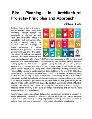
  • 1. Site Planning in Architectural Projects- Principles and Approach *Jit Kumar Gupta Buildings have critical and important role in making human settlements, productive, efficient, liveable and sustainable. No city can be made smart and sustainable, unless it is supported by built environment, which is carbon neutral, energy and resources efficient. Buildings, as largest consumers of energy, resources and generators of waste, are known to use over 40% world’s total energy, 30% global raw materials extracted, 25% timber harvested, 16% fresh water withdrawal, 35% of world’s CO2 emission, generators of 40% municipal solid waste and 50% ozone depleting CFC besides making 30% residents suffering from sick building syndrome. With number of people rushing towards urban centres, energy requirements of cities due to buildings, is going to rise sharply in future. As per McKinsey Global Institute Report (April, 2010), ‘India Urban Awakening: Building Inclusive Cities’, India would be required to create ,on annual basis, buildings to the tune of 700-900 million sqmts (equal to the built-up volume of Chicago City in USA), to meet the emerging needs of urban India for housing and trade and commerce. Considering the large volume of built space to be created, its implications in terms of resources, energy and waste, are going to be colossal. Despite huge implications, very little focus is being given to mitigate the adverse impact on the environment caused by rapid and uncontrolled growth of building industry. Thus building, as a sector, would require close scrutiny and monitoring, for effecting overall economy in the levels of energy consumption and for making cities resource efficient and sustainable. Experience and studies have shown that adopting an integrated and passive approach to design and designing with nature, orientation, climate, wind and using natural elements of Sun, Space and Greenery, can help in proper site planning. Integrated approach to building design is known to essentially revolve round; rationalising site planning;
  • 2. optimising shape and size of the buildings; evolving sustainable built form; optimising surface to volume ratio; promoting building efficiency; designing energy efficient building envelop; rationalising ratio between length and depth of the building; making building structurally light and cost-effective; adopting solar passive techniques; controlling lighting, heating, ventilation; using solar energy, optimising landscaping etc. Making optimum use of existing natural elements/sources and vegetation, offer the best options for creating green buildings. In order to ensure that buildings are made energy and resource efficient, they must be planned and designed to conform to the stipulations laid down by the Indian Green Building Council (IGBC) ,for site planning and designing of buildings. Making buildings sustainable will be largely contingent upon the quality of site selected and approach used for site planning; designing buildings including defining building fabric, positioning footprints in the context of site. In this paper, we will define and explain the approach which can be considered for adoption for site planning of any project to make the buildings/project qualitative, sustainable and rational. Site Planning Site planning is considered both as an art and most crucial component of any project. Site planning is also considered and valued as the most crucial aspect of architecture while evolving design solutions and placing them within a given site. Architectural solutions have their origin and genesis in the site on which they are to be located. All sites remain unique in their fabric, shape, size, structure, area, location, physical features, orientation, surroundings, environment, ecology, and accessibility. Accordingly, design solutions provided by Architects remain different, distinct and unique, considering response of the designer to the uniqueness of the site and its surroundings. Site planning remains a complex and intricate process, involving number of elements and studying number of contexts including; positioning of structures and designing internal and external elements including defining space and positioning of various
  • 3. services and parking. Site planning is considered both an art and science of determining the basic fabric, footprints and typology of buildings besides locating them in the context of a given site, having due regard to prevailing orientation, landscaping, infrastructure, mobility, parking, privacy, view etc. A site plan is a graphical depiction showing the layout and includes the location, design, and specifications for roads, streets and parking areas; storm water management systems, wastewater management systems, utilities, and other infrastructure; structures; landscaping and common areas; and other facilities associated with the project. Site planning essentially involves arranging structures on a given land besides shaping spaces between them. In addition, it also involves making optimum use of available resources on site and reduction of impervious surfaces, decreased generation of pollutants, and treatment of storm water runoff. Kelvin Lynch considered site planning, ‘As a process, linking architecture, engineering, landscaping and city planning’. Creating logical relation between mass, space, zoning, services & maintenance is also known to be the outcome of site planning besides locating activities and objects in space and time. Site planning is considered, both as a compromise between the site, modified to work out building program taking into account existing features of site. Since land remains the basic and essential platform of site planning, accordingly site planning is also reckoned as art and science of planning, designing and management of land. Considering numerous implications and its role and importance in promoting sustainability of architectural projects, site planning has to be done with sensitivity, care and caution to eliminate any possible adverse impact and blend the project with local environment, ecology, climate, culture and bio-diversity. Suggested Principles for Site Planning; Considering major implications of site planning in the context of making architectural projects sustainable, cost-effective, rational, supportive and making value addition to prevailing quality of environment, ecology and local bio-diversity, it will be essential that broad principles governing the process of site planning must be defined and detailed to serve as a guide to all architects while planning the sites of their projects. These principles should revolve around; * Respecting site and respecting all physical features existing on site- to make optimum use of such features in the designing of the built environment and placing various project element in site planning
  • 4. *Planning with nature, using natural elements of sun, space and greenery- should invariably be the approach which should form the guiding principle of site planning. Any site planning leveraging the nature and panchmahabhutas including Prithvi, Jal, Agni, Vayu and Akash, shall always remain relevant, rational and logical; never failing on the altar of sustainability. * Adopting strategy of protecting, preserving enhancing and promoting available physical features shall invariably help in making site planning more rational and realistic *Minimise fingerprints of proposed buildings should be used one of the guiding principle of preparing the site plan for covering minimum area of site and leaving maximum open area within the site, to be used for promoting landscaping, creating green spaces and for giving a sense of more openness in the site, besides overcoming limitations imposed by smaller land area. Having minimum building footprints will help in promoting higher order of ground water recharging, lowering incidence of heat island, lowering temperature on site, reducing demand for energy for heating and cooling and ensuring adequate air, light and ventilation besides making living and working area more user friendly. *Keeping maximum area under open – will go a long way in promoting air, light and ventilation, creating large area for landscape, providing enlarged scope for water absorption, making provision for adequate parking space, reducing congestion, improving environment, creating large open space for sit-outs, providing adequate space for laying basic services, providing protection to adjoining properties from fire and making provision for rainwater harvesting and ensuring ground water re-charging. *Identifying entire range of flora and fauna- on site and preserving them ,by making them integral part of site planning and building design process, will not only help in improving environment but also ensure imparting a distinct ambience, character and culture to the project. Preservation existing/ natural vegetation on site is known to help in creating natural buffer, protecting existing soils from water and wind erosion, removing sediments / other pollutants from storm water runoff and protecting unique or endangered plant species besides making value addition to the project. This principle remains universal and has applicability for all site planning. Retaining existing vegetation offers distinct advantages in term of reducing the intensity of rainwater by absorbing the energy of falling rain; holding soils/soil particles in place and developing soil structure for increasing the soil’s absorptive capacity / soil permeability to absorb storm water runoff through dense root structures . Vegetation also helps in slowing down the velocity of runoff and acts as a filter to trap sediment; reducing noise by creating a buffer zone; makes value addition to the area; reducing heat /minimizing heat island, lowering temperature, providing shade during summer; creating value for the residential and commercial properties. Retaining existing flora and fauna not only remains valuable but
  • 5. also help in promoting economy in the project through reduced maintenance cost when compared with planting new vegetation. In addition, it promotes local environment, preserve ecology and bio-diversity besides contributing to sustainability of the project. Preserving existing wealth of trees and plantation would remain most appropriate and critical in areas, which are prone to high rates of soil erosion and where other soil erosion control measures would be difficult to establish, install, or maintain. Trees can be used with considerable advantage in areas where storm water runoff flow velocities need considerable reduction. However, preserving existing vegetation has to be planned as integral part of the building design and site planning process and should be completed before the commencement of any construction activity on the site.Architects must do a detailed study and analysis of the existing vegetation with regard to the quality, age, growth, value etc and come to a logical conclusion as to vegetation which needs to be preserved and conserved, based on the proposed road network and building/structures finalized . Barricades/signs should be erected to protect vegetation boundaries selected for preservation. Planning for protecting vegetation should also include the maintenance requirements of the existing vegetation, based on soil types and climate. Different species require different maintenance activities in terms of fertilization, irrigation, pruning, and weed/pest control. These activities should be performed regularly during construction in order to safeguard the existing vegetation. *Making adequate provision for rain water harvesting -and ground water recharging will improve and help in not only raising the water table in the area but will also make available large amount of precious water for use and reduce the demand /pressure on ground water. * Opting for brownfield development by using areas, which were earlier used for buildings, to help in minimising adverse impact of green field development and regenerating the existing derelict areas. *Providing setbacks of adequate width, - for ensuring availability of adequate air- light and ventilation within and outside the buildings and for facilitating easy vehicular access of the fire/ ambulance vehicles in case of natural and manmade disasters; for creating large landscaped area within the site, providing space for parking; mitigating outside noise; promoting privacy and allowing expansion of urban road network/laying of city services, will be critical while preparing part of site planning *Minimising damage to the site-- by minimising changes to existing environment, ecology, bio-diversity, flora& fauna, physical terrain/contours of the site and by making value addition to the site through rational site planning will be vital and crucial.
  • 6. *Restoring the derelict area existing within the site by developing them and restoring them to original status, as part of the site planning process, shall be crucial for promoting sustainability of the project. * Site planning for Planning steep sites and sites falling in the hill areas/ contoured sites- should preferably be based on placing and designing buildings along the contours to the extent possible so as to minimise damage to physiography and environment. When placed across contours, care should be taken that building design/fabric must involve minimum cutting/filling and damage to the structure of the site. In case of hilly terrain and undulating sites, efforts should invariably be made to avoid development on steep hill, ridge, and ravine slopes, especially those with side slopes of 15 percent or greater. In addition, efforts should be made to preserve, existing vegetation to minimize erosion potential and generation of sediment. It has been observed that building on flatter areas invariably reduces soil erosion; cut-and-fill volumes and the cost of grading operations. Accordingly planning along contours should be reckoned as the best option of development on hilly sites. However, where due to certain reasons, construction has to be done across contours, then it should be ensured that Cutting and filling shall be minimum. * Minimising changing/tempering with the existing physiography of the site * Preserving and protecting all existing natural areas and elements of natural/ scenic beauty and protecting all good views of built/ manmade /natural heritage to and from the site *Evaluating, analysing and mitigating the adverse impact of development on heritage buildings/ site and adjoining areas, communities, ecology and environment Approach to Site Planning After briefing about the principles to be considered and approach to be adopted for site planning, it will be relevant to define and describe the process which needs to be followed in order to evolve rational options for site planning. Rational site planning needs to be considered and evaluated looking at the broad range of concerns and issues related to building design and their inter- relationship before finalisation. Site planning should essentially be made a synthesis of a number of collated factors and should be based on carrying out
  • 7. detailed study and analysis of existing physical aspects of site; vision/ program of client; designer’s own creative inclination; concerns of community; interests of end user; zoning /bye-laws requirements for regulating the density, height, coverage, geometry of development, road widths , parking and drainage requirements; protection of natural resources ; Neighbourhood Character; Physical Characteristics etc. Accordingly, site planning must incorporate an accurate description of well-defined, well-designed and well-executed site analysis, which remains critical for evolving cost-effective, environmentally sustainable and eco- friendly design options. Considering the total fabric and structure of any architectural project, site planning process includes large number of elements involving; buildings, roads, walkways, trees, gardens, water bodies, landscaping, plazas, environment, services, parking, natural and manmade features etc. Evolving site plan design based on prevailing site conditions and respecting existing natural features can minimize, to a large extent, the project’s adverse environmental impacts. Considering large number of elements and factors involved, following approach is being suggested, for rationalizing and optimizing the process of site planning of any project for achieving its sustainability. i. Looking at Project brief Before undertaking the exercise of site planning of any project, it will be important to understand the genesis, context, intent and content of the project. Reference in this regard needs to be made to the project profile already prepared; so that scope of the project, built spaces requirements, services and infrastructures to be provided, are clearly delineated, understood and appreciated. If no such document is available, then such a document must be created for keeping the project on track , keeping it within defined scope and for avoiding any complications and omissions arising out of time overrun / cost- overrun, at a later date. ii. Locating and Understanding Site • After having understood the project profile and requirements of the project, it will be critical to do a detailed study and analysis of the site, identified for the project for understanding its complexity, uniqueness, strength and locational peculiarities. Understanding site, remains critical, important, vital for preparing rational site planning and state of art designing of buildings. Before starting planning of site and designing of buildings proposed; site needs to be properly documented, visited, studied, analyzed and understood thoroughly and objectively. Preparing site plan and designing buildings have to be the outcome • of the prevailing site conditions and they should effectively respond to those conditions. Premeditated designs have always/invariably failed to produce great and sustainable solutions and do justice to the project, making them in majority of cases irrational/ unsustainable. • For rational site planning, it will be important to carry out in-depth site analysis. Carrying out a realistic and rational site analysis, endeavor shall be to do research to the extent possible and collect all relevant and available data that
  • 8. relates to the site and building design. A poorly executed site analysis can lead to a sub- standard design due to the designer not having all requisite and critical information to respond and develop appropriate designsolutions for the project. Knowing fully any site and its peculiarities and characteristics, always remain a challenge. To help collecting adequate, relevant and vital information for the site, it will be advisable to prepare a check list which should define and include, all the aspects which needs to be looked into, as part of the site analysis. Checklist should be the starting point for analyzing the site and gathering data. The checklist will need to be made exhaustive/updated on continued basis every time any new issue or factors relating to a site is observed. • Looking at the entire context of site analysis, data and information required can be divided into two distinct and separate categories ie Hard data and Soft data. Soft data will involve and comprise of study of different aspects of site concerned with site conditions that are variable and can be changed, whereas Hard data would look at elements which cannot be varied and would essentially revolve around and include; boundaries of site, site areas, location of utilities and services, contours, accessibility, orientation, dimensions, site features, flora and fauna, structures, water features, climate, legal information. Initial site investigations need to focus on issues related to hard data, which will help in identifying and establishing elements which will have critical bearing on the design, both positive and negative. Site for its proper understanding and planning needs to be studied and analyzed in terms of Location; Accessibility; Shape and size; Topography; Vegetation; Infrastructure; Connectivity of site with water, electricity, gas, telephone, sewerage, power poles, sub-stations, and other services; Orientation; Wind Direction; prevailing traffic conditions; Climate; Local culture, Soil conditions; View from site /View to site; Prevailing typology of buildings; Structures existing within site; Existing encumbrances- electric /gas lines, water bodies etc; local Building bye laws; Developmental Controls- Height, FAR, setbacks ,land use and restrictions imposed by Master Plans/ statutory document; any rights of way passing through the site along with dimensions; existing easements ; location of heritage /listed buildings within/ in close proximity to site Understanding site has been valued and observed to greatly help in understanding and appreciating the contexts of ; defining and designing structure and contours of the project; positioning buildings; determining solid and void relationship within site; determining shape, size & and volume of buildings; determining distances and relationship between buildings; planning and designing state of art buildings; planning and designing sustainable
  • 9. buildings; making buildings cost–effective/energy /waste efficient ; planning spaces rationally and objectively- both internal and external; placing buildings and determining building setbacks; preparing landscape design; evolving Traffic and Transportation/mobility Plans ; preparing Infrastructure plans; evolving service plan ; preparing drainage plan and providing Rain water harvesting. Understanding and carrying out an extensive site analysis, before initiating the design process, also remains critical and vital from the point of view of client, who would be keen to know whether construction on the site would be financially and technically feasible, based on established /set parameters and for evolving and implementing design options which will appropriately respond to the existing physical and environmental features of the site. Understanding the context, complexity, peculiarity and specificity of a site, remains key for the designer to make informed decisions about the project and evolving realistic options that can effectively gel the building design with existing fabric and culture of the site, based on available opportunities and prevailing problems . A detailed and accurate survey of the site indicating the shape, size, dimensions, orientation, easements, levels / contours of site, difference in levels between site / surrounding properties, location/ height of existing physical features on site/ surrounding properties, existing flora & fauna, use/height of surrounding buildings, details of means of accessibility, location and availability of municipal services including roads, water supply, sewerage, electricity, drainage location of institutions of healthcare, education and shopping areas etc, relevant to project profile, will be critical and valuable for good site planning. Survey of site should be supplemented with getting information of the soil available at site for assessing soil bearing capacity along with ascertaining the water table for taking a call on the design of buildings. This will be critical for projects involving creation of multi-level basements for meeting the parking needs and buildings with large footprints which fall in the category of high-rise buildings. • Physical survey and soil testing should be supplemented by visit of the architect to have a realistic feel of site and its settings and surrounding besides understanding the context of the site with its neighborhood communities and the city. Site needs to be looked out both from inside and outside and from top and bottom to understand its uniqueness/ complexity and fabric.. Critical and objective evaluation and appreciation of the different facets of the site will help
  • 10. in planning of the site in a realistic manner based on the prevailing ground realities. Carrying out a detailed SWOT analysis will further help the designer to understand the strength of the site, enumerate its weaknesses, identify opportunities offered by the site and possible threats posed by the site , which need to be encountered. Locating and understanding site, will always remain most vital component of site planning process. Thorough and objective site analysis remains most valuable and potent mechanism/ critical for evolving cost-effective, environmentally sustainable and rational design solution for any project. Site analysis has been valued for understanding of the site in terms of its existing potential, understanding environmental impact of development, Impact on community, Impact on adjoining development/properties, defining project design, defining scope of project and understanding development constraints. Before physically visiting, efforts should be made to source maximum information about the site from client and by using technology involving computers, looking at the available maps of the area including GIS maps/ google maps/ Survey of India maps/Aerial photographs etc for locating the physical position, understanding the surroundings, flora& fauna existing within the site, defining boundaries of the site and identifying specific things that require check/ look out at site. While visiting the site, it will be important that site is properly documented and recorded and nothing is missed out, which merits consideration and valuation while preparing the site plan and project design. Accordingly, before visiting site, one should carry camera/ Smart phone. for taking pictures of site , existing physical features, accessibility, area surrounding the site, existing services, water bodies, flora &fauna, existing structures within/outside the site etc Note book for recording and writing down; tape for measuring etc needs to be invariably carried while visiting the site. iii Evaluating Building Controls & Building Regulations Detailed study and understanding of the provisions made in the prevailing building bye-laws, zoning regulations, architectural controls, zonal plans, zoning plans, development plans etc shall be vital for evolving site plans which will stand the testimony and scrutiny of legal framework for statutory approvals. Accordingly, it will be desirable to know the applicable building controls to the project site in terms of; permissible
  • 11. ground coverage, maximum permissible height, prescribed floor area ratio, minimum stipulated setbacks, area zoned as building envelop, area permissible under basement, norms prescribed for parking/population density/dwelling units, extent of projections permitted , positioning of entry and exits, number of storeys permitted, requirements of public health services, mobility within/outside buildings, structural stability requirement of the buildings, requirements of fire exit/disaster for the buildings, distance to be left between buildings etc, so that site plan remains within the confines of these statutory limits. These controls need to be followed and clearly defined in the site plan so that building designs are also prepared within the same framework. Limitations on height/ setbacks/coverage imposed by the location of the project close to airport, location on highways, heritage areas, wetland, protected monuments, defence installations and coastal areas, also need to be clearly deciphered, defined and followed as part of site planning process. IV Studying Climates Climate will be one of the major determinants of the shape, size and location of the buildings in the site. Climate shall invariably be studied in the three distinct contexts in terms of; Micro, Meso and Micro climates. In the Macro context, site will be studied at the zonal level for ascertaining precisely in which climate zone it falls. Based on climatic considerations, India has been divided into five distinct climate zones including; Hot and Dry; Warm and Humid; Temperate; Composite and Cold climate Zones. Depending upon the relevant zone, site plan will need orientation to mitigate the adverse impact and challenges posed by the prevailing climate of the zone. At the second level, city climate shall be considered so that design solutions could be made more realistic, based on general climatic conditions prevailing at the settlement level. At the lowest level, site climate will need detailed study and analysis ,which will be major determinant of contours of site planning and building design .It will include evaluating all the distinct feature existing on the site and in its surroundings for evolving site specific planning. Based on climatic consideration site planning shall address all issues related to heat radiation and humidity, based on orientation, movement of sun and prevailing wind direction. V Understanding Orientation
  • 12. Orientation is the position/positioning of site with relation to points of compass and other specific directions. Orientation is the most critical factor which needs to be effectively leveraged in site planning/building designs, inorder to evolve rational site plan and energy efficient/sustainable/green building designs, by making optimum use of solar light/heat/radiation and the available wind energy. However, requirements of building design would vary from region to region, state to state, cities to cities and within regions, states and cities. Accordingly, buildings, with regard to sun , wind, heating, ventilation, cooling and lighting, will have to be designed and oriented differently in different regions. In order to ensure that buildings make best use of solar and wind energy, it would be essential that majority of buildings would have the site advantage of having best orientation, where such buildings are to be constructed. Accordingly, in this context, urban planners have important role cast for themselves for ensuring, that while preparing the layout plan of the area, highest consideration is given to orientation, so that maximum number of plots have the distinct advantage of best orientation. Once this is ensured at the planning level, it would be much easier for the Architects to evolve a design which would be energy efficient. Further, the planners should ensure that ratio of plot width and depth is fixed in such a manner that the entire depth of built-up area permitted on a plot should have access to natural light and ventilation during the day, minimizing the requirement of artificial lighting. This would be particularly important in case of row housing, where plots have the limitation of drawing light from front and the rear only. Understanding site orientation would essentially involve; looking at the position of North, South, East and West with respect to project site. Context of each cardinal direction needs to be understood and appreciated with respect to these directions, both individually and collectively. These cardinal directions have both positivities and negativities besides strength and weaknesses, considering the climate zone in which they are located. South- East remains best orientation in composite climate whereas North orientation is considered best for sourcing glare- free and uniform natural light, without any heat gain. North direction provides good opportunities for having large area under glazing and remain most suitable for industrial buildings, because sun never rises and sets in the North.
  • 13. If North remains the coolest side, South remains hottest in terms of highest radiation. Sun also remains at highest altitude both in summer and winter in the Southern side. However, elevation of sun remains much higher during the Summer as compared to winter. Sun revolves around North during summer, as it rises in the North- East and sets in the North- West. During winters, Sun revolves around South, rising in the South- East and setting in the South- West. Considering the movement of Sun, with sun not available in the North, in Cold regions locating buildings on the North direction/slopes needs to be invariably avoided due to obvious reason of non-availability of sun. Buildings in hill areas should preferably be located on the Southern slope, followed by East and west sides in order to maximize the heat gain provided by the Sun. West direction has its inherent limitations and implications and is known to be worst orientation in all hot climate regions due to maximum heat and horizontal radiations falling in that direction and accordingly exposure of the buildings in this direction needs to be minimized and avoided to the extent possible. However, it will not be possible to avoid western direction in the large projects having setbacks on all sides or sites having exposure to western direction. Accordingly, while preparing site planning, minimum building surfaces should be given exposure in the west side to avoid heat gain. In order to avoid the adverse impact of the heat on west side, mechanism of providing properly designed shading devices could be used as an option. Planting rows of deciduous trees for shading the western walls or greening western walls through well-planted creepers, will be other options available for reducing impact of heat on such walls. Painting western walls white or adopting cavity walls for west can considerably reduce the adverse impact of heat on western side. Accordingly, it will be desirable that detailed study and analysis of the site orientation must be made along with studying and mapping the behavior and movement of Sun, during different seasons of the year while preparing the site plan and designing buildings. Good and bad sides of the site need to be clearly identified and demarcated while preparing site plan/building plans. All areas involving human habitation should be placed along good orientation, whereas all areas providing worst orientation, should be made to house non-habitable areas of the project in site plans. Considering the entire context, orientation plays important role in site planning and siting buildings. When combined with wind direction and sun path, orientation help in providing optimum solution regarding how buildings should be oriented and sited. Orientation along with sun path will always remains major determinant of
  • 14. site planning, positioning of the buildings and that of placement of rooms inside buildings vi. Ascertaining Wind Direction Prevailing wind direction will be another major determinant for evolving rational site plan. Wind direction remains location and season specific and accordingly varies during the year. However, it will be appropriate to consider and identify the direction, in which for majority of the time wind flows. For designing / evolving climate responsive site planning/building design, it will be important to consider and map indicating the direction of wind in which it flows for majority of the time in the year and to channelized it through interiors of the buildings to minimise the adverse impact of radiation and humidity on the human living. This will be particularly important in the case of sites falling in the warm and humid climatic zones, where cross- ventilation emerges as the most important feature of the building design to counter the adverse impact of high percentage of moistures present in the air. However, in case of cold regions and hot climate regions, cross ventilation has to be invariably avoided during the flow of the cold winds in cold regions and that of hot winds in the hot and dry regions, during the daytime. f vii Defining Setbacks and Building Envelop Set-backs remain the most important component of site planning and positioning of buildings. Adequate set backs are always considered vital for promoting sustainability and liveability of the project. Set- backs in the shape of minimum distance to be provided, are generally defined as part of the building rules and zoning plans, where no construction is permitted. There is no limit prescribed for the maximum width of the setback to be left within the site. While designing and placing buildings in site, there remains considerable flexibility for defining the set- backs, particularly in the projects having large area. Accordingly, it will be desirable that due care and caution should be exercised while deciding the depth of set- backs. Minimum set- backs can be considered for sides having worst orientation whereas maximum setbacks should be provided on sides having best orientation.
  • 15. Maximum set-backs provided in the front side of the site will always make value addition to site planning for reasons of safety, security, sealing buildings from noise, privacy, developing green spaces, avoiding demolition during widening/laying infrastructure etc. Fire safety, height of building, air-light and ventilation in buildings are the other determinants of the extent of set-backs to be provided in the site. Identifying open spaces to be left within buildings, positioning of existing flora- fauna and area to be used for landscaping, can also be factors considered useful , while site planning for determining depth of set-backs. While dealing with irregular sites, it will always be appropriate to respect the roads facing the site. All buildings must be placed, planned and designed, parallel to the streets on which they fall and site plans should invariably be evolved on that principle. All irregularities in the site, need to be adjusted as part of building design process. Irregular set-backs should be invariably avoided in site planning. viii Defining Exit and Entry to the Site Entries and exits ,and their numbers, defined in the project are also known to impact the site planning due to provision of accessibility to be made for the mechanised/non-mechanised vehicles, pedestrians, public, private, VIP;, loading/unloading of goods, parking etc. in the site. Accordingly, they need to be carefully considered for location. In case of big sites/campus having multiple exits, entries and parking, preparing rational site plan requires lot of study and analysis. ix Existing Flora and Fauna Site planning needs to invariably value the prevailing physical conditions on the site and also give credibility to the trees and vegetable wealth existing on site. Accordingly, all the trees and physical encumbrances existing on the site, along with their size, shape, foliage, age , canopy , cover etc., must be duly identified, mapped and marked accurately on the site plans in order to prepare rational site plans. It also needs to be
  • 16. ascertained whether trees existing on site are protected under any legal framework. Decisions needs to be taken right at the outset regarding existing trees, whether they are to be adjusted as integral part of the building design or integrated with landscaped area or made part of the space marked for parking/ services. Such a strategy will help in not only saving all trees existing on the site but will also help in designing and positioning of the buildings, placing of open spaces and services in the site planning. x Making provision for Rain Water Harvesting and Solar Energy Generation Rain water harvesting must be made integral part of site planning by earmarking dedicated space in the plan for not only harvesting the rain water but also for meeting the demand of non-potable water for the landscaping and other needs of the buildings. In addition, adequate provision should also be made in the site plan for recharging the ground water so as to add to the ground water resource of the area. Site planning potential can be leveraged for promoting the sustainability of the project if dedicated area is marked for generating energy from renewable and natural resources. These provisions shall be made based on prescribed norms and standards. Adequate provision shall also be made in the site plan for minimising the adverse impact of heat island by innovatively designed pathways, walkways etc. Low- lying area available in the site should be considered for creating water bodies as part of site planning to collect rain water and also for modulate prevailing climate besides promoting greening on a large scale.
  • 17. xi. Valuing surrounding land uses and buildings For optimum site planning and creating sustainable design solution for proposed project/buildings, it will be relevant and desirable that prevailing pattern of planning and that of surrounding land uses and buildings should be brought under close focus and consideration. While taking decisions regarding planning and designing of the project, incompatible land uses existing in close vicinity to project site need to be avoided to the extent possible considering its implications, adverse impact it may have on the project and issues they may create in planning and designing. Adjoining structures/development needs evaluation in terms of their height, setbacks, building footprints, materials, typologies etc, which will be important in the context of privacy, ensuring free flow of air, light, ventilation and sunlight, within and outside buildings, Prominent Vision lines / Visual linkages, to natural and made objects are invariably considered relevant and Important elements in site planning and building design process. Views to site as well views from the site need careful consideration, evaluation and inclusion while preparing site plans and design of buildings. Conclusion Considering the broad parameters explained above and factors defined by Indian Green Building Council ( IGBC ), for evaluating and rating of green buildings, preparing rational site plans for any project should essentially be based on the factors involving; adopting Integrated approach to design; preserving sites ; adopting passive approach to Architecture solutions; providing basic amenities; promoting proximity to local transport; respecting natural topography; promoting tree preservation , promoting rain water harvesting, adding to the environment, ecology etc. Adopting the defined principles, approach and process, would be valuable and helpful for putting in place rational site planning for the project and evolving sustainable building designs. Site planning approach for both small,
  • 18. medium and large projects shall be at variance, depending upon nature of project, location, client perception, climate etc of the project but basic principles governing site planning and building design will always remain same. As per, ‘First in Architecture – Architecture Site Analysis Guide”-- site planning and building design should have genesis in and should invariably revolve around having careful site analysis in terms of ;  Location – where the site is situated;  Neighborhood context – the immediate surrounding of the site including data on zoning /buildings/ other impacts on our project.  Zoning and size – dimensional considerations such as boundaries, easements, height restrictions, site area, access along with any future plans.  Legal information – ownership, restrictions or covenants, future urban development plans.  Natural physical features – actual features of the site- including- trees, rocks, topography, rivers, ponds, drainage patterns.  Manmade features – existing buildings, walls, surrounding vernacular, setbacks, materials, landscaping etc  Circulation – Vehicle / pedestrian movements in/through/around the site, timing of these movements ; duration of peak/heavier patterns; proposed future traffic/ road developments  Utilities – electricity, gas, water, sewer and telephone services situated in/ near the site, along with distances, depths and materials.  Climate – Climatic information including rainfall, snowfall, wind directions, temperatures, sun path, considered during the year.  Sensory – visual, audible and tactile aspects of the site, including views, noise, considered in time frames  Human and cultural – cultural, psychological, behavioral and sociological aspects of the surrounding neighborhood. In terms of activities and patterns, density, population ethnic patterns, employment, income, values etc
  • 19.  Before going for site planning / building design- ensure site is properly/accurately surveyed, documented -- mapping everything within/ outside the site which would be relevant for its planning/ designing.  Site survey should include details of ; determining accurately dimensions of outer boundaries, area of site, angles of all sides ,contours/levels at regular intervals- gradient, landform, elevation, drainage pattern etc ; existing trees/flora fauna- in terms of type, size, location, shape, pattern, aesthetics, ecology; existing water bodies ;electric lines; existing services- both underground /over-ground/within /outside; approach roads- inside/outside along with their dimensions; existing structures – within/outside of area of site; views of the site- within /outside ; existing water table/ flood-ability of site, low lying areas etc;  Testing Soil, for determining the soil load bearing capacity  Locating North in relation to site along with other cardinal directions for quantifying the context of site planning, site orientation and building design.  Identifying Wind direction /pattern of wind flow;  Defining Setbacks to be left within building as per bye-laws; Defining- ‘No building Zone’- to be left within site, as per Master Plan/National /State Highways, applicable legal framework etc; Defining Mandatory,’ No building zone’-- to be left , when located near defense installations/ protected monuments/ zoo/ botanical gardens/ electric installations; Defining-‘No Building Zone’ --to be left when site located near water bodies/rivers etc ; Defining right of way for High Tension Electric Lines when passing through site  Obtaining Zoning Plan of the site , when site allotted by any Development Authority/Urban Local Body/Improvement Trust/ Industrial Corporation etc, will be useful and should guide the site planning and building design process..  Site planning and building design should be carried out simultaneously for rational planning and designing with site planning dictating the location of various project components and footprints/contours of the buildings to be housed within the site..  Planning residential complexes should invariably focus on segregating the vehicular and pedestrian traffic while keeping vehicles on periphery and making core as the pedestrian paradise.  Site planning needs to be based on making assessment of parking requirement and deciding where parking is to be provided- surface/stilts/ground- for making adequate provision of space for parking, within and outside buildings.  Site planning- for large sites calls for carrying out detailed land suitability analysis of the area in terms of; area to be preserved, area to be conserved
  • 20. and area fit for development. Derelict areas remain vital for development and accordingly needs to be addressed in site planning. Site planning of large sites, must be carried out initially by drawing a master plan; in terms of area zoned for different uses along with broad road network.  Requirement of adequate and appropriate lighting/ ventilation are the critical factors to dictate positioning of buildings. North direction remaining best for glare free/uniform/cool light  In irregular project sites- plan for regular buildings running parallel to abutting roads , leaving residual irregular spaces to be used for landscaping/ defining setbacks.  In site -planning and building designing-- respecting site, respecting nature, respecting existing topography and valuing existing water bodies must remain the most important consideration.  Site planning must be based on considerations guided by climatic conditions prevailing at Regional/ Settlement/Site levels  Valuing prevailing wind direction for rational site planning and positioning of buildings in site ,while looking for desirable winds/undesirable winds would be critical.  Looking at the views from/to the site to make optimum /best use of views focusing on nature, avoiding views of slums /industry /pollution etc should invariably be considered while preparing site plan and positioning/designing buildings.  Different elements of site which impact the final design of a building include; Topography, Vegetation, flora & fauna, Infrastructure, Existing buildings, climate, Culture, orientation, wind direction, Site plan showcases existing and proposed conditions of site with the proposed building design and would essentially show, North and Scale, boundaries of Property, set backs and distance between buildings, Existing & Proposed buildings, Area under Parking, existing Easements, Covered area, Floor Area ratio, Accessibility, Driveway, services References  Gupta J K; Site Planning for Architectural Projects ppt  Wikipedia; Site Planning; en.wikipedia.org/wiki/site_ plan  Archisoup; Architecture Site Analysis- An Introduction; https://www.archisoup.com/architecture-site-analysis-introduction  First in Architecture; Architecture Site Analysis Guide; https://www.firstinarchitecture.co.uk/architecture-site-analysis-guide-2 :  Storm Water Manual 2007- Chapter 4-Planning Principles and Design Considerations .
  • 21.  Note; All images shown in the text are sourced and have genesis in the Google.com , which are gratefully and thankfully acknowledged by the author. Author;--- Ar Jit Kumar Gupta #344/40-a, Chandigarh-160036 Former, Director, College of Architecture IET Bhaddal (Pb) ---- mail-jit.kumar1944@gmail.com