Sibeli us mongolian-data-cube
•Download as PPTX, PDF•
0 likes•388 views

SIBELI Mongolian Data Cube

Recommended
Recommended
More Related Content
Similar to Sibeli us mongolian-data-cube
Similar to Sibeli us mongolian-data-cube (20)
More from GeoMedeelel
More from GeoMedeelel (20)
Recently uploaded
Recently uploaded (20)
Sibeli us mongolian-data-cube
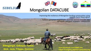
- 1. sibelius.blog www.facebook.com/SIBELIUs Mongolian DATACUBE Improving the resilience of Mongolian herding communities using satellite Earth Observation Хиймэл дагуулын мэдээллийг ашиглан монгол малчин, ард иргэдийн амьдрах чадварыг сайжруулах Elbegjargal, Odbayar, Turbat Nick, Jack, Filippo, Dominic www.facebook.com/SIBELIUs https://mongolia.sibelius-datacube.org/
- 2. sibelius.blog www.facebook.com/SIBELIUs SIBELIUs overview The SIBELIUs project began in 2018 and is supported by the UK Space Agency The aim of the SIBELIUs project is to work in partnership with Mongolian institutions to help build greater resilience for herding communities using satellite earth observation https://www.spacefordevelopment.org/
- 3. sibelius.blog www.facebook.com/SIBELIUs 2.4m X-/L-band tracking antenna EOS Terra & Aqua ingest, NOAA & MetOp ingest & processing, 2x MODIS processing and Suomi-NPP ingest & processing systems Upgrades: • In 2018/19: • New L-band receiver • JPSS-1 ingest & processing software • Upgraded level 1B & 2 software • Migration to 64-bit OS • In 2019/20: • New X-band ingest system • New X-band processing system • New L-band ingest & processing system • In 2019/20 or 2020/21: • New antenna control cabinet • Migration to Ethernet control • New servo motors & gearboxes • New servo & RF cables NAMEM main building in Ulaanbaatar (antenna in (heated) radome top-centre) Ulaanbaatar from Zaisan Monument (in 2007) working in Mongolia since 2007 Over ¼ of the 50 years of Remote Sensing in Mongolia
- 4. sibelius.blog www.facebook.com/SIBELIUs SIBELIUs: Routes to Impact 1. Insurance 3. Direct 2 Government Coordination Herding Communities NAME M UK World Food Programme (WFP) NEMA Defined three Impact Metrics relating to SDG 1.5: “Build the resilience of the Mongolian herders, and reduce their exposure and vulnerability to climate-related extreme events and other economic, social and environmental shocks and disaster”.
- 5. sibelius.blog www.facebook.com/SIBELIUs Thank you Working with UK team and IRIMHE team
- 8. sibelius.blog www.facebook.com/SIBELIUs The Mongolian Data Cube The Mongolian Data Cube is at the heart of the SIBELIUs processing system The Mongolian Data Cube is an efficient way of storing large volumes of data so that it can be accessed easily by users Open Data Cubes were originally pioneered by Digital Earth Australia in 2013, with the Australian Data Cube. Recent years have seen several Data Cubes deployed in many countries worldwide
- 9. sibelius.blog www.facebook.com/SIBELIUs Satellite data Landsat 8, 5 years Sentinel 2, 6 years Terra, Aqua/ MODIS 13 years Soumi-NPP VIIRS (10 years)
- 10. sibelius.blog www.facebook.com/SIBELIUs The Mongolian Data Cube – Imagery & Products • The Mongolian Data Cube contains surface reflectance imagery from Sentinel-2, Landsat 8, MODIS & VIIRS • Month long and 10 day indices (NDVI, NDSI, NDWI & NDDI) are also produced within the Data Cube • Using these indices, final products are being generated: • Pasture biomass • Pasture anomaly • Pasture trend • Snow coverage/persistence • Plus NAMEM are now creating their own products Example NDDI Product (data from Sentinel-2 & Landsat 8)
- 11. sibelius.blog www.facebook.com/SIBELIUs Operational services Datacube has its operational activities like acquisition of satellite data from MODIS-TERRA/AQUA, NPP, NOAA, Metop, processing satellite data to products, data sharing to the users, etc. - Wildfire: Steppe fire and Forest /MODIS/ - Snow cover /MODIS/ - Vegetation /MODIS/ - Biomass - Dust /MODIS/ - Aerosol /MODIS/ - Land surface temperature /MODIS/ - Drought /MODIS/ - Cloud /FY2D/ - Cloud and Wildfire /Suomi-NPP/
- 13. sibelius.blog www.facebook.com/SIBELIUs 10 day composite image Datacube Numpy as np dcUtilsDataset Xarray as xr Geopandas as gpd Matplotib.pyplot as plt rasterstats
- 24. sibelius.blog www.facebook.com/SIBELIUs Access to Mongolian DataCube • Вэб Зураглалын Үйлчилгээ (Web Mapping Service-WMS) • Вэб Хамрах Үйлчилгээ (Web Coverage Service-WCS) • ArcGIS • QGIS
- 27. sibelius.blog www.facebook.com/SIBELIUs Pasture Anomaly Product (data from Sentinel-2 & Landsat 8) Snow Product (data from Sentinel-2 & Landsat 8) The Mongolian Data Cube – Imagery & Products (tailored for herders) Currently being distributed via Facebook in the SIBELIUs test sites
- 28. sibelius.blog www.facebook.com/SIBELIUs Regional “Greenness” Charts Clear up-to-date information about local pasture conditions
- 29. sibelius.blog www.facebook.com/SIBELIUs The Mongolian Data Cube – Visualisation (Government Stakeholders) • Products from the Data Cube use the in-built web services (datacube-ows) for dissemination • Currently building a web app using Leaflet & node.js to allow users in Mongolian institutions to view and manipulate Data Cube products • Investigations are underway to ensure that these systems are not too data heavy Current test visualization from datacube built with OpenLayers (data from Sentinel-2 & Landsat 8)
- 30. sibelius.blog www.facebook.com/SIBELIUs Applications of Earth Observation for Mongolia • We will mostly be talking about monitoring: Pasture Snow Drought • But, important to note there are many other Mongolian applications: A simple Earth Observation example Monitoring agriculture Monitoring mining Monitoring city development Air pollution
- 31. sibelius.blog www.facebook.com/SIBELIUs This photograph was taken from Batbuyan Batjav’s drone in the Kherlenbayan Ulaan bag in the Delgerkhaan soum in the Khentii aimag and shows a small settlement consisting of two gers and associated shelters Drone photograph Date taken: 17/10/2018 Lat: 44.3430 Lon: 56.5039 Altitude: 1,214 metres Question: can we see these structures using satellite data? A very Mongolian Earth Observation question
- 32. sibelius.blog www.facebook.com/SIBELIUs Question: Can we see these structures using satellite data? Answer: Yes we can. 17/10/2018, Lat: 45.6528, Lon: 48.5884, Altitude: 1,410.85m Acquired: 17/10/2018, 03:47:29 UTC Batbuyan Batjav’s drone photograph 1,214 metres Sentinel-2 satellite RGB composite image 786 km • The 2 white dots are the gers • The darker regions are the shelters and their surrounding areas • The drone position is indicated by the yellow pin
- 33. sibelius.blog www.facebook.com/SIBELIUs Sentinel-2 RGB Drone photograph Gers Shelters Zooming in we can see there is a correspondence between the gers and shelters in the drone and satellite image
Editor's Notes
- SIBELIU-ийн төслийн зорилго нь хиймэл дагуулын мэдээллийг ашиглан малчны нийгэмлэгт орон зайн мэдээгээр хангах, туслах зорилгоор Монголын байгууллагуудтай хамтран ажиллах явдал юм.
- Монгол Дата Куб/Өгөгдлийн Шоо нь их хэмжээний өгөгдлийг хадгалах үр дүнтэй арга бөгөөд ингэснээр хэрэглэгчид хялбархан нэвтрэх боломжтой. Нээлттэй өгөгдлийн шоог анх 2013 онд Тоон Дэлхий Австрали болон Австралийн Дата Куб-н хамт анх үүсгэн байгуулж байжээ.
- Contains level 2 surface reflectance imagery from Sentinel-2 and Landsat 8 satellites to comprise the “high-res” system MODIS & VIIRS data in the “medium-res” system. Ultimately these product will be contain within the same Data Cube infrastructure. Explain why having both datasets initially. Creating aggregated 10 day indices – vegetation, snow, water, drought initially, probably include more Mongolia specific indices in future. From these images, final products for stakeholders can be produced.
- Products need to be tailored for end users, these ones for the herders. Don’t mention left or right.
- Considerations being made for how the products from the Data Cube will be served out to project partners. This will be tailored to partners needs, but utilize datacube-ows (Open Web Services) for dissemination of products. Can be accessed from there, or pushed into a dashboard/webapp which is currently being constructed using OpenLayers. Investigations into seeing if partners have sufficient bandwidth to access products. For UB people (government, stakeholders)