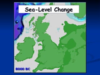
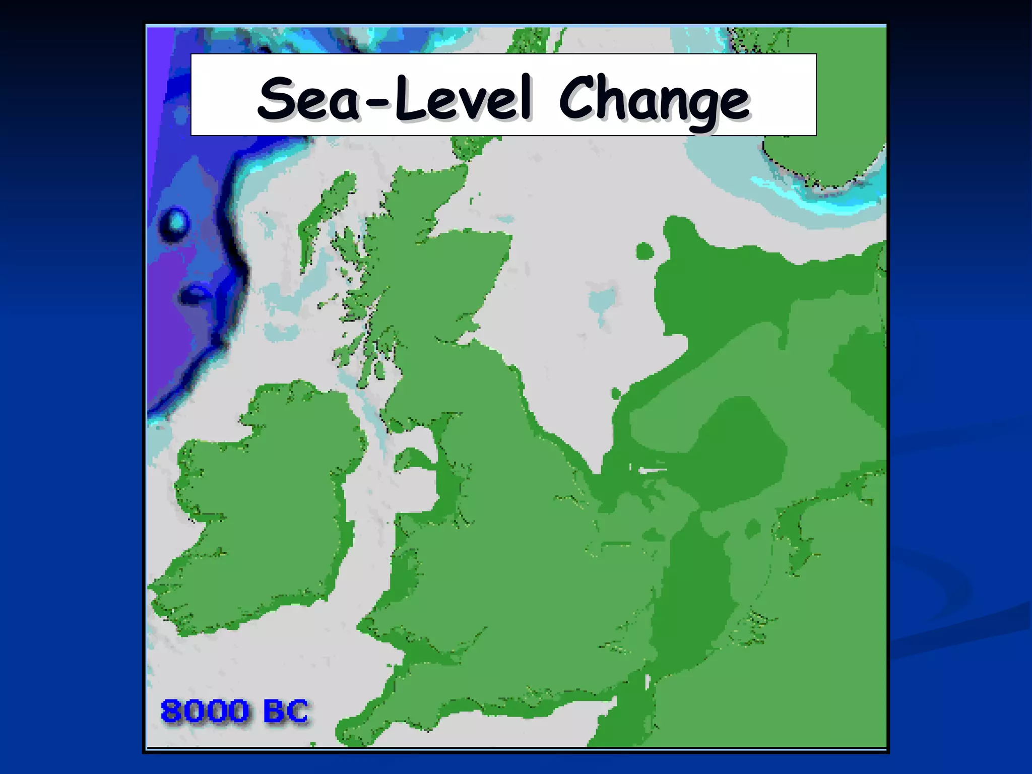
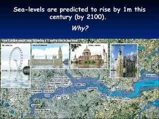
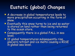
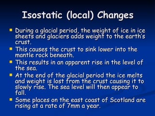
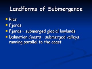
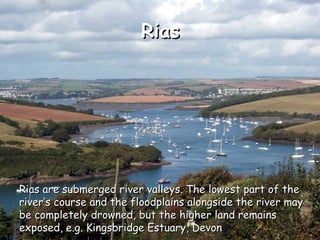
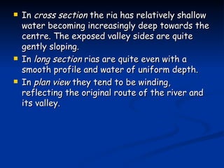
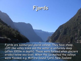
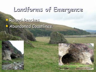
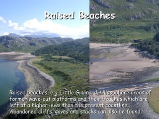
Sea-Level Change
Sea-levels are predicted to rise by 1m this century (by 2100).  Why?
Sea-Level Change Key Terms Eustatic  – global-scale sea level change caused by a change in the volume of water in the ocean store Isostatic  – local-scale sea level change caused by a change in the level of the land relative to the level of the sea. Emergence  – the impact of a relative FALL in sea level  (Marine Regression) Submergence  – the impact of a RISE in relative sea level  (Marine Transgression)
Eustatic (global) Changes A decrease in global temperatures leads to more precipitation occurring in the form of snow.  Eventually this snow turns to ice and so water is stored on land rather than being returned to the ocean store.  Consequently there is a global FALL in sea level. If global temperatures subsequently rise, glaciers retreat and ice melts causing a RISE in global sea level.
Isostatic (local) Changes During a glacial period, the weight of ice in ice sheets and glaciers adds weight to the earth’s crust. This causes the crust to sink lower into the mantle rock beneath. This results in an apparent rise in the level of the sea. At the end of the glacial period the ice melts and weight is lost from the crust causing it to slowly rise. The sea level will then appear to fall. Some places on the east coast of Scotland are rising at a rate of 7mm a year.
Landforms of Submergence Rias Fjords Fjards – submerged glacial lowlands Dalmatian Coasts – submerged valleys running parallel to the coast
Rias Rias are submerged river valleys. The lowest part of the river’s course and the floodplains alongside the river may be completely drowned, but the higher land remains exposed, e.g. Kingsbridge Estuary, Devon
In  cross section  the ria has relatively shallow water becoming increasingly deep towards the centre. The exposed valley sides are quite gently sloping. In  long section  rias are quite even with a smooth profile and water of uniform depth. In  plan view  they tend to be winding, reflecting the original route of the river and its valley.
Fjords Fjords are submerged glacial valleys. They have steep, cliff-like valley sides and the water is uniformly deep (often 1000m in depth). These were formed when glaciers eroded below sea-level. When the ice melted the valleys were flooded, e.g. Milford Sound fjord, New Zealand
The u-shaped cross-section reflects the original shape of the glacial valley. Unlike rias, fjords are not deepest at their mouths, but have a shallow section at the seaward end known as the threshold. Fjords have much straighter routes, due to the erosive power of the glacier.
Landforms of Emergence Raised Beaches Abandoned Coastlines
Raised Beaches Raised beaches, e.g. Little Gruinard, Ullapool are areas of former wave-cut platforms and their beaches which are left at a higher level than the present coastline. Abandoned cliffs, caves and stacks can also be found.
PLAY YOUR CARDS RIGHT Dalmatian Coast Abandoned Cliff Fjard Ria 2 3 5 7 8 9 1 6 4

Sea Level Change AS

  • 1.
  • 2.
    Sea-levels are predictedto rise by 1m this century (by 2100). Why?
  • 3.
    Sea-Level Change KeyTerms Eustatic – global-scale sea level change caused by a change in the volume of water in the ocean store Isostatic – local-scale sea level change caused by a change in the level of the land relative to the level of the sea. Emergence – the impact of a relative FALL in sea level (Marine Regression) Submergence – the impact of a RISE in relative sea level (Marine Transgression)
  • 4.
    Eustatic (global) ChangesA decrease in global temperatures leads to more precipitation occurring in the form of snow. Eventually this snow turns to ice and so water is stored on land rather than being returned to the ocean store. Consequently there is a global FALL in sea level. If global temperatures subsequently rise, glaciers retreat and ice melts causing a RISE in global sea level.
  • 5.
    Isostatic (local) ChangesDuring a glacial period, the weight of ice in ice sheets and glaciers adds weight to the earth’s crust. This causes the crust to sink lower into the mantle rock beneath. This results in an apparent rise in the level of the sea. At the end of the glacial period the ice melts and weight is lost from the crust causing it to slowly rise. The sea level will then appear to fall. Some places on the east coast of Scotland are rising at a rate of 7mm a year.
  • 6.
    Landforms of SubmergenceRias Fjords Fjards – submerged glacial lowlands Dalmatian Coasts – submerged valleys running parallel to the coast
  • 7.
    Rias Rias aresubmerged river valleys. The lowest part of the river’s course and the floodplains alongside the river may be completely drowned, but the higher land remains exposed, e.g. Kingsbridge Estuary, Devon
  • 8.
    In crosssection the ria has relatively shallow water becoming increasingly deep towards the centre. The exposed valley sides are quite gently sloping. In long section rias are quite even with a smooth profile and water of uniform depth. In plan view they tend to be winding, reflecting the original route of the river and its valley.
  • 9.
    Fjords Fjords aresubmerged glacial valleys. They have steep, cliff-like valley sides and the water is uniformly deep (often 1000m in depth). These were formed when glaciers eroded below sea-level. When the ice melted the valleys were flooded, e.g. Milford Sound fjord, New Zealand
  • 10.
    The u-shaped cross-sectionreflects the original shape of the glacial valley. Unlike rias, fjords are not deepest at their mouths, but have a shallow section at the seaward end known as the threshold. Fjords have much straighter routes, due to the erosive power of the glacier.
  • 11.
    Landforms of EmergenceRaised Beaches Abandoned Coastlines
  • 12.
    Raised Beaches Raisedbeaches, e.g. Little Gruinard, Ullapool are areas of former wave-cut platforms and their beaches which are left at a higher level than the present coastline. Abandoned cliffs, caves and stacks can also be found.
  • 13.
    PLAY YOUR CARDSRIGHT Dalmatian Coast Abandoned Cliff Fjard Ria 2 3 5 7 8 9 1 6 4

Editor's Notes

  • #2 http://www.discoverysoftware.co.uk/GallerySeaLevel.htm