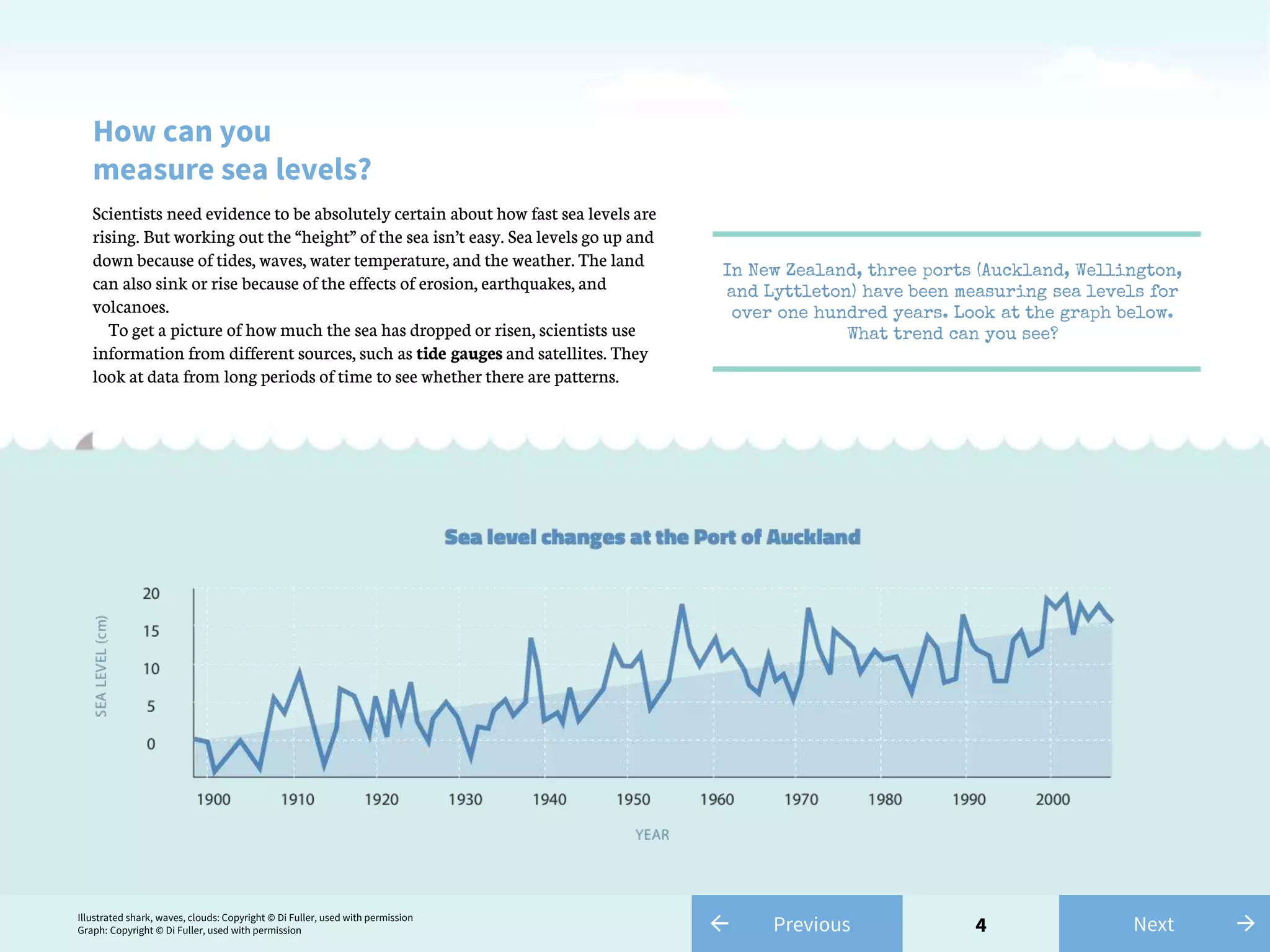
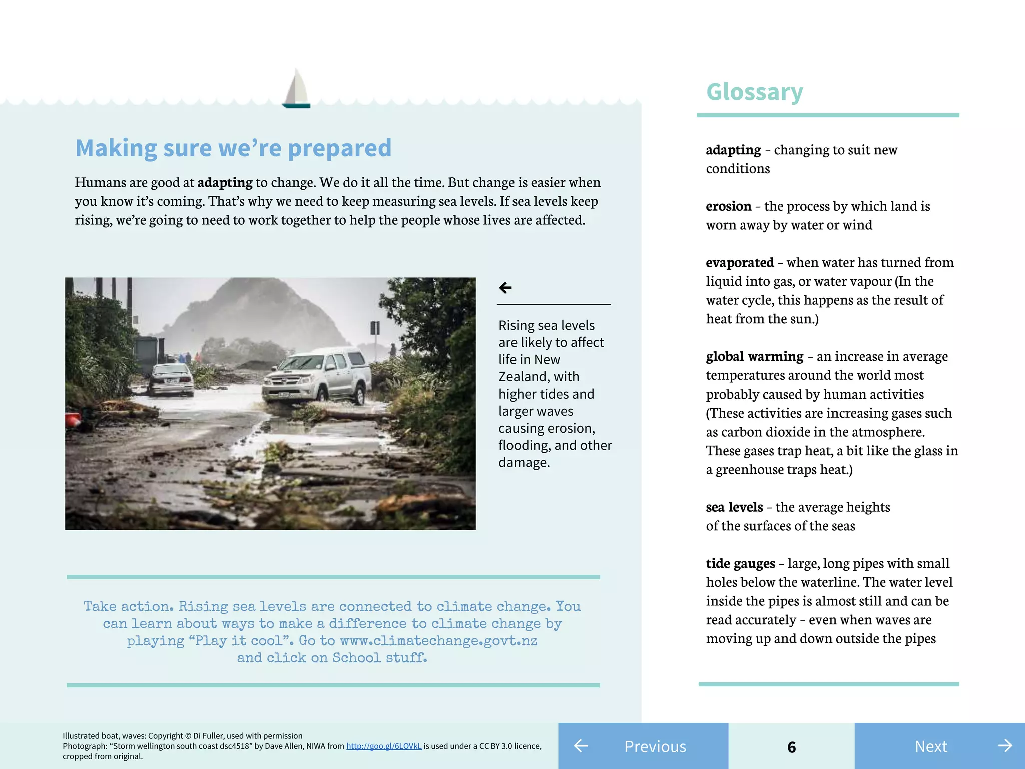
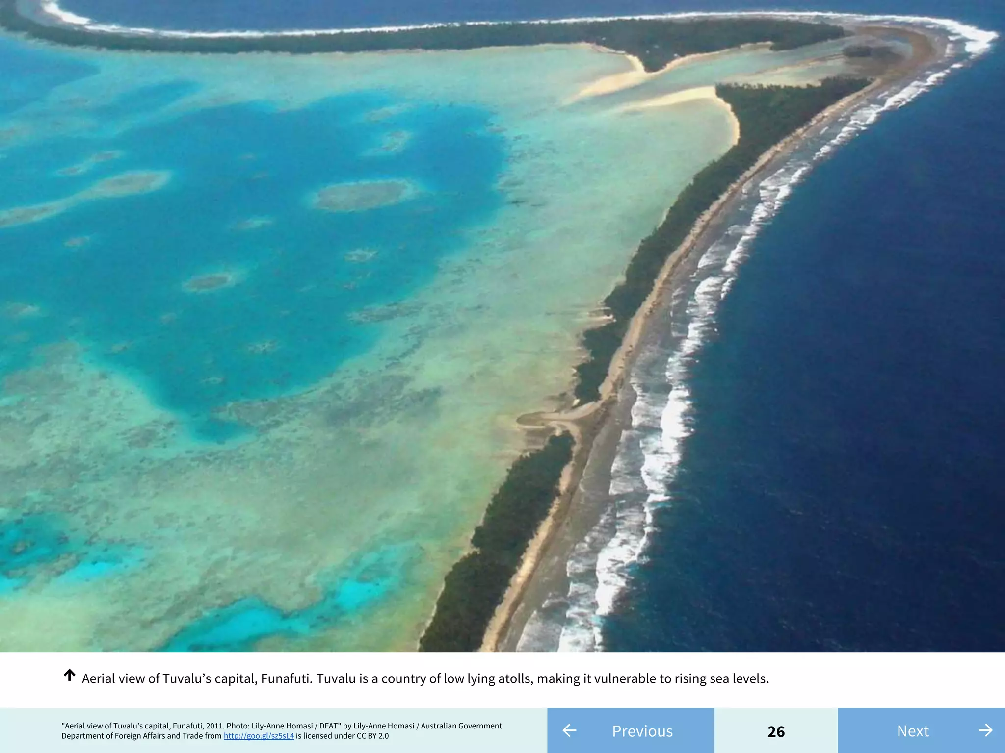
Oceans cover most of the Earth's surface and contain nearly all of its water. Sea levels are rising at about 10 times the rate over the past 3,000 years due to global warming, which is causing oceans to increase in size. Rising sea levels threaten coastal areas through increased erosion, flooding, and damage from storms. Scientists project that by 2100, sea levels could be 0.8 to 2 meters higher than current levels without action to address climate change.


![13← Previous"Bloom in the Ross Sea [detail]" by NASA Goddard Space Flight Center from http://goo.gl/I24ehg is licensed under CC BY 2.0 →Next
Bloom in the Ross Sea, south of New Zealand, in Antarctica. The bloom is an annual massive growth of phytoplankton in response to increased
sunlight.
↑](https://image.slidesharecdn.com/risingseas-160320064441/75/Rising-seas-13-2048.jpg)


![Glacial_Period_Sea_Level_Rise_Presentation[1].pptx](https://cdn.slidesharecdn.com/ss_thumbnails/glacialperiodsealevelrisepresentation1-250404173224-70fd2ab9-thumbnail.jpg?width=640&height=640&fit=bounds)


