The document discusses MOMSEI cruises conducted from 2011-2013 by Indonesian and Chinese scientists to study the Asian monsoon. It provides details of the 3rd and 4th MOMSEI cruises in 2011-2012 that were carried out in the waters off Sumatra aboard the RV Madidihang III. It also outlines plans for the 5th MOMSEI cruise in 2013 off Java using the RV Baruna Jaya VIII. The cruises involved ocean observations like CTD and plankton sampling to understand the monsoon's impacts on the marine environment and fisheries.
Editorial – April 2011 – Special Issue jointly coordinated by Mercator Ocean and Coriolis
focusing on Ocean Observations
Greetings all,
Once a year in April, and for the second time after the April 2010 issue, the Mercator Ocean Forecasting Center in Toulouse and the Coriolis
Infrastructure in Brest publish a common newsletter. Some papers are dedicated to observations only, when others display collaborations
between the 2 aspects: Observations and Modelling/Data assimilation.
The two first papers introducing this issue are presenting the data requirement for the GMES Marine Core Service (Le Traon and Pouliquen) and
the Eurosites Open Ocean Observatory Network (Larkin et al.).
Then, Doxaran et al. are writing about the Provpanache project which uses of ProvBio floats to study the dynamics of suspended particles in river
plumes. Two papers are then dealing with eXpendable BathyThermograph (XBT) observations: Hamon et al. start with “Empirical correction of
XBT fall rate” and shows that maximum heat content in the top 700 meters found in earlier studies can be explained by now identified XBT
biases. XBT are also used by Maes et al. who look at the geostrophic component of oceanic jets entering in the eastern Coral Seas. Next, Brion
et al. are using complementary in situ data among which Thermosalinographs (TSG) for the calibration and validation of SMOS.
The two last papers of the present issue are displaying the collaboration between the Ocean Observations and Ocean Modelling communities:
Juza et al. are using a numerical model in order to determine how the Argo array could be extended to better monitor the Global Ocean heat
content variability. Drevillon et al. are then presenting the Mercator Ocean quaterly validation bulletin “Quo Va Dis?” which is using the Coriolis
data in order to draw the picture of the quality of the Mercator Ocean products.
We will meet again next year in April 2012 for a new jointly coordinated Newsletter between Mercator Ocean and Coriolis. Regarding next July
2011 Newsletter coordinated by Mercator Ocean only, it will display papers about the latest space missions and their use for oceanography and
research.
We wish you a pleasant reading,
Laurence Crosnier and Sylvie Pouliquen, Editors.
RC Hovercraft: An I-Bylogical Enzyme (I-BE) Biosensor Carrier IJECEIAES
In this research, a hovercraft was developed as a transportation tool to carry an I-Bylogical Enzyme (I-BE) biosensor. The main function of the biosensor is to measure the level of dangerous chemical materials from factory’s liquid waste. Hence, fiber and acrylic materials, that widely known for its resistance to chemical reaction, are needed to build the hovercraft. By using Atmega 8535 microcontroller and Arduino Uno board, a remote control was choosen to navigate hovercraft’s movement with support of 6 channels Transmitter Receiver. As a result, after series of tests that were carried out, indicate that the hovercraft’s prototype was found to meet design and requirements expectation.
Presentation at the APEC Workshop on the Climate Change Impact on Oceans and Fisheries Resources, held on May 9th, 2015, in Boracay Island, The Philippines.
How to get involved in IODP and what you gain as a scientist - presentation by David McInroy at the UKCCSRC Glacistore meeting "Impact of glacial advances and retreats on the strata overlying prospective North Sea CO2 storage sites", 27 February 2015
C1.05: Sustained observations for many users - a perspective from Australia’s...Blue Planet Symposium
Australia is a ‘marine nation’ – an island continent with the third largest ocean territory on the ‘Blue Planet’. Our borders are maritime and we generate massive wealth from marine industries. Most of our population lives in highly urbanised centres on or near the coast, and we are extremely sensitive to ocean-influenced climate and weather, through drought, flood, and tropical cyclones. Our ocean territory contains marine biodiversity of globally significant conservation and tourism value, ranging from the high tropics to Antarctica. These factors combine to establish the need for sustained ocean observing in the Australian context, for many uses and users.
Despite this clear, national need, responsibility for ocean observing and management is fragmented and dispersed. A National Oceans Policy and independent National Oceans Office were established in 1998, but were subsumed into the Federal Environment portfolio by 2005. The Bureau of Meteorology is Australia's national weather agency, and while its role has expanded to encompass climate and water services over the last decade, it is only now beginning to consider an expanded role in marine services. Jurisdiction of the marine environment, including responsibility for marine monitoring, is shared across Federal, State and Territory Governments, across different Departments within those various Governments, and between industrial users and regulators in areas like offshore oil and gas and commercial fishing. It is also significant to note that Australia has no earth observation from space (EOS) capability of its own.
Since 2006, Australia has put in place a national Integrated Marine Observing System (IMOS). Established as a research infrastructure, IMOS routinely operates a wide range of observing equipment, making all of its data openly accessible to the marine and climate science community, other stakeholders and users, and international collaborators. It is integrated from open-ocean to coast, and across physical, chemical and biological ocean variables.
This talk will focus on what has been learnt through the experience of building IMOS as a research infrastructure in a context where sustained ocean observations are needed by many users.
Assessment of coral reefs damaged due to MV Pazifik ran aground in the Sape S...Yayasan TERANGI
Assessment of coral reefs damaged due to MV Pazifik ran aground in the Sape Strait using an aerial photography approach and species distribution modeling
Marine fieldwork looking in depth at all the requirement and methodologies necessary to be able to organise, record and extrapolate data from sampled marine mammals, sea birds, fish and benthic marine life assemblages.
Greetings all,
Once a year in April, the Mercator Ocean Forecasting Center in Toulouse and the Coriolis Infrastructure in Brest publish a common newsletter. Papers are dedicated to observations only.
• The first paper introducing this issue is presenting the Coriolis 2014-2020 framework which was renewed in 2014 in order to go on integrating in-situ ocean observation infrastructure for operational oceanography and ocean/climate research.
• Next paper by Poffa et al. describes how some Argo floats are deployed by the sailing community, through ship-based non-governmental organization or trans-oceanic races. It allows Argo floats to be deployed in poorly sampled areas where there is no regular shipping. Sailors got also involved in oceanographic science activities. An example of float deployment is given in the case of the Barcelona World Race.
• Next paper by Pouliquen et al. describes the EURO-ARGO ERIC infrastructure which is now officially set-up since May 2014. The objective of the Euro-Argo ERIC is to organize a long term European contribution to the international Argo array of profiling floats.
• Le Traon et al. are then presenting how the assessment of the impact of ARGO in Ocean models and satellite validation is conducted in the context of E-AIMS (Euro-Argo improvements for the GMES/Copernicus Marine Service) FP7 project. Observing System Evaluations and Observing System Simulation Experiments have been conducted to quantify the contribution of Argo to constrain global and regional monitoring and forecasting centers and validate satellite observations. Recommendations for the new phase of Argo are also elaborated.
• Kolodziejczyk et al. follow with the presentation of the complementarity of ARGO and SMOS Sea Surface Salinity (SSS) observations to help monitoring SSS variability from basin to meso scale. Using a 4-year time-series of SMOS SSS data and the global Argo array of in situ measurements, a statistical approach and an optimal interpolation method are used to characterize biases and reduce noises. Results are promising and show strong complementarity between SMOS and Argo data.
• Herbert et al. then describe Shipboard Acoustic Doppler Current Profilers (SADCP) observations which are carried out in the Tropical Atlantic during yearly cruises in the framework of the PIRATA program. The present note displays the SADCP data processing methodology applied for 8 PIRATA cruises by using CASCADE software.
• Cravatte et al. follow with a paper presenting the new international TPOS2020 project (2014-2020). The project objective is to build a renewed, integrated, internationally-coordinated and sustainable observing system in the Tropical Pacific, meeting both the needs of climate research and operational forecasting systems and learning lessons from the great success-and finally partial collapse- of the TAO/TRITON array.
• Saout-Grit et al. next present an updated procedure for CTD-oxygen calibration along with new
General Discussion: Riset Dampak Perubahan Iklim Global Dengan Menggunakan Ar...widodopranowo
General Discussion: Riset Dampak Perubahan Iklim Global Dengan Menggunakan Argo Float sebagai bahan diskusi di Badan Riset Kelautan dan Perikanan Republik Indonesia pada 21 April 2005, hasil kerjasama dengan CSIRO Marine Labs Hobart Tasmania.
Greetings all,
This month’s newsletter is devoted to Data Assimilation and its techniques and progress for operational oceanography.
Gary Brassington is first introducing this newsletter with a paper telling us about the international summer school for “observing,
assimilating and forecasting the ocean” which will be held in Perth, Western Australia in 11-22 January 2010
(http://www.bom.gov.au/bluelink/summerschool/). The course curriculum will include topics covering the leading edge science in
ocean observing systems, as well as the latest methods and techniques for analysis, data assimilation and ocean modeling.
Scientific articles about Data Assimilation are then displayed as follows: The first article by Broquet et al. is dealing with Ocean
state and surface forcing correction using the ROMS-IS4DVAR Data Assimilation System. Then, Cosme et al. are describing the
SEEK smoother as a Data Assimilation scheme for oceanic reanalyses. The next article by Brankart et al. is displaying a synthetic
literature review on the following subject: Is there a simple way of controlling the forcing function of the Ocean? Then Ferry et al.
are telling us about Ocean-Atmosphere flux correction by Ocean Data Assimilation. The last article by Oke et al. is dealing with
Data Assimilation in the Australian BlueLink System.
The next October 2009 newsletter will review the current work on ocean biology and biogeochemistry.
We wish you a pleasant reading!
Balitbang KKP for UKP4 Meeting 7 Jan 2014 One Data Policy.pptlabdatalautpesisir
Konsep Kebijakan One Data Policy dari Badan Litbang Kelautan dan Perikanan: Data Sumberdaya Kelautan dan Perikanan. Bahan submisi Rapat di UKP4 7 Januari 2014.
Country Report on Climate Change Policy to Support Marine Affairs & Fisheries...labdatalautpesisir
Presented on The Government of Indonesia and FAO Workshop on Reducing Vulnerability To Disasters and Climate Change Impacts In Asia for The Fisheries and Aquaculture Sector - 2013
Research & Development Center for Marine & Coastal Resources (P3SDLP), Ministry of Marine Affairs & Fisheries of The Republic of Indonesia, presenting their research activities on Ocean-Climate Variability during 2002-2013 to support the national policy on Marine & Fisheries Sector, in the United Nations Office for Outer Space Affairs Climate Change Conference at Jakarta Indonesia 2013.
GDG Cloud Southlake #33: Boule & Rebala: Effective AppSec in SDLC using Deplo...James Anderson
Effective Application Security in Software Delivery lifecycle using Deployment Firewall and DBOM
The modern software delivery process (or the CI/CD process) includes many tools, distributed teams, open-source code, and cloud platforms. Constant focus on speed to release software to market, along with the traditional slow and manual security checks has caused gaps in continuous security as an important piece in the software supply chain. Today organizations feel more susceptible to external and internal cyber threats due to the vast attack surface in their applications supply chain and the lack of end-to-end governance and risk management.
The software team must secure its software delivery process to avoid vulnerability and security breaches. This needs to be achieved with existing tool chains and without extensive rework of the delivery processes. This talk will present strategies and techniques for providing visibility into the true risk of the existing vulnerabilities, preventing the introduction of security issues in the software, resolving vulnerabilities in production environments quickly, and capturing the deployment bill of materials (DBOM).
Speakers:
Bob Boule
Robert Boule is a technology enthusiast with PASSION for technology and making things work along with a knack for helping others understand how things work. He comes with around 20 years of solution engineering experience in application security, software continuous delivery, and SaaS platforms. He is known for his dynamic presentations in CI/CD and application security integrated in software delivery lifecycle.
Gopinath Rebala
Gopinath Rebala is the CTO of OpsMx, where he has overall responsibility for the machine learning and data processing architectures for Secure Software Delivery. Gopi also has a strong connection with our customers, leading design and architecture for strategic implementations. Gopi is a frequent speaker and well-known leader in continuous delivery and integrating security into software delivery.
Neuro-symbolic is not enough, we need neuro-*semantic*Frank van Harmelen
Neuro-symbolic (NeSy) AI is on the rise. However, simply machine learning on just any symbolic structure is not sufficient to really harvest the gains of NeSy. These will only be gained when the symbolic structures have an actual semantics. I give an operational definition of semantics as “predictable inference”.
All of this illustrated with link prediction over knowledge graphs, but the argument is general.
Transcript: Selling digital books in 2024: Insights from industry leaders - T...BookNet Canada
The publishing industry has been selling digital audiobooks and ebooks for over a decade and has found its groove. What’s changed? What has stayed the same? Where do we go from here? Join a group of leading sales peers from across the industry for a conversation about the lessons learned since the popularization of digital books, best practices, digital book supply chain management, and more.
Link to video recording: https://bnctechforum.ca/sessions/selling-digital-books-in-2024-insights-from-industry-leaders/
Presented by BookNet Canada on May 28, 2024, with support from the Department of Canadian Heritage.
Securing your Kubernetes cluster_ a step-by-step guide to success !KatiaHIMEUR1
Today, after several years of existence, an extremely active community and an ultra-dynamic ecosystem, Kubernetes has established itself as the de facto standard in container orchestration. Thanks to a wide range of managed services, it has never been so easy to set up a ready-to-use Kubernetes cluster.
However, this ease of use means that the subject of security in Kubernetes is often left for later, or even neglected. This exposes companies to significant risks.
In this talk, I'll show you step-by-step how to secure your Kubernetes cluster for greater peace of mind and reliability.
Software Delivery At the Speed of AI: Inflectra Invests In AI-Powered QualityInflectra
In this insightful webinar, Inflectra explores how artificial intelligence (AI) is transforming software development and testing. Discover how AI-powered tools are revolutionizing every stage of the software development lifecycle (SDLC), from design and prototyping to testing, deployment, and monitoring.
Learn about:
• The Future of Testing: How AI is shifting testing towards verification, analysis, and higher-level skills, while reducing repetitive tasks.
• Test Automation: How AI-powered test case generation, optimization, and self-healing tests are making testing more efficient and effective.
• Visual Testing: Explore the emerging capabilities of AI in visual testing and how it's set to revolutionize UI verification.
• Inflectra's AI Solutions: See demonstrations of Inflectra's cutting-edge AI tools like the ChatGPT plugin and Azure Open AI platform, designed to streamline your testing process.
Whether you're a developer, tester, or QA professional, this webinar will give you valuable insights into how AI is shaping the future of software delivery.
LF Energy Webinar: Electrical Grid Modelling and Simulation Through PowSyBl -...DanBrown980551
Do you want to learn how to model and simulate an electrical network from scratch in under an hour?
Then welcome to this PowSyBl workshop, hosted by Rte, the French Transmission System Operator (TSO)!
During the webinar, you will discover the PowSyBl ecosystem as well as handle and study an electrical network through an interactive Python notebook.
PowSyBl is an open source project hosted by LF Energy, which offers a comprehensive set of features for electrical grid modelling and simulation. Among other advanced features, PowSyBl provides:
- A fully editable and extendable library for grid component modelling;
- Visualization tools to display your network;
- Grid simulation tools, such as power flows, security analyses (with or without remedial actions) and sensitivity analyses;
The framework is mostly written in Java, with a Python binding so that Python developers can access PowSyBl functionalities as well.
What you will learn during the webinar:
- For beginners: discover PowSyBl's functionalities through a quick general presentation and the notebook, without needing any expert coding skills;
- For advanced developers: master the skills to efficiently apply PowSyBl functionalities to your real-world scenarios.
JMeter webinar - integration with InfluxDB and GrafanaRTTS
Watch this recorded webinar about real-time monitoring of application performance. See how to integrate Apache JMeter, the open-source leader in performance testing, with InfluxDB, the open-source time-series database, and Grafana, the open-source analytics and visualization application.
In this webinar, we will review the benefits of leveraging InfluxDB and Grafana when executing load tests and demonstrate how these tools are used to visualize performance metrics.
Length: 30 minutes
Session Overview
-------------------------------------------
During this webinar, we will cover the following topics while demonstrating the integrations of JMeter, InfluxDB and Grafana:
- What out-of-the-box solutions are available for real-time monitoring JMeter tests?
- What are the benefits of integrating InfluxDB and Grafana into the load testing stack?
- Which features are provided by Grafana?
- Demonstration of InfluxDB and Grafana using a practice web application
To view the webinar recording, go to:
https://www.rttsweb.com/jmeter-integration-webinar
Epistemic Interaction - tuning interfaces to provide information for AI supportAlan Dix
Paper presented at SYNERGY workshop at AVI 2024, Genoa, Italy. 3rd June 2024
https://alandix.com/academic/papers/synergy2024-epistemic/
As machine learning integrates deeper into human-computer interactions, the concept of epistemic interaction emerges, aiming to refine these interactions to enhance system adaptability. This approach encourages minor, intentional adjustments in user behaviour to enrich the data available for system learning. This paper introduces epistemic interaction within the context of human-system communication, illustrating how deliberate interaction design can improve system understanding and adaptation. Through concrete examples, we demonstrate the potential of epistemic interaction to significantly advance human-computer interaction by leveraging intuitive human communication strategies to inform system design and functionality, offering a novel pathway for enriching user-system engagements.
DevOps and Testing slides at DASA ConnectKari Kakkonen
My and Rik Marselis slides at 30.5.2024 DASA Connect conference. We discuss about what is testing, then what is agile testing and finally what is Testing in DevOps. Finally we had lovely workshop with the participants trying to find out different ways to think about quality and testing in different parts of the DevOps infinity loop.
Builder.ai Founder Sachin Dev Duggal's Strategic Approach to Create an Innova...Ramesh Iyer
In today's fast-changing business world, Companies that adapt and embrace new ideas often need help to keep up with the competition. However, fostering a culture of innovation takes much work. It takes vision, leadership and willingness to take risks in the right proportion. Sachin Dev Duggal, co-founder of Builder.ai, has perfected the art of this balance, creating a company culture where creativity and growth are nurtured at each stage.
State of ICS and IoT Cyber Threat Landscape Report 2024 previewPrayukth K V
The IoT and OT threat landscape report has been prepared by the Threat Research Team at Sectrio using data from Sectrio, cyber threat intelligence farming facilities spread across over 85 cities around the world. In addition, Sectrio also runs AI-based advanced threat and payload engagement facilities that serve as sinks to attract and engage sophisticated threat actors, and newer malware including new variants and latent threats that are at an earlier stage of development.
The latest edition of the OT/ICS and IoT security Threat Landscape Report 2024 also covers:
State of global ICS asset and network exposure
Sectoral targets and attacks as well as the cost of ransom
Global APT activity, AI usage, actor and tactic profiles, and implications
Rise in volumes of AI-powered cyberattacks
Major cyber events in 2024
Malware and malicious payload trends
Cyberattack types and targets
Vulnerability exploit attempts on CVEs
Attacks on counties – USA
Expansion of bot farms – how, where, and why
In-depth analysis of the cyber threat landscape across North America, South America, Europe, APAC, and the Middle East
Why are attacks on smart factories rising?
Cyber risk predictions
Axis of attacks – Europe
Systemic attacks in the Middle East
Download the full report from here:
https://sectrio.com/resources/ot-threat-landscape-reports/sectrio-releases-ot-ics-and-iot-security-threat-landscape-report-2024/
Elevating Tactical DDD Patterns Through Object CalisthenicsDorra BARTAGUIZ
After immersing yourself in the blue book and its red counterpart, attending DDD-focused conferences, and applying tactical patterns, you're left with a crucial question: How do I ensure my design is effective? Tactical patterns within Domain-Driven Design (DDD) serve as guiding principles for creating clear and manageable domain models. However, achieving success with these patterns requires additional guidance. Interestingly, we've observed that a set of constraints initially designed for training purposes remarkably aligns with effective pattern implementation, offering a more ‘mechanical’ approach. Let's explore together how Object Calisthenics can elevate the design of your tactical DDD patterns, offering concrete help for those venturing into DDD for the first time!
Designing Great Products: The Power of Design and Leadership by Chief Designe...
Rizki anggoro momsei summer school s
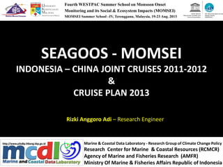
1. SEAGOOS - MOMSEI
INDONESIA – CHINA JOINT CRUISES 2011-2012
&
Fourth WESTPAC Summer School on Monsoon Onset
Monitoring and its Social & Ecosystem Impacts (MOMSEI)
MOMSEI Summer School –IV, Terengganu, Malaysia, 19-23 Aug. 2013
&
CRUISE PLAN 2013
Rizki Anggoro Adi – Research Engineer
Marine & Coastal Data Laboratory - Research Group of Climate Change Policy
Research Center for Marine & Coastal Resources (RCMCR)
Agency of Marine and Fisheries Research (AMFR)
Ministry Of Marine & Fisheries Affairs Republic of Indonesia
3. MOMSEI in Indonesia
• MOMSEI activities in Indonesia, which has been
implemented since 2011
• Cooperation between the Research Center for
Marine & Coastal Resources, Agency of Marine
and Fisheries, Ministry Of Marine & Fisheriesand Fisheries, Ministry Of Marine & Fisheries
Affairs Republic of Indonesia with First Institute
of Oceanography, State Oceanic Administration
of People's Republic of China
• Based on Implementation of Arrangement (IA) of
the Indonesian Chinese Center for Ocean
Climate (ICCOC) which was signed in 2010.
4. The Profile of Research Center for Marine &
Coastal Resources…
5. The Profile of Research Center for Marine &
Coastal Resources…
11. The MOMSEI Cruises in Indonesia Waters
• 3rd MOMSEI CRUISE 2011 at Western Sumatra Waters
April 19 - May 13, 2011 - RV Madidihang III
• 4rd MOMSEI CRUISE 2012 2011 at Western Sumatra
Waters
April 26-May 14, 2012 - RV Madidihang III
• 5th MOMSEI CRUISE PLAN 2013 2011 at Southern Java
Waters
Sept.23 - Oct 02, 2013 - RV Baruna Jaya VIII
12. • To understand the Asian Monsoon in April
• Has been successfully carried out by using a training
ship “Madidihang 3” which operated by the Jakarta
University of Fisheries (STP) of the Ministry of Maritime
Affairs and Fisheries
The MOMSEI Cruises in Western Sumatera
Waters 2011 - 2012
Affairs and Fisheries
• Was also carrying 30 students Jakarta University of
Fisheries (STP) for field practice.
• There are 2 students from Padjajaran University and 1
student from Bandung Institut of Technology had
graduated with using the data MOMSEI for their theses.
• In 2013, one Researcher from the Research Center for
Marine & Coastal Resources went on to PhD study in
China using this MOMSEI data cruise.
14. RV Madidihang 3
• Multi Purposes Fisheries Training and
Research Vessel operated by Jakarta Fishery
University, Minister of Marine and Fisheries
AffairsAffairs
• Joint cooperation between the Government of
Republic Indonesia and The Government of
The Kingdom Spain.
• Was Build by Astilleros Gondan S.A in 2009
and arrived in Indonesia on May 2010 ).
16. RV Madidihang 3
Instrument
• CTD : SBE 911 plus, 6600
• Scientific Echosounder : EA 600
• Fish Finder : EK 60
• ADCP : TRDI 75 Hz• ADCP : TRDI 75 Hz
• TSGF : SBE 21
• Turner 10 Au Flourmeter
• Guidekine Salinometer : PORTASAL
• Meteo
• Scientific GPD : SEAPATH 20 NAV
• Dive equipment : 10 units
• Underwater Camera : 2
17. 3rd MOMSEI CRUISE 2011
• Apr.19-May 13, 2011
• Third MOMSEI cruise in the East Equatorial Indian
Ocean
• using the R/V MADIDIHANG-03.• using the R/V MADIDIHANG-03.
• Four scientists from FIO and 13 Indonesian
scientists and technicians joined in this cruise
(detailed information as showed in Table below)
• Cruise Observation : 37 CTD stations had been
designed and observated along the cruise track
(detailed information as showed in Table below)
18. 3rd MOMSEI CRUISE 2011
No. Nama Jabatan Unit
1 Huiwu Wang Chief Scientist FIO
2 Liu Lin Scientist FIO
3 Su Bo Master Student FIO
4 Yujie Dong Master Student FIO
5 Fajar Yudi Prabawa Scientist KKP-P3SDLP
6 Lestari Cendikia Dewi Scientist KKP-P3SDLP
7 August Daulat Scientist KKP-P3SDLP7 August Daulat Scientist KKP-P3SDLP
8 Riswan Hasan Technician KKP-P3SDLP
9 Teguh Agustiadi Scientist KKP-BROK
10 Rodo Lasniroha Scientist KKP-PRPT
11 Tri Altanto Scientist KKP-LRKPL
12 Ilham Technician KKP-LRKPL
13 M. Vikky Arindi UndGrad Student Kelautan UNPAD
14 Gilang Ardi Pratama UndGrad Student Kelautan UNPAD
15 Yasser Krisnafi Lecturer STP
16 Firman Agus Lecturer STP
17 Nur Nugraha Security officer BAIS - Kemenhankam
20. 3rd MOMSEI CRUISE 2011
Cruise track and positions of observed stations
21. 4th MOMSEI CRUISE 2012
• April 26-May 14, 2012
• Implemented by FIO and AMFRD scientists
jointly,
• using the R/V MADIDIHANG-03.
• Four scientists from FIO and 13 Indonesian
scientists and technicians joined in this cruise
22. 4th MOMSEI CRUISE 2012
Cruise Observation:
• 39 CTD stations had been designed and
observated along the cruise track, together
with 2 additional stations.with 2 additional stations.
• Also, 24 stations were selected for Chem-Bio
stations
23. 4th MOMSEI CRUISE 2012
Physical Oceanography and MET Observations
• CTD observations at 39 stations, with special
focus on the tropical eastern Indian;
• Meteorology observations including the air• Meteorology observations including the air
temperature, relative humility, pressure and
wind along the cruise tracks,
• Observations, including ADCP, partial CO2 of
seawater, Weather station;
24. 4th MOMSEI CRUISE 2012
Ocean ecosystem observation and analysis
24 of 39 stations were selected for ocean biology and chemical observations
and analysis, 1897 samples were received with detailed information following,
• 530 plastic bags each with 60 milligrams water sample;
• 72 glass vials with screw-caps, each with 40 milligrams Dissolved Organic• 72 glass vials with screw-caps, each with 40 milligrams Dissolved Organic
Carbon;
• 36 glass vials with screw-caps, each with 40 milligrams Total Organic
Carbon;
• 432 plastic vials with screw-caps, each with 5milligrams sea water only
frozen;
• 256 plastic vials with screw-caps, each with 90 milligrams sea water
• 81 plastic vials with screw-caps, each with one filter fill ;
• 490 filter fill, wrapping by Aluminim frozen with dry ice;
26. 5th MOMSEI CRUISE PLAN 2013
• MOMSEI 2013 will focus on the Australian
Monsoon and its impact on upwelling systems
that support the fisheries sector.
• Measurement of the mass water parameters• Measurement of the mass water parameters
such as temperature, salinity, oxygen,
nutrients and identification for zoo-and
phytoplankton-plankton will be done.
• Additionally, it will also be measured flux of
dissolved CO2 in several layers of the ocean
depths to see the ocean-climate variability.
27. 5th MOMSEI CRUISE PLAN 2013
• September 23 – October 2, 2013
• using the R/V BARUNA JAYA 8.
• 7 (seven) scientists from FIO and 13• 7 (seven) scientists from FIO and 13
Indonesian scientists and technicians will be
joined in this cruise
• There 3 transect line perpendicular the Java
Island, each transect line consist of 5 sampling
station
28. 5th MOMSEI CRUISE PLAN 2013
Physical Oceanography and MET Observations
• CTD observations at 15 stations,
• Meteorology observations including the air
temperature, relative humility, pressure andtemperature, relative humility, pressure and
wind along the cruise tracks,
• Observations, including ADCP, partial CO2 of
seawater, surface CT, Weather station;
• Video Plankton Recorder operation
30. RV Baruna Jaya 8
General Information
• Ship Name : KR. BARUNA JAYA VIII
• Call Sign : YFZQ
• Owner : Indonesia Institute of Sciences• Owner : Indonesia Institute of Sciences
• Kind of Ship : Research Vessel
• IMO Number : 9155171
• Port Register : JAKARTA
• Place Builder : Mjellem & Karlsen AS Bergen,
Norway
• Year of Build : July 1997 – August1998
31. RV Baruna Jaya 8
Main Measurement
• Panjang Keseluruhan (LOA) : 53.20 m
• Panjang antara Garis Tegak (LBP) : 46.50 m
• Panjang Garis Air (LWL) : 48.89 m
• Lebar Terbesar (Moulded Breath) : 12.50 m
• Tinggi dari Selther Dek (Depth for S.Deck) : 7.10 m
Tinggi dari Main Dek (Depth for M.Deck) : 4.70• Tinggi dari Main Dek (Depth for M.Deck) : 4.70
• Sarat Maksimum (Draft Maximum) : 4.30 m
• Jarak Gading-gading (Frame Distance) : 0.60 m
• Berat Keseluruhan (Displacement) : 1476.4 ton
• Berat Kapal (Leight Ship) : 918.8 ton
• Gross Tonnage : 1273 RT
• Net Tonnage : 382 RT
• Kecepatan (Speed) : 12 Knot-14 Knot
• Jarak Jelajah : 5000 mile/20 days
• Akomodasi (Accomodation) : 23 Crew,
33 Person Surveyor
32. RV Baruna Jaya 8
Tenaga Penggerak
• Mesin Penggerak Utama : Caterpillar 3516 B, Single
Enggine and Propeller (Pich Propeler),
• 149.5 KW/HP
• Motor Bantu : Cummnin (2 unit), 2x336 KW/HP,
380/220 V AC380/220 V AC
• Motor Bantu Darurat : Cummnin (1 unit), 163 KW/HP,
380/220 V AC
Peralatan Navigasi
• Radar 72 mile (freq 9 GHz); Radar ARPA120 mile; SIMRAD
Planning Station (Electronic Chart Display Instrument);
Current Meter; Anemometer; Barometer; Thermometer
Humidity; Salinity Dopller Log (Speed Log); GPS/DGPS;
Navtex
33. RV Baruna Jaya 8
Peralatan Komunikasi :
• VHF SAILOR Consol (VHF, SSB, DSC, NBDB, Wah-keeping Receiver);
Inmarsat C SAILOR (Telex, facsimile, EGC Program); Inmarsat B
NERA (Telephone, telex, facsimile, data, Hight Speed Data)
Scientific Equipment :Scientific Equipment :
• CTD System, SBE 911 Plus, 6.800m; Acoustic Dopller Current Propiler
• 75 kHz (ADCP); Micro Flow Analysis System; Data Management
System (MDM 400); Seismic (Streamer 700m, Hidrophone 200m,
Water Gun and Air Gun); Gravitymeter with recorder; Scientific
Echosounder EK 500,
• 10000m; Multibeam EM 1000, 1000m; Echosounder EA 500,
10000m;
• Depth Sonar SD 570 with colour scope; Identification Trawl
Instrumentation; Coring Equipment; Diving Compressor.
34. 2S Agu 2S
Sep
Cruise plan Concept by Prof Weidong Yu (before revised):
1. Three sections perpendicular to the Java Island orientation, as shown below.
2. Length of sections: Section 1, 100nm (5 stations); Section 2, 200nm (9 stations); Section 3: 100nm (5 stations);
5th MOMSEI CRUISE PLAN 2013
100E 103E 106E 109E 112E 115E 118E
12S
10S
8S
6S
4S
100E 103E 106E 109E 112E 115E 118E
12S
10S
8S
6S
4S
-2.8 -2.4 -2 -1.6 -1.2 -0.8 -0.4 0 0.4 0.8 1.2
Monthly SST minus annual mean SST
1
2 3
1
2 3