Downloaded 123 times
![ORBIT ALLOCATION
Satellites in geostationary orbit must all occupy a single
ring above the Equator. The requirement to space these
satellites apart to avoid harmful radio-frequency
interference during operations means that there are a
limited number of orbital "slots" available, thus only a
limited number of satellites can be operated in
geostationary orbit. This has led to conflict between
different countries wishing access to the same orbital
slots (countries near the same longitude but
differing latitudes) and radio frequencies. These
disputes are addressed through the International
Telecommunication Union's allocation
mechanism.[10][11] In the 1976 Bogotá Declaration, eight
countries located on the Earth's equator claimed
sovereignty over the geostationary orbits above their
territory, but the claims gained no international
recognition](https://image.slidesharecdn.com/whatisgeostationarysatellite-150629145205-lva1-app6891/85/What-is-geostationary-satellite-5-320.jpg)
![Satellite Launch Date Launch Vehicle Remarks ISRO Link
Aryabhata 19 April 1975 u-11 Interkosmos
Active technological
experience in building
and operating a satellite
system.
[1]
Bhaskara-I 7 June 1979 C-1 Interkosmos
First experimental remote
sensing satellite. Carried
TV and microwave
cameras.
[2]
Rohini Technology
Payload
10 August 1979 SLV-3
Intended for measuring
in-flight performance of
first experimental flight of
SLV-3, the first Indian
launch vehicle. Did not
achieve orbit.
[3]
Rohini RS-1 18 July 1980 SLV-3
Used for measuring in-
flight performance of
second experimental
launch of SLV-3.
[4]
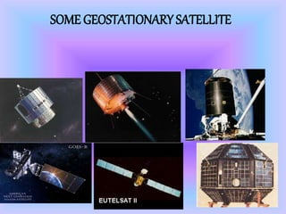
SOME INDIAN GEOSTATIONARY SATELLITES](https://image.slidesharecdn.com/whatisgeostationarysatellite-150629145205-lva1-app6891/85/What-is-geostationary-satellite-8-320.jpg)


The document discusses geostationary satellites and related technologies. It provides details on: - What defines a geostationary satellite's orbit and how it revolves with the Earth's rotation. - The purposes of geostationary satellites including communication, broadcasting, earth observation, and military/remote sensing applications. - The design of typical early geostationary satellites, which were spin-stabilized cylinders around 3 meters long supplemented with solar panels and communication antennae. - Issues around limited orbital slots in geostationary orbit and conflicts between countries over access to frequencies and positions.


