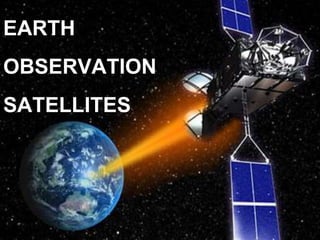
Earth Observation Satellites
•Download as PPTX, PDF•
5 likes•2,568 views

Earth observation satellites monitor Earth from orbit and are used for environmental monitoring, meteorology, and terrain mapping. The ASTER satellite collects visible, near infrared, and thermal infrared imagery at 15-90m resolution for monitoring clouds, glaciers, land, temperature, sea ice, and snow cover. Landsat-8 collects operational land imagery and thermal data at 30-90m resolution for uses including oceanography, vegetation, and biomass mapping. SPOT-5 collects high resolution geometric data at 5-20m for environmental assessment, agriculture, and marine studies.

More Related Content
What's hot
What's hot (20)
Similar to Earth Observation Satellites
Similar to Earth Observation Satellites (20)
Recently uploaded
Recently uploaded (20)
Earth Observation Satellites
- 2. Earth observation satellites are satellites specifically designed to observe Earth from orbit. Earth-observation satellites help us monitor and protect our environment, manage our resources
- 3. Uses: 1. Environmental monitoring 2. Meteorology 3. Mapping of terrain
- 4. ASTER •Advanced Spaceborne Thermal Emission And Reflection Radiometer •Government of Japan and NASA •One of the 5 payloads on the Terra Satellite Terra (EOS AM-1)
- 5. ASTER Uses: Cloud cover Glaciers Land Temperature Sea ice Snow cover Launch Date: 18 , December 1999 705 km 98.8 min 16 days VNIR (visible Near Infrared) SWIR (short wave Infrared) TIR (Thermal Infrared) 3 6 5 15x15m 30x30m 90x90m 8 bit 8 bit 12 bit 60km 60km 60km ± 8.55° ± 8.55° ± 24° Name Altitude Orbital Temporal Sensor # of Spatial Quant- Swath off period Res. Bands Res. Titization nadir
- 6. Visible and Near infrared Short wave infrared Thermal infrared ASTER IMAGES
- 7. False color image of a volcanic eruption and the direction of flow of ash
- 8. Landsat-8 •NASA and USGS •The most recent satellite added to the landsat program
- 9. Name Altitude Orbital Temporal Sensor # of Spatial Quant- Swath off period Res. Bands Res. Titization nadir Landsat-8 Uses: Oceano- graph Aerosols Vegetation Types Thermal Mapping Biomass Content Cloud Cover Launch date: Feb 11,2013 705 km 99 min 16 days OLI (Operati- onal Land Imager) Push broom TIR (Thermal Infrared) Push broom 9 2 30x30m M.S 15x15m pan 90x90m TI 12 bit 12 bit 185 km 185 km ± 15° ± 15°
- 10. Shrinkage of the Araj Sea from 1977-2010 due to diversion of water for agricultural use.
- 11. SPOT-5 •Satellite Pour L’observation de la terre •CNES National Center for Space studies,French Space Agency
- 12. Name Altitude Orbital Temporal Sensor # of Spatial Quant- Swath off period Res. Bands Res. Titization nadir SPOT-5 Uses: Environment- al Assessment Agriculture Marine Studies Launch date: May 3, 2002 822 km 101.4 min 26 days HGR (High Resolution Geometric Instrument) 4 10x10m M.S 20x20 MIR 5x5m pan 8 bit 60 km ± 27°
- 13. Landsat-7 • NASA and USGS •Seventh satellite of the Landsat program
- 14. Name Altitude Orbital Temporal Sensor # of Spatial Quant- Swath off period Res. Bands Res. Titization nadir Landsat-7 Uses: Oceano- graph Vegetation Types Mineral Deposit Identification Launch date: April 15,1999 705 km 99 min 16 days ETM+ (Enhanch -ed Thematic Mapper) Whisk broom 8 30x30m M.S 60x60m thermal 15x15m pan 8 bit 183 km No off nadir View- ing