Download to read offline
![BACK TO THE FUTURE:
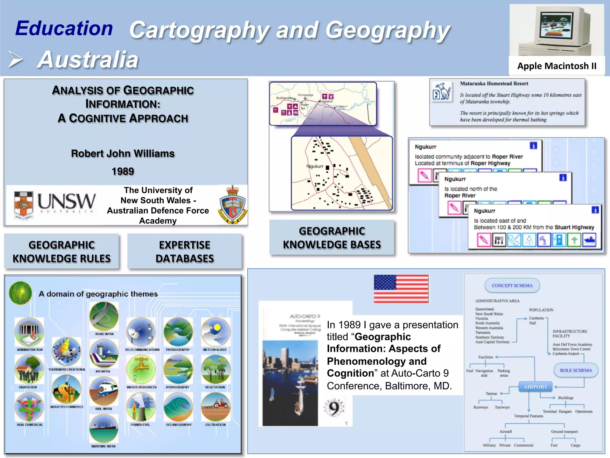
Education
Dr R.J. (Bob) Williams [Retired]
Cartographer
Topographic Surveyor,
Geographer & Geospatial Scientist
February 2022
Supporting slides to
presentation at
HYDROSPATIAL 2021](https://image.slidesharecdn.com/rjweducation-220308003641/75/Back-to-the-future-A-Personal-Experience-1-2048.jpg)


![Photo taken in December 1979 of
[then] SSGT Bob Williams
Military symbols produced using
PLOT10 software
[Then] SSGT Bob Williams – First supervisor of the
Royal Australian Survey Corps’ Input Sub-system of
Automap 1 at ‘Fortuna’, Bendigo, 1976
Dr Bob Williams an observer at DGIWG
meting held in Madrid, Spain 1993. He
was the first Australian participant.
Robert (Bob) Williams
One of Australia’s Military Mapmakers](https://image.slidesharecdn.com/rjweducation-220308003641/75/Back-to-the-future-A-Personal-Experience-6-2048.jpg)

The document outlines the educational journey and contributions of Dr. R.J. Williams, a retired cartographer and geospatial scientist, emphasizing his studies in cartography and geography from the 1970s to the 1990s. It highlights his presentations at various conferences and his innovative approaches to digital mapping, including his work with the Royal Australian Survey Corps. Key themes include the transition from traditional mapping to virtual worlds and the role of education in shaping geographic information systems.


![Future Defence Geospatial Environment Future [2000]](https://cdn.slidesharecdn.com/ss_thumbnails/futuregeoenv2000-210923064710-thumbnail.jpg?width=640&height=640&fit=bounds)


