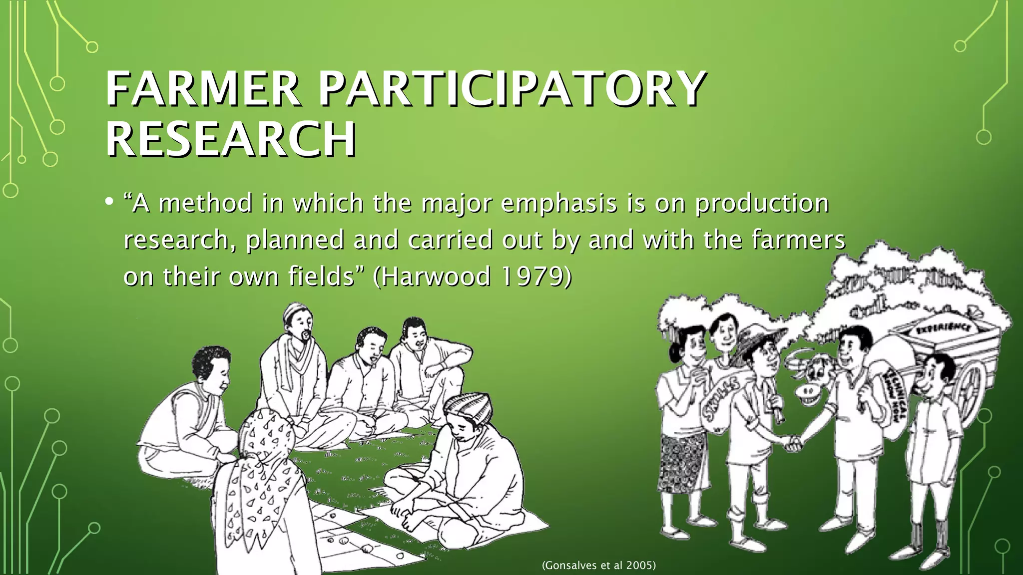
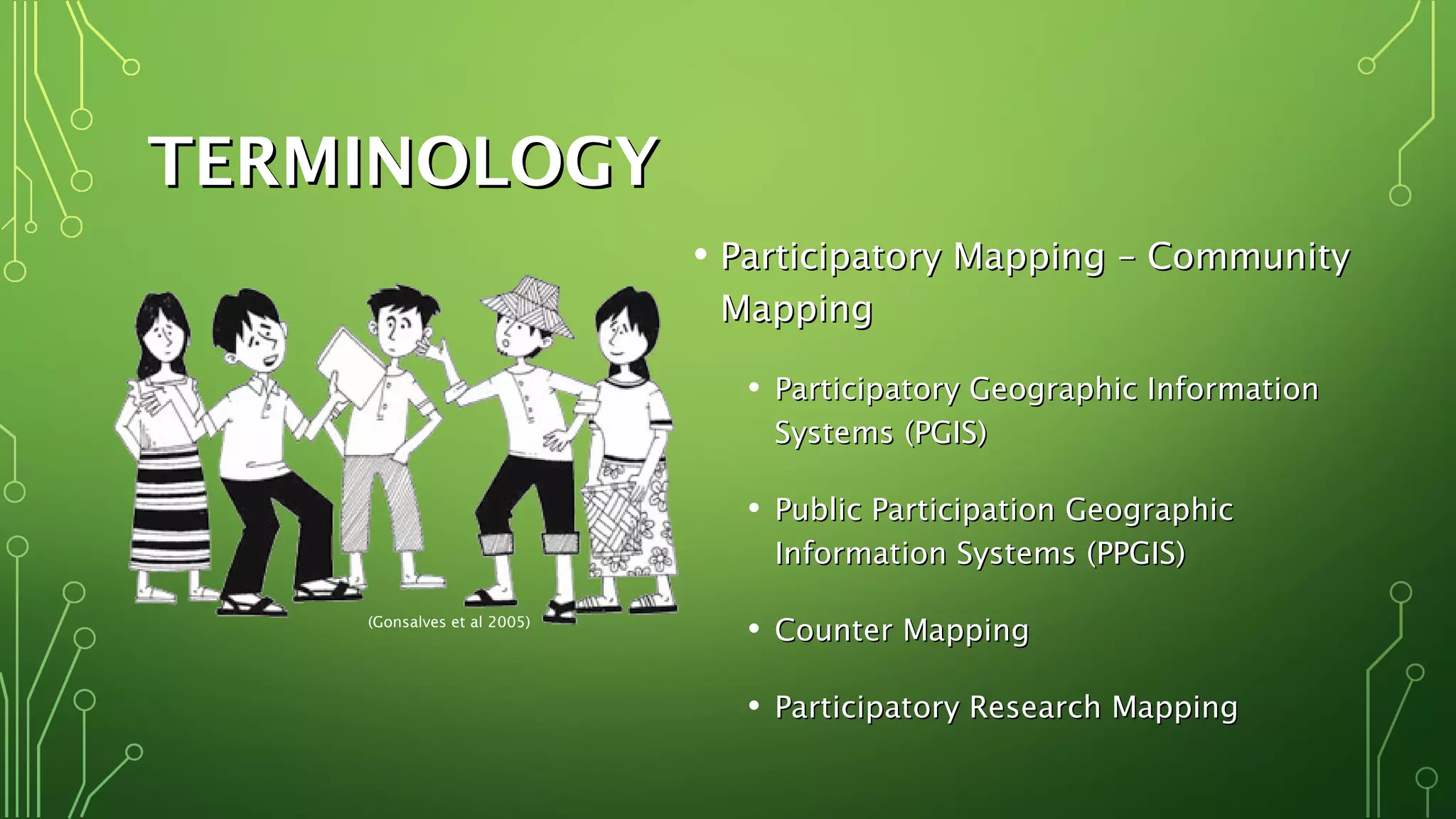
PARTICIPATORYPARTICIPATORY
MAPPINGMAPPING
PROCESSES FORPROCESSES FOR
DATA GENERATION &DATA GENERATION &
EXCHANGE IN SIDSEXCHANGE IN SIDS
MS. ALISON DEGRAFF, GISP, BAMS. ALISON DEGRAFF, GISP, BA
DEPARTMENT OF GEOMATICS ENGINEERING & LAND MANAGEMENTDEPARTMENT OF GEOMATICS ENGINEERING & LAND MANAGEMENT
FACULTY OF ENGINEERING, UNIVERSITY OF THE WEST INDIESFACULTY OF ENGINEERING, UNIVERSITY OF THE WEST INDIES
SAINT AUGUSTINE, TRINIDAD, WEST INDIESSAINT AUGUSTINE, TRINIDAD, WEST INDIES
FARMER PARTICIPATORYFARMER PARTICIPATORY
RESEARCHRESEARCH
• ““A method in which the major emphasis is on productionA method in which the major emphasis is on production
research, planned and carried out by and with the farmersresearch, planned and carried out by and with the farmers
on their own fields” (Harwood 1979)on their own fields” (Harwood 1979)
(Gonsalves et al 2005)
PARTICIPATORY MAPPINGPARTICIPATORY MAPPING
• StakeholdersStakeholders
• CommunitiesCommunities
• Local and traditional knowledgeLocal and traditional knowledge
• Public participationPublic participation
• Decision-makingDecision-making
• Collaboration geospatialCollaboration geospatial
data collectiondata collection
• MAPSMAPS
(Gonsalves et al 2005)
LOCAL KNOWLEDGELOCAL KNOWLEDGE
• Skills and knowledgeSkills and knowledge
possessed by persons of apossessed by persons of a
regionregion
• Passed down throughPassed down through
generationsgenerations
• OrallyOrally
• Direct experienceDirect experience
• Adapted and adjusted toAdapted and adjusted to
address changing conditionsaddress changing conditions
and circumstancesand circumstances
(Gonsalvesetal2005)
TERMINOLOGYTERMINOLOGY
• Participatory Mapping – CommunityParticipatory Mapping – Community
MappingMapping
• Participatory Geographic InformationParticipatory Geographic Information
Systems (PGIS)Systems (PGIS)
• Public Participation GeographicPublic Participation Geographic
Information Systems (PPGIS)Information Systems (PPGIS)
• Counter MappingCounter Mapping
• Participatory Research MappingParticipatory Research Mapping
(Gonsalves et al 2005)
BASIC TECHNIQUESBASIC TECHNIQUES
• Ground MappingGround Mapping
• Mental MappingMental Mapping
• Sketch MappingSketch Mapping
• Transect MappingTransect Mapping
• Scale MappingScale Mapping
(Rainforest Foundation 2015)
(UT Austin 2015)
(Brown 2015)
(ADPC 2015)
(ILRI 2015)
ADVANCEDADVANCED
TECHNIQUESTECHNIQUES
• Participatory 3-D Modelling (P3DM)Participatory 3-D Modelling (P3DM)
• Global Positioning System (GPS)Global Positioning System (GPS)
Mapping and Small Unmanned AerialMapping and Small Unmanned Aerial
Systems (sUAS) based mappingSystems (sUAS) based mapping
• Geographic Information System (GIS)Geographic Information System (GIS)
MappingMapping
• Multimedia MappingMultimedia Mapping
• Internet-based MappingInternet-based Mapping
(Bobb-Prescott 2014)
(Rainforest Foundation 2015)
TECHNOLOGIESTECHNOLOGIES
• Effective applications place as much value on theEffective applications place as much value on the participatoryparticipatory
processprocess as the development of mapping or GIS as a toolas the development of mapping or GIS as a tool
(Gonsalves and Mohan 2011)
PARTICIPATIONPARTICIPATION
Co-option Compliance Consultation Cooperation Co-learning
Collective
Action
No real
(token)
community
power or
input
Communities
assigned tasks
by outsiders
Local opinion is
sought; outsiders
analyse situation/
decide actions
Locals work with
outsiders to
determine
priorities; process
directed by
outsiders
Locals and
outsiders share
knowledge and
work together
to form action
plans
Locals set
their own
agenda and
carry it out in
absence of
external
initiators
““Top-down”Top-down” ““Bottom-up”Bottom-up”
(Gonsalves and
Mohan 2011)
(Cornwall 2008, Dana 2010, McAllister 1999)
(Gonsalvesetal2005)
UNION ISLAND, ST. VINCENT & THE
GRENADINES (SusGren 2013)
BARBUDA (SeaSketch 2014)
HAITI (CartONG 2014)
(Alison DeGraff)
APPLICATIONSAPPLICATIONS
• Biodiversity/resource mappingBiodiversity/resource mapping
• Cultural heritage mappingCultural heritage mapping
• Disaster risk/vulnerability mappingDisaster risk/vulnerability mapping
• PlanningPlanning
• Integrated coastal zoning andIntegrated coastal zoning and
management (ICZM)management (ICZM)
• Marine spatial planning (MSP)Marine spatial planning (MSP)
• Agricultural/agribusiness mappingAgricultural/agribusiness mapping
(Gonsalves et al 2005)
ACCESSIBILITYACCESSIBILITY
• Age of technologyAge of technology
• Digital and web-based mappingDigital and web-based mapping
• Mobile GISMobile GIS
• Broader WIFI and 3G/4G accessibilityBroader WIFI and 3G/4G accessibility
• Cheaper technologyCheaper technology
• Unmanned Aerial Vehicles (UAVs)Unmanned Aerial Vehicles (UAVs)
(drones)(drones)
(Gonsalves and Mohan 2011)
(Gonsalves et al 2005)
COMMUNITY OF PRACTICECOMMUNITY OF PRACTICE
• ““Good PGIS practice should ensure that spatial knowledgeGood PGIS practice should ensure that spatial knowledge
located on a map is not separated from the wisdom (moral,located on a map is not separated from the wisdom (moral,
ethical and cultural values) which is attached to it.”ethical and cultural values) which is attached to it.”
• Nigel Crawhall, 2007Nigel Crawhall, 2007
(CTA2015)
AGRICULTURE IN THE CARIBBEANAGRICULTURE IN THE CARIBBEAN
• Agricultural data in the Caribbean:Agricultural data in the Caribbean:
• Often too coarse (only useful region-wide or globally)Often too coarse (only useful region-wide or globally)
• Frequently limited, outdated, inaccurate, lacking metadataFrequently limited, outdated, inaccurate, lacking metadata
• Importance of access to spatial data for agribusinessImportance of access to spatial data for agribusiness
communities:communities:
• Assists in informed decision-makingAssists in informed decision-making
• Can improve data sharing in policy decisionsCan improve data sharing in policy decisions
(Delerue 2015)
CONCLUSIONCONCLUSION
• Powerful toolPowerful tool
• Visualise and representVisualise and represent
spatial local knowledgespatial local knowledge
• Collaborative collectionCollaborative collection
of dataof data
• Strengthen publicStrengthen public
participation inparticipation in
governancegovernance
• Community engagementCommunity engagement
(Gonsalves et al 2005)
THANKS! QUESTIONS?THANKS! QUESTIONS?
(Gonsalves et al 2005)
For more information, please feel
free to contact Ms. DeGraff at:
akdegraff@gmail.com
Participation at this event was supported by CTA.

Participatory mapping processes for data generation and exchange in SIDS

  • 1.
    PARTICIPATORYPARTICIPATORY MAPPINGMAPPING PROCESSES FORPROCESSES FOR DATAGENERATION &DATA GENERATION & EXCHANGE IN SIDSEXCHANGE IN SIDS MS. ALISON DEGRAFF, GISP, BAMS. ALISON DEGRAFF, GISP, BA DEPARTMENT OF GEOMATICS ENGINEERING & LAND MANAGEMENTDEPARTMENT OF GEOMATICS ENGINEERING & LAND MANAGEMENT FACULTY OF ENGINEERING, UNIVERSITY OF THE WEST INDIESFACULTY OF ENGINEERING, UNIVERSITY OF THE WEST INDIES SAINT AUGUSTINE, TRINIDAD, WEST INDIESSAINT AUGUSTINE, TRINIDAD, WEST INDIES
  • 2.
    FARMER PARTICIPATORYFARMER PARTICIPATORY RESEARCHRESEARCH •““A method in which the major emphasis is on productionA method in which the major emphasis is on production research, planned and carried out by and with the farmersresearch, planned and carried out by and with the farmers on their own fields” (Harwood 1979)on their own fields” (Harwood 1979) (Gonsalves et al 2005)
  • 3.
    PARTICIPATORY MAPPINGPARTICIPATORY MAPPING •StakeholdersStakeholders • CommunitiesCommunities • Local and traditional knowledgeLocal and traditional knowledge • Public participationPublic participation • Decision-makingDecision-making • Collaboration geospatialCollaboration geospatial data collectiondata collection • MAPSMAPS (Gonsalves et al 2005)
  • 4.
    LOCAL KNOWLEDGELOCAL KNOWLEDGE •Skills and knowledgeSkills and knowledge possessed by persons of apossessed by persons of a regionregion • Passed down throughPassed down through generationsgenerations • OrallyOrally • Direct experienceDirect experience • Adapted and adjusted toAdapted and adjusted to address changing conditionsaddress changing conditions and circumstancesand circumstances (Gonsalvesetal2005)
  • 5.
    TERMINOLOGYTERMINOLOGY • Participatory Mapping– CommunityParticipatory Mapping – Community MappingMapping • Participatory Geographic InformationParticipatory Geographic Information Systems (PGIS)Systems (PGIS) • Public Participation GeographicPublic Participation Geographic Information Systems (PPGIS)Information Systems (PPGIS) • Counter MappingCounter Mapping • Participatory Research MappingParticipatory Research Mapping (Gonsalves et al 2005)
  • 6.
    BASIC TECHNIQUESBASIC TECHNIQUES •Ground MappingGround Mapping • Mental MappingMental Mapping • Sketch MappingSketch Mapping • Transect MappingTransect Mapping • Scale MappingScale Mapping (Rainforest Foundation 2015) (UT Austin 2015) (Brown 2015) (ADPC 2015) (ILRI 2015)
  • 7.
    ADVANCEDADVANCED TECHNIQUESTECHNIQUES • Participatory 3-DModelling (P3DM)Participatory 3-D Modelling (P3DM) • Global Positioning System (GPS)Global Positioning System (GPS) Mapping and Small Unmanned AerialMapping and Small Unmanned Aerial Systems (sUAS) based mappingSystems (sUAS) based mapping • Geographic Information System (GIS)Geographic Information System (GIS) MappingMapping • Multimedia MappingMultimedia Mapping • Internet-based MappingInternet-based Mapping (Bobb-Prescott 2014) (Rainforest Foundation 2015)
  • 8.
    TECHNOLOGIESTECHNOLOGIES • Effective applicationsplace as much value on theEffective applications place as much value on the participatoryparticipatory processprocess as the development of mapping or GIS as a toolas the development of mapping or GIS as a tool (Gonsalves and Mohan 2011)
  • 9.
    PARTICIPATIONPARTICIPATION Co-option Compliance ConsultationCooperation Co-learning Collective Action No real (token) community power or input Communities assigned tasks by outsiders Local opinion is sought; outsiders analyse situation/ decide actions Locals work with outsiders to determine priorities; process directed by outsiders Locals and outsiders share knowledge and work together to form action plans Locals set their own agenda and carry it out in absence of external initiators ““Top-down”Top-down” ““Bottom-up”Bottom-up” (Gonsalves and Mohan 2011) (Cornwall 2008, Dana 2010, McAllister 1999) (Gonsalvesetal2005)
  • 10.
    UNION ISLAND, ST.VINCENT & THE GRENADINES (SusGren 2013) BARBUDA (SeaSketch 2014) HAITI (CartONG 2014) (Alison DeGraff)
  • 11.
    APPLICATIONSAPPLICATIONS • Biodiversity/resource mappingBiodiversity/resourcemapping • Cultural heritage mappingCultural heritage mapping • Disaster risk/vulnerability mappingDisaster risk/vulnerability mapping • PlanningPlanning • Integrated coastal zoning andIntegrated coastal zoning and management (ICZM)management (ICZM) • Marine spatial planning (MSP)Marine spatial planning (MSP) • Agricultural/agribusiness mappingAgricultural/agribusiness mapping (Gonsalves et al 2005)
  • 12.
    ACCESSIBILITYACCESSIBILITY • Age oftechnologyAge of technology • Digital and web-based mappingDigital and web-based mapping • Mobile GISMobile GIS • Broader WIFI and 3G/4G accessibilityBroader WIFI and 3G/4G accessibility • Cheaper technologyCheaper technology • Unmanned Aerial Vehicles (UAVs)Unmanned Aerial Vehicles (UAVs) (drones)(drones) (Gonsalves and Mohan 2011) (Gonsalves et al 2005)
  • 13.
    COMMUNITY OF PRACTICECOMMUNITYOF PRACTICE • ““Good PGIS practice should ensure that spatial knowledgeGood PGIS practice should ensure that spatial knowledge located on a map is not separated from the wisdom (moral,located on a map is not separated from the wisdom (moral, ethical and cultural values) which is attached to it.”ethical and cultural values) which is attached to it.” • Nigel Crawhall, 2007Nigel Crawhall, 2007 (CTA2015)
  • 14.
    AGRICULTURE IN THECARIBBEANAGRICULTURE IN THE CARIBBEAN • Agricultural data in the Caribbean:Agricultural data in the Caribbean: • Often too coarse (only useful region-wide or globally)Often too coarse (only useful region-wide or globally) • Frequently limited, outdated, inaccurate, lacking metadataFrequently limited, outdated, inaccurate, lacking metadata • Importance of access to spatial data for agribusinessImportance of access to spatial data for agribusiness communities:communities: • Assists in informed decision-makingAssists in informed decision-making • Can improve data sharing in policy decisionsCan improve data sharing in policy decisions (Delerue 2015)
  • 15.
    CONCLUSIONCONCLUSION • Powerful toolPowerfultool • Visualise and representVisualise and represent spatial local knowledgespatial local knowledge • Collaborative collectionCollaborative collection of dataof data • Strengthen publicStrengthen public participation inparticipation in governancegovernance • Community engagementCommunity engagement (Gonsalves et al 2005)
  • 16.
    THANKS! QUESTIONS?THANKS! QUESTIONS? (Gonsalveset al 2005) For more information, please feel free to contact Ms. DeGraff at: akdegraff@gmail.com Participation at this event was supported by CTA.

Editor's Notes

  • #3 Participatory research focuses on the stakeholder, in this case, the farmer or agribusiness professional, with the emphasis placed on bottom-up initiatives Meaning that projects are ideally initiated and led by communities themselves rather than by policymakers or government officials
  • #4 P-mapping is the solicitation of LK in geospatial data collection and the subsequent incorporation of data in a cartographic format appropriate for the audience Provides wide decision-making base, taking into consideration the collaborative collection and validation of data Strives to allow stakeholders (such as those in agribusiness) to realise the importance of LK and build ownership in the info generated Through the solicitation & incorporation of LK in data collaboration, p-mapping can strengthen PP in governance & social change By leaving control of and access to spatial data & info in the community, this practice is therefore ideal for the protection of knowledge that stakeholders might be hesitant to record due to a history of exploitation
  • #5 LK is the sustained inherent body of skills or knowledge possessed by persons of specific geographic region, passed down through generations Over past 25 yrs – there has been shift in environmental management as scientists have begun to acknowledge the importance of incorporating LK with conventional scientific approaches Shift brought p-mapping into wider range of applications and recognized the intrinsic value of LK
  • #6 There are a number of terms in participatory mapping that describe a variety of techniques & tools developed over the past 25 yrs These include, but are not limited to: PGIS, PPGIS, Counter Mapping, and P-Research Mapping
  • #7 Additionally, within these forms of p-mapping, there are a wide variety of specific mapping techniques The most basic are hands-on methods These are low-cost and not reliant on geospatial technology They don’t need exact measurements, but instead display a relative scale They don’t discriminate against non-literate community members & encourage confidence in stakeholders without prior map experience There’s also more complex techniques which require geospatial data/maps, employ technology, and can require training For ex: scale mapping allows for LK to be recorded on hard copy maps or aerial images by referencing landmarks
  • #8 P3DM combines LK with 3D elevation data to create scaled, geo-referenceable models GPS receivers or unmanned aerial vehicles used to accurately collect data GIS methods use software to allow for the creation of authoritative maps and widely applicable data Multimedia mapping supplements maps with text and photos; and interactive (web-based) mapping can utilize further embeddable media (such as video and audio) and allow for the exploration of data at a variety of scales These techniques allow for info and LK to be integrated into widely credible product – but they can be limited by low literacy rates and technical experience, as well as poor access to internet
  • #9 It’s important to choose appropriate mapping tools for a project Software/hardware should be chosen based on analytical needs of project, the cost of the technology and training, and the institutional capacity It’s impractical to choose expensive or overly complicated software, when less would better serve the community Additionally, it’s essential to note that placing costly technology in unprepared local organisations can result in unattainable datasets, further disenfranchising a community
  • #10 Essential to have proper facilitation and respectful interaction with stakeholders and respect for the value of LK in p-mapping – regardless of what org facilitates/funds process All info and data collected should be shared regularly, transparently & fairly w/ stakeholders – who should be consulted and given frequent opportunities to validate and provide feedback There are many levels of participation, from simply informing stakeholders of a project, to assuring that the final decision-making remains in their control The more collaborative – the more valuable the outcome for community and project
  • #11 P-mapping has been used in countries across the Caribbean for a variety of diverse purposes since the 1990s. On Union Is. SVG, P3DM was used to record LK and find ecosystem-based adaptations to climate change In BarbOOda, an ocean zoning project (or MSP) allowed for the visualisation of how stakeholder-generated zones could combine with scientific data & policy to maximise ecosystem protection while minimising negative economic impacts In Haiti, crowdsourced geospatial data after the 2010 earthquake was validated and built upon by local communities through participatory mapping via UAVs
  • #12 Applications of p-mapping are beneficial to the region, and can be further enhanced through the continuation of community involvement after the completion of a mapping product. E.g. p-co-management of marine parks; on-going collaboration in agribusiness work Further capacity building in communities and organisations and governments alike would be a positive and effective step towards end-goals such as cultural preservation or sustainable development
  • #13 In an age of improved access to tech, use of web/mobile mapping is being increasingly utilised in p-processes While there are still many places without access to internet – accessibility improves every year – especially with popularity of mobile smartphones Increase in web-enabled technology opens doors to online p-mapping – allowing for increased inclusion of remotely located stakeholders It’s important to note, however, that access to internet-enabled technology does not equal participation Additionally, technology can further disenfranchise stakeholders without formal education or without the necessary funds to support personal technological devices
  • #14 It’s exciting to note that there is a continuously growing community of practitioners dealing with all the participatory practices we’ve discussed here, both globally and in the region
  • #15 While access to tech is continuously improving, geospatial data in the Caribbean is still not easily accessible – it is frequently limited, outdated, inaccurate, lacking necessary metadata, or requiring further base data validation or collaboration Therefore, the collaborative collection of spatial data for improved decision-making is useful for farming communities, agribusinesses, and policymakers alike. Participatory mapping techniques, such as P3DM, can be used in sustainable agriculture initiatives as a planning tool. It can be used, for example, to plan crop rotations and can be amended as needed to keep the entire community up-to-date with plans. Likewise, simple techniques such as mental mapping can help stakeholders spatially visualise their context and make informed decisions that can lead to policy decisions
  • #16 Outside of the box of traditional top-down mapping, here is an approach that, while not new, returns the decision-making process to the communities who really matter P-mapping’s intent subverts a legacy of mapping for the authority – aiming to help communities (oftentimes those who are frequently marginalized) assert their LK It’s a powerful tool applied to visualise and represent peoples spatial stories In order to guide development, innovative tools and approaches are needed to ensure that stakeholders are engaged – p-mapping encourages this participation in the governance process People should have a say in decisions that affect their community and their lives Through collaborative collection of data – p-mapping can strengthen PP in governance and drive community engagement SIDS could greatly benefit from increase in pub accessible, accurate geospatial data – especially LK Conservation and planning strategies show a higher rate of success when local stakeholders support a project through informed decision-making The use of p-mapping initiatives and decision-support systems are powerful tools for public awareness and capacity strengthening As p-mapping continues to evolve as discipline – becomes an even more relevant & engaging resource – particularly in sustainable development – and SIDS could easily be at the forefront of realizing the value of this initiative