South America has a total area of 17,840,000 km2 and a population of 387,489,196 people as of 2011. It contains 12 independent countries including Argentina, Brazil, Chile, Colombia, and Venezuela. The region was initially colonized by Spain and Portugal and has seen waves of democratization and regional integration in recent decades through organizations like Mercosur and the Andean Community. Mercosur is the largest trade bloc, comprising Argentina, Brazil, Paraguay, Uruguay, and Venezuela, while the Andean Community includes Bolivia, Colombia, Ecuador, and Peru.
Namibia is a country in southern Africa bordering the Atlantic Ocean. It shares land borders with several countries and was a German colony until the end of World War I when it came under South African rule as a territory. Namibia gained independence in 1990 and has a stable government. The official language is English and main cities include the capital Windhoek, Gobabis, and Rundu located on the Okavango River bordering Angola. Namibian culture is a blend of different peoples and incorporates both African and European traditions. Popular sports include football and rugby. Notable landmarks are the Fish River Canyon, Spitzkoppe rock formations, and coastal town of Swakopmund.
Indo-Europeans migrated throughout Europe, India, and Southwest Asia between 1700-1200 BCE. As nomadic pastoral people from the steppes north of the Caucasus mountains, they introduced horses, chariots, and iron technology to the peoples they encountered. Their languages gave rise to language families across the regions like English, Spanish, Persian, and Hindi. Groups like the Hittites established kingdoms in Anatolia and Southwest Asia, while Aryan peoples entered India and developed one of the earliest caste systems as they established kingdoms across the subcontinent.
Namibia is located in southern Africa and borders Angola and South Africa. The capital is Windhoek. Namibia was a German colony until World War 1 and then came under South African rule until gaining independence in 1990. The population is around 2.3 million people, most of whom are black. The economy relies heavily on South Africa and features a developed banking sector. The climate is hot and dry as most of the country is desert, though some areas have canyons. Culture incorporates Christian faiths and Bantu languages, while education is free until age 16.
This document provides information about the climates found in Africa. It discusses that Africa has a variety of climates, including Mediterranean, rainforest, savanna, steppe, and desert climates. Key details are provided about the typical temperatures, precipitation levels, and seasonal patterns associated with each climate type. Students are instructed to take notes on the climates of Africa for an upcoming quiz.
The document summarizes the physical landscape and people of the Middle East region. It describes the Middle East as a crossroads between Africa, Asia and Europe, where migrating people spread ideas and culture. It outlines five major regions - the Northern Tier, Arabian Peninsula, Fertile Crescent, Nile Valley and Maghreb. The climate is mostly desert with a lack of water, though civilizations developed around oasis and rivers. The people are ethnically and religiously diverse, with Arabs and Islam being the majority populations.
Central America is a region connecting North and South America, comprising Mexico, Central American countries, and the Caribbean islands. It has a population of over 188 million and is geographically, culturally, and linguistically diverse. Central America experienced colonial rule by European powers and domination by the United States through interventions and support of authoritarian regimes. More recently, neoliberal economic policies promoted by institutions like the IMF have led to increased inequality, poverty, crime, and social unrest in the region.
North America is the third largest continent, spanning over 24 million square km between latitudes of 7-85 degrees north and longitudes of 20-179 degrees west. Its major physical features include the Canadian Shield of old rocky areas, the Eastern Highlands including the Appalachian Mountains, the vast Central Lowlands agricultural region, and the Western Cordilleras mountain range extending from Alaska to Panama. The climate varies significantly from tundra and taiga in the north to grasslands, Mediterranean, desert, and tropical rainforest zones in the south, influenced by proximity to oceans and mountain ranges. The continent's economy is based around agriculture in the central plains, dairy farming, fishing, and major industries like mining, manufacturing,
The Andes Mountains are the longest continental mountain range in the world, stretching over 7 countries in South America. It has over 100 active volcanoes and contains great biodiversity, including 30,000 plant species and over 1,000 amphibian species. The climate and ecosystems vary greatly from the wet Northern Andes to the drier Central and Southern Andes. Ancient civilizations like the Incas developed advanced irrigation for agriculture in the mountainous terrain, domesticating crops like potatoes and maize that still play an important cultural and economic role in the region.
The United States is the third largest country by population with over 318 million people, spread across 9.62 million square kilometers. It contains several mountain ranges, including the Rocky Mountains which are the longest in North America, stretching over 4,800 km. The Cascade Range sees volcanic activity as it is part of the Ring of Fire around the Pacific Ocean. Notably, Mount St. Helens erupted in May 1980, part of this volcanic range.
The Missouri Compromise of 1820 balanced the number of free and slave states by admitting Missouri as a slave state and Maine as a free state. It also prohibited slavery in territories north of the 36°30' parallel, excluding Missouri. This compromise temporarily resolved the issue of the expansion of slavery but increased sectional tensions and ultimately failed to prevent the Civil War.
This document provides information about the major physical features of Africa, including deserts, rivers, lakes, and biomes. It notes that the Sahara is the world's largest hot desert, while the Kalahari and Sahel are also significant deserts. Major rivers discussed include the Nile, which flows north, the Congo, and Niger. Large lakes include Victoria, the largest in Africa, and Tanganyika. The document also describes the tropical rainforest and savanna biomes, which cover large portions of Africa and influence the wildlife and human activities. Mountain ranges mentioned are the Atlas Mountains.
The document provides an overview of the geography, history, and religions of South Asia. It summarizes that South Asia was formed when a piece of Gondwanaland collided with Asia, forming the Himalayas. It describes the major geographical features and climate of South Asia. It then outlines the major empires that ruled over South Asia, including the Mauryan Empire, Gupta Empire, Mughal Empire, and eventual British colonization. The document also summarizes the origins and key beliefs of Hinduism, Buddhism, Jainism, and the ancient Indus Valley Civilization.
South Asia has a population of over 1.5 billion people as of 2010. The region is experiencing rapid demographic changes, including a falling infant mortality rate, though it varies significantly between countries. The total fertility rate is around 2.78 children per woman. The annual population growth rate for the region was approximately 1.43% in 2012. However, poverty remains widespread, with over 40% of the population living below the international poverty line. Resources are also becoming increasingly scarce as the population continues to rise dramatically.
The Nile River is the longest river in the world, flowing through nine countries in Africa. Its source is Lake Victoria in Uganda, though some of its largest tributaries come from Ethiopia. In ancient times, the annual flooding of the Nile provided fertile soil and resources like fish and papyrus reeds that were vital to the civilization of ancient Egypt.
The document summarizes the seven continents of the world: North America, South America, Antarctica, Europe, Asia, Africa, and Australia. It provides details on the location, countries, and some interesting animals found in each continent. It also discusses how all the continents were originally a single landmass called Pangaea before drifting apart over millions of years.
The ancient Greek city-states of Sparta and Athens emerged as centers of power due to the mountainous geography of Greece. Sparta developed a strict military society ruled by kings and elders, while Athens gradually transitioned to a democratic system where male citizens could directly participate in governing. Under the leadership of Pericles, Athenian democracy broadened further and Athens became a cultural center, though democracy was still limited. The Peloponnesian War between Athens and Sparta weakened both cities and marked the decline of Greek dominance. Key Greek contributions to political thought included concepts of direct democracy, participation of citizens in government, and separation of governmental powers.
This document discusses political geography and nation states. It defines a nation state as having a defined territory, permanent population, effective government, and ability to enter international relations. There are currently 196 sovereign countries, with 193 UN members. Nation state sovereignty is viewed differently by countries and faces challenges from internal decentralization and external organizations. Disputes can arise over issues like control of resources, ideologies, nationalistic conflicts, and economic instability. The document examines examples of ongoing territorial and sovereignty disputes around the world.
GEOGRAPHY YEAR 9: NIGERIA. Presentation suitable for Geography Year 9, which contains: geography, borders, maps, flags, current leaders, etymology, currency, area, early and modern history, governance, foreign relations, military, topography and relief forms, rivers and lakes, climate, biodiversity, economy, natural resources, population and density, capital, largest cities, ethnic groups, language, religion, health system, education system and literacy, culture, personalities.
The document summarizes the physical geography of Southwest Asia. It describes the region as mostly arid or desert, defined by its lack of water and abundance of oil. It then covers the harsh landforms of the region like sandy deserts and salt flats that divide and isolate areas, as well as important resources like oil deposits and scarce water sources. It discusses how irrigation and dams have been used to farm arid areas and provide water to growing populations, as well as how oil was discovered and is now transported globally, bringing economic importance but also risks like oil spills.
The Civil War was caused by several key factors that divided the North and South:
1. Sectionalism led to the country being divided along regional lines, with the North and South developing distinct economies and political interests.
2. The issue of slavery deeply divided the regions, as the South depended on it for its economy while the North opposed its expansion.
3. Other contributing causes included states' rights, as Southerners supported a state's autonomy over federal law, and tariffs, which Southerners felt unfairly taxed their exports.
4. Tensions came to a head after Abraham Lincoln's election in 1860, which prompted Southern states to secede and form the Confederacy.
The document provides an overview of the human geography of Russia and surrounding republics. It describes how Russia expanded greatly between 1500-1900, incorporating a diverse array of peoples and cultures. It then discusses three main regions in more detail: 1) Russia and the western republics, which have a history of expansion and incorporation into the former Soviet Union; 2) Transcaucasia, a culturally diverse region and historical gateway between Europe and Asia with economic potential from oil and gas; 3) Central Asia, a historical crossroads on the Silk Road that is working to establish stability after the Soviet era despite borders drawn by Soviet officials.
Africa is known as the "plateau continent" as a large plateau covers most of its land area. It features various landforms like basins, rift valleys, and mountains formed by volcanic activity. Africa has a diversity of climates from hot deserts to tropical rainforests. However, human activities like overgrazing, deforestation, and oil extraction have led to issues like desertification and environmental damage in places like the Niger Delta. Major projects to control rivers, like the Aswan High Dam on the Nile, have allowed for increased agriculture but also disrupted ecosystems and communities.
Mount Kilimanjaro in Tanzania is the highest point in Africa at 19,340 feet. The lowest point is Lake Assal in Djibouti, which lies 155 meters below sea level. The Sahara desert, located in North Africa, is the largest desert in the world, covering a third of the African continent. The longest river is the Nile River, which flows through eleven countries in northeast Africa and has a length of 6,670 km.
This document discusses the key concepts and tools used in physical geography. It covers the five themes of geography: location, place, region, human-environment interaction, and movement. Geographers use various tools to study these themes, including maps, globes, aerial photography, satellite imaging, and geographic information systems. Maps come in different types and projections and help geographers understand the relationships between physical features and human activities on Earth.
The Northern Plains of India were formed by the deposition of sediments from the Himalayan mountains and peninsular plateau over millions of years. The plains stretch from the Indus River in the west to the Brahmaputra River in the east, covering an area of 7 lakh square kilometers. The major rivers of the Ganga and Brahmaputra plains, along with their many distributaries, have deposited fertile alluvial soil, making this one of the most productive agricultural regions in India.
Three major groups - native peoples, French, and English - have shaped Canada into a diverse nation. The document is divided into three sections that describe Canada's history, economy/culture, and subregions. Section 1 discusses French and British colonization and the establishment of Canada as a self-governing dominion within the British Empire. Section 2 outlines Canada's transition to a highly industrialized, service-based economy and its multicultural population. Section 3 divides Canada into four subregions - the Atlantic, Core, Prairie, and Pacific provinces - which differ in their landscapes, industries, and populations.
The document provides an overview of human geography across Latin America, with sections focusing on specific regions. It describes how native civilizations, varied landscapes, colonial influences, and resources have created a diverse cultural blend across Latin America. The economies of different areas are primarily based in agriculture, mining, manufacturing, and tourism. Overall cultural identities have emerged from the intermixing of native, European, and African heritages over time.
MERCOSUR is the largest trading bloc in South America, created in 1991 by Argentina and Brazil to improve diplomatic and economic relations. It aims to promote free trade and the fluid movement of goods, people, and currency between its member states. Originally consisting of Brazil, Argentina, Paraguay, and Uruguay, MERCOSUR established a customs union in 1995. It has since signed several free trade agreements with other trading blocs and countries.
Spain has almost 50 million inhabitants in 2013, more than in the past, due to a higher birth rate than death rate and immigration. Most people live along the coast or in Madrid, with the center of Spain being less populated. The economy relies on services (69% of active population), industry (26%), and agriculture (5%). Spain is a constitutional monarchy divided into 17 autonomous communities and 2 cities, with the monarch as head of state and parliament approving laws.
ASEAN, GATT, FTAA, Mercosur, NAFTA....powerpointNiloy Saha
The document summarizes information about several international trade agreements:
- ASEAN was established in 1967 between Indonesia, Malaysia, the Philippines, Singapore and Thailand to promote economic and cultural cooperation.
- The FTAA was an attempt to create a free trade agreement between all countries in North, Central and South America except Cuba, with negotiations beginning in 1994.
- GATT was formed in 1947 to extend international trade and was later replaced by the WTO in 1995 to further regulate global trade.
- MERCOSUR created a common market between Argentina, Brazil and other South American countries in 1991 to promote free movement of goods and currency.
- NAFTA created a trade bloc between Canada, Mexico and the US when it
Mercosur a new address for us investmentkikanovais
This document provides an overview of Mercosur, a regional trade bloc in South America composed of Argentina, Brazil, Paraguay and Uruguay. It discusses the economic development trends in Latin America that led to the formation of Mercosur. It then briefly outlines the history of Mercosur, describes its institutions, and analyzes the integration of economic policies between members. Finally, it argues that Mercosur represents an attractive market for US investors and that its rules could accelerate US investment in the region.
The Andean Community of Nations (CAN) is a trade bloc comprising Bolivia, Colombia, Ecuador and Peru that was formed in 1969. Its original objectives were to promote balanced development, reduce external vulnerability, and improve standards of living. Chile and Venezuela were previously members but have since withdrawn. The Interoceanic Highway connects these four CAN countries and provides access between the Pacific and Atlantic Oceans, with the goal of facilitating trade between South America, Asia, Europe and North America. It links ports in Peru and Brazil.
The Planning System of the Iberian Peninsula: Past, EU Integration, EU Cohesi...Private
This document provides a summary of the history of Portugal in 7 periods:
1) From prehistory to the formation of an independent monarchy
2) From the founding of the monarchy in 1128
3) From the founding of the House of Avis dynasty
4) From 1415 when Portugal began maritime expansion, exploring Africa and discovering Madeira and Azores
5) From 1580 during the imperial decline period when Portugal was part of the Iberian Union until 1640
6) From 1820 with the establishment of a constitutional monarchy
7) From 1910 with the downfall of the monarchy and establishment of the First Republic.
The document discusses regional integration in Latin America and the Caribbean. It provides background on the concepts of region, integration, and levels of economic integration such as free trade areas and customs unions. It then examines the history of integration efforts dating back to Simón Bolívar's Gran Colombia in the early 19th century. Current integration bodies and groupings like CARICOM, Mercosur, and the OAS are described. Challenges to integration like political disputes, language barriers, and larger countries feeling burdened are outlined. The document concludes by discussing the need for flexible, unbiased policies and clear goals to strengthen future integration efforts.
International trade involves the exchange of goods and services across national borders. It can occur at both national and international levels. Historically, trade developed from simple barter systems and long distance trade routes like the Silk Road. In modern times, international trade is the basis of the world's economic organization and is driven by factors like comparative advantage and differences in national resources. Major global organizations like the WTO and GATT work to facilitate and regulate international trade between nations.
The document discusses market opportunities in Latin America for Atlantic Healthcare Group across several economic regions, including Mercosur, Argentina, Brazil, Chile, Mexico, the Andean Community, Central America and the Caribbean, and future integration under the Free Trade Area of the Americas. It provides an overview of the healthcare industry and market size in each country or region, noting opportunities for foreign companies to establish local subsidiaries and export medical products.
Running head DB FORUM THREE – SOUTH AMERICAN RTA1DB FORUM THRE.docxsusanschei
Running head: DB FORUM THREE – SOUTH AMERICAN RTA 1
DB FORUM THREE – SOUTH AMERICAN RTA 5
DB Forum Three: South American RTAs
Conner Linde
BUSI 464-B01
Liberty University
Respectfully submitted to Dr. Hammett
February 1, 2017
South American RTAs:
Long unwelcoming to any form of international trade, the nations of South America are in the process of strengthening the continent’s negotiating position by integrating their economies through trade (Lynch, 2010, pp. 88-89). Though regional and national tensions still exist, the continent has come together by means of two primary trade agreements, MERCOSUR and the Andean Community of Nations (CAN). Though they are unique from one another, these two agreements, together, attract the membership of the majority of the South American nations, yet there are a notable few nations that belong to neither. The distinctions, benefits, and disadvantages of the agreements illustrate well the current standing of South American international trade and consideration of those independent nations is indeed intriguing.
MERCOSUR
MERCOSUR, with the greater economic weight behind it (Lynch, 2010, p. 87), is currently officially made up of four full member nations and six associate member nations (Lynch, 2010, p. 113). Considered the world’s fourth largest trading bloc, MERCOSUR has incredible potential for making a lasting impact in South America, yet it has not been very sluggish in doing so (Downey, 2014, p. 1178). While MERCOSUR definitely has substantially lowered the trade barriers of its full member nations, it does have ambitious goals of completely lowering trade barriers, further integrating its member nations, becoming a common market (Lynch, 2010 p. 115), and strengthening South America within the global economy and “it has not made substantial progress aligning its policies, thereby hindering its progress” (Downey, 2014, p. 1178). These conflicted agendas have caused MERCOSUR to progress very slowly towards its ambitious goals. Though MERCOSUR has the magnitude of a juggernaut, momentum is still needed to actually accomplish that which it has set out to accomplish.
Andean Community of Nations (CAN)
Originally intended to become an Andean common market, the Andean Community of Nations (CAN) has become “one of the most institutionalized regional agreements among developing nations” (Lynch, 2010, p. 99). Though integration slowed during the 1970s, CAN has continued to bridge cultural and national divides, resolving disputes and bringing peace to many of its member nations (Lynch, 2010, p. 99). However, CAN’s primary member nations all rely heavily upon agriculture and remain poor, with a high percentage of their populations living in poverty (Morles, 2012). This creates a dependence, first of all, upon the nation’s current agricultural capacity, and secondly, upon imported external goods. This is problematic, however, if each of the primary member nations are experiencing the same needs and none ar ...
This report examines the human rights situation of indigenous peoples in Argentina. It finds that while the government has taken steps to recognize indigenous rights, there remains a gap between the legal framework and its implementation. The report focuses on issues related to land and natural resources, access to justice, and social and economic conditions. It concludes with recommendations to prioritize indigenous rights and develop public policies and measures to promote knowledge and action on indigenous issues across all levels of government.
la integracion de sur america a travez de los tiempos que no se ha podido lograr pese a las numerosas instituciones creades en varios gobiernos de derecha y de izquierda
The Pacific Alliance is an economic integration agreement between Chile, Colombia, Mexico, and Peru aimed at promoting regional economic growth and development through free trade. Key objectives include establishing free movement of goods, services, capital and people. As a bloc, the four countries have a population of over 209 million people and combined GDP of over $1 trillion USD, accounting for 35% of Latin America's total GDP. The agreement seeks to create an open market to attract trade and investment, especially from Asia-Pacific countries.
This document provides information about different types of societies. It discusses traditional, industrial, and post-industrial societies. It also describes modern societies as being divided into four main civilizations: Western, Muslim, African, and Eastern. Modern societies are characterized by their culture, languages, and religions. Developed countries typically have three main social classes, while developing countries have more rigid social divisions and a powerful ruling class. Societies are organized through states, which are the governing bodies that exercise political power over a population.
The document summarizes key information about 10 South American countries: Argentina, Bolivia, Brazil, Chile, Colombia, Paraguay, Peru, Uruguay, Venezuela, and Ecuador. It provides details on each country's capital city, current president, date of independence, approximate population, and official currency. For each country, it also lists 1-2 additional facts and discusses aspects of that nation's history, government, economy, or culture.
Economic integration and levels of integrationMahadi Hasan
The document discusses different levels of economic integration globally, including free trade areas, customs unions, common markets, economic unions, and political unions. It provides examples for each type of integration, such as NAFTA for a free trade area and the European Union as both an economic and political union. The highest level of integration is a political union, where members subordinate national political interests to a multistate organization.
The document discusses the transformation of indigenous governance in the Colombian Amazon over the past 30 years. It describes how indigenous groups have struggled to assert their identity and rights to their ancestral territories. With legal recognition of indigenous lands and rights in the 1990s Constitution, indigenous peoples have increasingly governed their own territories through their own organizations. The document outlines the progress made in strengthening indigenous culture, education, healthcare, and sustainable development projects through these governance systems. However, it also notes new threats from mining interests seeking to extract resources within indigenous territories.
Best Places to Stay in New Brunswick, Canada.Mahogany Manor
New Brunswick, a picturesque province in eastern Canada, offers a plethora of unique and charming places to stay for every kind of traveler. From the historic allure of Fredericton and the vibrant culture of Saint John to the natural beauty of Fundy National Park and the serene coastal towns like St. Andrews by-the-Sea, there's something for everyone. Whether you prefer luxury resorts, cozy inns, rustic lodges, or budget-friendly options, the best places to stay in New Brunswick ensure a memorable stay, allowing you to fully immerse yourself in the province's rich history, stunning landscapes, and warm hospitality.
https://www.mmanor.ca/blog/best-5-bed-and-breakfast-new-brunswick-canada
How do I plan a Kilimanjaro Climb?
Planning to climb Mount Kilimanjaro is an exciting yet detailed process. Here’s a step-by-step guide to help you prepare for this incredible adventure.
Assessing the Influence of Transportation on the Tourism Industry in Nigeriagsochially
This research dissertation investigates the complex interplay between transportation and the tourism industry in Nigeria, aiming to unravel critical insights that contribute to the enhancement of the overall tourist experience. The study employs a multi-faceted approach, literature review establishes a robust theoretical framework, incorporating The Service Quality and Satisfaction Theory to guide the research questions and hypotheses.
The methodology involves the distribution of a structured questionnaire, ensuring a representative sample and facilitating a comprehensive analysis of the gathered data.
Key findings include the nuanced perceptions of transportation infrastructure adequacy, safety and security concerns, financial influences on travel decisions, and the cultural and ecological impacts of transportation choices. These findings culminate in a comprehensive set of recommendations for policymakers and practitioners in the Nigerian tourism industry. The findings contribute to the existing literature by providing actionable insights for policymakers, stakeholders, and researchers in the Nigerian tourism sector.
The recommendations encompass gender-sensitive planning, infrastructure enhancements, safety measures, and strategic interventions to address financial constraints, ensuring a holistic and sustainable development of the tourism industry in Nigeria.
Author: Imafidon Osademwingie Martins
The Power of a Glamping Go-To-Market Accelerator Plan.pptxRezStream
Unlock the secrets to success with our comprehensive 8-Step Glamping Accelerator Go-To-Market Plan! Watch our FREE webinar, where you'll receive expert guidance and invaluable insights on every aspect of launching and growing your glamping business.
Wayanad-The-Touristry-Heaven to the tour.pptxcosmo-soil
Wayanad, nestled in Kerala's Western Ghats, is a lush paradise renowned for its scenic landscapes, rich biodiversity, and cultural heritage. From trekking Chembra Peak to exploring ancient Edakkal Caves, Wayanad offers thrilling adventures and serene experiences. Its vibrant economy, driven by agriculture and tourism, highlights a harmonious blend of nature, tradition, and modernity.
Our excursions in tahiti offer stunning lagoon tours, vibrant marine life encounters, and cultural experiences. We ensure unforgettable adventures amidst breathtaking landscapes and serene waters. For more information, mail us at tracey@uniquetahiti.com.
Un viaje a Buenos Aires y sus alrededoresJudy Hochberg
A travelogue of my recent trip to Argentina, most to Buenos Aires, but including excursion to Iguazú waterfalls, Tigre, and Colonia del Sacramento in Uruguay
BTW UK Visa Application Process, Uk Visa complete guide, Uk Visa fees, requirements and application process. Know all about uk visa and best way to apply for the uk visa. Get to know about the requirements that allows you for the faster visa appliaction. BTW UK Visa Application Process, Uk Visa complete guide, Uk Visa fees, requirements and application process. Know all about uk visa and best way to apply for the uk visa. Get to know about the requirements that allows you for the faster visa appliaction. BTW UK Visa Application Process, Uk Visa complete guide, Uk Visa fees, requirements and application process. Know all about uk visa and best way to apply for the uk visa. Get to know about the requirements that allows you for the faster visa appliaction. BTW UK Visa Application Process, Uk Visa complete guide, Uk Visa fees, requirements and application process. Know all about uk visa and best way to apply for the uk visa. Get to know about the requirements that allows you for the faster visa appliaction. BTW UK Visa Application Process, Uk Visa complete guide, Uk Visa fees, requirements and application process. Know all about uk visa and best way to apply for the uk visa. Get to know about the requirements that allows you for the faster visa appliaction. BTW UK Visa Application Process, Uk Visa complete guide, Uk Visa fees, requirements and application process. Know all about uk visa and best way to apply for the uk visa. Get to know about the requirements that allows you for the faster visa appliaction. BTW UK Visa Application Process, Uk Visa complete guide, Uk Visa fees, requirements and application process. Know all about uk visa and best way to apply for the uk visa. Get to know about the requirements that allows you for the faster visa appliaction. BTW UK Visa Application Process, Uk Visa complete guide, Uk Visa fees, requirements and application process. Know all about uk visa and best way to apply for the uk visa. Get to know about the requirements that allows you for the faster visa appliaction. Get information in this PDF and simplyfy your visa process.
How To Talk To a Live Person at American Airlinesflyn goo
This page by FlynGoo can become your ultimate guide to connecting with a live person at American Airlines. Have you ever felt lost in the automated maze of customer service menus? FlynGoo is here to rescue you from endless phone trees and automated responses. With just a click or a call to a specific number, we ensure you get the human touch you deserve. No more frustration, no more waiting on hold - we simplify the process, making your travel experience smoother and more enjoyable.
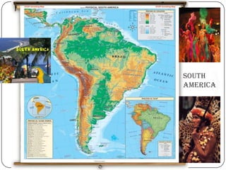
2. Introduction.
Area -17,840,000 km2.
Population -387,489,196
(2011, 5th).
Pop. Density - 21.4 per km2 .
Countries -12 (Independent
Countries).
3. South American Countries.
12 independent countries—
Argentina, Bolivia, Brazil, Chile, Colombia, Ecuador, Guyana, Paraguay, Peru, Suri
name, Uruguay, and Venezuela—and French Guiana, which is an overseas region
of France. The South American countries that border the Caribbean Sea—
Colombia, Venezuela, Guyana, Suriname, and French Guiana—are also known as
Caribbean South America.
4. Know The Region.
Colonized by Spain & Portugal initially.
Revolutionary movements and right-wing military
dictatorships became common after World War
II, but since the 1980s, a wave of democratization
came through the continent, and democratic rule is
widespread now.
International indebtedness turned into a severe
problem in late 1980s .
The last twenty years have seen an increased push
towards regional integration, with the creation of
uniquely South American institutions such as the
Andean Community, Mercosur and Unasur.
5. Some More Facts….
During the first decade of the 21st century, South
American governments have drifted to the political
left, with socialist leaders being elected.
Despite the move to the left, South America for the
most part still embraces free market policies, and it is
taking an active path toward greater continental
integration.
Recently, an intergovernmental entity has been
formed which aims to merge the two existing customs
unions: Mercosur and the Andean Community, thus
forming the third-largest trade bloc in the world.[ This
new political organization known as Union of South
American Nations seeks to establish free movement
of people, economic development, a common
defense policy and the elimination of tariffs.
6. Patterns of Cultural Coherence and Diversity.
The Decline of Native Populations
There were many complex civilizations in South America
before Europeans arrived
1500: population of 47 million; 1650: 5 million
Causes: disease, warfare, forced labor, collapse of food
production system
Indian Survival
Largest populations of Indians today:
Guatemala, Ecuador, Peru, and Bolivia
Indians trying to secure recognized territory in their
countries
Comarca: loosely defined territory similar to a province or
homeland, where Indians have political and resource
control
6
7. Patterns of Cultural Coherence and Diversity (cont.)
Patterns of Ethnicity and Culture
Racial caste system under Spanish: blanco
(European), mestizo (mixed ancestry), indio (Indian), negro
(African)
Languages
About 2/3 Spanish speakers, 1/3 Portuguese speakers
Indigenous languages in central Andes and Guatemala
Blended Religions
90% Roman Catholic
El Salvador, Uruguay have sizeable Protestant
populations
Syncretic religions: blending of different beliefs
Allows animist practices to be included in Christian
worship
Catholicism and African religions, with
Brazil’s carnival as an example
7
8. Economy
South America has a rapidly developing economy.
With many industries and a flourishing trade and
import-export market, it is fast becoming a
economy with considerable size.
The biggest individual economies in South
America are those of Brazil, Argentina, Colombia
and Chile.
Major industries in South America are
agriculture, which encompasses a vital part of the
economy, and other important industries like
fishing, natural resources, handicrafts etc. Trade is
also an important part of the economy.
South America relies heavily on the exporting of
goods and natural resources.
The economic gap between the rich and poor in
9.
10. Trade Blocks
The biggest trade block in South America is
Mercosur (or Mercosul in
Portuguese), comprising
Argentina, Brazil, Paraguay, Uruguay and
Venezuela. Associate states include
Bolivia, Chile, Colombia, Ecuador and Peru. The
second-biggest trade bloc is the Andean
Community of Nations comprising
Bolivia, Colombia, Ecuador, Peru, Venezuela and
as of 2006 Chile. The Union of South American
Nations is expected to merge both trade blocks.
11. MERCOSUR
COUNTRIES-
Argentina, Brazil, Parag
uay and Uruguay
FOUNDED- 1991 by the
Treaty of Asunción
PURPOSE-promote
free trade and the fluid
movement of
goods, people, and
currency
LANGUAGES-
Portuguese, Guaraní, a
nd Spanish
CURRENCY-Gaucho
12. MERCOSUR(Contd.)
Mercosur origins trace back to 1985 when
Presidents Raúl Alfonsín of Argentina and José
Sarney of Brazil signed the Argentina-Brazil
Integration and Economics Cooperation Program
or PICE.
Venezuela signed a membership agreement on
17 June 2006.
The founding of the Mercosur Parliament was
agreed at the December 2004 presidential
summit. It should have 18 representatives from
each country by 2010, regardless of population.
Bolivia, Chile, Colombia, Ecuador and Peru
currently have associate member status
13. MERCOSUR(Contd.)
OBJECTIVES-
The free transit of produced goods, services and factors
among the member states
Fixing of a common external tariff (CET) and adopting of a
common trade policy with regard to nonmember states
Coordination of macroeconomic and sectorial policies of
member states relating to foreign
trade, agriculture, industry, taxes, monetary
system, exchange and
capital, services, customs, transport and communications
The commitment by the member states to make the
necessary adjustments to their laws in pertinent areas to
allow for the strengthening of the integration process
Mercosur initially targeted free-trade zones, then customs
unification, and finally a common market.
14. MERCOSUR(Contd.)
STRUCTURE OF THE ORGANIZATION
- Common Market Council.
The Council is the highest-level agency of Mercosur with authority to
conduct its policy. The Council is composed of the Ministers of Foreign
Affairs and the Economy (or the equivalent) of all five countries. Council
members shall meet whenever necessary, but at least once a year.
Council decisions shall be made by consensus, with representation of all
member states.
- Common Market Group
The Group is the executive body of Mercosur, and is coordinated by
the Ministries of Foreign Affairs of the member states.
Composition:
(i) the Ministry of Foreign Affairs;
(ii) the Ministry of Economy, or the equivalent (from industry, foreign
affairs and/or economic coordination); and
(iii) the Central Bank.
15. MERCOSUR(Contd.)
Work Subgroups
the Work Subgroups are the following: Commercial Matters;
Customs Matters; Technical Standards; Tax and Monetary Policies
Relating to Trade; Land Transport; Sea Transport; Industrial and
Technology Policies; Agricultural Policy; Energy Policy; Coordination
of Macroeconomic Policies; and Labor, Employment and Social
Security Matters
Joint Parliamentary Committee
The Committee will have both an advisory and decision-making
nature, with powers to submit proposals as well. The Committee will
be composed of a maximum of 64 acting parliamentary members, 16
per member state, and an equal number of alternates, appointed by
the Congress to which they pertain, and with a term of office of at
least two years.
Trade Commission:
The Trade Commission will assist the Mercosur executive
body, always striving to apply the instruments of common trade
policy agreed to by the member states for operation of the customs
unification.
Looks after the Trade agreements with other countries or
international entities Elimination and harmonization of tariff
16. Andean Community of Nations
COUNTRIES-
Bolivia, Colombia, Ecuador and
Peru
The original Andean Pact was
founded in 1969 by
Bolivia, Chile, Colombia, Ecuador
and Peru. In 1973, the pact
gained its sixth
member, Venezuela. In
1976, however, its membership
was again reduced to five when
Chile withdrew. Venezuela
announced its withdrawal in
2006, reducing the Andean
Community to four member
states.
FOUNDED- Andean Pact until
1996 and came into existence
with the signing of the Cartagena
Agreement in 1969
LANGUAGES- Spanish
(Community's working
language), Quechua, Aymara, 34
17. Andean Community of
Nations(Contd.)
OBJECTIVES
Promote the Member Countries’ balanced and harmonious
development under equitable conditions through
integration and economic and social cooperation;
Step-up their growth and job creation;
Facilitate their participation in the regional integration
process, with a view to the gradual formation of a Latin
American common market
Reduce the Member Countries’ external vulnerability and
improve their position in the international economy;
Reinforce subregional solidarity and reduce differences in
development among the Member Countries; and
Seek the continuing improvement of the living standards of
the subregion’s inhabitants.
18. ANDEAN INTEGRATION SYSTEM
(SAI)
The Andean Integration System (SAI) is a set of
bodies and institutions forming part of the Andean
Community, designed to allow for an effective
coordination between them in order to maximize
subregional Andean integration, promote their
external projection and strengthen the actions related
to the integration process.
The SAI comprises the following bodies and
institutions: 1.Andean Presidential Council;2.
Andean Council of Foreign Affairs Ministers;3. the
Andean Community Commission;4. Andean
Community General Secretariat; 5.Andean
Community Court of Justice; 6.Andean
Parliament; Business Consultative Council;
7.Labor Consultative Council; Andean
Development Corporation; 8.Latin American
Reserve Fund.
19. Union of South American Nations
An intergovernmental
union integrating two
existing customs
unions: Mercosul and
the Andean Community
of Nations (CAN), as
part of a continuing
process of South
American integration.
It is modeled on the
European Union.
Membership: 12
members and 2
observers(Mexico and
Panama).
20. Structure of the UNASUR
At the moment, the provisional structure of the UNASUR is as follows:
-A permanent Secretariat is to be established in Quito, Ecuador.
-The presidents of the member nations will have an annual
meeting, which will have the superior political mandate.
-The Presidency Pro Tempore, is exercised for a one-year period
on a pro tempore basis by one of the heads of state of each UNASUR
Member State, the succession following alphabetical order.
-The ministers of foreign affairs of each country will meet once
every six months. They will formulate concrete proposals of action and of
executive decision.
-Sectorial Ministers' meeting will be called upon by the presidents.
The meetings will be developed according to Mercosur's and CAN's
mechanisms.
-On 9 December 2005, a special commission was established in
charge of advancing the process of South American Integration. It consists
of 12 members, whose function is to elaborate proposals that will help the
process of integration between the South American nations.
-An Executive Commission, which was created by the II CSN
21. UNASUR-Current work in
progress.
Single market
One of the initiatives of UNASUR is the
creation of a single market, beginning with the
elimination of tariffs for non-sensitive products by
2014, and for sensitive products by 2019.
Economic development
The Bank of the South will finance economic
development projects to improve local
competitiveness and to promote the scientific
and technological development of the member
states.The founding chart affirms that the Bank
will promote projects in "stable and equal"
manner and priorities will be pointed to reinforce
South American integration, to reduce
22. UNASUR-Current work in
progress(Contd..)
Defence policy
The South American Defence Council (CDS) was proposed by
Venezuela and Brazil to serve as a mechanism for regional
security, promoting military co-operation and regional defence. It is a
cooperative security arrangement, enhancing multilateral military
cooperation, promoting confidence and security building measures and
fostering defense industry exchange.
Infrastructure cooperation
There is an Initiative for Infrastructure Integration of South America
(IIRSA) underway, which has received the support of the Inter-American
Development Bank and the Andean Development Corporation.
Free movement of peoples
Visits by South American citizens to any South American independent
country of up to 90 days only require an identification document issued by
the traveler's country. Mercosur, Bolivia and Chile established that their
territories together form an "area of free residence with the right to work" to
all its citizens, with no additional requirements other than nationality
23. India-South America Trade
Relationship.
A framework agreement was signed between India and MERCOSUR
on June 17, 2003. The plan of this framework agreement is to
generate circumstances and mechanisms for discussions in the first
stage, by granting mutual tariff preferences and in the second
stage, to bargain a free trade area between the two parties in
conventionality with the rules of the World Trade Organization. As a
follow up to the framework agreement, a preferential trade
agreement was signed in New Delhi on January 25, 2004. The plan of
this Preferential Trade Agreement is to increase and reinforce the
accessible relations between MERCOSUR and India and endorse the
growth of trade by yielding mutual fixed tariff preferences with the
ultimate objective of creating a free trade area between the parties.
Brazil-India trade increased from $1 billion in 2003 to $4.7 billion in
2008.
The Agreement on Fixed Tariff Preferences between India and
Mercosur, which came into force in 2009 and covers import-export
of 452 products, will gradually be expanded to include new products
with special taxation.
It is expected that the trade volume between Mercosur and India
should reach around $17 billion in 2012 and $30 billion in 2030.