Pieber, Simone: Simulations of atmospheric CO₂ and δ¹³C-CO₂ compared to real-time observations at the high altitude station Jungfraujoch
•
0 likes•19 views

This document describes simulations of atmospheric CO2 and stable carbon isotope ratios (δ13C-CO2) compared to observations at Jungfraujoch, Switzerland. It presents the measurement technique using quantum cascade laser absorption spectroscopy. It then summarizes results on the decadal trend and seasonality in observations, simulations of regional CO2 contributions from different processes and fuel types, and simulations of δ13C-CO2 values compared to observations.

Recommended
More Related Content
What's hot
What's hot (20)
Similar to Pieber, Simone: Simulations of atmospheric CO₂ and δ¹³C-CO₂ compared to real-time observations at the high altitude station Jungfraujoch
Similar to Pieber, Simone: Simulations of atmospheric CO₂ and δ¹³C-CO₂ compared to real-time observations at the high altitude station Jungfraujoch (20)
More from Integrated Carbon Observation System (ICOS)
More from Integrated Carbon Observation System (ICOS) (20)
Recently uploaded
Recently uploaded (20)
Pieber, Simone: Simulations of atmospheric CO₂ and δ¹³C-CO₂ compared to real-time observations at the high altitude station Jungfraujoch
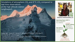
- 1. Simone.Pieber@empa.ch – Laboratory for Air Pollution and Environmental Technology ICOS Science Conference 2020 Page 1Page 1Simone.Pieber@empa.ch – Laboratory for Air Pollution and Environmental Technology ICOS Science Conference 2020 Pieber SM1, Tuzson B1, Henne S1, Karstens U2, Gerbig C3, Brunner D1, Steinbacher M1 , Emmenegger L1 1 Laboratory for Air Pollution and Environmental Technology at Empa, Dübendorf, Switzerland 2 ICOS Carbon Portal, Lund University, Sweden 3 Max Planck Institute, Jena, Germany SIMONE.PIEBER@EMPA.CH MSc Environmental & Analytical Chemistry PhD @ETH-Z Atmospheric & Aerosol Chemistry currently: PostDoc @Empa Atmospheric Trace Gases & Stable Isotopes Upcoming Project (2021+) GHGs & Pollutants from Wildfires © Konsta Punkka Simulations of atmospheric CO2 and δ13C-CO2 compared to real-time observations at the high altitude station Jungfraujoch
- 2. Simone.Pieber@empa.ch – Laboratory for Air Pollution and Environmental Technology ICOS Science Conference 2020 Page 2Page 2Simone.Pieber@empa.ch – Laboratory for Air Pollution and Environmental Technology ICOS Science Conference 2020 Jungfraujoch, Swiss Alps, 3580 m asl European and Global Background Air Quality Monitoring since around 1970 ICOS Class 1 © Konsta Punkka CO2
- 3. Simone.Pieber@empa.ch – Laboratory for Air Pollution and Environmental Technology ICOS Science Conference 2020 Page 3Page 3Simone.Pieber@empa.ch – Laboratory for Air Pollution and Environmental Technology ICOS Science Conference 2020 12 C 16 O 18 O 13 C 16 O2 Lukas Emmenegger (Empa) with QCLAS optical unit in 2008 Natural Abundance 12C16O2 98.42 % 13C16O2 1.100 % 12C16O18O 0.395 % δ Notation 𝛿𝛿13C = ( [13C/12C]𝑆𝑆𝑆𝑆𝑆𝑆𝑆𝑆𝑆𝑆𝑆𝑆 [13C/12C]𝑅𝑅𝑅𝑅𝑅𝑅𝑅𝑅𝑅𝑅𝑅𝑅𝑅𝑅𝑅𝑅𝑅𝑅 − 1) 𝛿𝛿18O = ( [18O/16O]𝑆𝑆𝑆𝑆𝑆𝑆𝑆𝑆𝑆𝑆𝑆𝑆 [18O/16O]𝑅𝑅𝑅𝑅𝑅𝑅𝑅𝑅𝑅𝑅𝑅𝑅𝑅𝑅𝑅𝑅𝑅𝑅 − 1) continuous/in-situ QCLAS 2008 © Konsta Punkka STABLE ISOTOPES OF CO2: Element with equal numbers of protons but different numbers of neutrons . Isotopes differ in relative atomic mass but not chemical properties. Chemical, physical and biological processes (may) fractionate between different isotopes. Ideal tracers of environmental processes. CO2 Jungfraujoch, Swiss Alps, 3580 m asl European and Global Background Air Quality Monitoring since around 1970 ICOS Class 1
- 4. Simone.Pieber@empa.ch – Laboratory for Air Pollution and Environmental Technology ICOS Science Conference 2020 Page 4Page 4Simone.Pieber@empa.ch – Laboratory for Air Pollution and Environmental Technology ICOS Science Conference 2020 Outline Methods: (a) Quantum Cascade Laser Absorption Spectroscopy (b) Atmospheric simulations I. Decadal trend & seasonality of CO2, δ13C and δ18O observations II. CO2 simulations at JFJ: contributions per process, plant and fuel type III. δ13C-CO2 simulation estimates vs. observations
- 5. Simone.Pieber@empa.ch – Laboratory for Air Pollution and Environmental Technology ICOS Science Conference 2020 Page 5Page 5Simone.Pieber@empa.ch – Laboratory for Air Pollution and Environmental Technology ICOS Science Conference 2020 Measurement Technique References: Nelson et al., 2008 Tuzson et al., 2008ab Sturm et al., 2013 © Béla Tuzson QCLAS Empa, B. Tuzson & L. Emmenegger Transmittance,% Wavenumber, cm-1 1.0 0.9 0.8 2310.0 2310.2 2310.4 4.3 µm pulsed QC laser, scans 3 spectral lines, frequency near 2310 cm-1 2 multi-pass cells (sample and reference) spectral ratio method, external calibration
- 6. Simone.Pieber@empa.ch – Laboratory for Air Pollution and Environmental Technology ICOS Science Conference 2020 Page 6Page 6Simone.Pieber@empa.ch – Laboratory for Air Pollution and Environmental Technology ICOS Science Conference 2020 STILT-ECMWF (Carbon Portal) FLEXPART- COSMO (Empa) Atmospheric Transport Simulations Meteorological Input - ECMWF (25x25 km) - COSMO7 (7x7 km) Lagrangian Particle Dispersion Model (LPDM), 3h time-resolution - STILT Carbon Portal, U. Karstens / MPI-BGC, C. Gerbig https://stilt.icos-cp.eu/worker/ - FLEXPART Empa, S. Henne/D. Brunner Boundary conditions - Jena CarboScope for CO2 MPI-BGC, C. Rödenbeck - Scaling Factors for δ13C-CO2 NOAA) Regional fluxes - Anthropogenic: EDGAR v4.3 for 14 fuel types JRC, G. Janssens-Maenhout - Biosphere: VPRM v3/v2020 for 7 PFTs MPI-BGC, C. Gerbig Source δ13C - Literature-based assumptions Example: LPDM Domain Boundary
- 7. Simone.Pieber@empa.ch – Laboratory for Air Pollution and Environmental Technology ICOS Science Conference 2020 Page 7Page 7Simone.Pieber@empa.ch – Laboratory for Air Pollution and Environmental Technology ICOS Science Conference 2020© Konsta Punkka RESULTS I. II. III.
- 8. Simone.Pieber@empa.ch – Laboratory for Air Pollution and Environmental Technology ICOS Science Conference 2020 Page 8Page 8Simone.Pieber@empa.ch – Laboratory for Air Pollution and Environmental Technology ICOS Science Conference 2020 I. Decadal Trend & Seasonalityδ18O,‰CO2,ppmδ13C,‰ 380400420-2-1012 2010 2012 2014 2016 2018 -10.0-9.0-8.0-7.0 -0.50.00.5 J F M A M J J A S O N D -0.4-0.20.00.20.4-505 January to December, mean±1SD (2009-2017) August April June highly time-resolved measurments (10-min), from 2009 to 2017 +2.31 ppm yr-1 -0.03 ‰ yr-1 +0.00 ‰ yr-1 2010 2012 2014 2016 2018 J F M A M J J A S O N D Δ=9.9 ppm Δ=0.47 ‰ Δ=0.73 ‰
- 9. Simone.Pieber@empa.ch – Laboratory for Air Pollution and Environmental Technology ICOS Science Conference 2020 Page 9Page 9Simone.Pieber@empa.ch – Laboratory for Air Pollution and Environmental Technology ICOS Science Conference 2020 II. «Regional signal»: shorter-term CO2 variationsΔCO2,ppm CO2 event characterisation: (1) Intensity and frequency of events (2) Geographic origin of events (3) Source composition of events a) Model simulations b) Isotopic composition A B C D E F G H I 5101520253035 ΔCO2,ppm Local Pollution ΔCO2>5 ppm (Oct-Apr) as function of residence time clusters North- West Central Europe West South- West South -East East (2) Intensity & Geographic Origin(1) Intensity & Frequency ΔCO2 frequency Oct-Apr, days yr-1 avg. min-max >5 ppm 35 18-53 >10 ppm 9.7 2-21 >15 ppm 4.2 1-6
- 10. Simone.Pieber@empa.ch – Laboratory for Air Pollution and Environmental Technology ICOS Science Conference 2020 Page 10Page 10Simone.Pieber@empa.ch – Laboratory for Air Pollution and Environmental Technology ICOS Science Conference 2020 II. CO2 simulation vs. observation 420 400 380 CO2,ppm 420 400 380 FLEXPART-COSMO STILT-ECMWF OBS SIM+BG BG REGIONAL SIGNAL TOTAL SIGNAL = REGIONAL SIGNAL + BACKGROUND
- 11. Simone.Pieber@empa.ch – Laboratory for Air Pollution and Environmental Technology ICOS Science Conference 2020 Page 11Page 11Simone.Pieber@empa.ch – Laboratory for Air Pollution and Environmental Technology ICOS Science Conference 2020 II. CO2 simulation vs. observation 420 400 380 CO2,ppm 420 400 380 FLEXPART-COSMO STILT-ECMWF OBS SIM+BG BG TOTAL SIGNAL = REGIONAL SIGNAL + BACKGROUND 0.0 0.5 1.0 1.5 slope 0.0 0.2 0.4 0.6 0.8 1.0 r2 0.0 1.0 2.0 3.0 RMSE 0.0 0.5 1.0 1.5 slope 0.0 0.1 0.2 0.3 0.4 0.5 r2 a b c a-2 b-2 STILT- ECMWF FLEXPART- COSMO STILT- ECMWF FLEXPART- COSMO all year DJF-winter MAM-spring JJA-summer SON-autumn REGIONAL SIGNAL TOTAL SIGNAL 1.8 – 2.8 ppm
- 12. Simone.Pieber@empa.ch – Laboratory for Air Pollution and Environmental Technology ICOS Science Conference 2020 Page 12Page 12Simone.Pieber@empa.ch – Laboratory for Air Pollution and Environmental Technology ICOS Science Conference 2020 -5.5 -4.5 -3.5 -2.5 -1.5 -0.5 0.5 1.5 2.5 1 2 3 4 5 6 7 8 9 10 11 12 regionalCO2,ppm month of year II. CO2 simulation vs. observation REGIONAL SIGNAL 0.0 0.5 1.0 1.5 1 2 3 4 5 6 7 8 9 10 11 12 anthropoenic,ppm month of year 0 1 2 3 4 5 1 2 3 4 5 6 7 8 9 10 11 12 respiration,ppm -10 -8 -6 -4 -2 0 1 2 3 4 5 6 7 8 9 10 11 12 gee,ppm month of year ANTHROPOGENIC CO2 RESPIRATION «UPTAKE» May - SeptJan - Apr Oct - Dec
- 13. Simone.Pieber@empa.ch – Laboratory for Air Pollution and Environmental Technology ICOS Science Conference 2020 Page 13Page 13Simone.Pieber@empa.ch – Laboratory for Air Pollution and Environmental Technology ICOS Science Conference 2020 Example for 2013, https://stilt.icos-cp.eu/viewer/ CO2.fuel CO2.net.biosphere CO2.biospheric.respiration («RESP») CO2.photosynthetic.uptake («GEE») CO2.cement CO2,ppm GROSS RESPIRATION: primarily cropland and mixed forests II. CO2 simulations by fuel and process Light & Heavy OIL GAS COAL BIOMASS RelativeContribution 2009-2017 CEMENT
- 14. Simone.Pieber@empa.ch – Laboratory for Air Pollution and Environmental Technology ICOS Science Conference 2020 Page 14Page 14Simone.Pieber@empa.ch – Laboratory for Air Pollution and Environmental Technology ICOS Science Conference 2020 fuel formation biomass is strongly depleted in 13C compared to atmosphere Ecosystem Respiration (CO2 Source) Photosynthetic Uptake (CO2 Sink) fossil and biogenic fueles are consequently also strongly depleted in 13C compared to atmosphere LAND OCEANS ATMOSPHERE Fuel burning (CO2 Emission) using diverse fuels and processes (natural wildfires) e.g., δ13C ~ -22‰ C3-Plants, dry δ13C ~ -37‰ C3-Plants, tropical δ13C ~ -12‰ C4-Plants Respiration CO2 Fuel Burning CO2 e.g., δ13C ~ -24‰ coal δ13C ~ -27‰ oil δ13C ~ -44‰ gas Atmospheric CO2 e.g., free troposphere or marine boundary layer δ13C= ~ -8.5‰ III. δ13C simulation
- 15. Simone.Pieber@empa.ch – Laboratory for Air Pollution and Environmental Technology ICOS Science Conference 2020 Page 15Page 15Simone.Pieber@empa.ch – Laboratory for Air Pollution and Environmental Technology ICOS Science Conference 2020 III. δ13C simulation δ13Ces Literature- compilation FOSSIL FUELS OIL (liquid) -26.5‰ OIL_heavy OIL_light OIL_mixed GAS (gas) -44.0‰ GAS_natural GAS_derived COAL (solid) -24.1‰ COAL_hard COAL_brown COAL_peat BIOGENIC FUELS BIOMASS (solid) -24.1‰ BIOGAS (gas) -60.0‰ BIOFUEL (liquid) -26.5‰ OTHER SOURCES OTHER_solid (solid) -25‰ CEMENT -0‰ ECOSYSTEM (w/seasonality) BIOSPHERE RESPIRATION -27 to -22‰ PHOTOSYNTHETIC UPTAKE -25 to -20‰ δmixed_es_sim = Σ(|fes_sim, i| × δes, i) / Σ(|fes_sim, i|) FLEXPART-COSMO CO2 subcategories (in ppm) Literature based δ13Cemissions_signature in ‰ δambient_sim = [(fb×δb) + (Σ(fes_sim, i)×δmixed_es_sim)] / [fb+Σ(fes_sim, i)] Background assumptions for the model (CO2 and δ13C) δmixed_es_sim References: Vardag et al., 2015 Vardag et al., 2016
- 16. Simone.Pieber@empa.ch – Laboratory for Air Pollution and Environmental Technology ICOS Science Conference 2020 Page 16Page 16Simone.Pieber@empa.ch – Laboratory for Air Pollution and Environmental Technology ICOS Science Conference 2020 III. δ13Cambient simulation vs. observation 400410420-9.5-9.0-8.5 Background Pollution CO2,ppmδ13C,‰ 15th October 2015 00:00 08:00 16:00 00:00 -9.6-9.2-8.8-8. 00:00 04:00 08:00 12:00 16:00 20:00 00:00 d13C sim w / GPP d13C sim w /o GPP d13C obs δambient,‰ observation simulation (v1) simulation (v2) a b g f d i hc je FLEXPART-COSMO winter, DJF spring, MAM summer, JJA autumn, SON STILT-ECMWF all year regional CO2 observation regionalCO2simulation δambient,‰
- 17. Simone.Pieber@empa.ch – Laboratory for Air Pollution and Environmental Technology ICOS Science Conference 2020 Page 17Page 17Simone.Pieber@empa.ch – Laboratory for Air Pollution and Environmental Technology ICOS Science Conference 2020 Summary THANK YOU! Nine years of highly time-resolved QCLAS measurements of atmospheric CO2, δ13C and δ18O at the high alpine measurement site Jungfraujoch. Nine years of CO2 simulations with 2 models: FLEXPART-COSMO and STILT-ECMWF. Simulated regional CO2 components at Jungfraujoch dominated by biosphere respiration and uptake. Best agreement of CO2 and δ13C-CO2 simulation with observations is achieved in spring, autumn and winter, larger discrepancies in summer. Acknowledgements HFSJG – High Altitude Research Stations Jungfraujoch & Gornergrat Swiss National Science Foundation (ICOS-CH Phase 2) and Swiss Federal Office for the Environment (BAFU) for supporting the Swiss RINGO activities Atmosphere Open-Access Journal for my post-doctoral travel award 2020 SIMONE.PIEBER@EMPA.CH
- 18. Simone.Pieber@empa.ch – Laboratory for Air Pollution and Environmental Technology ICOS Science Conference 2020 Page 18 QCLAS for in-situ stable CO2 isotope measurements Nelson DD, et al. 2008: https://link.springer.com/article/10.1007/s00340-007-2894-1 Tuzson B, et al, 2008a: https://link.springer.com/article/10.1007/s00340-008-3085-4 Tuzson B, et al, 2008b: https://doi.org/10.1016/j.infrared.2007.05.006 Tuzson B, et al, 2011: https://doi.org/10.5194/acp-11-1685-2011 Sturm P, et al, 2013: https://doi.org/10.5194/amt-6-1659-2013 STILT-ECMWF Lin JC, et al, 2003: https://doi.org/10.1029/2002JD003161 Trusilova K, et al, 2010: https://doi.org/10.5194/acp-10-3205-2010 Vardag SN, et al, 2016: https://doi.org/10.5194/bg-13-4237-2016 Kountouris P, et al, 2018: https://doi.org/10.5194/acp-18-3047-2018 FLEXPART-COSMO Stohl A, et al, 2005: https://doi.org/10.5194/acp-5-2461-2005 Baldauf, M et al, 2011: https://doi.org/10.1175/MWR-D-10-05013.1 Henne S, et al, 2016: https://doi.org/10.5194/acp-16-3683-2016 Pisso I, et al, 2019: https://doi.org/10.5194/gmd-12-4955-2019 Anthropogenic emissions inventory (EDGAR) Janssens-Maenhout G, et al, 2019: https://doi.org/10.5194/essd-11-959-2019 Vegetation Photosynthesis and Respiration Model (VPRM) Mahadevan P, et al, 2008: https://doi.org/10.1029/2006GB002735 Gerbig Ch., online at: https://www.bgc-jena.mpg.de/bgc-systems/index.php/Staff/GerbigChristoph CarboScope Rödenbeck Ch., online at: https://www.bgc-jena.mpg.de/CarboScope/ δ13C-CO2 source signatures e.g., CDIAC, online at https://cdiac.ess-dive.lbl.gov/ Vardag SN, et al, 2015 : https://doi.org/10.5194/acp-15-12705-2015 Vardag SN, et al, 2016. : https://doi.org/10.5194/bg-13-4237-2016 BIBLIOGRAPHY
- 19. Simone.Pieber@empa.ch – Laboratory for Air Pollution and Environmental Technology ICOS Science Conference 2020 Page 19Page 19Simone.Pieber@empa.ch – Laboratory for Air Pollution and Environmental Technology ICOS Science Conference 2020 BONUS SLIDES
- 20. Simone.Pieber@empa.ch – Laboratory for Air Pollution and Environmental Technology ICOS Science Conference 2020 Page 20Page 20Simone.Pieber@empa.ch – Laboratory for Air Pollution and Environmental Technology ICOS Science Conference 2020 Keeling plot intercept method 0.4-0.2-0.8400410420-9.5-9.0-8.5 Background Pollution δ18O,‰CO2,ppmδ13C,‰ 15th October 2015 00:00 08:00 16:00 00:00 δ18O Signature at 1/CO2=0: -20.0 (±1.7) ‰ Pollution Background 1/CO2, ppm-1 0.00235 0.00245 0.00255 δ18O,‰ -0.5-1.0-1.50.00.5 Pollution Background δ13C Signature at 1/CO2=0: -39.3 (±1.3) ‰ 1/CO2, ppm-1 0.00235 0.00245 0.00255 δ13C,‰ -9.5-8.5-8.0-10.0-9.0
- 21. Simone.Pieber@empa.ch – Laboratory for Air Pollution and Environmental Technology ICOS Science Conference 2020 Page 21Page 21Simone.Pieber@empa.ch – Laboratory for Air Pollution and Environmental Technology ICOS Science Conference 2020 CO2,ppm -10.0-9.0-8.0-7.0 δ13C,‰ -2-1012 2010 2012 2014 2016 2018 δ18O,‰ 380400420 Time Series GC-FID and IRMS data provided by MPI-BGC Jena (A. Jordan, H. Moossen, M. Rothe)
- 22. Simone.Pieber@empa.ch – Laboratory for Air Pollution and Environmental Technology ICOS Science Conference 2020 Page 22Page 22Simone.Pieber@empa.ch – Laboratory for Air Pollution and Environmental Technology ICOS Science Conference 2020 380 390 400 410 420 38039040041042 -9.5 -9.0 -8.5 -8.0 -7.5 -9.5-9.0-8.5-8.0-7. -1.0 -0.5 0.0 0.5 1.0 -1.0-0.50.00.51.0 δ18O-CO2,‰CO2, ppm QCLAS δ13C-CO2, ‰ GC-FID IRMS n=151 slope (se) = 0.98 (0.01) n=141 slope (se) = 1.01 (0.11) n=138 slope (se) = 1.00 (0.04) IRMS Comparison QCLAS vs IRMS and GC-FID, 2009-2017 GC-FID and IRMS data provided by MPI-BGC Jena (A. Jordan, H. Moossen, M. Rothe)
- 23. Simone.Pieber@empa.ch – Laboratory for Air Pollution and Environmental Technology ICOS Science Conference 2020 Page 23Page 23Simone.Pieber@empa.ch – Laboratory for Air Pollution and Environmental Technology ICOS Science Conference 2020 1. perform calculations: STILT on-demand calculator https://stilt.icos-cp.eu/worker/ 2. view calculations: STILT results visualisation: https://stilt.icos-cp.eu/viewer/ 3. analyze simulations output: contact CP (U. Karstens) & use Jupyter Notebooks Atmospheric Transport Simulations at CP JFJ
- 24. Simone.Pieber@empa.ch – Laboratory for Air Pollution and Environmental Technology ICOS Science Conference 2020 Page 24Page 24Simone.Pieber@empa.ch – Laboratory for Air Pollution and Environmental Technology ICOS Science Conference 2020 FLEXPART-COSMO Empa, w/ inventory input from ICOS Carbon Portal & JRC Transport Simulation w/ FLEXPART-COSMO • FLEXPART (Lagrangian Particle Dispersion Model) • COSMO (Numerical weather forecast model) • CO2 Emissions and Transport Simulation Emissions • EDGARv4.3fuel (Emission Database from JRC) fuel categories: fossil: oil, coal, gas biogenic: biofuels, biomass, biogas others: peat- and wild-fires, waste-as-industry-fuel • VPRM (Vegetation Photosynthesis and Respiration Model) output: biospheric respiration photosynthetic uptake • Literature based δ13C emissions signatures Residence Time Clustering
- 25. Simone.Pieber@empa.ch – Laboratory for Air Pollution and Environmental Technology ICOS Science Conference 2020 Page 25Page 25Simone.Pieber@empa.ch – Laboratory for Air Pollution and Environmental Technology ICOS Science Conference 2020 E2 E4 E3 E1 STILT-ECMWF FLEXPART-ECMWF FLEXPART-COSMO FLEXPART-ECMWF.cropped 0.0 0.2 0.4 0.6 0.8 1.0 1.2 1.4 1.6 1.8 (i) E1 vs E2 (ii) E3 vs E2 (iii) E1 vs E4 (iv) E3 vs E4 slope 7PFT cropland mixed forest 5PFT a b c 0.0 0.2 0.4 0.6 0.8 1.0 (i) E1 vs E2 (ii) E3 vs E2 (iii) E1 vs E4 (iv) E3 vs E4 r2 0.0 0.2 0.4 0.6 0.8 1.0 1.2 (i) E1 vs E2 (ii) E3 vs E2 (iii) E1 vs E4 (iv) E3 vs E4 BRMS
- 26. Simone.Pieber@empa.ch – Laboratory for Air Pollution and Environmental Technology ICOS Science Conference 2020 Page 26Page 26Simone.Pieber@empa.ch – Laboratory for Air Pollution and Environmental Technology ICOS Science Conference 2020 STILT- ECMWF FLEXPART- ECMWF FLEXPART- COSMO FLEXPART- ECMWF. cropped E1 E2 E3 E4 winter summer winter summer winter summer winter summer all year all year all year all year syntheticCO2(ppm) time in UTC+1 summer