Download to read offline
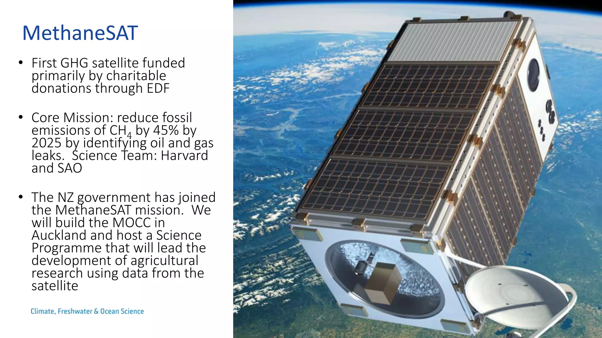
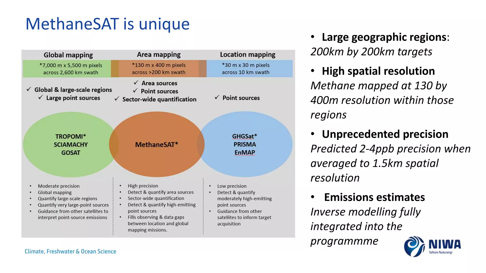
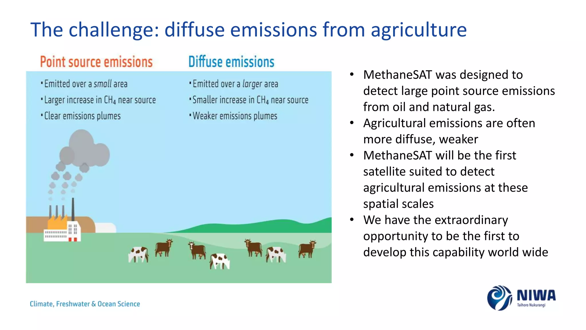
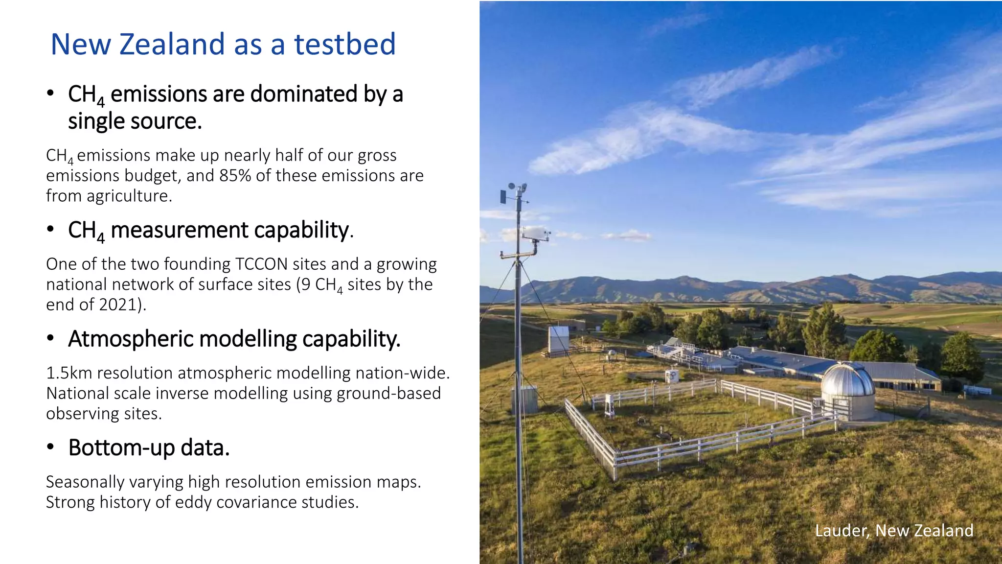
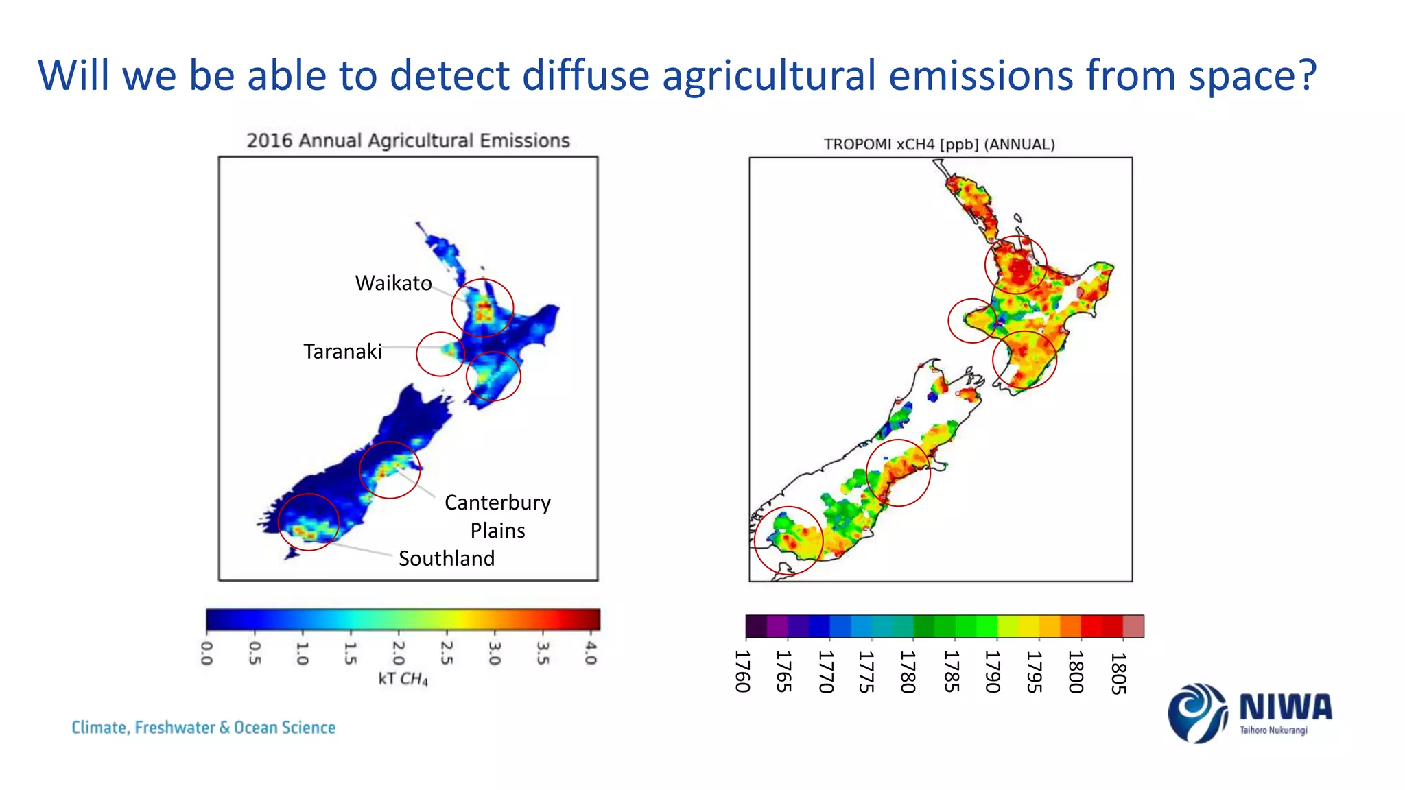
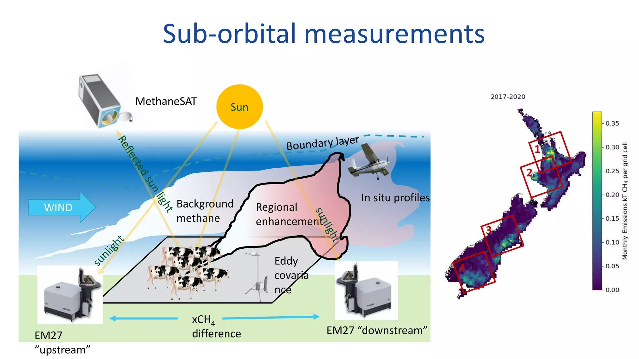
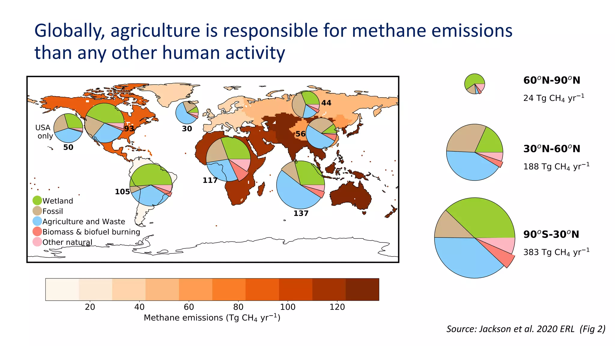
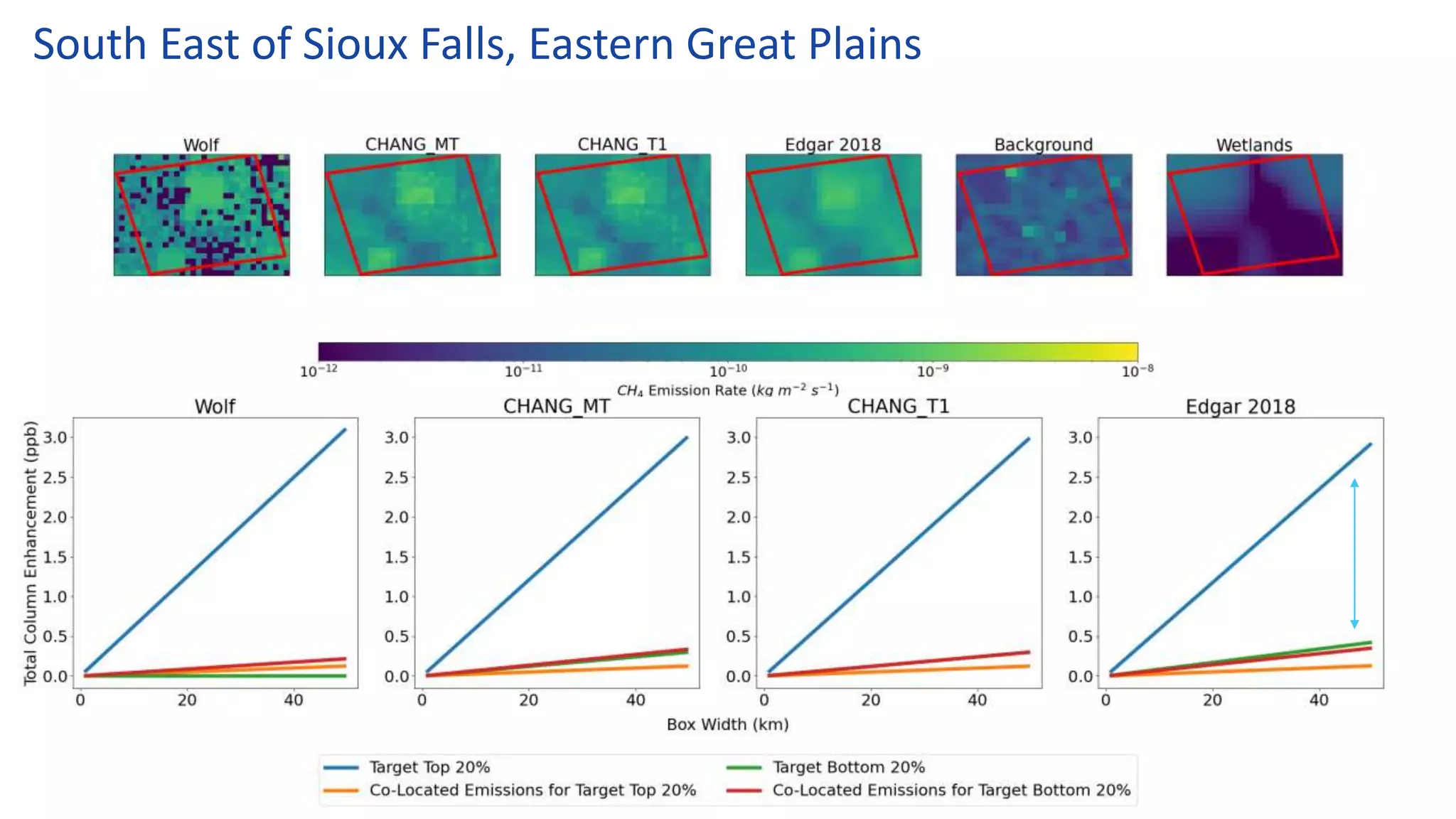
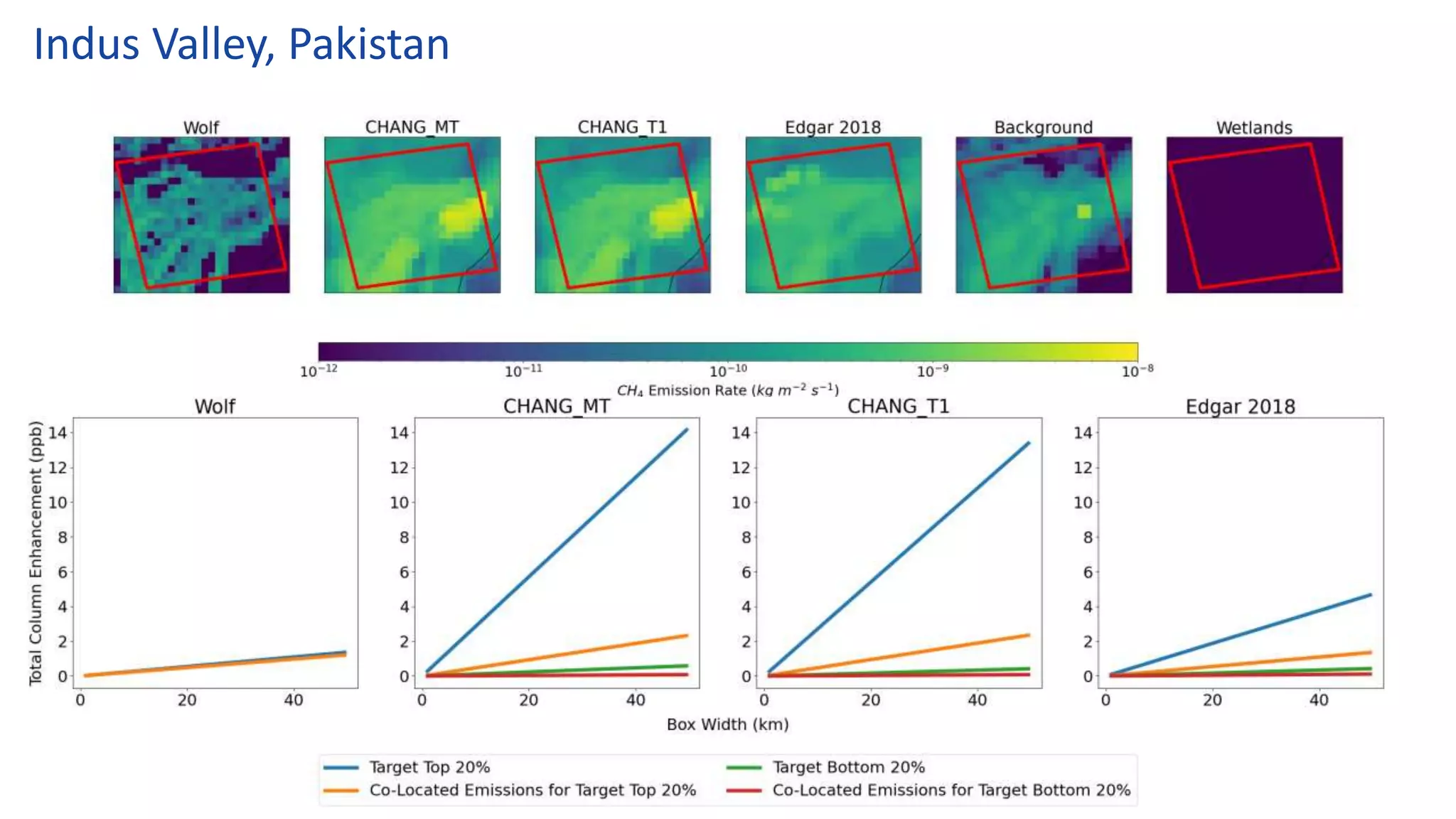

MethaneSAT is a new satellite funded by donations that aims to measure methane emissions globally to help reduce them. Its high resolution could allow detecting diffuse agricultural emissions for the first time from space. New Zealand's researchers will help develop methods to measure agricultural methane using MethaneSAT data. They will test these methods with measurement campaigns in New Zealand, where agriculture is a major source of methane emissions. The goal is to then apply this capability to measure methane from livestock and rice farming globally.