OpenStreetMap (en Zzzinc)
•Download as ODP, PDF•
3 likes•1,007 views

OpenStreetMap is a collaborative project to create a free editable map of the world. It uses geospatial data that is collected through contributions and made available under an open license. The project relies on various open source tools and technologies to render and serve map tiles, edit and upload geospatial data, and develop software applications using OpenStreetMap data. Contributors frequently gather at "mapping parties" to collect geospatial data using GPS devices and add or update information in OpenStreetMap.

More Related Content
Similar to OpenStreetMap (en Zzzinc)
Similar to OpenStreetMap (en Zzzinc) (20)
More from Iván Sánchez Ortega
Recently uploaded
Recently uploaded (20)
OpenStreetMap (en Zzzinc)
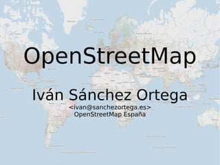
- 1. OpenStreetMap Iván Sánchez Ortega <ivan@sanchezortega.es> OpenStreetMap España
- 9. 1/4: El porqué de OSM
- 10. Platón
- 12. Mundo de las ideas
- 13. Alegoría de la caverna
- 15. Platón Mapas
- 16. Platón Mapas web
- 18. “Están sacando los mapas del cajón”
- 19. “Puedo ver mapas gratis”
- 20. “Puedo usar mapas gratis”
- 21. “Puedo hacer aplicaciones con sus mapas”
- 23. “A pessimist is an optimist with experience.” -- François Roland Truffaut
- 26. “El estilo es feo y no lo puedo cambiar”
- 27. “La API no me deja hacer X”
- 29. Licencia
- 30. Puedo hacer aplicaciones con sus mapas... ... bajo sus condiciones
- 32. Sólo si nos dices quién eres
- 33. Sólo si pongo publicidad en tu web
- 34. Sólo si lo programas en X lenguaje
- 35. Sólo si sopla viento de levante y es jueves
- 36. Conclusión:
- 40. ¡Queremos datos!
- 41. ¡Queremos todos los datos para hacer lo que sea !
- 42. (para que quede claro)
- 43. ¡Queremos todos los datos para hacer lo que sea !
- 44. No lo digo sólo yo...
- 46. Schuyler Erie
- 52. Tim-Berners Lee
- 59. v = = = -> -> -> {{taxobox |name = Pleurodema borellii |status = LC |status_system = IUCN3.1 |regnum = [[Animalia]] |phylum = [[Chordata]] |classis = [[Amphibia]] }} '''''Pleurodema borellii''''' is a species of [[frog]] in the [[Leptodactylidae]] family. <node id="206358572" lat="37.3905641" lon="-5.9882308" timestamp="2009-02-20T17:16:48+00:00"/> <way id="22744006" visible="true" timestamp="2008-10-31T13:50:26+00:00"> <nd ref="206358593"/> <nd ref="206358594"/> <nd ref="206358595"/> <nd ref="206358596"/> <tag k="highway" v="residential"/> static int read_fw (struct usb_dev_handle *dev, char *filename, long off) { int fd, len, req, llen, res, ret = -1; unsigned char data[4], rdata[1024], *ptr;
- 60. v<
- 61. 2/4: La tecnología de OSM
- 62. Mapnik renderer (tile.osm.org) tiles@home (osmarender) www.osm.org website map editing software PostgreSQL backend Planet dump , Planet diffs PostGIS OpenLayers (“slippy map”) Mapnik style- sheets API 0.6 Mapnik + mod_tile mod_tile cache osm2pgsql osmosis Potlatch JOSM import scripts Geodata GPX traces, photos & notes WMS services Yahoo! imagery map tiles etcetera etcetera [email_address] server MySQL [email_address] clients Merkaator etcetera XAPI Mapping parties (the fun stuff)
- 63. Mapnik renderer (tile.osm.org) tiles@home (osmarender) www.osm.org website map editing software PostgreSQL backend Planet dump , Planet diffs PostGIS OpenLayers (“slippy map”) Mapnik style- sheets API 0.6 Mapnik + mod_tile mod_tile cache osm2pgsql osmosis Potlatch JOSM import scripts Geodata GPX traces, photos & notes WMS services Yahoo! imagery map tiles etcetera etcetera [email_address] server MySQL [email_address] clients Merkaator etcetera XAPI Mapping parties (the fun stuff)
- 66. Mapnik renderer (tile.osm.org) tiles@home (osmarender) www.osm.org website map editing software PostgreSQL backend Planet dump , Planet diffs PostGIS OpenLayers (“slippy map”) Mapnik style- sheets API 0.6 Mapnik + mod_tile mod_tile cache osm2pgsql osmosis Potlatch JOSM import scripts Geodata GPX traces, photos & notes WMS services Yahoo! imagery map tiles etcetera etcetera [email_address] server MySQL [email_address] clients Merkaator etcetera XAPI Mapping parties (the fun stuff)
- 68. Mapnik renderer (tile.osm.org) tiles@home (osmarender) www.osm.org website map editing software PostgreSQL backend Planet dump , Planet diffs PostGIS OpenLayers (“slippy map”) Mapnik style- sheets API 0.6 Mapnik + mod_tile mod_tile cache osm2pgsql osmosis Potlatch JOSM import scripts Geodata GPX traces, photos & notes WMS services Yahoo! imagery map tiles etcetera etcetera [email_address] server MySQL [email_address] clients Merkaator etcetera XAPI Mapping parties (the fun stuff)
- 70. <node id='30894545' lat='41.9797918' lon='2.8201551'> <tag k='place' v='town' /> <tag k='name' v='Girona' /> <tag k='name:es' v='Gerona' /> <tag k='is_in' v='Geronès, Girona, Catalonia, Spain, EU' /> <tag k='population' v='92186' /> <tag k='source:population' v='BOE REAL DECRETO 1683/2007, de 14 de diciembre' /> </node> Nodo Par de coordenadas, y etiquetas
- 71. <way id='23151177'> <nd ref='250101455' /> <nd ref='250101457' /> .... <nd ref='250671038' /> <nd ref='250671042' /> <tag k='created_by' v='JOSM' /> <tag k='highway' v='road' /> <tag k='name' v='Carrer de Industria' /> </way> Way Conjunto ordenado de nodos, y etiquetas
- 72. <relation id='48044'> <member type='way' ref='1216' role='' /> [...] <member type='way' ref='3047850' role='' /> <member type='way' ref='3047851' role='' /> <tag k='ref' v='E 15' /> <tag k='route' v='road' /> <tag k='type' v='route' /> <tag k='int_ref' v='E 15' /> </relation> Relación Conjunto de otros nodos, ways y/o relaciones con roles, y etiquetas
- 73. <tag k='highway' v='residential' /> <tag k='junction' v='roundabout' /> <tag k='barrier' v='bollard' /> <tag k='oneway' v='yes' /> <tag k='landuse' v='military' /> <tag k='place' v='town' /> <tag k='name' v='Carrer de Industria' /> <tag k='population' v='92186' /> <tag k='ref' v='E 15' /> Etiqueta Par clave-valor arbitrario (Aunque la mayoría se usa por consenso)
- 76. Descargar un way (por ID)
- 77. Descargar una relación (por ID)
- 78. Descargar todos los datos de un área
- 79. Subir nuevos elementos (nodo/way/rel)
- 81. (etc)
- 82. Mapnik renderer (tile.osm.org) tiles@home (osmarender) www.osm.org website map editing software PostgreSQL backend Planet dump , Planet diffs PostGIS OpenLayers (“slippy map”) Mapnik style- sheets API 0.6 Mapnik + mod_tile mod_tile cache osm2pgsql osmosis Potlatch JOSM import scripts Geodata GPX traces, photos & notes WMS services Yahoo! imagery map tiles etcetera etcetera [email_address] server MySQL [email_address] clients Merkaator etcetera XAPI Mapping parties (the fun stuff)
- 84. Mapnik renderer (tile.osm.org) tiles@home (osmarender) www.osm.org website map editing software PostgreSQL backend Planet dump , Planet diffs PostGIS OpenLayers (“slippy map”) Mapnik style- sheets API 0.6 Mapnik + mod_tile mod_tile cache osm2pgsql osmosis Potlatch JOSM import scripts Geodata GPX traces, photos & notes WMS services Yahoo! imagery map tiles etcetera etcetera [email_address] server MySQL [email_address] clients Merkaator etcetera XAPI Mapping parties (the fun stuff)
- 87. Mapnik renderer (tile.osm.org) tiles@home (osmarender) www.osm.org website map editing software PostgreSQL backend Planet dump , Planet diffs PostGIS OpenLayers (“slippy map”) Mapnik style- sheets API 0.6 Mapnik + mod_tile mod_tile cache osm2pgsql osmosis Potlatch JOSM import scripts Geodata GPX traces, photos & notes WMS services Yahoo! imagery map tiles etcetera etcetera [email_address] server MySQL [email_address] clients Merkaator etcetera XAPI Mapping parties (the fun stuff)
- 88. Mapping Parties
- 89. Mapping Parties = Frikis + GPS + cerveza
- 96. Mapnik renderer (tile.osm.org) tiles@home (osmarender) www.osm.org website map editing software PostgreSQL backend Planet dump , Planet diffs PostGIS OpenLayers (“slippy map”) Mapnik style- sheets API 0.6 Mapnik + mod_tile mod_tile cache osm2pgsql osmosis Potlatch JOSM import scripts Geodata GPX traces, photos & notes WMS services Yahoo! imagery map tiles etcetera etcetera [email_address] server MySQL [email_address] clients Merkaator etcetera XAPI Mapping parties (the fun stuff)
- 98. Planet dump: .osm.bz2 (cada miércoles) Planet diffs: .osmc.gz (cada día/hora/minuto)
- 99. Mapnik renderer (tile.osm.org) tiles@home (osmarender) www.osm.org website map editing software PostgreSQL backend Planet dump , Planet diffs PostGIS OpenLayers (“slippy map”) Mapnik style- sheets API 0.6 Mapnik + mod_tile mod_tile cache osm2pgsql osmosis Potlatch JOSM import scripts Geodata GPX traces, photos & notes WMS services Yahoo! imagery map tiles etcetera etcetera [email_address] server MySQL [email_address] clients Merkaator etcetera XAPI Mapping parties (the fun stuff)
- 102. Mapnik renderer (tile.osm.org) tiles@home (osmarender) www.osm.org website map editing software PostgreSQL backend Planet dump , Planet diffs PostGIS OpenLayers (“slippy map”) Mapnik style- sheets API 0.6 Mapnik + mod_tile mod_tile cache osm2pgsql osmosis Potlatch JOSM import scripts Geodata GPX traces, photos & notes WMS services Yahoo! imagery map tiles etcetera etcetera [email_address] server MySQL [email_address] clients Merkaator etcetera XAPI Mapping parties (the fun stuff)
- 104. Mapnik renderer (tile.osm.org) tiles@home (osmarender) www.osm.org website map editing software PostgreSQL backend Planet dump , Planet diffs PostGIS OpenLayers (“slippy map”) Mapnik style- sheets API 0.6 Mapnik + mod_tile mod_tile cache osm2pgsql osmosis Potlatch JOSM import scripts Geodata GPX traces, photos & notes WMS services Yahoo! imagery map tiles etcetera etcetera [email_address] server MySQL [email_address] clients Merkaator etcetera XAPI Mapping parties (the fun stuff)
- 108. (z=0, x=0, y=0)
- 110. (z=1, x=0, y=0) (z=1, x=1, y=0) (z=1, x=0, y=1) (z=1, x=1, y=1)
- 112. Mapnik renderer (tile.osm.org) tiles@home (osmarender) www.osm.org website map editing software PostgreSQL backend Planet dump , Planet diffs PostGIS OpenLayers (“slippy map”) Mapnik style- sheets API 0.6 Mapnik + mod_tile mod_tile cache osm2pgsql osmosis Potlatch JOSM import scripts Geodata GPX traces, photos & notes WMS services Yahoo! imagery map tiles etcetera etcetera [email_address] server MySQL [email_address] clients Merkaator etcetera XAPI Mapping parties (the fun stuff)
- 114. Mapnik renderer (tile.osm.org) tiles@home (osmarender) www.osm.org website map editing software PostgreSQL backend Planet dump , Planet diffs PostGIS OpenLayers (“slippy map”) Mapnik style- sheets API 0.6 Mapnik + mod_tile mod_tile cache osm2pgsql osmosis Potlatch JOSM import scripts Geodata GPX traces, photos & notes WMS services Yahoo! imagery map tiles etcetera etcetera [email_address] server MySQL [email_address] clients Merkaator etcetera XAPI Mapping parties (the fun stuff)
- 115. Mapnik renderer (tile.osm.org) tiles@home (osmarender) www.osm.org website map editing software PostgreSQL backend Planet dump , Planet diffs PostGIS OpenLayers (“slippy map”) Mapnik style- sheets API 0.6 Mapnik + mod_tile mod_tile cache osm2pgsql osmosis Potlatch JOSM import scripts Geodata GPX traces, photos & notes WMS services Yahoo! imagery map tiles etcetera etcetera [email_address] server MySQL [email_address] clients Merkaator etcetera XAPI Mapping parties (the fun stuff)
- 116. 3/4: Cosas que se hacen con OSM
- 120. TopOSM
- 133. Trafficman (Android)
- 136. trackmyjourney
- 137. GpsMID
- 141. X- Plane
- 143. OSMlive
- 144. MapAnalyst
- 145. OpenStreetBugs
- 161. CENSURADO
- 171. Layar
- 175. 4/4: Lugares interesantes
- 179. (This slide intentionally left blank)
- 191. West Bank Mappers
- 192. (Vídeo ITOworld “a year of edits”)
- 193. ¿?