Downloaded 78 times

![REFERENCES
• Barthelmie, R.J., 1993, Prospects for Offshore Wind Energy, Wind Engineering, 17, 2, 86-89.
• Ladenburg, J., Dubgaard, A., Preferences of coastal zone users regarding the siting of
offshore wind farms, Ocean & Coastal Management, 52 (2009) 233-242.
• Offshore Wind Resource Assessment of the Gulf of Thailand J. Waewsak1, M. Landry2 and
Y. Gagnon2
• Nikolaos, N., 2004. Deep water offshore wind technologies. A thesis submitted for the
degree of Master in Science In Energy Systems and the Environment. University of
Strathclyde. Department of Mechanical Engineering September 2004. Available at:
www.esru.strath.ac.uk/Documents/ MSc_2004/nikolaos.pdf [Accessed 26 March 2009].
• IEA, 2005. Offshore Wind Experiences. International Energy Agency, Brussels.](https://image.slidesharecdn.com/offshorewindresourceassessment-150801065648-lva1-app6892/85/Offshore-wind-resource-assessment-40-320.jpg)

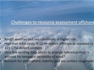
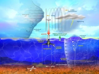
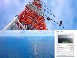
The document details the assessment of offshore wind resources, emphasizing advantages like higher wind speeds and larger potential farm sizes, while also noting the higher costs compared to onshore wind farms. It outlines necessary metocean data for design considerations, challenges such as rough weather, and the importance of accurate modeling for wind shear and turbulence. The document further explores India's offshore wind potential, infrastructure requirements, and the experience of other countries in developing offshore wind energy projects.


![Power system planning & operation [eceg 4410]](https://cdn.slidesharecdn.com/ss_thumbnails/powersystemplanningoperationeceg-4410-130607134359-phpapp01-thumbnail.jpg?width=640&height=640&fit=bounds)