
Download to read offline


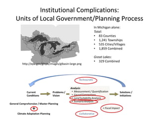
The document discusses the development of land use regulations and infrastructure policies to manage the Great Lakes shoreland area, supported by a grant from relevant governmental organizations. It outlines the project's focus on infrastructure, coastal community economies, and habitat, emphasizing the need for regulatory and non-regulatory responses to variable lake levels. Additionally, it highlights the importance of addressing broader regulatory reforms and the transferability of these issues to other Great Lakes settings.


