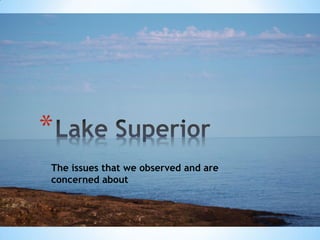
Lake superior areas of concern
•
1 like•298 views
Presentation on Lake Superior issues based on observations of our Full Circle Superior walk around the lake.
Report
Share
Report
Share

Recommended
Seasonal variation of physicochemical parameters of water and sediments from ...
This document summarizes a study on the seasonal variation of physicochemical parameters in the water and sediments of Iko River in Nigeria. Key findings include:
- Salinity, chloride, and cation levels in the river water exceeded WHO limits, indicating saline water intrusion from the nearby Atlantic Ocean.
- Sediments were predominantly medium to fine sand, containing over 200mg/kg of total hydrocarbons.
- Pollution indices calculated for wet and dry seasons showed some pollution, particularly in the dry season due to lower dilution.
- Most parameters measured, including dissolved oxygen, were within WHO guidelines for surface waters supporting the study's aim to monitor pollution levels.
Lakes and Ocean
The document discusses different types of lakes and oceans. It describes five types of lakes: tectonic, volcanic, glacier, salty, and artificial lakes. Tectonic lakes are formed by earth's crust movement, volcanic lakes occur near volcanic activity, and glacier lakes result from glacial scouring. Salty lakes have limited freshwater supply. The document also lists three lakes in Bukidnon: Lake Napalit, Lake Pinamaloy, and Lake Apo. Oceans are defined as large bodies of salt water covering most of Earth. Ocean water movement is driven by wind and modified by coriolis effect, as well as upwelling, downwelling, and tidal forces caused by the moon and
Greater Vancouver Local Environment Geography
Greater Vancouver is a region located in southwest British Columbia that includes cities like Vancouver, Surrey, and Richmond. It has a temperate climate with warm, dry summers and mild, wet winters. The region lies within a temperate rainforest biome and Pacific Maritime ecozone. Common trees include Douglas fir, western red cedar, and western hemlock. Soils are predominantly orthic humo-ferric podzol and orthic humic gleysol. Agriculture is an important industry in the region, with over 2,800 family-run farms generating $789 million annually, though agricultural land faces development pressures.
Lakes
Lakes are inland bodies of fresh water formed in depressions on the land surface. They are found all over the world but are most common in high latitude and mountainous regions. Lakes form through processes such as glacial erosion and deposition, shifts in the Earth's crust, volcanic activity, and landslides. Lakes stratify into layers based on water temperature and density. In temperate lakes, seasonal changes cause the layers to mix, replenishing oxygen levels. Lakes support a variety of plant and animal life adapted to different depths and oxygen conditions. Human activities can negatively impact lakes through pollution, development, and other disturbances.
Fresh Water Notes (Ch 11)Andie
The document discusses the Earth's freshwater resources. It notes that only 3% of the Earth's water is freshwater, with 97% being saltwater. Of the 3% freshwater, 76% is locked up in ice sheets and glaciers, while 23% is underground. The water cycle, which is powered by the sun, moves water between bodies of water, land, living things, and the atmosphere through evaporation, condensation, and precipitation. Fresh surface water exists in rivers, lakes, and wetlands. Underground, freshwater is stored in aquifers, which are porous rock that can be accessed through wells. The document also discusses freshwater pollution and the importance of water conservation.
Lake
This document discusses stratification in lakes. It describes how lakes are vertically divided into three layers - the epilimnion on top which is mixed by wind, the metalimnion in the middle where temperature drops rapidly, and the hypolimnion on the bottom which remains cool and unaffected by wind. It also explains how the stability of this stratification depends on the energy required to uniformly mix the layers, and discusses differences between eutrophic and oligotrophic lakes in terms of biomass, diversity, and water quality.
Chapter 6.2 - Lakes and Reservoirs
The document discusses the formation and ecology of lakes. It describes how lakes form naturally from glacial scouring, sediment deposits from glaciers, and crustal movements. Lakes can also form after volcanic eruptions when rain fills the collapsed caldera. Human-made lakes occur when dams are constructed. The document then covers the different life found in shallow and deep zones of lakes, how sediment and nutrients affect lakes over time leading to eutrophication, and the seasonal turnover of nutrients in deep lakes.
Lakes and reservoir
Lakes and ponds are bodies of relatively still, or standing, water.
Although no definite size distinguishes a lake from a pond, lakes generally are larger and deeper than ponds.
Water enters lakes from streams and rivers, by rain or snow falling on or near the depression, and from groundwater.
HOW PHYSICOCHEMICAL PARAMETERS OF WATER CHANGE WITH DISTANCE IN A LAKE: CASE ...
Pollution resulting from unsustainable agricultural and urbanization activities in the Ruhezamyenda and Bunyonyi catchments are threatening lake Bunyonyi. These have led to high chemical oxygen demand (COD), electrical conductivity, turbidity, pH, iron (II) concentration and low dissolved oxygen (DO5). In this study we have investigated the how COD, turbidity, pH, concentration of iron, total suspended solids, total nutrients and DO5 of water changed with distance in lake. Water sampled from different distances in the lake filtered using Whatman paper at ambient temperatures was tested for COD, electrical conductivity, turbidity, total nutrients, iron, hardness and DO5. COD was 20.8±.0.03mg/L to 16 ± 0.03mg/L; total hardness was 16.5±0.2 mg/L to 18.6 ± 0.3 mg/L total nitrate was 103.5± 2 mg/L to 88 ± 3 mg/L; total phosphate was 100.8 ±.2.5 to 87± 3 mg/L; high TSS values from 3.4 ± 0.1 mg/L to 2.5 ± 0.1 mg/L showed contamination of water. As pH decreased from 8.3 ± 0.03 to 7.6 ± 0.04 revealed that bases were getting removed. The turbidity dropped from 25.7 ± 0.3 NTU to 20 ± 2 NTU due settling down of sediments. Iron (II) concentration ranging from 1.1± 0.1 to 0.8± 0.1 mgL-1 . Dissolved oxygen decreased from 7.9 ±0.3 mg/L to 4.8 ± 0.2 mg/L indicating surface water can uphold life of aquatic organisms. Total hardness ranged from 0.22± 0.05 to 0.19± 0.05 mg/L Electrical conductivity was high and ranged from 130± 5 to 150± 5 µS/cm indicating presence of electrolytes. Lake Bunyonyi water is not greatly polluted, but requires to be safe guarded against poor unsustainable agricultural practices, sewage draining from towns, schools and hotels in nearby settlements.
Yamini
This document discusses various types of environmental pollution including water pollution, soil pollution, noise pollution, and acid rain. It outlines the causes and effects of each type of pollution as well as potential measures to address them. Water pollution refers to contamination of water bodies caused by human activities and can harm aquatic plants and organisms. Soil pollution occurs when chemicals enter the soil and alter its natural environment. Noise pollution increases the risk of health issues like headaches and heart problems. Acid rain was discovered in 1971 and forms when emissions from vehicles and industry combine with water vapor in the atmosphere. It damages ecosystems and releases toxic chemicals like aluminum into water and soil.
July 30-130-CIG-Joseph Sweeney
The document discusses removing legacy impairments from mill dams to improve water quality. It summarizes a presentation on using lidar data to identify erosion hotspots and prioritize restoration efforts. Lidar analysis of a breached dam site found 30,000 cubic meters of erosion in 3 years, releasing about 13,000 tons of sediment annually. Over 1,000 mill dams have been identified in historic county maps, with many still impairing streams. Restoration projects can significantly reduce sediment, nutrients, and increase water storage capacity.
STRATIFICATION OF FRESHWATER ECOSYSTEMSTRATIFICATION OF FRESHWATER ECOSYSTEM
This document provides an overview of freshwater ecosystems, including types, characteristics, and flora and fauna. It discusses the two main types of freshwater ecosystems: lentic systems, which include ponds and lakes, and lotic systems, which include streams and rivers. For ponds and lakes, it outlines the different zones from littoral to profundal and describes characteristics like temperature variation. It also discusses general characteristics of streams and rivers like temperature differences between headwaters and mouths. Finally, it provides some examples of common plant and animal life found in freshwater ecosystems.
Low flows issues
Low flows refer to reduced water levels in rivers caused by drought conditions, dam construction which regulates downstream flow, and over abstraction of water. This can lead to water shortages, deteriorating water quality, increased sedimentation, and ecological changes.
Two case studies are examined: the Colorado River in the US, where growing demand from agriculture and urban areas has left little flow reaching the Gulf of Mexico and increased salinity; and the River Wylye in Wiltshire, UK, where groundwater abstraction reduced typical summer flows by 50-60%, harming fish stocks and increasing algal growth.
Causes of the River Derwent Flood, 2009
The 2009 flood in the River Derwent, Cumbria was caused by both physical and human factors. Physically, warm moist air dropped over 400mm of rain in 24 hours, breaking the UK record, which was too much for the ground to absorb. This caused overflow that rapidly filled streams and rivers like the Derwent and Cocker. At their confluence, high discharges combined to cause flooding in Workington. Human factors were urbanization increasing impermeable surfaces and faster water flow into rivers, and blocked or inadequate sewers in towns like Cockermouth and Keswick that caused flooding.
APES Ch. 8, part 2
This document summarizes key aspects of freshwater ecosystems, including different types of standing and flowing water. It describes the various zones that exist in lakes and ponds based on depth and sunlight exposure. These zones include the littoral, limnetic, profundal and benthic zones. The document also discusses different types of lakes based on their nutrient levels, such as oligotrophic, eutrophic, and mesotrophic lakes. Additionally, it outlines the three zones that generally make up watersheds - the source, transition, and floodplain zones - and notes some characteristics of each. Finally, the document lists several human impacts that threaten freshwater ecosystems like dams, levees, pollution, and loss of
Aquatic biomes
There are two main types of aquatic biomes: freshwater and marine. Freshwater biomes include lakes, ponds, rivers, streams, and wetlands. Marine biomes include oceans, coral reefs, and estuaries. Both freshwater and marine biomes can be physically stratified based on variables like light, temperature, and nutrients. Primary productivity in aquatic ecosystems is limited by available light, nutrients, and temperature, with nutrients often being the limiting factor for growth.
Lakes of the world
Studying the geomorphology of lakes is a part of earth science studies. The presence of a lake, in any region, greatly influences the life of the people, living adjacent to it. There are several kinds of lakes in the world. Their characteristics are explained in this module.
Carlisle floods jan 2005
Carlisle, located on the flood plain of the River Eden where three rivers meet, has a long history of flooding. The January 2005 floods were caused by exceptionally heavy rainfall that saturated the ground and led to rapid rising of river levels. Over 2,700 homes were affected, three people died, and costs were estimated at over £400 million. Impacts included homes flooded to the second floor, emergency services stations flooded, and difficulties with evacuation efforts. Responses involved immediate evacuation of people and relief centers, as well as long-term plans for flood management schemes and engineering solutions.
Lake restoration
I designed a restoration and conservation plan to improve the island habitat and native special at the Cedar Creek/Lake Muhlenberg region of Allentown, PA. My research proposal was part of an interdisciplinary Sustainability Studies course where each student selected a real environmental issue facing the City of Allentown in which the Parks and Recreation Department desired to improve. My proposal was actually picked up, funded by, and put into action by various partners who contributed their expertise to the project, such as the Edge of the Woods Nursery in Allentown, a nonprofit organization Friends of the Allentown Parks, and the Lehigh Valley Chapter of the National Audubon Society
Freshwater ecosystem
This document defines and describes different types of freshwater habitats. It identifies lentic habitats as calm standing water and lotic habitats as running water. Major freshwater habitats include lakes, ponds, rivers, streams, springs, and wetlands. The document also discusses the thermal stratification of lakes and classifies four types of lakes: oligotrophic, eutrophic, mesotrophic, and hypereutrophic.
Impact of dams on river
Dams provide benefits like water regulation and power generation but also have negative environmental impacts. They block sediment flow and change water quality, quantity, and temperature downstream. This disrupts the local river ecology and harms fish. Over 40,000 large dams have been constructed worldwide, altering circulation systems. Specific impacts include erosion, siltation of reservoirs, salinization of irrigation water, and disruption of natural cycles that aquatic plants and animals depend on. While dams provide irrigation and flood control, they also submerge land and wildlife habitats.
#5 - Comp Plan - Groundwater
This document discusses groundwater storage and flux in the Coon Creek Watershed District. It outlines the surficial geology including lake deposits and river terrace deposits. The generalized geology profiles from west to east and in the upper 120 feet are presented. Implications are discussed such as more available groundwater storage, more infiltration, difficulty maintaining surface water resources, and groundwater resources behaving differently. Expectations for management include increased irrigation demand, and increased recreational/aesthetic use concerns.
Categorisation of limnetic fisheries resources
This document categorizes and describes different types of limnetic (inland water body) fisheries resources. It discusses lacustrine (lake) systems, including zonation patterns in lakes and thermal stratification. It also covers rivers, cold water bodies, wetlands including flood plains, and threats/conservation efforts. Key points include descriptions of eutrophic, oligotrophic, and mesotrophic lakes; types of wetlands like swamps, marshes, bogs, and fens; fish diversity in different systems; and impacts of habitat loss.
stratification of water environments -
The document stratifies different aquatic biomes as follows:
1. Freshwater biomes include ponds, lakes, streams and rivers. Ponds and lakes are divided into littoral, limnetic and profundal zones. Streams and rivers have headwaters, middle sections and mouths.
2. Transitional waters between freshwater and saltwater include estuaries and wetlands. Wetlands are divided into mineral soil and organic soil types. Estuaries have four formation types.
3. Marine biomes include the intertidal zone, neritic zone, oceanic zone and benthic zone. The intertidal zone is the area between high and low tide lines with changing conditions
Marine biome
The document discusses the marine biome, including estuaries like Elkhorn Slough, coral reefs, oceans and ocean zones. It explores how the marine biome affects life on Earth through water, heat and oxygen. It also addresses issues facing the marine biome.
Aquatic biomes
This document summarizes the major water biomes on Earth. It notes that 75% of the Earth's surface is covered by water and that most of the biosphere consists of aquatic ecosystems. It then describes the main zones of both freshwater and saltwater environments, including photic and aphotic zones, benthic zones, categories of freshwater (rivers, lakes, wetlands), coastal wetlands, estuaries, and marine zones. It provides examples of characteristic organisms found in each biome.
Erosivity of rainfall
THIS PPT COVERS ABOUT EROSIVITY OF RAINFALL ,FACTORS AFFECTING EROSIVITY AND ESTIMATION OF EROSIVITY WHICH IS DONE BY 2 METHODS 1EI METHOD AND KE>25 METHOD.
History and future_of_como_park
The document provides a history of Como Park located in St. Paul, Minnesota. It details how the park was established in the 1870s through private funding to purchase 300 acres of former farmland. It describes some of the parks early features and additions over time, including the Japanese Garden in 1904 and Conservatory opening in 1915. The summary highlights more recent developments like the Education Resource Center opening in 2005 and corpse flower blooming in 2008. It concludes by providing sources for more information about Como Park and upcoming events.
History and future_of_como_park
The document provides a history of Como Park located in St. Paul, Minnesota. It details how the park was established in the 1870s through private funding to purchase 300 acres of former farmland. It describes some of the early additions to the park like the Japanese garden in 1904 and conservatory in 1915. The summary continues to discuss more recent developments such as the education center in 2005 and corpse flower bloom in 2008. It concludes by providing sources for more information on Como Park and its upcoming events.
The elders of the environment
This document discusses several influential environmentalists throughout history including John James Audubon, Henry David Thoreau, John Muir, Gifford Pinchot, John Burroughs, Ansel Adams, Aldo Leopold, Paul Ehrlich, Marjorie Stoneham, Edward Abbey, Dave Foreman, Sigurd Olson, Chico Mendes, and David Mech who helped create awareness about environmental issues and shape modern environmentalism.
More Related Content
What's hot
HOW PHYSICOCHEMICAL PARAMETERS OF WATER CHANGE WITH DISTANCE IN A LAKE: CASE ...
Pollution resulting from unsustainable agricultural and urbanization activities in the Ruhezamyenda and Bunyonyi catchments are threatening lake Bunyonyi. These have led to high chemical oxygen demand (COD), electrical conductivity, turbidity, pH, iron (II) concentration and low dissolved oxygen (DO5). In this study we have investigated the how COD, turbidity, pH, concentration of iron, total suspended solids, total nutrients and DO5 of water changed with distance in lake. Water sampled from different distances in the lake filtered using Whatman paper at ambient temperatures was tested for COD, electrical conductivity, turbidity, total nutrients, iron, hardness and DO5. COD was 20.8±.0.03mg/L to 16 ± 0.03mg/L; total hardness was 16.5±0.2 mg/L to 18.6 ± 0.3 mg/L total nitrate was 103.5± 2 mg/L to 88 ± 3 mg/L; total phosphate was 100.8 ±.2.5 to 87± 3 mg/L; high TSS values from 3.4 ± 0.1 mg/L to 2.5 ± 0.1 mg/L showed contamination of water. As pH decreased from 8.3 ± 0.03 to 7.6 ± 0.04 revealed that bases were getting removed. The turbidity dropped from 25.7 ± 0.3 NTU to 20 ± 2 NTU due settling down of sediments. Iron (II) concentration ranging from 1.1± 0.1 to 0.8± 0.1 mgL-1 . Dissolved oxygen decreased from 7.9 ±0.3 mg/L to 4.8 ± 0.2 mg/L indicating surface water can uphold life of aquatic organisms. Total hardness ranged from 0.22± 0.05 to 0.19± 0.05 mg/L Electrical conductivity was high and ranged from 130± 5 to 150± 5 µS/cm indicating presence of electrolytes. Lake Bunyonyi water is not greatly polluted, but requires to be safe guarded against poor unsustainable agricultural practices, sewage draining from towns, schools and hotels in nearby settlements.
Yamini
This document discusses various types of environmental pollution including water pollution, soil pollution, noise pollution, and acid rain. It outlines the causes and effects of each type of pollution as well as potential measures to address them. Water pollution refers to contamination of water bodies caused by human activities and can harm aquatic plants and organisms. Soil pollution occurs when chemicals enter the soil and alter its natural environment. Noise pollution increases the risk of health issues like headaches and heart problems. Acid rain was discovered in 1971 and forms when emissions from vehicles and industry combine with water vapor in the atmosphere. It damages ecosystems and releases toxic chemicals like aluminum into water and soil.
July 30-130-CIG-Joseph Sweeney
The document discusses removing legacy impairments from mill dams to improve water quality. It summarizes a presentation on using lidar data to identify erosion hotspots and prioritize restoration efforts. Lidar analysis of a breached dam site found 30,000 cubic meters of erosion in 3 years, releasing about 13,000 tons of sediment annually. Over 1,000 mill dams have been identified in historic county maps, with many still impairing streams. Restoration projects can significantly reduce sediment, nutrients, and increase water storage capacity.
STRATIFICATION OF FRESHWATER ECOSYSTEMSTRATIFICATION OF FRESHWATER ECOSYSTEM
This document provides an overview of freshwater ecosystems, including types, characteristics, and flora and fauna. It discusses the two main types of freshwater ecosystems: lentic systems, which include ponds and lakes, and lotic systems, which include streams and rivers. For ponds and lakes, it outlines the different zones from littoral to profundal and describes characteristics like temperature variation. It also discusses general characteristics of streams and rivers like temperature differences between headwaters and mouths. Finally, it provides some examples of common plant and animal life found in freshwater ecosystems.
Low flows issues
Low flows refer to reduced water levels in rivers caused by drought conditions, dam construction which regulates downstream flow, and over abstraction of water. This can lead to water shortages, deteriorating water quality, increased sedimentation, and ecological changes.
Two case studies are examined: the Colorado River in the US, where growing demand from agriculture and urban areas has left little flow reaching the Gulf of Mexico and increased salinity; and the River Wylye in Wiltshire, UK, where groundwater abstraction reduced typical summer flows by 50-60%, harming fish stocks and increasing algal growth.
Causes of the River Derwent Flood, 2009
The 2009 flood in the River Derwent, Cumbria was caused by both physical and human factors. Physically, warm moist air dropped over 400mm of rain in 24 hours, breaking the UK record, which was too much for the ground to absorb. This caused overflow that rapidly filled streams and rivers like the Derwent and Cocker. At their confluence, high discharges combined to cause flooding in Workington. Human factors were urbanization increasing impermeable surfaces and faster water flow into rivers, and blocked or inadequate sewers in towns like Cockermouth and Keswick that caused flooding.
APES Ch. 8, part 2
This document summarizes key aspects of freshwater ecosystems, including different types of standing and flowing water. It describes the various zones that exist in lakes and ponds based on depth and sunlight exposure. These zones include the littoral, limnetic, profundal and benthic zones. The document also discusses different types of lakes based on their nutrient levels, such as oligotrophic, eutrophic, and mesotrophic lakes. Additionally, it outlines the three zones that generally make up watersheds - the source, transition, and floodplain zones - and notes some characteristics of each. Finally, the document lists several human impacts that threaten freshwater ecosystems like dams, levees, pollution, and loss of
Aquatic biomes
There are two main types of aquatic biomes: freshwater and marine. Freshwater biomes include lakes, ponds, rivers, streams, and wetlands. Marine biomes include oceans, coral reefs, and estuaries. Both freshwater and marine biomes can be physically stratified based on variables like light, temperature, and nutrients. Primary productivity in aquatic ecosystems is limited by available light, nutrients, and temperature, with nutrients often being the limiting factor for growth.
Lakes of the world
Studying the geomorphology of lakes is a part of earth science studies. The presence of a lake, in any region, greatly influences the life of the people, living adjacent to it. There are several kinds of lakes in the world. Their characteristics are explained in this module.
Carlisle floods jan 2005
Carlisle, located on the flood plain of the River Eden where three rivers meet, has a long history of flooding. The January 2005 floods were caused by exceptionally heavy rainfall that saturated the ground and led to rapid rising of river levels. Over 2,700 homes were affected, three people died, and costs were estimated at over £400 million. Impacts included homes flooded to the second floor, emergency services stations flooded, and difficulties with evacuation efforts. Responses involved immediate evacuation of people and relief centers, as well as long-term plans for flood management schemes and engineering solutions.
Lake restoration
I designed a restoration and conservation plan to improve the island habitat and native special at the Cedar Creek/Lake Muhlenberg region of Allentown, PA. My research proposal was part of an interdisciplinary Sustainability Studies course where each student selected a real environmental issue facing the City of Allentown in which the Parks and Recreation Department desired to improve. My proposal was actually picked up, funded by, and put into action by various partners who contributed their expertise to the project, such as the Edge of the Woods Nursery in Allentown, a nonprofit organization Friends of the Allentown Parks, and the Lehigh Valley Chapter of the National Audubon Society
Freshwater ecosystem
This document defines and describes different types of freshwater habitats. It identifies lentic habitats as calm standing water and lotic habitats as running water. Major freshwater habitats include lakes, ponds, rivers, streams, springs, and wetlands. The document also discusses the thermal stratification of lakes and classifies four types of lakes: oligotrophic, eutrophic, mesotrophic, and hypereutrophic.
Impact of dams on river
Dams provide benefits like water regulation and power generation but also have negative environmental impacts. They block sediment flow and change water quality, quantity, and temperature downstream. This disrupts the local river ecology and harms fish. Over 40,000 large dams have been constructed worldwide, altering circulation systems. Specific impacts include erosion, siltation of reservoirs, salinization of irrigation water, and disruption of natural cycles that aquatic plants and animals depend on. While dams provide irrigation and flood control, they also submerge land and wildlife habitats.
#5 - Comp Plan - Groundwater
This document discusses groundwater storage and flux in the Coon Creek Watershed District. It outlines the surficial geology including lake deposits and river terrace deposits. The generalized geology profiles from west to east and in the upper 120 feet are presented. Implications are discussed such as more available groundwater storage, more infiltration, difficulty maintaining surface water resources, and groundwater resources behaving differently. Expectations for management include increased irrigation demand, and increased recreational/aesthetic use concerns.
Categorisation of limnetic fisheries resources
This document categorizes and describes different types of limnetic (inland water body) fisheries resources. It discusses lacustrine (lake) systems, including zonation patterns in lakes and thermal stratification. It also covers rivers, cold water bodies, wetlands including flood plains, and threats/conservation efforts. Key points include descriptions of eutrophic, oligotrophic, and mesotrophic lakes; types of wetlands like swamps, marshes, bogs, and fens; fish diversity in different systems; and impacts of habitat loss.
stratification of water environments -
The document stratifies different aquatic biomes as follows:
1. Freshwater biomes include ponds, lakes, streams and rivers. Ponds and lakes are divided into littoral, limnetic and profundal zones. Streams and rivers have headwaters, middle sections and mouths.
2. Transitional waters between freshwater and saltwater include estuaries and wetlands. Wetlands are divided into mineral soil and organic soil types. Estuaries have four formation types.
3. Marine biomes include the intertidal zone, neritic zone, oceanic zone and benthic zone. The intertidal zone is the area between high and low tide lines with changing conditions
Marine biome
The document discusses the marine biome, including estuaries like Elkhorn Slough, coral reefs, oceans and ocean zones. It explores how the marine biome affects life on Earth through water, heat and oxygen. It also addresses issues facing the marine biome.
Aquatic biomes
This document summarizes the major water biomes on Earth. It notes that 75% of the Earth's surface is covered by water and that most of the biosphere consists of aquatic ecosystems. It then describes the main zones of both freshwater and saltwater environments, including photic and aphotic zones, benthic zones, categories of freshwater (rivers, lakes, wetlands), coastal wetlands, estuaries, and marine zones. It provides examples of characteristic organisms found in each biome.
Erosivity of rainfall
THIS PPT COVERS ABOUT EROSIVITY OF RAINFALL ,FACTORS AFFECTING EROSIVITY AND ESTIMATION OF EROSIVITY WHICH IS DONE BY 2 METHODS 1EI METHOD AND KE>25 METHOD.
What's hot (19)
HOW PHYSICOCHEMICAL PARAMETERS OF WATER CHANGE WITH DISTANCE IN A LAKE: CASE ...
HOW PHYSICOCHEMICAL PARAMETERS OF WATER CHANGE WITH DISTANCE IN A LAKE: CASE ...
STRATIFICATION OF FRESHWATER ECOSYSTEMSTRATIFICATION OF FRESHWATER ECOSYSTEM
STRATIFICATION OF FRESHWATER ECOSYSTEMSTRATIFICATION OF FRESHWATER ECOSYSTEM
Viewers also liked
History and future_of_como_park
The document provides a history of Como Park located in St. Paul, Minnesota. It details how the park was established in the 1870s through private funding to purchase 300 acres of former farmland. It describes some of the parks early features and additions over time, including the Japanese Garden in 1904 and Conservatory opening in 1915. The summary highlights more recent developments like the Education Resource Center opening in 2005 and corpse flower blooming in 2008. It concludes by providing sources for more information about Como Park and upcoming events.
History and future_of_como_park
The document provides a history of Como Park located in St. Paul, Minnesota. It details how the park was established in the 1870s through private funding to purchase 300 acres of former farmland. It describes some of the early additions to the park like the Japanese garden in 1904 and conservatory in 1915. The summary continues to discuss more recent developments such as the education center in 2005 and corpse flower bloom in 2008. It concludes by providing sources for more information on Como Park and its upcoming events.
The elders of the environment
This document discusses several influential environmentalists throughout history including John James Audubon, Henry David Thoreau, John Muir, Gifford Pinchot, John Burroughs, Ansel Adams, Aldo Leopold, Paul Ehrlich, Marjorie Stoneham, Edward Abbey, Dave Foreman, Sigurd Olson, Chico Mendes, and David Mech who helped create awareness about environmental issues and shape modern environmentalism.
Natural history art of europe
Natural History art of Europe
- Pliny the Elder compiled his work "Natural History" in the 1st century CE, the largest and only surviving work from antiquity. He was killed in the eruption of Mount Vesuvius in 79 CE while studying it.
- In the 17th century, Robert Hooke made important early microscopic observations and developed "binomial nomenclature" for classifying organisms.
- William Curtis and John Curtis in the 18th-19th centuries were early British naturalists who studied and illustrated plants and insects indigenous to Britain.
Risk and the wilderness
Mike Link discusses the role of risk in wilderness experiences. He recalls conversations with his son about accepting risk as part of enjoying wilderness areas. While his son later died in a kayaking accident, Link believes risk is an inevitable and necessary part of experiencing wilderness. He argues that wilderness areas need to allow for getting lost and facing dangers in order to provide meaningful experiences that allow people to challenge themselves, discover independence, and respect life. Removing risk would remove important qualities that help people understand themselves and nature.
Izaak walton league of america
The Izaak Walton League of America was founded in 1922 and is named after Izaak Walton, author of The Compleat Angler. The organization's mission is to conserve natural resources like soil, forests, water, and promote public education around their enjoyment and sustainable use. The League works on conservation projects focused on agriculture, clean air, clean water, outdoor ethics, and sustainability education. Some of the Minnesota chapter's victories include establishing the Upper Mississippi National Wildlife Refuge and protecting wetlands and public lands.
Gaylord nelson
Gaylord Nelson was an American politician born in 1916 in Wisconsin who is best known for founding Earth Day. He served as a U.S. Senator from 1963 to 1981, championing numerous environmental causes. In 1962, Nelson began developing the idea of an environmental teach-in, which materialized on April 22, 1970 as the first Earth Day. Earth Day engaged 20 million Americans and is credited with launching the modern environmental movement. Nelson continued advocating for the environment until his death in 2005 at age 89.
NRSC Open EO Data Archive
NRSC/ISRO Open data and product archive facilitates the user to select, browse and download IRS satellite data and products from this portal.
Jean louis rodolphe agassiz 2003
The document provides biographical information about Jean Louis Rodolphe Agassiz, a Swiss born naturalist who immigrated to the United States and studied glacial formations. It mentions some of his scientific expeditions and discoveries regarding ancient shorelines, rivers, and glacial till. It also briefly discusses his wife Elizabeth Agassiz and her influence as an educator, including founding the first women's college, Radcliffe College.
Bhuvan2 d
Bhuvan 2D is a web-based mapping application developed by the National Remote Sensing Centre that provides access to geospatial data and tools. It allows users to view live satellite imagery as an overlay map of India, perform geospatial analysis tools, and access archival weather, soil, and environmental data layers. Bhuvan 2D is built using open-source technologies and can measure distances and areas on the map, draw vector features, and export shapes to common file formats.
Consuming Bhuvan services
1. To consume Bhuvan OGC webservices in ArcGIS, click "Add Data" and select "GIS Servers" from the dropdown. Select the "Add WMS Server" option and enter the Bhuvan WMS URL.
2. Available services will be listed after clicking "Get Layers"; select a service and click "OK" to submit default parameters.
3. The Bhuvan WMS Server will now be included; select it, click "Add", then select a layer of interest and click "Add" to display the data in the viewer.
Consuming bhuvan services in QGis
This presentation shows how to consume Bhuvan services in QGis as Web Map Servce (WMS) layer. URLs are available on the bhuvan website under Thematic Data Dissemination.
Making FCC Erdas from AWiFS/LISS-III individual bands data
This presentation shows how to make False Color composite (FCC) in Erdas from AWiFS/LISS-III individual bands data. AWiFS/LISS-III data can be obtained through NRSC Open EO Data Archive (NOEDA) in Bhuvan website.
Thematic Data Dissemination on bhuvan
This is the presentation on "Thematic Data Dissemination on bhuvan" presented at FOSS 4G India 2012 conference at hyderabad
Winter chemistry and solar affects
Winter ecology is like all life - it begins with chemical interactions and finally with energy expenditures.
Here are some background details to use in exploring this aspect.
Winter ecology notes frost, snow, and ice
The basic aspects of winter revolve around water and how it freezes and how our bodies try to prevent its freezing. In the exterior world ice, frost, snow are expressions of the winter season.
Prairie dogs
Prairie dogs are closely tied to the prairie ecosystem. They eat mostly grasses and communicate through postures and calls. Their burrows provide shelter and are used for many social behaviors like grooming and nursing. Prairie dogs have predators like coyotes, eagles, and badgers. Their burrowing and grazing impacts the prairie landscape and benefits other species that use their mounds. They are a key part of maintaining the prairie through their foraging on grasses and aeration of the soil.
Viewers also liked (17)
Making FCC Erdas from AWiFS/LISS-III individual bands data
Making FCC Erdas from AWiFS/LISS-III individual bands data
Similar to Lake superior areas of concern
Environmental problems
The document discusses several environmental problems including deforestation, dynamite fishing, climate change, acid rain, and eutrophication. It outlines the causes and effects of each problem. Causes generally include human activities like overpopulation, pollution from industry and agriculture, and unsustainable fishing practices. Effects involve damage to ecosystems, soil, water quality and biodiversity. Climate change in particular causes sea level rise, extreme weather and melting Arctic sea ice.
Environmentalproblems 110413211208-phpapp02
The document discusses several environmental problems including deforestation, dynamite fishing, climate change, eutrophication, and acid rain. It outlines the causes and effects of each problem. The causes generally include human activities like population growth, pollution, and unsustainable practices. The effects impact ecosystems, biodiversity, climate, and human health and livelihoods. To address these issues, the document recommends educating oneself, sharing knowledge, adopting sustainable habits like reducing waste, and engaging in conservation efforts like tree planting.
Butler
Oregon has abundant water resources but also faces challenges from climate change. Precipitation and river flows vary greatly over the year and between years. Rising sea levels and increased coastal erosion threaten coastal areas, while longer dry periods impact water supply. Equitable access to water is important for human and environmental justice.
Make Sure You Know....
The document discusses the formation of waterfalls and meanders. It explains that waterfalls form where bands of hard and soft rock create overhangs that eventually collapse, deepening the plunge pool. Meanders form an asymmetrical cross-section due to faster, deeper flow on the outside bend eroding a river cliff, while slower, shallower flow on the inside deposits alluvium in a slip-off slope. Ox-bow lakes form when meander loops are cut off during floods.
8 physical regions of north america social studies
The document provides an overview of the 8 major physical regions of North America, summarizing the key characteristics of each:
1) The Appalachian Region contains mountain ranges from Newfoundland to Alabama, with rolling hills and valleys formed from erosion. Economic activities include mining, forestry, fishing, and chemical industries.
2) The Coastal Plains extend along the Atlantic and Gulf coasts, with flat, low-lying land and marshes. Economic activities include fishing, tourism, and farming. Environmental concerns include urban sprawl and air/water pollution.
3) The Great Lakes-St. Lawrence Lowland region has a rolling landscape near the Great Lakes, with manufacturing as a major industry. Environmental
Great Lakes Climate Global Warming Presentation
The document discusses climate change impacts in the Great Lakes region based on a conference presentation. It finds that (1) the climate is already changing, with temperatures rising especially in winter and other impacts like shorter ice cover, (2) these changes will exacerbate existing problems like worsening water resources and human health issues, and (3) common sense solutions exist now but it is unclear if governments, industries and citizens are adequately preparing for these challenges.
Niagara
Niagara Falls is located between Lakes Erie and Ontario along the border of the United States and Canada. The falls began forming around 12,000 years ago as the Wisconsin Glacier receded, cutting off outlets for the lakes and forcing water over a resistant limestone ridge. Today, the falls are composed of both the American Falls and the larger Horseshoe Falls, though historically there was just one large waterfall. Erosion of the falls has retreated them around 393 meters since first being recorded in 1678, though human intervention like hydroelectric plants has reduced the erosion rate significantly in recent decades.
Hydrosphere add By Muhammad Fahad Ansari 12IEEM14
The document discusses the structure and distribution of Earth's hydrosphere. It notes that 96.5% of water is found in oceans, with the remaining 3.5% being fresh water distributed between ice (1.762%), groundwater (1.7%), surface fresh water (0.014%), and the atmosphere and soil (0.002%). It also describes the locations of fresh water including rivers, streams, lakes, aquifers, and wetlands. Finally, it discusses the roles of the hydrosphere, cryosphere, and atmosphere in weathering land surfaces and influencing climate through ice ages and global warming.
Climate and its effects on soil
Climate affects soil formation over long periods of time through factors like temperature, rainfall, humidity, wind, and solar radiation. Temperature and rainfall particularly influence soil processes, with high temperatures speeding up organic matter decomposition and rainfall impacting soil pH, runoff, and organic matter levels. Climate change is expected to alter temperature and rainfall patterns, disrupting nutrient cycling in soils and their ability to support plant life and sequester carbon.
08 water supplies
The document discusses issues related to global water supplies and how climate change may impact availability and access to freshwater. It notes that most available freshwater comes from groundwater aquifers and surface water sources like rivers and lakes. Climate change could impact precipitation patterns and amounts, increasing demand for water while reducing supplies in some areas. This may exacerbate existing problems like overpumping of groundwater causing saltwater intrusion or land subsidence. Reduced snowpack and earlier snowmelt also threaten to diminish surface water supplies in many regions. Adapting to and mitigating these impacts, such as through improved infrastructure and water conservation, will be an important challenge.
8 physical regions of north america social studies (finished one)
The document describes the 8 major physical regions of North America: the Appalachian Region, Coastal Plains, Great Lakes-St. Lawrence Lowland, Interior Plains, Canadian Shield, Western Cordillera, Intermountain Region, and Arctic. Each region is briefly characterized by its topography, climate, vegetation, economic activity, and environmental concerns. The regions vary widely in their landscapes, from flat coastal areas to mountainous western regions, and support different climates and industries.
Flooding 2 Causes
This document discusses flooding and river discharge. It provides background on hydrograph data and plotting. It then discusses several physical factors that can cause rivers to flood such as heavy rainfall, snow melt, soil conditions, relief, and rock type. It also discusses human factors like urbanization, deforestation, and building on floodplains that can exacerbate flooding. The document aims to explain these concepts and factors to know terms related to flooding and river discharge.
8 physical regions
The document describes the 8 major physical regions of Canada:
1. The Arctic Plains are very flat with few plants able to grow in the cold climate and short summer. Economic activity includes mining, fishing, and oil/gas drilling. Climate change poses a major environmental concern.
2. The Great Lakes-St. Lawrence Lowlands have a moderate climate influenced by the Great Lakes. Agriculture, fishing, and tourism are important economic activities but the region faces ongoing environmental stresses.
3. The Canadian Shield has boreal forest and varying climate depending on location. Recreational activities and acid rain are concerns.
4. The Interior Plains were heavily forested but now feature agriculture, mining, and oil/
Floods causes & impacts
Flooding can be caused by both physical and human factors. Heavy rainfall, snowmelt, steep drainage basins, and coastal influences can increase flooding risk naturally. Human activities like urbanization, deforestation, and improper infrastructure development exacerbate flooding through reduced infiltration and faster runoff. Flooding can have severe social and economic impacts through property damage, transportation disruptions, and health issues, but may also provide benefits like fertile soils under some circumstances. Risk analysis aims to estimate the probability and potential impacts of flood events.
Yr 11 Rivers Revision 2009
- A drainage basin is the area of land where rain and snowmelt drains into a body of water, such as a river, lake, reservoir or sea.
- Larger drainage basins contain many tributaries that feed into the main river channel. This increases the risk of flooding.
- Impermeable rock and soil, steep slopes, deforestation and heavy rainfall all increase surface runoff in a drainage basin, raising flood risk. Controlling land use and replanting trees can help reduce this.
Social ppt - global warming
this is a social science ppt on global warming.
made abt a few month ago.
I hope you d lyk it
good! enjoy
let me know wat do you think abt this ppt.
Sand Minning
Sand mining can be done through open pits, dredging river beds, or beaches. It is used to extract sand for construction and manufacturing, as well as minerals like titanium. However, sand mining risks damaging habitat, altering river flows, and increasing turbidity. It can degrade instream and riparian environments by removing vegetation, disturbing river beds and banks, and lowering water tables. Proper siting and monitoring of mining is needed to reduce environmental impacts.
Wyoming project(1)(1)
The document summarizes water resources in Wyoming. It notes that the largest water users are for crop production to feed livestock. The major water supply sources are surface water from river basins, groundwater throughout the state, mountain snowpack which provides around 70% of the supply, and reservoir storage. Wyoming relies heavily on its snowpack and surface water sources, making it vulnerable to climate change. The document also lists some of the major reservoirs in Wyoming.
Chapter8novideo 120912001517-phpapp02
This document discusses aquatic biodiversity and ecosystems. It describes different aquatic life zones like coral reefs, estuaries, and wetlands. It explains that these ecosystems provide important services like supporting fisheries and tourism. However, it also notes that human activities like pollution, development, and climate change are degrading aquatic environments and threatening biodiversity. Key threats include coastal development, overfishing, pollution from agriculture and cities, and warmer ocean temperatures causing coral bleaching.
ARID ENVIRONMENT AND ASSOCIATED PROCESSES
1. Arid environments receive very little rainfall, less than 25 cm per year, and cover over one-fifth of the Earth's land area. They experience high rates of evaporation and low humidity.
2. Aridity is caused by climate factors like atmospheric circulation patterns that limit rainfall, continentality which prevents moisture absorption over land, and mountain ranges that create rain shadows, as well as tectonic processes and human activities like overgrazing.
3. In arid regions, sediment is transported mainly by suspension, saltation, and creep, and weathering occurs through thermal expansion and contraction, salt crystal growth, and hydration/dehydration of minerals. Zones of net erosion that
Similar to Lake superior areas of concern (20)
8 physical regions of north america social studies
8 physical regions of north america social studies
8 physical regions of north america social studies (finished one)
8 physical regions of north america social studies (finished one)
More from mikelink45
Winter ecology notes climate
A look at the factors of winter weather and the challenges of a changing climate. Many of the notes refer to MN, but are true across the northern landscape
Theodore wirth
Theodore Wirth was a landscape designer and parks superintendent born in Switzerland in 1863. He held several horticulture jobs in Europe before moving to the United States in 1888. In 1906, he became Superintendent of Parks in Minneapolis where he designed the city's park system to incorporate natural spaces and ensure every resident had access to a park within a quarter mile. Under his leadership, the Minneapolis park system became renowned for its beauty and recreation offerings. Wirth retired in 1936 after transforming the city's parks, and two of his sons also went on to careers in parks and conservation.
Oberholtzer iii from ethics class
Ernest Oberholtzer was an early 20th century environmental advocate and explorer known for his efforts to protect the Quetico-Superior region on the Minnesota-Ontario border. In the early 1900s, he canoed over 3,000 miles in the region and nearly froze to death on a 2,000 mile canoe trip along Hudson Bay in 1912. Later in life, Oberholtzer fought successfully to establish some of the first protected wilderness areas in North America, including helping pass the Shipstead Nolan Act in 1930 and supporting the creation of Voyageurs National Park in 1972. He spent 50 years living simply on an island he owned in the border lakes region, advocating for balance between
Natural history art of europe
Natural History art of Europe
- Pliny the Elder compiled his vast work "Natural History" in the 1st century CE, the only one of his works to survive. He was killed in the eruption of Mount Vesuvius in 79 CE while studying it.
- Robert Hooke was a 17th century English scientist best known for his work with microscopy and observations published in "Micrographia".
- Carl Linnaeus developed binomial nomenclature for classifying organisms in the 18th century.
Mc phee pres
The Atchafalaya River was originally a small stream flowing from the Mississippi River to the Gulf of Mexico. In 1839, when a logjam blocking the river was cleared, it allowed the Mississippi to carve a deeper channel through the Atchafalaya River bed. This started the Atchafalaya River's tendency to capture the flow of the Mississippi River and divert it into the shorter route to the sea. The U.S. Army Corps of Engineers then developed a plan to control how much water flows from the Mississippi River into the Atchafalaya River.
Na wildlife art
This document summarizes the contributions of several important artists to the documentation of North American wildlife through history. It discusses Maria Sibylla Merian who traveled to Surinam in the late 1600s to study insects and flowers in their natural habitat. Mark Catesby made journeys in North America from 1710-1726, collecting specimens and creating drawings which he later published. Alexander von Humboldt traveled extensively in Central and South America from 1799-1804, publishing his findings over 29 years. John James Audubon collaborated with Rev. John Bachman to produce an important work on North American quadrupeds. The document also briefly profiles several other influential wildlife artists including Roger Tory Peterson, Robert Bateman
Mardy murie le ann weikle
Mardy Murie was born in 1902 in Seattle and spent her youth in Fairbanks, Alaska. She met her husband Olaus Murie in 1921 and they married in 1924. Together, Mardy and Olaus dedicated their lives to conservation work. They were founding members of The Wilderness Society and advocated tirelessly for the protection of wilderness areas. After Olaus' death in 1963, Mardy continued their conservation efforts and played a key role in the passage of the Alaska National Interest Lands Conservation Act in 1980, which protected over 100 million acres of Alaskan land. Mardy was recognized as the "Grandmother of the American Conservation Movement" for her lifelong commitment to environmental causes.
Lester brown.missie
Lester Brown is an influential environmental thinker and founder of influential organizations. He has over 50 publications and has received numerous awards for his work on population issues and developing sustainable systems. Brown's mission is to conduct research and provide information to decision-makers on achieving an eco-economy and transitioning to renewable energy through publications at the World Watch Institute and Earth Policy Institute.
Globe power point
The GLOBE Program is an international science and education program involving over 40,000 teachers and 20,000 schools across 110 countries. Students conduct inquiry-based science projects and have contributed over 18 million measurements to a global database. The program aims to improve student achievement in environmental science, increase environmental awareness, contribute to scientific understanding of Earth, and inspire future scientists.
Izaak walton league of america
The Izaak Walton League of America was founded in 1922 and is named after Izaak Walton, author of The Compleat Angler. The organization's mission is to conserve natural resources like soil, forests, water, and promote public education around their enjoyment and sustainable use. The League works on conservation projects focused on agriculture, clean air, clean water, outdoor ethics, and sustainability education. Some of the League's victories in Minnesota include establishing the Upper Mississippi National Wildlife Refuge and protecting wetlands and public lands.
Gaylord nelson
Gaylord Nelson was a politician from Wisconsin who is best known for founding Earth Day. He was born in 1916 and served as a U.S. Senator from 1963 to 1980. In 1970, Nelson initiated the first Earth Day, a national teach-in on environmental issues, in response to growing public awareness about pollution. Approximately 20 million Americans participated in events across the country. Earth Day raised significant awareness of environmental issues and contributed to the passage of several major environmental laws in the 1970s. Nelson continued to advocate for environmental causes until his death in 2005 at the age of 89.
Ansel adams
Ansel Adams was an American photographer born in 1902 in San Francisco. He is best known for his black-and-white photographs of the American West, especially Yosemite National Park. Adams helped establish photography as an art form and was a founding member of Group f/64, an association of photographers advocating "pure" or straight photography using sharp focus and high depth of field. He produced several books of his work and was a longtime member and director of the Sierra Club, advocating for environmental causes including the preservation of wilderness areas. Adams died in 1984 at the age of 82, leaving a significant legacy as both an artist and environmentalist.
Anna botsford comstock presentation
Anna Botsford Comstock was a pioneering American nature educator. She was born in 1854 and attended Cornell University where she studied languages and literature. She left Cornell when she married John Comstock in 1878. She went on to illustrate many of her husband's publications on entomology. She received her bachelor's degree in natural history from Cornell in 1885. In the late 1890s, she began teaching nature education at Cornell and authored several books on nature studies to train teachers. She retired from Cornell in 1922 but continued teaching in the summer. Comstock was recognized as the mother of nature education and inducted into the National Wildlife Federation Conservation Hall of Fame in 1988.
Forest history and management
The original vegetation of Minnesota consisted of deciduous and coniferous forests. Early European exploration and logging followed the waterways, which were the primary means of travel. The large pine forests located between the Mississippi and St. Croix Rivers were heavily logged within 30 years in a non-sustainable manner. This led to catastrophic fires in 1871, 1894, and 1918 that destroyed millions of acres and killed thousands due to poor logging practices and a lack of seed sources to regenerate the forests. After the fires, sustainable forest management practices were implemented, including setting land aside and requiring forest management plans.
Guns germs steel
The document discusses Jared Diamond's book Guns, Germs, and Steel, which aims to explain why Eurasian civilizations dominated globally. It explores how environmental factors led to some populations acquiring an early "head start" in food production and domestication of animals in places like the Fertile Crescent, which indirectly laid the groundwork for technological advances like guns and steel. Natural experiments like those between the Maori and Moriori peoples on different islands show how environments can profoundly shape societies over short periods.
Oberholtzer
Ernest Oberholtzer was an early 20th century environmental advocate and explorer known for his efforts to protect the Quetico-Superior region on the Minnesota-Ontario border. In the early 1900s, he canoed over 3,000 miles in the region and nearly froze to death on a 2,000 mile canoe trip along Hudson Bay in 1912. Later in life, Oberholtzer fought successfully to establish the region as one of the first officially recognized wilderness areas through the Shipstead Nolan Act of 1930. He lived simply for 50 years on an island in the region, advocating for preservation and establishing a nature retreat center.
Na wildlife art
The document discusses several American wildlife artists from the 17th-18th centuries including Maria Sibylla Merian who traveled to Surinam to study native flowers and insects, Mark Catesby who collected specimens in America and published illustrations, and Alexander von Humboldt who traveled extensively in Central and South America and published results over 29 years. It also mentions 19th century American artist and naturalist John James Audubon who collaborated on a work about North American quadrupeds, and 20th century American field guide author and artist Roger Tory Peterson who published influential guides including on birds.
Mc phee
The Atchafalaya River was originally a small stream flowing from the Mississippi River to the Gulf of Mexico. In 1839, when a logjam blocking the river was cleared, it allowed the Mississippi to carve a deeper channel through the Atchafalaya River bed. This started the Atchafalaya River's tendency to capture the flow of the Mississippi River and divert it into the shorter route to the sea. The U.S. Army Corps of Engineers then developed a plan to control how much water flows from the Mississippi River into the Atchafalaya River.
Lester brown
Lester Brown is an influential environmental thinker and founder of influential organizations. He has over 50 publications and has received numerous awards for his work on population issues and developing sustainable systems. Brown's career began as a farmer and includes roles with the US Department of Agriculture and founding the Worldwatch Institute and Earth Policy Institute to research sustainability solutions and policies.
Mardy murie
Mardy Murie was born in 1902 in Seattle and spent her youth in Fairbanks, Alaska. She met her husband Olaus Murie in 1921 and they married in 1924. Together, Mardy and Olaus dedicated their lives to conservation work. They were founding members of The Wilderness Society and advocated tirelessly for the protection of wilderness areas. After Olaus' death in 1963, Mardy continued their conservation efforts and played a key role in the passage of the Alaska National Interest Lands Conservation Act in 1980, which protected over 100 million acres of Alaskan land. Mardy was recognized as the "Grandmother of the American Conservation Movement" for her lifelong commitment to environmental causes.
More from mikelink45 (20)
Recently uploaded
Essentials of Automations: Exploring Attributes & Automation Parameters
Building automations in FME Flow can save time, money, and help businesses scale by eliminating data silos and providing data to stakeholders in real-time. One essential component to orchestrating complex automations is the use of attributes & automation parameters (both formerly known as “keys”). In fact, it’s unlikely you’ll ever build an Automation without using these components, but what exactly are they?
Attributes & automation parameters enable the automation author to pass data values from one automation component to the next. During this webinar, our FME Flow Specialists will cover leveraging the three types of these output attributes & parameters in FME Flow: Event, Custom, and Automation. As a bonus, they’ll also be making use of the Split-Merge Block functionality.
You’ll leave this webinar with a better understanding of how to maximize the potential of automations by making use of attributes & automation parameters, with the ultimate goal of setting your enterprise integration workflows up on autopilot.
Fueling AI with Great Data with Airbyte Webinar
This talk will focus on how to collect data from a variety of sources, leveraging this data for RAG and other GenAI use cases, and finally charting your course to productionalization.
Skybuffer SAM4U tool for SAP license adoption
Manage and optimize your license adoption and consumption with SAM4U, an SAP free customer software asset management tool.
SAM4U, an SAP complimentary software asset management tool for customers, delivers a detailed and well-structured overview of license inventory and usage with a user-friendly interface. We offer a hosted, cost-effective, and performance-optimized SAM4U setup in the Skybuffer Cloud environment. You retain ownership of the system and data, while we manage the ABAP 7.58 infrastructure, ensuring fixed Total Cost of Ownership (TCO) and exceptional services through the SAP Fiori interface.
Taking AI to the Next Level in Manufacturing.pdf
Read Taking AI to the Next Level in Manufacturing to gain insights on AI adoption in the manufacturing industry, such as:
1. How quickly AI is being implemented in manufacturing.
2. Which barriers stand in the way of AI adoption.
3. How data quality and governance form the backbone of AI.
4. Organizational processes and structures that may inhibit effective AI adoption.
6. Ideas and approaches to help build your organization's AI strategy.
Apps Break Data
How information systems are built or acquired puts information, which is what they should be about, in a secondary place. Our language adapted accordingly, and we no longer talk about information systems but applications. Applications evolved in a way to break data into diverse fragments, tightly coupled with applications and expensive to integrate. The result is technical debt, which is re-paid by taking even bigger "loans", resulting in an ever-increasing technical debt. Software engineering and procurement practices work in sync with market forces to maintain this trend. This talk demonstrates how natural this situation is. The question is: can something be done to reverse the trend?
Astute Business Solutions | Oracle Cloud Partner |
Your goto partner for Oracle Cloud, PeopleSoft, E-Business Suite, and Ellucian Banner. We are a firm specialized in managed services and consulting.
Energy Efficient Video Encoding for Cloud and Edge Computing Instances
Energy Efficient Video Encoding for Cloud and Edge Computing Instances
Main news related to the CCS TSI 2023 (2023/1695)
An English 🇬🇧 translation of a presentation to the speech I gave about the main changes brought by CCS TSI 2023 at the biggest Czech conference on Communications and signalling systems on Railways, which was held in Clarion Hotel Olomouc from 7th to 9th November 2023 (konferenceszt.cz). Attended by around 500 participants and 200 on-line followers.
The original Czech 🇨🇿 version of the presentation can be found here: https://www.slideshare.net/slideshow/hlavni-novinky-souvisejici-s-ccs-tsi-2023-2023-1695/269688092 .
The videorecording (in Czech) from the presentation is available here: https://youtu.be/WzjJWm4IyPk?si=SImb06tuXGb30BEH .
Driving Business Innovation: Latest Generative AI Advancements & Success Story
Are you ready to revolutionize how you handle data? Join us for a webinar where we’ll bring you up to speed with the latest advancements in Generative AI technology and discover how leveraging FME with tools from giants like Google Gemini, Amazon, and Microsoft OpenAI can supercharge your workflow efficiency.
During the hour, we’ll take you through:
Guest Speaker Segment with Hannah Barrington: Dive into the world of dynamic real estate marketing with Hannah, the Marketing Manager at Workspace Group. Hear firsthand how their team generates engaging descriptions for thousands of office units by integrating diverse data sources—from PDF floorplans to web pages—using FME transformers, like OpenAIVisionConnector and AnthropicVisionConnector. This use case will show you how GenAI can streamline content creation for marketing across the board.
Ollama Use Case: Learn how Scenario Specialist Dmitri Bagh has utilized Ollama within FME to input data, create custom models, and enhance security protocols. This segment will include demos to illustrate the full capabilities of FME in AI-driven processes.
Custom AI Models: Discover how to leverage FME to build personalized AI models using your data. Whether it’s populating a model with local data for added security or integrating public AI tools, find out how FME facilitates a versatile and secure approach to AI.
We’ll wrap up with a live Q&A session where you can engage with our experts on your specific use cases, and learn more about optimizing your data workflows with AI.
This webinar is ideal for professionals seeking to harness the power of AI within their data management systems while ensuring high levels of customization and security. Whether you're a novice or an expert, gain actionable insights and strategies to elevate your data processes. Join us to see how FME and AI can revolutionize how you work with data!
JavaLand 2024: Application Development Green Masterplan
My presentation slides I used at JavaLand 2024
Northern Engraving | Nameplate Manufacturing Process - 2024
Manufacturing custom quality metal nameplates and badges involves several standard operations. Processes include sheet prep, lithography, screening, coating, punch press and inspection. All decoration is completed in the flat sheet with adhesive and tooling operations following. The possibilities for creating unique durable nameplates are endless. How will you create your brand identity? We can help!
The Microsoft 365 Migration Tutorial For Beginner.pptx
This presentation will help you understand the power of Microsoft 365. However, we have mentioned every productivity app included in Office 365. Additionally, we have suggested the migration situation related to Office 365 and how we can help you.
You can also read: https://www.systoolsgroup.com/updates/office-365-tenant-to-tenant-migration-step-by-step-complete-guide/
How to Interpret Trends in the Kalyan Rajdhani Mix Chart.pdf
A Mix Chart displays historical data of numbers in a graphical or tabular form. The Kalyan Rajdhani Mix Chart specifically shows the results of a sequence of numbers over different periods.
Introduction of Cybersecurity with OSS at Code Europe 2024
I develop the Ruby programming language, RubyGems, and Bundler, which are package managers for Ruby. Today, I will introduce how to enhance the security of your application using open-source software (OSS) examples from Ruby and RubyGems.
The first topic is CVE (Common Vulnerabilities and Exposures). I have published CVEs many times. But what exactly is a CVE? I'll provide a basic understanding of CVEs and explain how to detect and handle vulnerabilities in OSS.
Next, let's discuss package managers. Package managers play a critical role in the OSS ecosystem. I'll explain how to manage library dependencies in your application.
I'll share insights into how the Ruby and RubyGems core team works to keep our ecosystem safe. By the end of this talk, you'll have a better understanding of how to safeguard your code.
Freshworks Rethinks NoSQL for Rapid Scaling & Cost-Efficiency
Freshworks creates AI-boosted business software that helps employees work more efficiently and effectively. Managing data across multiple RDBMS and NoSQL databases was already a challenge at their current scale. To prepare for 10X growth, they knew it was time to rethink their database strategy. Learn how they architected a solution that would simplify scaling while keeping costs under control.
Monitoring and Managing Anomaly Detection on OpenShift.pdf
Monitoring and Managing Anomaly Detection on OpenShift
Overview
Dive into the world of anomaly detection on edge devices with our comprehensive hands-on tutorial. This SlideShare presentation will guide you through the entire process, from data collection and model training to edge deployment and real-time monitoring. Perfect for those looking to implement robust anomaly detection systems on resource-constrained IoT/edge devices.
Key Topics Covered
1. Introduction to Anomaly Detection
- Understand the fundamentals of anomaly detection and its importance in identifying unusual behavior or failures in systems.
2. Understanding Edge (IoT)
- Learn about edge computing and IoT, and how they enable real-time data processing and decision-making at the source.
3. What is ArgoCD?
- Discover ArgoCD, a declarative, GitOps continuous delivery tool for Kubernetes, and its role in deploying applications on edge devices.
4. Deployment Using ArgoCD for Edge Devices
- Step-by-step guide on deploying anomaly detection models on edge devices using ArgoCD.
5. Introduction to Apache Kafka and S3
- Explore Apache Kafka for real-time data streaming and Amazon S3 for scalable storage solutions.
6. Viewing Kafka Messages in the Data Lake
- Learn how to view and analyze Kafka messages stored in a data lake for better insights.
7. What is Prometheus?
- Get to know Prometheus, an open-source monitoring and alerting toolkit, and its application in monitoring edge devices.
8. Monitoring Application Metrics with Prometheus
- Detailed instructions on setting up Prometheus to monitor the performance and health of your anomaly detection system.
9. What is Camel K?
- Introduction to Camel K, a lightweight integration framework built on Apache Camel, designed for Kubernetes.
10. Configuring Camel K Integrations for Data Pipelines
- Learn how to configure Camel K for seamless data pipeline integrations in your anomaly detection workflow.
11. What is a Jupyter Notebook?
- Overview of Jupyter Notebooks, an open-source web application for creating and sharing documents with live code, equations, visualizations, and narrative text.
12. Jupyter Notebooks with Code Examples
- Hands-on examples and code snippets in Jupyter Notebooks to help you implement and test anomaly detection models.
Principle of conventional tomography-Bibash Shahi ppt..pptx
before the computed tomography, it had been widely used.
Recently uploaded (20)
Essentials of Automations: Exploring Attributes & Automation Parameters
Essentials of Automations: Exploring Attributes & Automation Parameters
Deep Dive: AI-Powered Marketing to Get More Leads and Customers with HyperGro...
Deep Dive: AI-Powered Marketing to Get More Leads and Customers with HyperGro...
Astute Business Solutions | Oracle Cloud Partner |
Astute Business Solutions | Oracle Cloud Partner |
Energy Efficient Video Encoding for Cloud and Edge Computing Instances
Energy Efficient Video Encoding for Cloud and Edge Computing Instances
Driving Business Innovation: Latest Generative AI Advancements & Success Story
Driving Business Innovation: Latest Generative AI Advancements & Success Story
JavaLand 2024: Application Development Green Masterplan
JavaLand 2024: Application Development Green Masterplan
Northern Engraving | Nameplate Manufacturing Process - 2024
Northern Engraving | Nameplate Manufacturing Process - 2024
The Microsoft 365 Migration Tutorial For Beginner.pptx
The Microsoft 365 Migration Tutorial For Beginner.pptx
How to Interpret Trends in the Kalyan Rajdhani Mix Chart.pdf
How to Interpret Trends in the Kalyan Rajdhani Mix Chart.pdf
Introduction of Cybersecurity with OSS at Code Europe 2024
Introduction of Cybersecurity with OSS at Code Europe 2024
Overcoming the PLG Trap: Lessons from Canva's Head of Sales & Head of EMEA Da...
Overcoming the PLG Trap: Lessons from Canva's Head of Sales & Head of EMEA Da...
Freshworks Rethinks NoSQL for Rapid Scaling & Cost-Efficiency
Freshworks Rethinks NoSQL for Rapid Scaling & Cost-Efficiency
Monitoring and Managing Anomaly Detection on OpenShift.pdf
Monitoring and Managing Anomaly Detection on OpenShift.pdf
Principle of conventional tomography-Bibash Shahi ppt..pptx
Principle of conventional tomography-Bibash Shahi ppt..pptx
Lake superior areas of concern
- 1. * The issues that we observed and are concerned about
- 2. *
- 3. *
- 4. *
- 5. *
- 7. * Ratio = Watershed Area Lake Area Low High Higher ratio – often poorer water quality
- 8. Drainage Areas and Lake Surface Areas for the Great Lakes Drainage Area Square miles 200,000 Lake Surface Area 150,000 100,000 50,000 0 Superior Michigan Huron Erie Ontario
- 9. 16 11 2 6 3
- 10. * Poor soils Naturally low in “fertilizer”
- 12. * Retention Time for each of the Great Lakes Retention Time (years) 200 150 100 50 0 Superior Michigan Huron Erie Ontario
- 13. * * Small drainage basin *Less pollution coming in * BUT very long retention time *Pollutants accumulate and remain for a long time
- 14. *
- 15. *
- 16. *
- 17. *
- 18. *
- 19. *
- 20. *
- 21. * BWCAW * North of Marquette * Ontario * When mining activities expose sulfide bearing rock to air and water it decomposes releasing among other chemicals, sulfuric acid which causes acid mine drainage and heavy metal acid rain * Sulfide mining kills rivers, lakes, streams and ponds *
- 22. *
- 23. Schmidt Creek
- 24. *
- 25. *
- 26. *
- 27. *
- 28. *
- 29. *
- 30. *
- 31. *
- 32. *
- 33. *
- 34. *
- 36. * Temperature * Precipitation * Lake Levels * Water temp and ice cover *
- 37. * 1970 – 2000 annual * 10% increase in temp rises .4F per precipitation across decade region since 1900 * Last two decades * Frequency of heavy hottest months in rains – doubled. Great Lakes region * Strong cyclones in Nov * By 2003 last spring – Dec doubled freeze one week early * Since 1951 increase in lake effect snow *
- 38. * Lake Levels had thee * Near shore decades of high water temperatures rise until 1990’s. * Summer surface water * Since 1997 there has temp increased 4.5 F since 1980. been a severe decrease in water level * Maximum ice formation decrease * Since 1997Huron and 10% Michigan have dropped * Surface wind increase 3.5 feet. 5% *
- 39. * Aids invasive species – both terrestrial and land. Shifts fish population to deeper water. Creates thermal bar that can lead to hypoxia in bays
- 41. * Over all precipitation up. Individual severe storms increase dramatically. Between severe event – drought and drying. Winter storms break up ice cover. Lake effect snow changing to lake effect winter rain
- 44. * Reduced ice pack creates more evaporation Overall lake level will lower Lower lakes will lower more than Superior and put pressure on Superior to fill their basins Lower lake levels also impact the ground water reservoir
- 48. *
- 49. * More winds, more waves, altered shorelines – means more erosion.
- 50. * Shipping depends upon hauling large volumes of materials in and out of ports. Ports maintain minimum clearance for ships. Cost of dredging, reshaping harbors is large.
- 51. * Long summer stratification will increase oxygen depletion – especially in lower great lakes and Lake Superior bays. Increase in invasive species Invasive species will be favored over native fish Wetlands will be damaged and dried