

Recommended
Recommended
More Related Content
What's hot
What's hot (20)
Viewers also liked
Viewers also liked (15)
Similar to Wetland conservation plan
Similar to Wetland conservation plan (20)
Recently uploaded
Recently uploaded (20)
Wetland conservation plan
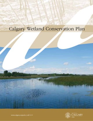
- 1. www.calgary.ca/parks | call 3-1-1 Calgary Wetland Conservation Plan
- 2. Calgary Wetland Conservation Plan – Aproved by Council, May 14, 2004 Acknowledgements . . . . . . . . . . . . . . . . . . . . . 2 Introduction. . . . . . . . . . . . . . . . . . . . . . . . . . . 6 Vision, Principles and Goals. . . . . . . . . . . . . . 8 1. Vision . . . . . . . . . . . . . . . . . . . . . . . . . . . . . . 8 2. Principles And Goals . . . . . . . . . . . . . . . . . . . 8 2.1. Conservation and Sustainability . . . . . . . 8 2.2. “No Net Loss” . . . . . . . . . . . . . . . . . . . . . . 9 2.3. Regional Planning . . . . . . . . . . . . . . . . 10 2.4. Management of Wetland Habitats. . . . . 10 2.5. Wetland Monitoring and Research & Development Program. . . . . . . . . . . . 10 2.6. Public Education . . . . . . . . . . . . . . . . . . 11 Types of Calgary Wetlands . . . . . . . . . . . . . . 12 Inventory . . . . . . . . . . . . . . . . . . . . . . . . . . . . 14 Development Approval Policies . . . . . . . . . . 16 1. Community Plan Policies . . . . . . . . . . . . . . . 16 2. Land Use/Outline Plan Policies . . . . . . . . . . 17 2.1. Crown Owned Wetlands. . . . . . . . . . . . . 17 2.2. Environmental Reserve (ER) & Natural Area Wetlands. . . . . . . . . . . . . . 17 3. Tentative Plan Policies . . . . . . . . . . . . . . . . . 21 4. Construction Plan Policies . . . . . . . . . . . . . . 22 Mitigation Process . . . . . . . . . . . . . . . . . . . . . 24 Mitigation Options . . . . . . . . . . . . . . . . . . . . . . . 25 The Benefits of Wetlands. . . . . . . . . . . . . . . . 26 Issue Identification . . . . . . . . . . . . . . . . . . . . 28 Role of the Wetland Conservation Plan . . . . 30 Monitoring Program . . . . . . . . . . . . . . . . . . . 32 1. Inventory Monitoring (Landscape Assessment) . . . . . . . . . . . . . . . . . . . . . . . . 32 2. Development Standards/Wetland Restoration Monitoring. . . . . . . . . . . . . . . . . 33 3. Ecological Monitoring . . . . . . . . . . . . . . . . . 34 4. Economic Monitoring . . . . . . . . . . . . . . . . . 34 Wetland Management . . . . . . . . . . . . . . . . . . 36 Implementation Plan. . . . . . . . . . . . . . . . . . . 37 Appendix 1-9 . . . . . . . . . . . . . . . . . . . . . . . . . 38 Appendix 1: Steward & Kantrud Wetland Classification System . . . . . . . . . . . . . . . . . . . . 38 1. Class I – Ephemeral Ponds. . . . . . . . . . . . 38 2. Class II – Temporary Ponds. . . . . . . . . . . 39 3. Class III – Seasonal Ponds and Lakes.. . . . 40 4. Class IV – Semi-permanent Ponds and Lakes. . . . . . . . . . . . . . . . . . . . . . . . 41 5. Class V – Permanent Ponds and Lakes.. . . 42 6. Class VI – Alkali Ponds and Lakes.. . . . . . 43 7. Class VII – Fen (alkaline bog) Ponds. . . . 43 8. Spatial Relationship of Vegetation Zones . 44 Appendix 2: Wetland Evironmental Significance Assessment (ESA) . . . . . . . . . . . . . 45 Appendix 3: Tools for Wetland Protection. . . . . 46 Appendix 4: Legal Tools for Municipalities to Conserve Environmentally Sensitive Areas . . . . 48 1. Designation Tools . . . . . . . . . . . . . . . . . . 48 2. Sales And Purchase Transactions . . . . . . . 49 3. Gifts . . . . . . . . . . . . . . . . . . . . . . . . . . . . 50 4. Personal, Term And Common Law Partial Interests. . . . . . . . . . . . . . . . . 51 Table of Contents
- 3. THE CITY OF CALGARY 1 5. Adminstrative And Planning Tools, Traditional . . . . . . . . . . . . . . . . . . . . . . . 53 6. Administrative/planning Novel. . . . . . . . . 54 7. Regulatory And Administrative Tools . . . . . . . . . . . . . . . . 55 Appendix 5: Mitigation. . . . . . . . . . . . . . . . . . . 56 1. Avoidance Of Impact. . . . . . . . . . . . . . . . 56 2. Minimization And Mitigation Of Impacts . . . . . . . . . . . . . . . . . . . . . . . 56 3. Mitigation For Impacts That Cannot Be Minimized. . . . . . . . . . . . . . . . . . . . . . . . 56 Appendix 6: Federal, Provincial and Municipal Legislation . . . . . . . . . . . . . . . . . . . . 60 1. Federal Legislation. . . . . . . . . . . . . . . . . . 60 2. Provincial Legislation. . . . . . . . . . . . . . . . 61 3. Municipal Legislation. . . . . . . . . . . . . . . . 62 Appendix 7: Wetland Functions and Values. . . . 63 1. Life Support . . . . . . . . . . . . . . . . . . . . . . 63 2. Hydrology. . . . . . . . . . . . . . . . . . . . . . . . 64 3. Water Quality . . . . . . . . . . . . . . . . . . . . . 65 4. Socio-economic. . . . . . . . . . . . . . . . . . . . 66 Appendix 8: Review of Wetland Policies within Canada, the United States and Internationally . . 67 Appendix 9: Wetland Functional Assessment. . . 70 1. Introduction . . . . . . . . . . . . . . . . . . . . . . 70 2. Function . . . . . . . . . . . . . . . . . . . . . . . . . 70 3. Assessment Methods . . . . . . . . . . . . . . . . 70 4. Utility in Mitigation . . . . . . . . . . . . . . . . . 71 5. Terms of Reference . . . . . . . . . . . . . . . . . 71 Glossary . . . . . . . . . . . . . . . . . . . . . . . . . . . . . 73 Maps . . . . . . . . . . . . . . . . . . . . . . . . . . . . . . . . 77 Bibliography . . . . . . . . . . . . . . . . . . . . . . . . . 80 Document Abbreviations BIA Biophysical Impact Assessment CCC Construction Completion Certificate ENGO Environmental, Non-Governmental Organization ER Environmental Reserve ESA Environmental Significance Assessment FAC Final Acceptance Certificate GIS Geographic Information Systems MR Municipal Reserve MSR Municipal School Reserve PE Public Park, School and Recreation District PUL Public Utility Lot SWMF Stormwater Management Facility TLL Total Loading Limitations
- 4. Calgary Wetland Conservation Plan2 The Wetland Conservation Plan took over one year to develop and involved the co-ordination, input and collaboration of several individuals and groups. These policies and procedures for wetland protection are the result of their dedication, hard work and awareness of the need to ensure that residential, commercial and industrial development continues in an orderly manner. The City of Calgary Parks would like to take this opportunity to acknowledge and thank all those involved: Project Management Dennis LaFreniere, Planner, City of Calgary Parks. Chris Manderson, Planner, City of Calgary Parks. Working Committee A Wetlands Working Committee was established to ensure that the Wetland Conservation Plan is comprehensive, sustainable and meets multiple needs. This committee assisted with the research, analysis and development of a draft policy and was made up of the following individuals. Thank you for your hard work: Acknowledgements Carolyn Bowen; Erin Furlong Environmental Services Paul Cochrane; Karen Donnelly; Deborah Cooper Planning & Transportation Policy Jerry Brunen; Les Wetter Ducks Unlimited Greg McAndrews Alberta Public Lands Sandy Menzies; George Nieuwenhuis Corporate Properties Tim Haufe The Office of the Solicitor Dave Travis Urban Development Pat Young Alberta Fish & Wildlife Dwayne Manchak Alberta Environment Kim Jaska; Yin Deong Wastewater Dave Elphinstone Calgary Parks Mona Keffer Calgary Parks Wetlands Working Committee Chris Manderson; Michael Kenny Co-chairs Calgary Parks Dennis LaFreniere Facilitator Calgary Parks
- 5. THE CITY OF CALGARY 3 Key Stakeholder Advisory Committee The Key Stakeholder Advisory Committee advised on the content of the Terms of Reference for the project, provided valued input through an issue identification workshop, and worked toward consensus on the content of the policy. Thank you to all of the members of the Advisory Committe: Neil J. Angus Municipal District of Rocky View No. 44 Jarret Berezanski Alberta Transportation Planning Carolyn Bowen City of Calgary Utilities and Environment Protection Jerry Brunen Ducks Unlimited Canada Bob Clark Carma Developers Ltd. Urban Development Institute Deborah Cooper City of Calgary Planning & Transportation Policy Yin Deong City of Calgary Wastewater & Drainage Karen Donnelly City of Calgary Planning & Transportation Policy Dave Elphinstone City of Calgary Parks Resource Management Judy Ferguson Urban Development Institute Heather Ferguson Enviro Consult Urban Development Institute Don Gerlinsky Alberta Infrastructure Paul Gregoire Canadian Wildlife Service Environment Canada Denis Gourdeau City of Calgary Parks Resource Management Hugo Haley University of Calgary Student Calgary Wetlands Committee Tim Haufe City of Calgary Law Heather Hemingway MD of Foothills Kim Jaska City of Calgary Utilities and Environment Protection Michael Kenny City of Calgary Parks Planning and Design Services
- 6. Calgary Wetland Conservation Plan4 Gary Kindrat Ducks Unlimited Canada Denise Kors City of Calgary Land Use & Mobility Judy Lupton City of Calgary Development & Building Approvals Paula Magdich City of Calgary Roads Patrick Mahaffey City of Calgary Parks Planning and Design Services Sheena Majewski Fisheries and Oceans Canada Central and Arctic Region Dwayne Manchak Alberta Environment Water Administration, Bow Region Greg McAndrews Sustainable Resource Development Public Lands Steve Meadows Bow River Basin Council/River Valleys Committee Sandy Menzies City of Calgary Corporate Properties Bill Morrison River Valleys Committee George Nieuwenhuis City of Calgary Corporate Properties Grant Pearsell City of Edmonton Planning Bob Pella Calgary Field Naturalists’ Society Ian Rudland Alberta Environment Water Management Division Pauline Scoffield Alberta Environment Regional Services Kathy Strong-Duffin City of Calgary Environmental Management Paul Taylor Hopewell Urban Development Institute Tracy Tarves Parks Foundation, Calgary Terry Thompson Calgary Airport Authority Dave Travis City of Calgary Urban Development Ron Ui Alberta Infrastructure David Weinkauf National Association of Industrial & Office Properties Les Wetter Ducks Unlimited Canada Pat Young Fish and Wildlife Wildlife Management Branch Peter Ziriada City of Calgary Parks Planning and Design Services Acknowledgements
- 7. THE CITY OF CALGARY 5 Other Key Stakeholders, General Public and Community Associations The City of Calgary Parks would also like to thank all the community associations and other key stakeholder groups for their willingness to review and comment on the Public Draft for Discussion. Finally, we would like to thank the members of the general public who took time out of their busy schedules to attend the public open houses and provide us with valuable input. Editorial Assistance Thanks to Julie Sengl, Calgary Parks for editing and proofreading the final draft.
- 8. Calgary Wetland Conservation Plan6 The City of Calgary is home to some of the most significant wetland areas in North America.1 In 1981, it was estimated that 78 per cent of the pre-settlement wetlands in Calgary had been lost. Today, the estimate is closer to 90 per cent. Urban development is now extending into areas of significant wetland complexes, some of which are considered provincially and nationally significant to breeding waterfowl.2 These wetlands also play an important role in improving water quality and quantity, reducing flooding and soil erosion, providing bio-diversity, moderating climate conditions, contributing to an aesthetic urban design, and providing educational and recreational opportunities. To ensure that these benefits remain viable and sustainable for our future generations, The City of Calgary has developed the Wetland Conservation Plan, which sets priorities and explores alternatives for wetland conservation in order to guide future urban development. In developing the Wetland Conservation Plan, several issues were identified by a Key Stakeholder Advisory Group (see Acknowledgements). They included: • adherence to related provincial and federal laws and policies; 1 U.S. Prairie Pothole Joint Venture. 1995. U.S. Prairie Pothole Joint Venture Implementation Plan (update). 86 pp. Jamestown, ND 2 Ibid. • ensuring “No Net Loss” of Calgary Wetlands by promoting their conservation and/or mitigation within areas of future urban development and within transportation and utility corridors; • maintaining or improving local water quality and quantity; • ensuring orderly and cost-efficient development of lands within the city while addressing engineering constraints; • the use of naturally occurring wetlands for stormwater treatment while ensuring their long- term viability; • identifying and mitigating the effects of telecommunication lines on avian life; and • providing consistency, efficiency and effectiveness in dealing with wetlands through the development application process. One major challenge in the development of the Wetland Conservation Plan was to ensure that The City maintains or improves local water quality and quantity while adhering to related provincial and federal laws and policies. A municipality’s authority for the protection of wetlands is primarily through the Municipal Government Act (i.e. protection as Environmental Reserve or protection as Municipal eserve). The result within the Wetland Conservation Plan is that: Introduction
- 9. THE CITY OF CALGARY 7 1. Approximately 600 wetlands were classified as seasonal, semi-permanent, permanent or alkali ponds within our wetland inventory (see p.18). These are the only wetlands that The City can legally classify and protect as Environmental Reserve, thus ensuring their long-term contribution to local water quality and quantity. 2. Approximately 6,800 ephemeral and temporary ponds which contribute to groundwater discharge/ recharge and water purification (see Appendix 7, Items 2 and 3) are primarily protected through the Provincial Water Act which is administered by Alberta Environment. Through the development of the Wetland Conservation Plan it was recognized that The City of Calgary can assist in the protection of these wetlands by: • helping proponents of development adhere to legislation/regulations by circulating Community Plans and Land Use/Outline Plans to the appropriate provincial and federal agencies; • acquiring those wetlands that have been deemed environmentally significant or are of a quality and character that warrant conservation within a Natural Environment Park (see Conservation Plan 2.2.9, p. 23); • establishing a Total Loading Limits (TLL) program and action plan based on target limits of pollutants into the Bow River; • proactively planning for the quality of stormwater runoff in new communities in accordance with Wastewater’s Stormwater Management & Design Manual; and • circulating all Master Drainage Plans to Alberta Environment for their approval at the Community Plan stage. The Wetland Conservation Plan has policies and procedures for the timely identification of Calgary Wetlands and their associated environmental significance in order to ensure their conservation and/or mitigation within the development approval process (i.e. Community Plan stage through to Construction Plan stage). Guidelines have also been established for the implementation of a monitoring program that will continually evaluate the success of implementing the policies and procedures. Finally, criteria have been established for the development of management plans that will ensure the efficient and effective operation and maintenance of the city’s wetlands.
- 10. Calgary Wetland Conservation Plan8 1. Vision Calgarians have an awareness, understanding and appreciation of the benefits of wetlands. As a result, wetlands have become an integral part of our city’s urban fabric and they are maintained for the benefit, use and enjoyment of present and future Calgarians and visitors. 2. Principles and Goals 2.1. Conservation and Sustainability Balancing the conservation of Calgary’s Wetlands within the context of urban development is a priority for The City. The primary goals for meeting this principle are: 2.1.1. Efforts shall be made to avoid the impact from development on Calgary Wetlands that are environmentally significant and/or contribute to water quality and quantity, and that can be integrated into urban development while maintaining their ecosystem survivability and sustainability. 2.1.2. The contribution of wetlands to water quality and quantity shall be considered in terms of: a. the local watershed and/or aquifer; and b. the Total Loading Limitations (TLL) which manage total pollutant loadings to the Bow River, in order to ensure acceptable water quality at the point that the Bow River exits the city. 2.1.3. A standardized, Corporate-wide policy shall be developed and innovative methodologies and practices will be supported for incorporating sustainable wetlands into the city of Calgary. Such standards will ensure that proponents of development are compliant with The City’s statutory plans, bylaws, and policies (e.g. The Calgary Plan, Calgary Open Space Plan, Urban Parks Master Plan, Natural Area Management Plan, Calgary Stormwater Management & Design Manual, etc.). 2.1.4. Where possible, Calgary Wetlands shall be integrated into The City’s Natural Environment Park system to ensure their long-term sustainability. 2.1.5. In a timely manner and at key decision points within the planning application process, proponents of developments that include Calgary Wetlands shall be advised to be compliant with the provincial Water Act and Public Lands Act as well as other provincial and federal laws and policies. Vision, Principles and Goals
- 11. THE CITY OF CALGARY 9 2.1.6. Clear and workable definitions that are consistent with the regulatory environment and accepted scientific authorities shall be provided to aid in the decision-making process. These would include the development of a working definition of a wetland and associated uplands. 2.2. “No Net Loss” The City of Calgary shall ensure that there is No Net Loss of Calgary Wetlands after efforts have been made to avoid impact from development (see Conservation and Sustainability goal # 2.1.1). The primary goals for meeting this principle are: 2.2.1. The City of Calgary shall be proactive in setting a consistent development application process that would balance approved wetland disturbances or losses with mitigation through wetland restoration, enhancement and creation. 2.2.2. A wetland mitigation policy shall be developed where disturbances or losses to Calgary Wetlands will be considered in the following order of priority: a. minimization of and mitigation for unavoidable impacts; b. mitigation for residual impacts after avoidance (see Conservation and Sustainability goal # 2.1.1) and minimization have been considered. 2.2.3. The mitigation of disturbances or losses to Calgary Wetlands shall occur in places that make sense ecologically: adjacent to or contiguous with an existing or potential mosaic of upland and wetland systems, or as a sustainable part of an existing or potential Natural Environment Park. Potential locations for ecological mitigation shall be considered in the following order of priority: a. restoration of wetlands that have been disturbed; b. enhancement of wetlands within the same watershed of the Outline Plan area; c. creation of wetlands within the same watershed of the Outline Plan area; d. Compensation Banking for the enhancement or creation of wetlands within the same watershed outside the Outline Plan area; e. enhancement of wetlands outside the watershed within the Outline Plan area; f. creation of wetlands outside the watershed within the Outline Plan area; g. Compensation Banking for the enhancement or creation of wetlands outside of the watershed and outside the Outline Plan area.
- 12. Calgary Wetland Conservation Plan10 2.2.4. Using best practices and, as approved by The City of Calgary, proponents of development shall mitigate one or all of the following features and functions of a Calgary Wetland that have been disturbed or lost due to development: a. wetland and upland plant communities; to ensure their normal succession pattern; b. wildlife (including fish) habitat; c. hydrologic regimes (contribution to water quality and quantity); d. flood attenuation and erosion control functions; e. cultural, recreational and educational functions; and f. urban design functions. 2.2.5. The more environmentally significant a wetland is (see Appendix 2), the greater its overall functional contribution to the natural ecosystem. Furthermore, science cannot yet fully replicate the complexity of an environmentally significant wetland. Therefore, the amount of area required as mitigation for a disturbed or lost Calgary Wetland shall depend on its environmental significance, and the likelihood of success of a proposed mitigation plan, using best practices, to adequately compensate for disturbed or lost wetland functions. 2.3. Regional Planning Ecological boundaries of watersheds and/or aquifers do not respect political boundaries. Therefore, a regional planning perspective should be considered when unavoidable losses to existing wetlands are compensated through wetland enhancement and/or creation. The primary goals for meeting this principle are: 2.3.1. Mitigation for losses to existing wetlands shall first occur within the same watershed and/or aquifer within the city of Calgary. 2.3.2. Established inter-municipal mechanisms (e.g. The Calgary Regional Partnerships Committee, Inter-municipal Committees, Inter-municipal Development Plans) shall be used to provide clarity on the scope and nature of co-operation between The City of Calgary and surrounding municipalities. These inter-municipal mechanisms will work toward the development of a Regional Wetland Mitigation Plan that would work in conjunction with The City of Calgary Wetland Conservation Plan. 2.4. Management of Wetland Habitats Calgary Wetlands shall be managed to ensure their long-term sustainability. The primary goal for meeting this principle is: 2.4.1. Best management practices shall be developed and continually updated for the operations, maintenance, lifecycle and programming of Calgary Wetlands in accordance with approved Natural Area Management Plans. 2.5. Wetland Monitoring and Research & Development Program In partnership with other government, community, corporate and/or commercial organizations, The City of Calgary shall support a wetland monitoring and research and development program that will develop standards for, and measure the success of incorporating existing, restored, enhanced and created wetlands into the urban landscape. The primary goals for meeting this principle are: Vision, Principles and Goals
- 13. THE CITY OF CALGARY 11 2.5.1. Quality and quantity measurements shall be developed for determining: a. the sustainability of Calgary Wetlands; b. the success of current management practices; and c. the ecological and economic value of the wetlands to The City of Calgary. 2.5.2. In partnership with other government, community, corporate and/or commercial organizations, The City of Calgary shall facilitate the establishment of a foundation that will support one or more academic institutions in the long-term research and development of restoring, enhancing and creating wetlands, as well as developing engineered stormwater wetlands. 2.5.3. Due to the inability of current science to fully replicate the complexity of a wetland, the results of a wetland monitoring and research and development program will be used to update the Wetland Conservation Plan every two years. 2.6. Public Education Educating the public about the importance of wetland functions and their value in producing environmental, social and economic benefits will play an important role in wetland conservation and protection. The primary goal for meeting this principle is: 2.6.1. Educate the citizens of Calgary and their surrounding neighbours by increasing public: a. awareness of the role that wetlands play in addressing the pressures and demands that population growth and industrial developments are having on the local and regional water supply;3 b. understanding that a wetland is one of the most biologically productive and bio-diverse ecosystems within our natural environment; and c. appreciation of how Calgary Wetlands contribute to the reduction in flooding and soil erosion, climate moderation, landscape variability, and educational and recreational opportunities. 3 Government of Alberta. Water for Life – Alberta’s Strategy for Sustainability – Draft. 2002-2003.
- 14. Calgary Wetland Conservation Plan12 In general, wetlands can be defined as areas occupying a transitional zone between land and water. Adapting the definition outlined in Wetlands of Canada, wetlands are areas where the water table is at, near, or just above the surface, and where soils are saturated for a sufficient period of time such that they lack atmospheric oxygen (i.e anaerobic). The result is the growth of plants that are adapted to grow in water (i.e. hydrophytic vegetation). Therefore, the primary characteristics of a wetland are: • Water – Wetlands are characterized by the presence of surface water, sub-surface water, or both. The lands may be inundated with water for an extended period of time or for only some of the time. • Vegetation – Wetlands support plants called hydrophytes or hydrophytic plants that are indicative of wet sites and can only be found in wetland ecosystems. • Soil – Wetland soil is called hydric soil that has little or no oxygen and possesses physical and chemical properties that are characteristic of waterlogged conditions. The above general definition and primary characteristics of a wetland, as well as the definitions, policies and legislation within the Calgary Open Space Plan, Surveys Act and Water Act were used to more clearly define what a wetland is within the city of Calgary. It is important to note that periodically, the city of Calgary receives low amounts of precipitation due to its location within the Foothills Fescue and Foothills Parkland Natural Regions (see Map 1). During these periods of low precipitation it is quite common for the water table to fall below the surface of certain wetlands, at which time they contain no water. A Calgary Wetland is a waterbody and its bed and shores, that is naturally occurring or disturbed and is located within the Foothills Fescue and Foothills Parkland Natural Regions within the city of Calgary (see Map 1). This wetland is saturated with water long enough to promote wetland or aquatic processes, as indicated by poorly drained soils, hydrophytic vegetation and various kinds of biological activity which are adapted to a wet environment.4 The bed and shores of the waterbody end at the bank, or the physically ascertainable line where long action of water has caused the bed and shore to have no vegetation, distinct vegetation (i.e. marshland or other wetland vegetation), or a distinct soil.5 There are four types of Calgary Wetlands: 4 City of Calgary. Open Space Plan. Cerlox. 2003 5 Surveys Act, R.S.A. 1980, c. s-29.1 Types of Calgary Wetlands
- 15. THE CITY OF CALGARY 13 1. Crown Owned Wetland – a Calgary Wetland that is permanent and naturally occurring and is owned by the Province because it was never subject to a grant, is specifically excluded from a land title, or is claimed under Section 3 of the Public Lands Act. 2. Environmental Reserve (ER) Wetland – a part of a parcel of land that is the subject of a proposed subdivision and is to be provided as environmental reserve as required by the subdivision authority. It is a Calgary Wetland that: a. is located within the city of Calgary; b. may or may not be an environmentally significant area; c. a shallow-marsh zone, deep-marsh zone, deep-water zone or an intermittent-alkali zone dominates the deepest part of the wetland area (i.e. Class III, IV, V, or VI Wetland – Steward & Kantrud – see Appendix 1); and d. is naturally occurring or disturbed. 3. Natural Area Wetland – a part of a parcel of land that is the subject of a proposed subdivision and may be acquired through a variety of means (see policy 2.2.9. p.23). It is a Calgary Wetland that is: a. located within the city of Calgary; b. in an environmentally significant area, or part of a proposed natural environment park or natural environment zone; c. a wetland-low-prairie zone, a wet-meadow zone, or an intermittent-alkali zone dominates the deepest part of the wetland area (i.e. Class I, II, or VII Wetland – Steward & Kantrud – see Appendix 1); and d. is naturally occurring or disturbed. 4. Engineered Stormwater Wetland – “A constructed and/or modified waterbody that fluctuates with water drainage peaks but holds water at all times. The wetland is used to improve stormwater runoff quality through nutrient and sediment removal using vegetation, detention, settlement and other best management practices. The wetland is also used to manage the volume of runoff through storage and restricted pipe outlets. Its depth will vary depending on site design criteria and its live storage area is vegetated. Engineered Stormwater Wetlands have a habitat function with existing or constructed riparian and upland vegetation communities. The boundary of the wetland will be dedicated as Environmental Reserve, in accordance with the MGA, and the adjacent buffer of riparian and upland vegetation will be dedicated as Municipal Reserve...and all forebays shall be dedicated as Public Utility Lots.” 6 6 City of Calgary. Open Space Plan. Cerlox. 2003.
- 16. Calgary Wetland Conservation Plan14 In order to ensure the conservation and protection of Calgary Wetlands during the development approval process, a detailed inventory of the wetlands is required. Therefore, The City of Calgary entered into a letter of understanding with Ducks Unlimited Canada to conduct such an inventory (see Maps 2 & 3). The inventory identified: 1. Environmental Reserve Wetlands and Potential Natural Area Wetlands using Stewart and Kantrud (1971) Wetland Classification Methodology (Appendix 1). Note: The numbering of the Stewart and Kantrud wetland Classes I through VII does not imply wetland priority or significance. The wetland Classes are numbered for identification purposes only. 2. Riparian Areas: Riparian areas are those areas where the plants and soils are strongly influenced by the presence of water. They are transitional lands between aquatic ecosystems (wetlands, rivers, streams or lakes) and terrestrial ecosystems. 3. Upland Areas and Associated Vegetation and/or Condition (i.e. cultivated and/or urbanized): An upland area is an area of land, usually terrestrial (not aquatic), either upstream or surrounding the wetland. It is not part of the wetland but may contribute to the integrity of the wetland. Although Crown Owned Wetlands have not been identified in the inventory, they are a subset of the Environmental Reserve wetlands and they may be claimed under Section 3 of the Public Lands Act at the Community Plan stage. Inventory
- 17. THE CITY OF CALGARY 15 Through the Steward and Kantrud Wetland Classification Methodology, using aerial photography, approximately 8,000 wetlands have been identified within the city of Calgary and entered into The Wetland Inventory. After field checking 1,000 wetlands, it was calculated that the Steward and Kantrud Class assigned to each wetland has an accuracy of 61 per cent, and the location of the waterbody boundaries has an accuracy of ± 0.50 metre. When there is an error in assigning a class to a wetland, the correct class will be either up or down one class (i.e. if a wetland is incorrectly assigned a Class 3, the correct class will be either Class 2 or 4). Because the classes assigned to each wetland are not entirely accurate, they will need to be verified on site at the Community Plan stage as part of the Habitat and Environmental Significance Assessment. Furthermore, at the Land Use/Outline Plan stage, surveyors will locate the bank of Crown Owned, ER and Natural Wetlands at the normal or ordinary high water mark, and the limits of the ER surrounding these water bodies will be identified and delineated by a Qualified Wetland Specialist.7 7 Kwasniak, Arlene. Alberta Wetlands – A Legal & Policy Guide. Environmental Law Centre and Ducks Unlimited Canada. 2001.
- 18. Calgary Wetland Conservation Plan16 1. COMMUNITY PLAN POLICIES 1.1. Steward Kantrud Wetland Classes (identified in Maps 2 and 3) shall be verified on site at the Community Plan stage by the City through a Qualified Wetland Specialist (see Inventory p.18). 1.2. An Environmental Significance Assessment (Appendix 2) shall be completed by The City on all Calgary Wetlands to determine whether an existing wetland is environmentally significant. These assessments will be completed in conjunction with a Habitat Assessment and Environmental Significance Assessment of all Natural Areas.8 1.3. The first priority in The City’s commitment to the conservation and protection of Calgary Wetlands is the avoidance of impact from development. Where it can be demonstrated to the satisfaction of the approving authority that avoidance of impact to a Calgary Wetland is not possible or practical due to inherent constraints upon a site, then disturbance to the wetland(s) will be considered in the following order of priority: Priority 2 – Minimization of and mitigation for unavoidable development impacts; Priority 3– Mitigation for development impacts that cannot be minimized. 8 City of Calgary, Open Space Plan. Cerlox. 2003. 1.4. Further to policy 1.3, roads and utility rights-of-way shall only be allowed to cross Calgary Wetlands when: a. alternative alignments are neither reasonable nor practical; b. roads and utilities are aligned together to minimize the number of crossings; c. the amount of disturbance to the area is minimized; and d. any disturbed areas are restored using native plants. 1.5. Proponents of development are solely responsible for adherence to all relevant provincial and federal legislation/regulations (see Appendix 6). However, upon the submission of a proposed Community Plan, the Planning Authority will circulate the plans to: • Alberta Environment – re: Water Act; • Sustainable Resource Development, Public Lands and Forests Division – re: Section 3, Public Lands Act; • Sustainable Resource Development, Fish and Wildlife Division – re: Wildlife Act; Development Approval Policies
- 19. THE CITY OF CALGARY 17 • The Department of Fisheries and Oceans – re: Fisheries Act; • Environment Canada’s Canadian Wildlife Service – re: Migratory Birds Convention Act and Species at Risk Act. • The Calgary Airport Authority – re: Canada Aeronautics Act. Note: In no way should the above list of agencies and associated Acts be deemed comprehensive. It is solely the proponent’s responsibility to contact the appropriate administrative agencies to ensure that all legislation/regulations are adhered to. 2. LAND USE/OUTLINE PLAN POLICIES 2.1.Crown Owned Wetlands 2.1.1. If Crown Owned Wetlands are environmentally significant areas, or of a quality and character that warrant conservation within a Natural Environment Park, the Department of Sustainable Resource Development should issue a Recreation Lease or a License of Occupation to The City of Calgary. 2.1.2. If the Department of Sustainable Resource Development issues a Recreation Lease or a License of Occupation to The City of Calgary for Crown Owned Wetlands, the wetlands shall be subject to the Land Use/Outline Plan conditions described in policy 2.2 below. 2.2. Environmental Reserve (ER) & Natural Area Wetlands General Conditions 2.2.1. Where a proponent of development is applying for land use and not a subdivision of the lands, and the lands contain privately owned wetlands that are not claimed by the Crown, and the wetlands have been identified as potential ER and/or Natural Area Wetlands, the proponent, through negotiations with The City, will be encouraged to meet the development approval policies of the Wetland Conservation Plan. Given that the proponent agrees to adhere to the development approval policies, if disturbance to the wetlands is avoided or minimized, and if the wetlands can be sustained into the future, the privately owned wetlands should be designated as Direct Control Sites. These sites should have a permitted land use of a Natural Area, and a Recreation
- 20. Calgary Wetland Conservation Plan18 Lease should be issued to The City to ensure the ongoing monitoring, upkeep and protection of the wetlands as part of The City’s Natural Environment Park System. Note: upon revision of the Land Use Bylaw, these privately owned wetlands will be designated as Natural Environment (NE) Sites. 2.2.2. For all ER and Natural Area Wetlands, a Biophysical Impact Assessment (BIA) will be completed at the Land Use/Outline Plan approval stage by a qualified professional, to the satisfaction of the approving authority.9 2.2.3. In accordance with Alberta law, surveyors will locate the bank of Crown, ER and Natural Area Wetlands. The bank will be located at the normal or ordinary high water mark.10 The limits of the ER surrounding these water bodies will be identified and delineated in accordance to the Municipal Government Act by a Qualified Wetland Specialist. 2.2.4. If a Crown Owned Wetland naturally becomes permanently dry, the waterbody will accrue to the ER and/or MR parcel. 2.2.5. Where an ER or Natural Area Wetland within a Land Use/Outline Plan can remain viable and sustainable over the long-term, it shall be retained in a natural state, except for the following situations as determined by the approving authority: a. the addition of passive recreational amenities such as pathways, benches and viewing areas considered necessary to enhance public enjoyment of the area; b. grading or engineering improvements necessary to integrate the development with the wetland to ensure its sustainability in an urban context; and 9 City of Calgary, Open Space Plan. Cerlox. 2003. 10 Kwasniak, Arlene. Alberta Wetlands – A Legal & Policy Guide. Environmental Law Centre and Ducks Unlimited Canada. 2001. c. the incorporation of salvaged soils and plant material from disturbed wetlands, naturalized planting or landscaping that restores the wetland and its immediate shoreline. 2.2.6. Urban development adjacent to an ER and Natural Area Wetland should be designed in a manner that provides for a low impact interface with the wetland. Acquisition (see also Appendix 3 & 4) 2.2.7. All wetlands qualifying as an Environmental Reserve Wetland shall be dedicated to The City of Calgary as Environmental Reserve. 2.2.8. Based on the ESA and BIA reports, a negotiated buffer of upland area may be dedicated as MR on a site-by-site basis to assist in the long-term sustainability of an ER or Natural Area Wetland.11 2.2.9. Natural Area Wetlands that are Environmentally Significant Wetlands (see Appendix 2), or are of a quality and character that warrant conservation within a Natural Environment Park, should be protected in their natural state as determined through site specific evaluations and the Land Use/Outline Plan approval process, which includes (but is not limited to): a. owner dedication as credit Municipal Reserve; b. voluntary owner dedication as Environmental Reserve, in excess of the requirements of the Municipal Government Act (subject to negotiation); c. density transfers: both within developments and between developments (subject to negotiation); d. donations to appropriate not-for-profit agencies, Land Trusts, or The City (subject to negotiation); 11 City of Calgary, Open Space Plan. Cerlox. 2003. Development Approval Policies
- 21. THE CITY OF CALGARY 19 e. outright purchase (subject to negotiation); f. land swapping and transfer of credit reserve (subject to negotiation); g. conservation easements and associated caveats to restrict development within or around the wetlands, as per the provisions of the Environmental Protection and Enhancement Act; h. Environmental Reserve easements, as per the provisions of the Municipal Government Act. Mitigation (see also Appendix 5) 2.2.10.Once all avenues of avoidance and minimization of development impact have been explored by a proponent of development, and an appropriate level of disturbance has been authorized by the approving authority at the Community Plan stage, mitigation by the proponent for the impact on the wetland will adhere to the “No Net Loss” principle of the Wetland Conservation Plan (see p.12), and shall include one, or all of the following options in order of priority: Priority 1 – Restoration of wetlands that have been disturbed; Priority 2 – Enhancement of wetlands within the same watershed of the Outline Plan area; Priority 3 – Creation of wetlands within the same watershed of the Outline Plan area; Priority 4 – Compensation Banking for the enhancement or creation of wetlands within the same watershed, outside the Outline Plan area; Priority 5 – Enhancement of wetlands outside the watershed, within the Outline Plan area; Priority 6 – Creation of wetlands outside the watershed, within the Outline Plan area; Priority 7 – Compensation Banking for the enhancement or creation of wetlands outside the watershed, and outside of the Outline Plan area. 2.2.11.Further to policy 2.2.10, prior to Outline Plan approval, the proponent shall submit for approval by the approving authority, a Mitigation Plan indicating a recommended mitigation option(s) to restore, enhance, or create lost wetland functions based on: a. an approved Environmental Significance Assessment (Appendix 2); and b. an approved Functionality Assessment (Appendix 9) and Biophysical Impact Assessment prepared by a qualified professional. 2.2.12.Further to policy 2.2.11, if a Mitigation Plan includes Compensation Banking for the enhancement and/or creation of wetlands outside the Outline Plan area, the proponent shall provide funds toward a Wetland Mitigation Bank that is to be accounted for separately from General Revenue as compensation for the loss of wetland in accordance with the following calculation: (C1 x EC) + C2 = funds to be provided as compensation Where • C1 = cost per square metre to enhance and/or create wetland(s) to ensure No Net Loss of functions on the site where the disturbance or loss occurred; • EC = the number of square metres of a wetland(s) to be enhanced or created as determined in the approved Mitigation Plan to ensure No Net Loss of functions; and • C2 = the cost of the land at the site(s) where the disturbance or loss occurred.
- 22. Calgary Wetland Conservation Plan20 2.2.13.If compensation funds are received prior to July of any year, and together with other funds in the Wetland Mitigation Bank, are sufficient to complete the next priority wetland project, funding for that project will be included in the following year’s budget, with the intent for it to be substantially complete within two years. 2.2.14.Further to policy 2.2.11, if a Mitigation Plan includes wetland restoration to disturbed wetlands, the proponent shall provide the following for approval: a. a preliminary Grading Plan showing the extent of any disturbance proposed on ER and Natural Area Wetlands; and b. a Landscape Concept Plan that is in accordance with the current edition of Calgary Parks’ Development Guidelines and Standard Specifications, Landscape Construction, showing the proposed landscape and method of restoration. 2.2.15.Further to policy 2.2.11, if a Mitigation Plan includes wetland enhancement or creation within the Outline Plan area, the proponent shall provide for approval, a Landscape Concept Plan that is in accordance with the current edition of Calgary Parks’ Development Guidelines and Standard Specifications, Landscape Construction. Note: Where possible, the Concept Plan should include the use of soils and plant material from the wetland(s) that was disturbed or lost. Provincial and Federal Legislation/Regulations (see also Appendix 6) 2.2.16. Proponents of development are solely responsible for demonstrating adherence to all relevant provincial and federal legislation/regulations. However, upon the submission of proposed Land Use/Outline Plans, the Planning Authority will circulate the plans to: • Alberta Environment – re: Water Act; • Sustainable Resource Development, Public Lands and Forests Division – re: Section 3, Public Lands Act; • Sustainable Resource Development, Fish and Wildlife Division – re: Wildlife Act; • The Department of Fisheries and Oceans – re: Fisheries Act; • Environment Canada’s Canadian Wildlife Service – re: Migratory Birds Convention Act and Species at Risk Act. • The Calgary Airport Authority – re: Canada Aeronautics Act Note: In no way should the above list of agencies and associated Acts be deemed comprehensive. It is solely the proponent’s responsibility to contact the appropriate administrative agencies to ensure that all legislation/regulations are adhered to. 2.2.17.Prior to the Alberta Energy and Utility Board granting a transmission line permit for the construction of a transmission line in or around Calgary Wetlands, the transmission line company must receive approval for the location of the line from Calgary Parks at the Outline Plan approval stage. Approval will be granted if the transmission line does not jeopardize the urban design, recreational and/or environmental protection functions of the wetland. Development Approval Policies
- 23. THE CITY OF CALGARY 21 Engineered Stormwater Wetlands 2.2.18.According to the Municipal Government Act, stormwater management facilities (SWMFs) cannot be located in an Environmental Reserve: they should be located in a Public Utility Lot. Prior to the approval by Wastewater of any new master drainage plans that incorporate SWMFs within ER and Natural Area Wetlands, a Biophysical Impact Assessment shall be conducted by the proponent of development, in consultation with The City of Calgary Parks, to determine if the following conditions, which would allow clean water to be accepted into the wetland from a Public Utility Lot, apply: a. the water is needed to maintain the predevelopment character of the wetland; b. the water will not cause any unacceptable environmental change to the wetland; and c. the wetland can be designed and managed to function in a natural manner.12 2.2.19.Subject to policy 2.2.18 above, Engineered Stormwater Wetlands will be supported in Major Natural Environment Parks where the wetlands can be integrated into an existing natural drainage course with minimal disturbance to the quality of the natural system.13 2.2.20.Engineered Stormwater Wetlands should not be located in Special Protection Natural Environment Parks.14 12 City of Calgary. Open Space Plan. Cerlox. 2003. 13 Ibid. 14 Ibid. 2.2.21.Engineered Stormwater Wetlands shall be designed to balance the functions of stormwater management with habitat creation/diversity and recreational use. The ER designation will extend to the boundary of the wetland, and MR designation beyond the boundary as required.15 Note: The City of Calgary will consider voluntary ER dedication on sites that were not classified as ER Wetlands prior to construction of the Engineered Stormwater Wetlands. 2.2.22.All forebays shall be located on Public Utility Lot lands outside the MR and ER.16 2.2.23.Urban development adjacent to an Engineered Stormwater Wetland should be designed in a manner that provides for a low impact interface with the wetland. 3. Tentative Plan Policies 3.1. Subdivision design, grading, Stormwater Management Plans, and roadway and utility alignments shall provide for a low impact interface with ER and Natural Area Wetlands by: a. providing for integration with the open space and regional pathway system where it can be achieved in an environmentally sensitive manner; b. encouraging the retention and re-use of stormwater on-site for irrigation or other suitable uses; c. providing a subdivision, regional pathway and road design that facilitates public access; and 15 Ibid. 16 Ibid.
- 24. Calgary Wetland Conservation Plan22 d. creating parcels adjacent to wetlands of a size and orientation that will provide for suitable site interface conditions as outlined in policy 2.2.6. 3.2. Prior to approval of the Tentative Plan, ER and Natural Area Wetlands shall be fenced off by the proponent of development, to the satisfaction of the approving authority. 4. Construction Plan Policies General Conditions 4.1. All recreational amenity development, such as pathways, shall be located above the high water line.17 4.2. Where a stormwater pond is located adjacent to lands to be dedicated as ER or Natural Area Wetlands, the pond shall be: a. landscaped, designed, and managed in a satisfactory manner; and b. developed to enhance wildlife habitat and to provide for recreational opportunities. Mitigation 4.3. If an approved Mitigation Plan includes wetland restoration, proponents of development shall submit for approval detailed Restoration Plans in accordance with the current edition of Calgary Parks’ Development Guidelines and Standard Specifications, Landscape Construction for approval. 17 City of Calgary, Open Space Plan. Cerlox. 2003. 4.4. If an approved mitigation plan includes wetland enhancement or creation, proponents of development shall submit for approval, detailed Construction Plans in accordance with the current edition of Calgary Parks’ Development Guidelines and Standard Specifications, Landscape Construction. 4.5. When submitting detailed Restoration Plans and Construction Plan as described in policies 4.3 and 4.4 above, proponents of development shall reference the Council approved Integrated Pest Management Plan, and remediate against the creation of habitat for mosquitoes, other insects (e.g. midges), noxious weeds, etc. Engineered Stormwater Wetlands 4.6. Proponents of development will be, at their cost, solely responsible for the preparation of detailed construction drawings, and the associated development of Engineered Stormwater Wetlands. 4.7. Engineered Stormwater Wetlands shall be designed and constructed in accordance with the City of Calgary Wastewater’s Stormwater Management & Design Manual, and the current edition of Calgary Parks’ Development Guidelines and Standard Specifications, Landscape Construction. 4.8. During the design and construction of Engineered Stormwater Wetlands, proponents of development will work closely with The City of Calgary Parks and Wastewater to ensure the following: a. opportunities are sought to tie in the riparian and acquired upland area with the wetland to assist in the long-term sustainability of the wetland’s ecosystem; Development Approval Policies
- 25. THE CITY OF CALGARY 23 b. base flows from the forebay (Public Utility Lot) to the wetland are maintained to ensure positive effects on the natural system; c. the re-creation of existing vegetative communities; d. the protection of rare/unique plant or animal species that will be directly affected; e. the development and execution of a monitoring program to ensure that re-establishment of environmental communities is completed successfully; f. the use of locally grown plant material to maximize establishment rates; and g. the system shall be designed for the long-term conservation of the natural wetland system.
- 26. Calgary Wetland Conservation Plan24 In order to facilitate use of the Wetland Conservation Plan, the following is a summary of the mitigation process described within the Development Approval Policies (p.20 and Appendix 5): Mitigation Process Calgary Wetlands identified at Community Plan stage through on-site verification of Steward Kantrud Wetland Classes Crown Owned Wetlands claimed at Community Plan stage under Section 3 of the Public Lands Act Habitat and Environmental Significance Assessments conducted at Community Plan stage Priority 1 Community Plan demonstrates avoidance of impact from development If Avoidance not Possible Priority 2 Community Plan demonstrates minimization of unavoidable impacts to ER and Natural Area wetlands. Priority 3 If priority 2 cannot be realized, the approving authority authorizes mitigation for development impacts that cannot be minimized. Approval of Mitigation Plan at Outline Plan stage demonstrating No Net Loss for impacts to ER and Natural Area wetlands based on Functionality, Biophysical Impact and Environmental Significance Assessments. Approval of disturbance to waterbodies and Crown Owned Wetlands by Alberta Environment & Public Lands and Forests Division
- 27. THE CITY OF CALGARY 25 Mitigation Options Priority 1 – Restoration of wetlands that have been disturbed. Priority 2 – Enhancement of wetlands within the same watershed of the Outline Plan area. Priority 3 – Creation of wetlands within the same watershed of the Outline Plan area. Priority 4 – Compensation banking for the enhancement or creation of wetlands within the same watershed, outside the Outline Plan area. Priority 5 – Enhancement of wetlands outside the watershed, within the Outline Plan area. Priority 6 – Creation of wetlands outside the watershed within the Outline Plan area; Priority 7 – Compensation banking for the enhancement or creation of wetlands outside the watershed, and outside the Outline Plan area.
- 28. Calgary Wetland Conservation Plan26 Alberta’s wetlands provide a host of environmental, social and economic benefits that are often overlooked until those benefits are lost through habitat degradation or drainage. The primary benefits of wetlands and their associated riparian habitats are discussed below. There are however, numerous other benefits that wetlands provide to the environment and our society. A more detailed discussion on the functions and values of wetlands in producing environmental, social and economic benefits is provided in Appendix 7. Water Quality and Quality Improvement Values: • Improve Water Quality: Wetlands can improve water quality by reducing sedimentation and serving as natural filters that remove and store suspended solids, nutrients and other pollutants from water. • Groundwater Recharge: Many wetlands serve as a source of water to maintain local and regional groundwater supplies. • Regulate Soil Salinity: As long as their riparian vegetation is left intact, wetlands can help moderate movement of salts. Flood Attenuation and Erosion Control Values: • Buffer Shorelines: Wetlands can protect shorelines against excessive erosion if their riparian vegetation is left intact. • Flood Reduction and Erosion Control: Wetlands store and gradually release water, reducing flooding and soil erosion. • Flood Attenuation: Wetlands reduce the intensity of flooding by storing and slowly releasing water to their watershed, thereby reducing the need to construct man-made flood control works. Ecological Values: • Biodiversity: Wetlands serve as a substantial source of biodiversity by increasing the complexity of landscapes. • Fish Habitat: Wetlands can provide critical nursery habitat for many species of fish. • Wildlife Habitat: Wetlands provide habitat for an incredible diversity of animal and plant species including many threatened and endangered species. The Benefits of Wetlands
- 29. THE CITY OF CALGARY 27 • Drought Buffering: Wetlands can provide a particularly valuable source of water for habitat during drought conditions. • Nutrient Source: Wetlands provide nutrients that fuel food webs in many freshwater systems. Climate Amelioration Values: • Carbon Sequestration: Many wetlands can store atmospheric carbon in their vegetation and soils. • Climate Stabilization: Wetlands provide a source of atmospheric water and oxygen and can help moderate variation in climatic conditions accordingly. • Temperature Moderation: Wetlands can help moderate temperatures through their high thermal inertia (i.e., they heat up or cool down slowly). Socio-Economic Values: • Urban Design: Wetlands are a valuable amenity within a proposed development. They are complex natural areas with high bio-diversity that enhances the quality, form and function of the built environment by providing visual aesthetics, character, variety, noise/sight buffering and the creation of public areas. • Cultural Heritage Areas: Because of their importance to man over time, many wetlands are key historical or archeological sites. • Educational Opportunities: Wetlands can provide enhanced educational and scientific research opportunities because of their high bio- diversity. • Recreational Opportunities: Wetlands can provide numerous opportunities for tourism, boating, bird watching, nature photography and other recreational activities.
- 30. Calgary Wetland Conservation Plan28 On 2002, June 21, an Issues Identification Workshop was held with a Key Stakeholder Advisory Committee. The issues identified during the workshop provided a focus for the development of the Wetland Conservation Plan. The main issues identified that relate to provincial and federal laws and policies are: 1. Under Section 3 of the Public Lands Act, the Crown owns all permanent, naturally occurring waterbodies. This ownership is not registered on title — ownership is legislated. Recently, the Public Lands and Forests Division claimed waterbodies in two subdivisions after land use was granted by Council. As a result, the need for The City to work with the Public Lands and Forests Division was identified. Note: Any development within Crown owned waterbodies requires approval under the Public Lands Act. 2. Any development with the potential to disturb waterbodies requires an approval under the Water Act and/or the Environmental Protection and Enhancement Act. As a result, Alberta Environment has requested to work co-operatively with The City to develop a wetland policy that ensures development complies with the Water Act and Environmental Protection and Enhancement Act. 3. The Wetland Conservation Plan should be consistent with existing municipal and provincial policy (e.g. The Interim Policy on Wetland Management in the Settled Area of Alberta). 4. The Calgary Airport Authority has identified the issue of providing input to wetland protection within a zone of control as per the Aeronautics Act. Proposed changes to this Act would allow them to provide input on wetlands as it relates to aviation safety within a specified zone around the Calgary airport. Furthermore, the Calgary Airport Authority has recognized a need to develop a wetland policy for its lands that addresses issues related to aviation safety, wetland loss and mitigation. 5. The Wetland Conservation Plan should reflect additional legislation including the Wildlife Act, the Federal Fisheries Act, the Navigable Waters Act, the Canadian Environmental Protection Act, the Canadian Environmental Assessment Act, the Species at Risk Act and the Migratory Birds Convention Act. Issue Identification
- 31. THE CITY OF CALGARY 29 With the above regulatory issues in mind, several other issues were also identified: 6. Protection of wetlands within transportation and utility corridors. 7. Identifying and mitigating the effects of telecommunication towers on avian life. 8. Maintenance and/or enhancement of water quality and quantity. 9. Use of wetlands for stormwater treatment (e.g. Engineered Stormwater Wetlands), and ensuring their viability following development. 10. Ensuring that engineering constraints are addressed. 11. Ensuring orderly and cost-efficient development of lands within the city. 12. Ensuring that development applications for lands containing wetlands receive consistent, efficient and effective approvals from the municipal, provincial and federal approving authorities. 13. Exploration of the ramifications of all means of ensuring No Net Loss of wetland habitat, such as mitigation, Compensation Banking, etc.
- 32. Municipal Government Act and Other Provincial and Federal Legislation e.g. the Public Lands Act, Water Act, Environmental Protection and Enhancement Act. City- wide / larger in scope; multiple functions; partnerships Inter-municipal Development Plans The Calgary Plan and other Council-approved policies (e.g. Go Plan, Land Use Bylaw) Joint Use Agreement City- wide; all open space Open Space Plan City- wide; specific to an issue or aspect of open space. Examples include: Urban Park Master Plan Natural Areas Mgmt Plan Wetland River Valleys Plan Stormwater Mgmt Plan Urban Forestry Mgmt Plan Policy for a broad geographic area Area Redevelopment Plans Community Plans Area Structure Plans Special Studies (e.g. Bow Valley Centre, CFB) Plans for location / configuration of open space in a specific area Land Use Amendments, Outline Plans and Tentative (Subdivision) Plans Implementation of policy through development of a specific site or project Development Permits Review of Developer-built/Partnership projects Development agreements Design Development Plans for City park projects Business Plans Calgary Wetland Conservation Plan30 The role of the Wetland Conservation Plan is to provide policies and procedures for the conservation of wetlands within the city of Calgary. Detailed implementation will occur as Community Plans, Outline Plans, Area Redevelopment Plans, etc. are developed and implemented. The following table illustrates where the Wetland Conservation Plan fits within the overall planning framework:18 18 City of Calgary. Open Space Plan. Cerlox. 2003. Role of the Wetland Conservation Plan
- 33. THE CITY OF CALGARY 31 **Note: • A summary of federal, provincial and municipal legislation that guided the development of the Wetland Conservation Plan is in Appendix 6; and • See Appendix 8 for a review of wetland policies from within Canada, the United States and internationally that were referenced in the development of the Wetland Conservation Plan.
- 34. Calgary Wetland Conservation Plan32 Protecting and improving wetland quality and determining the success of the Wetland Conservation Plan relies on a successful monitoring program. Establishing a monitoring plan for wetlands allows The City of Calgary to identify trends and relationships related to the health, functionality, value, economics and overall wetland resources within an urban context. Collecting and monitoring data over time is critical for making informed management decisions and for evaluating whether or not policy objectives are being met. Monitoring is both a research and a management tool. Monitoring programs must be designed to assess specific wetland criteria, resulting in scientifically credible data while maximizing available resources. The type of information to be monitored depends on the management questions being asked. Within The City of Calgary, criteria to be monitored can be classified into four general categories: 1. Inventory monitoring: monitoring of wetland resources (i.e., numbers of wetlands/area over time). 2. Development standards/wetland restoration monitoring: monitoring and inspecting wetlands and restored wetlands to the CCC (Construction Completion Certificate) and the FAC (Final Acceptance Certificate) requirements in the development/landscape construction phase of park development. 3. Ecological monitoring: monitoring the overall value, function and quality of the wetlands once incorporated into an urban landscape. 4. Economic monitoring: monitoring the economic components of wetland protection within the city, such as land values in relation to wetland protection, which is important for potential mitigation and the economics of wetland protection. 1. Inventory Monitoring (Landscape Assessment) Assessing and monitoring wetland resources over time, including wetland area and numbers and types of wetlands, can provide valuable information, such as trends and current status of wetlands within the city, patterns of wetland distribution, abundance of wetland types and changes over time, wetlands lost or disturbed due to development, and success of wetland mitigation projects. Monitoring Program
- 35. THE CITY OF CALGARY 33 Inventory monitoring is important for providing quantitative, credible information that can be used by decision-makers within The City of Calgary. The information collected is especially relevant to subdivision and park planning and to establishing contiguous natural areas and wildlife corridors. Reporting on wetland resources also allows The City to monitor progress toward the goals outlined in The City’s Wetland Conservation Plan. Monitoring can provide the means for developing environmental indicators, or trends, and information on the health of Calgary’s ecosystems. Several environmental indicators are currently being monitored by The City of Calgary and are published in the State of the Environment Report, providing a snapshot of trends in Calgary’s environment. Inventory monitoring is essential to effective integrated pest management. Monitoring will provide information for the control of mosquitoes, other insects (e.g. midges), noxious weeds, etc. Inventory and monitoring is inextricably linked with wetland and environmental management. To manage the environment effectively, The City of Calgary is implementing an Environmental Management System. A component of the Environmental Management System requires that monitoring and measurement programs be established for significant environmental aspects, including Wetlands and other Natural Areas. Establishing a program for monitoring wetland resources is relatively simple. The baseline data has been collected through the Wetland Inventory. By establishing a reporting and fieldwork schedule, and maintaining and updating the database already in the Geographic Information System (GIS), changes in wetland resources can be monitored over time. 2. Development Standards/wetland Restoration Monitoring Specific development guidelines/specifications are identified for restoration, enhancement and creation of Calgary Wetlands within the current edition of Calgary Parks’ Development Guidelines and Standard Specifications, Landscape Construction. Proponents of development must meet these criteria prior to receiving Construction Completion and Final Acceptance Certificates. Monitoring is therefore necessary to ensure that The City’s development requirements are being met.
- 36. Calgary Wetland Conservation Plan34 3. Ecological Monitoring Several studies indicate that the affects of urbanization on the ecology and hydrology of urban wetlands changes the functionality of wetlands compared with those found in non-urban environments. As well, urban wetlands may take on urban-associated values not found in rural wetlands. Monitoring for functionality and value of wetlands within the urban environment is therefore critical. The goal of ecological monitoring is to preserve and restore the functions and values of urban wetlands, and to provide information on how the functions have been changed and affected by human activities. Monitoring also increases the effectiveness of wetland restoration and protective actions, correlates wetland conditions with land use practices, provides evidence of wetland value, and improves decision-making related to wetland management and mitigation. Monitoring can include restored/enhanced/created wetlands, Engineered Stormwater Wetlands and Natural Area Wetlands. Sampling design depends on the management question being asked. At the broadest level, a monitoring program should include: a. detecting and characterizing the baseline conditions of existing wetlands; b. describing whether wetland condition is improving, degrading or staying the same; c. defining seasonal patterns in wetland conditions; d. identifying thresholds for system stressors (how much can be disturbed without causing unacceptable changes in the wetland system (EPA, 2002)); and e. identifying thresholds for the control of mosquitoes, other insects (e.g. midges), noxious weeds, etc 4. Economic Monitoring Monitoring the economics of wetland protection over time is critical to the sustainability of wetland protection. A cost benefit analysis may be able to provide economic information on protecting specific wetlands, and this information may be extrapolated to include wetlands in general. Other economic information relating to wetlands, land values and distance from Calgary become important in mitigation decision-making. Note: Mitigation outside the city will only be considered after a Regional Wetland Mitigation Plan has been developed (see Principle 2.3, p.13). Monitoring Program
- 37. THE CITY OF CALGARY 35 Several questions to be answered from a Monitoring Plan include: a. What does wetland protection mean to proponents of development, financially? Does conserving wetlands become a significant burden for proponents or The City to bear? b. What does wetland protection do to the cost of development? c. What is the net cost of using existing wetlands as stormwater wetlands vs. the cost of building an engineered wetland, and what are the pros and cons? d. What is the relationship between land values and the distance from Calgary? If mitigation occurs, how do the economics and functionality of wetlands relate to The City of Calgary (i.e., the further from the city, the lower the land value but less functionality to The City of Calgary)? e. What is the economic contribution of natural wetlands towards the sustainability of the city? To ensure that goals described above (inventory monitoring; development standards/wetland restoration monitoring; ecological monitoring; and economic monitoring) are evaluated on a continual and efficient basis, The City needs to establish a detailed monitoring program.
- 38. Calgary Wetland Conservation Plan36 Management plans shall be developed for all Crown Owned Wetlands that The City holds a Recreation Lease or License of Occupation from the Department of Sustainable Resource Development, and for all Environmental Reserve Wetlands and Natural Area Wetlands. Management plans will be developed for either individual wetlands or for the Natural Environment Park that the wetland would be located within. At a minimum, the management plans should contain the following: 1. Goals and objectives for the wetland. 2. Plant species management strategies. 3. Migratory bird and wildlife management strategies (if applicable). 4. Restoration strategies (if applicable). 5. Stormwater retention strategies, including water quality and quantity (if applicable). 6. Maintenance strategies. 7. Lifecycle strategies. 8. Program and public education strategies (if applicable). 9. Facility development strategies (if applicable). 10. Pest control strategies. Wetland Management
- 39. THE CITY OF CALGARY 37 The role of the Wetland Conservation Plan is to provide policies and procedures for the protection of priority wetlands within the city of Calgary. Detailed implementation of its policy and procedures will occur as Community Plans, Outline Plans, Area Redevelopment Plans, etc. are developed and implemented. However, in meeting the policies and procedures, further detail is required for effective and efficient implementation, operations, and monitoring. The following provides a description of the work required and the projected cost and timelines for their completion: 2004 – $140,000 one-time to Parks’ operating budget, previously approved by Council. • Amend the Land Use Bylaw to reflect the Wetland Conservation Plan; • Deliver training sessions on the Wetland Conservation Plan to City staff, developers and consultants; • Identify Priority Wetland Mitigation Sites within the city ($5,000); • Complete inner city wetland inventory ($20,000); • Develop a wetland functional assessment protocol in consultation with the UDI, Ducks Unlimited Canada, Alberta Environment and Sustainable Resource Development ($105,000); • Develop a project charter for a monitoring and research and development program ($10,000); and • Establish a wetland mitigation bank that collects funds from proponents of development as compensation for the loss of a Calgary Wetland. The wetland mitigation bank shall be a revenue account separate from general revenue for the future enhancement or creation of wetlands within the city. 2005 – $110,000 base budget adjustment to the Parks’ operating budget for consideration in the 2005 Shadow Budget Guidelines. • Implementation of a monitoring and research and development program in partnership with the UDI, the scientific community, Ducks Unlimited Canada, etc.; • Develop a pilot public education workshop; and • Develop a project charter for a regional wetland plan and inventory. Implementation Plan
- 40. Calgary Wetland Conservation Plan38 Appendix 1: Steward & Kantrud Wetland Classification System19 Seven major classes of wetlands in natural basins are recognized on the basis of ecological differentiation. Each class is distinguished by the vegetational zone occurring in the central or deeper part and occupying 5 percent or more of the total wetland area being classified. The classes are designated as follows: 1. Class I – Ephemeral Ponds. Picture 1: The wetland-low-prairie zone dominates the deepest part of the pond basin. 19 Stewart, Robert E. and Harold A. Kantrud. Classification of natural ponds and lakes in the glaciated prairie region. Resource Publication 92, Bureau of Sport Fisheries and Wildlife. U.S. Fish and Wildlife Service, Washington, D.C. (Northern Prairie Wildlife Research Center Home Page). 1971. Wetland-low-prairie zone. In certain types of basin wetlands, low-prairie vegetation may occupy the central area of a pond. Occasionally, in deeper ponds and lakes with other zones, a narrow border of surrounding low prairie is inundated during unusually high water. Because of the porous condition of the soil in this vegetational zone, the rate of bottom seepage is very rapid. As a result, surface water ordinarily is maintained for only a brief period in the early spring before the bottom ice seal disappears. Measurements of specific conductance (micromhos/cm3) of surface water in low-prairie plant associations in central areas of pond basins indicate that these species are characteristic of fresh water. In natural untilled low-prairie zones, a normal emergent phase, with low-prairie plants, occurs regularly. Occasionally in the early spring, when water levels rise above the tops of low-prairie plants, an open-water phase without submerged aquatic plants develops. Under agricultural use, the cropland tillage phase nearly always persists as dry tilled soil, with or without weedy plant growth or crops. Tilled low-prairie zones may also appear briefly in the open- water phase during extremely high water conditions. Appendix 1-9
- 41. THE CITY OF CALGARY 39 2. Class II – Temporary Ponds. Pictures 2 & 3: The wet-meadow zone dominates the deepest part of the wetland area. A peripheral low-prairie zone is usually present. Wet-meadow zone. Wet-meadow vegetation occupies the central areas of many of the shallower pond basins and commonly occurs as a peripheral band in most of the deeper ponds and lakes. Water loss from bottom seepage is fairly rapid in this zone, so that surface water usually is maintained for only a few weeks after the spring snowmelt and occasionally for several days after heavy rainstorms in late spring, summer and fall. Wetland phases in untilled wet-meadow zones include a normal emergent phase with typical wet-meadow plants occurring as emergents, and an open-water phase that develops only when water levels rise above the tops of wet-meadow plants. Most of the more numerous plant species in the normal emergent phase are fine-textured grasses, rushes, and sedges of relatively low stature. Under cultivation a wet- meadow zone in early spring normally has an open- water phase without submerged aquatic plants; this is soon replaced by a drawdown bare-soil phase unless old-growth plants from previous years are present. Shortly afterwards, typical species of the cropland drawdown phase appear. A similar sequence of phases may take place later in the season, particularly when surface water is temporarily replenished or when there is repeated cultivation. Cultivation of dry bottom soils results in the appearance of the cropland tillage phase.
- 42. Calgary Wetland Conservation Plan40 Wet-meadow zones in the central areas of shallow pond basins are restricted to fresh or slightly brackish wetlands, while peripheral bands of wet- meadow zone frequently occur in deeper, more permanent ponds or lakes with salinity ranging from fresh to subsaline. Characteristic species of plant associations in the normal emergent phase and cropland drawdown phase differ markedly, and major differences in species composition within the normal emergent phase may be correlated with variations in salinity. 3. Class III – Seasonal Ponds and Lakes. Pictures 4 & 5: The shallow-marsh zone dominates the deepest part of the wetland area. Peripheral wet-meadow and low-prairie zones are usually present. Shallow-marsh zone. Shallow-marsh vegetation dominates the central areas of pond basins that normally maintain surface water for an extended period in spring and early summer but frequently are dry during late summer and fall. In the deeper, more permanent ponds and lakes, this zone often occurs as a concentric band between wet-meadow and deep-marsh zones; in shallow alkali ponds and lakes it may occur as a band between wet- meadow and intermittent-alkali zones. Under natural untilled conditions, this zone is represented by four wetland phases: a normal emergent phase of regular occurrence; an open-water phase, often with submerged aquatic plants, occurring during high water; and a natural drawdown emergent phase, occasionally preceded by a drawdown bare- soil phase that develops during periods of low precipitation. Typical dominant species in the normal emergent phase are grasses or grass-like plants that are intermediate in height in comparison with emergent plants in the normal emergent phase of wet- meadow and deep-marsh zones. Wetland phases occurring when this zone is tilled include the following: an open-water phase, with or without submerged aquatic plants, which is generally present during the spring and occasionally present after heavy rainstorms in summer and fall; a drawdown bare-soil phase, developing as open surface water disappears; a cropland drawdown phase that becomes established on exposed mud flats, particularly during late summer and fall; and a cropland tillage phase immediately following cultivation. Whenever surface water is maintained for a considerable period in late spring and summer, a distinctive normal emergent phase characteristic of the tilled shallow-marsh zone occurs. This phase is composed of pioneering shallow-marsh species that also appear, although less commonly, in the normal emergent phase of natural untilled shallow-marsh zones. Appendix 1-9
- 43. THE CITY OF CALGARY 41 Shallow-marsh zones occurring in central areas of pond basins are largely restricted to fresh, slightly brackish, or moderately brackish ponds or lakes. In the deeper, more permanent ponds and lakes, the concentric bands of shallow marsh adjoining the more centrally located deep-marsh zones are of regular occurrence throughout the range of salinity, from fresh to subsaline. Tillage of shallow-marsh zones ordinarily occurs only in fresh, slightly brackish, and moderately brackish ponds. Outer bands of shallow marsh in strongly saline alkali lakes are subsaline, in contrast to the greater salinity of the central open areas. Surface water in brackish and subsaline shallow marsh tends to be shallower and less permanent than surface water in shallow-marsh zones of the fresher ponds and lakes. Nevertheless, the spatial relation of shallow-marsh to wet-meadow and deep-marsh remains the same, regardless of salinity. Differences in species composition are quite pronounced between shallow-marsh plant associations characteristic of untilled and tilled conditions, and among emergent, open-water, natural drawdown, and cropland drawdown phases of this zone. More subtle differences within each phase may be represented as a continuum of overlapping species that is correlated with differences in salinity. 4. Class IV – Semi-permanent Ponds and Lakes. Pictures 6 & 7: The deep-marsh zone dominates the deepest part of the wetland area. Shallow-marsh, wet-meadow, and low-prairie zones are usually present, and isolated marginal pockets of fen zones occasionally occur.
- 44. Calgary Wetland Conservation Plan42 Deep-marsh zone. Deep-marsh vegetation dominates the central areas of pond basins that ordinarily maintain surface water throughout the spring and summer and frequently maintain surface water into fall and winter. Deep- marsh zones usually occur also as marginal bands that adjoin the deep permanent-open-water zones of permanent ponds and lakes. Four wetland phases are represented in this zone: a normal emergent and an open-water phase, both of regular occurrence, and a drawdown bare-soil (nonvegetated) phase and a natural drawdown emergent phase, both of which develop only during drought. In the deeper ponds, an alternation of the normal emergent phase and the open-water phase is common because of annual and seasonal changes in water depth. The normal emergent phase is generally present in the shallower areas of this zone, while the open-water phase occupies the deeper areas. In permanent lakes, marginal bands of deep marsh are usually represented by the normal emergent phase in the outer, shallower portions, while the open-water phase is typical of the deeper portions that adjoin the permanent-open-water zone. Submerged or floating plants are often found throughout this zone; certain species of these plants occur as subdominants in the normal emergent phase, while many other species are characteristic of the open-water phase. Dominant plant species in the normal emergent phase are in general coarser and taller than corresponding species in shallow-marsh zones. Deep-marsh zones are nearly always present in the deeper ponds and lakes in which salinity ranges from slightly brackish to subsaline. During high water this zone may also be found locally in some of the deep fresh-water ponds. Species composition of plant associations differs noticeably in the three vegetational phases of deep marsh and under different ranges of salinity within each phase. 5. Class V – Permanent Ponds and Lakes. Picture 8: The permanent-open-water zone dominates the deepest part of the wetland area. Peripheral deep-marsh, shallow-marsh, wet-meadow, and low-prairie zones are often present, and isolated marginal pockets of fen zone occasionally occur. Permanent-open-water zone. This deep-water zone, of local occurrence in a few ponds and lakes that maintain fairly stable water levels, is represented only by the open-water phase. Measurements of specific conductance (micromhos/ cm³) indicated that water in this zone may be classified as slightly brackish, moderately brackish, brackish, or subsaline. Only two species of vascular plants were found in this zone (see under Class V). Western widgeongrass (Ruppia occidentalis) is quite regular in occurrence, and occasionally it is associated with big-sheath pondweed (Potamogeton vaginatus). In some lakes the deeper portions of this zone are completely devoid of submerged vegetation. Because of stability of water levels and greater water depth, emergent plants do not develop in this zone. Toward shore this zone is frequently bordered by a band of open water representing the open-water phase of the deep-marsh zone. Although superficially similar in appearance, this shallow open-water band differs in species composition of submerged plants. Appendix 1-9
- 45. THE CITY OF CALGARY 43 6. Class VI – Alkali Ponds and Lakes. Picture 9 & 10: The intermittent-alkali zone dominates the deepest part of the wetland area. Peripheral shallow-marsh, wet-meadow, and low-prairie zones are usually present. A deep-marsh zone is normally absent except occasionally for isolated patches near marginal seepage areas. A few isolated pockets of fen zone are normally present along the margins. Intermittent-alkali zone. This zone is characterized by highly saline shallow water that frequently alternates with exposed glistening-white alkali saltflats. The principal salts represented are sulfates and chlorides of sodium and magnesium, which are termed alkali salts by common usage throughout the Great Plains. Under dry conditions this zone is frequently subject to wind erosion. On windy days it is not unusual for great clouds of white alkali dust to form. Emergent plants do not develop in this zone, apparently because of the high salt content, but one submerged aquatic species, saltwater widgeongrass (Ruppia maritima), is frequently abundant whenever surface water is maintained for a few weeks during the summer. 7. Class VII – Fen (alkaline bog) Ponds. Picture 11: The fen zone dominates the deepest part of the wetland area. Peripheral wet-meadow and low-prairie zones are often present. Fen (alkaline bog) zone. Vegetation characteristic of fens occasionally dominates the central areas of pond basins, but more frequently occurs as isolated pockets along the margins of typical ponds and lakes. Surface water is sometimes lacking in this zone, although the bottom soils are normally saturated by alkaline ground-water seepage. Most bottom soils in the deeper portions have the consistency of soft muck or ooze. In many cases, fen zones could be considered quagmires with floating or quaking surface mats of emergent vegetation. Springs are sometimes present, and these are usually on raised mounds of wet organic material that are covered with mats of dense vegetation. Specific conductance (micromhos/cm3) measurements of surface water indicate that fen zones are in the slightly brackish salinity range.
- 46. Calgary Wetland Conservation Plan44 Pockets of fen zones adjoining the more typical basin wetlands are most frequent along the margins of brackish, subsaline, and saline ponds and lakes. In these situations fen zones are often located on gently sloping terrain with a perceptible flow of ground water on or near the surface, extending from seepage inflow or spring sites to the ponded surface water below. Ordinarily, salinity increases as water moves down the slope, and this is reflected in changes in species composition of wetland plants. Typical fen species gradually merge with and are replaced by species characteristic of salinity ranges in other zones. Vegetation of fens is represented by a normal emergent phase and an open-water phase. 8. Spatial Relationship of Vegetation Zones Below are illustrations of the spatial relations of vegetational zones in the major classes of ponds and lakes. Normally, wetland classes are easily distinguished in the field. Occasionally, a pond or lake intermediate between two classes will be encountered in which the deepest part of the wetland area is occupied by a mixture of species characteristic of two different zones. In such a case, the class designation would depend on which characteristic species group represents more than 50 percent of the vegetational growth in the deeper central area. ZONES Permanent Open Water Deep-Marsh Shallow-marsh Wet-Meadow Low-prairie Intermittent Alkali Fen Class I Ephemeral Pond Class II Temporary Pond Class III Seasonal Pond or Lake Class IV Semi-permanent Pond or Lake Class V Permanent Pond or Lake Class VI Alkali Pond or Lake Class VII Fen Pond Appendix 1-9
- 47. THE CITY OF CALGARY 45 Appendix 2: Wetland Evironmental Significance Assessment (ESA) MEETS ONE OR ALL OF THE CRITERIA BELOW Significance Disturbance Flora Fauna Flood & Erosion Control Hydrological (water quality & quantity) Function Cultural, Recreational & Educational Potential Urban Design Potential Environmentally Significant Wetland Very little to no disturbance is evident. . Dominated by native species that may: •Exhibit high flora diversity relative to other area wetlands; and/or •Be unique species including those that are locally, provincially or nationally rare. •High species diversity; •Act as an important staging area for wildlife movement; or •Contains unique species. High contribution to flood and erosion control. High contribution to the long-term maintenance of the hydrological regime beyond its boundaries. High potential for developing passive recreational, interpretative, and/or educational facilities. High potential to enhance the quality, form and function of the built environment through visual aesthetics, character, variety, sun allowances, noise/sight buffering, and/or the creation of public spaces. Major Wetland Moderate to very little disturbance is evident. Predominately native in character with some non-native species and may have: •moderate to high flora diversity. •Moderate to high species diversity; or •Act as a moderately important to important staging area for wildlife movement. Moderate to high contribution to flood and erosion control. Moderate to high contribution to the long-term maintenance of the hydrological regime beyond its boundaries. Moderate to high potential for developing passive recreational, interpretative, and/or educational facilities. Moderate to high potential to enhance the quality, form and function of the built environment through visual aesthetics, character, variety, sun allowances, noise/sight buffering, and/or the creation of public spaces. Supporting Wetland High to moderate disturbance is evident High to moderate invasion by non- native species and may have: •low to moderate flora diversity. •Low to moderate species diversity; or •Low importance to moderately important staging area for wildlife movement. Low to moderate contribution to flood and erosion control. Low to moderate contribution to the long-term maintenance of the hydrological regime beyond its boundaries. Low to moderate potential for developing passive recreational, interpretative, and/or educational facilities. Low to moderate potential to enhance the quality, form and function of the built environment through visual aesthetics, character, variety, sun allowances, noise/sight buffering, and/or the creation of public spaces.
- 48. Calgary Wetland Conservation Plan46 Appendix 3: Tools for Wetland Protection There are several legal tools (Appendix 4) available to The City of Calgary for protecting wetlands from potential development. Although these tools are available, there is a need for a more in-depth awareness and understanding of their utility. The following information was adapted from Conserving Edmonton’s Natural Areas: A Framework for Conservation Planning in an Urban Landscape, Alberta Environmental Network and the City of Edmonton, 2001. 1. Conservation Easements In 1996, the provincial government amended the Alberta Environmental Protection and Enhancement Act (EPEA) to increase the property rights of landowners. It now gives landowners a choice to not develop the land (indefinitely, or for a specific time period) and to preserve the land’s natural value. This legal agreement is called a Conservation Easement. The landowner retains ownership of their property but specifies certain rights to a land conservation organization or a public body, to protect the natural values of all, or part of their land, for reasons identified in the EPEA. The owners, or future owners, agree not to make changes to the property that would negatively affect the natural features of the site, such as filling in wetlands. The landowner does not lose full control of the land even though some development rights may be transferred. The organization holding the Conservation Easement is responsible for monitoring compliance with the terms of agreement and has the right to enforce the restrictions under provincial or territorial laws, and to require restoration, should the terms be broken. Conservation Easements may be granted to certain qualifying non-profit, conservation organizations with charitable status. 2. Administrative and Planning Tools Administrative and planning tools include land taken as Municipal Reserve and Environmental Reserve. The City is entitled to acquire Municipal Reserve (MR) under sections 661-670 of the Municipal Government Act. Ordinarily, the municipality may take no more than 10 per cent of land and must incorporate that land for schools, public parks or recreation areas or to separate land used for different purposes within this 10 per cent allotment. The City is entitled to acquire Environmental Reserve (ER) under section 664 of the Municipal Government Act, without compensation. ER may be acquired only if it consists of a swamp or gully, land that is subject to flooding, is unstable, or land (not less than 6m) abutting the bed and shore of any lake, river, stream or other body of water (see definition of ER in the Glossary of Terms). Both ER and MR are only triggered by application for subdivision and the amount of land is limited. However, advantages of MR/ER dedication are that it may be acquired by the subdivision authority as a condition for the subdivision; it is simple; and does not cost The City. ER generally offers a high degree of protection and is difficult to undo. Where the municipality and the landowner agree, Environmental Reserve may be taken as an Environmental Reserve Easement, where the title to the reserve land remains in the name of the landowner. Appendix 1-9
- 49. THE CITY OF CALGARY 47 3. Acquisition The City of Calgary can acquire land through an outright purchase. It is simple and offers a high degree of protection if The City agrees. However, it is costly for The City and the landowner must be willing to sell. Typically, it doesn’t bind future landowners. 4. Ecological Gifts The Ecological Gifts program is a federal program for private and corporate landowners in Canada to make donations of land, or interests in these lands, with tax benefits. An ecological gift must be land that is certified by the federal Minister of the Environment to be ecologically sensitive, and is subject to long-term restrictions on future sale and land use changes. Other tools for wetland protection include voluntary action by landowners; leases to The City; and density transfers (i.e., City approving authority provides added subdivision or development potential in return for protecting wetlands). 5. Natural Area Wetland Protection Approximately 6,800 ephemeral and temporary ponds which contribute to groundwater discharge/ recharge and water purification (see Appendix 7, Items 2 and 3) are primarily protected through the Provincial Water Act which is administered by Alberta Environment. Through the development of the Wetland Conservation Plan it was recognized that The City of Calgary can assist in the protection of these wetlands by: • helping proponents of development adhere to legislation/regulations by circulating Community Plans and Land Use/Outline Plans to the appropriate provincial and federal agencies; • acquiring those wetlands that have been deemed environmentally significant or are of a quality and character that warrant conservation within a Natural Environment Park (see Conservation Plan 2.2.9, p. 23); • establishing a Total Loading Limits (TLL) program and action plan based on target limits of pollutants into the Bow River; • proactively planning for the quality of stormwater runoff in new communities in accordance with Wastewater’s Stormwater Management & Design Manual; and • circulating all Master Drainage Plans to Alberta Environment for their approval at the Community Plan stage.
- 50. Calgary Wetland Conservation Plan48 Appendix 4: Legal Tools for Municipalities to Conserve Environmentally Sensitive Areas (Adapted from the Environmental Law Centre’s (Arlene Kwasniak) contribution to Conserving Edmonton’s Natural Areas: A Framework for Conservation Planning in an Urban Landscape (Alberta Environmental Network and City of Edmonton 2001), (by Westworth Associates Environmental Ltd., The Dagny Partnership, the Land Stewardship Centre of Canada and the Environmental Law Centre.) The following has been taken directly from: Kwasniak, Arlene. Alberta Wetlands – A Legal & Policy Guide. Environmental Law Centre and Ducks Unlimited Canada. 2001. 1. Designation Tools Tool Advantages and Benefits Disadvantages and Costs Comments Sale to and establishment by the federal government as a national park, park reserve, national historic site, migratory bird sanctuary or national wildlife area • High degree of protection • Difficult to undo • Flexible protection • Federal government carries out monitoring, upkeep and enforcement, less costly to City and proponent • Dependent on action from the federal government • Provincial government must agree • Costly to the federal government • Difficult to meet criteria • See the Canada National Parks Act, the Migratory Birds Convention Act, the Canada Wildlife Act Gift to and establishment by the federal government as a national park, park reserve, national historic site, migratory bird sanctuary or national wildlife area • High degree of protection • Difficult to undo • Flexible protection • Federal government carries out monitoring, upkeep and enforcement; less costly to City and proponent • Tax advantages if a gift of capital property • Could be an ecological gift • Dependent on action from the federal government • Provincial government must agree • For best tax benefits must qualify as an ecological gift • Costly to the land owner • Difficult to meet criteria • See the Canada National Parks Act, the Migratory Birds Convention Act, the Canada Wildlife Act Sale to and designation by the provincial government as a provincial park, wildlands park, recreation area, ecological reserve, natural area, wilderness area or wildlife sanctuary • Varying degrees of protection depending on designation • Some designations are difficult to undo • Flexible protection • Provincial government carries out monitoring, upkeep and enforcement; less costly to City and proponent • Dependent on action from the provincial government • Costly to the provincial government • Difficult to meet criteria • See the Wilderness Areas, Ecological Reserves and Natural Areas Act, the Provincial Parks Act and the Wildlife Act Appendix 1-9
- 51. THE CITY OF CALGARY 49 2. Sales And Purchase Transactions Tool Advantages and Benefits Disadvantages and Costs Comments Sale to the City • Simple • Flexible protection • High degree of protection if City agrees • Costly for the City • Land owner must be willing to sell the land • City free to develop land in future • Does not bind future owners Sale of Conservation Easement to City or other Government Body • Simple • Flexible protection • High degree of protection • Binds future owners • Less costly than sale of land itself • Costly to the City or other government recipient • Easement must fit within purpose set out in s. 22.1(2) of EPEA • Easement can be terminated by agreement or by the Minister of Environment • The City, Alberta or government agencies qualify to accept a grant of a conservation easement. Sale to an ENGO • Simple • Flexible • Unlikely to be undone • ENGO carries out monitoring, upkeep and enforcement; • Less costly to City and proponent. • Costly to the ENGO • Land owner must be willing to sell the land Sale of Conservation Easement to ENGO. • Simple • Terms of the agreement can be modified by agreement • Binds future owners • ENGO carries out monitoring, upkeep and enforcement; • Less costly to City and proponent. • Costly to the ENGO who must pay market value for the easement • Easement must fit within a purpose set out in s. 22.1(2) of EPEA • Easement can be terminated by agreement or by the Minister of Environment • The ENGO must be a “qualified organization” as set out in s. 22.1(1)(e)(iv) of EPEA.