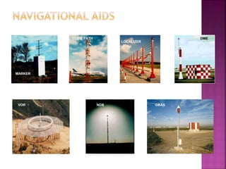
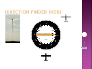
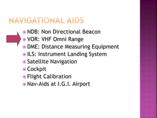
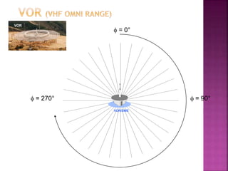
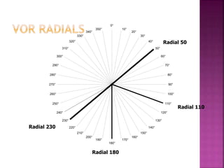
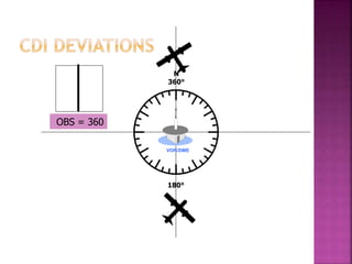
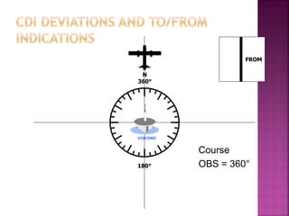
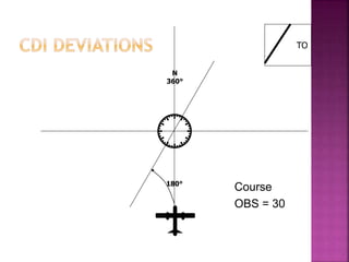
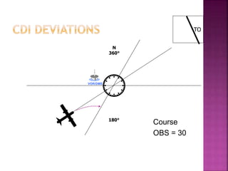
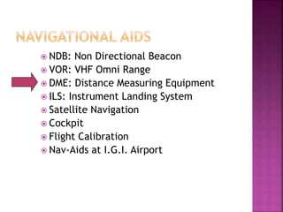
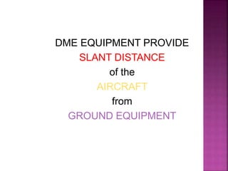
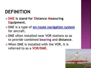
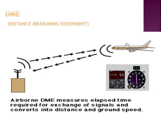
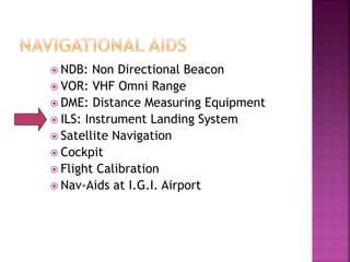
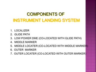
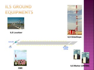
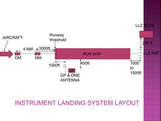
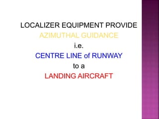
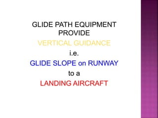
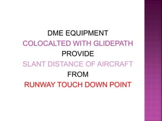
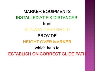
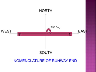
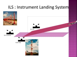
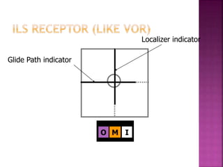
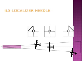
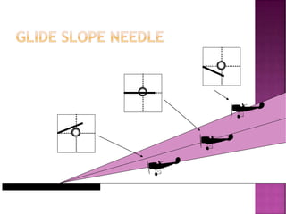
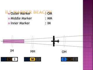
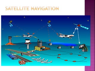
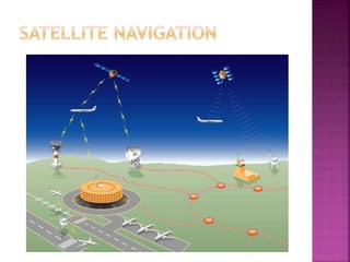
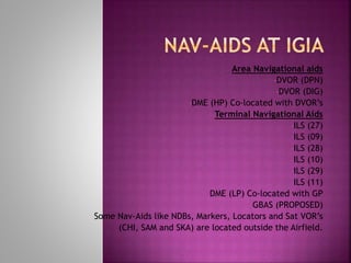
Presented By:
NEHA AGARWAL
MANAGER(CNS)
Airports Authority of India
 AIR TRAFIC CONTROL
 COMMUNICATION FACILITIES
 ENGINEERING
 CARGO
 COMMERCIAL
 FIRE SAFETY
 LAND MANAGEMENT
 TERMINAL MANAGEMENT
 OTHER ALLIED SERVICES
COMMUNICATION OPERATIONS
COMMUNICATION TECHNICAL
1. COMMUNICATION
2. NAVIGATION
3. SURVEILLANCE
4. DATA PROCESSING
 Navigation is the 'ART' of determining the
position of an aircraft over earth's surface
and guiding its progress from one place to
another.
 To accomplish this ART, some sort of ‘AIDS'
are required by the PILOTS.
 NDB: Non Directional Beacon
 VOR: VHF Omni Range
 DME: Distance Measuring Equipment
 ILS: Instrument Landing System
 Satellite Navigation
VOR GBAS
DME
NDB
MARKER
GLIDE PATH
LOCALIZER
 NDB: Non Directional Beacon
 VOR: VHF Omni Range
 DME: Distance Measuring Equipment
 ILS: Instrument Landing System
 Satellite Navigation
 Cockpit
 Flight Calibration
 Nav-Aids at I.G.I. Airport
NDB PROVIDE RELATIVE BEARING
TO THE AIRCRAFT
W.R.T.
DIRECTION OF
NDB EQUIPMENT
IRRESPECTIVE OF
AIRCRAFT HEADING
N
S
E
W
N
S
E
W
NDB
 NDB: Non Directional Beacon
 VOR: VHF Omni Range
 DME: Distance Measuring Equipment
 ILS: Instrument Landing System
 Satellite Navigation
 Cockpit
 Flight Calibration
 Nav-Aids at I.G.I. Airport
VOR EQUIPMENT
PROVIDE
ABSOLUTE BEARING
TO AN AIRCRAFT
with respect to
MAGNETIC NORTH
Irrespective of
AIRCRAFT HEADING
 = 0°
 = 90°
 = 270°
VOR/DME
VOR
0°
10°
20°
30°
40°
50°
60°
70°
80°
90°
100°
110°
120°
130°
140°
150°
160°
170°
180°
190°
200°
210°
220°
230°
240°
250°
260°
270°
280°
290°
300°
310°
320°
330°
340°
350°
Radial 180
Radial 230
Radial 110
Radial 50
180°
N
360°
VOR/DME
OBS = 360
TO
180°
N
360°
Course
OBS = 360°
VOR/DME
FROM
180°
N
360°
Course
OBS = 360°
VOR/DME
TO
Course
OBS = 30
180°
N
360°
TO
Course
OBS = 30
180°
N
360°
VOR/DME
 NDB: Non Directional Beacon
 VOR: VHF Omni Range
 DME: Distance Measuring Equipment
 ILS: Instrument Landing System
 Satellite Navigation
 Cockpit
 Flight Calibration
 Nav-Aids at I.G.I. Airport
DME EQUIPMENT PROVIDE
SLANT DISTANCE
of the
AIRCRAFT
from
GROUND EQUIPMENT
 DME is stand for Distance Measuring
Equipment.
 DME is a type of en-route navigation system
for aircraft.
 DME often installed near VOR stations so as
to provide combined bearing and distance.
 When DME is installed with the VOR, it is
referred to as a VOR/DME.
 DME enables aircraft to establish its range to the
ground station: Distance in nautical miles, Ground
speed in knots, Flying time to the station in minutes
 NDB: Non Directional Beacon
 VOR: VHF Omni Range
 DME: Distance Measuring Equipment
 ILS: Instrument Landing System
 Satellite Navigation
 Cockpit
 Flight Calibration
 Nav-Aids at I.G.I. Airport
COMPONENTS OF
INSTRUMENT LANDING SYSTEM
1. LOCALIZER
2. GLIDE PATH
3. LOW POWER DME (CO-LOCATED WITH GLIDE PATH)
4. MIDDLE MARKER
5. MIDDLE LOCATER (CO-LOCATED WITH MIDDLE MARKER)
6. OUTER MARKER
7. OUTER LOCATER (CO-LOCATED WITH OUTER MARKER)
ILS-LOC
ILS-GS
ILS Marker (OM/MM)
DME
ILS GlideSlope
ILS Localizer
RUN WAY LLZ ANT
1000
to
1500ft
LLZ BLDG
200 ft
GP
GP & DME
ANTENNA
1000ft
Runway
threshold
MM
OM
3500ft
4 NM
AIRCRAFT
450ft
INSTRUMENT LANDING SYSTEM LAYOUT
LOCALIZER EQUIPMENT PROVIDE
AZIMUTHAL GUIDANCE
i.e.
CENTRE LINE of RUNWAY
to a
LANDING AIRCRAFT
GLIDE PATH EQUIPMENT
PROVIDE
VERTICAL GUIDANCE
i.e.
GLIDE SLOPE on RUNWAY
to a
LANDING AIRCRAFT
DME EQUIPMENT
COLOCALTED WITH GLIDEPATH
PROVIDE
SLANT DISTANCE OF AIRCRAFT
FROM
RUNWAY TOUCH DOWN POINT
MARKER EQUIPMENTS
INSTALLED AT FIX DISTANCES
from
RUNWAY THRESHOLD
PROVIDE
HEIGHT OVER MARKER
which help to
ESTABLISH ON CORRECT GLIDE PATH
LOCATER EQUIPMENTS
COLOCATED WITH MARKERS
HELPS
TO LOCATE
MARKER
NORTH
SOUTH
EAST
WEST
090 Deg
60
27
NOMENCLATURE OF RUNWAY END
ILS : Instrument Landing System
Glide Path
ILS GP
ILS Localizer
Glide Path indicator
Localizer indicator
O M I
 Outer Marker : OM
 Middle Marker : MM
 Inner Marker : IM
OM
MM
IM
CRITICAL AREA
is an area of defined dimensions
about the LOCALIZER and GLIDE PATH
where
vehicles, including aircraft,
and any obstructions
(e.g. buildings, fences, trees, etc.)
will cause unacceptable disturbances
to the
ILS performance.
SENSITIVE AREA
is an area extending beyond
the critical area where the
parking and/or movement of
vehicles, including aircraft,
and the
presence of buildings, trees, fences, etc.
may affect the
ILS performance.
 NDB: Non Directional Beacon
 VOR: VHF Omni Range
 DME: Distance Measuring Equipment
 ILS: Instrument Landing System
 Satellite Navigation
 Cockpit
 Flight Calibration
 Nav-Aids at I.G.I. Airport
 NDB: Non Directional Beacon
 VOR: VHF Omni Range
 DME: Distance Measuring Equipment
 ILS: Instrument Landing System
 Satellite Navigation
 Cockpit
 Flight Calibration
 Nav-Aids at I.G.I. Airport
 NDB: Non Directional Beacon
 VOR: VHF Omni Range
 DME: Distance Measuring Equipment
 ILS: Instrument Landing System
 Satellite Navigation
 Cockpit
 Flight Calibration
 Nav-Aids at I.G.I. Airport
 Calibration is the validation of signals
transmitted by an equipment.
 VOR, ILS, NDB, DME are different navigation
aids that need periodic flight inspection.
Aircraft equipped with special and dedicated
hardware (called Flight Inspection System)
collect radio-navigation aids’ data and apply
(compare with) international standards’ tolerance
to validate electronic signal in space and certify
final status of aids.
The goal is having a safe air navigation
infrastructure, ensuring the integrity of
instrument approaches and airway
procedures.
 NDB: Non Directional Beacon
 VOR: VHF Omni Range
 DME: Distance Measuring Equipment
 ILS: Instrument Landing System
 Satellite Navigation
 Cockpit
 Flight Calibration
 Nav-Aids at I.G.I. Airport
Area Navigational aids
•DVOR (DPN)
•DVOR (DIG)
•DME (HP) Co-located with DVOR’s
Terminal Navigational Aids
•ILS (27)
•ILS (09)
•ILS (28)
•ILS (10)
•ILS (29)
•ILS (11)
•DME (LP) Co-located with GP
•GBAS (PROPOSED)
Some Nav-Aids like NDBs, Markers, Locators and Sat VOR’s
(CHI, SAM and SKA) are located outside the Airfield.
Nav_Aids_Presentation_NA.pptx

Nav_Aids_Presentation_NA.pptx