This document provides an overview of Narrow Band Internet of Things (NB IoT) technology. It begins with introductions to IoT and the key elements that make up IoT systems. It then describes NB IoT, including its objectives to enable low cost, long battery life connections for a large number of devices. The document outlines the NB IoT standards development and provides details on its deployment scenarios, operation modes, architecture and characteristics. It also summarizes the different layers of the NB IoT protocol stack, including the radio resource control layer.
An Introduction to IoT: Connectivity & Case Studies3G4G
The document discusses various scenarios for connecting coffee machines in an office building to the Internet of Things (IoT). It begins by describing a basic scenario where coffee machine levels are checked manually multiple times per day. It then discusses scenarios where the machines can send basic notifications when low on supplies, and where they are connected to office systems and databases to optimize replenishment. The most advanced scenario discussed involves the machines ordering their own supplies based on inventory and usage patterns. The document suggests this level of connectivity could allow machines to automate remaining tasks.
WLAN and Bluetooth Indoor Positioning SystemProjectENhANCE
The document summarizes the development of an indoor positioning system using WLAN and Bluetooth technologies. It describes how a team of 9 members created a prototype system over the course of a year that uses signal fingerprinting and positioning algorithms running on an Android phone to pinpoint its location within a school campus. The system was improved throughout development to add Bluetooth, more advanced algorithms, usability enhancements, and scalability features. It provides technical details on the positioning engine, system implementation across servers and clients, and how to use the calibration and positioning applications.
5G technology will be the next major phase of mobile telecommunications, providing speeds 10 times faster than current 4G networks. It will use technologies like ultra wide band networks and smart antennas to achieve speeds up to 1 Gbps. 5G will have a unified software standard to connect various wireless technologies and be more globally accessible at lower cost than previous versions. It is expected to revolutionize wireless systems and be commercially available around 2020.
5G is the fifth generation cellular network technology. The industry association 3GPP defines any system using "5G NR" (5G New Radio) software as "5G", a definition that came into general use by late 2018. Others may reserve the term for systems that meet the requirements of the ITU IMT-2020. 3GPP will submit their 5G NR to the ITU.[1] It follows 2G, 3G and 4G and their respective associated technologies (such as GSM, UMTS, LTE, LTE Advanced Pro and others).
Mobile spectrum and network evolution to 2025 slides coleago - 24 mar 21Coleago Consulting
A review for telecoms regulators and operators of key global developments, insights, trends, and best international practices, to inform future spectrum policy and management and operator strategies.
Ultrawideband is a wireless radio technology originally developed for secure military communications and
radar that is now declassified. It is a high-speed, short-range wireless technology - nearly 10 times faster than
802.11b. It can be used for transferring digital content between devices in different entertainment and
computing clusters in the home, such as digital video recorders, set-top boxes, televisions and PCs. UWB is
designed to replace cables with short-range, wireless connections, but it offers the much higher bandwidth
needed to support multimedia data streams at very low power levels. And because UWB can communicate both
relative distance and position, it can be used for tracking equipment, containers or other objects
In order for the Internet of Things to function properly, a reliable wireless technology needs to be available. Radio frequencies are some of the most popular and effective means for IoT communication.
- 5G NR is designed as a unified, future-proof air interface to efficiently support diverse spectrum types, deployments, services and use cases over the next decade.
- It utilizes an OFDM-based framework with scalable numerology and slot structures to provide flexibility.
- Key 5G NR technologies like massive MIMO and mobile mmWave are aimed at delivering major improvements in areas like connection density, throughput and latency compared to previous standards.
WiFi 7 Training, Improved Latency, Introduction to 802.11beBryan Len
802.11be improvement. 802.11be training, known as WiFi 7.
It is the next noteworthy milestone in the Wi-Fi long-term success story what provides with extremely high throughput and compatible to real-time applications.
Watch the video https://www.youtube.com/watch?v=o-pILzlhP3I
The main features of 802.11be are:
320 MHz bandwidth
Multi-band/multi-channel aggregation
16 spatial streams and Multiple Input
Multiple Output (MIMO) protocols enhancements,
Multi-Access Point (AP) Coordination
Enhanced link adaptation
Adaptation to regulatory rules specific to 6 GHz spectrum,
Integrating Time-Sensitive Networking (TSN) extensions for low-latency real-time traffic (IEEE 802.11aa).
More…
Course outline:
Overview of Wi-Fi Evolution
New Features in Wi-Fi 7
Wi-Fi CERTIFIED 6™
Wi-Fi CERTIFIED 6E
Overview of a WiFi 6E Certified Product Example (Wi-Fi Alliance)
WiFi 6E Security
Overview of Wi-Fi 7
Advanced PHY Techniques Improving Spectrum Efficiency
Introduction to 802.11be, WiFi 7 Training
https://www.tonex.com/training-courses/introduction-to-802-11be-wifi-7-training/
Begin your evolution with Ericsson’s new small cell solutions.
There is need for the multi-operator dots, multi-dot enclosure, and strand -mounted bracket. The complicated arrangements are made easier with Ericsson small cell solutions.
5G is designed to serve an unprecedented range of capabilities with a single global standard. With enhanced mobile broadband (eMBB), massive IoT (mIoT), and mission-critical IoT, the three pillars of 5G represent extremes in performance and associated complexity. For IoT services, NB-IoT and eMTC devices prioritize low power consumption and the lowest complexity for wide-area deployments (LPWA), while enhanced ultra-reliable, low-latency communication (eURLLC), along with time-sensitive networking (TSN), delivers the most stringent use case requirements. But there exists an opportunity to more efficiently address a broad range of mid-tier applications with capabilities ranging between these extremes.
In 5G NR Release 17, 3GPP introduced a new tier of reduced capability (RedCap) devices, also known as NR-Light. It is a new device platform that bridges the capability and complexity gap between the extremes in 5G today with an optimized design for mid-tier use cases. With the recent standards completion, NR-Light is set to efficiently expand the 5G universe to connect new frontiers.
Download this presentation to learn:
• What NR-Light is and why it can herald the next wave of 5G expansion
• How NR-Light is accelerating the growth of the connected intelligent edge
• Why NR-Light is a suitable 5G migration path for mid-tier LTE devices
The document discusses Cloud RAN and its evolution to 5G networks. It covers key aspects of Cloud RAN including disruptive challenges like increasing bits per second per hertz, network virtualization, low latency requirements, and open interfaces. It also provides an overview of Cloud RAN architecture and how Mavenir's solutions align with an evolution from 4G to 5G networks through cloudification of the RAN.
the file is related to my online seminars over Instagram.
this is first presentation about 5G
5G is the 5th generation mobile network. It is a new global wireless standard after 1G, 2G, 3G, and 4G networks. 5G enables a new kind of network that is designed to connect virtually everyone and everything together including machines, objects, and devices.
#5G
#5GNR
#Massive MIMO
#tactile_internet
Join Us:
inststagram.com/ali.nikfal1985
Transforming enterprise and industry with 5G private networksQualcomm Research
The 3GPP put the spotlight on industry expansion in July with 5G NR Release 16 and set the stage for enterprise and industry verticals to look at how to provide high-performance wireless connectivity with 5G private networks. With a variety of options for spectrum, different network architectures, a rich feature set to meet the demanding needs of the industrial Internet of Things (IIoT), and the privacy and security required for business assurance, 5G private networks are poised to transform enterprise and industry.
Watch the webinar at: https://pages.questexnetwork.com/Webinar-Qualcomm-Registration-101520.html?source=Qualcomm
6G networking and connectivity promises significant improvements over 5G through innovative architectures and technologies. 6G aims to enable near-instant, unlimited wireless connectivity to support novel applications like telepresence, autonomous vehicles, and bio-IoT. It envisions integrating space, air, and maritime communications with terrestrial networks. 6G is expected to expand spectrum usage to low THz and visible light bands and employ technologies like nanonetworking, bionetworking, optical networking, and 3D networking. Major research challenges for 6G include developing low-power circuits for new spectrum ranges, seamless integration of multiple technologies, and addressing security and privacy issues in distributed networks.
This presentation provides an introduction to Mobile Cellular Macrocells & Small Cells. It looks at Macrocell components and different terminology associated with it. It also looks at Distributed Antenna Systems (DAS). Then it looks at the need for small cells, different definitions and types of small cells. It also looks at some interesting examples of small cells, especially on drones and helikites. Finally it looks at the difference between boosters, repeaters, relays and small cells.
This presentation outlines the synergistic nature of 5G and AI -- two disruptive areas of innovations that can change the world. It illustrates the benefits of adopting AI for the advancements of 5G, as well as showcases the latest progress made by Qualcomm Technologies, Inc.
Cellular networks have facilitated positioning in addition to voice or data communications from the beginning, since 2G, and we’ve since grown to rely on positioning technology to make our lives safer, simpler, more productive, and even fun. Cellular positioning complements other technologies to operate indoors and outdoors, including dense urban environments where tall buildings interfere with satellite positioning. It works whether we’re standing still, walking, or in a moving vehicle. With 5G, cellular positioning breaks new ground to bring robust precise positioning indoors and outdoors, to meet even the most demanding Industry 4.0 needs.
As we look to the future, the Connected Intelligent Edge will bring a new dimension of positional insight to a broad range of devices, improving wireless use cases still under development. We’re already charting the course to 5G Advanced and beyond by working on the evolution of cellular positioning technology to include RF sensing for situational awareness.
Download the deck to learn more.
An indoor positioning system (IPS) uses wireless technologies like Wi-Fi to locate objects or people inside buildings, as GPS does not work well indoors. IPS relies on nearby nodes with known positions rather than satellites. Wi-Fi fingerprinting involves collecting and storing Wi-Fi signal strengths to develop location fingerprints. IPS has many potential uses including indoor navigation, location-based services, security, and analytics. Researchers are working to increase IPS accuracy by supplementing Wi-Fi with other sensor data.
This document summarizes a seminar presentation on Mobile Ad-Hoc Networks (MANETs). It introduces MANETs as networks without infrastructure where nodes can connect in dynamic and flexible topologies. It discusses routing challenges in MANETs due to the dynamic topology. It also summarizes several routing protocols used in MANETs like DSR, DSDV, CGSR, ABR and SSR, which aim to establish and maintain routes between nodes that are moving. Finally, it discusses security and performance issues in MANETs and proposes the dynamic virtual backbone approach to abstract node mobility.
Dr Rahul Pandya 6G Vision, Potential technologies, and Challenges - Animated ...Dr. Rahul Pandya
The document discusses 6G wireless networks, including key possibilities such as peak data rates over 1 Tb/s and latency under 100 μs. Potential 6G technologies mentioned include terahertz communications in the 0.1-10 THz range, which could provide wide bandwidths but face challenges from atmospheric absorption, rain attenuation, and other factors. The role of artificial intelligence in 6G is also discussed. The document outlines applications such as augmented reality and the internet of nano-things that could be enabled by 6G's high speeds and connectivity.
(1) The document discusses key technology trends and mega trends that will impact the path to 6G networks by 2030. These include a race for 6G research leadership among stakeholders, increasing support for more vertical industries, and the rise of data-driven networks using AI/ML. Other trends include widespread network virtualization, a push for new spectrum and regulation, and momentum for supporting more verticals with specialized requirements.
(2) The document outlines some of the major forums and standards bodies that will help define 6G, including 3GPP, IEEE, IETF, and ITU. It also summarizes expected capabilities for 6G networks compared to 5G, such as higher bandwidths up to 300GHz
This document provides an overview of 5G wireless technology. It discusses how 5G represents the next major phase in mobile telecommunications, offering speeds up to 1 Gbps which is 10 times faster than 4G. The presentation covers the evolution from 1G to 5G networks, the key architecture and hardware/software components of 5G including open wireless architecture and open transport protocol. It also outlines some of the main features, advantages, and applications of 5G technology.
This document discusses Wi-Fi and wireless networking security. It defines Wi-Fi as a wireless technology that uses radio frequencies to transmit data through the air based on the 802.11 standards. It describes the roles of the Wi-Fi Alliance and certification process. It provides an overview of the 802.11 standards including 802.11b, 802.11g and 802.11a. It discusses the advantages and disadvantages of Wi-Fi and outlines some basic security strategies and techniques used to secure wireless networks like blocking the SSID, changing default passwords, and using firewalls.
1. The document discusses the evolution of mobile technologies from 1G to 6G, comparing their key features such as bandwidth, deployment years, and services provided. 2. 6G is proposed to integrate 5G networks with satellite technology to provide global coverage with high-speed internet connectivity up to 11 Gbps for multimedia and weather information services on mobile devices. 3. 6G aims to use nanotechnology and artificial intelligence to connect all network operators to a single core and provide benefits like smart homes and cities, space technology applications, and disaster control.
Autonomous military robot with short range radar and guidance system SatyamShivansh
The document describes a project to develop an autonomous military robot with short range radar and guidance system. The robot is intended to perform dangerous tasks like defusing bombs or scouting instead of risking human lives. It uses cameras, ultrasonic sensors, a microwave radar sensor and GPS for navigation and targeting. The robot can be controlled remotely via a control station and transmit live video feeds. The project aims to build a prototype robot and integrate technologies like motion tracking and a weapon mechanism to demonstrate its military capabilities.
Introduction to Location-Based Service (LBS)Yi-Hsueh Tsai
This document provides an introduction and overview of location-based services and several mobile locating methods, including Enhanced Cell Identity (E-CID), Assisted GPS (A-GPS), Uplink Time Difference of Arrival (U-TDOA), Matrix, and Angle of Arrival (AOA). It describes the basic principles and capabilities of each method, along with their advantages and limitations. The document is intended to explain the technical aspects of locating mobile devices for location-based applications and services.
This document discusses positioning and sensing technologies that are important for vehicular safety applications in 5G and beyond networks. It explores how these technologies, such as GPS, IMUs, radar and lidar, can be used alone or together to determine a vehicle's precise location and sense its environment to improve safety. The high-speed and low-latency connectivity of 5G and beyond networks can facilitate the rapid sharing of this information between vehicles and infrastructure to enable advanced safety features like connected and autonomous vehicles. Novel methods are needed to exploit multipath environments for positioning using large antenna arrays, especially at millimeter-wave frequencies.
The document proposes solutions for improving low-power, wireless, netted sensor networks. It discusses using micro laser radar (MLR) and passive infrared (PIR) sensors that can detect objects at ranges from 100-1000 meters while using low power. The document also proposes using a strategic exfiltration relay infrastructure (SERI) to allow effective sensor data exfiltration and commanding across a widespread network in a scalable way using technologies like GSM cellular networks. It then describes an active 3D micro-scanning laser radar called ARMMIC that can perform localization and volumetric measurements even without GPS to create detailed 3D maps of structures both above and below ground.
IRJET- Personal Assistant for Visually Impaired People in MallsIRJET Journal
This document proposes a personal assistant system for visually impaired people navigating indoor areas like malls using WiFi fingerprinting. The system uses existing WiFi access points to locate a user's position by comparing received signal strength indicator (RSSI) values to a database of reference points mapped to specific locations. It determines the shortest route between locations using Dijkstra's algorithm on a graph of reference points. The system was designed to help the large visually impaired population navigate complex indoor areas more easily using a mobile app and WiFi positioning without the need for additional infrastructure deployment. It aims to provide an indoor location system as an alternative to GPS which does not work well inside buildings.
UAV-Borne LiDAR with MEMS Mirror Based Scanning Capability Ping Hsu
Firstly, we demonstrated a wirelessly controlled MEMS scan module with imaging and laser tracking capability which can be mounted and flown on a small UAV quadcopter. The MEMS scan module was reduced down to a small volume of <90mm><70mm><50g when powered by the UAV‟s battery. The MEMS mirror based LiDAR system allows for ondemand ranging of points or areas within the FoR without altering the UAV‟s position. Increasing the LRF ranging frequency and stabilizing the pointing of the laser beam by utilizing the onboard inertial sensors and the camera are additional goals of the next design. Keywords: MEMS Mirrors, laser tracking, laser imaging, laser range finder, UAV, drone, LiDAR.
This document summarizes research on positioning accuracy for cooperative intelligent transport systems. It discusses how GPS alone cannot satisfy the high-accuracy positioning needs of safety-critical applications in certain environments. New positioning algorithms are being developed that integrate GPS with other sensors and vehicle-to-vehicle communication using DSRC. Current research includes developing techniques for collaborative positioning based on radio range, range-rates, and non-radio ranges. Evaluation of collaborative positioning datasets shows improvements over standalone GPS/INS of up to 60% in positioning accuracy. Future work aims to improve DSRC observations and integration algorithms while incorporating additional sensors.
Location based services (LBS) use a mobile device's positioning information to offer personalized location-aware services to users. LBS can be categorized into services like public safety, location-based charging, tracking, and information services. Key positioning techniques include Cell Global Identity (CGI), Enhanced CGI (E-CGI), triangulation, and Global Positioning System (GPS). CGI provides coarse location within a cell while E-CGI offers greater accuracy using timing advance. Triangulation and GPS provide more precise location data. Assisted GPS (A-GPS) improves GPS performance using assistance data from cellular networks, allowing for faster positioning in difficult environments.
IRJET- A Survey on Various Location Tracking SystemsIRJET Journal
This document summarizes 10 research papers on various location tracking systems. It begins by defining location tracking systems and their importance in fields like transportation, security, and more. It then summarizes the key technologies used in location tracking like GPS, GSM, RFID, and Google Maps. The majority of the papers discussed Android-based systems that use GPS signals from smartphones to determine and share a target's location in real-time. Several papers focused on using SMS messages or mobile apps to alert contacts if a target strayed from their planned route or moved outside a predefined area. Overall, the document provides an overview of different techniques for real-time person and object tracking using wireless technologies and location-based services.
Lidar is an acronym for light detection and ranging. It is an optical remote sensing technology that can measure the distance to, or other properties of a target by illuminating the target with light, often using pulses from a laser.
IRJET- Simultaneous Localization and Mapping for Automatic Chair Re-Arran...IRJET Journal
This document describes a simultaneous localization and mapping (SLAM) technique implemented in an automatic chair re-arrangement system. The system uses an overhead camera and image processing to track a chair's position and orientation. It determines the angle between the chair and its original location, represented by a red dot. The chair has a magnetometer to determine its heading relative to a defined north. The system calculates needed rotations and movements to maneuver the chair back to its original position when displaced. This demonstrates a SLAM solution to automate returning objects like chairs to their proper locations.
AUTOMATIC VEHICLE ACCIDENT INFORMATION BY SMS SYSTEM 0kailashgavare
To reduce number of people losing the life propose system, sending automatic information to the ambulance and ambulance will reach the spot fastly and can save human life and reduce no. of people dying everyday. The proposed system is to reduce the death rate of human every day due to accident by sending SMS to the ambulance an so can save human life .To ensure the safety of the passenger and help the passenger if the accident occurs is the key role plays in our project.
Hybrid Target Tracking Scheme in Wireless Sensor NetworksIRJET Journal
1) The document discusses a hybrid target tracking scheme for wireless sensor networks that combines range-free and range-based localization techniques to more accurately determine the location of unknown nodes.
2) It describes some of the challenges with localization in wireless sensor networks, including environmental factors that can impact variables used for localization like transmission range and signal strength.
3) The hybrid approach determines the exact location of an unknown node using a combination of range-free and range-based methods to improve accuracy compared to using either method alone.
Quadcopter (uavs) for border security with gui systemeSAT Journals
Abstract The authors are designing the Quad-copter (UAVs) for Border Security with GUI System. Now-a-days the security issues of borders are daily increasing. Terrorist activities, firing, etc. at border are increasing day by day. Monitoring is becoming more difficult due to weather conditions, difficult areas which are out of reach etc and risk of losing life of soldier is also increasing. Designing an unmanned air vehicle which will monitor the border area, difficult location, movie shooting etc from long distance can be a good option. GPS is used to track the position of intruder or our troops or vehicles. This GPS data will be received by ARM9 processor and conveyed to observer or controller via zigbee. The Quad-copter is controlled by observer via the IR remote. Observer will fly the Quad-copter from a distance to area which has to be monitored. The Audio-Visual will be transmitted to PC via Wireless camera mounted on assembly. Also recording will be done. Keywords: Quadcopter, GPS, Zigbee, Wireless camera, IR remote, Battery, ARM9 processor, GUI
IJRET : International Journal of Research in Engineering and Technology is an international peer reviewed, online journal published by eSAT Publishing House for the enhancement of research in various disciplines of Engineering and Technology. The aim and scope of the journal is to provide an academic medium and an important reference for the advancement and dissemination of research results that support high-level learning, teaching and research in the fields of Engineering and Technology. We bring together Scientists, Academician, Field Engineers, Scholars and Students of related fields of Engineering and Technology
IRJET - High Frequency Landmine Detection RobotIRJET Journal
This document describes a proposed high frequency landmine detection robot. The robot uses various sensors and modules like an inductive proximity sensor to detect mines, a GPS module to locate the position of detected mines, a GSM module to send the location via SMS, and a camera to capture images of the mine location. The robot is controlled remotely using hand gestures and sends detected mine locations and images to help minimize risk to soldiers. It provides an automated way to scan areas for landmines from a safe distance.
UAVs have been operating since 1996 in Indian Armed Forces . Although there is a huge limitation in the development of the communication system for a wireless HD video and data telemetry link for real time surveillance in BVLOS operations.. What are the main components required for the basic transmission of video and data link? What are the parameters on basis of which such link should be feasible for long range communication? This paper focuses on integration aspects and comparison of the components and its parameters by conducting tests on a UAV set-up.
This webinar with Rohit Gupta, Olivier Hersent and Bart Hendriks aims to reply to the following questions: What are the market opportunities and use cases enabled by IoT Geolocation? What are the benefits of multi-technology geolocation? What are the benefits of using LPWAN technologies (LoRaWAN, NB-IoT, LTE-M) for connectivity? How LPWAN-enabled Geolocation will evolve in the future? How is Actility building multi-technology geolocation platform?
Localization of wireless sensor networkIRJET Journal
This document summarizes a range-free localization algorithm for wireless sensor networks called TSBMCL (Temporary-Seed Based Monte Carlo Localization) that uses the Monte Carlo method. It discusses how TSBMCL works in two main parts: 1) voting for temporary anchor nodes from localized nodes, and 2) using the temporary anchors to aid localization of other nodes. The algorithm is shown to improve localization accuracy over the MCB algorithm. Simulation results demonstrate that TSBMCL reduces localization failure rates and requires fewer sampling particles than standard Monte Carlo localization methods. In conclusion, TSBMCL provides an accurate and efficient range-free localization scheme for mobile wireless sensor networks.
-> Explanation of various techniques for Localization like Triangulation and Proximity Based Techniques. (OTDOA/ AOA/ GSM Fingerprinting/Hybrid technologies, etc.)
-> Working of GPS and its drawbacks.
-> AGPS- working and advantages.
-> E911 call processing in AGPS.
->Location Based Services in 4G
Similar to Marvelmind indoor positioning technologies review (20)
In his public lecture, Christian Timmerer provides insights into the fascinating history of video streaming, starting from its humble beginnings before YouTube to the groundbreaking technologies that now dominate platforms like Netflix and ORF ON. Timmerer also presents provocative contributions of his own that have significantly influenced the industry. He concludes by looking at future challenges and invites the audience to join in a discussion.
Goodbye Windows 11: Make Way for Nitrux Linux 3.5.0!SOFTTECHHUB
As the digital landscape continually evolves, operating systems play a critical role in shaping user experiences and productivity. The launch of Nitrux Linux 3.5.0 marks a significant milestone, offering a robust alternative to traditional systems such as Windows 11. This article delves into the essence of Nitrux Linux 3.5.0, exploring its unique features, advantages, and how it stands as a compelling choice for both casual users and tech enthusiasts.
Why You Should Replace Windows 11 with Nitrux Linux 3.5.0 for enhanced perfor...SOFTTECHHUB
The choice of an operating system plays a pivotal role in shaping our computing experience. For decades, Microsoft's Windows has dominated the market, offering a familiar and widely adopted platform for personal and professional use. However, as technological advancements continue to push the boundaries of innovation, alternative operating systems have emerged, challenging the status quo and offering users a fresh perspective on computing.
One such alternative that has garnered significant attention and acclaim is Nitrux Linux 3.5.0, a sleek, powerful, and user-friendly Linux distribution that promises to redefine the way we interact with our devices. With its focus on performance, security, and customization, Nitrux Linux presents a compelling case for those seeking to break free from the constraints of proprietary software and embrace the freedom and flexibility of open-source computing.
Threats to mobile devices are more prevalent and increasing in scope and complexity. Users of mobile devices desire to take full advantage of the features
available on those devices, but many of the features provide convenience and capability but sacrifice security. This best practices guide outlines steps the users can take to better protect personal devices and information.
UiPath Test Automation using UiPath Test Suite series, part 5DianaGray10
Welcome to UiPath Test Automation using UiPath Test Suite series part 5. In this session, we will cover CI/CD with devops.
Topics covered:
CI/CD with in UiPath
End-to-end overview of CI/CD pipeline with Azure devops
Speaker:
Lyndsey Byblow, Test Suite Sales Engineer @ UiPath, Inc.
Pushing the limits of ePRTC: 100ns holdover for 100 daysAdtran
At WSTS 2024, Alon Stern explored the topic of parametric holdover and explained how recent research findings can be implemented in real-world PNT networks to achieve 100 nanoseconds of accuracy for up to 100 days.
Infrastructure Challenges in Scaling RAG with Custom AI modelsZilliz
Building Retrieval-Augmented Generation (RAG) systems with open-source and custom AI models is a complex task. This talk explores the challenges in productionizing RAG systems, including retrieval performance, response synthesis, and evaluation. We’ll discuss how to leverage open-source models like text embeddings, language models, and custom fine-tuned models to enhance RAG performance. Additionally, we’ll cover how BentoML can help orchestrate and scale these AI components efficiently, ensuring seamless deployment and management of RAG systems in the cloud.
Unlocking Productivity: Leveraging the Potential of Copilot in Microsoft 365, a presentation by Christoforos Vlachos, Senior Solutions Manager – Modern Workplace, Uni Systems
HCL Notes und Domino Lizenzkostenreduzierung in der Welt von DLAUpanagenda
Webinar Recording: https://www.panagenda.com/webinars/hcl-notes-und-domino-lizenzkostenreduzierung-in-der-welt-von-dlau/
DLAU und die Lizenzen nach dem CCB- und CCX-Modell sind für viele in der HCL-Community seit letztem Jahr ein heißes Thema. Als Notes- oder Domino-Kunde haben Sie vielleicht mit unerwartet hohen Benutzerzahlen und Lizenzgebühren zu kämpfen. Sie fragen sich vielleicht, wie diese neue Art der Lizenzierung funktioniert und welchen Nutzen sie Ihnen bringt. Vor allem wollen Sie sicherlich Ihr Budget einhalten und Kosten sparen, wo immer möglich. Das verstehen wir und wir möchten Ihnen dabei helfen!
Wir erklären Ihnen, wie Sie häufige Konfigurationsprobleme lösen können, die dazu führen können, dass mehr Benutzer gezählt werden als nötig, und wie Sie überflüssige oder ungenutzte Konten identifizieren und entfernen können, um Geld zu sparen. Es gibt auch einige Ansätze, die zu unnötigen Ausgaben führen können, z. B. wenn ein Personendokument anstelle eines Mail-Ins für geteilte Mailboxen verwendet wird. Wir zeigen Ihnen solche Fälle und deren Lösungen. Und natürlich erklären wir Ihnen das neue Lizenzmodell.
Nehmen Sie an diesem Webinar teil, bei dem HCL-Ambassador Marc Thomas und Gastredner Franz Walder Ihnen diese neue Welt näherbringen. Es vermittelt Ihnen die Tools und das Know-how, um den Überblick zu bewahren. Sie werden in der Lage sein, Ihre Kosten durch eine optimierte Domino-Konfiguration zu reduzieren und auch in Zukunft gering zu halten.
Diese Themen werden behandelt
- Reduzierung der Lizenzkosten durch Auffinden und Beheben von Fehlkonfigurationen und überflüssigen Konten
- Wie funktionieren CCB- und CCX-Lizenzen wirklich?
- Verstehen des DLAU-Tools und wie man es am besten nutzt
- Tipps für häufige Problembereiche, wie z. B. Team-Postfächer, Funktions-/Testbenutzer usw.
- Praxisbeispiele und Best Practices zum sofortigen Umsetzen
Driving Business Innovation: Latest Generative AI Advancements & Success StorySafe Software
Are you ready to revolutionize how you handle data? Join us for a webinar where we’ll bring you up to speed with the latest advancements in Generative AI technology and discover how leveraging FME with tools from giants like Google Gemini, Amazon, and Microsoft OpenAI can supercharge your workflow efficiency.
During the hour, we’ll take you through:
Guest Speaker Segment with Hannah Barrington: Dive into the world of dynamic real estate marketing with Hannah, the Marketing Manager at Workspace Group. Hear firsthand how their team generates engaging descriptions for thousands of office units by integrating diverse data sources—from PDF floorplans to web pages—using FME transformers, like OpenAIVisionConnector and AnthropicVisionConnector. This use case will show you how GenAI can streamline content creation for marketing across the board.
Ollama Use Case: Learn how Scenario Specialist Dmitri Bagh has utilized Ollama within FME to input data, create custom models, and enhance security protocols. This segment will include demos to illustrate the full capabilities of FME in AI-driven processes.
Custom AI Models: Discover how to leverage FME to build personalized AI models using your data. Whether it’s populating a model with local data for added security or integrating public AI tools, find out how FME facilitates a versatile and secure approach to AI.
We’ll wrap up with a live Q&A session where you can engage with our experts on your specific use cases, and learn more about optimizing your data workflows with AI.
This webinar is ideal for professionals seeking to harness the power of AI within their data management systems while ensuring high levels of customization and security. Whether you're a novice or an expert, gain actionable insights and strategies to elevate your data processes. Join us to see how FME and AI can revolutionize how you work with data!
In the rapidly evolving landscape of technologies, XML continues to play a vital role in structuring, storing, and transporting data across diverse systems. The recent advancements in artificial intelligence (AI) present new methodologies for enhancing XML development workflows, introducing efficiency, automation, and intelligent capabilities. This presentation will outline the scope and perspective of utilizing AI in XML development. The potential benefits and the possible pitfalls will be highlighted, providing a balanced view of the subject.
We will explore the capabilities of AI in understanding XML markup languages and autonomously creating structured XML content. Additionally, we will examine the capacity of AI to enrich plain text with appropriate XML markup. Practical examples and methodological guidelines will be provided to elucidate how AI can be effectively prompted to interpret and generate accurate XML markup.
Further emphasis will be placed on the role of AI in developing XSLT, or schemas such as XSD and Schematron. We will address the techniques and strategies adopted to create prompts for generating code, explaining code, or refactoring the code, and the results achieved.
The discussion will extend to how AI can be used to transform XML content. In particular, the focus will be on the use of AI XPath extension functions in XSLT, Schematron, Schematron Quick Fixes, or for XML content refactoring.
The presentation aims to deliver a comprehensive overview of AI usage in XML development, providing attendees with the necessary knowledge to make informed decisions. Whether you’re at the early stages of adopting AI or considering integrating it in advanced XML development, this presentation will cover all levels of expertise.
By highlighting the potential advantages and challenges of integrating AI with XML development tools and languages, the presentation seeks to inspire thoughtful conversation around the future of XML development. We’ll not only delve into the technical aspects of AI-powered XML development but also discuss practical implications and possible future directions.
Cosa hanno in comune un mattoncino Lego e la backdoor XZ?Speck&Tech
ABSTRACT: A prima vista, un mattoncino Lego e la backdoor XZ potrebbero avere in comune il fatto di essere entrambi blocchi di costruzione, o dipendenze di progetti creativi e software. La realtà è che un mattoncino Lego e il caso della backdoor XZ hanno molto di più di tutto ciò in comune.
Partecipate alla presentazione per immergervi in una storia di interoperabilità, standard e formati aperti, per poi discutere del ruolo importante che i contributori hanno in una comunità open source sostenibile.
BIO: Sostenitrice del software libero e dei formati standard e aperti. È stata un membro attivo dei progetti Fedora e openSUSE e ha co-fondato l'Associazione LibreItalia dove è stata coinvolta in diversi eventi, migrazioni e formazione relativi a LibreOffice. In precedenza ha lavorato a migrazioni e corsi di formazione su LibreOffice per diverse amministrazioni pubbliche e privati. Da gennaio 2020 lavora in SUSE come Software Release Engineer per Uyuni e SUSE Manager e quando non segue la sua passione per i computer e per Geeko coltiva la sua curiosità per l'astronomia (da cui deriva il suo nickname deneb_alpha).
GraphSummit Singapore | The Art of the Possible with Graph - Q2 2024Neo4j
Neha Bajwa, Vice President of Product Marketing, Neo4j
Join us as we explore breakthrough innovations enabled by interconnected data and AI. Discover firsthand how organizations use relationships in data to uncover contextual insights and solve our most pressing challenges – from optimizing supply chains, detecting fraud, and improving customer experiences to accelerating drug discoveries.
Unlock the Future of Search with MongoDB Atlas_ Vector Search Unleashed.pdfMalak Abu Hammad
Discover how MongoDB Atlas and vector search technology can revolutionize your application's search capabilities. This comprehensive presentation covers:
* What is Vector Search?
* Importance and benefits of vector search
* Practical use cases across various industries
* Step-by-step implementation guide
* Live demos with code snippets
* Enhancing LLM capabilities with vector search
* Best practices and optimization strategies
Perfect for developers, AI enthusiasts, and tech leaders. Learn how to leverage MongoDB Atlas to deliver highly relevant, context-aware search results, transforming your data retrieval process. Stay ahead in tech innovation and maximize the potential of your applications.
#MongoDB #VectorSearch #AI #SemanticSearch #TechInnovation #DataScience #LLM #MachineLearning #SearchTechnology
Unlock the Future of Search with MongoDB Atlas_ Vector Search Unleashed.pdf
Marvelmind indoor positioning technologies review
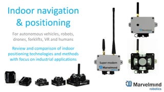
1. Indoor navigation
& positioning
For autonomous vehicles, robots,
drones, forklifts, VR and humans
Review and comparison of indoor
positioning technologies and methods
with focus on industrial applications
2. Problem to solve
• GPS does not work indoor:
1. no direct view to satellites
2. location precision is measured in meters rather than
in centimeters (required indoor)
• Other indoor navigation systems - UWB, Bluetooth
beacons, odometry, magnitometers, WiFi RSSI, laser
triangulation, optical, etc. - have their own serious
limitations – usually, either precision, or price, or
size
• Without precise and timely knowledge of location,
autonomous navigation is impossible
2
3. Terminology
3
- AoA Angle of Arrival
- AoD Angle of Departure
- AR Augmented Reality
- BLE Bluetooth Low Energy
- GNSS Global Navigation Satellite System (GPS, GLONASS,
Galileo, Beidou. Michibiki
- GPS Global Positioning System
- IA Inverse Architecture (Marvelmind Robotics)
- ILS Indoor Localization System
- IP67 Ingress Protection
- IPS Indoor Positioning System
- IMU Inertial Measurement Unit
- LIDAR Light Detection and Ranging
- LoS Line-of-sight
- MEMS Micro-Electro-Mechanical Systems
- NIA Non-Inverse Architecture
- Non-LoS Non-line-of-sight
- RSSI Received Signal Strength Indicator
- RTLS Real-time Locating Systems
- TDoA Time Difference of Arrival
- TDMA Time Division Multiple Access
- ToA Time of Arrival
- UWB Ultra Wideband
- VR Virtual Reality
- ZigBee Wireless mesh network standard
4. Types of indoor positioning methods
- Trilateration – time of flight
- GPS
- UWB
- Marvelmind Robotics’ Indoor “GPS”
- RSSI-based
- BLE (Bluetooth Low Energy)
- WiFi
- ZigBee
- Triangulation
- LIDARs
- Mixed
- BLE + angle of arrival (AoA)
- Odometry
- Inertial
- Inexpensive MEMS IMU vs. laser IMU
4
- Optical
- QR codes
- Stargazers
- Optical flow
- Motion capture
- Sensor fusion
- IMU+ultrasonic
- Drift vs. jumps
- Location update rate
- Other types and exotic
- Li-Fi
- RFID
- Magnetic
5. No methods or RTLS good for all
Too many contradicting requirements. Users must choose:
- Update rate
- Update on request vs. 100-400Hz for VR/AR
- IP67 and Ex requirements
- Price
- Power consumption and battery lifetime
- Weight
- Size
- Tolerance to particular types of interferences (radio, light, sound)
- Location vs. Location+Direction
- Embedded IMU
- Data communication to and from mobile beacons
5
6. RSSI-based RTLS imprecise by design
- WiFi, BLE (Bluetooth), ZigBee, LoRa – not designed for positioning, but
can be used in many cases with technology related limitations
- Signal strength (RSSI) easily deviates 10x times over the course of 1m
- Fingerprint Database and need for calibration – time and efforts
- Additional improvements:
- Averaging => but leads to more latency and shorter battery lifetime
- Mathematical models => limits applicability
- Angle of Arrival (AoA) and Angle of Departure (AoD)
- Combination of imprecise RSSI + angles => up to 3 times better precision
- Multiple antennas => larger size, larger cost, limitations of applicability
6
https://people.csail.mit.edu/bkph/ftmrtt_intro
7. IMU-based RTLS drifts a lot
- IMU (inertial measurement unit) – usually, 3D accelerometer + 3D gyroscope.
Often, additionally, 3D magnetometer
- Magnetometers work poorly indoor – don’t rely on them
- Pure IMU indoor RTLS can’t really perform for long time period (more than
seconds) due to very-very high drift of double integration of accelerometer data
- Still, they can be sufficiently precise depending on the types of IMU units (laser-
based IMU vs. MEMS IMUs) and required precision (cm vs. km) – fraction of
seconds to small seconds. Need constant drift elimination by external systems
- Pedestrian Dead Reckoning algorithms and different flavors of them
- IMU+Ultrasonic sensor fusion of Marvelmind Robotics
7
8. Trilateration can be very precise
‐ Trilateration ≠ triangulation
‐ Trilateration; measure distances from 3 or more known points
and calculate location of mobile beacon. Usually, time of flight
‐ 1D, 2D, 3D, multilateration
‐ Examples of systems based on trilateration – time of flight:
- GPS – radio waves 1.2GHz & 1.5GHz
- UWB – ultra wideband radio waves (3..10GHz)
- Marvelmind Robotics’ Indoor “GPS” – ultrasound (20..60kHz) +
radio in license-free ISM band (433MHz or 868/915MHz)
- Light based trilateration RTLS – could exist
- Still uncertainty where the intersection point is – know-hows
- Timing and synchronization – know-hows
- Noise and interference
- Obstructions => use redundancy
8
9. Precise RTLS must have line of sight
‐ Time of flight trilateration systems assumes that:
‐ Distance measured precisely => Distance measured as speed*time =>
speed must be constant. But the signal propagation speed in air and in
the wall are very different! Thus, you can rely on them any longer
‐ Non-line of sight precise RTLS are in fact, line of sight RTLS,
but with transparent walls/obstructions:
‐ Carton-like gypsum walls of many offices are radio transparent for UWB
‐ “Breathable” cloth is transparent to Marvelmind Indoor “GPS” ultrasound
‐ But!
‐ Concrete walls of warehouses, palettes, metal shelves are radio
non-transparent for UWB
‐ Even sheet of paper is not transparent for ultrasound or LIDAR
light
9
Line of sight is a must for
precise industrial RTSL
10. What to do in Non-LOS situations?
‐ Make line of sight possible
‐ Proper network planning and beacon placement*
‐ Use submaps and install more stationary beacons*
‐ N+m redundancy of stationary beacons (anchors)*
‐ 2N and TDMA approach for redundancy*
‐ Use sensor fusion
‐ Odometer+Indoor “GPS”*
‐ IMU+Indoor “GPS”*
‐ Special algorithms: instead of pure 3D – temporary 2D**
‐ Tolerate lack of tracking for some areas
‐ More beacons & more cost vs. fewer beacons & lack of coverage in
some areas – decision based on economics of the business case
10
Line of sight is a must for
precise industrial RTSL
* Methods used in Marvelmind Indoor “GPS”
11. Different flavors of UWB
11
https://kinexon.com/technology/real-time-locating-system-rtls
12. LIDARs: precise, but not really designed
for positioning and navigation
12
‐ Price: Long-range LIDARs are costly. For indoor less expensive LIDARs can be used
‐ Applicability: Good for obstacle avoidance and detection. Not really designed for
positioning
‐ Use cases: robotics, AGVs. Rarer – drones. Hardly possible for people
‐ Rather complex SLAM algorithms with questionable performance in real-life
environment of a factory floor or a busy warehouse
Quality of positioning very much depends on the complexity of the environment. In basic
and simple rooms with few changes in the environment and few other mobile objects
(AGVs/robots, people) – works rather well. In real complex ever-changing environment of
production site or a warehouse – either unreliable or lost completely
Use LIDARs for obstacle avoidance and
detection. Don’t rely for positioning
13. QR codes + IMU + odometry
‐ Kiva Robotics prominently used the method years ago.
The very large number of robotics companies-copycats
use now this very good and robust method
‐ Uses:
‐ QR codes on the floor every 1-2m – absolute positioning
‐ Odometry + IMU to move precisely, but with accumulated
error – relative positioning between the QR code spots
‐ Suits for robots. Doesn’t suit for forklifts, drones, people
13
Sensor fusion systems optimally tuned for a task
perform the best among all indoor navigation systems
14. Visual positioning
Multiple flavors from limited and special to generic:
‐ Stargazing and landmark navigation
‐ Optical flow: drones, VR. Good for relative positioning
‐ Works with special QR codes or with other encrypted in patterns
information. Can be very practical in some cases
‐ Inside Out vs. Outside In positioning
‐ VR/AR
‐ Motion capture => cinema/VR
‐ Quality of positioning depends on lighting and distance
(a few meters at most, usually)
14
Some visual positioning methods become good
options despite immense internal complexity
15. Requirements: Location update rate
GPS satellites send radio signals, but don’t track all
millions of users:
- Very often, we need to track multiple mobile users. Thus,
there is a trade off between update rate per user and the
number of mobile users supported
Marvelmind Robotics has two architectures:
1. Non-Inverse Architecture (NIA)
• Great for drones and other noisy mobile objects
• Simple to understand and to deploy. Very robust
2. Inverse Architecture (IA)
• Great for tracking multiple 5-200 mobile objects without update rate
reduction. More complex to deploy
15
16. Requirements: Power supply & battery lifetime
Higher update rate => nearly proportionally shorter battery
lifetime
- If only possible, use external power supply and have piece of mind
- Choose optimally between required update rate and battery lifetime
- Replaceable battery vs. re-chargeable batteries
- “5-year battery lifetime” is meaningless. What is the update rate?
What is the range?
- Power supply of stationary beacons vs. mobile beacons
- Powering of stationary beacons externally may be very challenging
and costly
- BLE stationary is great. UWB stationary – terrible
- Mobile UWB great. BLE – terrible
- Marvelmind Indoor “GPS” is in the middle between the BLE and UWB
16
17. Requirements: Location vs. Location+Direction
Magnetometers or compasses are not
reliable indoor
difficult to figure direction where robot / AGV /
drone / person is facing
1. Solution 1: Moving 1m => IMU lock => constant IMU drift correction –
complex and not always possible and reliable
2. Solution 2: Use Marvelmind feature called Paired Beacons – but very
precise positioning required for small base between mobile beacons =>
works with Marvelmind’s Indoor “GPS” and RTK GPS. Not really works
with UWB and reasonable size base due to insufficient precision of
UWB. Doesn’t work with BLE v4.0 but may work to some extend with
BLE v5.1 supporting AoA
17
18. Market approach by Marvelmind Robotics
18
UWB (10-30cm)
A few dozens
of companies worldwide
Bluetooth (2-5m), WiFi (5-10m)
A few hundreds of companies worldwide.
Suitable, mostly, for consumer markets
Very low entry-barriers in BLE positioning:
- Dozens of BLE beacon HW providers – no need to have HW
competence. Nearly ready to use BLE SW stack
Thus, hundreds of players chasing large consumer market:
navigating people with phones <=> not exactly tuned for industrial
applications
Relatively low entry-barriers in UWB field:
- Ready to use UWB chipsets or even UWB modules (Decawave, etc.) – ready to use
low-level HW. Ready to use low-level SW stack from chip vendors
- Companies create only high-level SW and make final product in HW
Problems for players:
- Totally dependent on chip vendors: in terms of performance (nearly all UWB
systems show about the same performance) and in terms of roadmaps => delays
Marvelmind’s approach – superior precision and avoiding direct competition:
- Own architectures & own protocols → full independence and world’s superior performance
- Own HW design from scratch on generic ARM processors → development speed and low cost
- Own SW from low-level to high-level → speed, low cost, easy scaling
- Open external interfaces and ready to use SW libraries and APIs → easy integration by end-users
1) Few startups have deep Architecture & HW & SW competences => simply can’t develop as we did
2) Large corporations prefer to buy proven – either product from us or us as a company completely
19. Marvelmind Indoor “GPS”
• Off-the-shelf ready-to-use indoor
navigation system based on stationary
ultrasonic beacons united by radio
interface in license-free ISM band
• Location of a mobile beacon installed on a
robot (vehicle, copter, human) is
calculated based on the propagation delay
of ultrasonic signal to a set of stationary
ultrasonic beacons using trilateration
19
20. Indoor “GPS” (±2cm)
• Starter Set configuration:
• 1 mobile beacon – 99 USD
• 4 stationary beacons – 4*99 USD
• 1 router – 99 USD
• All required SW included
Ready to use 3D (x, y, z) system for 499 USD
Covers up to 1000m²
20
22. Advertising robots with high-
tech charm - shows, shopping
malls, conferences, museums
Virtual reality for
BIM, quests, training
and gaming
Automatic
delivery inside
large buildings
Autonomous drones indoor
for inventory management,
video/photo, security
22
Marvelmind beacon
PM of India
Modi and
Ivanka Trump
Autonomous robots, drones, VR
23. Use cases: mobile assets tracking
Use case:
- Tracking vehicles, buggies, trolleys, forklifts and other mobile assets in
tunnels, passenger and cargo areas of airports and warehouses
Problems solved:
- Speeding
- Accidents
- Broken equipment and goods
- Lost or underutilized mobile assets
Benefits:
- Precise knowledge of who is doing what and where => productivity increase
- Real-time data about speed, acceleration, position of the mobile assets =>
productivity increase
- Preventing accidents and decreasing insurance and other avoidable costs
23
24. Tracking workers’ location underground,
in metro or tunnels, on construction sites
or railways stations or under bridges
Use case:
• Underground / mining / metro
• Construction sites
• Large manufacturing factories
• Dangerous manufacturing
• Oil refineries and gas companies
- Increasing productivity
- Improving safety
Use cases: safety & productivity
24
25. Stationary beacons:
– Mounted on walls or ceilings
– Users have to measure distances between
stationary Mini-RX beacons manually
– Communicate with router wirelessly in
ISM/SRD bands
Distance between
beacons-neighbors is
up to 25 meters.
Router/modem:
– Central controller of the system
– Calculates position of mobile beacon up to 25 Hz
– Communicates via USB/virtual UART with Dashboard or
robot
Mobile beacon:
– Installed on robot and interacts with it via UART
or SPI or I2C or USB
– Receives location update from router up to 25
times per second
– May contain IMU (accelerometer + gyroscope +
compass module)
Mini-RX
Beacon N
Non-Inverse Architecture (NIA)
Indoor Navigation System
consists of:
– 2 or more stationary beacons
– 1 or more mobile beacons
– 1 central router
Mini-RX Beacon 1
Mini-RX Beacon 3
Mini-RX Beacon 2
Submaps:
– Advanced feature that allows building independent
maps/clusters of beacons in separate rooms and thus
covering large buildings (with area of thousands of
m2) similar to cellular network coverage
Key requirement for the system to work:
unobstructed sight by a mobile beacon of 2 or more
stationary beacons simultaneously (like in GPS)
26. Stationary beacons:
– Mounted on walls or ceilings
– In inverse system beacons belonging to the
same submap should have different ultrasound
frequencies (19 & 25kHz or 25 & 31 kHz, for
example)
– Communicate with router wirelessly in
ISM/SRD band (433/868/915MHz)
Distance between
beacons-neighbors is
up to 25 meters.
Router/modem:
– Central controller of the system
– Communicates via USB/virtual UART with Dashboard or robot
– Get location data from Mobile Mini-RX beacons
– Supports up to 250 beacons
Mobile Mini-RX beacon(s):
– Installed on robot (human) and interacts with it
via virtual UART over USB
– Contains 3D IMU (accelerometer+gyroscope)
– Beacon’s update rate doesn’t directly depend on
the number of mobile beacons unlike in NIA
– Calculates its location by itself – not by modem
– Recommended distance from mobile beacon to
stationary ones up to 25m
Beacon N
(19, 25, 31,
37, 45 kHz)
Indoor Navigation System
consists of:
– 2 or more stationary beacons
– 1 or more mobile Mini-RX beacons
– 1 central router
Beacon 1 (19kHz)
Beacon 3
(31kHz)Beacon 2
(25kHz)
Submaps:
– Advanced feature that allows building independent
maps/clusters of beacons in separate rooms and
thus covering large buildings (with area of
thousands of m2) similar to cellular network
coverage
– In Inverse Architecture every submap must have
beacons with non-repeating ultrasound frequency
– Available frequencies: 19, 25, 31, 37, 45 kHz
Key requirement for the system to work:
unobstructed line of hearing/sight by a mobile
beacon to 2 or more stationary beacons
simultaneously (like in GPS)
Inverse Architecture (IA)
27. Huge AGV, transport and people
Result:
- High precision tracking Marvelmind Indoor
GPS
- Alarm for workers and equipment drivers
- Recording violations in a CSV file for
further analysis
- AGV auto stop (optional)
Configuration:
- 4 x Industrial Super-Beacon-Plastic (Placed
on AGV)
- N x Marvelmind Headlight (1 per worker,
placed on the helmet)
- 1 x Super-Modem (Placed on AGV)
Task:
- Prevent dangerous proximity of AGV and humans
- Prevent AGV-Human Collision
Solution:
- Marvelmind Indoor GPS system installed directly on the AGV,
with a mobile geofencing zone
Mobile Geofencing zone on AGV
Super-Modem
Marvelmind
Headlight
Ind Super-Beacon
≤30m
Alarms:
‐ Visual
‐ Vibration
‐ Sound
Navigation system’s
service zone
Geofencing zone:
‐ Custom sizes and
options
‐ Violation of the zone
leads to alarms
Marvelmind
Helmet
Marvelmind Jacket
Principle of operation:
- The Marvelmind Indoor GPS system, where
the AGV is a mobile map, the entrance to
the Geofencing zone of which will warn the
person and operator about a dangerous
proximity, and also, at a critically
dangerous proximity, stop the AGV
Super-Modem:
- Central system controller. Collects data
from all beacons, and sends them through
an external 4G modem to the central
Dashboard
28. Safety at the construction site, people
Result:
- High precision tracking Marvelmind Indoor
GPS
- Alarm for workers and shift supervisor
- CSV file with recording of all movements
during the shift
- Automatic recording of all violations in a
file for further analysis (optional)
Configuration:
- N x Industrial Super-Beacon-Plastic
(mounted on a tripods)
- N x Marvelmind Headlight (1 per worker,
placed on the helmet)
- 1 x Super-Modem (placed in the center)
Task:
- To warn the employee's dangerous approach to the danger
zone, to obtain data on the movement of people
Solution:
- Marvelmind Indoor GPS system installed on site with
customizable geofencing zones
Static Geofencing zones at a construction site
Super-Modem
Marvelmind
Headlight
Navigation system’s
service zone
Marvelmind
Helmet
Marvelmind Jacket
Principle of operation:
- The Marvelmind Indoor GPS system in this
configuration provides tracking of people
with customizable geofencing zones and
warns a person of approaching danger
Industrial
Super-Beacon,
mounted on a
tripod
Ind Super-beacon
Battery
Battery-12V-
5Ah-Outdoor
orSuper-Beacon-
Outdoor,
mounted on a
tripod
Geofencing zone:
‐ Custom sizes and
options
‐ Violation of the zone
leads to alarms
Alarms:
‐ Visual
‐ Vibration
‐ Sound
Super-Modem:
- Central system controller.
Collects data from all
beacons, and sends them
through an external 4G
modem to the central
Dashboard Direct visibility:
‐ For 2D tracking, a
prerequisite is the
presence of a mobile
beacon in the line of
sight, at least up to
two stationary
29. Alarms:
‐ Visual
‐ Vibration
‐ Sound
Navigation system’s
service zone
Geofencing zone:
‐ Custom sizes and
options
‐ Violation of the zone
leads to alarms
Super-Modem:
- Central system controller.
Collects data from all
beacons, and sends them
through an external 4G
modem to the central
Dashboard
Cargo
>3m
Base of beacons on the crane
Safety when working cranes and people
Result:
- High precision tracking Marvelmind Indoor
GPS
- Alarm for workers and shift supervisor
- CSV file with recording of all movements
during the shift
- Automatic recording of all violations in a
file for further analysis (optional)
Configuration:
- 3 x Industrial Super-Beacon-Plastic (placed
on the crane)
- N x Marvelmind Headlight (1 per worker,
placed on the helmet)
- 1 x Super-Modem (placed on the crane)
Task:
- Prevent dangerous approach and collision of cargo with a
person
Solution:
- Marvelmind Indoor GPS system installed directly on the crane
with a mobile geofencing zone, which moves after the crane's
boom
Mobile geofencing zone on crane boom
Super-Modem
Marvelmind
Headlight
Ind Super-Beacon
Marvelmind
Helmet
Marvelmind Jacket
Principle of operation:
- In this configuration, the end of the crane
boom is a card, the entrance to the
Geofencing zone of which will warn the
person and operator about a dangerous
proximity
30. Time
Worker 1
(>80%)
Worker 2
(>50%)
Worker 3
(<50%)
8:00-8:15
9:00-9:15
11:00-11:15
20:00-20:15
21:00-21:15
22:00-22:15
23:00-23:15
Reporting Table (Marvelmind)
‐ The report is generated by the Central
Super-Modem, and sent via Wi-Fi to your IP
address on request or in a pre-set time (for
example, nightly)
Side view
Restroom Result:
- Automatic report on movements in the
areas of responsibility of service employees
(CSV file)
- Auto-fill table (optional)
Configuration:
- N x Super-Beacon (1 per restroom)
- N x Badge (1 per worker)
- N+1 x Super-Modem (1 per floor + 1
central)
Badge
Super-Beacon
Task:
- Tracking service staff
- Performance monitoring
Solution:
- Marvelmind Indoor GPS system for monitoring and analyzing
the work of service personnel in 1D configuration
Super-Modem
Central Super-
Modem
Server with report
Tracking service staff
On the example of one floor of a shopping center
31. Station 1
Station 2
Super-Modem 1
Station N
Super-Modem 2
Super-Super Modem
PC with Windows/Linux
No direct visibility
≤30m
≤ 60m
Stationary
beacons
Direct visibility
Modem 1 radio coverage zone
Beacon ultrasonic
coverage zone
Tunnel
Modem 2 radio
coverage zone
Modem N radio coverage zone
31
Super-Modem
Super-Modem N
Industrial
Super-Beacon
Badge
Marvelmind
Helmet
Battery-12V-
5Ah-Outdoor
Converter-
220V-12V-IP67
Marvelmind
Headlight
Marvelmind
Jacket
Tunnel safety and performance
Multi-modem system for underground tracking
32. Beacon Mini-RX/Beacon Mini-
RX-Outdoor
Beacon Mini-TX
Beacon Mini-TX
batteryless
Super-Beacon/Super-Beacon-Outdoor Industrial-Super/Industrial-Super-EX Industrial-RX/Industrial-RX-EX
Specialty and main use
Universal, multi-frequency and
high-sensitivity RX-only beacon
Small TX only beacon
The lightest TX only
beacon
Universal dual-use beacon. Support of
433- or 915/868MHz bands
Heavy-duty outdoor/Explosion dangerous
environment; RS485 or CAN
Heavy-duty outdoor/Explosion dangerous
environment; RS485 or CAN
Mode of operation RX only TX only Dual-use (RX and TX) Dual-use (RX and TX) RX only
Range
- Up to 30m with Super-
Beacons
- Up to 30m with Super-Beacon
- Up to 30m with Super-Beacons
- Up to 30m with Beacon v4.9³
- Up to 30m with Industrial-RX - Up to 30m with Ind. Super-Beacon
Ultrasonic frequencies
- 19/25/31/37/45kHz
- Several at the same time
- 31/45kHz
- Only one HW defined frequency at the time
- 19/25/31/45kHz
- Only one frequency at the time
‐ 19/25/31/45kHz
- 19/25/31/45kHz
- Several at the same time
Radio band 915/868MHz 915/868MHz 915/868MHz or 433MHz 915/868MHz or 433MHz 915/868MHz or 433MHz
Power/LiPol battery USB/750mAh USB/250mAh USB/No embedded battery USB/1000mAh +6..16V or IP67 converter/Ext.battery +6..16V or IP67 converter/Ext.battery
Environmental
conditions
- Indoor/Outdoor up to IP67
- t=0..40C⁶
- Indoor/Outdoor²
- t=0..40C⁶
- Indoor
- t=0..40C⁶
- Indoor/Outdoor²
- t=0..40C⁶
- Outdoor²/Intrinsically Safe⁵
- t=-20..40C⁶
- Outdoor²/Intrinsically Safe⁵
- t=-20..40C⁶
Size and weight 47x42x15mm & 25g 35x35x26mm & 19g 35x35x20mm & 12g⁹ 55x55x33(64⁷)mm & 62/75g 83x58x65mm⁸ & 250g 83x58x33mm⁸ & 200g
IMU (3D gyro+acc+mag) Yes (6D) Yes (6D) Yes (6D) Yes (6D) Yes (6D) Yes (6D)
Price 99/129 USD 89 USD 89 USD 99/129 USD 149/189 USD 149/189 USD
32
1) Withstand submersion to water on 1m up to 30m (IPx7 requirements)
2) IP56. Performance during this time is no guaranteed
3) 1D mode: RX4 to RX4 sensors; other sensors are disabled
4) Other power options available upon request
5) Exact type of certification shall be discussed separately
6) Temperature range down to -40C is available with external power supply only
and upon request
7) With antenna
8) Sizes without mounting holes
9) 6.3g without housing
Beacons comparison
33. Summary
33
1. No method suits all needs → choose yours
2. Systems specifically designed for positioning
(Marvelmind’s Indoor “GPS”, UWB), expectedly,
perform significantly better than regular data
transmission systems (BLE, WiFi, LoRa)
3. Sensor fusion systems shows the best results
34. Thank you!
Marvelmind Robotics
Marvelmind Inc.
1111 W El Camino Real #109-365
Sunnyvale CA
94087
USA
34
info@marvelmind.com
https://marvelmind.com/#watch_demo – selected video demos
https://marvelmind.com/#customers – selected customers
Marvelmind OÜ
Ahtri tn 12, Kesklinna linnaosa,
Harju maakond,
Tallinn, 10151
Estonia
Marvelmind2 LLC
Skolkovo Innovation Center
Lugovaya str., 4 bld 5 room 17
Moscow, 143026
Russian Federation