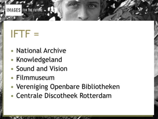
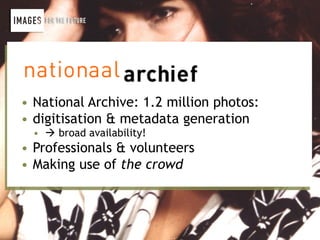
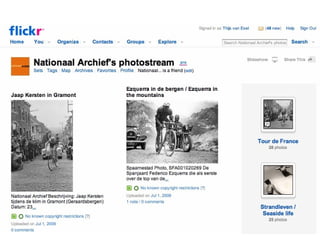
Download to read offline


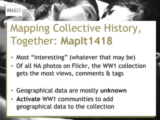
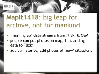


This document summarizes the MapIt1418 project, which aims to add geographic data to historical photos from World War 1 by activating communities on Flickr. The project "mashes up" Flickr photo data with mapping data from OpenStreetMap to allow people to geotag photos on a map and add their own stories. The organizers chose OpenStreetMap due to its openness, social ecosystem, and ability to be customized. They developed MapIt1418 with thorough interaction and graphic design to make mapping accessible despite the non-technical audience. The project brings together Flickr, OpenStreetMap, and other technologies to enrich cultural heritage collections and make them more discoverable.


