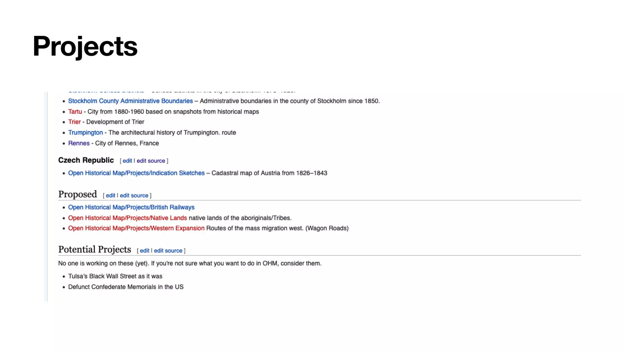
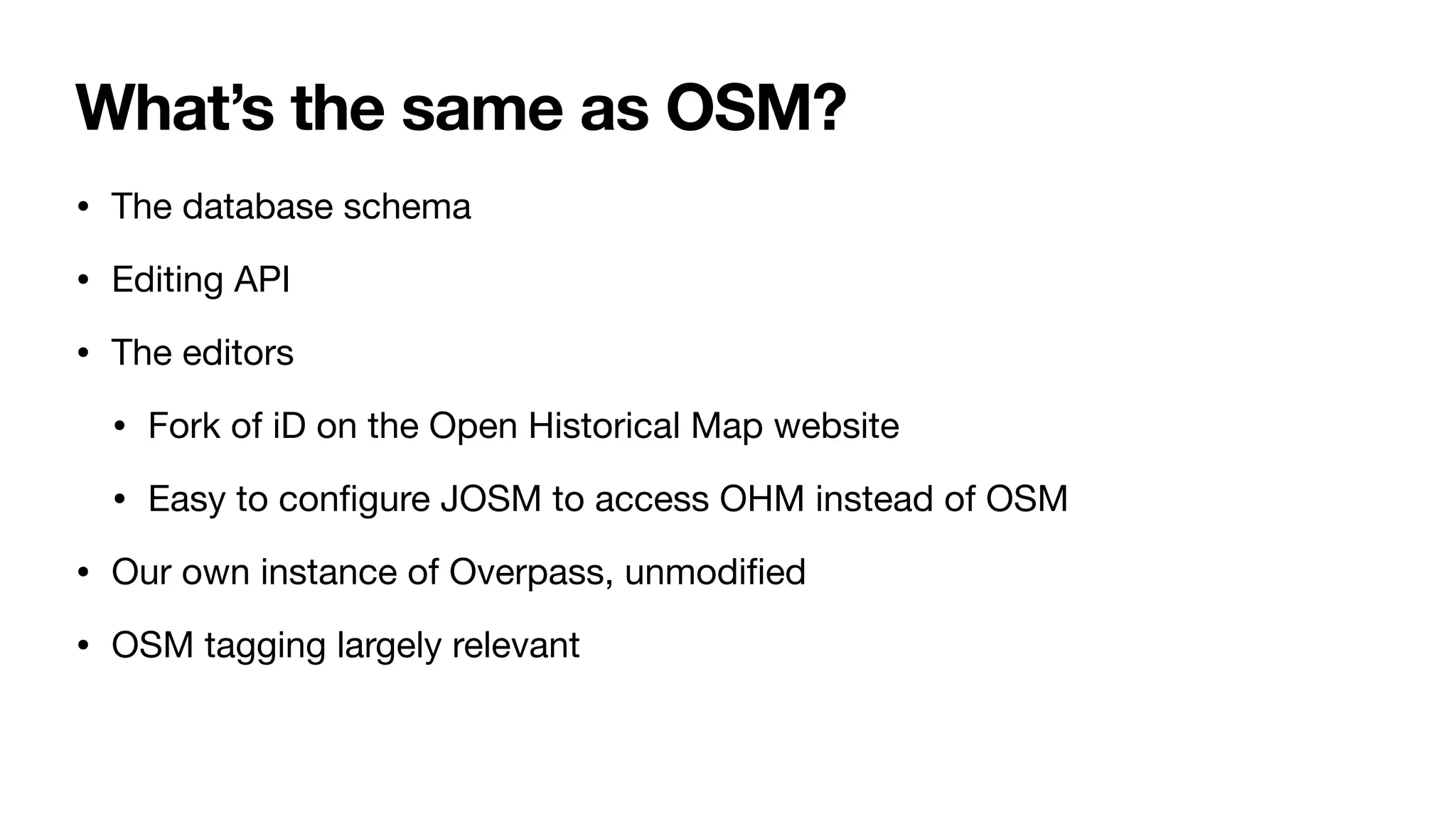
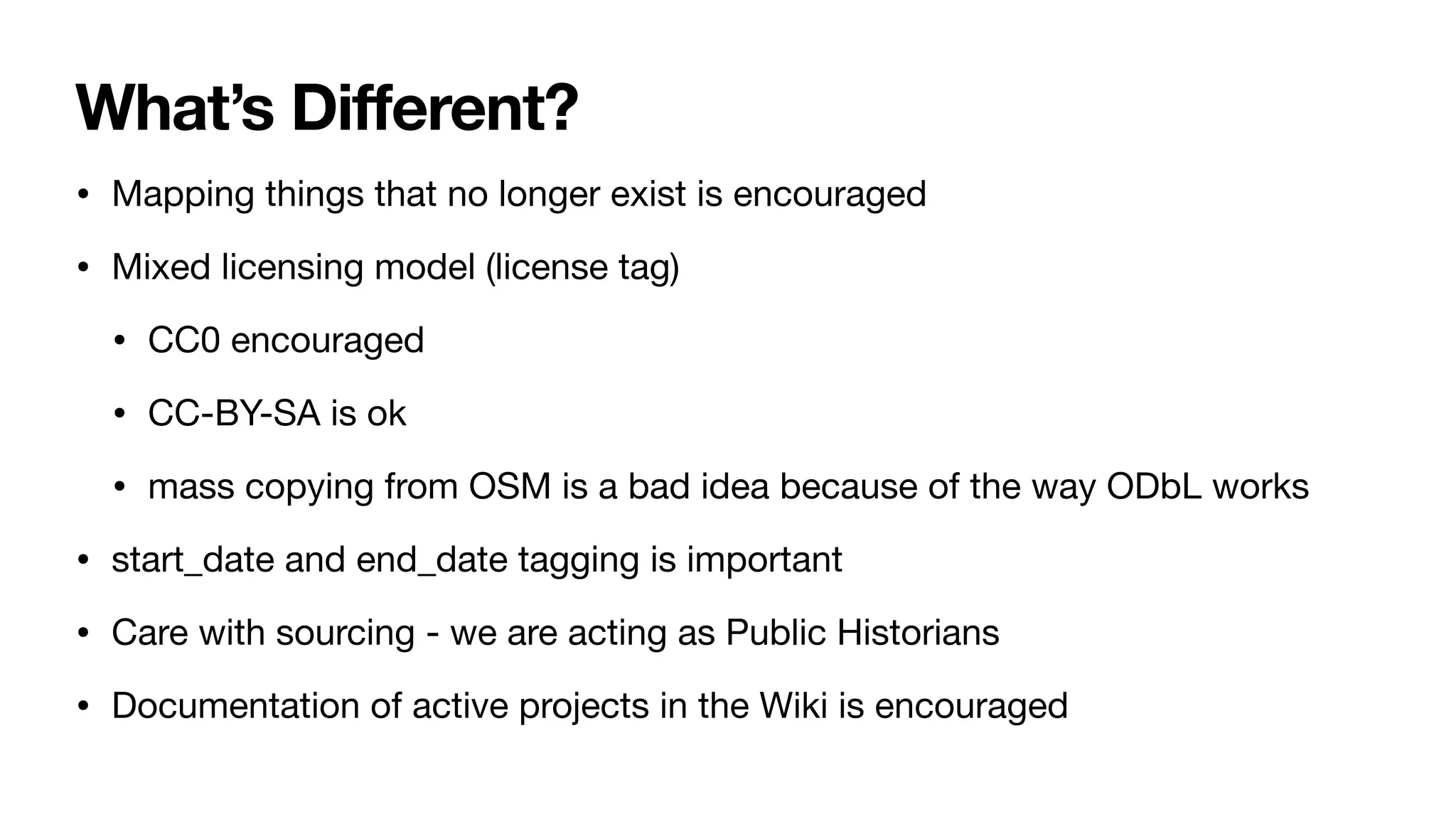
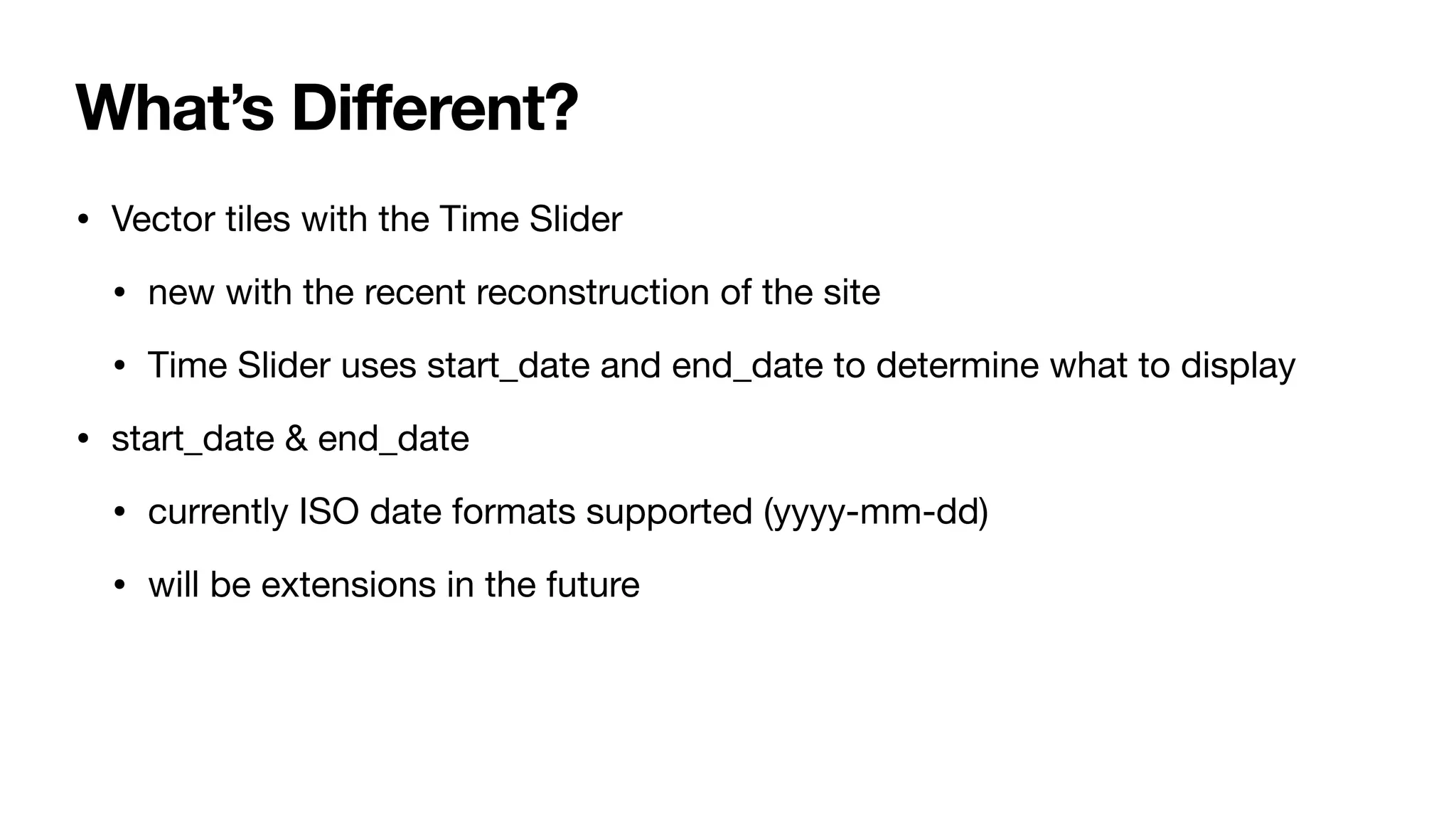
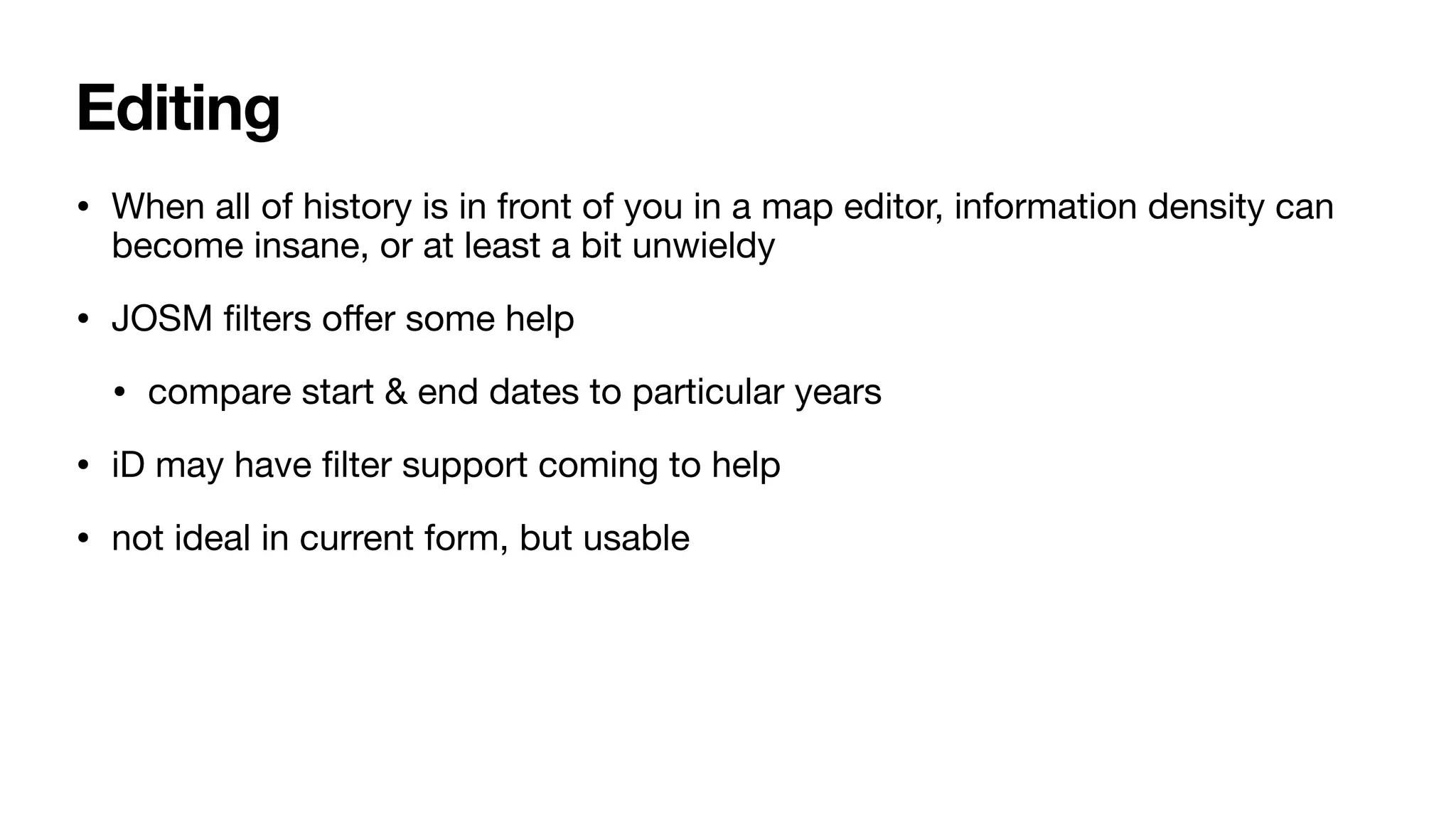
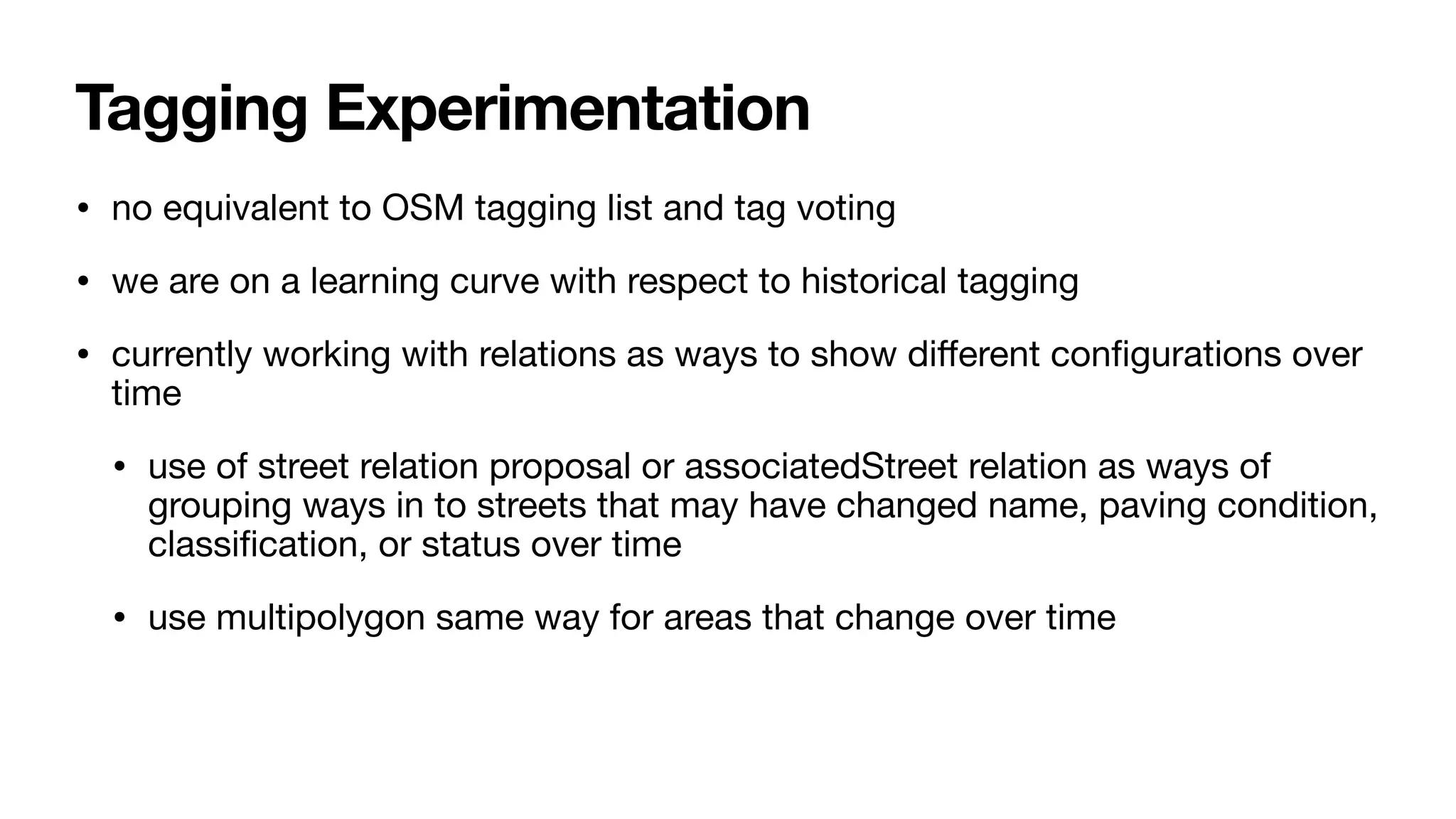
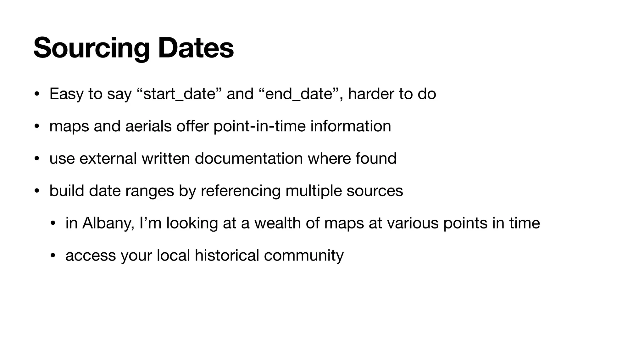
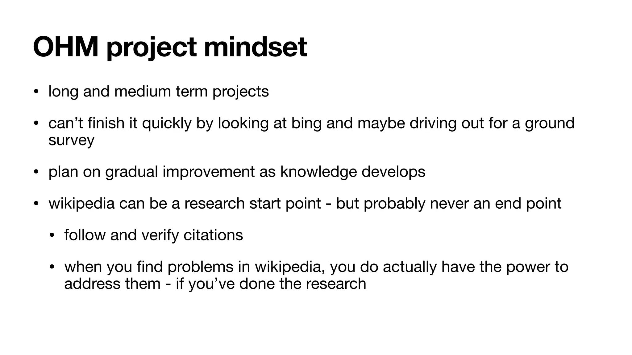
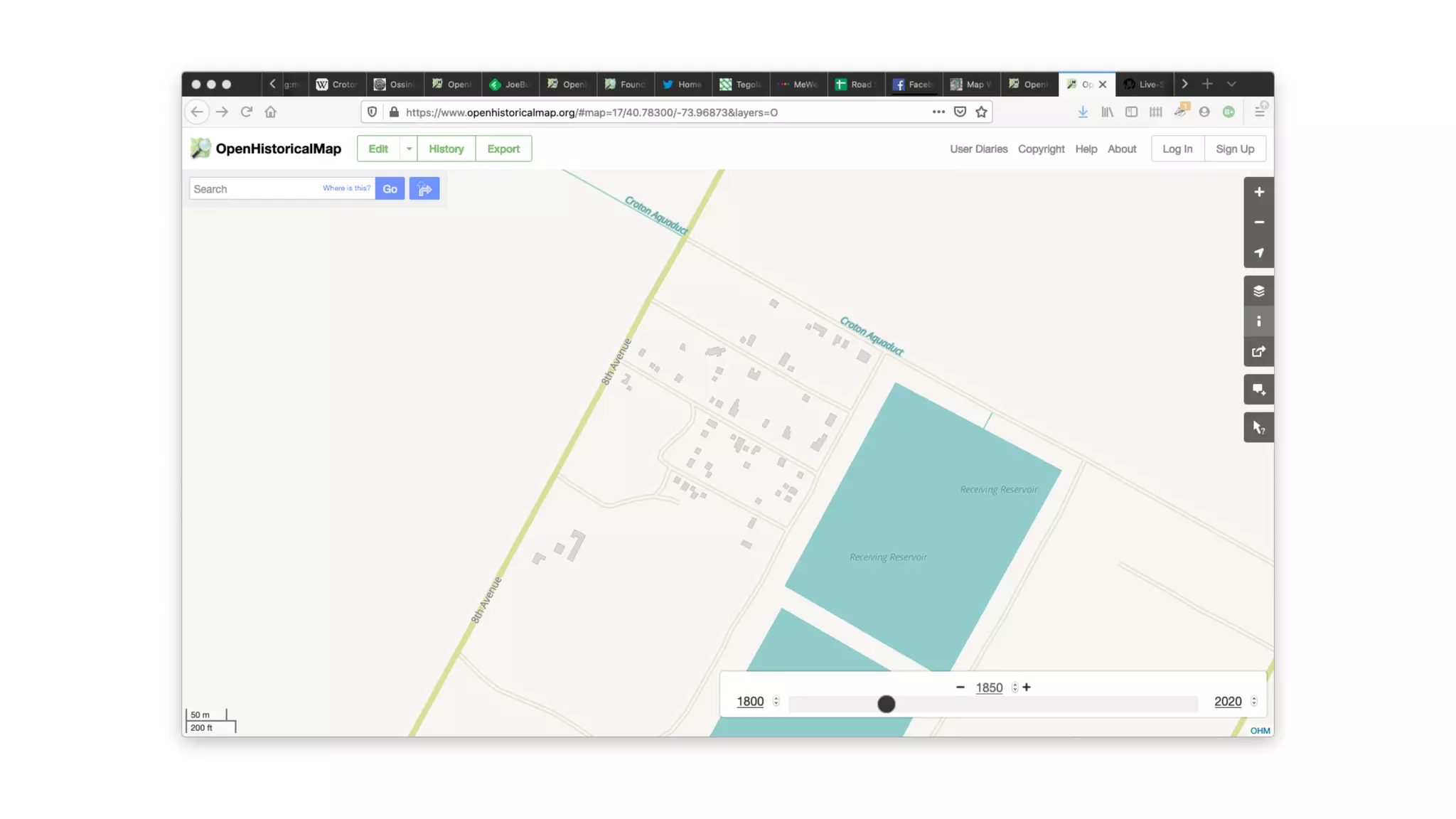
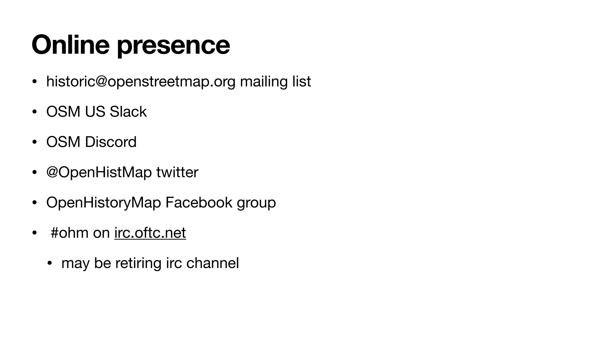
Richard Welty
Mappy Hour - 2020-07-08
Open Historical Map
The Goal
… is to create the world's most
universal, detailed, and out-of-date
map
The Reality
• There is much blank space in OHM
• There is more than enough of history after all
• There are some very detailed areas
Projects
https://wiki.openstreetmap.org/wiki/Open_Historical_Map/Projects
Projects
What’s the same as OSM?
• The database schema
• Editing API
• The editors
• Fork of iD on the Open Historical Map website
• Easy to con
fi
gure JOSM to access OHM instead of OSM
• Our own instance of Overpass, unmodi
fi
ed
• OSM tagging largely relevant
What’s Different?
• Mapping things that no longer exist is encouraged
• Mixed licensing model (license tag)
• CC0 encouraged
• CC-BY-SA is ok
• mass copying from OSM is a bad idea because of the way ODbL works
• start_date and end_date tagging is important
• Care with sourcing - we are acting as Public Historians
• Documentation of active projects in the Wiki is encouraged
What’s Different?
• Vector tiles with the Time Slider
• new with the recent reconstruction of the site
• Time Slider uses start_date and end_date to determine what to display
• start_date & end_date
• currently ISO date formats supported (yyyy-mm-dd)
• will be extensions in the future
Timeslider demo
Editing
• When all of history is in front of you in a map editor, information density can
become insane, or at least a bit unwieldy
• JOSM
fi
lters o
ff
er some help
• compare start & end dates to particular years
• iD may have
fi
lter support coming to help
• not ideal in current form, but usable
Tagging Experimentation
• no equivalent to OSM tagging list and tag voting
• we are on a learning curve with respect to historical tagging
• currently working with relations as ways to show di
ff
erent con
fi
gurations over
time
• use of street relation proposal or associatedStreet relation as ways of
grouping ways in to streets that may have changed name, paving condition,
classi
fi
cation, or status over time
• use multipolygon same way for areas that change over time
Sourcing
• modern sources (Bing, Mapbox, ESRI, etc.) of limited value
• permissions may not extend to OHM
• Mapbox and ESRI have responded positively to our requests
• most importantly, stu
ff
we want to map is often not in modern imagery
• historic sources are everywhere
• Libraries, Universities, Historical Societies, Museums
• May or may not be geo referenced
• mapwarper.net
• for maps and aerial imagery that is not available in georeferenced form (TMS, WMS, WTMS
URLs)
Sourcing Dates
• Easy to say “start_date” and “end_date”, harder to do
• maps and aerials o
ff
er point-in-time information
• use external written documentation where found
• build date ranges by referencing multiple sources
• in Albany, I’m looking at a wealth of maps at various points in time
• access your local historical community
OHM project mindset
• long and medium term projects
• can’t
fi
nish it quickly by looking at bing and maybe driving out for a ground
survey
• plan on gradual improvement as knowledge develops
• wikipedia can be a research start point - but probably never an end point
• follow and verify citations
• when you
fi
nd problems in wikipedia, you do actually have the power to
address them - if you’ve done the research
Examples - military history
• Munin project
• WWI
fi
eld forti
fi
cations
• American Civil War
• Gettysburg
• Antietam
• potential for driving animations
Examples
• Diversity
• Seneca Village (NYC)
• Rapp Road Historic District (Albany NY)
• Potential diversity projects
• Tulsa OK - Black Wall Street as it was
• other majority minority communities of note
• deed restrictions
Examples
• OHM-OSM synthesis
• Monument/Statues
• migrate monuments/statues to OHM as they are removed
• document start & end dates, other properties
• Ghost Tracks
• race tracks of the past
Online presence
• historic@openstreetmap.org mailing list
• OSM US Slack
• OSM Discord
• @OpenHistMap twitter
• OpenHistoryMap Facebook group
• #ohm on irc.oftc.net
• may be retiring irc channel

mappy-hour-2020.pdf

  • 1.
    Richard Welty Mappy Hour- 2020-07-08 Open Historical Map
  • 2.
    The Goal … isto create the world's most universal, detailed, and out-of-date map
  • 3.
    The Reality • Thereis much blank space in OHM • There is more than enough of history after all • There are some very detailed areas
  • 4.
  • 5.
  • 6.
    What’s the sameas OSM? • The database schema • Editing API • The editors • Fork of iD on the Open Historical Map website • Easy to con fi gure JOSM to access OHM instead of OSM • Our own instance of Overpass, unmodi fi ed • OSM tagging largely relevant
  • 7.
    What’s Different? • Mappingthings that no longer exist is encouraged • Mixed licensing model (license tag) • CC0 encouraged • CC-BY-SA is ok • mass copying from OSM is a bad idea because of the way ODbL works • start_date and end_date tagging is important • Care with sourcing - we are acting as Public Historians • Documentation of active projects in the Wiki is encouraged
  • 8.
    What’s Different? • Vectortiles with the Time Slider • new with the recent reconstruction of the site • Time Slider uses start_date and end_date to determine what to display • start_date & end_date • currently ISO date formats supported (yyyy-mm-dd) • will be extensions in the future
  • 9.
  • 10.
    Editing • When allof history is in front of you in a map editor, information density can become insane, or at least a bit unwieldy • JOSM fi lters o ff er some help • compare start & end dates to particular years • iD may have fi lter support coming to help • not ideal in current form, but usable
  • 11.
    Tagging Experimentation • noequivalent to OSM tagging list and tag voting • we are on a learning curve with respect to historical tagging • currently working with relations as ways to show di ff erent con fi gurations over time • use of street relation proposal or associatedStreet relation as ways of grouping ways in to streets that may have changed name, paving condition, classi fi cation, or status over time • use multipolygon same way for areas that change over time
  • 12.
    Sourcing • modern sources(Bing, Mapbox, ESRI, etc.) of limited value • permissions may not extend to OHM • Mapbox and ESRI have responded positively to our requests • most importantly, stu ff we want to map is often not in modern imagery • historic sources are everywhere • Libraries, Universities, Historical Societies, Museums • May or may not be geo referenced • mapwarper.net • for maps and aerial imagery that is not available in georeferenced form (TMS, WMS, WTMS URLs)
  • 13.
    Sourcing Dates • Easyto say “start_date” and “end_date”, harder to do • maps and aerials o ff er point-in-time information • use external written documentation where found • build date ranges by referencing multiple sources • in Albany, I’m looking at a wealth of maps at various points in time • access your local historical community
  • 14.
    OHM project mindset •long and medium term projects • can’t fi nish it quickly by looking at bing and maybe driving out for a ground survey • plan on gradual improvement as knowledge develops • wikipedia can be a research start point - but probably never an end point • follow and verify citations • when you fi nd problems in wikipedia, you do actually have the power to address them - if you’ve done the research
  • 15.
    Examples - militaryhistory • Munin project • WWI fi eld forti fi cations • American Civil War • Gettysburg • Antietam • potential for driving animations
  • 16.
    Examples • Diversity • SenecaVillage (NYC) • Rapp Road Historic District (Albany NY) • Potential diversity projects • Tulsa OK - Black Wall Street as it was • other majority minority communities of note • deed restrictions
  • 18.
    Examples • OHM-OSM synthesis •Monument/Statues • migrate monuments/statues to OHM as they are removed • document start & end dates, other properties • Ghost Tracks • race tracks of the past
  • 19.
    Online presence • historic@openstreetmap.orgmailing list • OSM US Slack • OSM Discord • @OpenHistMap twitter • OpenHistoryMap Facebook group • #ohm on irc.oftc.net • may be retiring irc channel