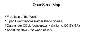
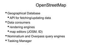
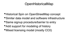
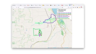
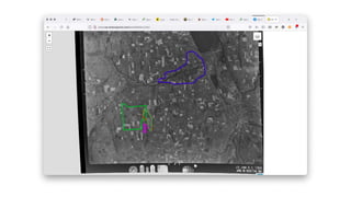
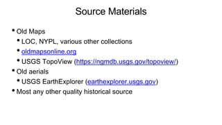
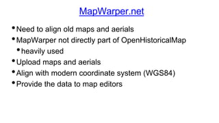
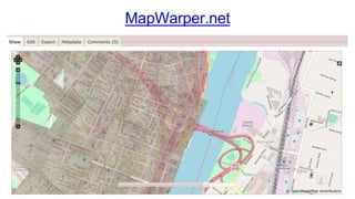
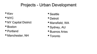
Richard Welty gave a presentation on OpenHistoricalMap (OHM), a project to add historical data and a time dimension to OpenStreetMap (OSM). OHM uses the same data model and software as OSM but adds support for modeling changes over time. It has a time-aware map viewer and tools for aligning historical maps and images. Current projects focus on modeling urban development, infrastructure changes, and places of historical and cultural significance. Challenges include representing time-varying data accurately and modeling historical events.
Richard Welty discusses OpenHistoricalMap at Wikiconference 2021
1. Richard Welty - Wikiconference 2021
OpenHistoricalMap
Historical Geography Wiki style
2. OpenStreetMap
•Free Map of the World
•Open Contributions (rather like wikipedia)
•Data under ODbL (conceptually similar to CC-BY-SA)
•About the Now - the world as it is
3. OpenStreetMap
•Geographical Database
•API for fetching/updating data
•Data consumers
•rendering engines
•map editors (JOSM, ID)
•Nominatium and Overpass query engines
•Tasking Manager
4. OpenHistoricalMap
•Historical Spin on OpenStreetMap concept
•Similar data model and software infrastructure
•Same signup procedure/barrier to entry
•Add support for modeling of history
•Mixed licensing model (mostly CC0)
5. Who is OpenHistoricalMap
•Mostly not academically trained historians
•Rather, serious amateurs
•Wiki model suits who we are and where we’re coming
from
•Happy to bring more serious amateurs into the fold and
work with them
6. OpenHistoricalMap
•Originally an unaffiliated side project
•Went live in 2013
•2021: formal affiliation with OSM US local chapter as a
Charter Project
•Current Advisory Board: Jeff Meyer and Richard Welty
•Advisory Board has openings. Need non-US mapper
7. Visualization
•OpenHistoricalMap has a time capable rendering engine
for the website (www.openhistoricalmap.org)
•Adds the “time slider” feature (which OSM has never had
because it’s not needed)
•slide the time slider to change the year depicted
•new in 2020
•refinements being discussed
8.
9. Visualization
•Specialized visualization tools for different scenarios will be
springing up
•some already exist, e.g. Ghost Tracks javascript widget
•the Overpass query engine (built for OSM) is available,
and can be called from javascript widgets or other code to
support alternative visualizations
•Event data creates a need for animation capabilities
10.
11.
12. Editing
•Standard OSM editors
•Time filters needed to simplify editing in temporally dense
areas
•Filters are improving
•but can be improved further
13. Source Materials
•Old Maps
•LOC, NYPL, various other collections
•oldmapsonline.org
•USGS TopoView (https://ngmdb.usgs.gov/topoview/)
•Old aerials
•USGS EarthExplorer (earthexplorer.usgs.gov)
•Most any other quality historical source
14. MapWarper.net
•Need to align old maps and aerials
•MapWarper not directly part of OpenHistoricalMap
•heavily used
•Upload maps and aerials
•Align with modern coordinate system (WGS84)
•Provide the data to map editors
16. Projects - Urban Development
•Kiev
•NYC
•NY Capital District
•Boston
•Portland
•Manchester, NH
•Seattle
•Detroit
•Mansfield, WA
•Sydney, AU
•Buenos Aries
•Toronto
17. Projects - Infrastructure
• Highways
• Roman Roads
• Westward trails (US 1800s)
• Railways
• Early US Highway system
• Lincoln Highway
• Canals
• Erie and Champlain Canals in Upstate NY
19. Projects - Diversity
•Following OSM US lead
•Interesting mapping projects abound
•Seneca Village (NYC)
•Rapp Road Historic District (Albany NY)
•Native Lands (proposed)
•Black Wall Street (Tulsa OK, proposed)
20. Climbing a learning curve
•Much historical data is point-in-time
•start_date and end_date can be elusive
•Life cycle issues need to be thought through carefully
•Need expanded set of notations to accurately specify what
is known about time
•Library Of Congress EDTF for Gregorian time?
•Need to support “local units” (Julian, Roman, Asian?)
21. Events?
•Something OSM does not do that OHM can
•Much to learn about modeling event data
•Experiment in progress on the Antietam
Battlefield (US Civil War)
22. Where Are We?
• www.openhistoricalmap.org
• https://wiki.openstreetmap.org/wiki/Open_Historical_Map/
• #openhistoricalmap on osmus.slack.com (very active)
• #openhistoricalmap on OpenStreetMap World on Discord
• OpenHistoricalMap group on Facebook
• @openhistmap on twitter
• me: nfgusedautoparts many places, @nfgusedautopart on twitter