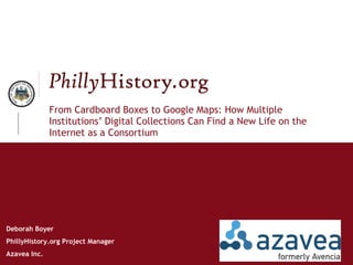
"From Cardboard Boxes to Google Maps: How Multiple Institutions’ Digital Collections Can Find a New Life on the Internet as a Consortium" was originally presented at the Museums and the Web conference, April 13-17, 2010, in Denver, Colorado,
Augmented Reality and Mobile Access to Historic CollectionsAzavea
This document discusses the development of augmented reality applications to overlay historical photos from the PhillyHistory.org collection onto current street views. It received a grant to develop a prototype app allowing users to view additional contextual information about locations by pointing their phone's camera at them. Key challenges include accuracy, interface design, and performance. The goal is to engage the public in history by bringing the past to life in the present environment.
Exploring Community Engagement with OpenTreeMapAzavea
On Tuesday, June 12, we hosted "Exploring Community Engagement with OpenTreeMap," a webinar that provided an introduction to the public engagement features in OpenTreeMap, the open source system for collaborative tree inventory. Kelaine Vargas from Urban Forest Map and Phil Silva from TreeKIT joined us to discuss their experiences with community urban forestry initiatives, particularly in terms of the accuracy of citizen generated data and encouraging long-term engagement in tree care.
From OpenStreetMap to PhillyTreeMap - Esri Dev SummitAzavea
Presentation at Esri Dev Meetup Philadelphia in June 2011 on OpenStreetMap and other crowd-sourced data projects as well as an introduction to the PhillyTreeMap project for inventorying and documenting trees.
NTEN Webinar - Data Cleaning and Visualization Tools for NonprofitsAzavea
Slides from a webinar we conducted for NTEN that covers tools that nonprofits can use to clean and prepare their datasets and then visualize them via charts, maps, and graphs.
From crowdsourced geographic information to participatory citizen science - e...Muki Haklay
Slides from presentation at Leicester Geography seminar March 2014, which is based on earlier discussion in a 'thinking and doing digital mapping' workshop in June 2013 in http://blog.digitalcartography.eu/2013/03/26/june-workshop-thinking-and-doing-digital-mapping/ as part of Charting the Digital project http://digitalcartography.eu/
The presentation discusses Volunteered Geographic Information (crowdsourced information) and Citizen Science, using the philosophy of technology of Albert Borgmann.
Presentation to Digital Humanities class at Pratt Institute on the history of computing in the field of archaeology and current digital humanities projects.
S12. Digital Infrastructures and New (and Evolving) Technologies in Archaeology (Roundtable)
The role of new technologies in digital infrastructures.
Significant investment, potential risks and rewards.
Pros and cons of technology [platforms] already in use within an archaeological data infrastructure, OR introduction of new technology [photog; XR, GIS+].
Technologies may include but are not limited to Linked Data, Natural Language Processing, Image Recognition and machine/deep learning. OR VR, AR, MR.
Challenges and potential usefulness of these technologies within archaeological data infrastructures
Current and future best practices.
Urbanopoly: Collection and Quality Assessment of Geo-spatial Linked Data via ...Irene Celino
This document describes Urbanopoly, a game that collects and verifies geo-spatial data through human computation. The game challenges players to complete missions that validate existing data or contribute new data. Player contributions are assigned confidence scores and aggregated to consolidate statements using majority voting. Validated data and provenance information are published as linked open data. An evaluation found the game enjoyable with good throughput of collected data, though consolidation rate could be improved. Surveys also provided positive feedback on usability and social aspects.
Crowdsourcing involves distributing tasks traditionally done by specific agents to a distributed group of people through an open call. It includes volunteered geographic information where individuals voluntarily provide geographic data, and participatory sensing where mobile devices form networks for individuals to gather and share local knowledge. Crowdsourcing provides benefits like gamification, community impact, and career opportunities, and is used for applications like mapping, crisis response, product testing, and gathering real-time energy and transportation data. Issues include ensuring quality, authority, and consistency as knowledge is gathered from diverse non-experts.
Motivation: the popularity of smart phones, and availability of data allow us to create an application that provide students with useful services, and allow them to share their experience
Integrate various types of data, including public data (Google Map, Facebook, Twitter), user data (picture, location), USC's private data (event, alert)
Uses the four dimensions of "what, when, where and who“, and allow USC community members to easily add their own apps
Robert Cheetham works at Azavea, a B Corporation focused on civic and social apps, summer of maps, and pro bono work. Azavea does spatial analysis, high performance computing, UI/UX design, and 10% of its work is dedicated to research. It collaborates academically and develops open source and open data tools related to land, water, and people such as urban forests, stormwater infrastructure, elections, public health, and crime analysis.
Smart City Semantics - Data Analytics and Human Computation to understand the...Irene Celino
Smart City Semantics: Data Analytics and Human Computation to understand the Living Land Use. Presentation at the "Comitato Italo-Svizzero per la Geoinformatica"
A talk about humanitarian mapping with OpenStreetMap. This was August 9th 2011 at an event organised by <a>Article25</a>, <a>sponge network</a>, and <a>RIBA knowledge communities</a>.
Sides of the presentation by Jan Neumann from the North Rhine-Westphalian Library Services Centre at OpenEd14 about the OER World Map project, phase II.
GeoWeb Concepts, Tools and ApplicationsMatthew Dance
This was an invited presentation to the University of Alberta's Human Geography and Planning 100 class. As the title implies, I provided a brief overview of GeoWeb concepts, tools and provided an overview of the maps I found most interesting in the past couple of months.
Living Land Use - Telecom Big Data Challenge - Trento ICT Days 2014Irene Celino
Short presentation of the Living Land Use application (http://livinglanduse.cefriel.com/), finalist in the Application track of the Telecom Italia Big Data Challenge (http://www.telecomitalia.com/tit/en/bigdatachallenge.html) @ Trento ICT Days - April 3rd 2014
Abstract:
Public Participation GIS (PPGIS) defines a practice where GIS technology and methods are used in support of public participation and decision making in a number of domain applications (Sieber, 2000). PPGIS is viewed as a top-down process where a central authority identifies a problem, the stakeholders and the best way to address it (Ghose, 2007). Current advances in the GeoWeb are challenging the top-down purview of PPGIS in that more citizens are directly engaging with tools that enable the collection and communication of place-based knowledge by non-experts. This emerging process raises pertinent questions, including: How is knowledge of place expressed, and to what extent is it relevant to PPGIS? This talk will highlight local research that centered on Edmonton’s river valley trail network where 17 informants were interviewed regarding their knowledge of place, in addition to their collection and communication of place-based information. This research will address the crowdsourcing of such information through the GeoWeb as a means of replacing traditional, authority controlled, PPGIS processes. We will demonstrate that individuals possess a complex, detailed and nuanced understanding of place. And, finally, we will discuss the current limits and future trends of the GeoWeb’s ability to capture that depth of understanding.
Five Technology Trends Every Nonprofit Needs to KnowAzavea
Are you tired of hearing about big data, social media, web 2.0, and other buzzwords? This session will introduce five emerging technology trends that will fundamentally impact the independent sector. Join us and learn how to incorporate them into your current plans to better reach your donors, engage your constituents, and maximize your impact.
We talk a lot about Ai as the superpower for process and automation of jobs. But what about creativity? What happens when artists, coders, designers, technologists and industry professionals collaborate to promote creative applications of artificial intelligence in art, music, film, design and beyond? Can Ai ever truly be creative? Or merely just a super-tool for designers and artists to work with.
Curated by the BIMA Ai Think Tank, join BIMA and a panel of industry experts for this very special breakfast briefing on creative Ai and what that truly means for digital.
Speakers:
Luba Elliott, Curator and Researcher
Hooman Sayani, Autodesk Research
Georgia Ward Dyer
Marco Marchesi, Happy Finish
Oded Ben-Tal, Kingston University
Digital + Community: what works and how do I build a strategy around this?
Working with community and digital experiences requires a lot of thinking through. You need to consider what the actual experience it is that you are trying to deliver and how your community can participate with you and your content. Using the latest technology is not enough, there needs to be a strategy behind why you are doing the initiative in the first place. This talk will discuss many digital experiences the Powerhouse Museum has conceived of and delivered utilising a strategy and different technologies and plaftorms behind each experience. Successes and some failures will be shared.
This document contains meeting notes from the Los Altos Forward group on October 18, 2011. It summarizes discussions on recent city updates, including a city council study session and a pop-up dinner event in the downtown area. It also provides an overview of projects and actions taken by different working groups within Los Altos Forward related to parking, the village image, commercial interests, the city process, and social interests. The primary discussion involved breaking into groups to identify top goals, which were then voted on: 1) Pushing the city to do a community visioning process, 2) Making "First Fridays" social events a focus, and 3) Electing action-oriented city council members.
Workshop at the Information Experience Design programme at RCA.
The blurb:
"Till Nagel will introduce his Unfolding Map library for Processing to create geospatial data visualizations. Participants will learn how to find and use urban data sets, how to load and display them, and how to design simple visualizations. It will be a very hands-on and interactive workshop. All participants should bring their own computer with Processing installed."
The document discusses changes and future trends in the global location industry. It identifies several near term focus areas, including the power of location data to connect people digitally and physically; developing 3D and indoor spatial/temporal models; harnessing big data and machine learning for modeling, simulation, and prediction; making spatial data more accessible through web APIs and linked data; leveraging new sources of geospatial data from IoT sensors, remote sensing technologies like UAVs and drones; creating immersive and ambient geospatial user experiences; and advancing software through federation and publish-subscribe architectures. The document examines how these trends are driving expansion of geospatial applications in domains like utilities, health, government, marine, statistics, land administration
On the Horizon for Interpretive Education: Augmented RealityAzavea
This presentation was given as part of the On the Horizon for Interpretive Education panel held at the American Public Gardens Association conference held in June 2011 in Philadelphia.
This document discusses mobile strategies for museums and provides examples from the Smithsonian Institution. Some key points:
1) Mobile apps and websites are not typically profitable on their own but can support museums' missions and generate network effects by enhancing the visitor experience and engaging communities.
2) The Smithsonian aims to "recruit the world" to contribute knowledge through mobile, putting the institution in people's hands not just pockets.
3) Examples from Cooper-Hewitt, NMNH, and NASM demonstrate how mobile can extend exhibits and engage audiences both on and off-site.
4) The vision is for museums to become distributed networks through multiplatform engagement and crowdsourcing via mobile.
Case study of the 24 Hour Museum and its journey from portal to publisher. Presented to the Culturemondo Roundtable by Jane Finnis on Thursday 11th December 2008.
This document discusses Preservation Detroit's use of Flickr to catalog and provide access to its collection of over 200 books on local history, architecture, and preservation. Previously, access to the books was by appointment only with no catalog. Flickr was chosen as it provided a simple, volunteer-friendly way to upload book cover photos, add metadata, and make the collection searchable online with no technology experience required. The cataloging process using Flickr is demonstrated to be straightforward. While it is too early to determine increased usage, Flickr allows for creative uses of special collections beyond a traditional catalog.
Mapping Historical Photos For The Common GoodJon Voss
The document discusses LookBackMaps, a website that geotags historical photos to make local history more accessible. It summarizes how digital archives have evolved from siloed collections in the 1990s to more open and collaborative models today. It also outlines LookBackMaps' goals to bridge archive silos by creating a centralized, open-source database of images and metadata, using public engagement to add value and make the data searchable via an API. Finally, it notes an iPhone app is in development and solicits feedback.
On Oral Histories, Communities and Annotating the Cityconiecto
This document outlines a project that uses mobile technologies and participatory design methods to collect and share oral histories and stories from communities in Limerick, Ireland. It discusses the origins and evolution of using location-based apps to annotate the city with personal experiences. A prototype app was developed and tested that allows users to listen to audio stories and view transcriptions as they navigate locations in the city. Future plans include improving tools for content creation and tagging, developing a stable app, and supporting ongoing citizen involvement in sharing stories about their city. The project aims to give voices to communities and increase diversity and awareness of the histories and meanings attached to urban spaces.
Essential Online Tools for Historical Societiesvtrural
Presentation to the 2013 League of Local Historical Societies & Museums Annual Meeting Building on a Strong Foundation - Friday, November 1, 2013 - Barre, Vermont
What online tools are must-haves for your local historical society? You are invited to attend a discussion on how local historical societies are using digital tools to spread history, recruit volunteers, document events, and archive their collections. Specific topics of discussion will include getting your historical society online, using social media (Facebook) for education, recruitment and research, and the importance of archiving your collection on the “cloud.
Presentation by: Rob Fish, Vermont Digital Economy Project and Adriene Katz, Shelburne Museum.
Changing contexts: museums, audiences and technologyMia
A presentation for the International Training Programme run by the British Museum for museum professionals from around the world. This is based on a presentation I prepared for OpenCulture 2011, but includes additional material on mobile phones/devices including the 'Hidden Histories' pilot.
GIS for arts outreach:
The walls of Philadelphia are covered in murals - more than 2,700 of them. To expose an even wider community to these beautiful resources, the Mural Arts Program developed a GIS-based website, enabling users to find information and photos of murals based on their location in the city.
This document proposes partnering with cultural heritage organizations to create a web-based site for them to engage online. It discusses developing a prototype project with the Westport Historical Society called "Uncovering Westport" that allows users to explore the town through different historical eras and themes on an interactive map. The goal is to engage communities and allow organizations to create and maintain a web presence using open-source tools like Wordpress, Google Maps, Flickr, and YouTube without needing significant funds or expertise. A workplan for the prototype is outlined focusing on key moments in Westport's history to draw on living community memories.
Engage on the go:Mastering Mobile Content Delivery (presentation at the Ameri...Layla Masri Soares
This document summarizes a presentation about mastering mobile content delivery for museums. It discusses knowing the audience and their mobile habits, defining engagement, using various tech tools to create content that can be deployed across platforms, and examples of mobile strategies from different institutions. Metrics of success discussed include accessibility, quality, relevance, sustainability and accountability. The presentation emphasizes making content portable and reusable across different devices and interfaces.
From Headphones to Microphones: Mobile 2.0 and the Museum as Distributed NetworkNancy Proctor
The document discusses how mobile devices are transforming museums from physical spaces into distributed networks. It notes that over half of museum platforms are already mobile. Mobile allows museums to meet audiences where they are and take them to new places. While apps may not be profitable, mobile offers new tools for communication, learning, and content distribution. The document advocates for using mobile to recruit the world and increase knowledge diffusion by enlisting global collaborators. It presents the Smithsonian's mobile strategy of integrating mobile into all efforts to achieve strategic goals of accessibility, quality, relevance, sustainability and accountability.
History at Hand: Combining Special Collections and Mobile Technology to Engag...Cory Lown
The Red, White, and Black (RWB) project was conceived as a human-guided walking-tour about African-American history at NC State University. The current generation of mobile devices has enabled us to publish this interactive guide on the web, so that anyone with a smart phone can explore this important aspect of university history. This talk outlines the creation of the RWB mobile application, which integrates existing digital collections and infrastructure to provide access to events, images, and audio that highlight the lives and experiences of African-Americans at NC State. This project is one example of the ways NCSU Libraries is creating opportunities for situated discovery and learning. We will explore some of the challenges and possibilities of repurposing special collections materials to provide new avenues for learning, discuss the technologies and infrastructure that make this possible, and highlight future directions for exposing library resources using mobile devices.
Lego Beowulf and the Web of Hands and Hearts, for the Danish national museum ...Michael Edson
This talk was delivered at the awards ceremony for the 2012 Bikuben Foundation Danish Museum Prize in Copenhagen, Denmark.
Ideas about what museums are, who they serve, and the role they play in society are changing with dramatic speed, driven largely by social media and the participatory culture of global networks.
Denmark supports world-class museums, with remarkable collections, expert staff, and beautiful architecture. But how can museum leaders balance the traditional concepts of organizational mission and outcomes with the disruptive possibilities being demonstrated by those who love and use museums in new ways?
A text version of this presentation, with hyperlinks and footnotes, is available at http://www.slideshare.net/edsonm/michael-edson-lego-beowulf-and-the-web-of-hands-and-hearts-for-the-danish-national-museum-awards-13444266
1. The document discusses DERI, a research institute focused on the semantic web and social semantic web.
2. It describes DERI's work developing the SIOC ontology to represent data from social websites on the semantic web in a standardized and interoperable way.
3. The SIOC ontology aims to connect users and data across different social/collaborative websites and allow users to easily move between sites while bringing their data.
Social Web lecture for Matching dag IMM 2016Victor de Boer
Social Web lecture for Matching dag IMM 2016. With input from Davide Ceolin, Lora Aroyo.
Hands on session instructions can be found here: https://docs.google.com/document/d/1XW4UBr_dZeejI2Rp8T4tHaDxNrGsu4xxlVJh91s2AGM/edit#heading=h.jel9otx51ed
Geostories - A BBC Innovation Mobile Citizenship projectPriya Prakash
Geo-stories is a BBC project that combines location and time-based content with video, pictures, and text to create narrative mobile citizen journalism stories. It aims to explore how to most effectively use these elements to inform new mobile formats. The project will develop a mobile and web experience that allows users to create stories using multimedia user-generated content tagged with location. It will also pull in BBC local news feeds and enable group storytelling from multiple perspectives.
More-than-than human contact, conspicuous mobility, and the digital frontierMatthew Wilson
This 'lightning-talk' was delivered at the VGI Preconference at the AAG meetings in Seattle, 11 April 2011. Organized by Dan Sui, Michael Goodchild, and Sarah Elwood.
Similar to Creating an Online Digital Consortium for Historic Collections (20)
Using New Tools to Analyze and Plan Your Urban Forest Azavea
This document discusses Azavea's OpenTreeMap software for analyzing and planning urban forests. It describes Azavea's background in civic technology and geospatial data. OpenTreeMap allows users to model forest growth and prioritize tree planting locations using various data layers. The document seeks feedback on additional data sources and customization options to improve the software's modeling and scenario-building capabilities.
7 misconceptions about predictive policing webinarAzavea
Over the last few years, Predictive Policing has become more common in police departments around the world. With the rising interest in crime forecasting tools, important questions concerning ethics, privacy and fairness have been raised. We know that there are some misconceptions when it comes to the topic, and we want to dispel some of the common myths about Predictive Policing.
We invite you to join us as we walk through 7 Misconceptions of Predictive Policing. In this webinar, we aim to discuss some of the charged rhetoric and beliefs that surround the term. Also, we will highlight the some of the diverse crime modeling concepts that are used to make robust, predictions when forecasting crime.
OpenTreeMap is a platform that enables individuals and organizations to map and inventory their urban forest. This webinar provides an overview of OpenTreeMap's Green Infrastructure module and was given by Azavea on November 11, 2015. For more information on OpenTreeMap visit www.opentreemap.org or email us at opentreemap@azavea.com.
Growing Your Urban Forest: Using the OpenTreeMap Bulk UploaderAzavea
The "Growing Your Urban Forest: Using the OpenTreeMap Bulk Uploader" webinar was held on April 16, 2015. These slides provide an overview of that webinar.
Forecasting Space-Time Events - Strata + Hadoop World 2015 San JoseAzavea
This presentation uses the speaker’s experience in building a crime forecasting package to outline some tools and techniques useful in modeling space-time event data. While the case study focuses on modeling crime, the techniques and tools presented are applicable to a broad selection of domains.
This presentation was given at Strata + Hadoop World 2015 in San Jose by Jeremy Heffner.
November 12, 2014 Webinar: Hackers, Beer Geeks, and Arborly Love - Reaching o...Azavea
In this webinar based on our 2014 Partners in Community Forestry conference presentation, Andrew Thompson (OpenTreeMap), Erica Smith Fichman (TreePhilly), and Lee Mueller (Friends of Grand Rapids Parks) talked about three outreach events our organizations have done in urban forestry, and discussed tips and tricks your urban forestry group can use with your events and marketing to expand to new audiences. This webinar covered:
- A general framework for organizing events and campaigns geared toward exciting audiences and communities with little experience with urban forestry
- Pointers, tips, caveats, and potential downfalls to keep in mind to organize a successful event
- "Lessons learned" from three specific case studies organized by a government, nonprofit, and commercial company
This presentation covers the requirements to get started with HunchLab 2.0's predictive policing system. It starts discussing technical requirements (security, authentication) and then proceeds to discuss guidelines for configuring meaningful predictive models of crime. The presentation concludes with information about related geographic and temporal datasets that are useful in forecasting crime with recommendations on how to prioritize data sets to use in HunchLab.
Is it a Package or a Wrapper? Designing, Documenting, and Distributing a Pyth...Azavea
Andrew Thompson delivered this talk at the January 2014 joint meeting of the PhillyPUG Python User's Group and the GeoPhilly GIS Meetup group. Topics covered include Rest APIs, API wrappers, Python documentation tools, and Python module packaging practices and the Python Package Index.
HunchLab 2.0 Predictive Missions: Under the HoodAzavea
HunchLab is a predictive policing software that uses machine learning to analyze historical crime data and predict future crime hotspots. It represents common crime theories like risk terrain modeling and routine activity theory as variables. The modeling process involves generating training examples from years of data, enriching it with geographic and temporal variables, building and evaluating multiple models using techniques like gradient boosting and generalized additive models, and selecting the best performing model. HunchLab aims to learn from a jurisdiction's unique data to help prioritize police patrols.
Using Open Data and Citizen Science to Promote Citizen Engagement with Green ...Azavea
Presentation given at the Green Infrastructure and Water Management in Growing Metropolitan Areas conference on January 15, 2014 at the Patel College of Global Sustainability at the University of South Florida, Tampa, Florida.
This document presents a preview of the new version of HunchLab with a focus on geographic modeling. HunchLab 2.0 allows police departments to prioritize resource deployments by using predictive analytics that take into account many data sets and reflect the priorities of the police department. The webinar was recorded on September 25th, 2013.
PhillyHistory.org - Tracking Metrics for a Digital ProjectAzavea
Presentation given at the Delaware Valley Archivists Group meeting on March 21, 2013. The slides provide an overview of how visitor statistics and user engagement are measured on PhillyHistory.org and how similar tracking may be done on other digital history projects.
Azavea develops software to analyze large geospatial datasets for social good. Their Big (Geo) Data Science work includes spatial forecasting of crime patterns in Philadelphia using statistical analysis of past incidents. They created automated maps and alerts for the police department to help predict crime hotspots and accelerate response times. Azavea also conducts open source research on high performance geoprocessing techniques to enable analysis of massive global datasets within seconds.
Modeling Count-based Raster Data with ArcGIS and RAzavea
This presentation outlines the conceptual framework for building regression models of event counts where the unit of analysis is small. It explains how ArcGIS for Desktop can be used to build raster data sets that are modeled as generalized linear models within the open source R package.
OpenTreeMap is an open source tree data management system developed by Azavea that allows citizens, governments, and organizations to collaboratively inventory and map urban trees. It features tools for searching tree data, viewing ecosystem benefits, adding and editing tree information, uploading photos, and tracking stewardship activities. The system is customizable and can integrate with mobile apps to facilitate public tree mapping efforts and encourage citizen involvement in urban forestry.
Driving Business Innovation: Latest Generative AI Advancements & Success StorySafe Software
Are you ready to revolutionize how you handle data? Join us for a webinar where we’ll bring you up to speed with the latest advancements in Generative AI technology and discover how leveraging FME with tools from giants like Google Gemini, Amazon, and Microsoft OpenAI can supercharge your workflow efficiency.
During the hour, we’ll take you through:
Guest Speaker Segment with Hannah Barrington: Dive into the world of dynamic real estate marketing with Hannah, the Marketing Manager at Workspace Group. Hear firsthand how their team generates engaging descriptions for thousands of office units by integrating diverse data sources—from PDF floorplans to web pages—using FME transformers, like OpenAIVisionConnector and AnthropicVisionConnector. This use case will show you how GenAI can streamline content creation for marketing across the board.
Ollama Use Case: Learn how Scenario Specialist Dmitri Bagh has utilized Ollama within FME to input data, create custom models, and enhance security protocols. This segment will include demos to illustrate the full capabilities of FME in AI-driven processes.
Custom AI Models: Discover how to leverage FME to build personalized AI models using your data. Whether it’s populating a model with local data for added security or integrating public AI tools, find out how FME facilitates a versatile and secure approach to AI.
We’ll wrap up with a live Q&A session where you can engage with our experts on your specific use cases, and learn more about optimizing your data workflows with AI.
This webinar is ideal for professionals seeking to harness the power of AI within their data management systems while ensuring high levels of customization and security. Whether you're a novice or an expert, gain actionable insights and strategies to elevate your data processes. Join us to see how FME and AI can revolutionize how you work with data!
Building Production Ready Search Pipelines with Spark and MilvusZilliz
Spark is the widely used ETL tool for processing, indexing and ingesting data to serving stack for search. Milvus is the production-ready open-source vector database. In this talk we will show how to use Spark to process unstructured data to extract vector representations, and push the vectors to Milvus vector database for search serving.
5th LF Energy Power Grid Model Meet-up SlidesDanBrown980551
5th Power Grid Model Meet-up
It is with great pleasure that we extend to you an invitation to the 5th Power Grid Model Meet-up, scheduled for 6th June 2024. This event will adopt a hybrid format, allowing participants to join us either through an online Mircosoft Teams session or in person at TU/e located at Den Dolech 2, Eindhoven, Netherlands. The meet-up will be hosted by Eindhoven University of Technology (TU/e), a research university specializing in engineering science & technology.
Power Grid Model
The global energy transition is placing new and unprecedented demands on Distribution System Operators (DSOs). Alongside upgrades to grid capacity, processes such as digitization, capacity optimization, and congestion management are becoming vital for delivering reliable services.
Power Grid Model is an open source project from Linux Foundation Energy and provides a calculation engine that is increasingly essential for DSOs. It offers a standards-based foundation enabling real-time power systems analysis, simulations of electrical power grids, and sophisticated what-if analysis. In addition, it enables in-depth studies and analysis of the electrical power grid’s behavior and performance. This comprehensive model incorporates essential factors such as power generation capacity, electrical losses, voltage levels, power flows, and system stability.
Power Grid Model is currently being applied in a wide variety of use cases, including grid planning, expansion, reliability, and congestion studies. It can also help in analyzing the impact of renewable energy integration, assessing the effects of disturbances or faults, and developing strategies for grid control and optimization.
What to expect
For the upcoming meetup we are organizing, we have an exciting lineup of activities planned:
-Insightful presentations covering two practical applications of the Power Grid Model.
-An update on the latest advancements in Power Grid -Model technology during the first and second quarters of 2024.
-An interactive brainstorming session to discuss and propose new feature requests.
-An opportunity to connect with fellow Power Grid Model enthusiasts and users.
Let's Integrate MuleSoft RPA, COMPOSER, APM with AWS IDP along with Slackshyamraj55
Discover the seamless integration of RPA (Robotic Process Automation), COMPOSER, and APM with AWS IDP enhanced with Slack notifications. Explore how these technologies converge to streamline workflows, optimize performance, and ensure secure access, all while leveraging the power of AWS IDP and real-time communication via Slack notifications.
In the rapidly evolving landscape of technologies, XML continues to play a vital role in structuring, storing, and transporting data across diverse systems. The recent advancements in artificial intelligence (AI) present new methodologies for enhancing XML development workflows, introducing efficiency, automation, and intelligent capabilities. This presentation will outline the scope and perspective of utilizing AI in XML development. The potential benefits and the possible pitfalls will be highlighted, providing a balanced view of the subject.
We will explore the capabilities of AI in understanding XML markup languages and autonomously creating structured XML content. Additionally, we will examine the capacity of AI to enrich plain text with appropriate XML markup. Practical examples and methodological guidelines will be provided to elucidate how AI can be effectively prompted to interpret and generate accurate XML markup.
Further emphasis will be placed on the role of AI in developing XSLT, or schemas such as XSD and Schematron. We will address the techniques and strategies adopted to create prompts for generating code, explaining code, or refactoring the code, and the results achieved.
The discussion will extend to how AI can be used to transform XML content. In particular, the focus will be on the use of AI XPath extension functions in XSLT, Schematron, Schematron Quick Fixes, or for XML content refactoring.
The presentation aims to deliver a comprehensive overview of AI usage in XML development, providing attendees with the necessary knowledge to make informed decisions. Whether you’re at the early stages of adopting AI or considering integrating it in advanced XML development, this presentation will cover all levels of expertise.
By highlighting the potential advantages and challenges of integrating AI with XML development tools and languages, the presentation seeks to inspire thoughtful conversation around the future of XML development. We’ll not only delve into the technical aspects of AI-powered XML development but also discuss practical implications and possible future directions.
Fueling AI with Great Data with Airbyte WebinarZilliz
This talk will focus on how to collect data from a variety of sources, leveraging this data for RAG and other GenAI use cases, and finally charting your course to productionalization.
For the full video of this presentation, please visit: https://www.edge-ai-vision.com/2024/06/building-and-scaling-ai-applications-with-the-nx-ai-manager-a-presentation-from-network-optix/
Robin van Emden, Senior Director of Data Science at Network Optix, presents the “Building and Scaling AI Applications with the Nx AI Manager,” tutorial at the May 2024 Embedded Vision Summit.
In this presentation, van Emden covers the basics of scaling edge AI solutions using the Nx tool kit. He emphasizes the process of developing AI models and deploying them globally. He also showcases the conversion of AI models and the creation of effective edge AI pipelines, with a focus on pre-processing, model conversion, selecting the appropriate inference engine for the target hardware and post-processing.
van Emden shows how Nx can simplify the developer’s life and facilitate a rapid transition from concept to production-ready applications.He provides valuable insights into developing scalable and efficient edge AI solutions, with a strong focus on practical implementation.
Monitoring and Managing Anomaly Detection on OpenShift.pdfTosin Akinosho
Monitoring and Managing Anomaly Detection on OpenShift
Overview
Dive into the world of anomaly detection on edge devices with our comprehensive hands-on tutorial. This SlideShare presentation will guide you through the entire process, from data collection and model training to edge deployment and real-time monitoring. Perfect for those looking to implement robust anomaly detection systems on resource-constrained IoT/edge devices.
Key Topics Covered
1. Introduction to Anomaly Detection
- Understand the fundamentals of anomaly detection and its importance in identifying unusual behavior or failures in systems.
2. Understanding Edge (IoT)
- Learn about edge computing and IoT, and how they enable real-time data processing and decision-making at the source.
3. What is ArgoCD?
- Discover ArgoCD, a declarative, GitOps continuous delivery tool for Kubernetes, and its role in deploying applications on edge devices.
4. Deployment Using ArgoCD for Edge Devices
- Step-by-step guide on deploying anomaly detection models on edge devices using ArgoCD.
5. Introduction to Apache Kafka and S3
- Explore Apache Kafka for real-time data streaming and Amazon S3 for scalable storage solutions.
6. Viewing Kafka Messages in the Data Lake
- Learn how to view and analyze Kafka messages stored in a data lake for better insights.
7. What is Prometheus?
- Get to know Prometheus, an open-source monitoring and alerting toolkit, and its application in monitoring edge devices.
8. Monitoring Application Metrics with Prometheus
- Detailed instructions on setting up Prometheus to monitor the performance and health of your anomaly detection system.
9. What is Camel K?
- Introduction to Camel K, a lightweight integration framework built on Apache Camel, designed for Kubernetes.
10. Configuring Camel K Integrations for Data Pipelines
- Learn how to configure Camel K for seamless data pipeline integrations in your anomaly detection workflow.
11. What is a Jupyter Notebook?
- Overview of Jupyter Notebooks, an open-source web application for creating and sharing documents with live code, equations, visualizations, and narrative text.
12. Jupyter Notebooks with Code Examples
- Hands-on examples and code snippets in Jupyter Notebooks to help you implement and test anomaly detection models.
Main news related to the CCS TSI 2023 (2023/1695)Jakub Marek
An English 🇬🇧 translation of a presentation to the speech I gave about the main changes brought by CCS TSI 2023 at the biggest Czech conference on Communications and signalling systems on Railways, which was held in Clarion Hotel Olomouc from 7th to 9th November 2023 (konferenceszt.cz). Attended by around 500 participants and 200 on-line followers.
The original Czech 🇨🇿 version of the presentation can be found here: https://www.slideshare.net/slideshow/hlavni-novinky-souvisejici-s-ccs-tsi-2023-2023-1695/269688092 .
The videorecording (in Czech) from the presentation is available here: https://youtu.be/WzjJWm4IyPk?si=SImb06tuXGb30BEH .
Threats to mobile devices are more prevalent and increasing in scope and complexity. Users of mobile devices desire to take full advantage of the features
available on those devices, but many of the features provide convenience and capability but sacrifice security. This best practices guide outlines steps the users can take to better protect personal devices and information.
Unlock the Future of Search with MongoDB Atlas_ Vector Search Unleashed.pdfMalak Abu Hammad
Discover how MongoDB Atlas and vector search technology can revolutionize your application's search capabilities. This comprehensive presentation covers:
* What is Vector Search?
* Importance and benefits of vector search
* Practical use cases across various industries
* Step-by-step implementation guide
* Live demos with code snippets
* Enhancing LLM capabilities with vector search
* Best practices and optimization strategies
Perfect for developers, AI enthusiasts, and tech leaders. Learn how to leverage MongoDB Atlas to deliver highly relevant, context-aware search results, transforming your data retrieval process. Stay ahead in tech innovation and maximize the potential of your applications.
#MongoDB #VectorSearch #AI #SemanticSearch #TechInnovation #DataScience #LLM #MachineLearning #SearchTechnology
UiPath Test Automation using UiPath Test Suite series, part 6DianaGray10
Welcome to UiPath Test Automation using UiPath Test Suite series part 6. In this session, we will cover Test Automation with generative AI and Open AI.
UiPath Test Automation with generative AI and Open AI webinar offers an in-depth exploration of leveraging cutting-edge technologies for test automation within the UiPath platform. Attendees will delve into the integration of generative AI, a test automation solution, with Open AI advanced natural language processing capabilities.
Throughout the session, participants will discover how this synergy empowers testers to automate repetitive tasks, enhance testing accuracy, and expedite the software testing life cycle. Topics covered include the seamless integration process, practical use cases, and the benefits of harnessing AI-driven automation for UiPath testing initiatives. By attending this webinar, testers, and automation professionals can gain valuable insights into harnessing the power of AI to optimize their test automation workflows within the UiPath ecosystem, ultimately driving efficiency and quality in software development processes.
What will you get from this session?
1. Insights into integrating generative AI.
2. Understanding how this integration enhances test automation within the UiPath platform
3. Practical demonstrations
4. Exploration of real-world use cases illustrating the benefits of AI-driven test automation for UiPath
Topics covered:
What is generative AI
Test Automation with generative AI and Open AI.
UiPath integration with generative AI
Speaker:
Deepak Rai, Automation Practice Lead, Boundaryless Group and UiPath MVP
Creating an Online Digital Consortium for Historic Collections
1. From Cardboard Boxes to Google Maps: How Multiple Institutions’ Digital Collections Can Find a New Life on the Internet as a Consortium Deborah Boyer PhillyHistory.org Project Manager Azavea Inc.
2. Our story starts here, in the City Archives, where the image collection presented several challenges…
3. The first of which was ORGANIZATION . With images stored in boxes based on the city unit they represented (Streets, Schools, etc.), finding any particular image was a significant challenge.
4. The second was PRESERVATION . The oldest negatives are combustible, and newer ones are prone to warping.
5. The third was ACCESS . To access an image, a visitor would have to go to the archives and have a valid research reason for entrance. Approximately 100 people per year did this.
6. Certain images and/or photos on this page are the copyrighted property of 123RF Limited, its Contributors or Licensed Partners and are being used with permission under license. These images and/or photos may not be copied or downloaded without permission from 123RF Limited The last was FUNDING . Addressing these challenges was unlikely to be an inexpensive endeavor.
7. So what do you do with one million photographs? Digitize the Images Preserve the Original Media Increase Public Access via the Web Get the Public Involved!!! Generate Revenue through Print Sales Organize, Organize, Organize Create a Consortium of Organizations
19. The result is a collaboration that uses Sajara to make available to the public seven historic collections from three institutions – all on one website.