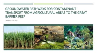
The document summarizes research on groundwater pathways for contaminant transport from agricultural areas to the Great Barrier Reef. Groundwater sampling near Barratta Creek found increasing concentrations of nitrogen and phosphorus that exceeded Australian water quality guidelines. Nitrate levels in groundwater increased after heavy rainfall events and correlated with increased agricultural fertilizer use over time. Closer bores to the creek showed higher ammonium levels, indicating nutrient transformation processes in the groundwater. The research aims to understand nutrient transport pathways to protect the Great Barrier Reef from agricultural runoff.
See a partial listing of various electric and gas transmission and distribution projects, and hydroelectric generation relicensing and license compliance services Sequoia has provided to PG&E.
Harriet LaMair's Presentation at the Cherry Hills Land Preserve Spring Speake...Kathryn Russell
About the Presenter:
Harriet LaMair is a founding member of the High Line Canal Conservancy. She is a former Founder and Executive Director of the Cherry Hills Land Preserve, as well as a Former Councilwoman for Cherry Hills Village. She has a tenure rich in government and public policy experience as well as an unsurpassed passion for building connections between communities and the natural world.
Problem of Water Quality Control in the Niger BasinIwl Pcu
M. Ould Aly Oumar
Niger-HYCOS Project Coordonator
Niger Basin Authority, Niamey, NIGER REPUBLIC
CONTENTS
1. INTRODUCTION
2. THE NIGER BASIN AND SUB-REGIONAL COOPERATION
3. RIVER NIGER HYDROLOGY
4. IMPACT OF CLIMATIC CHANGE ON HYDROLOGY
5. PROBLEMATIC OF WATER QUALITY CONTROL WITHIN THE NIGER BASIN
5.1 THE ACTUAL SITUATION
5.2 THE WAYS FORWARD
6. CONCLUSION
Presented at the Black Sea – Danube Regional Conference on Nutrient Pollution Control in Chisinau, Moldova – October 2006
Jenny Deakin from the EPA Catchments Unit gave a Teagasc Signpost Seminar on April 20 2021. The seminar covered water quality, focused on the agricultural sector, and the solutions needed to improve water quality, and new tools to target the right measure in the right place. This includes upgraded Pollution Impact Potential Maps for Nitrogen and Phosphorus, together with overland flow and focused delivery points.
This presentation by Jenny Deakin of the EPA Catchments Unit focuses on water quality and agriculture.
It looks at:
The condition of our waters
What are the problems?
A closer look at nutrients
What are the measures?
Challenges and Opportunities
It and the accompanying webinar were part of the Teagasc Signpost Series on emissions from agriculture and this webinar was broadcast on 5 June 2020. Further information on water quality is available on www.catchments.ie
Improving the quantification of agricultural emissions in low-income countries. WATCH LIVE on WEDNESDAY 4 DECEMBER 14:30 CET: http://ccafs.cgiar.org/videostream
The Westcountry Rivers Trust (WRT) is managing the Taw River Improvement Project on behalf of the project partnership. The project is funded through the Catchment Restoration Fund to deliver improvements in ‘Ecological Status’ across the catchment under the Water Framework Directive (WFD).
The TRIP Science Day, held at the North Wyke Rothamsted Research Institute on the 19th September 2013, was a chance to hear about some of the research and monitoring work that is going on within the Taw catchment to improve our understanding of the reasons why some sections are failing good ecological status.
Ecological and Agricultural monitoring of Sebou river waters at Kariat Bamoha...Agriculture Journal IJOEAR
— Kariat Bamohamed is an agricultural region located to the west of the city of Taounate and north of the city of Fez. The surface waters in the region are mainly composed by the Sebou river and many natural springs. The study concerns the analysis of hydrochemical parameters (T°, pH, CE, MES, O 2 , BOD 5 , COD, Cl-, PO 4 3 , NH 4 + and NO 3-) along the middle Sebou river region of Kariat Bamohamed in order to establish a diagnosis of the state of pollution of the surface waters of this part of the river. Wa ter sampling was carried out at four study stations during flood period and during low water period. In the light of the results obtained on the surface waters of the Sebou river, it is concluded to a degradation of water quality in both the winter and summer periods. In particular, an increase in the values of ammonium, COD and BOD 5 in addition to an acidic pH due to margine discharges and leaching of fertilizers and other discharges of wastewaters from the cities of Fez and Kariat Bamohamed.
CHARACTERIZATION OF LEACHATE FROM MUNCIPAL LANDFILL AND ITS EFFECT ON SURROUN...Dr. Naveen BP
Percolating water passing through waste becomes contaminated and will have dissolved soluble organic and inorganic compounds as well as suspended particles. Also the pore fluid of the waste is often released and mixes with this water. The entire contaminated fluid is called leachate. There are many factors that affect leachate production like annual precipitation, runoff, infiltration, evaporation, transpiration, and freezing, mean ambient temperature, waste composition, waste density, initial moisture content, and depth of the waste fill. The production of leachate reduces when a landfill is closed. The decomposition of waste in presence of water can be separated into two different phases of degradation viz., initial aerobic and subsequent anaerobic. Generally, the leachate undergoes natural chemical changes over time that reduces its toxicity. Some of the soluble contaminants enrich the water table, or the saturated zone. Some of remaining molecules naturally adsorbed to the clay liner particles. The paper discusses the characteristics of leachate generated from municipal solid waste landfill and its effect on surrounding water bodies near Mavallipura landfill area in Bangalore. Two samples of water from the nearby pond and well were collected from downstream of Mavallipura landfill site. Physico-chemical characterization of leachate has shown that the leachate contains high concentrations of organic and inorganic constituents beyond the permissible limits. While the heavy metals concentration was in traces as the waste is dumped in the landfill is mainly domestic in nature. The pH of the leachate is marginally alkaline as the pH is 7.4. The results also showed that the highest metal concentration that exists in the leachate was Iron which is about of 11.16 ppm. BOD5 and COD of the leachate are 1500 mg/l and 10400 mg/l, respectively. The leachate characteristics indicate favorable growth of algae in natural water contaminated with leachate with the alkaline condition and with the presence of magnesium as nutrient, which has been confirmed in the nearby surface pond. Knowledge of leachate quality will be useful in planning and providing remedial measures to protect surface and ground water quality in the area.
Irrigation Groundwater Quality for Agricultural Usability in Biochar and Fert...Jenkins Macedo
1J. Macedo, 2M. Souvanhnachit, 3S. Rattanavong, 4B. Maokhamphiou, 4T. Sotoukee, 4P. Pavelic, 1M. Sarkis, 1T. Downs
1 Department of International Development, Community, and Environment, Clark University, Worcester, MA. U.S.A.
2 Department of Water Resources Engineering, National University of Laos, Vientiane, Lao PDR
3Independent Consultant, Washington DC, U.S.A.
4 International Water Management Institute Vientiane, Lao PDR.
Climate change risks pose significant challenge to smallholder irrigators who rely on rainfed agriculture for their livelihoods. Increased mean surface temperatures, varying rainfall, increasing evaporation and declining soil moistures all serve to impact productivity. Groundwater irrigation poses promising potential for agricultural productivity and the livelihoods of smallholders. Groundwater irrigation for agriculture use requires constant water quality monitoring. This excerpt is part of a field research, which assessed the impacts of biochar and fertilizer treatments on soil nutrients status, soil moisture, irrigation groundwater quality for agricultural use on the growth and yield of water spinach (Ipomoea aquatica). Groundwater quality was monitored to determine the levels of electric conductivity (EC) and total dissolved solids (TDS) determinants of salinity and sodium, calcium, and magnesium to calculate the sodium absorption ratio (SAR) to estimate sodicity. The methods involved daily field tests to measure EC, TDS, pH, temperature, and detailed chemical analysis. The results indicate that the mean EC (0.021 dS/m; SD = 0.010) is significantly less than the salinity tolerance threshold for water spinach (< 1.3 dS/m) and the mean TDS (12 ppm; SD = 4.5) with soil pH of 6.6. The results suggest that the irrigation groundwater quality was suitable for agriculture and the chance of salinity was significantly low. The computed SAR 0.174 was significantly lower than the normal level (<10) above which soil water permeability could result from sodic soil condition. The results demonstrate that groundwater use for agriculture could assist smallholders adapt to climate change risks, but judicious use requires constant monitoring of groundwater quality and resources to increase crop yield and improve soil health.
Key Words: Salinity, Sodicity, Groundwater Quality, Electric Conductivity, Total Dissolved Solids, Sodium Absorption Ratio
This PowerPoint only focuses on assessing irrigation groundwater quality in objective 4 and not the water use efficiency aspect/soil water savings. Here, we are only interested in the ability for biochar to reduce soil water salinity and sodicity.
In alignment with the Sustainable Development Goals, Bangladesh is providing global leadership in understanding and responding to achieve safe water for all. With new insights and actionable approaches, REACH aims to collaborate with government, practitioners, enterprise, and communities to guide the policy choices to ensure interventions bene t the poor.
On 12 April 2018, REACH hosted a High-Level Symposium in Dhaka, convening key stakeholders to discuss the latest results from REACH Bangladesh along with insights from Kenya and Ethiopia.
Ensuring ecosystem integrity in Indian Sundarbansaranyermajhe
Peer Assignment - Turn Down the Heat: Why a 4°C Warmer World Must be Avoided : This artifact is intended for decision makers in the state of West Bengal, India. There is relatively little knowledge on the status of the Sundarbans ecosystem resilience and biodiversity groups contributing to it. However, the loss of diversity within functional groups may weaken the ability of the system to adapt to climate change impacts and therein impact the dependant community. The ecosystem linkers that control resilience and ecological stability in the Sundarbans should be determined. Decision makers will hardly have any control over extraneous drivers of change such as the climate but can alter present policies and pattern of governance.
Characterization and the Kinetics of drying at the drying oven and with micro...Open Access Research Paper
The objective of this work is to contribute to valorization de Nephelium lappaceum by the characterization of kinetics of drying of seeds of Nephelium lappaceum. The seeds were dehydrated until a constant mass respectively in a drying oven and a microwawe oven. The temperatures and the powers of drying are respectively: 50, 60 and 70°C and 140, 280 and 420 W. The results show that the curves of drying of seeds of Nephelium lappaceum do not present a phase of constant kinetics. The coefficients of diffusion vary between 2.09.10-8 to 2.98. 10-8m-2/s in the interval of 50°C at 70°C and between 4.83×10-07 at 9.04×10-07 m-8/s for the powers going of 140 W with 420 W the relation between Arrhenius and a value of energy of activation of 16.49 kJ. mol-1 expressed the effect of the temperature on effective diffusivity.
"Understanding the Carbon Cycle: Processes, Human Impacts, and Strategies for...MMariSelvam4
The carbon cycle is a critical component of Earth's environmental system, governing the movement and transformation of carbon through various reservoirs, including the atmosphere, oceans, soil, and living organisms. This complex cycle involves several key processes such as photosynthesis, respiration, decomposition, and carbon sequestration, each contributing to the regulation of carbon levels on the planet.
Human activities, particularly fossil fuel combustion and deforestation, have significantly altered the natural carbon cycle, leading to increased atmospheric carbon dioxide concentrations and driving climate change. Understanding the intricacies of the carbon cycle is essential for assessing the impacts of these changes and developing effective mitigation strategies.
By studying the carbon cycle, scientists can identify carbon sources and sinks, measure carbon fluxes, and predict future trends. This knowledge is crucial for crafting policies aimed at reducing carbon emissions, enhancing carbon storage, and promoting sustainable practices. The carbon cycle's interplay with climate systems, ecosystems, and human activities underscores its importance in maintaining a stable and healthy planet.
In-depth exploration of the carbon cycle reveals the delicate balance required to sustain life and the urgent need to address anthropogenic influences. Through research, education, and policy, we can work towards restoring equilibrium in the carbon cycle and ensuring a sustainable future for generations to come.
Willie Nelson Net Worth: A Journey Through Music, Movies, and Business Venturesgreendigital
Willie Nelson is a name that resonates within the world of music and entertainment. Known for his unique voice, and masterful guitar skills. and an extraordinary career spanning several decades. Nelson has become a legend in the country music scene. But, his influence extends far beyond the realm of music. with ventures in acting, writing, activism, and business. This comprehensive article delves into Willie Nelson net worth. exploring the various facets of his career that have contributed to his large fortune.
Follow us on: Pinterest
Introduction
Willie Nelson net worth is a testament to his enduring influence and success in many fields. Born on April 29, 1933, in Abbott, Texas. Nelson's journey from a humble beginning to becoming one of the most iconic figures in American music is nothing short of inspirational. His net worth, which estimated to be around $25 million as of 2024. reflects a career that is as diverse as it is prolific.
Early Life and Musical Beginnings
Humble Origins
Willie Hugh Nelson was born during the Great Depression. a time of significant economic hardship in the United States. Raised by his grandparents. Nelson found solace and inspiration in music from an early age. His grandmother taught him to play the guitar. setting the stage for what would become an illustrious career.
First Steps in Music
Nelson's initial foray into the music industry was fraught with challenges. He moved to Nashville, Tennessee, to pursue his dreams, but success did not come . Working as a songwriter, Nelson penned hits for other artists. which helped him gain a foothold in the competitive music scene. His songwriting skills contributed to his early earnings. laying the foundation for his net worth.
Rise to Stardom
Breakthrough Albums
The 1970s marked a turning point in Willie Nelson's career. His albums "Shotgun Willie" (1973), "Red Headed Stranger" (1975). and "Stardust" (1978) received critical acclaim and commercial success. These albums not only solidified his position in the country music genre. but also introduced his music to a broader audience. The success of these albums played a crucial role in boosting Willie Nelson net worth.
Iconic Songs
Willie Nelson net worth is also attributed to his extensive catalog of hit songs. Tracks like "Blue Eyes Crying in the Rain," "On the Road Again," and "Always on My Mind" have become timeless classics. These songs have not only earned Nelson large royalties but have also ensured his continued relevance in the music industry.
Acting and Film Career
Hollywood Ventures
In addition to his music career, Willie Nelson has also made a mark in Hollywood. His distinctive personality and on-screen presence have landed him roles in several films and television shows. Notable appearances include roles in "The Electric Horseman" (1979), "Honeysuckle Rose" (1980), and "Barbarosa" (1982). These acting gigs have added a significant amount to Willie Nelson net worth.
Television Appearances
Nelson's char
WRI’s brand new “Food Service Playbook for Promoting Sustainable Food Choices” gives food service operators the very latest strategies for creating dining environments that empower consumers to choose sustainable, plant-rich dishes. This research builds off our first guide for food service, now with industry experience and insights from nearly 350 academic trials.
Artificial Reefs by Kuddle Life Foundation - May 2024punit537210
Situated in Pondicherry, India, Kuddle Life Foundation is a charitable, non-profit and non-governmental organization (NGO) dedicated to improving the living standards of coastal communities and simultaneously placing a strong emphasis on the protection of marine ecosystems.
One of the key areas we work in is Artificial Reefs. This presentation captures our journey so far and our learnings. We hope you get as excited about marine conservation and artificial reefs as we are.
Please visit our website: https://kuddlelife.org
Our Instagram channel:
@kuddlelifefoundation
Our Linkedin Page:
https://www.linkedin.com/company/kuddlelifefoundation/
and write to us if you have any questions:
info@kuddlelife.org
UNDERSTANDING WHAT GREEN WASHING IS!.pdfJulietMogola
Many companies today use green washing to lure the public into thinking they are conserving the environment but in real sense they are doing more harm. There have been such several cases from very big companies here in Kenya and also globally. This ranges from various sectors from manufacturing and goes to consumer products. Educating people on greenwashing will enable people to make better choices based on their analysis and not on what they see on marketing sites.
3. IMPACTS OF EXCESS NUTRIENT INPUT TO THE GBR – ECOSYSTEM
LOSS
Reduction in coral growth
Shift in the relative
abundance and
composition of corals
Degradation of estuarine
waters
Shift in the relative
abundance and
composition of algae
Eutrophication
Increase in the global
nutrient cycling
Modifications in the
community structure
Promote the growth of
undesirable species of
macroalgae
Impairment of
photosynthetic activity
Growth of
Cyanobacterium: Lyngbya
majuscule
4. IMPACTS OF EXCESS NUTRIENT INPUT TO THE GBR
Society
Aesthetic conditions
Economic value
GBR’s inshore marine environment “poor”
• Cape York poor
• Wet Tropics poor
• Mackay Whitsundays poor
• Fitzroy and Burnett Mary poor
• Burdekin moderate
5. BIOCHEMICAL PROCESSES OF GROUNDWATER TRANSPORTATION –
SOIL PROFILE
Quantity + speed of groundwater
• permeability
• Porosity
Soil profile
• zoot zone
• soil moisture zone
• intermediate zone
• capillary zone water table
• saturated zone/groundwater zone
It is important to understand the soil profile in which nitrate and prosperous
transported. The quantity and speed of groundwater flow is highly dependen
permeability and the porosity of the soil. Typically, the soil profile in which g
travels consists of zoot zone soil moisture zone intermediate zone c
water table satu
zone
zone.
Soil Profile
6. Conceptualised illustration of all biochemical processes involved in Nitrogen
and Phosphorus flows from agricultural areas to the Reef
7. NUMERICAL MODELS FOR THE DETECTION OF CONTAMINATED
GROUNDWATER
Areas of
Numerical
Model
Development
Mulgrave
River Basin
Johnstone
River Basin
Tully-
Marray
River Basin
Lower
Burdekin
Lower
Herbert
River Basin
8. POLLUTANT MANAGEMENT METHODOLOGIES
Reduce herbicide quantities
Dilute N and P concentrations
Implement of monitoring wells
Execution of monitoring programs
Identification of existing boundaries contaminated
plumes
Cleaning of groundwater pollution
Adhering groundwater development to the quality
protection
Development numerical models to detect
groundwater contaminated sites
9. CURRENT AND FUTURE PROJECTS
Reef Extension program
Farm Management Systems
Mackay Whitsundays Sustainable Landscapes program
Rural Water Use Efficiency (RWUE) initiative
Community-based water quality monitoring through
‘Waterwatch’
‘Fertcare’ program
‘Six Easy Steps’ for pesticide control in sugarcane
AgForward program
10. GROUNDWATER INVESTIGATIONS NEAR BARRATTA CREEK
NORTHCOTE
Aim: to determine the likelihood and quantity of contaminated
groundwater discharge in to the Great Barrier Reef
Location: Barratta Creek at Northcote
Data sampling no.1
• Four bores: RN 11910204, RN 11911173, RN 11911174 and RN 11911175
• Sampling period: May 2012-April 2013
Data sampling no. 2
• Outputs generated by the gauging station no. 119101A
• Sampling period: February 1977 to December 2015
11. BORES AND ITS CORRESPONDING NUMBERS INSTALLED NEAR
BARRATTA CREEK AT NORTHCOTE
12. FINDINGS FROM GROUNDWATER
INVESTIGATIONS - RAINFALL
High degree of hydraulic connectivity RN 11911173
water height in the bore mirrors the river height
Intense rainfall events;
• March 2011
• July 2012-August 2012
• January-February 2013
13. FINDINGS FROM GROUNDWATER INVESTIGATIONS –
NITRATE+NITRITE AND PHOSPHATE CONCENTRATIONS
Data sampling no.1
• Increase in N levels RN11911173, RN11911174 and RN1191117
intense rainfall events
• Low phosphate concentrations RN11911173
• Precipitation of phosphate onto soil
• Fe (II) is oxidised to Fe (III), as iron (III)
14. CONCENTRATIONS OF NITRATE+NITRITE AS N SOLUBLE PRESENT IN ALL BORES
LOCATED NEAR BARRATTA CREEK AT NORTHCOTE
0.0000
0.1000
0.2000
0.3000
5/4/2012
6/4/2012
7/4/2012
8/4/2012
9/4/2012
10/4/2012
11/4/2012
12/4/2012
1/4/2013
2/4/2013
3/4/2013
4/4/2013
Milligrams/Litre
Date
Concentrations of nitrate+nitrite as N soluble
present in bore RN11911173
0.0000
0.0050
0.0100
5/4/2012
6/4/2012
7/4/2012
8/4/2012
9/4/2012
10/4/2012
11/4/2012
12/4/2012
1/4/2013
2/4/2013
3/4/2013
4/4/2013
Milligrams/Litre
Date
Concentrations of nitrate+nitrite as N soluble
present in bore RN11911174
0.0000
0.0500
0.1000
5/4/2012
6/4/2012
7/4/2012
8/4/2012
9/4/2012
10/4/2012
11/4/2012
12/4/2012
1/4/2013
2/4/2013
3/4/2013
4/4/2013
Milligrams/Litre
Date
Concentrations of nitrate+nitrite as N soluble
present in bore RN11911175
0.0000
0.5000
1.0000
1.5000
6/7/2012
7/7/2012
8/7/2012
9/7/2012
10/7/2012
11/7/2012
12/7/2012
1/7/2013
2/7/2013
3/7/2013
4/7/2013
Milligrams/Litre Date
Concentrations of nitrate+nitrite as N soluble
present in 11910204
15. CONCENTRATIONS OF TOTAL REACT P (ORTHO P) - SOLUBLE (FLDF) PRESENT IN ALL
BORES LOCATED NEAR BARRATTA CREEK AT NORTHCOTE
0.0000
0.1000
0.2000
0.3000
5/4/2012
6/4/2012
7/4/2012
8/4/2012
9/4/2012
10/4/2012
11/4/2012
12/4/2012
1/4/2013
2/4/2013
3/4/2013
4/4/2013
Milligrams/Litre
Date
Concentrations of Total React P (Ortho P) -
soluble (FldF) present in bore RN11911173
0.0000
0.0500
0.1000
0.1500
5/4/2012
6/4/2012
7/4/2012
8/4/2012
9/4/2012
10/4/2012
11/4/2012
12/4/2012
1/4/2013
2/4/2013
3/4/2013
4/4/2013
Milligrams/Litre
Date
Concentrations of Total React P (Ortho P) -
soluble (FldF) present in bore RN11911174
0.0000
0.0500
0.1000
0.1500
5/4/2012
6/4/2012
7/4/2012
8/4/2012
9/4/2012
10/4/2012
11/4/2012
12/4/2012
1/4/2013
2/4/2013
3/4/2013
4/4/2013
Milligrams/Litre
Date
Concentrations of Total React P (Ortho P) - soluble
(FldF) present in bore RN11911175
0.0000
0.0100
0.0200
0.0300
0.0400
6/7/2012
7/7/2012
8/7/2012
9/7/2012
10/7/2012
11/7/2012
12/7/2012
1/7/2013
2/7/2013
3/7/2013
4/7/2013
Milligrams/Litre Date
Concentrations of Total React P (Ortho P) -
soluble (FldF) present in bore RN11910204
16. FINDINGS FROM GROUNDWATER INVESTIGATIONS –
NITRATE+NITRITE AND PHOSPHATE CONCENTRATIONS
Data sampling no.2
• Increase in N and P concentrations throughout the years
• Reason 1: Denitrification may be inexistent in groundwater near Barratta
Creek
• Reason 2: Quantity of nitrate used by farmers on crops have increased
throughout
the years
17. INCREASING TREND IN THE CONCENTRATIONS OF NITRATE, TOTAL NITROGEN, ORGANIC
NITROGEN AND NITRITE IN BARRATTA CREEK AT NORTHCOTE STATION 119101A
0
2
4
6
8
10
12
14
2/10/1977
2/10/1978
2/10/1979
2/10/1980
2/10/1981
2/10/1982
2/10/1983
2/10/1984
2/10/1985
2/10/1986
2/10/1987
2/10/1988
2/10/1989
2/10/1990
2/10/1991
2/10/1992
2/10/1993
2/10/1994
2/10/1995
2/10/1996
2/10/1997
2/10/1998
2/10/1999
2/10/2000
2/10/2001
2/10/2002
2/10/2003
2/10/2004
2/10/2005
2/10/2006
2/10/2007
2/10/2008
2/10/2009
2/10/2010
2/10/2011
2/10/2012
2/10/2013
2/10/2014
2/10/2015
Milligrams/Litre
Date
Nitrate as… Total Nitrogen… Organic… Nitrate+nitrite as…
18. INCREASING TREND IN THE CONCENTRATIONS OF TOTAL PHOSPHORUS AND TOTAL REACT P
(ORTHO P) - SOLUBLE (FLDF) BARRATTA CREEK AT NORTHCOTE STATION 119101A
0
0.05
0.1
0.15
0.2
Nilligrams/Litre
Date
Total Phosphorus
as P (mg/L)
Total React P (Ortho P)
- soluble (FldF)
19. COMPARISON OF N AND P CONCENTRATIONS AGAINST AUSTRALIAN AND NEW ZEALAND
TRIGGER VALUES FOR TOXICANTS AND THE QUEENSLAND WATER QUALITY GUIDELINES
(QWQGS)
Nitrogen concentrations
• Median concentration RN11919204 exceeds QWQGs
• 95th percentile RN11919204 exceeds ANZECC
Phosphorus concentrations
•Median concentrations RN 11911173 and RN 11911174 exceeds
QWQGs
Gauge station 119191A N and P concentrations
• Median concentrations exceeds QWQGs
• 95th percentile nitrogen concentrations exceeds ANZECC
20. COMPARISON OF N AND P CONCENTRATIONS AGAINST AUSTRALIAN AND NEW ZEALAND
TRIGGER VALUES FOR TOXICANTS AND THE QUEENSLAND WATER QUALITY GUIDELINES
(QWQGS)
May 2012 - April 2013
Gauge Station 119101A
(1977-2015)
May 2012 - April 2013
Gauge Station 119101A
(1977-2015)
Range 0.0010-1.2700 0.0010-0.0330
Median 1.1050 0.0140
95th percentile 1.2570 0.0310
Range 0.0010-0.0830 0.0120-0.1270
Median 0.0030 0.0420
95th percentile 0.0445 0.1270
Range 0.0030-0.0090 0.0880-0.1360
Median 0.0030 0.1170
95th percentile 0.0063 0.1320
Range 0.0030-0.2000 0.0010-0.1920
Median 0.0030 0.0010
95th percentile 0.0895 0.0680
Phosphate phosphorus as P (mg/L)
0.02
Range = 0.033-0.1722
Median = 0.083
95th Percentile = 0.14
RN 11911175
RN 11911174
RN 11911173
ANZECC and ARMCANZ (2000) 0.2**
RN 11910204
Range = 0.003-2.7
Median= 0.1514
95th Perentile = 1.3
Nitrate+nitrite as N soluble (mg/L)
QWQG 0.06
21. FINDINGS FROM GROUNDWATER INVESTIGATIONS – AMMONIUM
CONCENTRATIONS
Bores closest to the creek reduction in N and P concentrations increase in ammonium
0
0.1
0.2
0.3
0.4
0.5
0.6
0.7
0.8
0.9
11911173 11911174 11911175 11910204
Ammonia as N 0.811929 0.057909 0.082231 0.083571
Nitriate + Nitrite 0.0236 0.0038 0.0101 0.833
Phosphate as P 0.0146 0.1148 0.0513 0.0154
Meanconcentration(milligrams/litre)
Bore Number
Mean ammonium-N, nitrate+nitrite and phosphate-P concentrations in bore located near
Barratta Creek at Northcote
Ammonia as N
Nitriate + Nitrite
Phosphate as P
22. 0
1
2
5/4/2012
6/4/2012
7/4/2012
8/4/2012
9/4/2012
10/4/20…
11/4/20…
12/4/20…
1/4/2013
2/4/2013
3/4/2013
4/4/2013
Milligrams/Litre
Date
Concentrations of
Ammonia present in the water analysis for bore
RN11911173
0
0.1
0.2
5/4/2012
6/4/2012
7/4/2012
8/4/2012
9/4/2012
10/4/20…
11/4/20…
12/4/20…
1/4/2013
2/4/2013
3/4/2013
4/4/2013
Milligrams/Litre
Date
Concentrations of
Ammonia present in the water analysis for bore
RN11911174
0
0.5
1
1.5
Milligrams/Litre
Date
Concentrations of
Ammonia present in the water analysis for bore
RN11910204
0
0.1
0.2
Milligrams/Litre
Date
Concentrations of
Ammonia present in the water analysis for bore
RN11911175
CONCENTRATIONS OF AMMONIA PRESENT IN ALL BORES LOCATED NEAR
BARRATTA CREEK AT NORTHCOTE
23. CONCENTRATIONS OF AMMONIA PRESENT IN BARRATTA CREEK AT
NORTHCOTE STATION 119101A
0
0.05
0.1
0.15
0.2
0.25
Milligrams/Litre
Date
24. FINDINGS FROM GROUNDWATER INVESTIGATIONS – AMMONIUM
CONCENTRATIONS
Elevated ammonium concentrations, Justification 1
• Result of dissimilatory nitrate reduction to ammonium (DNRA)
• High carbon to nitrate+nitrite concentration
• transformation of nitrate-N to ammonium-N
11911173 11911174 11911175 11910204
Nitriate + Nitrite 0.0236 0.0038 0.0101 0.833
DOC 2.1300 0.8778 1.6889 0.5000
0
0.5
1
1.5
2
2.5
Meanconcentration(Milligrams/litre)
Bore Number
Mean nitrate+nitrite and DOC concentrations in bore located
near Barratta Creek at Northcote
25. FINDINGS FROM GROUNDWATER INVESTIGATIONS – AMMONIUM
CONCENTRATIONS
Elevated ammonium concentrations, Justification 2
• Decomposition of organic material by removing nitrate nitrogen gas ammonium
26. FINDINGS FROM GROUNDWATER INVESTIGATIONS – DISSOLVED
OXYGEN CARBON (DOC)
Riparian zone dense stands of permanent + deep rooted vegetation
higher concentrations of DOC
Increase DOC remove nitrate from groundwater
DOC concentrations above 2 mg/L electrons for denitrification
Depletion of nitrate from groundwater shallow aquifers that of 5 to 8 m of
groundwater flow
27. FINDINGS FROM GROUNDWATER INVESTIGATIONS – DISSOLVED
OXYGEN CARBON (DOC)
Increase in DOC concentrations
• RN11911173
• RN11911174 Rainfall event January/February 2013
• RN11911175
Low and steady concentrations
• RN11910204
• average DOC 0.5 mg/L
DOC concentrations are lower that 2mg/L
• DOC increase due to rainfall
• Denitrification inexistent
28. CONCENTRATIONS OF DISSOLVED ORGANIC CARBON PRESENT IN ALL FOUR
BORES LOCATED NEAR BARRATTA CREEK AT NORTHCOTE
0.0000
2.0000
4.0000
6/7/2012
7/7/2012
8/7/2012
9/7/2012
10/7/2012
11/7/2012
12/7/2012
1/7/2013
2/7/2013
3/7/2013
4/7/2013
Milligrams/Litre
Date
Concentrations of Dissolved Organic Carbon
present in bore RN11911173
0.0000
5.0000
10.0000
6/7/2012
7/7/2012
8/7/2012
9/7/2012
10/7/2012
11/7/2012
12/7/2012
1/7/2013
2/7/2013
3/7/2013
4/7/2013
Milligrams/Litre
Date
Concentrations of Dissolved Organic Carbon
present bore RN11911175
0.0000
1.0000
2.0000
3.0000
6/7/2012
7/7/2012
8/7/2012
9/7/2012
10/7/2012
11/7/2012
12/7/2012
1/7/2013
2/7/2013
3/7/2013
4/7/2013
Milligrams/Litre
Date
Concentrations of Dissolved Organic Carbon
present in bore RN11911174
0.0000
0.2000
0.4000
0.6000
6/7/2012
7/7/2012
8/7/2012
9/7/2012
10/7/2012
11/7/2012
12/7/2012
1/7/2013
2/7/2013
3/7/2013
4/7/2013
Milligrams/Litre Date
Concentrations of Dissolved Organic Carbon
present in bore RN11910204
29. FINDINGS FROM GROUNDWATER INVESTIGATIONS – SPECIFIC CONDUCTIVITY
Highly variable conductivity levels
Assumption each bore draws from
different aquifers
RN 1191173 closest to the creek
significant specific conductivity (SC) variations
SC of samples had a reduction in variations
during rainfall events
Figure 39: Specific conductivity
measured in bores at Barratta Creek
(Vardy, et al., 2015)
30. FINDINGS FROM GROUNDWATER INVESTIGATIONS – SPECIFIC
CONDUCTIVITY
Increasing conductivity measurements in the Barratta Creek at Northcote gauging station
119191A
0
100
200
300
400
500
600
700
4/29/1983
4/29/1984
4/29/1985
4/29/1986
4/29/1987
4/29/1988
4/29/1989
4/29/1990
4/29/1991
4/29/1992
4/29/1993
4/29/1994
4/29/1995
4/29/1996
4/29/1997
4/29/1998
4/29/1999
4/29/2000
4/29/2001
4/29/2002
4/29/2003
4/29/2004
4/29/2005
4/29/2006
4/29/2007
4/29/2008
4/29/2009
4/29/2010
4/29/2011
4/29/2012
4/29/2013
4/29/2014
4/29/2015
μS/cm
Date
Conductivity (at 25C FLD) measurements in
Barratta Creek at Northcote Station 119101A
Data sampling no.1
Increase in N levels RN11911173, RN11911174 and RN1191117 intense rainfall events
Low phosphate concentrations RN11911173
Precipitation of phosphate onto soil
Fe (II) is oxidised to Fe (III), as iron (III)
Data sampling no.2
Increase in N and P concentrations throughout the years
Denitrification may be inexistent in groundwater near Barratta Creek
quantity of nitrate used by farmers on crops have increased throughout the years