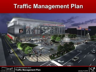
Louisville Arena Traffic Management Plan
•Download as PPT, PDF•
1 like•909 views
This presentation was presented by Qk4\'s senior vice president, David Reed at the Louisville Arena Authority Meeting on Tuesday, January 19, 2010.
Report
Share
Report
Share

Recommended
CONNECTKaro 2015 - Session 2 - Smart Mobility - Integrated Transport - The fi...
CONNECTKaro 2015 - Session 2 - Smart Mobility - Integrated Transport - The fi...WRI Ross Center for Sustainable Cities
The document discusses challenges with transportation infrastructure and the need to improve mobility for entire journeys, not just connections to stations. It argues that cities must enhance interchange zones between modes, provide safe first and last mile connections to transit hubs through improved routes and wayfinding, and ensure accessibility for all users. Better integrating all parts of each trip can help create truly smart and seamless mobility systems.AITPM Conference Presentation - Andrew Mc_Clurg
The document summarizes the evaluation of pilot "Safe Active Street" projects in Perth, Western Australia. Key findings from pre- and post-construction surveys include: an increase in cycling, especially on weekends, but inconsistent trends for pedestrians; higher cycling speeds on SAS routes; increased on-street parking occupancy despite reduced spaces; and an average 18% reduction in vehicle speeds. Design considerations for future SAS projects include ensuring narrow points every 120m to reinforce lower speeds and addressing pedestrian needs. More engagement is needed to achieve larger increases in active transportation.
Pedestrian Safety in North Texas
This document discusses pedestrian safety in the Dallas-Fort Worth metropolitan area. It provides an overview of the region, including population and crash data showing increasing pedestrian crashes and fatalities from 2012 to 2016. It also describes several programs and projects to improve pedestrian safety, such as workshops on design for pedestrian safety, research on pedestrian crash hotspots, developing a regional pedestrian safety action plan, identifying gaps in pedestrian access to rail stations, and a call for safety-related transportation projects. The goal is to reduce pedestrian crashes and fatalities through education, research, planning, and funding projects that improve pedestrian infrastructure and safety.
AITPM Conference Presentation - phil gray
This document discusses strategic cycling corridors in Melbourne. It outlines Victoria's Cycling Strategy, which aims to invest in a safer, lower-stress cycling network through priority routes like Coburg to St Kilda and Preston to CBD. The strategy goals include improving safety, lowering stress for cyclists, and prioritizing strategic cycling corridors. The document also discusses challenges like limited road space, constraints from other modes, and engaging stakeholders. It provides examples of concept designs for protected intersections and bicycle boulevards being used for priority routes.
Aecom - Streets for people workshop
This document summarizes a workshop on reimagining streets to focus more on people and activities rather than just mobility. The workshop aimed to analyze four street corridors under three scenarios of incremental to transformative change, and generate ideas to make streets more vibrant places for people. Participants worked in small groups to redesign streets using the different scenarios, then shared common ideas. A panel discussion addressed implementing a "Streets for People" approach in practice. The document provided background on trends toward more active transportation in cities and examples of projects from London and Perth that calm traffic and prioritize walking, cycling, and public spaces over cars.
Mobility B09 (Italian)
The document summarizes a study on pedestrian and boat mobility in Venice. The study collected pedestrian count data from 29 bridges over 6 weeks, totaling over 600,000 counts. It also analyzed video footage to classify pedestrians as Venetian or tourist. Boat schedule data was obtained from ACTV. An interactive computer model was developed using this data, treating pedestrians and boats as autonomous agents to simulate mobility throughout Venice and predict the impact of changes. The model can help city planners with evacuation planning and optimizing pedestrian flows. This was the first study to integrate pedestrian and boat mobility data into a single model of urban mobility for Venice.
City of Salina Brochure - Traffic Signal Systems
The document discusses traffic signal systems. It explains that traffic signals help coordinate traffic flow and increase safety by assigning right-of-way to vehicles in a controlled manner. While signals can reduce certain accidents, they may also increase rear-end collisions. The goal of traffic engineers is to design the safest and most efficient overall traffic flow. Modern traffic signals use detectors and controllers to monitor traffic demand and adjust signal timing accordingly.
Potomac River Crossing Data Development Study
The document summarizes a study examining existing and future cross-river traffic between Virginia and Maryland across the Potomac River. It analyzed traffic volumes, speeds, and origin-destination patterns at multiple river crossings. Key findings include that interstate highways carry the highest traffic volumes currently, while rail volumes are comparable during peak periods. Speeds varied by crossing and time of day. Origin-destination data showed disbursed trip patterns across the region. Traffic and passenger volumes are forecasted to increase the most by 2040 at more distant crossings. The study developed a common set of data on crossings but did not make recommendations, only defining problems.
CycleStreets: Past, present and future
CycleStreets is a website and app that provides cycling route planning and maps across the UK. It was originally created in 2006 by Cambridge Cycling Campaign and is now a social enterprise. The document discusses CycleStreets' history and growth, its routing features and open source approach, partnerships with other organizations, and its development of Cyclescape to help cycling campaign groups track issues and collaborate. CycleStreets aims to make cycling safer, easier and more popular through providing routing tools and supporting advocacy efforts.
Using spatial presentation of bus GPS data to identify and justify bus priori...
This document summarizes the analysis of bus priority data from Sydney's Public Transport Information and Priority System (PTIPS) to identify pinch points along bus corridors. Two methods of analysis were used: stop-by-stop analysis and time point analysis using GIS mapping. Key pinch points with low average speeds and high variability were identified. The analysis validated infrastructure improvements and informed options to enhance bus corridor efficiency, such as new bus lanes and stops. Transport NSW was satisfied with the outputs which provided a reliable basis for justifying planning and investment decisions.
India Vision Zero 2017: Addressing Safety Through Design for Dindoshi Terminal
India Vision Zero 2017: Addressing Safety Through Design for Dindoshi TerminalWRI Ross Center for Sustainable Cities
Addressing Safety Through Design for Dindoshi Terminal - Draft Concept: Priyanka Vasudevan, Managing Associate, Urban Transport and Road Safety, WRI India Ross Centre2.2. luís gonçalo campos, paulo fernandes, margarida c. coelho
2.2. luís gonçalo campos, paulo fernandes, margarida c. coelhoPlataforma Tecnológica da Bicicleta e Mobilidade Suave
S4C Colloquium Aveiro 2016
https://scientistsforcyclingaveiro2016.wordpress.com/
University of Aveiro (Portugal),
Region of Aveiro (CIRA), ABIMOTA/Portugal Bike Value
and the European Cyclists’ Federation (ECF)
with its global network Scientists for Cycling (S4C)City of Salina Brochure - Left Turn Traffic Signals
The document discusses left turn traffic signals used in Salina, Kansas. It provides information on different types of left turn signals, including protected/permissive signals, which allow left turns on a green light if there are gaps in opposing traffic. While these signals can help reduce delays, they cannot be used at all intersections due to the need for signal coordination. The city evaluates locations for protected/permissive signals but conversions cost $20,000 per intersection, so the city only implements them when safety benefits outweigh the costs.
Sharing the Road, Sharing the Bike by Jennifer McGrath
This document discusses plans for expanding the GREENbike bike sharing system along the Wasatch Front region of Utah. The Utah Transit Authority (UTA) sees bike sharing as an important part of its strategy to address growing transportation demands in the region by providing first/last mile connections to transit. UTA's service area is experiencing rapid population growth, increasing traffic congestion, and limited options for expanding roadways. Bike sharing has been shown to increase public transit ridership and reduce personal vehicle trips. The GREENbike system in Salt Lake City has experienced strong ridership growth since launching in 2013. UTA and regional partners are now studying how to expand and regionalize the GREENbike system to connect more communities along the Wasatch Front and
Innovation in London’s transport: Big Data for a better customer experience
Innovation in London’s transport: Big Data for a better customer experienceBCS Data Management Specialist Group
Transport for London (TfL) uses big data from sources like Oyster cards, social media, and traffic information to improve customer experience. Case studies showed how TfL uses data to tailor travel information emails, plan bus networks, provide alternative routes during bridge closures, automate fare refunds, segment station users, and influence travel demand during peak times through targeted messaging. TfL aims to further integrate diverse data sources to enhance performance of transport networks and gain deeper customer insights using new analytical tools.RV 2015: Pecha Kucha by Jacob Splan
UTA has seen increasing bike share ridership from 2013 to 2015 while paratransit calls have decreased over the same period. UTA has made several transit improvements such as upgrading bus stops, making stops ADA compliant, adding bike lockers and amenities at stations, and providing new accommodations for cyclists.
BRTS - Ahmadabad (Janmarg)
This document discusses an urban transportation system project on Bus Rapid Transit Systems (BRTS). It provides definitions of BRTS, describes the evolution and features of BRTS. The document outlines components of BRTS and lists its benefits, such as efficient, reliable service and reduced pollution, as well as disadvantages like lack of land availability and potential for increased congestion. It was prepared by 6th semester civil engineering students for their subject on urban transportation systems.
PTV Presentation
GITA & SIBA Breakfast, Melbourne 11th June 2015 @ CQ Functions.- Mr Sendur Kathir,The new Chief Information Officer Public Transport Victoria (PTV)
NACTO 2013 - SFCTA Apps
The San Francisco County Transportation Authority uses several apps and online tools to engage the public in transportation planning, including MyStreetSF.com, sfbudgetczar.com, and CycleTracks. These tools receive thousands of user submissions providing data on transportation issues and preferences. However, users tend to be overrepresented by ages 25-40, white, higher-income residents. The Authority analyzes user data along with other sources to inform planning of bicycle networks and facilities, transit funding priorities, and regional transportation modeling.
1.2. ricardo marqués
This document analyzes the relationship between cycling infrastructure and safety in Seville, Spain using regression analysis of accident data from 2000-2013. It finds that the development of a connected bikeway network in 2007 had the strongest influence on reducing accidents, more so than simply increasing bikeway length or bike trips. This supports the idea that networking bikeways plays an important role in safety, and that there may be a "quantum effect" where a fully connected system provides disproportionate safety benefits. The results also confirm the "safety in numbers" theory that more cyclists on the road can make streets safer for cycling.
Is Age a Factor in Crashes at Channelized Right-Turn Lanes?
A presentation given at the 2016 Traffic Safety Conference during Breakout Session 12: Engineering Research Findings. By Kay Fitzpatrick, Senior Research Engineer, Roadway Design, Texas A&M Transportation Institute
Miranda Saarentaus, ESA Business Applications program
1) The document discusses ESA Business Applications and downstream space solutions including satellite communication, earth observation, positioning and navigation, and space weather.
2) It provides examples of how these downstream solutions can be used for applications like AR/VR maintenance, ship routing in ice conditions, digital port operations, forest planning, and real estate valuation.
3) The document also outlines ESA funding opportunities such as the ESA BIC, ESA Business Applications, and ESA BASS programs that can provide funding and support for downstream space businesses and solutions.
RV 2015: Sustainable Corridors: Broad and Specific Looks by David Leard, AICP
What does it mean to build a sustainable corridor? How do you honor the overall goal of conserving resources, but also engage stakeholders to develop the right type of project for their community? Take a wider look at the national perspective on building sustainable corridors. What is being done across the country to conserve resources and involve communities in these efforts? Then hear stories about a successful sustainable corridor in Portland; Albuquerque's BRT project; and an urban green plan to transform existing park-and-ride lots along Los Angeles' growing transit network into more sustainable places.
Moderator: Shelley Poticha, AICP, Director, Urban Solutions, Natural Resources Defense Council; Board Member, Board of Directors, Rail~Volution, Washington, DC
Katherine Lemmon, Transportation Planning Manager, Metro, Los Angeles, California
Robert Hastings, Agency Architect, TriMet, Portland, Oregon
David Leard, AICP, Senior Management Consultant, HDR, Seattle, Washington
Lost Creek Blvd.: Security and Safety
Presentation given by Mario Porras, Anna Martin and Laura Dierenfield, Austin Transportation Department to the Lost Creek Civic Organization on August 3, 2017.
2.2. josé fajardo, margarida c coelho, josé santos
2.2. josé fajardo, margarida c coelho, josé santosPlataforma Tecnológica da Bicicleta e Mobilidade Suave
Scientists developed a sensor platform and smartphone app to warn cyclists of approaching vehicles. The sensor platform detects nearby vehicles and the app notifies cyclists through vibration and color alerts. Testing showed the sensors detected vehicles accurately 70-90% of the time. Most overtaking occurred within 1-1.5 meters of bicycles. Future work will focus on making the system more compact and usable at night or in different weather conditions.City of Salina Brochure - Traffic Signals, Why and When They Are Used
The document discusses the city's policies for installing traffic signals. It states that the primary purpose of traffic signals is to assign right-of-way at intersections, not to control speeding. Traffic signals will only be installed if the intersection meets certain volume or accident history warrants outlined in the Manual on Uniform Traffic Control Devices. The city engineering department carefully reviews intersection traffic volumes and the need for breaks in traffic flow before approving any new traffic signal installations.
Queensland’s Intelligent Transport Systems (ITS) Pilot Projects
The document discusses a proposed Queensland Intelligent Transport Systems Pilot Project. It aims to pilot emerging cooperative intelligent transport services (C-ITS) and automated vehicle technologies. The project would test C-ITS applications that share safety-related data between vehicles and infrastructure to provide drivers with timely warnings. It would also help advance the understanding of automated vehicles and how they can benefit from expanded sensing through C-ITS. The government sees opportunities in these technologies to improve mobility, safety and the environment. However, there are also uncertainties around impacts to business models, costs, regulations and public acceptance that require further pilot testing and research.
3.1. mariana vilaça, margarida c. coelho
Vulnerable road users such as pedestrians and cyclists account for a significant percentage of traffic fatalities in Portugal. The study analyzed 166 traffic accidents in Aveiro municipality involving motor vehicles and vulnerable road users from 2012-2015. It found that the majority resulted in minor injuries, occurred during the day with good weather and visibility, and involved male drivers over 35 years old in passenger vehicles traveling over the speed limit. The study also surveyed commuters and found that cyclists face challenges such as driver awareness, lack of dedicated bike lanes, and weather, but are motivated by low costs and exercise. It recommends improving infrastructure for active modes and raising road safety awareness.
Hutchinson Sports Arena
The document outlines a renovation master plan for the Hutchinson Sports Arena to improve the spectator and participant experience, become ADA compliant, and expand community use. The plan includes upgrades to the entry lobby, concession areas, restrooms, and locker rooms. A site concept is proposed with a main entry on the south side featuring more windows and natural light. The renovation aims to provide a modern facility that improves quality of life for the next 50 years with a small 0.35% sales tax increase generating an estimated $0.67 per week for residents spending $10,000 per year in Hutchinson.
Promerix 2008 Brochure
The PromeriX operating table from Merivaara:
1. Is a heavy-duty electro-hydraulic operating table designed for modern operating rooms with several innovative features.
2. Features include a modular table top, sliding function, wireless control, and integration with data management systems.
3. The PromeriX is intended to meet the needs of a variety of surgical specialties and procedures through its adjustable configurations and positions.
More Related Content
What's hot
CycleStreets: Past, present and future
CycleStreets is a website and app that provides cycling route planning and maps across the UK. It was originally created in 2006 by Cambridge Cycling Campaign and is now a social enterprise. The document discusses CycleStreets' history and growth, its routing features and open source approach, partnerships with other organizations, and its development of Cyclescape to help cycling campaign groups track issues and collaborate. CycleStreets aims to make cycling safer, easier and more popular through providing routing tools and supporting advocacy efforts.
Using spatial presentation of bus GPS data to identify and justify bus priori...
This document summarizes the analysis of bus priority data from Sydney's Public Transport Information and Priority System (PTIPS) to identify pinch points along bus corridors. Two methods of analysis were used: stop-by-stop analysis and time point analysis using GIS mapping. Key pinch points with low average speeds and high variability were identified. The analysis validated infrastructure improvements and informed options to enhance bus corridor efficiency, such as new bus lanes and stops. Transport NSW was satisfied with the outputs which provided a reliable basis for justifying planning and investment decisions.
India Vision Zero 2017: Addressing Safety Through Design for Dindoshi Terminal
India Vision Zero 2017: Addressing Safety Through Design for Dindoshi TerminalWRI Ross Center for Sustainable Cities
Addressing Safety Through Design for Dindoshi Terminal - Draft Concept: Priyanka Vasudevan, Managing Associate, Urban Transport and Road Safety, WRI India Ross Centre2.2. luís gonçalo campos, paulo fernandes, margarida c. coelho
2.2. luís gonçalo campos, paulo fernandes, margarida c. coelhoPlataforma Tecnológica da Bicicleta e Mobilidade Suave
S4C Colloquium Aveiro 2016
https://scientistsforcyclingaveiro2016.wordpress.com/
University of Aveiro (Portugal),
Region of Aveiro (CIRA), ABIMOTA/Portugal Bike Value
and the European Cyclists’ Federation (ECF)
with its global network Scientists for Cycling (S4C)City of Salina Brochure - Left Turn Traffic Signals
The document discusses left turn traffic signals used in Salina, Kansas. It provides information on different types of left turn signals, including protected/permissive signals, which allow left turns on a green light if there are gaps in opposing traffic. While these signals can help reduce delays, they cannot be used at all intersections due to the need for signal coordination. The city evaluates locations for protected/permissive signals but conversions cost $20,000 per intersection, so the city only implements them when safety benefits outweigh the costs.
Sharing the Road, Sharing the Bike by Jennifer McGrath
This document discusses plans for expanding the GREENbike bike sharing system along the Wasatch Front region of Utah. The Utah Transit Authority (UTA) sees bike sharing as an important part of its strategy to address growing transportation demands in the region by providing first/last mile connections to transit. UTA's service area is experiencing rapid population growth, increasing traffic congestion, and limited options for expanding roadways. Bike sharing has been shown to increase public transit ridership and reduce personal vehicle trips. The GREENbike system in Salt Lake City has experienced strong ridership growth since launching in 2013. UTA and regional partners are now studying how to expand and regionalize the GREENbike system to connect more communities along the Wasatch Front and
Innovation in London’s transport: Big Data for a better customer experience
Innovation in London’s transport: Big Data for a better customer experienceBCS Data Management Specialist Group
Transport for London (TfL) uses big data from sources like Oyster cards, social media, and traffic information to improve customer experience. Case studies showed how TfL uses data to tailor travel information emails, plan bus networks, provide alternative routes during bridge closures, automate fare refunds, segment station users, and influence travel demand during peak times through targeted messaging. TfL aims to further integrate diverse data sources to enhance performance of transport networks and gain deeper customer insights using new analytical tools.RV 2015: Pecha Kucha by Jacob Splan
UTA has seen increasing bike share ridership from 2013 to 2015 while paratransit calls have decreased over the same period. UTA has made several transit improvements such as upgrading bus stops, making stops ADA compliant, adding bike lockers and amenities at stations, and providing new accommodations for cyclists.
BRTS - Ahmadabad (Janmarg)
This document discusses an urban transportation system project on Bus Rapid Transit Systems (BRTS). It provides definitions of BRTS, describes the evolution and features of BRTS. The document outlines components of BRTS and lists its benefits, such as efficient, reliable service and reduced pollution, as well as disadvantages like lack of land availability and potential for increased congestion. It was prepared by 6th semester civil engineering students for their subject on urban transportation systems.
PTV Presentation
GITA & SIBA Breakfast, Melbourne 11th June 2015 @ CQ Functions.- Mr Sendur Kathir,The new Chief Information Officer Public Transport Victoria (PTV)
NACTO 2013 - SFCTA Apps
The San Francisco County Transportation Authority uses several apps and online tools to engage the public in transportation planning, including MyStreetSF.com, sfbudgetczar.com, and CycleTracks. These tools receive thousands of user submissions providing data on transportation issues and preferences. However, users tend to be overrepresented by ages 25-40, white, higher-income residents. The Authority analyzes user data along with other sources to inform planning of bicycle networks and facilities, transit funding priorities, and regional transportation modeling.
1.2. ricardo marqués
This document analyzes the relationship between cycling infrastructure and safety in Seville, Spain using regression analysis of accident data from 2000-2013. It finds that the development of a connected bikeway network in 2007 had the strongest influence on reducing accidents, more so than simply increasing bikeway length or bike trips. This supports the idea that networking bikeways plays an important role in safety, and that there may be a "quantum effect" where a fully connected system provides disproportionate safety benefits. The results also confirm the "safety in numbers" theory that more cyclists on the road can make streets safer for cycling.
Is Age a Factor in Crashes at Channelized Right-Turn Lanes?
A presentation given at the 2016 Traffic Safety Conference during Breakout Session 12: Engineering Research Findings. By Kay Fitzpatrick, Senior Research Engineer, Roadway Design, Texas A&M Transportation Institute
Miranda Saarentaus, ESA Business Applications program
1) The document discusses ESA Business Applications and downstream space solutions including satellite communication, earth observation, positioning and navigation, and space weather.
2) It provides examples of how these downstream solutions can be used for applications like AR/VR maintenance, ship routing in ice conditions, digital port operations, forest planning, and real estate valuation.
3) The document also outlines ESA funding opportunities such as the ESA BIC, ESA Business Applications, and ESA BASS programs that can provide funding and support for downstream space businesses and solutions.
RV 2015: Sustainable Corridors: Broad and Specific Looks by David Leard, AICP
What does it mean to build a sustainable corridor? How do you honor the overall goal of conserving resources, but also engage stakeholders to develop the right type of project for their community? Take a wider look at the national perspective on building sustainable corridors. What is being done across the country to conserve resources and involve communities in these efforts? Then hear stories about a successful sustainable corridor in Portland; Albuquerque's BRT project; and an urban green plan to transform existing park-and-ride lots along Los Angeles' growing transit network into more sustainable places.
Moderator: Shelley Poticha, AICP, Director, Urban Solutions, Natural Resources Defense Council; Board Member, Board of Directors, Rail~Volution, Washington, DC
Katherine Lemmon, Transportation Planning Manager, Metro, Los Angeles, California
Robert Hastings, Agency Architect, TriMet, Portland, Oregon
David Leard, AICP, Senior Management Consultant, HDR, Seattle, Washington
Lost Creek Blvd.: Security and Safety
Presentation given by Mario Porras, Anna Martin and Laura Dierenfield, Austin Transportation Department to the Lost Creek Civic Organization on August 3, 2017.
2.2. josé fajardo, margarida c coelho, josé santos
2.2. josé fajardo, margarida c coelho, josé santosPlataforma Tecnológica da Bicicleta e Mobilidade Suave
Scientists developed a sensor platform and smartphone app to warn cyclists of approaching vehicles. The sensor platform detects nearby vehicles and the app notifies cyclists through vibration and color alerts. Testing showed the sensors detected vehicles accurately 70-90% of the time. Most overtaking occurred within 1-1.5 meters of bicycles. Future work will focus on making the system more compact and usable at night or in different weather conditions.City of Salina Brochure - Traffic Signals, Why and When They Are Used
The document discusses the city's policies for installing traffic signals. It states that the primary purpose of traffic signals is to assign right-of-way at intersections, not to control speeding. Traffic signals will only be installed if the intersection meets certain volume or accident history warrants outlined in the Manual on Uniform Traffic Control Devices. The city engineering department carefully reviews intersection traffic volumes and the need for breaks in traffic flow before approving any new traffic signal installations.
Queensland’s Intelligent Transport Systems (ITS) Pilot Projects
The document discusses a proposed Queensland Intelligent Transport Systems Pilot Project. It aims to pilot emerging cooperative intelligent transport services (C-ITS) and automated vehicle technologies. The project would test C-ITS applications that share safety-related data between vehicles and infrastructure to provide drivers with timely warnings. It would also help advance the understanding of automated vehicles and how they can benefit from expanded sensing through C-ITS. The government sees opportunities in these technologies to improve mobility, safety and the environment. However, there are also uncertainties around impacts to business models, costs, regulations and public acceptance that require further pilot testing and research.
3.1. mariana vilaça, margarida c. coelho
Vulnerable road users such as pedestrians and cyclists account for a significant percentage of traffic fatalities in Portugal. The study analyzed 166 traffic accidents in Aveiro municipality involving motor vehicles and vulnerable road users from 2012-2015. It found that the majority resulted in minor injuries, occurred during the day with good weather and visibility, and involved male drivers over 35 years old in passenger vehicles traveling over the speed limit. The study also surveyed commuters and found that cyclists face challenges such as driver awareness, lack of dedicated bike lanes, and weather, but are motivated by low costs and exercise. It recommends improving infrastructure for active modes and raising road safety awareness.
What's hot (20)
Using spatial presentation of bus GPS data to identify and justify bus priori...
Using spatial presentation of bus GPS data to identify and justify bus priori...
India Vision Zero 2017: Addressing Safety Through Design for Dindoshi Terminal
India Vision Zero 2017: Addressing Safety Through Design for Dindoshi Terminal
2.2. luís gonçalo campos, paulo fernandes, margarida c. coelho
2.2. luís gonçalo campos, paulo fernandes, margarida c. coelho
City of Salina Brochure - Left Turn Traffic Signals
City of Salina Brochure - Left Turn Traffic Signals
Sharing the Road, Sharing the Bike by Jennifer McGrath
Sharing the Road, Sharing the Bike by Jennifer McGrath
Innovation in London’s transport: Big Data for a better customer experience
Innovation in London’s transport: Big Data for a better customer experience
Is Age a Factor in Crashes at Channelized Right-Turn Lanes?
Is Age a Factor in Crashes at Channelized Right-Turn Lanes?
Miranda Saarentaus, ESA Business Applications program
Miranda Saarentaus, ESA Business Applications program
RV 2015: Sustainable Corridors: Broad and Specific Looks by David Leard, AICP
RV 2015: Sustainable Corridors: Broad and Specific Looks by David Leard, AICP
2.2. josé fajardo, margarida c coelho, josé santos
2.2. josé fajardo, margarida c coelho, josé santos
City of Salina Brochure - Traffic Signals, Why and When They Are Used
City of Salina Brochure - Traffic Signals, Why and When They Are Used
Queensland’s Intelligent Transport Systems (ITS) Pilot Projects
Queensland’s Intelligent Transport Systems (ITS) Pilot Projects
Viewers also liked
Hutchinson Sports Arena
The document outlines a renovation master plan for the Hutchinson Sports Arena to improve the spectator and participant experience, become ADA compliant, and expand community use. The plan includes upgrades to the entry lobby, concession areas, restrooms, and locker rooms. A site concept is proposed with a main entry on the south side featuring more windows and natural light. The renovation aims to provide a modern facility that improves quality of life for the next 50 years with a small 0.35% sales tax increase generating an estimated $0.67 per week for residents spending $10,000 per year in Hutchinson.
Promerix 2008 Brochure
The PromeriX operating table from Merivaara:
1. Is a heavy-duty electro-hydraulic operating table designed for modern operating rooms with several innovative features.
2. Features include a modular table top, sliding function, wireless control, and integration with data management systems.
3. The PromeriX is intended to meet the needs of a variety of surgical specialties and procedures through its adjustable configurations and positions.
Managment for dvr surgery
Here i present about how to manage patient who under going DVR surgery
In this i included some topics like
INTRODUCTION TO HEART VALVULAR DISEASES
CAUSE OF HEART DISEASES & PREVENTION
DIAGNOSIS & TREATMENT
OPERATION THEATER PARAMETER
OPERATION THEATER TEAM MEMBERS
OPERATION THEATER SETUP
TYPES OF VALVE
VALVULAR SETUP
PREPARATION ROOM
INTRA OPERATIVE PROCESS
IMPORTANCE OF OT DOCUMENTS
RECOVERY ROOM
DISCHARGE INSTRUCTION
SUMMARY
@ UDRI - Traffic & Transportation Plan - Final
The document provides a traffic and transportation management plan for Mumbai. It outlines the plan's mission, scope of work, and background. Key objectives include ensuring Mumbai prioritizes public transport over private vehicles and becomes more pedestrian friendly. The plan proposes case studies and surveys to develop policies and proposals for specific traffic zones, including Ballard Estate and Chhatrapati Shivaji Terminus station. Short, medium, and long term proposals are provided for the station area focusing on separating modes of transport and improving pedestrian access. Survey findings show feeder bus usage peaks between 9:30-10:30 AM.
Adatto Bed 2005
The document summarizes an economic hospital bed called the Adatto. It has a 4-sectional mattress base and is lightweight and adaptable, making it suitable for long-term wards and ICUs. The bed has many adjustable positions and accessories to improve patient comfort and support nursing tasks. It also distributes pressure well and reduces risks of bed sores compared to standard 2-sectional beds.
Acs0108 Preparation Of The Operating Room
This document discusses the preparation of the operating room. It provides details on:
1) General principles of operating room design including patient positioning for common procedures like laparotomy, thoracotomy, and thyroidectomy.
2) Considerations for operating room design such as standards, physical layout, equipment needs, and integrating new technologies.
3) Ensuring patient safety, operating room efficiency, and quality improvement through proper patient positioning, communication systems, and disciplined introduction of new technologies.
Design of cssd
The document discusses trends in central sterile supply department (CSSD) design and operations. Key points include a movement toward larger, centralized "super CSSDs" to improve efficiency. New equipment allows for faster reprocessing times and integrated drying. There is also a trend toward more automated equipment and standardized carriers to streamline goods handling. Centralization and automation aim to reduce costs while improving ergonomics and the working environment.
Building Construction
The document summarizes the construction process observed at a construction site visited by the authors. It describes the site location and type of buildings being constructed. Safety measures at the site include signage and required protective equipment. Various plants and machinery used at different stages are discussed, including excavators, backhoes, cranes and concrete mixers. Foundations works involving piling and excavations are mentioned.
Sample project plan
The document outlines the plan for the Odessa Mobile Technology Project, which aims to implement new mobile devices, software, and systems to improve officer safety, information sharing, and job effectiveness. It describes the project goals, scope, budget, risks, timeline, roles and responsibilities, and communication approach to guide the implementation of the new technology. The plan is intended to define expectations and provide oversight for the successful rollout of the project.
Viewers also liked (9)
Similar to Louisville Arena Traffic Management Plan
2011 APA Positioning Planning Depts - Washington DC
One of three presentations made at the National Planning Conference in Boston in 2011 on Positioning Planning Departments in difficult times. This is the presentation made by Harriett Tregoning from Washington D.C.
MATC Fall Lecture Series: Eugene Russell
This document summarizes a seminar presentation about roundabouts. The presentation discussed why roundabouts are safer than traditional intersections with traffic signals or stop signs, providing statistics showing large reductions in crashes and injuries at roundabouts. It covered design elements of modern roundabouts that contribute to safety, such as deflection and low entry speeds. The presentation also addressed concerns about pedestrian, bicyclist, and visually impaired accessibility at roundabouts and showed how well-designed roundabouts can improve safety and traffic flow for all users. A brief history of roundabout development in various countries was presented as well.
Peer exchange
- Seattle has a high rate of biking with 36% of residents biking recreationally and 4000-8000 commuting by bike each year despite 140+ rainy days.
- Seattle DOT has been using GIS for 18 years to manage infrastructure and plan bike and pedestrian improvements.
- The Bike Master Plan aims to get more people biking through developing a network of bike lanes, sharrows, and routes covering 450 miles and within 0.25 miles of 95% of homes.
- The Pedestrian Master Plan aims for safety, equity, vibrancy and health through improving sidewalk coverage, crosswalks, and prioritizing high pedestrian areas and those serving low-income communities.
Open house boards, June 11, 2015
The document summarizes a public open house meeting for a transit study evaluating options to improve transit between Amherst and Buffalo, New York. It discusses the study process and screening of alternatives through three tiers. In Tier 2 screening, light rail and bus rapid transit alternatives were evaluated on criteria like ridership, environmental impacts, and engineering needs. Based on this, one light rail and three bus rapid transit alternatives were proposed to advance to more detailed Tier 3 analysis to identify a preferred alternative. Community feedback on the proposals was solicited. The schedule for completing Tier 3 analysis and selecting a preferred option was also outlined.
Open houseboards
This document summarizes a public open house meeting for a transit study between Amherst and Buffalo, New York. It presented the study process, alternatives being considered, and results of screening so far. Light rail transit and bus rapid transit alternatives on Niagara Falls Boulevard and Bailey Avenue were identified to advance to further analysis in the next phase of the study. The meeting provided information on the alternatives and sought public input to help identify a locally preferred alternative for the corridor by fall 2015.
convert_255356
This document provides an introduction and background information for development objectives for the University Avenue SE and 29th Avenue SE Transit Corridor in Minneapolis. It summarizes previous studies and policy direction, which support creating a "transit village" around the transit station with mixed-use, dense, and diverse development. An inventory of the study area maps existing land uses, transportation infrastructure, and boundaries. The objectives are intended to shape new transit-supportive development that increases ridership and supports the surrounding community.
Session 43: The Current State of Play on the Transportation Bill in Washingto...
This session focused on the current news from Capitol Hill on the Reauthorization of the US Transportation bill and other bicycling and walking issues.
Inspiring Innovations from the Field
During the opening plenary of the 2016 National Regional Transportation Conference, several presenters offered information about the regional planning work being conducted that ties transportation to community and economic development visions. Speakers included:
Gena McCullough, Bi-State Regional Commission (IL/IA); Jennifer Tinsley, Lower Savannah Council of Governments (SC); Elijah Sharp, New River Valley Regional Commission (VA); Mari Brunner, Southwest Regional Planning Commission (NH); Julio Portillo, River Valley Regional Commission (GA); Robby Cantrell, North Central Alabama Regional Council of Governments.
TRB Overivew 2006
The document summarizes the mission and activities of the Transportation Research Board (TRB). TRB fulfills its mission to promote innovation and progress in transportation through conducting research, disseminating information, and encouraging implementation of research results. It does this by organizing committees and task forces, publishing reports and papers, and administering cooperative research programs. Key activities include the annual TRB meeting with over 10,000 attendees and 550 sessions, as well as publications, conferences, and an online research database.
Urbanization of Suburbia
The document summarizes Robert Brosnan's presentation on Arlington County's experience with transit-oriented development along the Rosslyn-Ballston Metro corridor over the past 40 years. It discusses how Arlington used plans centered around new Metro stations to redevelop older commercial areas and ensure ridership. Key points include concentrating high-density development near stations, creating distinctive "urban villages" at each, balancing jobs and housing, and prioritizing pedestrian access to reduce car dependence and increase ridership. The outcome has been over $27 billion in new value and continued growth with relatively stable traffic.
Rick Hall: Place & Mobility
Presentation by Rick Hall, PE at Great Streets-Healthy Communities program hosted by ULI Memphis and the University of Memphis Partnership for Active Community Environments in Memphis, TN on April 21, 2010.
Los Or Bs Mike Lydon
The document discusses criticisms of using bicycle level of service (BLOS) metrics and the functional classification system to evaluate roadways for bicyclists. It argues that these approaches prioritize vehicles and are too focused on quantitative data without considering important broader factors like land use, urban form, different types of bicyclists and their needs. The document suggests it is time to meet latent demand for bicycling by redesigning streets in a way that shifts power away from drivers and toward people who live nearby.
Los Or Bs Mlydon
The document discusses criticisms of using bicycle level of service (BLOS) metrics and the functional classification system to evaluate roadways for bicyclists. It argues that these approaches prioritize vehicles and are too focused on quantitative metrics rather than issues like land use, urban form, different types of bicyclists. The document suggests it is time to meet latent demand for bicycling by redesigning streets to better serve bicyclists rather than just vehicles.
KAI - Modern Urban Roundabouts
The following presentation created by Kittelson & Associates, Inc. (KAI), provides an overview Modern Urban Roundabouts.
City of Chicago’s Complete Streets Policy (in search of total fabulousity)
City of Chicago’s Complete Streets Policy (in search of total fabulousity)Center for Neighborhood Technology
The document discusses Chicago's Complete Streets policy which aims to design roads to be safe and accessible for all users including pedestrians, bicyclists, transit riders and motorists. It found that pedestrian and bicyclist injuries were high and many trips were non-auto. The policy requires considering all users in transportation planning and projects. It led to improvements like wider sidewalks and crosswalks to create a more accessible transportation system for all.Combined gov hack meet the_data_owners_presentations
This document provides information about data sources and datasets that may be useful for GovHack 2014. It begins with an introduction to Melbourne City Council and Victorian government open data portals. It then lists and describes several datasets related to infrastructure locations, building information, events, urban environment performance, and more. Contact details are provided for Melbourne City Council open data representatives. The document encourages exploration of additional datasets on transport, events, communities, and traffic before concluding with contacts at VicRoads and Transport Safety Victoria.
Traffic engineering and traffic control devices 2
This document discusses various aspects of traffic engineering. It defines traffic engineering as dealing with the safe and efficient movement of people and goods on roads. It provides some basic traffic statistics for the US in 1986. It discusses the growing demand for urban traffic and challenges in meeting that demand given space constraints. It outlines elements that influence traffic such as highways, drivers, and vehicles. It also covers topics like traffic control devices, signs, traffic volume measurement, traffic problems and their causes.
TRAFFIC VOLUME STUDY AND DESIGN OF ROUNDABOUT AT PATHANAMTHITTA
The document summarizes a study conducted on designing a roundabout at Stadium Junction in Pathanamthitta, Kerala, India. Traffic volume data was collected over 7 days at the existing signalized intersection. Based on the traffic data, which found over 1200 passenger car units per hour, a single-lane roundabout with a 40m diameter central island was designed according to Indian Road Congress guidelines. The roundabout was designed to improve traffic flow and reduce conflicts compared to the existing signal system.
Nashville Regional Summit:
Lessons Learned in Implementing
Mass Transit
The document summarizes lessons learned from implementing mass transit in the Nashville region. It discusses the Regional Transportation District (RTD) which serves over 2 million people across eight counties and 40 municipalities. It provides statistics on RTD's operations, costs, funding, and economic impacts. Key lessons highlighted include the importance of regionalism, effective management, smart investments, accurate cost estimates and schedules, and maintaining quality as transit systems are developed and expanded.
Prineville HWY 126 Tom McCall Public Meeting 12-17-15
Presentation from public meeting on OR126 @ Tom McCall pulbic meeting held in Prineville on 12-17-15.
Similar to Louisville Arena Traffic Management Plan (20)
2011 APA Positioning Planning Depts - Washington DC
2011 APA Positioning Planning Depts - Washington DC
Session 43: The Current State of Play on the Transportation Bill in Washingto...
Session 43: The Current State of Play on the Transportation Bill in Washingto...
City of Chicago’s Complete Streets Policy (in search of total fabulousity)
City of Chicago’s Complete Streets Policy (in search of total fabulousity)
Combined gov hack meet the_data_owners_presentations
Combined gov hack meet the_data_owners_presentations
TRAFFIC VOLUME STUDY AND DESIGN OF ROUNDABOUT AT PATHANAMTHITTA
TRAFFIC VOLUME STUDY AND DESIGN OF ROUNDABOUT AT PATHANAMTHITTA
Nashville Regional Summit:
Lessons Learned in Implementing
Mass Transit
Nashville Regional Summit:
Lessons Learned in Implementing
Mass Transit
Prineville HWY 126 Tom McCall Public Meeting 12-17-15
Prineville HWY 126 Tom McCall Public Meeting 12-17-15
Louisville Arena Traffic Management Plan
- 2. Fair Board Metro Police Metro Public Works PARC U of L Metro Fire Metro Safe TARC PC Sports Metro EMS Riverside Parking TRIMARC Technical Advisory Committee Kentucky Transportation Cabinet Downtown Development Corporation Louisville Downtown Management District Waterfront Development Corporation
- 4. Recommended Daily Traffic Pattern
- 5. Parking
- 6. Event Seating and Parking 6,407 16,018 NCAA Wrestling 8,724 21,810 NCAA Volleyball 8,676 21,690 NCAA Swimming 9,143 22,858 Center Stage Concert 6,918 17,294 End Stage Concert 6,406 16,016 Hockey/Arena Football/Circus 8,866 22,166 NCAA Basketball Parking (2.5/ppv) Seating Event
- 7. Competing Venue Seating and Parking * Wharf Lot Parking available but not reserved 276 0* 276 (3.25 ppv) 900 Belle of Louisville 800 595 3,000 (3.0 ppv) 9,000 (avg) Louisville Slugger Field 860 340 1,200 (2.5 ppv) 3,000 Kentucky Center - 440 440 (2.5 ppv) 1,100 Actors Theatre Anticipated Competition (Overlap) Reserved Parking Supply Parking Demand Total Seats Venue
- 8. Exposition Center Parking by Radial Overlay
- 9. Primary Parking Inventory Area
- 10. Primary Parking Inventory Area by Origin
- 11. Traffic