
Recommended
Recommended
More Related Content
Similar to Prineville HWY 126 Tom McCall Public Meeting 12-17-15
Similar to Prineville HWY 126 Tom McCall Public Meeting 12-17-15 (20)
Recently uploaded
Recently uploaded (20)
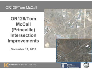
Prineville HWY 126 Tom McCall Public Meeting 12-17-15
- 2. Follow a public and transparent process Corridor Plan and TSPs provide direction Alternative Analysis by Kittelson & Assoc., Inc. Highway/Civil Engineering using Best Practices Can’t just pick a solution, must consider safety, engineering, and available funding Process
- 3. Problem OR126/Tom McCall Growth in traffic Extremely long queues and congestion Increased crashes Intersection becoming significant barrier to economic development
- 4. Need Safety - Intersection use is increasing as surrounding land use grows Purpose Serve existing use and support future use from development of nearby industrial land Need and Purpose
- 5. Design and construction of a roundabout Roundabout approach treatments to slow traffic Re-route George Millican Road and Airport Way What is the OR126/Tom McCall Project?
- 6. Key goals include: Provide a high level of safety in high-speed rural area Support economic development within the City’s industrial lands Accommodate oversized freight movements Key Goals OR126/Tom McCall
- 7. Project Background and Schedule OR126 Corridor Plan (2012) Prineville TSP (2012/13) City/County Requests STIP Funding (2012) Project Design/Stakeholder Outreach (2015/16) City and Freight Concurrence (2016) Construction 2017/18 Design Concepts Design Refinement
- 8. Kittelson & Associates, Inc. Kittelson & Associates, Inc. – Traffic Analysis
- 9. Study Area
- 11. Existing Safety Performance OR 126 Intersection Number of Crashes Million Entering Vehicles (MEV) Crash Rate (crash per MEV) Statewide 90th Percentile Rate Tom McCall Road 10 21.4 0.47 0.41 Airport Way-SW Millican Road 5 18.6 0.27 0.41 5 years of historical crash data (2009-2013)
- 12. Future Intersection Operations – No-Build Evaluation Year Stop-Controlled Approaches LOS V/C Delay (sec) 95th Percentile Queue (ft) OR 126 and Tom McCall Road 2035 Northbound F >1.0 >80 >500 Southbound F >1.0 >80 >500 OR 126 and Airport Way/SW Millican Road 2035 Northbound E 0.65 46.5 100 Southbound F 0.22 59.9 25
- 13. What is a roundabout?
- 14. What is not a modern roundabout? Photo:CityofFortWorth,TX Rotary Traffic Circle Photo:GoogleMaps Photo:LeeRodegerdts Neighborhood Traffic Circle
- 15. Conversion of Rotary to Roundabout: Kingston, NY Photo:NewYorkStateDOT 225 feet 600+ feet
- 17. Roundabouts reduce crashes Over 90% reduction in fatalities 76% reduction in injuries 35% reduction in total crashes * NCHRP Report 572 Photo:LeeRodegerdts
- 18. Safety Performance (NCHRP Report 572) 78% reduction in injuries 48% reduction in total crashes CONVERTED TO
- 20. How does a roundabout compare to a signal? Year 2035 Operations – Average Delay per Vehicle > 80s ~ 26s ~ 22s OR126/Tom McCall Vehicle stacking Queues are approximately half as long with roundabout vs. signal
- 21. How does a roundabout compare to a signal? Future Safety Performance over 5 Years 6.5 Crashes 3.5 Fatal/Injury 3.5 Crashes 1.5 Crashes 0.5 Fatal/Injury 74% reduction 89% reduction OR126/Tom McCall 44% reduction
- 23. Signal Concept
- 25. Freight Accommodation 1,552 single-use permits on OR126 (2007-2012) 764 single-use permits on Millican Road (2013-2014) Longest combination truck-trailer = 267 feet Widest load = 23.5 feet Over 12 loads = Height > 18 feet
- 26. Designing for Freight – US20/Barclay Example Full-scale test in two locations Tested 18 truck/trailer combinations – Up to 130’ in length All test vehicles made it through the roundabout
- 28. Questions?
- 29. What is a modern roundabout? YIELD control on entry – Priority to circulating vehicles Slow, consistent speeds Landscaping Pedestrian access & crossing No Parking Direction of circulation – Channelization
- 30. 32 conflict points High-speed Angle Crashes High Impact 8 conflict points Low-speed Non-angle Crashes Low Impact Vehicle Conflict Points: REDUCED
- 31. Pedestrian Conflict Points: REDUCED 16 conflict points 8 conflict points
- 32. Lower speed is safer for pedestrians Chance of pedestrian death increases with vehicle speed
- 33. Roundabouts and Bicyclists Roundabouts slow vehicles to speeds compatible with bicycles Bicyclists have wide range of skills and comfort levels in mixed traffic – Experienced cyclists (e.g., commuter or utility cyclists) – Inexperienced cyclists (e.g., children or occasional recreation cyclists) Give bicyclists option of either being vehicle or pedestrian
- 34. Pedestrian Safety Netherlands (181 Intersections converted to roundabouts) – 73% reduction in pedestrian crashes – 89% reduction in pedestrian injury crashes Norway (4 years of data) – 59 roundabouts = 1 pedestrian injury crash out of 33 injury crashes (3%) – 124 signals = 57 pedestrian injury crashes out of 287 injury crashes (20%) NCHRP Report 572 – 769 observed pedestrian events • No crashes • Four conflicts (0.5%)
- 35. Cyclist Safety NCHRP Report 572 – 690 observed bicyclist events • No crashes • Four conflicts (0.6%)
- 36. Public perception of roundabouts
- 37. Signalized Intersection Crashes in Oregon 2003 - 2007 (5 yrs) At 1,240 Signalized Intersections on State Highways – 32 Fatal crashes – 308 Serious Injury crashes – 5,171 Moderate & minor injury crashes
- 38. Future (Year 235) Intersection Operations – Signal Scenario #1 - No Airport Way/Millican Road Reroute Scenario #2 – With Airport Way/Millican Road Reroute
- 39. Future Intersection Operations – Roundabout 2035 Design Year (Volume Scenario #1 - no Airport Way/ Millican Road Reroute) 2035 Design Year (Volume Scenario #2 - with Airport Way/ Millican Road Reroute) Approach Lane Configurations Volume to Capacity Ratio1 Delay (sec)1 Lane Configurations Volume to Capacity Ratio1 Delay (sec)1 HCM 2010 Eastbound LT, TR 0.50 10.5 LTR 0.90 33.7 Westbound LTR 0.70 15.5 LTR 0.84 26.8 Northbound LTR 0.55 20.0 LT,R 0.68 31.3 Southbound LTR 0.41 13.8 LTR 0.52 18.7 HCM 2010 (with City of Bend Calibration) Eastbound LTR 0.77 16.9 LTR 0.72 15.2 Westbound LTR 0.57 10.0 LTR 0.68 14.0 Northbound LTR 0.50 16.6 LTR 0.71 24.7 Southbound LTR 0.29 8.4 LTR 0.36 10.3 1 Reported for the critical lane for multilane approaches LTR = Single lane approach; LT,TR = Left/through and Through/right lanes; LT,R = Left/through and right lanes
- 40. Summary Intersection Operations 2035 P.M. Peak Hour No-Build Signal Roundabout (HCM 2010) Roundabout (City of Bend Calibration) 95th Percentile Queue (ft) Eastbound OR 126 25 650 325 175 Westbound OR 126 25 500 275 150 Northbound Tom McCall Rd >500 100 125 150 Southbound Tom McCall Rd >500 125 75 50 Approach Capacity (v/c) Eastbound OR 126 0.02 0.78 0.90 0.72 Westbound OR 126 0.04 0.69 0.84 0.68 Northbound Tom McCall Rd >1.0 0.58 0.68 0.71 Southbound Tom McCall Rd >1.0 0.65 0.52 0.36 Approach Delay (s) Overall Intersection >80 25.9 28.3 16.0 Eastbound OR 126 0.5 22.7 33.7 15.2 Westbound OR 126 1.1 16.8 26.8 14.0 Northbound Tom McCall Rd >80 40.4 31.3 24.7 Southbound Tom McCall Rd >80 36.6 18.7 10.3 Level of Service (LOS) Overall Intersection F C D C Eastbound OR 126 A C D C Westbound OR 126 A B D B Northbound Tom McCall Rd F D D C Southbound Tom McCall Rd F D C B
- 43. Scenario Total Entering Volume OR126/Tom McCall Existing 1,210 2018 1,355 2035 1,915 Brookswood/Bond/Reed Market May 2014 Counts 2,476
- 44. US 50/US 77 – Florence, KS Steve King - KDOT 20% Trucks 40% Trucks 40% Trucks
- 46. Bypass for Overdimensional Loads