Downloaded 14 times
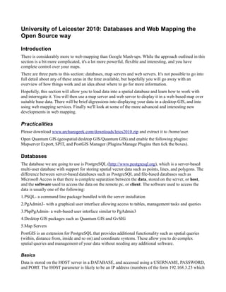
![Step 5 (purple): Positioning the Map
map.zoomToMaxExtent();
This code tells the map to zoom out to its maximum extent, which by default is the entire world. It is
possible to set a different maximum extent.
OpenLayers maps need to be told what part of the world they should display before anything will
appear on the page. Calling map.zoomToMaxExtent() is one way to do this. Alternative ways that offer
more precision include using zoomToExtent() and setCenter().
Step 6 (green): Loading the Map
<body onload="init()">
In order to ensure that your document is ready, it is important to make sure that the entire page has been
loaded before the script creating the map is executed.
We ensure this by putting the map-creating code into a function, and then calling it only when the
<body> element is fully loaded.
Task: Copy mapserver.html and save it in /var/www/openlayers/mydemo. View it at
http://localhost/openlayers/mydemo/mapserver.html. Experiment with the lat and lon values
(which are in the default coordinate system of EPSG 4326) and the zoom level to get your map
nicely centred and zoomed. Edit the descriptive text and experiment with the size of the map.
Check for problems using the firefox error console and firebug/httpfox.
Map controls and additional layers
Controls provide additional functionality for your map, such as zoom and scale bars, and mouse
position (the coordinates of your mouse cursor). These can be added as the map is drawn, using the
following syntax:
map = new OpenLayers.Map('map', {
controls: [
new OpenLayers.Control.Navigation(),
new OpenLayers.Control.PanZoomBar()]}
or after the map is drawn using this syntax:
map.addControl( new OpenLayers.Control.LayerSwitcher() );
TASK: Take a look at the various controls on offer in
http://localhost/openlayers/examples/controls.html and add some to your map.
Base Mapping
Displaying your data in a web map is one thing, but it looks much better when overlain on some base
mapping or satellite data. Openlayers can access base mapping from a variety of different mapping and
imagery providers, such as Google, Yahoo, Microsoft, OpenStreetmap and so on.
Overlaying data onto base mapping adds two additional factors:
1. The base mapping and your data may not necessarily be in the same coordinate system. In fact](https://image.slidesharecdn.com/leicester2010notes-100629060343-phpapp02/85/Leicester-2010-notes-11-320.jpg)
![it is quite unlikely that they will be, as your data is likely to be smaller in scale and the base
mapping is likely to be world-wide.
Commercial base layers tend to be in Spherical Mercator coordinates, which has the EPSG
code 900913 (it looks like GOOGLE as an aide memoire). Your data can be projected either
server-side by the map server or client-side by the openlayers code.
2. The layers you overlay onto the base mapping must have a transparent background.
3. You need a (free) api key from the commercial mapping provider to display their maps on your
web site.
We are going to cheat and use base mapping in standard EPSG:4326 format!
We need to add a number of additional parameters to our web page:
1. An additional layer of basic base mapping free from metacarta and set that as the base layer:
var wms = new OpenLayers.Layer.WMS( "OpenLayers WMS",
"http://labs.metacarta.com/wms/vmap0", {'layers': “basic”},
{'isBaseLayer': true} );
2. Change our layer from OpenLayers.Layer.MapServer to OpenLayers.Layer.WMS, and add
options for transparency:
var layer = new OpenLayers.Layer.WMS(“UK Counties”,
“http://localhost/cgi-bin/mapserv”,
{'map': “/home/user/demo.map”, 'layers': “UK Counties”, 'transparent': true,
'format': “png”});
3. Change the addLayer directive to addLayers:
map.addLayers([wms,layer]);
TASK: Add your base layers to your web page.
Beyond Openlayers
There are a number of alternative web mapping options than what have been demonstrated here. They
all have strengths and weaknesses and different approaches.
MapGuide Open Source (http://mapguide.osgeo.org) provides a pre-built web server and web mapping
application with a full Graphical User Interface for building your maps (in php or .net) without needing
to know any code.
Mapfish (http://mapfish.org/) builds on openlayers but adds additional libraries to allow you to build
more sophisticated applications, including working with the firefox google earth plugin.
Mapchat (http://mapchat.ca/) uses mapserver and ka-map, an alternative to openlayers and adds the
ability to do real-time chat, like a geospatial instant messenger.
Featureserver (http://featureserver.org/) is another cgi executable that works with openlayers to provide
full read- and write access to your data sources. In other words you can allow web-based editing of
your postgresql data, such as adding and deleting features or changing attribute text.](https://image.slidesharecdn.com/leicester2010notes-100629060343-phpapp02/85/Leicester-2010-notes-12-320.jpg)

This document provides an overview of creating web maps using open source tools, including: 1) It discusses using databases (PostgreSQL), map servers (MapServer), and web servers to store, serve, and display spatial data on the web. 2) It provides instructions on loading spatial data into a PostgreSQL database using Quantum GIS, then querying and styling the data for display in a web map using MapServer. 3) It describes basic map file syntax for MapServer and adding layers from shapefiles, databases, and other sources for rendering in a web map.