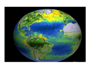
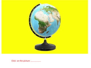
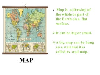
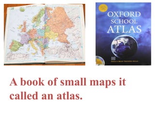
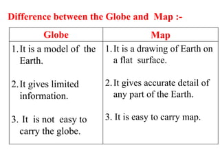
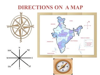
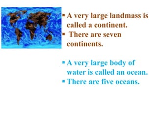
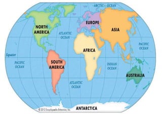
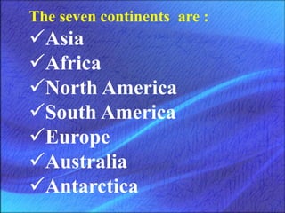
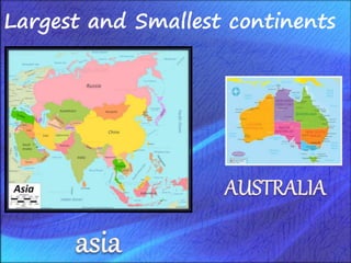
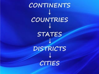
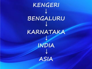
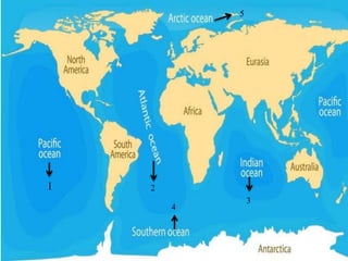
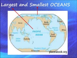
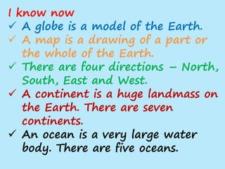
Click on the picture ………………..
In this lesson you will learn about :-
 Globes and maps
 The four main directions
 Continents and oceans
GLOBE
 Globe is a model of
Earth.
 It shows us the whole
Earth.
 We can rotate it to see
different places but it is
not big enough to show
all the places in detail.
MAP
 Map is a drawing of
the whole or part of
the Earth on a flat
surface.
It can be big or small.
A big map can be hung
on a wall and it is
called as wall map.
A book of small maps it
called an atlas.
Globe Map
1.It is a model of the
Earth.
2.It gives limited
information.
3. It is not easy to
carry the globe.
1.It is a drawing of Earth on
a flat surface.
2.It gives accurate detail of
any part of the Earth.
3. It is easy to carry map.
Difference between the Globe and Map :-
DIRECTIONS ON A MAP
landmasses
ocean
landmasses
 A very large landmass is
called a continent.
 There are seven
continents.
 A very large body of
water is called an ocean.
 There are five oceans.
The seven continents are :
Asia
Africa
North America
South America
Europe
Australia
Antarctica
Remember
Adorable Aunt Neena Saw Eight
Autorickshaws with Angles.
Largest and Smallest continents
CONTINENTS
COUNTRIES
STATES
DISTRICTS
CITIES
KENGERI
BENGALURU
KARNATAKA
INDIA
ASIA
1
3
2
4
5
Remember
PA I S A
Largest and Smallest OCEANS
 Oceans are very deep.
 Ocean floors are not plain or
flat.
 There are long mountain ranges
and trenches on the ocean floors.
 A sea is also a large water body
but is smaller than an ocean.
Watch a video to know
more about ocean floor.
I know now
 A globe is a model of the Earth.
 A map is a drawing of a part or
the whole of the Earth.
 There are four directions – North,
South, East and West.
 A continent is a huge landmass on
the Earth. There are seven
continents.
 An ocean is a very large water
body. There are five oceans.
L3- Continents and oceans.pptx

L3- Continents and oceans.pptx

  • 2.
    Click on thepicture ………………..
  • 3.
    In this lessonyou will learn about :-  Globes and maps  The four main directions  Continents and oceans
  • 4.
    GLOBE  Globe isa model of Earth.  It shows us the whole Earth.  We can rotate it to see different places but it is not big enough to show all the places in detail.
  • 5.
    MAP  Map isa drawing of the whole or part of the Earth on a flat surface. It can be big or small. A big map can be hung on a wall and it is called as wall map.
  • 6.
    A book ofsmall maps it called an atlas.
  • 7.
    Globe Map 1.It isa model of the Earth. 2.It gives limited information. 3. It is not easy to carry the globe. 1.It is a drawing of Earth on a flat surface. 2.It gives accurate detail of any part of the Earth. 3. It is easy to carry map. Difference between the Globe and Map :-
  • 8.
  • 9.
  • 10.
    landmasses  A verylarge landmass is called a continent.  There are seven continents.  A very large body of water is called an ocean.  There are five oceans.
  • 12.
    The seven continentsare : Asia Africa North America South America Europe Australia Antarctica
  • 13.
    Remember Adorable Aunt NeenaSaw Eight Autorickshaws with Angles.
  • 14.
  • 15.
  • 16.
  • 17.
  • 18.
  • 19.
  • 20.
     Oceans arevery deep.  Ocean floors are not plain or flat.  There are long mountain ranges and trenches on the ocean floors.  A sea is also a large water body but is smaller than an ocean.
  • 22.
    Watch a videoto know more about ocean floor.
  • 23.
    I know now A globe is a model of the Earth.  A map is a drawing of a part or the whole of the Earth.  There are four directions – North, South, East and West.  A continent is a huge landmass on the Earth. There are seven continents.  An ocean is a very large water body. There are five oceans.