Download to read offline

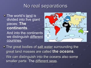
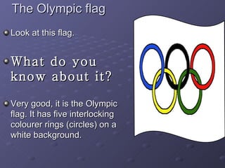
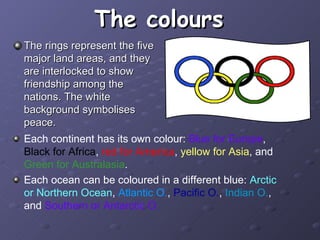

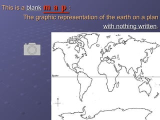
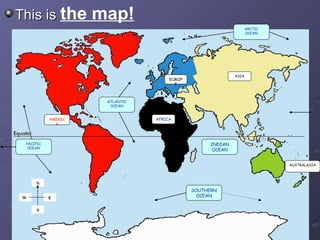
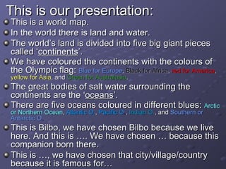
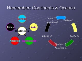

The document teaches children about maps and geography. It explains that a map is a representation of Earth's surface from above. The document discusses the major continents and oceans, using the colors of the Olympic rings to represent each continent. It provides a blank world map and instructs children to label the continents and oceans with their names and colors from the Olympic flag, and identify places they know on the map.


