The document provides information about consultancy services being offered by Aarvee Associates and G-Tech Infra for the preparation of detailed project reports (DPRs) for the Kalpasar project in India. It includes an overview of the companies and their relevant experience working on projects related to water resources development. The scope of services for the Kalpasar project consultancy includes project methodology, team details, activity schedule and more. Relevant past projects completed by the companies involving DPRs, detailed design, modernization studies, environmental impact assessments and rehabilitation are also summarized.
Sweet water catchment area near Cambay, in gujarat,this is in gulf of Cambay and project is to construct Dam to prevent sea water entering sweet water catchments.
Hydrologic Design of a Percolation TankC. P. Kumar
The document discusses the design of percolation tanks for artificial groundwater recharge. It provides details on:
1. The basic requirements for an effective percolation tank design, including the availability of surface water runoff and suitable hydrogeological conditions.
2. The steps involved in hydrologic design of a percolation tank, which include calculating the tank capacity based on catchment area and rainfall, designing the embankment dimensions, and checking for stability.
3. Design considerations like embankment slopes, spillway sizing, and locating the saturation line for stability. An example design calculation is also provided.
The document provides an outline for a presentation on the SWAT (Soil and Water Assessment Tool) hydrological model. It begins with an introduction to hydrological modeling and the development and utilities of the SWAT model. It describes the data requirements, model framework, and step-by-step procedure to run the model. A case study applying the SWAT model to the Simly Dam watershed in Pakistan is summarized. The limitations and future developments of the SWAT model are briefly discussed, followed by references.
identification of ground water potential zones using gis and remote sensingtp jayamohan
This document summarizes a study that mapped groundwater potential zones in the Muvattupuzha block of Kerala, India using GIS and remote sensing. Key factors like geology, geomorphology, lineaments, drainage density, rainfall, land use, slope and soils were analyzed as layers in GIS. Weighted overlay analysis was used to delineate excellent, moderate and poor groundwater potential zones. Validation with field data found good correlation. The study aims to aid groundwater development and management to address water scarcity in the region.
Morphometric Analysis and prioritization of watersheds of Mahanadi River Basi...RINKU MEENA
This document summarizes a student project analyzing watersheds in the Mahanadi River Basin in India using GIS. The objectives are to delineate watersheds and streams using DEM data in QGIS and calculate morphometric parameters to prioritize the watersheds. Methodology includes preprocessing DEM data in QGIS, extracting stream networks and channel networks, and delineating watersheds for five stations. Results show watershed delineation for specific stations. The conclusion discusses using QGIS tools for watershed delineation and how morphometric parameters can inform water and land use planning.
This document summarizes the key aspects of watershed development programs and the Sujala watershed development project in Karnataka. It discusses watershed programs as integrated area development approaches aimed at conserving natural resources through community participation. The Sujala project specifically aims to improve watershed productivity, strengthen community institutions, and build capacity for participatory natural resource management. It is being implemented across 7 districts in Karnataka with community groups and NGOs playing a central role in project execution.
This document provides an introduction and overview of groundwater modeling. It discusses why groundwater modeling is needed for effective groundwater management. It outlines the modeling process, including developing a conceptual model, selecting governing equations, model design, calibration, validation, and using the model for prediction. It describes different types of mathematical models, including analytical, finite difference, and finite element models. It emphasizes that a modeling protocol should establish the modeling purpose and ensure the conceptual model adequately represents the system behavior. The document stresses the importance of calibration, verification, and sensitivity analysis to evaluate a model's ability to reproduce measured conditions and the effects of uncertainty.
Application of GIS and RS in Watershed Managementholegajendra
This document outlines the use of GIS in watershed management. It begins with defining key terms like watershed and explaining the need for watershed management to scientifically manage land and water resources. It then provides an overview of how GIS works by capturing, storing, manipulating, analyzing and visualizing spatial data. The document presents a case study applying GIS to the Khuldabad watershed in India to delineate boundaries, create maps of terrain, land use and hydrological parameters to inform a development plan. It details the methodology used including collecting satellite data, creating base maps and analyzing the results.
This document discusses the use of geographic information systems (GIS) in water resource management and assessment. It provides examples of GIS applications in watershed management, groundwater assessment, flood management, and water quality studies. It then describes a case study that developed a GIS-based decision support system to assess watershed runoff in the Kk3 Macro Watershed in India. Key steps included delineating sub-watersheds, creating soil and land use maps, determining hydrologic response units, computing runoff, and generating thematic runoff maps. The system allows users to update rainfall data and evaluate variations in spatial runoff distribution over time.
IDENTIFICATION OF GROUNDWATER POTENTIAL ZONES USING REMOTE SENSING AND GEOGRA...IAEME Publication
The document describes a study that used remote sensing and GIS techniques to identify groundwater potential zones in the Konakaluva sub-basin of India. Various thematic maps were generated from satellite imagery and other data sources. These maps were overlaid and assigned weights based on their influence on groundwater occurrence. Soil data was given the highest weight of 40%, while land use/cover and drainage density were also significant at 25% and 10%, respectively. An integrated groundwater potential zones map was produced that classified areas as very good, good, fair, moderate or poor potential zones based on the overlay analysis. The results can help with better planning and management of groundwater resources in the study area.
Digital elevation models (DEMs) can be used to delineate watersheds through a multi-step hydrologic modeling process. The DEM is first used to determine flow direction from each cell based on steepest downhill slope. Flow accumulation is then calculated to identify streams above a threshold. Stream networks and outlets are identified and used to delineate watershed polygons for each outlet. Vector conversion and post-processing steps such as dissolving spurious polygons and merging watersheds produce the final watershed delineation.
This document provides an overview of irrigation engineering. It discusses the necessity of irrigation, benefits and ill-effects. It covers types of irrigation systems, soil-water relationships, irrigation development in India, and key concepts like duty and delta. Engineering, agriculture, and management aspects are described. Factors affecting evapotranspiration and methods to measure it are also summarized.
drought monitoring and management using remote sensingveerendra manduri
Monitoring drought and its management became easier with the help of remote sensing..several drought monitoring indices can be used to monitor drought condition. this ppt consists of information regarding droughts in relation to agriculture and their monitoring with the help of remotely sense based indices.
Iirs overview -Remote sensing and GIS application in Water Resources ManagementTushar Dholakia
Remote sensing and GIS application in Water Resources Management- By S.P. Aggarval spa@iirs.gov.in Indian Institute of Remote sensing ISRO, Department of space, Dehradun
CHARACTERISTICS OF WATERSHED: size, shape; physiography, slope, climate, drainage, land use, vegetation, geology and soils, hydrology and hydrogeology, socio-economic characteristics, basic data on watersheds.
The document discusses methods for flood control, including controlling water levels through dams and check dams, building barriers like levees and flood walls, altering river channels by straightening or widening them, controlling land use around rivers, and using floodways. It provides details on reservoirs, levees, and floodways as specific flood control techniques. Levees are described as earthen embankments built between rivers and protected areas to restrict flood water flow, with considerations for their height and freeboard. The Mississippi River levee system is highlighted as one of the largest in the world.
Tacheometric surveying is a method of surveying that determines horizontal and vertical distances optically rather than through direct measurement with a tape or chain. It uses an instrument called a tacheometer fitted with a stadia diaphragm to rapidly measure distances. The key principles are that the ratio of perpendicular to base is constant in similar triangles, allowing horizontal distance and elevation to be calculated from observed angles and staff intercept readings. Common tacheometric systems include fixed hair stadia, subtense stadia, and tangential methods. Distance and elevation formulas are derived for horizontal, inclined, and depressed line of sights depending on staff orientation. Tacheometric surveying is well-suited for difficult terrain where direct measurement is challenging
Data Requirements for Groundwater ModellingC. P. Kumar
Groundwater modeling requires data on the physical and hydrological framework of the aquifer. The physical framework data defines the aquifer geometry and properties, including topography, geology, aquifer thickness and boundaries. The hydrological framework data describes the flow in and out of the aquifer, such as water table elevations, recharge and discharge rates and areas. Collecting these types of data from existing sources and monitoring programs is the first step of any groundwater modeling study.
Measurement of rainfall is done using rain gauges, which collect precipitation and allow the amount to be measured. Non-recording rain gauges, like the commonly used Symons gauge in India, collect rainfall in a vessel that is read daily to determine the amount of precipitation. Recording rain gauges produce a continuous plot of rainfall over time through mechanisms like tipping buckets, weighing the collected water, or tracking a float level. Proper placement and regular maintenance of rain gauges is important for accurate measurement of precipitation.
This document discusses water resource management issues related to irrigated agriculture. It notes that competition for limited water supplies is intensifying as populations and economies grow. Despite water shortages, misuse of water is widespread. The largest demand for water globally comes from agriculture, with over two-thirds used for irrigation. Poor irrigation performance and drainage has led to problems like waterlogging and salinization on irrigated lands. Policymakers are looking to agriculture to improve water use efficiency to free up water for other higher-value uses. The document discusses the role of land grading and leveling in irrigated agriculture, outlining different design methods and criteria to create uniform land surfaces that allow for efficient irrigation and drainage.
The document discusses groundwater usage and management in India. It notes that groundwater provides 61% of irrigation needs, 85% of rural drinking water, and 45% of urban water supply. However, 803 of 5845 assessment units in India are overexploited, and levels are declining in many areas. The Central Ground Water Board's objectives include comprehensive aquifer mapping, management plans, capacity building, and regulation to shift from "groundwater development" to "groundwater management" in a sustainable way through community participation. The goals are to improve data accuracy, manage aquifers locally, ensure drinking water security, and sustainably develop groundwater resources.
Class notes of Geotechnical Engineering course I used to teach at UET Lahore. Feel free to download the slide show.
Anyone looking to modify these files and use them for their own teaching purposes can contact me directly to get hold of editable version.
This document discusses reservoir sedimentation. It begins by defining reservoirs and classifying them. It then explains how sedimentation occurs as rivers carry sediments that are deposited when the river flow is blocked by a reservoir. This leads to a reduction in water storage capacity over time. The document lists indicators of reservoir sedimentation and discusses trap efficiency. It also outlines the different forms of sediment transport in rivers and the impacts of reservoir sedimentation, such as reduced storage and hydroelectric power generation. In conclusion, sedimentation diminishes storage capacity and benefits of the reservoir over the long run.
This document discusses precipitation and methods of measuring precipitation. It defines precipitation as moisture falling from the atmosphere in any form. The key forms of precipitation are liquid (rain, drizzle) and frozen (snow, hail, sleet). Precipitation is measured using various devices like rain gauges and satellites. Rain gauges include non-recording and recording types like tipping bucket gauges. Methods to calculate average precipitation over an area include arithmetic averages, Thiessen polygons, and isohyetal mapping. Factors influencing precipitation amounts are also examined.
This document discusses methods of groundwater recharge. It is divided into two parts: natural recharge and artificial recharge. Natural recharge occurs when rainwater enters the soil through pores and fractures. Artificial recharge is necessary when natural recharge cannot meet water demands. Methods of artificial recharge include spreading methods like flooding, basins, and channels; injection methods using wells and galleries; and induced recharge by lowering the water table before monsoon season. The document provides details on various artificial recharge techniques and factors to consider for each method.
A watershed is defined as the area of land where all surface water drains into a common body of water such as a stream, river, lake, or ocean. Within a watershed, stormwater runoff is affected by human activities like development, agriculture, and mining. Watersheds are important because actions within the watershed can impact downstream water quality. Watershed management aims to control runoff, utilize water resources, and protect land and water quality within a watershed. Various structures are used in watershed management like contour bunds, terracing, check dams, and percolation ponds.
- Bhaskar Sarkar is an electrical engineer with over 40 years of experience in design, engineering, project management and consulting roles in India and abroad.
- His most relevant experience includes designing electrical, instrumentation and SCADA systems for large water supply projects in West Bengal, including a 52 MGD water treatment plant project where he developed technical specifications, evaluated tenders and supervised implementation.
- He has extensive experience in designing power distribution systems, illumination systems, and PLC-based control systems for material handling and industrial projects across various sectors.
K. Mohammed Aves has over 7 years of experience as a mechanical engineer working on water treatment plant and pipeline projects. He has extensive experience in design, site inspection, construction, testing and commissioning of water treatment plants, pumping stations and pipelines. His roles have included surveying, preparing designs, specifications and drawings, procuring materials, overseeing installation and maintenance. He is proficient in software such as PDMS, AutoCAD, MS Office and has strong communication, analytical and problem-solving skills.
This curriculum vitae summarizes the qualifications and experience of Vijayakanth M:
- He has over 9 years of experience in engineering consultancy, project management, and design of water supply schemes.
- His qualifications include a Bachelor's degree in Civil Engineering and experience working on projects in India and Qatar.
- Some of his project experience includes designing water supply schemes for municipalities in Tamil Nadu, preparing DPRs for schemes in Coimbatore and Vellore, and project management of a World Bank funded 24x7 water supply scheme in Jharkhand.
The document summarizes key details about the Indira Sagar Dam project in Madhya Pradesh, India. The dam is a multipurpose project located on the Narmada River that provides 1000 MW of power generation and irrigation of 2.7 lakh hectares of land. It involves the construction of a 653 meter long, 92 meter high concrete gravity dam and has created a reservoir with storage capacity of 12.22 billion cubic meters, the largest in India. The project required rehabilitation of 39,179 families and submerged an area of 91348 hectares.
IVRCL Limited (www.ivrcl.com), founded over 25 years ago in India, is a leading EPC and Infrastucture public limited company listed on the Bombay and National Stock Exchanges of India.
IVRCL is the largest water company in India and we take pride in building & owning India’s 1st and largest desalination plant at Minjur (near Chennai) with capacity of 100MLD.
IVRCL is present across the length and breath of India with its major offices in metro cities such as New Delhi(NCR-National Capital Region), Mumbai, Chennai,Kolkata, Hyderbad, Pune, Bangalore, Ahmedabad and Guwahati. They have also made our global footprints with operations in Sri Lanka and Africa.
IVRCl is a diversified group and its core areas of work include Value Chain across sectors such as:
Water & Environment
Irrigation
Transportation
Power Distribution & Transmission
This document provides information on the Pattuvam Scheme, which is part of the larger Kerala Water Supply Project (KWSP) in Kerala, India. The key points are:
- The Pattuvam Scheme aims to provide water to 530,000 people in 10 villages and 7 semi-urban areas at a cost of USD 80 million. Water will be sourced from the Pazhassi Barrage and treated at a new 93 MLD water treatment plant.
- The project involves constructing intake facilities, over 100 km of water transmission pipelines, water treatment infrastructure including clarifiers and filters, and water distribution networks across 350 km2.
- Chandra Dissanayake is the Senior Resident
This document provides an overview and summary of the Pattuvam Water Supply Project in Kerala, India. The key points are:
- The project aims to provide water to 530,000 people in 10 villages and cost $80 million. It involves infrastructure for water intake, treatment, transmission and distribution.
- Water is drawn from the Pazhassi Barrage and piped 11km to the 93 MLD water treatment plant. From there, pipes ranging from 75mm to 1,118mm diameter transmit water over 82km to reservoirs.
- The distribution network consists of 625km of pipes. Water is stored in 12 overhead and 1 ground-level service reservoirs totaling 27ML capacity.
PRiME consulting group provides quality consulting services for hydro power projects, water resources projects, infrastructure projects, and roads/highways [1]. They are experienced in the design of civil and structural aspects of hydro power projects including dams, barrages, power houses [2]. Their services also extend to projects related to roads, highways, tunnels, solar power, irrigation, real estate, bridges [3]. They have the capability to take on renovation and rehabilitation of existing hydroelectric projects [3].
Sunil Kumar Singh has over 22 years of experience as a Senior Manager. He is currently working at Abir Infrastructures Pvt Ltd in Kharisa, Chhattisgarh. Previously he has worked for IVRCL Infrastructures and Projects Limited, Trident Fabricators Pvt Ltd, Sunil Hi-Tech Engg Pvt Ltd, and Sheila Engineering Works on various projects. He holds a Diploma in Mining & Mine Surveying and a B.Tech in Mechanical Engineering. His responsibilities include planning, supervision, documentation, and coordination for fabrication, erection and commissioning of plant equipment and piping systems.
This resume is for Jefferson T. Tulabot, a civil engineer and structural inspector with over 15 years of experience in QA/QC for various civil and structural projects. He has worked on numerous water transmission system, pipeline, plant foundation, and marine projects in Saudi Arabia and the Philippines. His experience includes inspecting rebar works, formworks, concrete works, structural erection, coating works, and more. He holds certifications from the Saudi Council of Engineers and American Society of Civil Engineers.
Performance Evaluation of Small Hydro Power PlantGirish Gupta
This is a project on the study of small hydro power plant of Khairana, Ramgarh, Uttrakhand which is of the capacity 100 KW. This project is done under Center of Excellence, Technical Educational Quality Improvement Programme - II (COE, TEQIP-II) funded by Ministry of Human Resource and Developement, Government of India
This document is the editorial of an engineering magazine. It introduces the editorial team and discusses engineering's role in both improving the world through innovations but also sometimes causing unintended harm. It encourages readers to learn from both successes and failures of engineering to continue advancing the field. It also wishes all engineers a happy Engineer's Day on September 15th, which honors the achievements of Sir M Visvesvaraya, an influential Indian engineer.
Jundee Mar Tejedo has over 10 years of experience as a QA/QC Engineer and Civil Engineer in Qatar and the Philippines. He has extensive experience managing construction projects, including roads, infrastructure, grading works, and more. He is proficient in quality control, project coordination, resource management, and ensuring safety and regulatory compliance. Tejedo holds a Bachelor's degree in Civil Engineering and is a licensed Civil Engineer in the Philippines.
Ajaya Sankar provides his curriculum vitae. He has over 15 years of experience in civil engineering projects in Qatar, India, and Oman. His experience includes construction management roles on schools, hospitals, roads, pipelines, storage tanks, and other infrastructure projects. He lists his qualifications, roles and responsibilities on various projects, technology experience, and provides references from past employers and managers.
Sarvesh Deshmukh is an Assistant Manager at Tata Steel Ltd with over 6 years of experience in civil engineering projects. He has worked on large infrastructure projects including steel plants, thermal power plants and railway sidings. Currently he manages the maintenance of 224km of railway tracks and a team of 230 employees at Tata Steel. Previously he has worked at Avantha Power Ltd and Adani Power Ltd on projects such as chimney foundations, power plant structures and participated in training programs. He holds a BE in Civil Engineering.
The document is a curriculum vitae for Krishna Dhanya K V that summarizes her professional experience and qualifications. She has over 2.8 years of experience in water resources engineering, hydraulic modeling, and highway/stormwater drainage design. Her experience includes projects for Highways England, Transport Scotland, Essex County Council, and Birmingham City Council. She holds degrees from the Indian Institute of Technology Bombay and the National Institute of Technology Calicut.
Anil Kamboj has over 7 years of experience in planning, designing, and supervising water, sewage, and drainage projects. He has expertise with software like SewerCAD, WaterCAD, EPA-SWMM, and EPANET. Some of the projects he has worked on include designing water and sewage networks for industrial areas in India and South Africa, preparing detailed project reports for urban infrastructure in India, and providing engineering consultancy for port terminals. He holds an M.Tech in Environmental Engineering and has worked with companies like Royal Haskoning DHV, Mott MacDonald, and WAPCOS.
Summer internship Project on Sangam barrage working procedure,PANEM SRINIVASULU
I have completed my summer internship course in sangam which is located in nellore district ,new barrage is proposed due to old one is aged,every year needs to replace sand bags to rise the water level.
Similar to Kalpasar Project PPT _NCCR-1.3.22.pdf (20)
SATTA MATKA DPBOSS KALYAN MATKA RESULTS KALYAN CHART KALYAN MATKA MATKA RESULT KALYAN MATKA TIPS SATTA MATKA MATKA COM MATKA PANA JODI TODAY BATTA SATKA MATKA PATTI JODI NUMBER MATKA RESULTS MATKA CHART MATKA JODI SATTA COM INDIA SATTA MATKA MATKA TIPS MATKA WAPKA ALL MATKA RESULT LIVE ONLINE MATKA RESULT KALYAN MATKA RESULT DPBOSS MATKA 143 MAIN MATKA KALYAN MATKA RESULTS KALYAN CHART
Unlocking WhatsApp Marketing with HubSpot: Integrating Messaging into Your Ma...Niswey
50 million companies worldwide leverage WhatsApp as a key marketing channel. You may have considered adding it to your marketing mix, or probably already driving impressive conversions with WhatsApp.
But wait. What happens when you fully integrate your WhatsApp campaigns with HubSpot?
That's exactly what we explored in this session.
We take a look at everything that you need to know in order to deploy effective WhatsApp marketing strategies, and integrate it with your buyer journey in HubSpot. From technical requirements to innovative campaign strategies, to advanced campaign reporting - we discuss all that and more, to leverage WhatsApp for maximum impact. Check out more details about the event here https://events.hubspot.com/events/details/hubspot-new-delhi-presents-unlocking-whatsapp-marketing-with-hubspot-integrating-messaging-into-your-marketing-strategy/
SATTA MATKA DPBOSS KALYAN MATKA RESULTS KALYAN CHART KALYAN MATKA MATKA RESULT KALYAN MATKA TIPS SATTA MATKA MATKA COM MATKA PANA JODI TODAY BATTA SATKA MATKA PATTI JODI NUMBER MATKA RESULTS MATKA CHART MATKA JODI SATTA COM INDIA SATTA MATKA MATKA TIPS MATKA WAPKA ALL MATKA RESULT LIVE ONLINE MATKA RESULT KALYAN MATKA RESULT DPBOSS MATKA 143 MAIN MATKA KALYAN MATKA RESULTS KALYAN CHART
SATTA MATKA DPBOSS KALYAN MATKA RESULTS KALYAN MATKA MATKA RESULT KALYAN MATKA TIPS SATTA MATKA MATKA COM MATKA PANA JODI TODAY BATTA SATKA MATKA PATTI JODI NUMBER MATKA RESULTS MATKA CHART MATKA JODI SATTA COM INDIA SATTA MATKA MATKA TIPS MATKA WAPKA ALL MATKA RESULT LIVE ONLINE MATKA RESULT KALYAN MATKA RESULT DPBOSS MATKA 143 MAIN MATKA KALYAN MATKA RESULTS KALYAN CHART KALYAN CHART
Ellen Burstyn: From Detroit Dreamer to Hollywood Legend | CIO Women MagazineCIOWomenMagazine
In this article, we will dive into the extraordinary life of Ellen Burstyn, where the curtains rise on a story that's far more attractive than any script.
SATTA MATKA DPBOSS KALYAN MATKA RESULTS KALYAN CHART KALYAN MATKA MATKA RESULT KALYAN MATKA TIPS SATTA MATKA MATKA COM MATKA PANA JODI TODAY BATTA SATKA MATKA PATTI JODI NUMBER MATKA RESULTS MATKA CHART MATKA JODI SATTA COM INDIA SATTA MATKA MATKA TIPS MATKA WAPKA ALL MATKA RESULT LIVE ONLINE MATKA RESULT KALYAN MATKA RESULT DPBOSS MATKA 143 MAIN MATKA KALYAN MATKA RESULTS KALYAN CHART INDIA MATKA KALYAN SATTA MATKA 420 INDIAN MATKA SATTA KING MATKA FIX JODI FIX FIX FIX SATTA NAMBAR MATKA INDIA SATTA BATTA
The Most Inspiring Entrepreneurs to Follow in 2024.pdfthesiliconleaders
In a world where the potential of youth innovation remains vastly untouched, there emerges a guiding light in the form of Norm Goldstein, the Founder and CEO of EduNetwork Partners. His dedication to this cause has earned him recognition as a Congressional Leadership Award recipient.
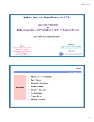
1. 3/17/2022
1
National Centre for Coastal Research ( NCCR)
Dated: 01st March,2022 (Tuesday)
Consultant
Consultancy Services
for
Technical Assistance in Preparation of DPR’s for Kalpasar Project
Client
National Centre for Coastal
Research ( NCCR)
Ministry of Earth Sciences,
NIOT Campus,
Pallikaranai, Chennai-
In JV with
At a Glance
About Aarvee Associates
Key Projects
About G – Tech Infra
Project in Brief
Scope of Services
Methodology
Project Team
Activity Schedule
In This Presentation
Contents
2. 3/17/2022
2
Countries of Operation
Established in 1989 with Head Quarters at Hyderabad
2000 employees
Aarvee Associates Architects, Engineers & Consultants Pvt Ltd
Key Projects
3. 3/17/2022
3
Project Technical Advisory Consultants (PTAC)
NAME PTAC-CS-2 under climate Adaptation in Vennar Sub basin
Location Thanjavur, Tamil nadu
Client Lower Cauvery Basin Circle, Water Resources Department
Scope of Work • Preparation of GIS maps for 37 rivers in Cauvery delta
• Preparation of survey DEM for each river
• Hydrological and hydraulic analysis of the streams and required
minimum section of the river is derived from HECRAS and SWAT
models
• To support the implementation of the establishment of a DSS,
and flood risk mapping and establishment of forecasting and
warning systems
Proof Engineering Consultant(PEC)
NAME PEC FOR IMPEMENTATION OF MEGA LIFT PROJECTS
Location Orissa
Client Department of Water Resources
Scope of Work • Vetting of Design Memorandum
• Review of Overall Lift irrigation Planning
• Review of Hydrologic, Hydraulic and Structural Planning and
Design of Intake works, Sump, Pump House, Rising Main,
Distribution Chamber and Irrigation Distribution Network
• Principles of Planning and design of Electro-Mechanical
components for Pumping and smooth Operation of Pump House
• Principle of Planning and Design of Power System Connectivity of
the Cluster and dedicated Power Supply to the Pump Station
4. 3/17/2022
4
Project Implementation
NAME PIU FOR MINOR LIFT IRRIGATION SCHEMES
Location Orissa
Client Department of Water Resources
Scope of Work Project Implementation Unit (PIU) for Minor Lift Irrigation
Planning and Implementation (MLIPI) ,Orissa
(Funded by ADB)
• Assist the Project Management Unit (PMU) in preparation of
appraisal reports for lift irrigation schemes
• Contracting NGOs and mobilization of WUA through NGOs
• Institutional building and strengthening of Water Users Associations
• Facilitation of WUA participation in rehabilitation
• Assisting PMU for procurement
• Training of WUA members, and Supervising rehabilitation
of 1400 lift irrigation schemes and agriculture intensification
Detailed Project Report
NAME SRIPADA SAGAR PROJECT
Location Karimnagar, Telangana, India.
Client I & CAD Department
Salient features
Barrage
Max. Flood Discharge – 55,900 Cumecs
Length of barrage – 1180m
No. of Vents – 62
Lift System
No. of stages of Lift – 12 stages
Total Lift – 235m (single max -95m)
Power Requirement – 330 MW Total
MS Pipe Line – 3m Dia
Ayacut – 4,62,000 Acres
Quantity of water Utilization – 43.5 TMC
Type of Gates - Vertical
5. 3/17/2022
5
Detailed Project Report
NAME P.V. NARSIMHA RAO KANTHANPALLI LIFT
IRRIGATION PROJECT
Location Warangal, Telangana, India.
Client I & CAD Department
Salient features Barrage
Max. Flood Discharge – 82,200 Cumecs
Length of barrage – 1972m
No. & size of Vents – 131 nos 12mX10m
Type of Gates - Radial
Lift System
No. of stages of Lift – 3 stages
Total Lift – 250m (single max -120m)
Power Requirement – 875 MW Total
Tunnels – 9.0m Dia (D-Shaped)
Ayacut – 4,00,000 Acres
Quantity of water Utilization – 50 TMC
Detailed Project Reports
NAME CHANAKA – KORATA BARRAGE
Location Adilabad, Telangana, India.
Client
Salient features Storage Capacity – 0.89 TMC
Ayacut - 13,500 Acres
I & CAD Department
Max. Flood Discharge – 16,400 Cumecs
Length of Barrage – 287.500m
No. & size of Vents – 20 nos 12mX10m
Type of Gates - Vertical
Quantity of water Utilization – 1.20 TMC
6. 3/17/2022
6
Detailed Project Reports
NAME RARHU RESERVOIR SCHEME
Location Jharkhand, India.
Client Public Works Department
Scope of Work Survey & Investigations, Design of
222' high dam and 49 Kms canal
Salient features
Storage Capacity - 4 TMC
Length of Dam – 706m
Length of Spillway – 205m
Ayacut - 49,000 Acres
Power Generation – 2X2.24 MW
Detailed Project Report
NAME BARRAGES(2 NOS) ON KRISHNA RIVER D/S
PRAKASAM BARRAGE
Location Vijayawada, A.P, India.
Client Water Resources Department
Salient features Barrage – 1 @ Km 16.110 D/S of Prakasam Barrage
Max. Flood Discharge – 35,099 Cumecs
Length of barrage – 1244.50m
No. & size of Vents – 84 nos 12mX4.45m
Type of Gates - Vertical
Barrage – 2 @ Km 67.100 D/S of Prakasam Barrage
Storage Capacity – 4.131 TMC
Length of barrage – 1252m
No. & size of Vents – 100 nos 10mX 3.0m
Type of Gates - Vertical
Storage Capacity – 4.950 TMC
7. 3/17/2022
7
Detailed Project Reports
Name Lower Penganga Inter State
Project
Location Adilabad, A.P. India.
Client I & CAD Department
Scope of
Work
Design of main canal &
distributaries, CM & CD
Structures, EIA & EMP Studies
Salient
features
Canal System
Utilisation - 5.12 TMC
Length of Canal – 90 Km.
Ayacut - 47,000 Acres
Detailed Design Engineering
Name Chagallu Barrage Project
Location Anantapur, A.P. India.
Client Navayuga –Transstroy (JV)
Scope of
Work
Detailed design of the project
components, Preparation of quality
control and quality assurance
programme, land acquisition
proposals
Salient
features
Construction of Barrage
Storage Capacity – 1.5 TMC
Length of Barrage – 2.15 Km
Length of Spillway – 291.5m
No. of Vents - 16 Nos. 14.5X7.5
Ayacut – 4,000 Acres
8. 3/17/2022
8
Name Bhima Lift Irrigation Project
Lift-II : Stage-1&2
Location Mahabubnagar, A.P. India.
Client NEC-NCC-Maytas (JV)
Scope of
Work
Detailed designs of tunnel, canal and
viaducts, pump house balancing
reservoirs and pipelines
Salient
features
Lift Irrigation Scheme.
Stage – I
Lifting Head – 38m
Quantity – 63.72 Cumecs
Lifting Pumps – 3X12 MW
Stage – II
Lifting Head – 23m
Quantity – 32.28 Cumecs
Lifting Pumps – 3X4 MW
Detailed Design Engineering
Name Panahitha – Chevella (Kaleswaram) Lift
Irrigation Scheme – Package:6
Location Karimnagar, A.P. India.
Client Navayuga – Patel – BHEL (Consortium)
Scope of
Work
Detailed Design of 10m twin tunnels,
underground surgepool and under ground
pump house
Salient
features
Mega Lift Irrigation Scheme.
Lifting Head – 102m
Quantity – 535cumecs (146.24 TMC)
Lifting Pumps – 6X110MW (reversible
turbine pumps)
Twin Tunnels – 10m dia. and about
10km long each (D-Shaped)
Under Ground Pumping Station
9. 3/17/2022
9
Name Pranahitha – Chevella (Kaleswaram) Lift Irrigation
Scheme - Package:11 (Ongoing)
Location Karimnagar, A.P. India.
Client MEIL
Scope of
Work
Detailed Design of 9.5m twin tunnels,
underground surgepool and under ground
pump house
Salient
features
Mega Lift Irrigation Scheme.
Lifting Head – 110m, Quantity – 88.24 TMC
Lifting Pumps – 4X85 MW (reversible turbine
pumps)
Twin Tunnels – 9.5m dia. and about 8.6km
long each (D-Shaped)
Under Ground Pumping Station
Distributory system of 1,10,000 Acres
Detailed Design Engineering
Modernization/Rehabilitation Studies
Comprehensive Safety of TB Dam
To evaluate the in-situ density of masonry dam
body by using Non Destructive methods -
Sonic tomography in collaboration with IIT
Madras and M/s SOLGEO Italy.
To increase the spillway capacity by providing
additional spillway.
A detailed study of warning time available and
capacity of the existing structure to handle PMF
without increasing FRL/MWL can be
established.
To check stability of dam for seismic forces and
proposing suitable rehabilitation measures.
10. 3/17/2022
10
Modernization of Canal
Name Modernization of TBP LLC
Main Canal
Location Bellary, Karnataka, India.
Client Tungabhadra Board
Scope of
Work
Study of existing canal system,
stability of structures, stabilization of
Ayacut
Salient
features
Modernization of TBP LLC main
Canal
Length of Canal - 250.58 Kms
Distributories - 11 Nos.
No. of Structures - 322 Nos.
Modernization/Rehabilitation Studies
Name Modernization of Nagarjuna Sagar
project
Location Nalgonda, A.P. India.
Client I & CAD Department
Scope of
Work
Study of existing canal system, stability of
structures, stabilization of Ayacut
Salient
features
Storage Capacity - 400 TMC
Height of the Dam - 125m
Length of the Dam – 4865m
Water Utilizaion – 264 TMC
Ayacut – 22,00,000 Acres
Length of Main Canals – 500Kms.
Length of Branches & Distributories: 24,140km
11. 3/17/2022
11
Diversity In
PROJECTS
(End-to-End
Solutions))
Real Estate
(Commercial Complexes,
Mixed Land Use, Stadium,
Integrated Check Post,
Terminal Buildings,
Institutional Buildings, Statue)
Water Supply
(Hydrology &
Irrigation)
Smart
Cities
Structural Health
Monitoring System
Smart Solid Waste
Management
Tunnels
Cable Stayed/Extra
Dosed Bridges
Intelligent
Lighting/
Illumination www.gtechinfra.in
Transportation
(Inland Waterways, Road &
Highways, Traffic, Railways,
Metro & Ports)
Environment
(EIA/ EMP)
www.repl.global
FLAGSHIP PROJECTS
www.gtechinfra.in
12. 3/17/2022
12
Flagship
PROJECTS
www.gtechinfra.in
WATER & ENVIRONMENT SECTOR
1. Consultancy services for “Feasibility Study, Environmental Impact Assessment (EIA),
Environmental Management Plan (EMP), Social Impact Assessment (SIA) and Resettlement
Action Plan (RAP) for Capacity Augmentation of National Waterways-1 (Jal Marg Vikas
Project) (Funded by the World Bank)”.
AMBIENT AIR QUALITY MONITORING
PUBLIC CONSULTATION
NOISE MONITORING GROUND WATER MONITORING
Flagship
PROJECTS
www.gtechinfra.in
WATER & ENVIRONMENT SECTOR
2. Consultancy Services for “Capacity Augmentation of Navigational Infrastructure of
National Waterway-1” at Varanasi & Sahibganj, TSSC-1 (Jal Marg Vikas Project)- World Bank
funded.”
TERMINAL AT VARANASI, INDIA HON’BLE PRIME MINISTER AT VARANASI
TERMINAL - INDIA’S FIRST MULTI MODAL
TERMINAL RECEIVING FIRST CARGO
TRANSPORTED ON INLAND WATERWAYS FROM
KOLKATA
13. 3/17/2022
13
Flagship
PROJECTS
www.gtechinfra.in
WATER & ENVIRONMENT SECTOR
3. Consultancy services for “Consultancy Services for Adityapur Water Supply Project.”
Flagship
PROJECTS
www.gtechinfra.in
WATER & ENVIRONMENT SECTOR
4. Consultancy services for “Consultancy Services for Dibrugarh town Water Supply Project.”
14. 3/17/2022
14
Flagship
PROJECTS
www.gtechinfra.in
WATER & ENVIRONMENT SECTOR
5. Consultancy services for “Consultancy Services for Environmental And Social Impact
Assessment (EIA-EMP & SIA) Studies In National Waterway -NW-95 in the state of Assam .”
Flagship
PROJECTS
www.gtechinfra.in
WATER & ENVIRONMENT SECTOR
6. Consultancy services for “Environment Impact Assessment and
Plan for obtaining multiple clearances for developing Inland
Waterway stretch between Pedaganjam And Ennore of North
Buckingham Canal in National Waterway-4”
18. Consultancy services for “Environment
Management Plan with Wildlife Clearance
and obtaining NOC for project initiation
along Inland Waterways in Ghaghra River,
NW 38.”
15. 3/17/2022
15
Flagship
PROJECTS
www.gtechinfra.in
TRANSPORTATION SECTOR
7. Consultancy services for “Authority’s Engineer for Supervision of Construction of 4 Lane
Signature bridge (900m long central cable stayed Module) connecting missing link between
Okha and Beyt Dwarka including Construction of Approaches on New National Highway No
NH -51in the State of Gujarat on EPC basis.”
Flagship
PROJECTS
www.gtechinfra.in
TRANSPORTATION SECTOR
8. Consultancy services for “Feasibility study & Preparation of EPC documents for
construction of 4 Lane high level vehicular bridge on Daman ganga river on NH/848-B at
Daman”
Major Features: Total length of bridge: 1.46 Km, Viaduct-
840 m, Centre span-250m, Total Cable portion- 446m.
16. 3/17/2022
16
Flagship
PROJECTS
www.gtechinfra.in
TRANSPORTATION SECTOR
Consultancy services for “Feasibility study & Preparation of EPC documents for construction
of 4 Lane high level vehicular bridge on Daman ganga river on NH/848-B at Daman”
Flagship
PROJECTS
www.gtechinfra.in
TRANSPORTATION SECTOR
9. Consultancy services for “Construction Design Engineering and Construction Supervision
of Cable Stayed Bridge across Yamuna River in Wazirabad, Delhi, India.”
17. 3/17/2022
17
Flagship
PROJECTS
www.gtechinfra.in
TRANSPORTATION SECTOR
10. Consultancy services for “Design and Engineering Support for the construction of 4 lane
Cable Stayed Bridge at Polavaram Irrigation Project, Andhra Pradesh.”
Flagship
PROJECTS
www.gtechinfra.in
SMART CITIES
11. Consultancy services for “Project Management to design, develop, implement and
manage Smart City Projects under Smart City Mission in Allahabad (now Prayagraj) , Uttar
Pradesh.”
18. 3/17/2022
18
Flagship
PROJECTS
www.gtechinfra.in
REAL ESTATE SECTOR
12. Consultancy services for “Detailed Engineering for Integrated Check Post (ICP) at Dawki,
Meghalaya.”
Flagship
PROJECTS
www.gtechinfra.in
REAL ESTATE SECTOR
13. Consultancy services for “Detailed Engineering for Integrated Check Post (ICP) at
Sabroom, Tripura”.
19. 3/17/2022
19
Flagship
PROJECTS
www.gtechinfra.in
REAL ESTATE SECTOR
14. Consultancy Services for “Fabrication, supply and installation of 106.68 meter high
bronze Statue of Bharatratna Dr. Babasaheb Bhimrao Ambedkar at United India Mill No.6
Mumbai, Maharashtra , India”.
Project in brief
20. 3/17/2022
20
Project in Brief
Kalpasar Project aims for creation of fresh water coastal reservoir in the
Gulf of Khambhat by construction of about 30kms dam connecting east and
west banks of the gulf.
It will be the world’s largest freshwater lake in the marine environment.
To create huge fresh water of about 10,000 Million cubic meters for
irrigation, drinking and industrial purposes
Introduction
Kalpasar
Dam
Project
Description Details
Length of dam (in sea) 30 km
Top width of dam 100m, 10 lane
Reservoir :
Full Reservoir Level (FRL) (+) 3.0m
Maximum Water Level (MWL) (+) 5.0m
Minimum Draw Down Level (MDDL) (-) 4.0m
Irrigation command
Water envisaged for irrigation 6500 mcm
Ground water improvement in periphery of
reservoir
7.0 lakh ha
Extra land to be recovered (Availability of new
fresh land)
1.2 lakh ha
Reduction in distance
Bhavnagar – South Gujarat 136 km
Proposed Power Generation
Wind Power 1470 MW
Solar Power 1000 MW
21. 3/17/2022
21
Kalpasar
Project
Layout
World's largest man made fresh water reservoir in the sea.
Highest importance and priority to irrigation and drinking water for
Saurashtra and Central Gujarat regions.
The Reservoir will have the storage more than double the Sardar
Sarovar (Narmada Reservoir) capacity.
Approx. 10.54-lakh hectare land in 37 talukas of nine districts of
Saurashtra region will get irrigation benefit facility including
rejuvenation of rivers. More than 60 existing dams will get
permanently filled up with water.
Wind and solar energy will be generated which can also be used for
lifting fresh water from the reservoir to the canal.
Benefits of the Project
22. 3/17/2022
22
Bhavnagar port will get revived which will result into speedy
development of the region.
There will be large saving in travel time and fuel due to reduction in
distance by about 136 km between Bhavnagar to Surat/Mumbai.
Saline ground water of coastal area of Saurashtra & Central Gujarat will
get converted into fresh water with reduction in soil salinity.
Substantial improvement in ground water quality as well as soil salinity
of coastal area of Saurashtra & Central Gujarat.
About 1.2 lakh hectare land along the periphery of the reservoir will be
opened up for development towards value-based land utilization.
Enhanced benefit of world class industrial estate like Dahej and Dholera
will be available to Bhavnagar/Saurashtra region.
Benefits of the Project
The key task of the consultant is to provide technical assistance to
support National Centre for Coastal Research (NCCR)
To assist client in review and finalization of DPRs by providing domain
experts’ technical input
Compile the reports of the completed studies,
Identify the gap areas,
Assist NCCR Carry out additional studies by engaging various
organisations, and
Finalization of Detailed Project Report (DPR) as per CWC and MoEF&CC
guidelines for obtaining the necessary clearances and statutory
approvals for the construction of the Dam.
Scope of the Services
24. 3/17/2022
24
Methodology
Preliminary works
Works Activities Results
Preliminary
works
Team Mobilisation Team exposure to clients
Interaction with the client
Methodology
Data Collection
Field Data
Irrigation Topographic Map, Water Source, Irrigation Canal System, Canal Design Discharge,
Irrigated Area
Hydrology, Meteorology
& Oceanography
Rainfall, Temperature (Max and Min), Humidity, Wind Speed, Tides, Currents,
Wave climate, Tsumani, Strom surges, seiches
Hydrology River System, River Discharge, Catchment area, Development Plans in the same
river basin, Existing irrigation systems related to the same river
Agriculture Current Cropping Patterns, Present Crop Yields, Crop water demand, Irrigation
and water supply
Drainage Inundation Condition, Drainage Requirement, Drainage System
Geology Geophysical profile, Reservoir seiches, Geotechnical strata,
Transportation Alignment survey, Logistics location survey
25. 3/17/2022
25
Methodology
Consultation and data collection
Works Activities Results
Consultation and
data collection
Collection & review of past
studies undertaken
Review and compilation of
available data on project,
summary of findings and go
ahead towards development
of designs
- Reconaisssance Study
- Pre-feasibility study
- Specific studies
- Tidal Power
- Dam Alignment studies
- Earlier feasibility studies
Methodology
Engineering Investigations
Works Activities Results
Engineering
Investigations
Review of data on
topographical survey,
Bathymetry
Water demand and Water
resources assement,
climate change aspects,
Transportation facilities
assessment
Review of meteorological
and Oceanography
Water resources Assessment
& Hydrological studies
Review of geological &
geophysical profile
Climate change aspects
Transportation studies
26. 3/17/2022
26
Methodology
Engineering Design
Works Activities Results
Engineering
Design
Configuration & Design of Kalpasar
dam
Feasibility study Report
Roadway & Railway Design
Irrigation & Flood protection
structures
Renewable energy design
Methodology of construction
Feasibility Benefits of the project
Economic Viability
Conclusions & Recommendations
Softwares
28. 3/17/2022
28
SL.
No.
Key
Expert
Name of
Expert
Qualification Total
Exp.
Relevant Experience
01. Dam
Design
Expert
Mr. Rakesh
Mahajan
• M.Tech (Civil),
Indian Institute
of Technology
(IIT) Delhi;
• MBA,
• BE(Civil);
39 Yrs • More than 35 years experience in Dam
Design, Design Review, Preparation of
Feasibility Reports, Tender Documents,
Detailed Project and Design Reports
• Successfully handled more than 25 dam
projects in India and abroad including
countries like Nepal, Afghanistan, Bhutan,
Democratic Republic of Congo, Rwanda,
Sri Lanka
02 Dam
Safety
&
Operati
ons
Expert
Mr. M V V
Saradhi
• M.Tech –Water
Resources
• B.Tech Civil
24 Yrs • 24 years’ experience in carrying out
operations for dams/barrages including
preparation of safety standards and
manuals for dams/barrages in similar
capacity
• experience of working in 21 projects of
dams/barrages
03 Dam
Constru
ction
Expert
Mr. Priya
Kant
Kaushik
• Master’s
Degree, ME-
Civil
Engineering
Bachelor’s
Degree, BE-Civil
Engineering
31 Yrs. • Total 27 years experience in carrying out
operations for dams/barrages including
preparation of safety standards and
manuals for dams/barrages
• Experience of working in 12 projects of
dams/barrages
SL.
No
.
Key
Expert
Name
of
Expert
Qualification Total
Exp.
Relevant Experience
04 Spillway
Design
Expert
Mr.Jagan
Mohan
Rao
• M.E. in
Water
Resources
Engineering
• B.E. Civil
45 Yrs. • 10 years’ experience in designing dam spillways
including foundations.
• Worked in 04 projects of dams/barrages
05 Hydrologi
st
Ms Jaya
Sood
• M.Tech in
Water
Resources
Engineering
• B.E in Civil
27 Yrs. • 22 years experience in River hydrology and
ground water hydrology in similar capacity
• Handled 20 projects of dams/barrages/civil
infrastructure
06 Irrigation
Planning
and
Comman
d Area
Expert
Mr. V
Balagura
vaiah
• M. Tech in
Water
Resources
Engineering
• B.Tech Civil
20 Yrs. • 16 years’ experience in Irrigation Planning and
Command Area Development in similar
capacity
• Worked in 16 projects of dams/barrages
29. 3/17/2022
29
SL.
No.
Key Expert Name of
Expert
Qualificati
on
Total
Exp.
Relevant Experience
07. Expert-
Analysis and
Design of
Ocean/Coa
stal
Structures
Mr. Maruti
Dattatrey
Kudale
• M.Tech
(Marine
Structures)
• B.E. (Civil)
41 Yrs. • 31 years experience in Analysis
and Design of Ocean and
Coastal structures including
Numerical Modelling of coastal
and ocean processes
• Involved in 14 nos. of
coastal/ocean projects
08. Geophysical
Survey
Expert
Dr. John
Devadas
• Post M.Sc
(Tech) in
Hydrogeol
ogy
• MSc in
Geology
26 Yrs. • 25 years’ experience in
geophysical and Seismological
survey for civil projects.
• Worked in more than 20 projects
09. Contract &
Tendering
Expert
Mr. Desh Raj • B.E (Hons)
Civil
42 Yrs. • Total 39 years’ experience in
contacting and tendering for
civil projects in similar Capacity
• Worked in 10 projects of large
civil infrastructure
SL.
No.
Key Expert Name of
Expert
Qualificati
on
Total
Exp.
Relevant Experience
10. Marine
Ecologist
Dr. Ashok Kumar • M.Sc. In
Biological
Sciences
• B.Sc in
Botany,
Chemistry,
Zoology
16 Yrs. • 16 years experience in marine
ecology projects
• worked in 19 infrastructure/civil
projects for preparation of EIA
11. Fishery
Expert
Mr. R
Nandakumar
• M.Sc. In
Coastal
Aquacultu
re
• B.Sc in
Zoology
22 Yrs • Total 18 years’ experience in Fisheries
for various projects.
• worked in 17 projects including fresh
water and saltwater
12. Project
Coordinator
Mr. Amit Kumar
Agrawal
• B.E.
(Mechani
cal
Engineerin
g)
26 Yrs. • 26 years’ experience in project
management and coordination
• Successfully handled more than 18
large infrastructure Projects