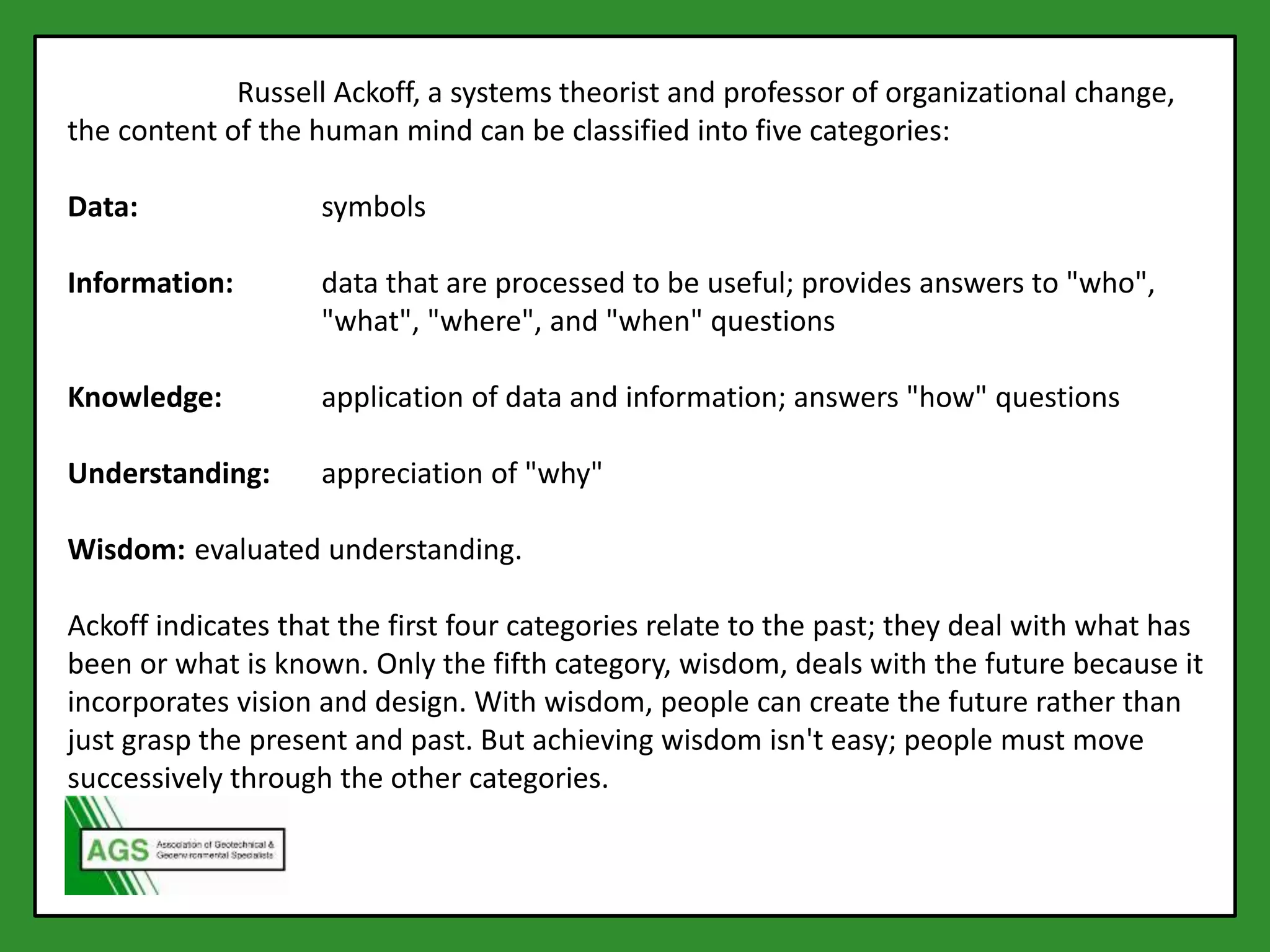
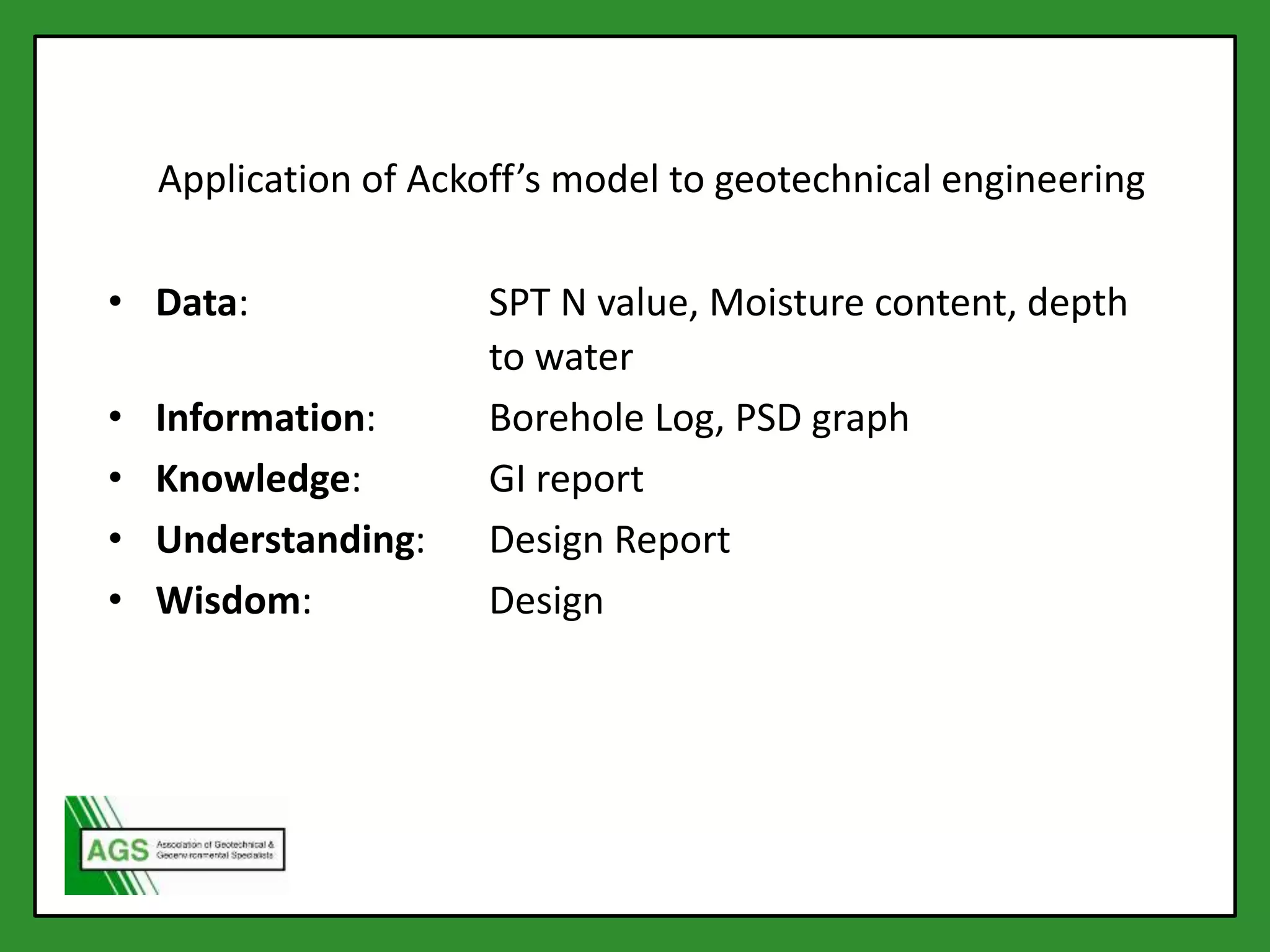
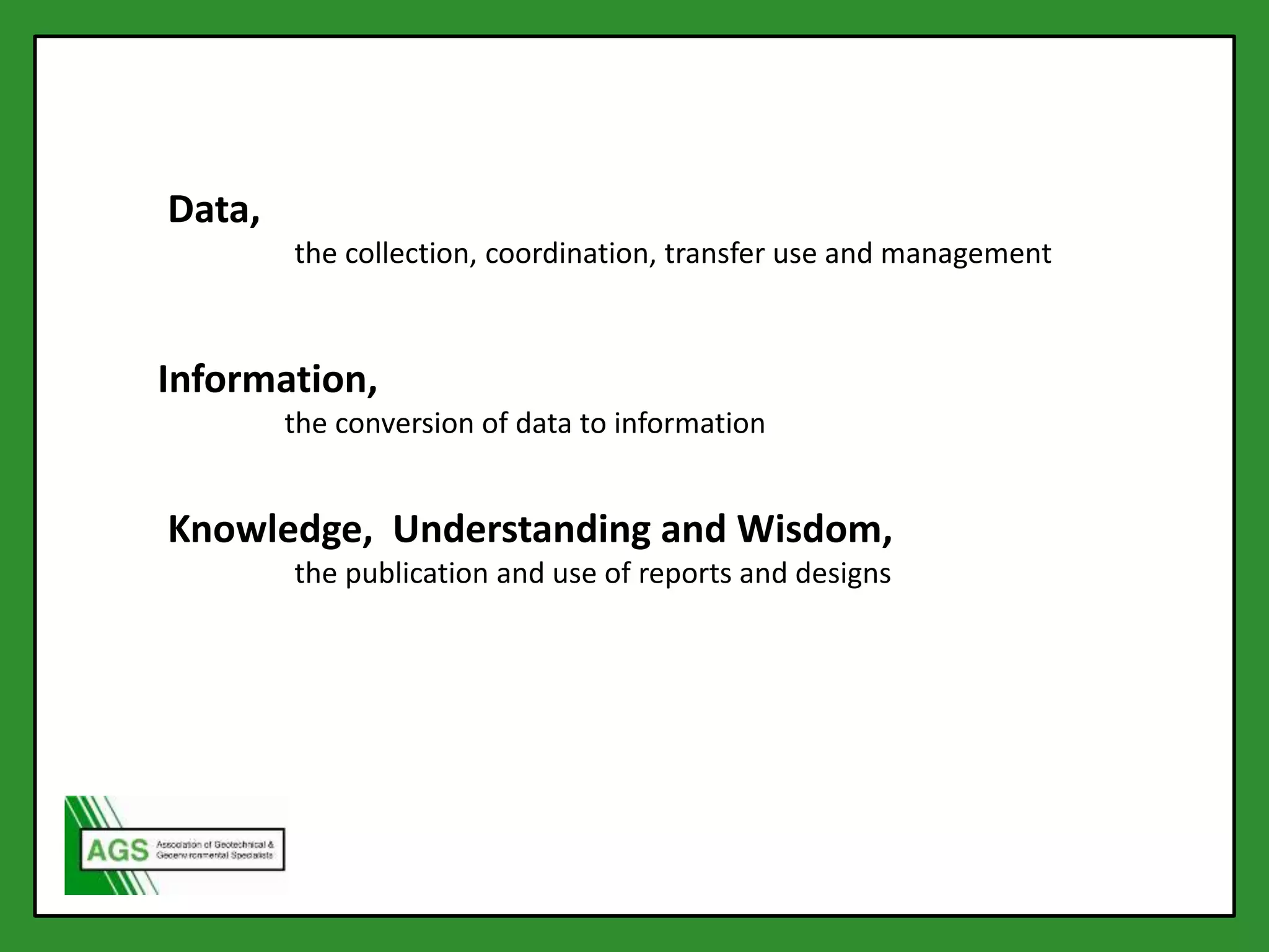
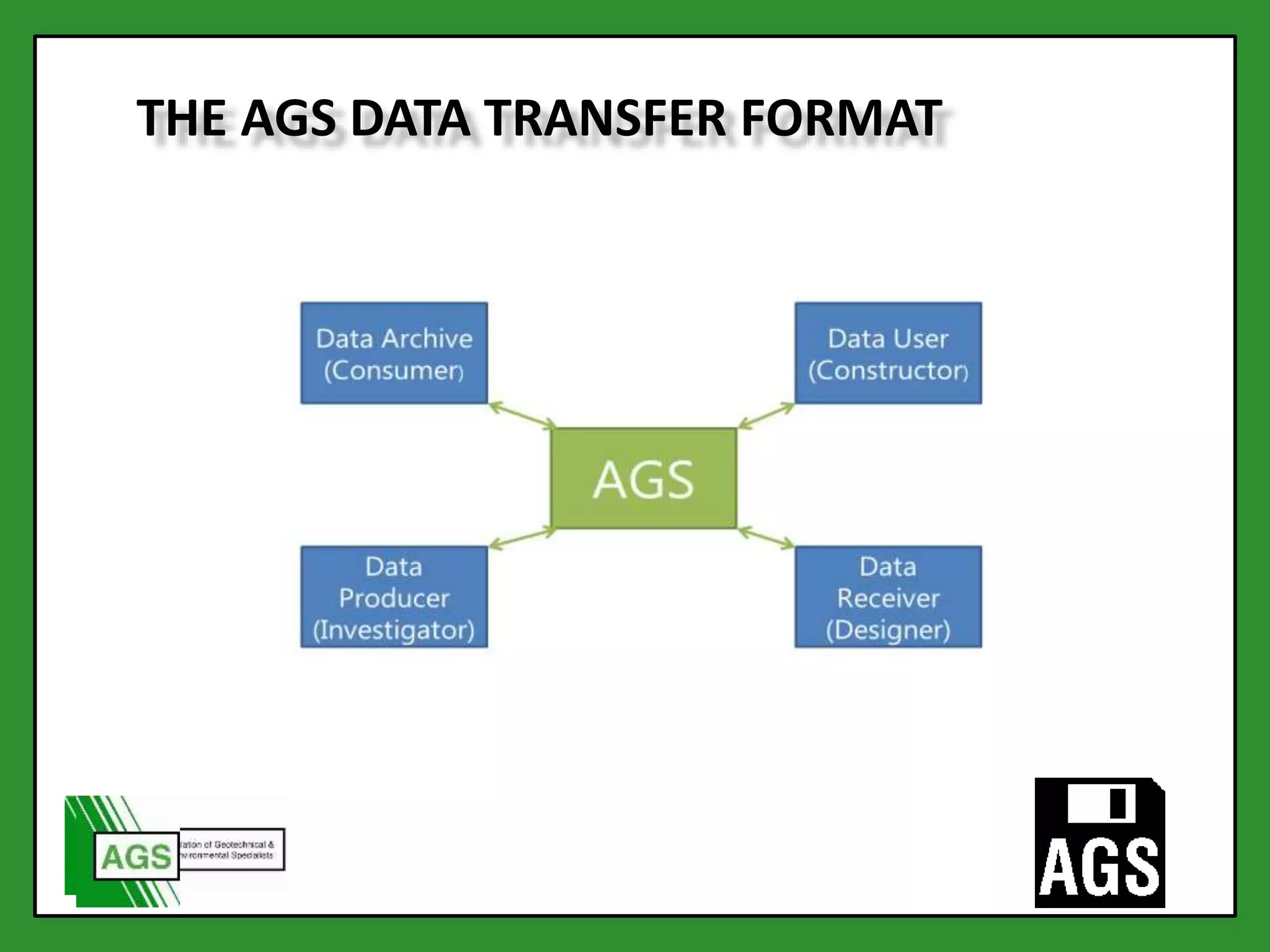
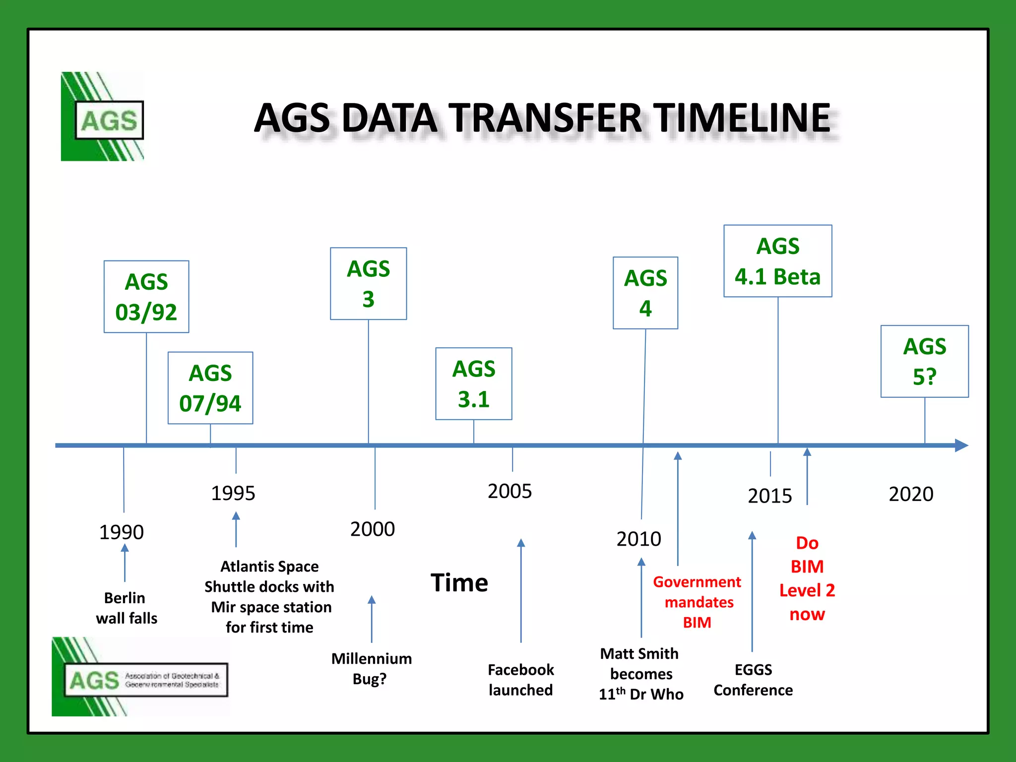
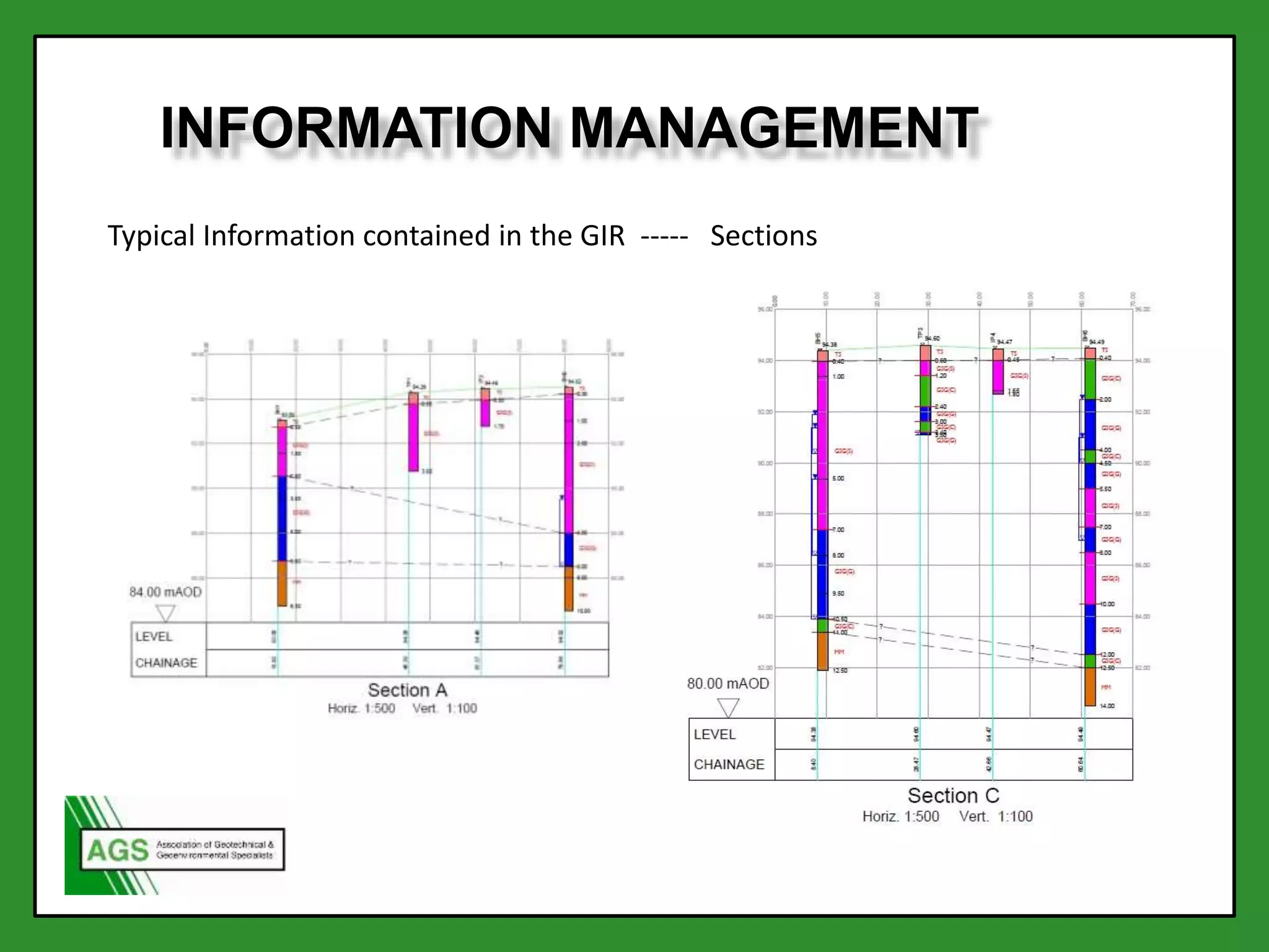
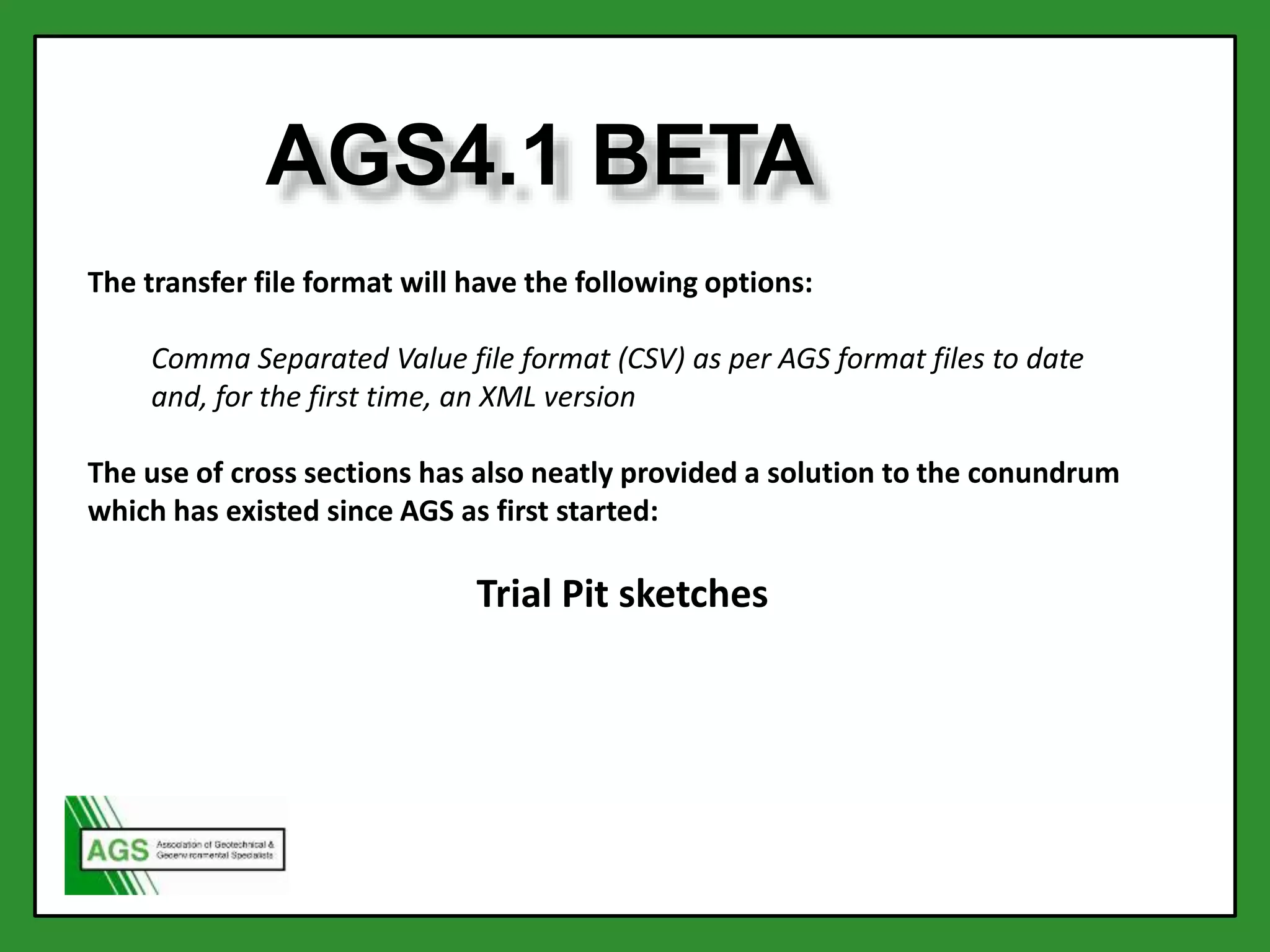
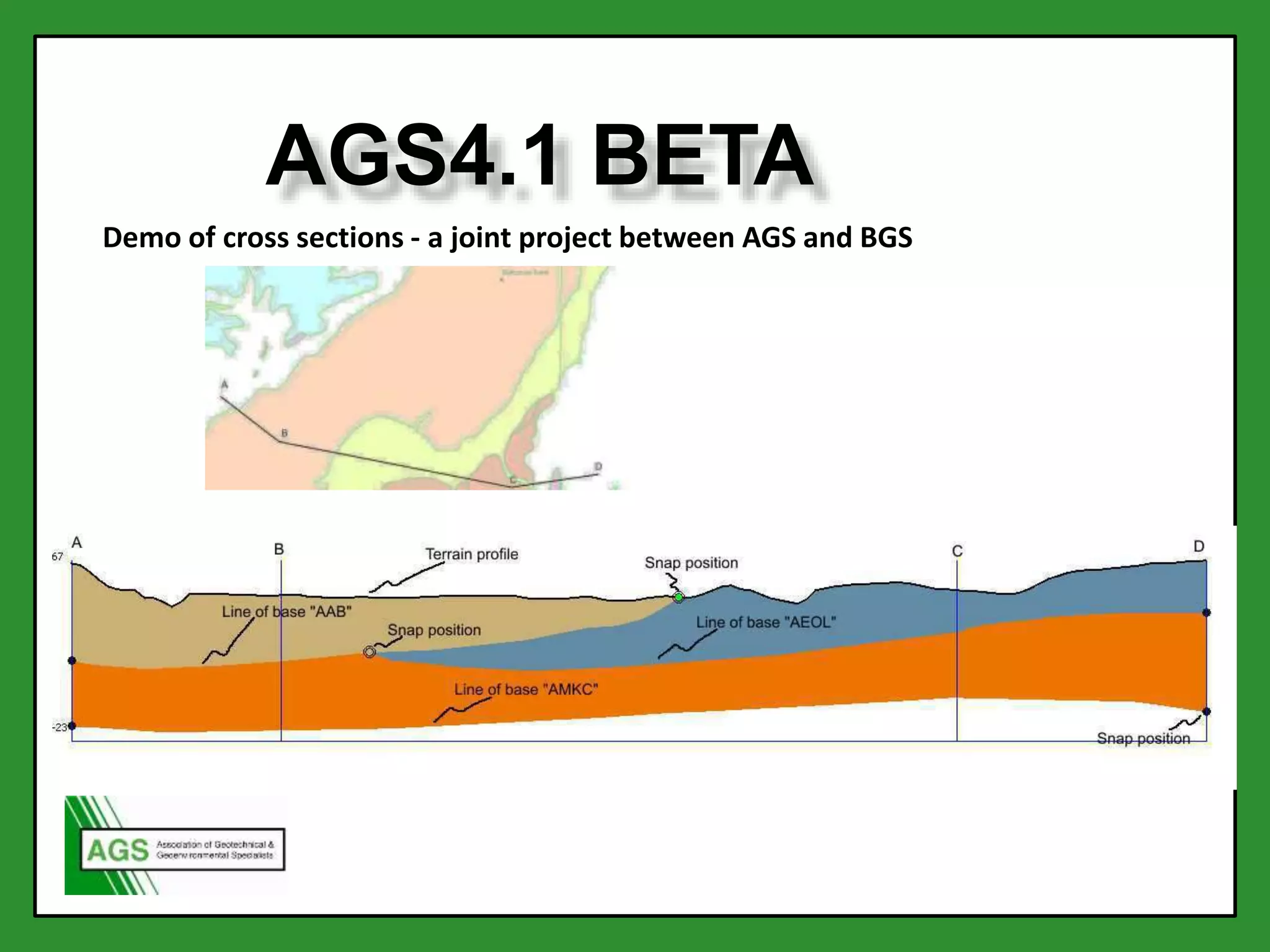
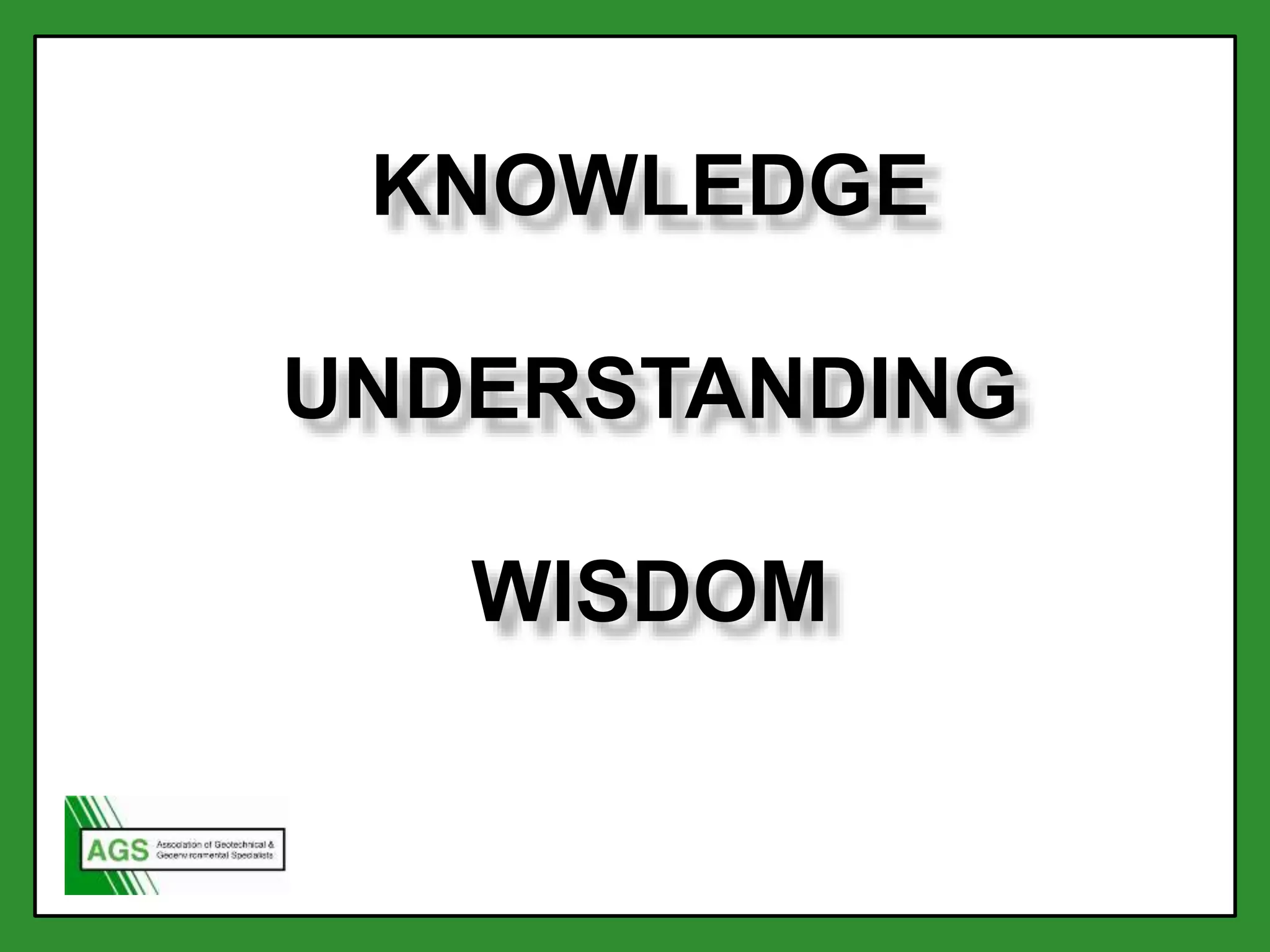
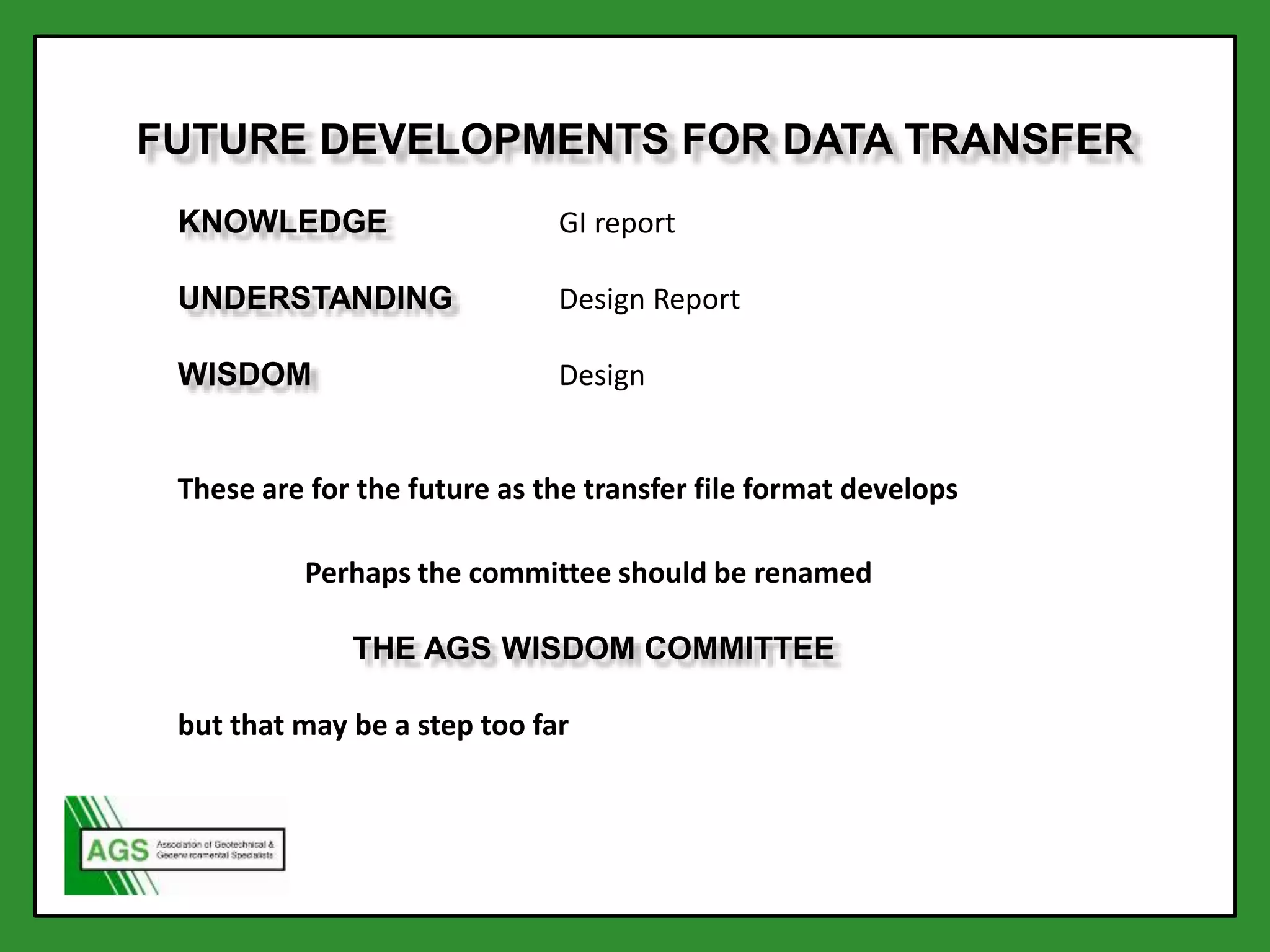
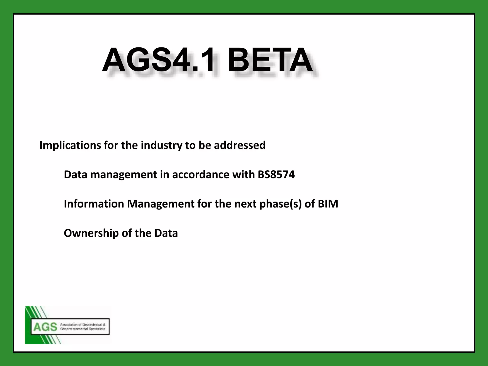
Jackie Bland, Geotechnics Ltd/Furgo
Steve Walthall, Bechtel
AGS Data Management Committee 2015
SYSTEMS THEORY
D. I. K. U. W.
According to Russell Ackoff, a systems theorist and professor of organizational change,
the content of the human mind can be classified into five categories:
Data: symbols
Information: data that are processed to be useful; provides answers to "who",
"what", "where", and "when" questions
Knowledge: application of data and information; answers "how" questions
Understanding: appreciation of "why"
Wisdom: evaluated understanding.
Ackoff indicates that the first four categories relate to the past; they deal with what has
been or what is known. Only the fifth category, wisdom, deals with the future because it
incorporates vision and design. With wisdom, people can create the future rather than
just grasp the present and past. But achieving wisdom isn't easy; people must move
successively through the other categories.
• Data: SPT N value, Moisture content, depth
to water
• Information: Borehole Log, PSD graph
• Knowledge: GI report
• Understanding: Design Report
• Wisdom: Design
Application of Ackoff’s model to geotechnical engineering
Data,
the collection, coordination, transfer use and management
Information,
the conversion of data to information
Knowledge, Understanding and Wisdom,
the publication and use of reports and designs
DATA, SOME BASICS
Data is both singular and plural
BS 8574 2.5 Geotechnical Data
Facts or figures obtained from all phases of a geotechnical project,
including derivations from other data , (Facts and figures might include
text, numbers and formulae).
BS 8574 2.6 logical data
data connected by location and/or time and not the representation or the
evaluation of that data
Meta Data
Additional information which describes the data, such as the borehole
number and depth for an SPT N value.
THE DATA JOURNEY (1990’S)
THE DATA JOURNEY (2014)
(Chandler 2014)
(After Romain Arnould 2014)
Data storage
Data ImportData Entry
validationvalidation
validation
Data AnalysisInformation
Production
Data
Visualisation
(Information)
Data Export
AGS AGS AGS
AGS
AGS
AGS
Why not use spreadsheets?
They are not data bases
They are INFORMATION not DATA
They are difficult to interrogate
They contain format information which is not transferable
They are not software independent
They often contain errors which are not easily found,
i.e. they are difficult to validate and verify
BS8574 A.2.4 NOTE Use of spreadsheet files for data transfer is discouraged
because they contain formatting information as well as data. Interoperability
problems between spreadsheet software might be experienced
THE AGS DATA TRANSFER FORMAT
1990
1995
2000
2005
2010
2020
AGS
03/92
AGS
07/94
AGS
3
AGS
3.1
AGS
4
AGS
5?
AGS DATA TRANSFER TIMELINE
TimeBerlin
wall falls
Atlantis Space
Shuttle docks with
Mir space station
for first time
Millennium
Bug?
Facebook
launched
Matt Smith
becomes
11th Dr Who
EGGS
Conference
2015
Government
mandates
BIM
Do
BIM
Level 2
now
AGS
4.1 Beta
DATA MANAGEMENT
A new British Standard has been created by the AGS Data
Management committee to formalise your data
management -
BS8574:2014
Code of practice for the
management of geotechnical
data for ground engineering
projects
WHAT IS BS8574?
Gives recommendations on the management of geotechnical
data throughout the life-cycle of civil engineering and building
projects at both an organizational and project level.
Defines data as a concept and provides recommendations on
the collection, verification, manipulation, distribution,
presentation and storage of data.
WHY USE BS 8574?
For each PROJECT
• Collections of data from different sources and formats
• Number of organisations processing and transferring data
• Data Management and delivery needs defining and
maintaining throughout as documented in the specification
Improves communication between the parties involved
Standard has been designed for use in a BIM project in accordance
with PAS 1192
DATA MANAGEMENT
To summarise Data Management is a combination of:-
BS8574, which determines what is to be done
and AGS Data, which is a tool for doing it
INFORMATION
INFORMATION
The use of information in the development of a project
Availability and transfer of information during the life cycle of the project
Access to and archiving of information.
INFORMATION MANAGEMENT
Typical Information contained in the GIR ----- Parameters
INFORMATION MANAGEMENT
Typical Information contained in the GIR ----- Sections
INFORMATION
A project with the working title AGSi is developing the AGS4 “Groups” and
“Headings” necessary to transfer the information contained in the GIR as data.
It will do this using the concept of “Layers”
These layers may be
Stratigraphic
Lithological
Weathering
Engineering
Environmental
Water
Or any combination
AGS4.1 BETA
The document will be issued as “AGS4.1 Beta (Draft for public consultation)”
It will contain the additional groups needed to transfer the data behind the
information contained in the GIR (Geotechnical Investigation Report)
The Parameters are derived values (not characteristic values which are in the Design
Reports)
The geometry of the layers will be transferred by one of three methods:
1. The use of a simple x,y,z file
2. The use of a project specific file format as defined in the BS8574 project plan,
using the existing AGS external file mechanism defined in the FILE group
(FILE_FSET)
3. The use of cross sections using the structure established by British Geological
Survey (BGS)
The new Groups
LAYA Layer definitions
PARA Layer parameters
LAYX Layer geometry (x,y,z co-ordinates)
LAYB Layer boundaries
LABX Layer boundary co-ordinates (x,y co-ordinates)
CSLG Cross-section lines
CSLA Cross-section line alignments (x,y coordinates)
CSLW Cross-section line layer geometry (w,z data)
additional groups to transfer ground surface topology
GRNG Ground surfaces
GRNX Ground surface topography (x,y,z co-ordinates)
AGS4.1 BETA
AGS4.1 BETA
The transfer file format will have the following options:
Comma Separated Value file format (CSV) as per AGS format files to date
and, for the first time, an XML version
The use of cross sections has also neatly provided a solution to the conundrum
which has existed since AGS as first started:
Trial Pit sketches
AGS4.1 BETA
Demo of cross sections - a joint project between AGS and BGS
KNOWLEDGE
UNDERSTANDING
WISDOM
KNOWLEDGE GI report
UNDERSTANDING Design Report
WISDOM Design
These are for the future as the transfer file format develops
Perhaps the committee should be renamed
THE AGS WISDOM COMMITTEE
but that may be a step too far
FUTURE DEVELOPMENTS FOR DATA TRANSFER
AGS4.1 BETA
Implications for the industry to be addressed
Data management in accordance with BS8574
Information Management for the next phase(s) of BIM
Ownership of the Data

AGS Members' Day 2015 - Data Transfer Format and BIM Presentation

  • 1.
    Jackie Bland, GeotechnicsLtd/Furgo Steve Walthall, Bechtel AGS Data Management Committee 2015
  • 3.
  • 4.
    According to RussellAckoff, a systems theorist and professor of organizational change, the content of the human mind can be classified into five categories: Data: symbols Information: data that are processed to be useful; provides answers to "who", "what", "where", and "when" questions Knowledge: application of data and information; answers "how" questions Understanding: appreciation of "why" Wisdom: evaluated understanding. Ackoff indicates that the first four categories relate to the past; they deal with what has been or what is known. Only the fifth category, wisdom, deals with the future because it incorporates vision and design. With wisdom, people can create the future rather than just grasp the present and past. But achieving wisdom isn't easy; people must move successively through the other categories.
  • 5.
    • Data: SPTN value, Moisture content, depth to water • Information: Borehole Log, PSD graph • Knowledge: GI report • Understanding: Design Report • Wisdom: Design Application of Ackoff’s model to geotechnical engineering
  • 6.
    Data, the collection, coordination,transfer use and management Information, the conversion of data to information Knowledge, Understanding and Wisdom, the publication and use of reports and designs
  • 8.
    DATA, SOME BASICS Datais both singular and plural BS 8574 2.5 Geotechnical Data Facts or figures obtained from all phases of a geotechnical project, including derivations from other data , (Facts and figures might include text, numbers and formulae). BS 8574 2.6 logical data data connected by location and/or time and not the representation or the evaluation of that data Meta Data Additional information which describes the data, such as the borehole number and depth for an SPT N value.
  • 9.
    THE DATA JOURNEY(1990’S)
  • 10.
    THE DATA JOURNEY(2014) (Chandler 2014)
  • 11.
  • 12.
    Data storage Data ImportDataEntry validationvalidation validation Data AnalysisInformation Production Data Visualisation (Information) Data Export AGS AGS AGS AGS AGS AGS
  • 14.
    Why not usespreadsheets? They are not data bases They are INFORMATION not DATA They are difficult to interrogate They contain format information which is not transferable They are not software independent They often contain errors which are not easily found, i.e. they are difficult to validate and verify BS8574 A.2.4 NOTE Use of spreadsheet files for data transfer is discouraged because they contain formatting information as well as data. Interoperability problems between spreadsheet software might be experienced
  • 15.
    THE AGS DATATRANSFER FORMAT
  • 16.
    1990 1995 2000 2005 2010 2020 AGS 03/92 AGS 07/94 AGS 3 AGS 3.1 AGS 4 AGS 5? AGS DATA TRANSFERTIMELINE TimeBerlin wall falls Atlantis Space Shuttle docks with Mir space station for first time Millennium Bug? Facebook launched Matt Smith becomes 11th Dr Who EGGS Conference 2015 Government mandates BIM Do BIM Level 2 now AGS 4.1 Beta
  • 18.
    DATA MANAGEMENT A newBritish Standard has been created by the AGS Data Management committee to formalise your data management - BS8574:2014 Code of practice for the management of geotechnical data for ground engineering projects
  • 19.
    WHAT IS BS8574? Givesrecommendations on the management of geotechnical data throughout the life-cycle of civil engineering and building projects at both an organizational and project level. Defines data as a concept and provides recommendations on the collection, verification, manipulation, distribution, presentation and storage of data.
  • 20.
    WHY USE BS8574? For each PROJECT • Collections of data from different sources and formats • Number of organisations processing and transferring data • Data Management and delivery needs defining and maintaining throughout as documented in the specification Improves communication between the parties involved Standard has been designed for use in a BIM project in accordance with PAS 1192
  • 21.
    DATA MANAGEMENT To summariseData Management is a combination of:- BS8574, which determines what is to be done and AGS Data, which is a tool for doing it
  • 22.
  • 23.
    INFORMATION The use ofinformation in the development of a project Availability and transfer of information during the life cycle of the project Access to and archiving of information.
  • 24.
    INFORMATION MANAGEMENT Typical Informationcontained in the GIR ----- Parameters
  • 25.
    INFORMATION MANAGEMENT Typical Informationcontained in the GIR ----- Sections
  • 26.
    INFORMATION A project withthe working title AGSi is developing the AGS4 “Groups” and “Headings” necessary to transfer the information contained in the GIR as data. It will do this using the concept of “Layers” These layers may be Stratigraphic Lithological Weathering Engineering Environmental Water Or any combination
  • 27.
    AGS4.1 BETA The documentwill be issued as “AGS4.1 Beta (Draft for public consultation)” It will contain the additional groups needed to transfer the data behind the information contained in the GIR (Geotechnical Investigation Report) The Parameters are derived values (not characteristic values which are in the Design Reports) The geometry of the layers will be transferred by one of three methods: 1. The use of a simple x,y,z file 2. The use of a project specific file format as defined in the BS8574 project plan, using the existing AGS external file mechanism defined in the FILE group (FILE_FSET) 3. The use of cross sections using the structure established by British Geological Survey (BGS)
  • 28.
    The new Groups LAYALayer definitions PARA Layer parameters LAYX Layer geometry (x,y,z co-ordinates) LAYB Layer boundaries LABX Layer boundary co-ordinates (x,y co-ordinates) CSLG Cross-section lines CSLA Cross-section line alignments (x,y coordinates) CSLW Cross-section line layer geometry (w,z data) additional groups to transfer ground surface topology GRNG Ground surfaces GRNX Ground surface topography (x,y,z co-ordinates) AGS4.1 BETA
  • 29.
    AGS4.1 BETA The transferfile format will have the following options: Comma Separated Value file format (CSV) as per AGS format files to date and, for the first time, an XML version The use of cross sections has also neatly provided a solution to the conundrum which has existed since AGS as first started: Trial Pit sketches
  • 30.
    AGS4.1 BETA Demo ofcross sections - a joint project between AGS and BGS
  • 31.
  • 32.
    KNOWLEDGE GI report UNDERSTANDINGDesign Report WISDOM Design These are for the future as the transfer file format develops Perhaps the committee should be renamed THE AGS WISDOM COMMITTEE but that may be a step too far FUTURE DEVELOPMENTS FOR DATA TRANSFER
  • 33.
    AGS4.1 BETA Implications forthe industry to be addressed Data management in accordance with BS8574 Information Management for the next phase(s) of BIM Ownership of the Data