Introduction to GIS and Conservation Planning
•Download as PPTX, PDF•
2 likes•890 views

A brief introduction to GIS concepts and its role in conservation planning and design in the Southern Appalachian region. Slides used for a guest lecture in Intro GIS class (February 2011).
![[object Object]](data:image/gif;base64,R0lGODlhAQABAIAAAAAAAP///yH5BAEAAAAALAAAAAABAAEAAAIBRAA7)
Recommended
Recommended
More Related Content
What's hot
What's hot (20)
Viewers also liked
Viewers also liked (20)
Similar to Introduction to GIS and Conservation Planning
Similar to Introduction to GIS and Conservation Planning (20)
Recently uploaded
Recently uploaded (20)
Introduction to GIS and Conservation Planning
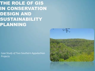
- 1. The Role of GisIn ConservationDesign and Sustainability Planning Case Study of Two Southern Appalachian Projects
- 3. GIS 101
- 4. Landscape Ecology & Green Infrastructure
- 5. Case studies of conservation and sustainable design: - Roan Highlands - Land of Sky
- 6. You are here
- 7. You are here
- 8. You are here
- 9. You are here
- 10. You are here
- 11. Geographic Information Systems (GIS)
- 12. A Look at a GIS
- 13. More Flavors of GIS
- 14. GIS on the Web
- 15. What is our Spatial Relationship to things we Value? Recreation Biodiversity Mineral, Forest, & Water Resources Aesthetic & Cultural Values
- 16. Where do We Like to Live? Chattanooga Atlanta
- 18. Managing ourselves and Resources?
- 20. Interstate Corridor – bedroom communities
- 21. Overall Southeast population growth evolution of a “Mega-region” – 68% increase in SE population by 2050** Center for Quality Growth and Regional Development (COGRD), Georgia Tech: http://hdl.handle.net/1853/13128
- 23. The Disconnect: Planning Unsustainable growth causes permanent losses in: - ecological function - wildlife diversity - agricultural resources - hunting and recreation access - water quality - cultural identity
- 25. Green Infrastructure? Strategically planned, managed network Parks, preserves, conservation easements, greenways, and working lands Supports native species, maintains ecological processes Sustains air land, and water resources Contributes to health and quality of life
- 26. Principles of Landscape Ecology
- 27. Natural Connectivity of Resources
- 29. Where should we Direct Growth
- 30. Case Studies:Examples from Applied Conservation Planning or Green Infrastructure Assessment Projects
- 31. Roan Highlands Conservation Plan Carter County, TN Avery County, NC
- 32. A .Carroll 2008 A. Carroll 2008 A. Carroll 2008 Courtesy of Flickr
- 33. Courtesy of The Conservation Fund (National Geographic Society 1979) http://www.learnnc.org/lp/media/collections/nc/overmountain.jpg
- 34. Privately Owned Lands ~ 81% of total project area is private or not managed for resource conservation
- 35. Project Objectives Spatially define multi-state priority habitat Prioritize results with recreational and cultural datasets Make this data available to local government and SAHC
- 36. Land Cover Derived from Satellite Imagery and Aerial Photography
- 37. Selected Model & Parameters
- 39. Linking Lands and Communities in the Land-of-Sky Region
- 40. Objectives Spatially define ecological, agricultural, recreational, and cultural resources Illustrate relationships, connectivity, and distribution across the landscape Use existing GIS datasets 35
- 43. Land Cover
- 51. Identifies and values known biodiversity hot spots
- 55. In Summary We are all part of a much larger landscape GIS allows us to view our place within this landscape, while examining our relationship to natural resources and ecological functions Growth is comingto this region We can make better informed decisions on land use and sustainability through GIS and modeling methods such as “Green Infrastructure” assessments Goal is to direct growth in a way that protects the natural environment and cultural resources Allow for smart growth in less important places
Editor's Notes
- Map views 2D & 3DDatabase viewsModel viewHardwareSoftwareMost important * The Operator
- Navigation RoutingNetwork analysisSpatial analysis and modelingVisualizationDecision support systems just to name a few……..
- Inventory of data, Standardize scale and formats, Depict multiple sources at one time