Introduction CMS (Coastal Modeling System) SMS
•
1 like•229 views

CMS merupakan bagian dari Surface water Modeling System yang dapat digunakan untuk memodelkan Gelombang (CMS-Wave) dan Pemodelan Arus (CMS Flow)

Recommended
More Related Content
What's hot
What's hot (20)
Similar to Introduction CMS (Coastal Modeling System) SMS
Similar to Introduction CMS (Coastal Modeling System) SMS (20)
More from bahar fahmi
Recently uploaded
Recently uploaded (20)
Introduction CMS (Coastal Modeling System) SMS
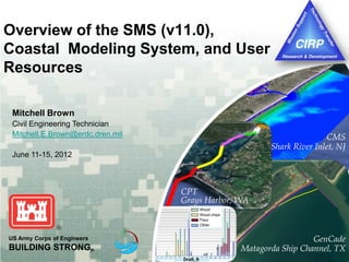
- 1. Draft, ft Wood Wood chips Flour Other US Army Corps of Engineers BUILDING STRONG® GenCade Matagorda Ship Channel, TX CMS Shark River Inlet, NJ CPT Grays Harbor, WA Overview of the SMS (v11.0), Coastal Modeling System, and User Resources Mitchell Brown Civil Engineering Technician Mitchell.E.Brown@erdc.dren.mil June 11-15, 2012
- 2. 1st CMS Webinar, Coastal Inlets Research Program, June 11-15, 2012 2 Overview of Presentation Introduction to the Coastal Modeling System (CMS) CMS-Flow – Hydrodynamics, Sediment Transport, Morphology Change CMS-Wave – Half-plane waves and Full-plane wind forcing.
- 3. 1st CMS Webinar, Coastal Inlets Research Program, June 11-15, 2012 3 Objective Deliver to engineers’ desktops integrated advanced models that can be used as practical engineering tools for coastal inlet and adjacent beach studies. Integrated: All relevant processes, models efficiently coupled together Practical: PC-based, user-friendly interface, fast, robust and accurate Deliver: Manuals, tech reports, journal papers, Wiki, workshops, phone help, etc.
- 4. 1st CMS Webinar, Coastal Inlets Research Program, June 11-15, 2012 Since 1997… 1 webinar 35 workshops Districts can independently run the CMS! Advantages… Robust Physics-based Integrated SYSTEM In SMS User-friendly Since 1997… 2 webinars 38 workshops Districts can independently run the CMS! Advantages… Robust Physics-based Integrated SYSTEM In SMS User-friendly CMS Overview
- 5. 1st CMS Webinar, Coastal Inlets Research Program, June 11-15, 2012 5 CMS-Flow Key Features Finite Volume Method Conserves mass Stable Accessible Coupled with spectral wave model (CMS-Wave) Wave-current interactions Inline sediment transport and morphology change Non-equilibrium sediment Transport model (NET) Nesting capability WSE, river, wind/atmospheric pressure forcing Tidal constituent forcing (NEW) Wave & Tide driven current Measured Calculated
- 6. 1st CMS Webinar, Coastal Inlets Research Program, June 11-15, 2012 6 CMS-Flow Key Features Grid options Non-uniform Cartesian grid: Easy to setup Quadtree (telescoping) grid: Efficient, flexible (presently, only available for Implicit model) Solver options Implicit: Tidal flow, long-term morphology change, parallel processing. ~5 - 30 minute time step Explicit: Flooding, breaching, super-critical flow. ~1 second time step, parallel processing Non-uniform Cartesian grid (Variable spacing) Quadtree grid (Telescoping)
- 7. 1st CMS Webinar, Coastal Inlets Research Program, June 11-15, 2012 7 Hydrodynamics Included terms for the depth-averaged shallow water equations in Cartesian coordinates Depth-averaged current velocity Total water depth Still water depth Water surface elevation Gravity Atmospheric Pressure Precipitation /Evaporation Coriolis Turbulent eddy viscosity Bottom stress (including waves) Wave stress (forcing) Wind stress
- 8. 1st CMS Webinar, Coastal Inlets Research Program, June 11-15, 2012 8 Packery Channel, TX 01/12 04/12 07/12 10/12 13/12 16/12 -0.2 -0.1 0 0.1 0.2 Waterlevel(m,MWL) Packery 005 Recorded Modeled 01/12 04/12 07/12 10/12 13/12 16/12 -1 -0.5 0 0.5 1 Velocity(m/s;-ebb,+flood) JFK Bridge 150 Recorded Modeled 150 005
- 9. 1st CMS Webinar, Coastal Inlets Research Program, June 11-15, 2012 9 Nested Grid Capability Nested Grid Extracted-WSE Extracted U,V, & WSE Tidal Database or larger domain grid
- 10. 1st CMS Webinar, Coastal Inlets Research Program, June 11-15, 2012 10 CMS-Wave: Key Features Shoaling, refraction, diffraction, reflection Bottom friction White capping Wave breaking (4 options) Wind generation Wave-current, and wave-wave interactions Transmission, runup and overtopping Muddy bottom Automatic grid rotation Non-uniform Cartesian grid with nesting capability “Fast Mode”
- 11. 1st CMS Webinar, Coastal Inlets Research Program, June 11-15, 2012 11 Wave Run-up Wave run-up: rush of waves up a slope or structure Two-percent run-up, R2 : the vertical up- rush level exceeded by 2-percent of the larger run-up height Ahrens & Titus (1981), Mase & Iwagaki (1984) ~ 400 laboratory experiments
- 12. 1st CMS Webinar, Coastal Inlets Research Program, June 11-15, 2012 12 Wave Generation Rita Hurricane Rita 0400 UTC, 24 September 2005 Matagorda Bay, TX
- 13. 1st CMS Webinar, Coastal Inlets Research Program, June 11-15, 2012 13 Wave Dissipation over Muddy Coast
- 14. 1st CMS Webinar, Coastal Inlets Research Program, June 11-15, 2012 14 Sediment Transport: Key features Sediment transport models Equilibrium Total Load (Exner equation) Eq. Bed Load + Advection-Diffusion (AD) Suspended Load Non-Eq. (AD Total Load) Sediment transport formulas Lund-CIRP Van Rijn Watanabe Soulsby Hard-bottom Avalanching Bed slope influence on bed load Multiple-sized sed. transport (NEW) Pensacola Pass, FL Channel Infilling ~700,000 cu m Blind Pass, FL
- 15. 1st CMS Webinar, Coastal Inlets Research Program, June 11-15, 2012 16 Computational Speed (Implicit) Shark River, NJ 33k cells Shinnecock, NY 53k cells 1 yr in 1.4 days1 yr in 1.3 days Gironde Estuary, FR 11k cells 1 yr in 7 hrs!
- 16. 1st CMS Webinar, Coastal Inlets Research Program, June 11-15, 2012 17 Documentation CIRP website CIRP Wiki http://cirp.usace.army.mil/ http://cirp.usace.army.mil/wiki/
- 17. 1st CMS Webinar, Coastal Inlets Research Program, June 11-15, 2012 Documentation Website 18 Products CMS GenCade Others Publications Technical Reports CHETNS Journal Articles Others Tech Transfer Upcoming Recent
- 18. 1st CMS Webinar, Coastal Inlets Research Program, June 11-15, 2012 Documentation Wiki 19 CMS Documentation Portal Tutorials Technical Info (Equations) Validation Cases Gencade Information User Guide CPT/CSMART Information and Guidance
- 19. 1st CMS Webinar, Coastal Inlets Research Program, June 11-15, 2012 20 Reports and Tech Notes Demirbilek, Z., K. J. Connell, N. J. MacDonald, and A. K. Zundel. 2008. Particle Tracking Model in the SMS 10: IV. Link to Coastal Modeling System,. Coastal and Hydraulics Engineering Technical Note ERDC/CHL CHETN-IV-71. Vicksburg, MS: U.S. Army Engineer Research and Development Center. Brown, M. E., and N. C. Kraus. 2007. Tips for developing bathymetry grids for Coastal Modeling System Applications, Coastal and Hydraulics Laboratory Engineering Technical Note ERDC/CHL CHETN-IV-69. Vicksburg, MS: U.S. Army Engineer Research and Development Center. Buttolph, A. M., Reed, C. W., Kraus, N. C., Ono, N., Larson, M., Camenen, B., Hanson, H., Wamsley, T., and Zundel, A. K. 2006. Two-Dimensional Depth-Averaged Circulation Model CMS-M2D: Version 3.0, Report 2, Sediment Transport and Morphology Change, Technical Report ERDC/CHL-TR-06-7, US Army Engineer Research and Development Center, Coastal and Hydraulics Laboratory, Vicksburg, Mississippi. Lin, L., Z. Demirbilek, H. Mase, J. Zheng., and F. Yamada. 2008. CMS-Wave: A Nearshore Spectral Wave Processes Model for Coastal Inlets and Navigation Projects. ERDC/CHL TR-08-13. Lin, L., H. Mase, F. Yamada, and Z. Demirbilek. 2006. Wave-Action Balance Equation Diffraction (WABED) Model: Tests of Wave Diffraction and Reflection at Inlets. ERDC/CHL CHETN-III-73.
- 20. 1st CMS Webinar, Coastal Inlets Research Program, June 11-15, 2012 21 Publications: Sediment Transport Sánchez, A., and Wu, W. 2011. “A Non-equilibrium Sediment Transport Model for Coastal Inlet Applications”. Journal of Coastal Research, in press. Camenen, B., and Larson, M., 2008. "Equivalent Roughness Height for Plane Bed Oscillatory Flow,"Estuarine, Coastal, and Shelf Science, Vol 81, pp 409-422. Camenen, B., and Larson, M., 2008. "A General Formula for Non-Cohesive Suspended Sediment Transport," Journal of Coastal Research, Vol 24, No. 3, pp 615-627. Camenen, B., and Larson, M. 2007. "A Unified Sediment Transport Formulation for Coastal Inlet Application," Contract Report ERDC/CHL-CR-07-1, US Army Engineer Research and Development Center, Coastal and Hydraulics Laboratory, Vicksburg, Mississippi. Camenen, B., and Larson, M. 2007. "A Total Load Formula for the Nearshore," Proceedings Coastal Sediments '07 Conference, ASCE Press, Reston, VA, 56-67. Hanson, H., and Camenen, B. 2007. "Closed Form Solution for Threshold Velocity for Initiation of Sediment Motion Under Waves," Proceedings Coastal Sediments '07 Conference, ASCE Press, Reston, VA, 15-27. Camenen, B. and Larson, M., 2006. "Phase Lag Effects in Sheet Flow Transport," Coastal Engineering,Vol 53, pp 531-542. Camenen, B., Bayram, A., and Larson, M., 2006. "Equivalent Roughness Height for Plane Bed Under Steady Flow," Journal of Hydraulic Engineering, Vol 132, No. 11, pp 1146-1158. Gravens, M. B., and Wang, P. 2007. "Data Report: Laboratory Testing of Longshore Sand Transport by Waves and Currents; Morphology Change Behind Headland Structures," Technical Report ERDC/CHL-TR-07-8, US Army Engineer Research and Development Center, Coastal and Hydraulics Laboratory, Vicksburg, Mississippi.
- 21. 1st CMS Webinar, Coastal Inlets Research Program, June 11-15, 2012 22 Publications: Applications/Projects Beck, T.M., and Wang, P. 2009. Influences of channel dredging on flow and sedimentation patterns at microtidal inlets, West-central Florida, USA. Proceedings Coastal Dynamics 2009. Li, H., Brown, M. E., Smith, T. D., Podoski, J. H., 2009 (draft). Evaluation of Proposed Channel on Circulation and Morphology Change at Kawaihae Harbor and Pelekane Bay, Island of Hawaii, HI, Technical Report ERDC/CHL-TR-XX-XX, US Army Engineer Research and Development Center, Coastal and Hydraulics Laboratory, Vicksburg, MS. Seabergh, W.C., Smith, E.R., and Rosati, J.D. 2009 (draft). Sabine-Neches Waterway, Sabine Pass Jetty System: Past and Future Performance, ERDC/CHL-TR-09-X, US Army Engineer Research and Development Center, Coastal and Hydraulics Laboratory, Vicksburg, MS Demirbilek, Z., Lin, L., and Nwogu, O. G. 2008. Wave Modeling for Jetty Rehabilitation at the Mouth of the Columbia River, Washington/Oregon, USA, ERDC/CHL-TR-08-3, US Army Engineer Research and Development Center, Coastal and Hydraulics Laboratory, Vicksburg, Mississippi. Barcak, R. G., Kraus, N. C., Lin, L., Smith, E. R., Heilman, D. J., and Thomas, R. C. 2007 Navigation Improvement, Mouth of the Colorado River, Texas, Proceedings Coastal Sediments '07 Conference, ASCE Press, Reston, VA, 1502-1514. Wang, P., Tidwell, D. K., Beck, T. M., and Kraus, N. C. 2007. Sedimentation Patterns in a Stabilized Migratory Inlet, Blind Pass, FL. Proceedings Coastal Sediments ’07 Conference, ASCE Press, Reston, VA, 1377-1390. Zarillo, G. A., and Brehin, F. G. A. (2007). Hydrodynamic and Morphologic Modeling at Sebastian Inlet, FL, Proceedings Coastal Sediments '07 Conference, ASCE Press, Reston, VA, 1297-1310. Wamsley, T. V., Cialone, M. A., Connell, K. J., and Kraus, N. C. 2006. Breach History and Susceptibility Study, South Jetty and Navigation Project, Grays Harbor, Washington, ERDC/CHL-TR-06-22, US Army Engineer Research and Development Center, Coastal and Hydraulics Laboratory, Vicksburg, MS. Hughes, S. A., and Cohen, J. 2006. Half Moon Bay, Grays Harbor, Washington: Movable-Bed Physical Model Study, Technical Report ERDC/CHL-TR-06-15, US Army Engineer Research and Development Center, Coastal and Hydraulics Laboratory, Vicksburg, MS.
- 22. 1st CMS Webinar, Coastal Inlets Research Program, June 11-15, 2012 23 Publications: Various Nam, P.T., and Larson, M. 2010. Model of nearshore waves and wave-induced currents around a detached breakwater, Journal of Waterway, Port, Coastal, and Ocean Engineering, 136(3),156-176. Wu, W., Sánchez, A., and Mingliang, Z., 2011. An Implicit 2-D Shallow Water Flow Model on an Unstructured Quadtree Rectangular Grid, Journal of Coastal Research, in press. Nam, P.T., Larson, M., Hanson, H., and Hoan, L.X. 2009. A numerical model of nearshore waves, currents, and sediment transport, Coastal Engineering, 56, 1084-1096. Demirbilek, Z., Lin, L., Seabergh, W.C., Mase, H., and Zheng, J.I. 2009. Laboratory and Numerical Studies of Hydrodynamics Near Jetties, Coastal Engineering Journal Vol. 51, No. 2, 143-175. Sánchez, A. 2008. Interactions between wetlands and tidal inlets, Coastal and Hydraulics Engineering Technical Note. ERDC/CHL CHETN-IV-72. Vicksburg, MS: U.S. Army Engineer Research and Development Center. Seabergh, W. C., Demirbilek, Z., and Lin, L. (2008). Guidelines Based on Physical and Numerical Modeling Studies for Jetty Spur Design at Coastal Inlets, International Journal of Ecology & Development (IJED), Vol. 11, No. F08, pp 4-19. Zheng, J., H. Mase, Z. Demirbilek, and L. Lin. 2008. Implementation and evaluation of alternative wave breaking formulas in a coastal spectral wave mode. Ocean Engineering. Vol. 35., pp.1090-1101. MacDonald, N. J., Davies, M. H., Zundel, A. K., Howlett, J. D., Demirbilek, Z., Gailani, J. Z., Lackey, T. C., and Smith, J. (2006). PTM: Particle Tracking Model; Report 1: Model Theory, Implementation, and Example Applications, Technical Report ERDC/CHL-TR-06- 20, US Army Engineer Research and Development Center, Coastal and Hydraulics Laboratory, Vicksburg, Mississippi.
- 23. 1st CMS Webinar, Coastal Inlets Research Program, June 11-15, 2012 24 Coastal Modeling System (CMS) Questions? Mitch Brown Mitchell.E.Brown@erdc.dren.mil 601-634-4036