AusCover is a national program that produces standardized remote sensing data products for Australian environments from satellite, airborne, and field data. It has multiple nodes around Australia that focus on different data products and research. AusCover provides remote sensing data, tools, and expertise to support studies of landcover, vegetation structure, fire dynamics, and other environmental monitoring applications.
AusCover Earth Observation Services and Data CubesTERN Australia
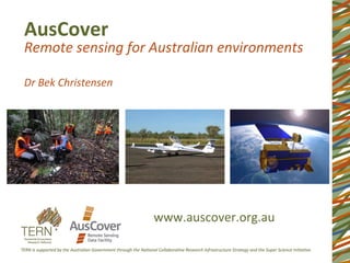
The presentation provides an overview of earth observation services offered by AusCover Facility of TERN. The presentation was part of the Workshop on Approaches to Terrestrial Ecosystem Data Management : from collection to synthesis and beyond which was held on 9th of March 2016 in University of Queensland.
Researchers at the Desert Research Institute (DRI) are exploring ways in which unmanned aircraft systems are increasingly being used in civilian government work as well as the private sector for use in applications as diverse as cloud seeding to fighting forest fires.
ACEF: Australian Coastal Ecosystems FacilityTERN Australia
The presentation provides an overview of services offered by ACEF. The presentation was part of the Workshop on Approaches to Terrestrial Ecosystem Data Management : from collection to synthesis and beyond which was held on 9th of March 2016 in University of Queensland.
AusCover Earth Observation Services and Data CubesTERN Australia
The presentation provides an overview of earth observation services offered by AusCover Facility of TERN. The presentation was part of the Workshop on Approaches to Terrestrial Ecosystem Data Management : from collection to synthesis and beyond which was held on 9th of March 2016 in University of Queensland.
Researchers at the Desert Research Institute (DRI) are exploring ways in which unmanned aircraft systems are increasingly being used in civilian government work as well as the private sector for use in applications as diverse as cloud seeding to fighting forest fires.
ACEF: Australian Coastal Ecosystems FacilityTERN Australia
The presentation provides an overview of services offered by ACEF. The presentation was part of the Workshop on Approaches to Terrestrial Ecosystem Data Management : from collection to synthesis and beyond which was held on 9th of March 2016 in University of Queensland.
The presentation provides an overview on how TERN data infrastructure works. The presentation was part of the Workshop on Approaches to Terrestrial Ecosystem Data Management : from collection to synthesis and beyond which was held on 9th of March 2016 in University of Queensland.
IEEE Young Professionals Webinar on 6/09/2016: NASA GSFC's WISM Radiometer wi...Quenton Bonds, PhD
NASA GSFC is developing a Wideband Instrument for Snow Measurement (WISM) and has teamed up with investigators from the Harris Corp., NASA Glenn Research Center, University of Washington (UWA), Boise State University (BSU), and Nuvotronics Corp. to achieve this task. WISM encompasses a suite of instruments, consisting of a Lidar, Synthetic Aperture Radar and Radiometer, with capability to perform snow parameter measurements across multiple frequency bands. NASA GSFC’s Role in this project is primarily to develop the Radiometer. Therefore, this work presents the prior accomplishments, current status and path forward for GSFC's WISM Radiometer.
VISION / AMBITION
-Australia the first drone-sensed nation (cm-scale)
-Pre-competitive data release for industry, environmental management, education & research
-Conventional survey & remote sensing techniques at ultra-high resolution and flexibility (time-series, rapid response etc)
-Next gen “UNDERCOVER” techniques (minerals and water resources)
Eco-informatics: Data services for bringing together and publishing the full ...TERN Australia
The presentation provides an overview of Advanced Ecological Knowledge and Observation System and SHaRED services by the TERN Eco-informatics to publish plot-based ecological data. The presentation was part of the Workshop on Approaches to Terrestrial Ecosystem Data Management : from collection to synthesis and beyond which was held on 9th of March 2016 in University of Queensland.
TERN's Siddeswara Guru presents on the Australian Ecosystem Science Cloud, which will provide the ecosystem science community improved access to shared data, tools, platforms and computing resources.
Air monitoring sensors and advanced analytics in exposure assessmentDrew Hill
https://doi.org/10.6084/m9.figshare.12354866.v2
We are in the middle of a movement in environmental sensors that is taking the world by storm— Californian governments and public health practitioners, in particular, are leading the nation in exploring and implementing environmental sensors in the production of highly granular, realtime air quality information. As this movement matures, we are seeing improved understanding of ambient exposures and insights that are truly actionable — for example informing community emissions reduction plans under the recent Assembly Bill 617. This innovation in air quality sensor science can be leveraged to improve measurements in the industrial and occupational spaces. This movement has also lead to innovations in analysis methods that facilitate exposure insights not feasible with standard filter, adsorbent, and general integrated samples. This presentation discusses recent advancements in these spaces and offer brief examples of their implementation and potential applicability toward the industrial and occupational hygiene spaces.
AusPlots field data collection with AusScribeTERN Australia
The presentation provides an overview of AuScribe, an Android-based ecology field survey App based on AusPLots Rangelands Survey Protocols Manual. The presentation is part of the Workshop on Approaches to Terrestrial Ecosystem Data Management : from collection to synthesis and beyond
Drones in the Earth Sciences - Opportunities and issuesARDC
Tim Rawling – AuScope, our vision and the National Research Infrastructure investment landscape
Steven Micklethwaite – Opportunity for application of drones in the Earth Sciences, technology and issues
Making Drone data open for Scientific ResearchARDC
Presentation by Dr Siddeswara Guru, TERN
Full webinar:https://youtu.be/a5pNMeePEi0
Individual webinar: https://youtu.be/qMr1XH4zBGQ?list=PLG25fMbdLRa5qsPiBGPaj2NHqPyG8X435
Land Health Surveillance Information for decision makingCIMMYT
Remote sensing –Beyond images
Mexico 14-15 December 2013
The workshop was organized by CIMMYT Global Conservation Agriculture Program (GCAP) and funded by the Bill & Melinda Gates Foundation (BMGF), the Mexican Secretariat of Agriculture, Livestock, Rural Development, Fisheries and Food (SAGARPA), the International Maize and Wheat Improvement Center (CIMMYT), CGIAR Research Program on Maize, the Cereal System Initiative for South Asia (CSISA) and the Sustainable Modernization of the Traditional Agriculture (MasAgro)
From pixels to point clouds - Using drones,game engines and virtual reality t...ARDC
Presentation by Dr Tim Brown
Full webinar: https://www.youtube.com/watch?v=bl_7ClXhQlA&list=PLG25fMbdLRa5qsPiBGPaj2NHqPyG8X435&index=11
Individual snippet:https://youtu.be/PVf4zYNJlmM?list=PLG25fMbdLRa5qsPiBGPaj2NHqPyG8X435
Evolving NASA’s Data and Information Systems for Earth Scienceinside-BigData.com
In this deck from the HPC User Forum, Rahul Ramachandran from NASA presents: Evolving NASA’s Data and Information Systems for Earth Science.
"NASA’s Earth Science Division (ESD) missions help us to understand our planet’s interconnected systems, from a global scale down to minute processes. Working in concert with a satellite network of international partners, ESD can measure precipitation around the world, and it can employ its own constellation of small satellites to look into the eye of a hurricane. ESD technology can track dust storms across continents and mosquito habitats across cities. ESD delivers the technology, expertise and global observations that help us to map the myriad connections between our planet’s vital processes and the effects of ongoing natural and human-caused changes."
Watch the video: https://wp.me/p3RLHQ-k8y
Learn more: https://science.nasa.gov/earth-science
and
http://hpcuserforum.com
Sign up for our insideHPC Newsletter: http://insidehpc.com/newsletter
The geophysical validation of satellite borne atmospheric chemistry instruments requires a large number of independent observations by a variety of in-situ, remote-sensing and satellite instruments. In the case of the Aura and Envisat missions more than 300 instruments have been formally included in the validation efforts.
In order to extract maximum information from the "ground-truth" measurements, these independent validation datasets must be readily accessible to all investigators in an simple format with standard metadata, variable naming and data structures.
Beginning in 2000, NASA and ESA have been collaborating under the auspices of the CEOS Working Group Calibration/Validation (WGCV) Atmospheric Chemistry Sub Group (ACSG) on the file format definition, metadata formulations, and variable definitions for validation datasets.
This standard, known as the AVDC/Envisat HDF format, is the basis of the Aura Validation Data Center (AVDC) and the Envisat Cal/ Val Data Center implementations. Recently, the AVDC/Envisat HDF formulation has been accepted as the new reporting standard of the Network for the Detection of Atmospheric Composition Change (NDACC), an international network of high quality remote sensing stations, and for the next ESA GMES Earth Observing missions. The concept behind the AVDC/Envisat HDF reporting standard, its implementation and future applications will to be presented in detail.
A presentation on the AusPlots program detailing it's aims and objectives, what and how data is collected, how it is delivered along with information on collaborations, data use, analysis and future opportunities
A Presentation created to introduce Year 9 Students to environmental monitoring, Surveillance monitoring as a type of monitoring, and Ausplots as a surveillance monitoring program.
Our capacity to tell and Australian Ecological Storybensparrowau
A presentation delivered at Intecol (London, 2013) detailing an analysis we conducted to determine which ecosystems in Australia had very little long term ecological monitoring occurring in them.
Artificial Reefs by Kuddle Life Foundation - May 2024punit537210
Situated in Pondicherry, India, Kuddle Life Foundation is a charitable, non-profit and non-governmental organization (NGO) dedicated to improving the living standards of coastal communities and simultaneously placing a strong emphasis on the protection of marine ecosystems.
One of the key areas we work in is Artificial Reefs. This presentation captures our journey so far and our learnings. We hope you get as excited about marine conservation and artificial reefs as we are.
Please visit our website: https://kuddlelife.org
Our Instagram channel:
@kuddlelifefoundation
Our Linkedin Page:
https://www.linkedin.com/company/kuddlelifefoundation/
and write to us if you have any questions:
info@kuddlelife.org
"Understanding the Carbon Cycle: Processes, Human Impacts, and Strategies for...MMariSelvam4
The carbon cycle is a critical component of Earth's environmental system, governing the movement and transformation of carbon through various reservoirs, including the atmosphere, oceans, soil, and living organisms. This complex cycle involves several key processes such as photosynthesis, respiration, decomposition, and carbon sequestration, each contributing to the regulation of carbon levels on the planet.
Human activities, particularly fossil fuel combustion and deforestation, have significantly altered the natural carbon cycle, leading to increased atmospheric carbon dioxide concentrations and driving climate change. Understanding the intricacies of the carbon cycle is essential for assessing the impacts of these changes and developing effective mitigation strategies.
By studying the carbon cycle, scientists can identify carbon sources and sinks, measure carbon fluxes, and predict future trends. This knowledge is crucial for crafting policies aimed at reducing carbon emissions, enhancing carbon storage, and promoting sustainable practices. The carbon cycle's interplay with climate systems, ecosystems, and human activities underscores its importance in maintaining a stable and healthy planet.
In-depth exploration of the carbon cycle reveals the delicate balance required to sustain life and the urgent need to address anthropogenic influences. Through research, education, and policy, we can work towards restoring equilibrium in the carbon cycle and ensuring a sustainable future for generations to come.
Willie Nelson Net Worth: A Journey Through Music, Movies, and Business Venturesgreendigital
Willie Nelson is a name that resonates within the world of music and entertainment. Known for his unique voice, and masterful guitar skills. and an extraordinary career spanning several decades. Nelson has become a legend in the country music scene. But, his influence extends far beyond the realm of music. with ventures in acting, writing, activism, and business. This comprehensive article delves into Willie Nelson net worth. exploring the various facets of his career that have contributed to his large fortune.
Follow us on: Pinterest
Introduction
Willie Nelson net worth is a testament to his enduring influence and success in many fields. Born on April 29, 1933, in Abbott, Texas. Nelson's journey from a humble beginning to becoming one of the most iconic figures in American music is nothing short of inspirational. His net worth, which estimated to be around $25 million as of 2024. reflects a career that is as diverse as it is prolific.
Early Life and Musical Beginnings
Humble Origins
Willie Hugh Nelson was born during the Great Depression. a time of significant economic hardship in the United States. Raised by his grandparents. Nelson found solace and inspiration in music from an early age. His grandmother taught him to play the guitar. setting the stage for what would become an illustrious career.
First Steps in Music
Nelson's initial foray into the music industry was fraught with challenges. He moved to Nashville, Tennessee, to pursue his dreams, but success did not come . Working as a songwriter, Nelson penned hits for other artists. which helped him gain a foothold in the competitive music scene. His songwriting skills contributed to his early earnings. laying the foundation for his net worth.
Rise to Stardom
Breakthrough Albums
The 1970s marked a turning point in Willie Nelson's career. His albums "Shotgun Willie" (1973), "Red Headed Stranger" (1975). and "Stardust" (1978) received critical acclaim and commercial success. These albums not only solidified his position in the country music genre. but also introduced his music to a broader audience. The success of these albums played a crucial role in boosting Willie Nelson net worth.
Iconic Songs
Willie Nelson net worth is also attributed to his extensive catalog of hit songs. Tracks like "Blue Eyes Crying in the Rain," "On the Road Again," and "Always on My Mind" have become timeless classics. These songs have not only earned Nelson large royalties but have also ensured his continued relevance in the music industry.
Acting and Film Career
Hollywood Ventures
In addition to his music career, Willie Nelson has also made a mark in Hollywood. His distinctive personality and on-screen presence have landed him roles in several films and television shows. Notable appearances include roles in "The Electric Horseman" (1979), "Honeysuckle Rose" (1980), and "Barbarosa" (1982). These acting gigs have added a significant amount to Willie Nelson net worth.
Television Appearances
Nelson's char
Characterization and the Kinetics of drying at the drying oven and with micro...Open Access Research Paper
The objective of this work is to contribute to valorization de Nephelium lappaceum by the characterization of kinetics of drying of seeds of Nephelium lappaceum. The seeds were dehydrated until a constant mass respectively in a drying oven and a microwawe oven. The temperatures and the powers of drying are respectively: 50, 60 and 70°C and 140, 280 and 420 W. The results show that the curves of drying of seeds of Nephelium lappaceum do not present a phase of constant kinetics. The coefficients of diffusion vary between 2.09.10-8 to 2.98. 10-8m-2/s in the interval of 50°C at 70°C and between 4.83×10-07 at 9.04×10-07 m-8/s for the powers going of 140 W with 420 W the relation between Arrhenius and a value of energy of activation of 16.49 kJ. mol-1 expressed the effect of the temperature on effective diffusivity.
UNDERSTANDING WHAT GREEN WASHING IS!.pdfJulietMogola
Many companies today use green washing to lure the public into thinking they are conserving the environment but in real sense they are doing more harm. There have been such several cases from very big companies here in Kenya and also globally. This ranges from various sectors from manufacturing and goes to consumer products. Educating people on greenwashing will enable people to make better choices based on their analysis and not on what they see on marketing sites.
WRI’s brand new “Food Service Playbook for Promoting Sustainable Food Choices” gives food service operators the very latest strategies for creating dining environments that empower consumers to choose sustainable, plant-rich dishes. This research builds off our first guide for food service, now with industry experience and insights from nearly 350 academic trials.
Diabetes is a rapidly and serious health problem in Pakistan. This chronic condition is associated with serious long-term complications, including higher risk of heart disease and stroke. Aggressive treatment of hypertension and hyperlipideamia can result in a substantial reduction in cardiovascular events in patients with diabetes 1. Consequently pharmacist-led diabetes cardiovascular risk (DCVR) clinics have been established in both primary and secondary care sites in NHS Lothian during the past five years. An audit of the pharmaceutical care delivery at the clinics was conducted in order to evaluate practice and to standardize the pharmacists’ documentation of outcomes. Pharmaceutical care issues (PCI) and patient details were collected both prospectively and retrospectively from three DCVR clinics. The PCI`s were categorized according to a triangularised system consisting of multiple categories. These were ‘checks’, ‘changes’ (‘change in drug therapy process’ and ‘change in drug therapy’), ‘drug therapy problems’ and ‘quality assurance descriptors’ (‘timer perspective’ and ‘degree of change’). A verified medication assessment tool (MAT) for patients with chronic cardiovascular disease was applied to the patients from one of the clinics. The tool was used to quantify PCI`s and pharmacist actions that were centered on implementing or enforcing clinical guideline standards. A database was developed to be used as an assessment tool and to standardize the documentation of achievement of outcomes. Feedback on the audit of the pharmaceutical care delivery and the database was received from the DCVR clinic pharmacist at a focus group meeting.
2. AusCover
Produc1on
and
delivery
of
na#onally
consistent
long-‐1me
series
of
satellite-‐based
biophysical
map
products
and
next
genera1on
remote
sensing
research
data
that
is
validated
for
Australian
condi#ons.
3. Remote
Sensing
Data
Delivery
Backbone
• Solving
data
formats,
interoperability,
data-‐policy,
• Physical
storage,
efficient
delivery
to
end-‐users
etc.
Data
Produc;on
Network
• Na1onally-‐consistent,
standard
biophysical
data
products,
• Metadata
and
technical
support
documents
• Specialised
space-‐borne,
airborne
&
in-‐situ
research-‐grade
data
Ground
Valida;on
Program
and
Instrumenta;on
• Set
na1onal
standards
&
field
valida1on
protocols
• AusPlots,
SuperSites
and
Environmental
transects
etc.
• Interna1onal
Benchmarking
How
we
work
–
program
structure
4. Perth
Node-‐
not
ac;ve
Surface
Reflectance
Products,
Hyperspectral
data,
atmospheric
Correc;on
ancillary
data;
Field
Valida;on
Data
from
Other
Na1onal
Agencies
And
Interna1onal
Space
Agencies
and
Collaborators
How
we
work
–
na1onal
network
Hobart
Node
UAV
–
mul;&
hyperspectral,
thermal
Melbourne
Node
Gridded
Climatology
Data
Airborne
Data
and
in-‐situ
Sensor
data.
Adelaide
Node
Frac;onal
Land-‐Cover
in
Rangelands
+
Field
Valida;on
Canberra
Node
Leaf-‐Area
Index/FPAR
Product
Frac;onal
Cover
Dynamic
Land
Cover
Map
Airborne
Data
products
Sydney
Node
Time-‐Series
Vegeta;on
Indexes
Phenology
Products
con;nental
+
In-‐situ,
Valida;on
Brisbane
Node
Foliage
Projected
Cover
Airborne
Data
Products
Field
Data
&
Valida;on
Darwin
Node
Burnt-‐Area
and
Bushfire
Products
and
Valida;on
5. User
Reference
Group
Current
AusCover
User
Advisory
Group
membership:
Dr
John
Leys
(OEH)
Dr
Shan1
Reddy
(DoE)
Dr
Dan
Tindall
(DSITI)
Dr
Michele
Barson
(Dept
of
Ag)
Dr
Peter
Stone
(CSIRO)
Prof
Phil
Tickle
(CRCSI)
Dr
Stephen
Roxburgh
(CSIRO)
Dr
Andrew
Edwards
(CDU)
Dr
Brendan
McAtee
Dr
Wendy
Thompson
Dr
Stephen
van
Leeuwen
(DoPWS)
Dr
Lalage
Cherry
(DoE
-‐
ERIN)
6. Infrastructure
• Data
products
–
satellite,
airborne,
field
• Data
delivery
and
access
• Tools
and
protocols
• Networks
and
exper1se
8. Vegeta1on
Structure
• Biomass
–
library
published,
map
coming
soon
• Height
• fPAR,
LAI
Biomass
field
data
9. Fire
dynamics
and
impacts
• Burned
area
• Grassland
curing
• Hotspots
Burnt
area
map
–
different
colours
represent
different
dates
of
burning
10. Cal/val
• Star
transects
+
tree
structure
• Terrestrial
LiDAR
(TLS)
• Hemispherical
photos
• Airborne
hyperspectral
and
LiDAR
Hemi
photo,
Chowilla
TLS
scan,
Tumbarumba
11. Other
environmental
data
• Water
vapour
• Cloud
• Surface
reflectance
• Rainfall
• Air
temperature
• Water
vapour
pressure
• Solar
radia1on
• Land
surface
temperature
Daily
solar
radia1on
Daily
rainfall
12. Data
delivery
–
field
portal
hVp://qld.auscover.org.au/public/html/field/
14. Data
delivery
Links
to
detailed
metadata
(Xwiki),
data
download,
visualisa1on
tool
and
status
updates
as
relevant
15. Data
delivery
–
metadata
lis1ng
E.g.-‐
h^p://www.auscover.org.au/xwiki/bin/view/Product+pages/Landsat
+Frac1onal+Cover
• Preview
image
• Link
to
data
• Data
licence
and
access
rights
• Alternate
1tle
• Abstract/summary
• Spa1al
extent
• Temporal
extent
• Point
of
contact
• Credit
• Keywords
• Data
quality
• Valida1on
status
• Related
products
• References
• Algorithm
summary
• Version
history
• Metadata
history
Metadata
includes:
16. Protocols
and
tools
• Data
handling
and
processing
standards
• ‘Good
prac1ce
guidelines’
for
field
cal/
val
• Geo-‐Wiki
17. Perth
Node-‐
not
ac;ve
Surface
Reflectance
Products,
Hyperspectral
data,
atmospheric
Correc;on
ancillary
data;
Field
Valida;on
Data
from
Other
Na1onal
Agencies
And
Interna1onal
Space
Agencies
and
Collaborators
Hobart
Node
UAV
–
mul;&
hyperspectral,
thermal
Melbourne
Node
Gridded
Climatology
Data
Airborne
Data
and
in-‐situ
Sensor
data.
Adelaide
Node
Frac;onal
Land-‐Cover
in
Rangelands
+
Field
Valida;on
Canberra
Node
Leaf-‐Area
Index/FPAR
Product
Frac;onal
Cover
Dynamic
Land
Cover
Map
Airborne
Data
products
Sydney
Node
Time-‐Series
Vegeta;on
Indexes
Phenology
Products
con;nental
+
In-‐situ,
Valida;on
Brisbane
Node
Foliage
Projected
Cover
Airborne
Data
Products
Field
Data
&
Valida;on
Darwin
Node
Burnt-‐Area
and
Bushfire
Products
and
Valida;on
Networks
and
exper1se
18. In
development
(2016-‐2017)
• UAV
(mul1spectral,
hyperspectral,
thermal,
LiDAR)
• New
data
streams,
e.g.
Himawari-‐8,
RADAR,
Sen1nel1&2
• Improved
user-‐friendliness
–
online
tools
to
visualise
and
explore
data
products
19. 16/17
and
beyond
• Reinvigora1ng
na1onal
network
• Improving
useability
for
non-‐research
audience
• Engaging
user
community
now
to
understand
needs
for
the
future…
20. Links
AusCover
website
–
www.auscover.org.au
AusCover
data
products
list
-‐
h^p://auscover.org.au/data/product-‐list
Field
data
portal
-‐
h^p://qld.auscover.org.au/public/html/field/
AusCover
Geo-‐Wiki
-‐
h^p://www.geo-‐wiki.org/branches/auscover/
21. Contacts
Bek
Christensen
–
Engagement,
r.christensen1@uq.edu.au
Alex
Held
–
Facility
Director,
alex.held@csiro.au
Ma^
Paget
–
Data
and
Systems
Coordinator,
ma^.paget@csiro.au