Housing for Developing Countries
•Download as PPTX, PDF•
1 like•157 views

AHOUSNG report on "Housing for Developing Countries". (National University - College of Architecture, 2017)

More Related Content
Similar to Housing for Developing Countries
Similar to Housing for Developing Countries (20)
Recently uploaded
Recently uploaded (20)
Housing for Developing Countries
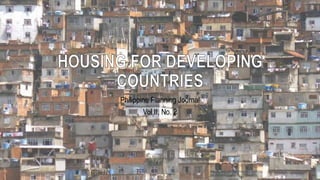
- 1. Philippine Planning Journal Vol II, No. 2
- 2. WALT WHITMAN ROSTOW American Economist And Political Theorist “…developing countries are in transition from traditional lifestyles towards the modern lifestyle which began in the Industrial Revolution in the 18th and 19th centuries.”
- 3. Developing economies according to the IMF Developing economies out of scope of the IMF Graduated to developed economy Newly industrialized countries IMF – International Monetary Fund (As of 2014) Countries on the boundary between developed and developing are often categorized under the term newly industrialized countries.
- 4. INTRODUCTION
- 5. MANILA 1966 – 30,200 hectares covered • 1,000 hectares developed per year
- 6. 1. HOUSING SQUATTERS 1966 - 1.1 squatters and slum dwellers 15% per year (3x the rate of national population) SUBDIVISION 1960 - 20 hectares (200-300 lots) e.g.: Project 4 in Quezon City Mid-income development 150-300 sq. m PhilAm Life Middle to High income (80-110 person/ hectare)
- 7. 2. COMMERCIAL 1960 - 42,000 small general merchandise • No waste water value.
- 8. 3. TRANSPORTATION RAILWAY 18-20 transportation are scheduled daily at North Luzon and South. • Abandoned lines are covered by squatters. MOTOR VEHICLES 1960 - 100,000 registered motor vehicles 1965 - 143,000 motor vehicles
- 9. 4. PUBLIC TRANSPORTATION AFTER WORLD WAR 2 U.S. Army Jeep – Converted “Jeepney” 8 to 10 passengers
- 10. NORTH MANILA BASIN 1. TONDO AREA • Covered by commercial , residential, containing families during Spanish era. • Largest slum and squatter area • 1966 - Half of the 278 hectare reclaimed area had been occupied by squatters • 1980 - they dampen the population 2. SAMPALOC AREA • 1960 - all area had been developed into residential • Student population is high and apartments are developed. 3. SANTACRUZ • Includes office buildings and mixed residential-commercial.
- 11. NORTH MANILA BASIN (cont.) 4. SAN NICOLAS • Heavy and light industry • Dense residential population 5. QUIAPO SUB-AREA • Commercial activity and light industry (furnitures, dress-making, auto repairs, etc.) 6. BINONDO • Zone for commercial and light industry
- 12. SOUTH MANILA BASIN 1. INTRAMUROS • 1945 – R.A. 1818: Commercial, residential and educational district • 40 hectares became high-rise office buildings • 30 hectares became shools • 90 hectares became vacant as of 1969 2. PORT AREA • Reclaimed until 1910 • 40 hectares became warehouses 3. ERMITA • Apartments and hotels (institutional and government offices moved to QUEZON CITY)
- 13. SOUTH MANILA BASIN (cont.) 4. BOUNDED AREAS OF HERRAN, GEN. LUNA, TAFT AVENUE • Residential may gradually replace into hospitals, schools and shops 5. PANDACAN • North- Industrialized areas • South- Market, church and school 6. STA. ANA • Crowded by squatters • 4,500 persons per 3 hectares • PUNTA - Expect public housing 1980 vertical expansion
- 14. SOUTH MANILA BASIN (cont.) 7. MALATE • 2 to 3-storey residential dwellings 8. PACO • NORTHEAST- Industries • NORTHWEST- Schools and colleges • CENTER - Commercial areas • SOUTH - Residential areas
- 15. SOUTH MANILA BASIN (cont.) PASAY CITY • CENTER - High quality homes • WEST- Embassies and hotels • ROXAS BOULEVARD - Entertainment buildings MAKATI • Retail and commerce district • Multi-storey office buildings • Most modern integrated planned community FORT BONIFACIO • Memorial military cemeteries • Serves as the housing development but was not developed • 1970-1980 - seems certain the land will be developed • Non-military character
- 16. POPULATION NATIONAL 3.5% per year but the study area growing rapidly more than the nation as a whole MANILA METROPOLITAN AREA 7.5% increase in population between 1903-1960 MANILA CITY • Attracts migrants from the rural countryside • 1910 to 1950 - most rapid growth
- 18. DEVELOPING COUNTRIES PROBLEM • Inhabitants living on land with no titles • Exerting little effort to invest time, money or energy in improving their surroundings • “A CITY-BOUND FLOOD OF MIGRANTS” • Adoption of cultural and technological solutions borrowed from more developed countries • Acquiring WESTERN-ORIENTED TECHNOLOGY (but with limited resources, therefore items must be imported which cost a lot of money) • Begun to abandon indigenous cultures and skills (generally ineffective in the attempt to create a Western-Oriented Technology)
- 19. ACQUIRING THE NEW REFUSING TO DISCARD THE OLD “OLD HABITS DIE HARD”, AND VILLAGE SOCIAL PATTERNS, SENSE OF KINSHIP AND NATIVE SKILLS IN HANDLING MATERIALS PERSIST.
- 20. MANILA Overcrowded, deteriorated, unsanitary, absence of facilities etc. 50,427 FAMILIES (12% OF POPULATION) Living under conditions, which, measured by the living standards of Europe and North America, DEEMED AT BEST TO BE SUB- STANDARD AND AT WORST TO BE IN HUMAN.
- 21. A study has been conducted by the government regarding the relocation of squatters outside the city to the countryside. A few years later, they moved again in the city due to the TRANSPORTATION, COMMUNICATION, AND EMPLOYMENT NEEDS.
- 22. SQUATTERS Are migrants from rural areas, overcrowding, lack of food, slums SQUATTERS’ POINT OF VIEW: Transportation and communication problems acts as a barrier to improving his situation. (Source of livelihood – usually within the city)
- 23. “Typical slum in Metro Manila. Urban slum dwellers are confronted by physical, economic, social, and environmental risks on a day-to-day basis.”
- 24. (a) (c) (d) (e) (b) AN ECONOMICALAND EFFECTIVE MECHANICAL CORE
- 25. (a) OVERHEAD WATER STORAGE TANK – to provide water pressure as well as on-site water storage (b) WASTE DISPOSAL TANK – replaces the pit toilet (c) SOLAR HEATING UNIT – utilizes the heat of the sun to warm water for bathing and washing (d) SHOWER NOZZLE AND VALVE – can be connected to water storage tank or the solar heater or both (e) ELECTRICAL CIRCUIT BREAKER AND OUTLET BOX
- 26. DEVELOPING COUNTRIES • Must seek solutions to their housing and planning problems. • Introduce alternative future solutions gradually: 1. Providing sanitary solutions in the housing communities. 2. Strengthening the transportation and communication links connecting cities
- 28. DEVELOPING COUNTRIES (cont.) SOLUTIONS TO THE PROBLEM MUST INCLUDE THE FOLLOWING: • Pure drinking water and storage • Waste disposal • Fuel for cooking • Ablutionary facilities • Provision for electrical power • Low cost
- 29. DEVELOPING COUNTRIES (cont.) FEASIBLE PATH CREATING SQUATTERS HOMES • Lightweight and flexible core • House the activities of ablution, waste disposal and food preparation • Independent energy or “plug-in” • Have wheels for transportation
- 30. DEVELOPING COUNTRIES (cont.) FUTURE SQUATTERS • Moving one place to another place • A permit to “camp” in order to avoid overcrowding
- 31. - END - GROUP 2 ARC 131 – HOUSING Ar. Guittap