
Download to read offline
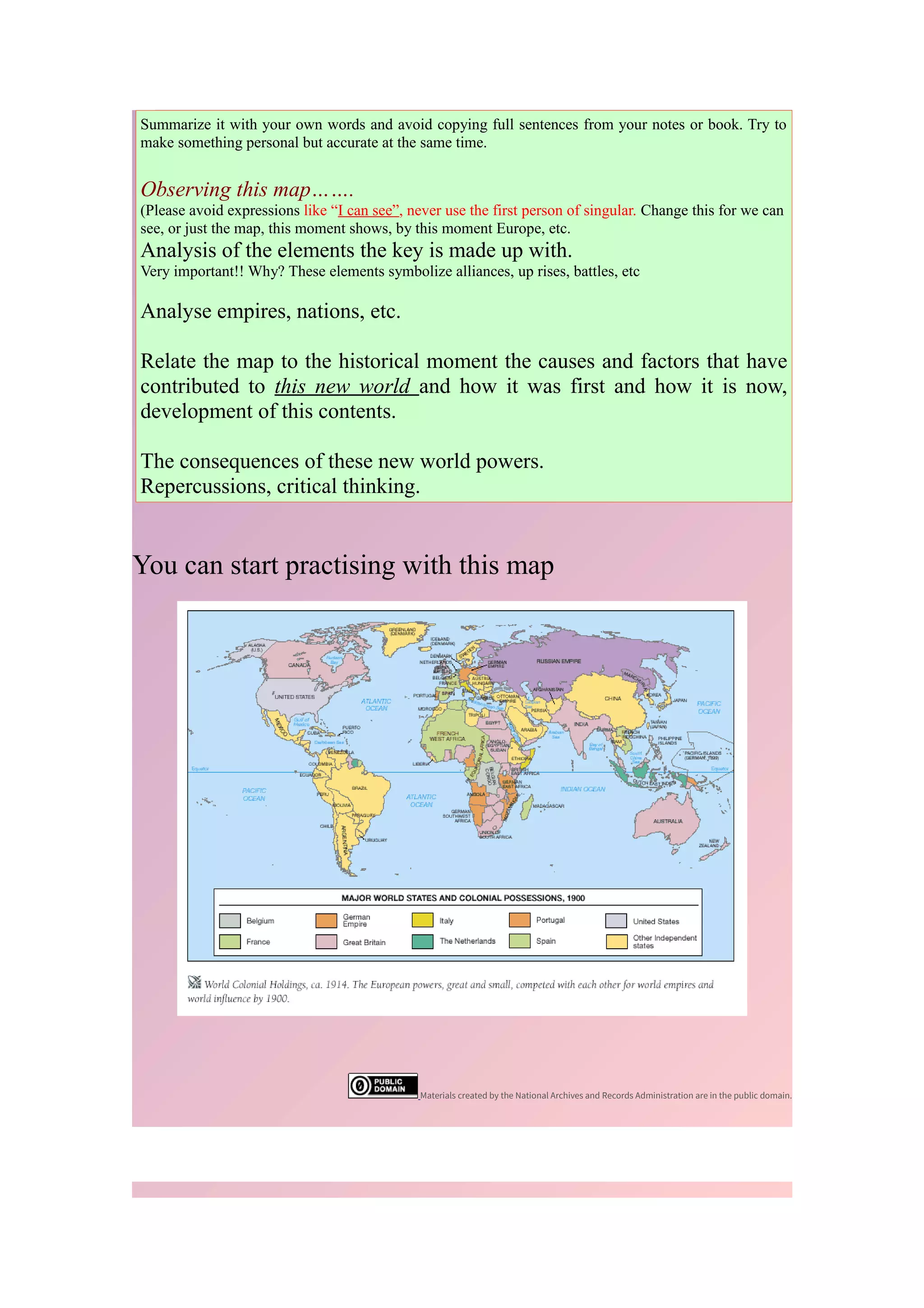

This document provides guidance on how to analyze a historical map by examining its various elements, understanding the historical context in which it was created, and using it as a primary source to learn about past events. Key steps include observing the map's title, scale, legend, locations, labels, symbols, date, and comparing it to a modern map of the same place to understand how places and borders have changed over time. The analysis should explain what was happening historically when the map was made and what it can teach about this event or topic that other sources may not.


![Objectives 1.01 to_1.04[1]](https://cdn.slidesharecdn.com/ss_thumbnails/objectives1-01to1-041-130124171820-phpapp01-thumbnail.jpg?width=640&height=640&fit=bounds)


