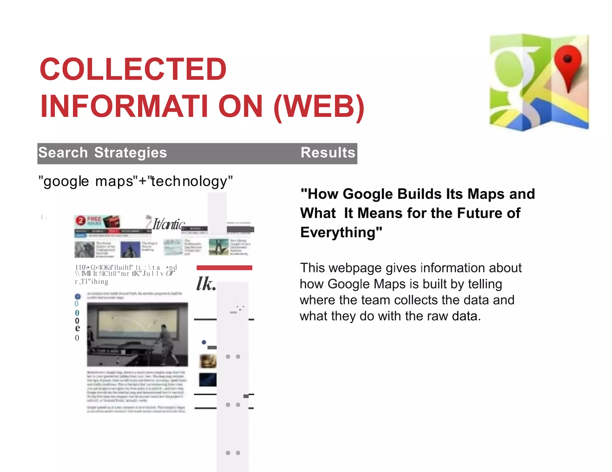
- Google Maps was launched in 2005 and provides map information from satellite images, street views, and more that can be accessed on desktops and smartphones.
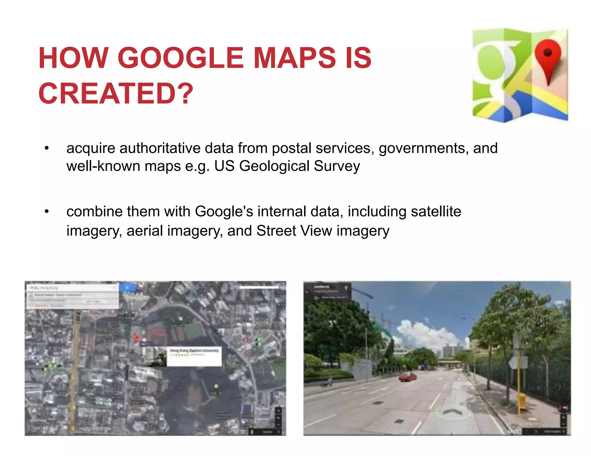
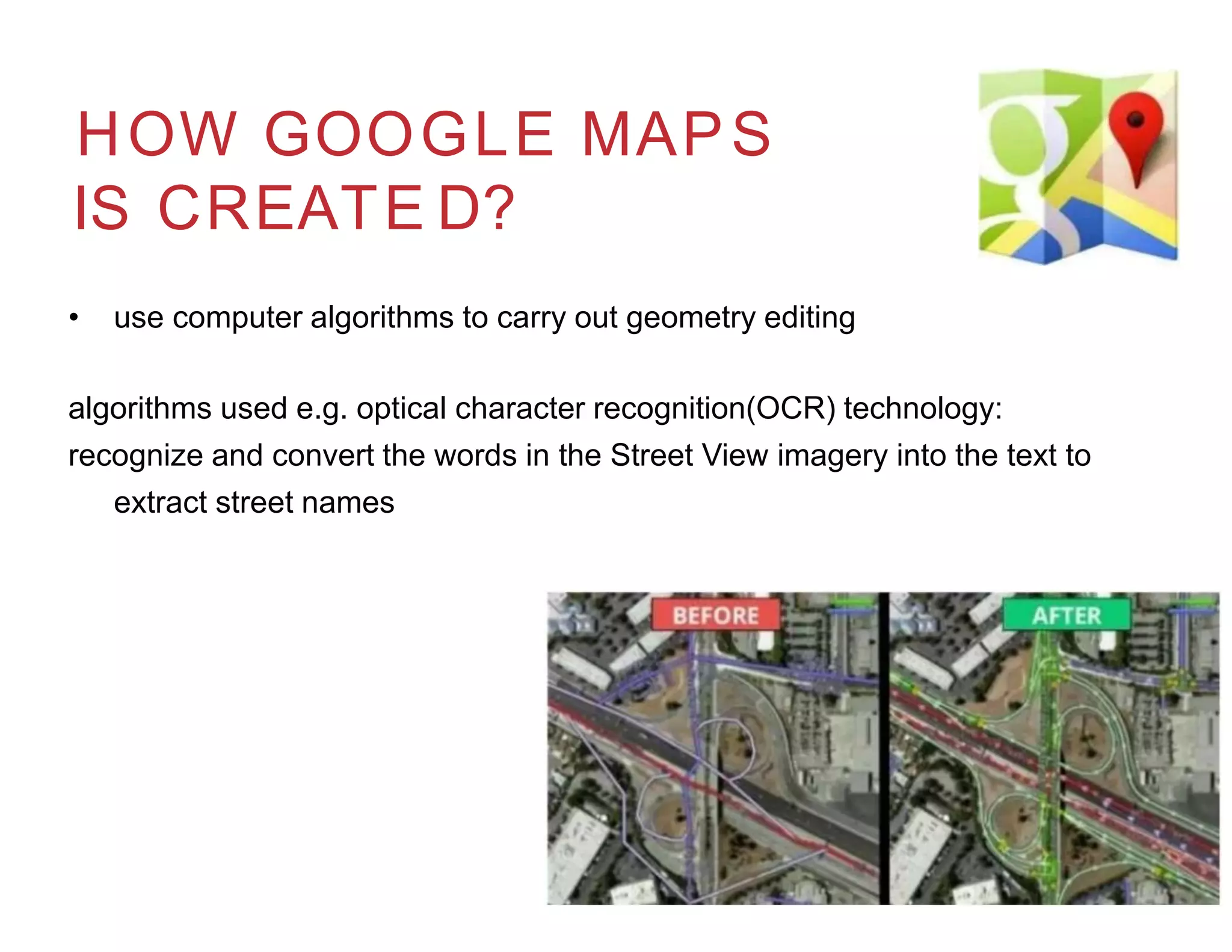
- Google collects authoritative map data from various sources and uses algorithms to combine, edit, and extract information from imagery to build and update their maps.
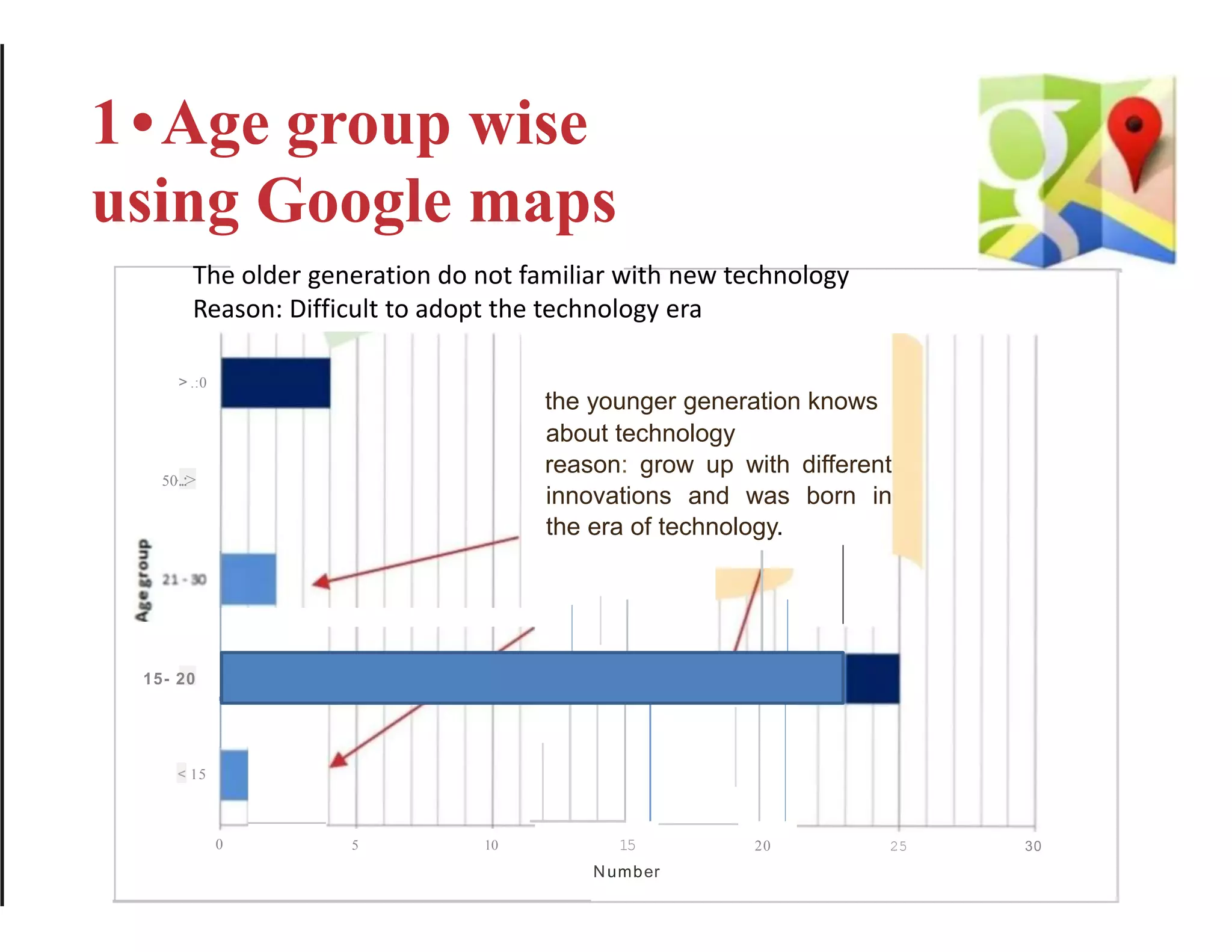
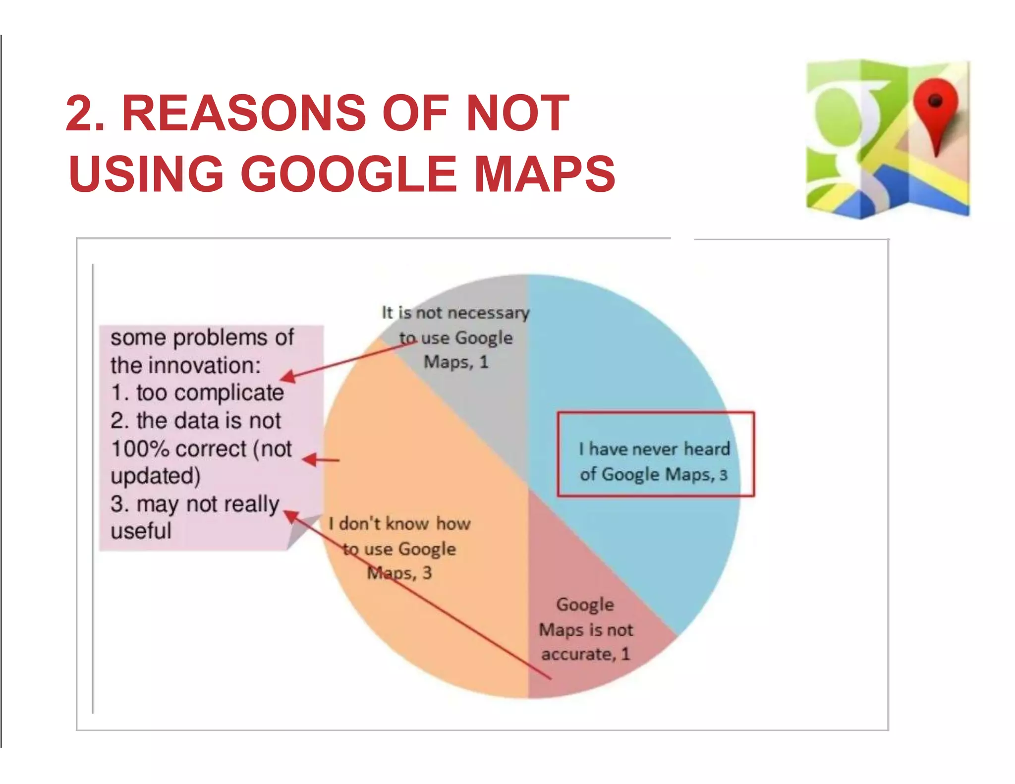
- A survey found that younger people are more likely to use Google Maps due to growing up in an era of technology innovation, while older people may find maps too complex or data not always accurate.


![Google map[1]](https://cdn.slidesharecdn.com/ss_thumbnails/googlemap1-190422093831-thumbnail.jpg?width=640&height=640&fit=bounds)


